Feeds:
Posts
Comments

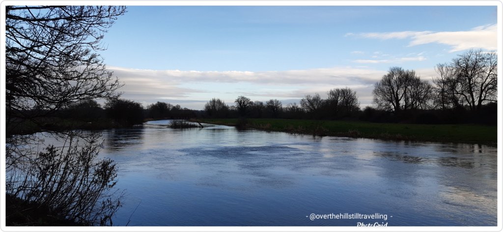
I finally found a bit of space to start reading up on the Mt. Everest virtual challenge which I completed last month, and although I had decided to not post any further posts about the various challenges I’m following, this was so very interesting that I changed my mind and so here we go….I hope you enjoy reading more about Everest and what the climbers who actually go there experience. So often we read or hear about climbers and teams of people who climb Mt Everest but we seldom read about the finer details. So this has been really interesting.

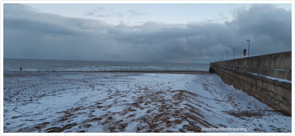
I actually started the challenge in Ramsgate on the 10th February on the tail-end of the ‘beast from the east’ snow storm. So this is a bit behind the actual times 😉 But since it’s not real anyway, it doesn’t really matter…anyway, I hope you enjoy reading these posts…

Where I actually was….pretty realistic really

Flying into Kathmandu is a walk in the park when compared to Lukla. Dubbed as the most dangerous airport in the world, Lukla’s runway is a mere 1,729ft (527m) long, with mountainous terrain to the north and a steeply angled drop to the south. It is built on a 12% uphill gradient to help planes slow down. There are no go-around procedures if the planes miss their approach, as such only highly experienced pilots with short-takeoff-and-landing missions under their belt, experience in Nepal and ten flights in Lukla with a certified instructor, are permitted to land at the airport. In a nutshell if climbing Everest doesn’t cause prickles on the back of your neck, then a high intensity landing in Lukla certainly should.

Where I wasn’t really 😁😁 Stage 1

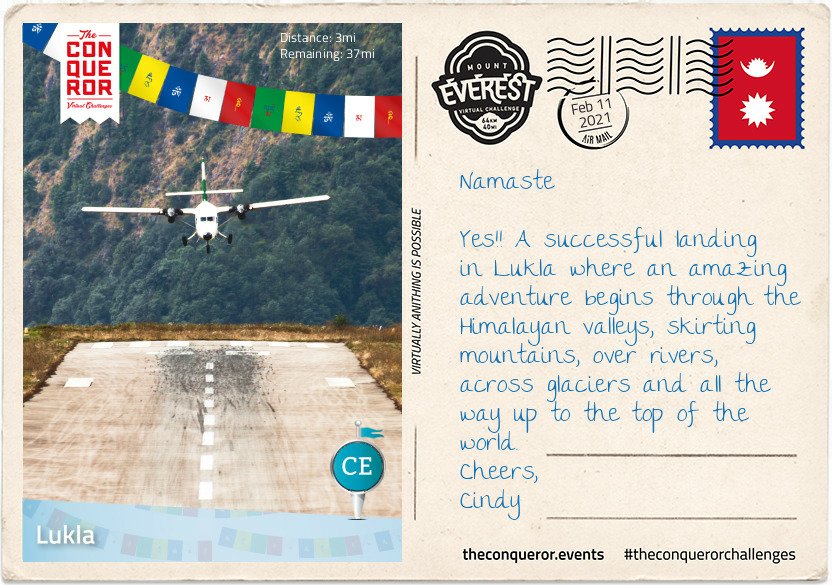
In 2008, Lukla airport was renamed Tenzing-Hillary Airport in honour of Sir Edmund Hillary and Sherpa Tenzing Norgay, the first climbers to reach the summit of Everest. Hillary was instrumental in the construction of the airfield in Lukla, building an unsurfaced airstrip on a mountain shelf in 1964. It took 37 years to finally asphalt the runway.

Home to 1200 people, the village sits at 9,383ft (2,860m) above sea level, nestled on a small plateau amongst the awe inspiring mountain peaks of the Himalayan Ranges. The nearly 40mi (64km) trek to Mount Everest, skirts steep mountainsides, through deep valleys and over alpine glaciers. The hike travels through small villages and teahouses, past prayer wheels and fluttering prayer flags to the memorial site honouring mountaineers and Sherpas who lost their lives climbing the mountain, continuing to Base Camp and then the final summit climb.
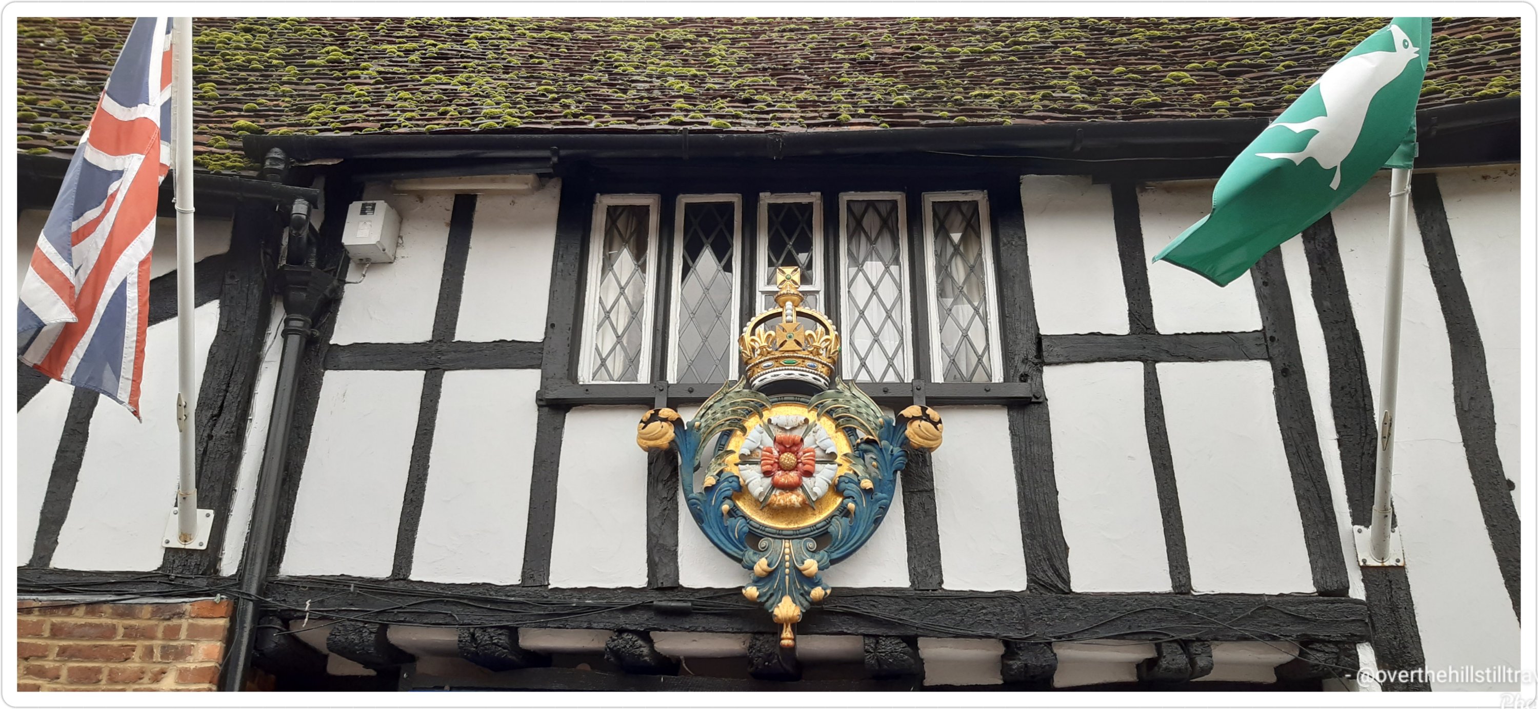
Leaving the viewing platform of the Lukla airport, I made my way through the centre of town on a narrow street that was sometimes cobbled and sometimes just compacted soil. Double-storey buildings lined the street filled with shops, teahouses and lodging services.

Shortly after leaving the village I passed through the National Luminary Pasan Lhamu Memorial Gate which was built to honour Pasan Lhamu, the first Sherpa woman to summit Everest in 1993. It is the gateway to the Khumbu Region that encompasses the Sagarmatha National Park and the Nepalese side of Mount Everest.

It was a gradual downhill hike, passing through a forest on narrow paths with the colossal mountainside ever present to my right. I continued on this downward hike, on a trail that wound itself up and down, passing through villages with teahouses until I reached Phakding, a small village that lies in the Dudh Kosi river valley. Here was the first of many suspension bridge crossings. The bridge, about 100ft (30m) above the river, stretched across what seemed to be an old landslide with large boulders and debris settling beside the river. As the bridge swayed and moved beneath my feet, I pondered about those whose fear of heights may find the crossing challenging. This isn’t the tallest suspension bridge on this trek, that is yet to come.

Finally reaching the small village of Benkar with its tin-roofed, brightly painted window frames, four-storey residences/storefronts, I settled into one of the teahouses for a meal. Known to aid with altitude adaptation I had garlic soup with Tibetan flat bread. Between the warmth of the soup and the crusty on the outside, fluffy on the inside bread, I filled my belly and finished with a Tibetan tea.
Rested and fed, I resumed my hike crossing another suspension bridge. Soon I reached the entrance to Sagarmatha National Park. A UNESCO listed site since 1976, the 1,148km² park is home to the Sherpa people, rare species like the snow leopard and several mountains including Mount Everest.

After obtaining the necessary permits to enter the park, I walked through the Jorsalle Entrance Gate, a concrete structure with Buddhist artwork on its interior walls to a set of steps that began a steep descent into a gorge, onto Jorsalle village, alongside the thundering Dhudh Kosi river and over two more suspension bridges.

However, what goes down, must come up and it wasn’t long before I engaged my hiking poles to start the steep ascent onto a woodland path until I reached a wide open low lying land beside the river filled with stones and boulders making trekking through it unstable and difficult.

But nothing prepared me for the next suspension bridge. Like all the others, Hillary Bridge was made of galvanized steel cables that’s connected to the grated deck by interlinked wire fence. An old version of the bridge was right beneath this one just hanging, blowing in the wind, no longer in use. At 410ft (125m) above the Dhudh Kosi river, this 459ft (140m) long bridge was exposed to the elements swaying laterally and vertically as the strong wind blew through the valley. It was a heart thumping, adrenaline spiking exercise that on this trek one could do without. I was grateful to reach solid ground.

If I ever entertained even the slightest idea of ACTUALLY doing this ‘walk’, reading about that bridge has pretty much scuppered any possibility 🤣🤣🤣 I don’t have a fear of heights and I’m a bit of an adrenaline junkie, but I have my limits 🤪🤪

So, no go for me thanks, virtual suits me just fine.

Coming home..

I arrived home last night, after a 4.5 hour journey, from a week’s booking in Salisbury. As much as what I really enjoyed exploring the city, and learning more of the history and her green spaces, it was wonderful to be back home.

You cannot underestimate the sheer joy of coming ‘home’ to your own place. It may not be much, but it’s got my stuff in it, and I’m home.

My own duvet…magic

After I’d dropped my bags off, I grabbed my walking poles and immediately set off for a sunset walk to the harbour

Absolutely stunning
A Royal harbour
Can you see the moon?
The sun setting in front of me

and then along the lower promenade

The snow moon rising behind me

before climbing up to the clifftop and a walk to Pegwell Bay.

View of Pegwell Bay from the bottom of the cliffs
From halfway up the path to the top of the cliffs

It was quite dark already by the time I reached the hotel, so I stopped there for a few photos and then walked back along the clifftop.

View from Pegwell Bay hotel
A bit of fun with the moon and the hands and molecules sculpture
One lone boat still has its Christmas lights on

A magical walk with no pressure to get back within 2 hours, and 9.9 kms added to my 2021 Conqueror virtual challenge.

I’m going to start the Ring Road Iceland virtual challenge on Monday 1st March. I’m so looking forward to the postcards, should be amazing. My daughter and I had a fantastic 4 day trip to Iceland in 2014, so I’m really keen to see the information that comes with the postcards.

The Sun Voyager (Icelandic: Sólfar); a sculpture by Jón Gunnar Árnason

When I got back from my Throwley booking earlier this month, I decided to take a walk along the beach to get some kms in since I’d completed the Alps to Ocean challenge and started climbing Mt. Everest 🥶🥶🥶🗻🗻 (also completed while in Salisbury).

BUT!!! To my horror I found that most of the beach has been stripped away by the storm. As far as the eye can see, used to be beach…its now mostly stones and rocks and the sand has been stripped right down to the chalk bedrock. I genuinely could not believe my eyes. I can see just beneath the waves there’s still some beach, but not sure how far it extends.

The beach where I used to take my grandson to play is now just a rocky morass.

To give you an idea of the power of the sea, this great big chunk of very degraded concrete was washed up and dumped onto the beach almost halfway up towards the Royal Pavilion
Quite awesome to see the pure chalk bottom though…just think….this is billions of sea creatures solidified into chalk from millions of years ago.

Unreal, the power of nature. I’m saddened too because it’s one of my favourite places to walk. But a local said the wind and sea will likely blow it all back when the winds blow from another direction. Meanwhile…😔😔😔 no beach walking🚶🏻‍♀️🚶🏻‍♀️ for me atm, I’ll have to try catch it when the tide is out.

Meanwhile, I shall have to head southward and visit Pegwell Bay again.

My time in Salisbury is now over, but fear not I shall return – when I start travelling with my grandson, Salisbury, Old Sarum and Avebury are on my very extensive list of ‘places to go on Granny and Jamie’s Adventures’. But I couldn’t leave without sharing what is, next to the Cathedral, the best aspect of the city…..The River Avon, in Salisbury, Wiltshire, such a beautiful space.

Synonymous with Shakespeare and Stratford Upon Avon, the Avon rises east of the town of Chipping Sodbury in South Gloucestershire, just north of the village of Acton Turville.

The river itself runs from a spring in Naseby in Northamptonshire, through Leicestershire, Warwickshire, Worcestshire and finally to the River Severn in Gloucestershire, passing through Bath and Bristol, the last big city on its route and beneath the famous Clifton Suspension Bridge.

The River Avon is an exceptionally meandery river with lots of small tributaries and channels breaking away, leaving hundreds of little islands in its wake enroute to the sea…I tried to follow it on Google maps but gave up 😄😄😄

Running a somewhat circular path, the river drains east and then south through Wiltshire. Its first main settlement is the village of Luckington, two miles (3 km) inside the Wiltshire border, and then on to Sherston.

At Malmesbury it joins up with its first major tributary, the Tetbury Avon, which rises just north of Tetbury in Gloucestershire.
This tributary is known locally as the Ingleburn, which in Old English means ‘English river’. Here, the two rivers almost meet but their path is blocked by a rocky outcrop of the Cotswolds, almost creating an island for the ancient hilltop town of Malmesbury to sit on. Upstream of this confluence the river is sometimes referred to as the ‘River Avon (Sherston Branch)’ to distinguish it from the Tetbury Branch.
Information ref wikipedia with thanks.

In Salisbury the river twists and winds within sight of the cathedral as it rushes past ancient inns, Norman churches, alongside meadows green and watery alive with wildflowers, butterflies, bees and swans, it splits into a multitude of channels and smaller tributaries around the city, with 2 distinct channels in the city rushing furiously through the millrace at the Maltings then flows fast beneath a 15th century bridge; Crane Bridge

The Maltings
Crane Bridge

Pretty much wherever you are, you are within a short walk of the river.

The chalk soils around the River Avon filter and purify the water, making the river a special place for wildlife. The Avon and its tributaries make up one of the largest chalk river systems in England, and is a source of clean drinking water.

Although I’ve been to Salisbury a few times, its always been a short visit and mostly spent in the cathedral or at Old Sarum (which is a fantastic place btw – a must visit), but I’ve never had the time to just meander and explore. Its been fantastic. I shall of course return someday in the future….

Meanwhile, here’s a short video showing scenes of the River Avon in Salisbury

I did a lot of walking during my breaks, through Churchill Park, Queen Elizabeth Park, and along the many and varied riverside walks in the city…I went as far afield as the area called Broken Bridges and had a walk along the River Nadder, blissful tranquility, a space of enchantment

Crossing the bridge towards Broken Bridges
River Nadder, so clear you can see the bottom

And that’s it ….goodbye Salisbury, hope your cathedral is open next time I visit, I’d like to see the Magna Carta again 😊😊

Besides all the most amazing and ancient buildings and houses dotted around Salisbury, there are many beautiful younger places. I was hard put to not photograph just about everything. I’ve scanned through my photos and pulled up the more interesting structures. Some are remnants of an older building, especially in The Close, others are dotted around the city. I hope you enjoy these as much as the others.

Front of the Medieval Hall

You can just see the spire of the Cathedral behind the building and the magical moon. I was lucky enough to work just around the corner from this building.

Back of the Medieval Hall
Not sure who this belongs to, but next door is the Archbishop’s house
Also from the same era,slightly modernised
In The Close
In The Close
In The Close
In The Close
In The Close facing the Cathedral – what a view…
Arundells – in The Close
The gate at De Vaux place
A house I saw in Harnham across the river
Side view of above house. I totally love this house
Alms Houses
Alms Houses
A relic of the ancient city gates 1378
Old School House
A side door of the old school house

A few random houses. The variety of architecture is wonderful, makes for an interesting mix

The Guildhall and War Memorial

And to end off today; the clouds finally blew away and I saw my first sunset since arriving last week Thursday and just in time for my departure tomorrow. Typical

And I couldn’t possibly end this post without a view of the Cathedral…the moon is almost full and it looks stunning

I’m not sure if I mentioned this before 🤔🤔 but I’m walking the Thames Path for my birthday…its a milestone birthday in as much as according to the government I can officially retire!!!  🤪🤪🤪 if only.

Initially I really wanted to walk from source to sea, but have not been able to find a good relevant guide book. The Cicerone books are excellent but they only had a sea to source guide, which has been irritating me.
So I’ve been pondering how I can turn this around so I can enjoy the walk instead of feeling like I’m doing it the wrong way around…

And I just had an idea 💡 ping the old  🧠 woke up….I shall pretend I’m an explorer 😁🕵️‍♀️🕵️‍♀️🚶🏻‍♀️🚶🏻‍♀️ who has just stumbled upon this great river, and now I have to follow it to find the mysterious source hidden in the jungle….in reality it’s in a barren field and the stream is mostly dry,🤦🏼‍♀️🤦🏼‍♀️ but who’s checking 🤷‍♀️🤷‍♀️ this is my adventure and if I say it’s a jungle, then it’s a jungle 🐒🐒🐒🐆🐅🦏🐘🦒🐊🤪🤪

Sometimes it helps to be on the verge of senility, you can make up all sorts of 💩🤣🤣🤣

Thames Path…I shall 👀👉 in April well that’s the plan anyway…the PM may scupper those plans once again, unless I go incognito.

Walking the Thames Path has been a dream of mine ever since we lived in London, and I’m actually quite excited that finally I can bring my dream to fruition 😃😃 Hoorah

Gravesend
The O2
Bermondsey
City of London – Commemorating the 1666 Great Fire of London in 2016
Westminster
Chelsea
Richmond lock
The Great River Race 2016 Richmond
The Gloriana processing along The Thames during the Tudor Pull near Teddington
Teddington Lock (during my 3 Days in London days)

Over the years I’ve walked sections of the Thames Path from Gravesend to Hampton Court and I initially toyed with the idea of skipping this section, which will take me 3 days of solid walking at approximately 20/5 kms per day, BUT I know myself too well…I won’t feel as if I’ve ‘actually’ walked the whole Thames Path unless I walk the whole route.

So, according to the guide, the path starts at the Thames Barrier, so that’s where I shall start my adventure…

The Thames Barrier

Did you know that the River Thames, a tidal river, is considered to be part of the English Coast right up until Teddington Lock ….

All I need now is for everyone to 🤞🤞🤞 that we don’t go into another lockdown before 20th April…thank you 😉

Good morning 😃😃 So, here we go. Over the last few days I’ve done some extensive walking, all round Salisbury to find you the oldest and most interesting of the buildings. Some of them date back to medieval times, circa 13th century, and certainly the inns date to the 15th and 16th centuries, with lots of renovations, repairs and restoration I’m sure.

I’ve not listed them in order of age, that would take a fair amount of time and I’m short on that atm, so I’ll just post them as I saw them over the last 3 days.

But I will say, there’s something quite extraordinary to be able to touch a wooden post that dates back to 1500!!! I mean seriously…think about how much has happened in the last 500+ years, and how many people have passed by or visited these buildings.

Without doubt I have to start with the Cathedral. Possibly not the oldest building in the area, but certainly the most famous. I know from reading many of the information posts dotted around, especially at the churches, that there are Saxon and Norman remains in some buildings, but mostly that is limited to the churches.

Salisbury Cathedral circa 1220
What I really appreciate about Salisbury is that pretty much wherever you are in the city, you can see the spire of the cathedral…no tall buildings compete.

‘Salisbury Cathedral is the most beautiful structure in England, and the Close around it the most beautiful space’. (‘Notes from a Small Island’ Bill Bryson.)

Starting off with what I do know, this building was part of a larger set of buildings all linked to the Bishops of the Cathedral which if course dates back to the early 13th century; started in 1220. I can recommend reading this article about The Close and its history. https://www.british-history.ac.uk/vch/wilts/vol6/pp72-79

The Wardrobe housing The Rifles Berkshire and Wiltshire Museum. The original building on the site was constructed in 1254. It was rebuilt in the 15th century and was used to store the robes of the Bishop of Salisbury; hence it was known as the “Bishop’s Wardrobe” or “The Wardrobe“.

The Wardrobe
Back of the Salisbury Museum
The Salisbury Museum – The King’s House; the house was referred to as the Court of the Abbott of Sherborne in 13th-century documents. The Abbot of Sherborne Abbey used this house as his prebendal residence in Salisbury prior to 1539, when Sherborne Abbey was decommissioned during the Dissolution of the Monasteries. At that time the house was known as Sherborne Palace
This is the top floors of a house that stands alongside St Nicholas Street on the river
Rose and Crown – 13th century coaching inn
Rose and Crown
The carvings on the facade of this building are stunning
15th century inn; The New Inn
Pheasant Inn circa 1500
The Old Forge…I LOVE this house
A 17th century Grade II listed building
Reminds me of a similar building in Kingston Upon Thames
The Poultry Cross featured in yesterday’s post about the 13th century market
The Old Mill, Harnham – The Old Mill is a 15th century building with features dating back to 1250. After it’s early ecclesiastical beginnings, it was transformed in the 16th century to a paper mill.
The Old Mill is just across the river and meadows from Salisbury proper
Quaint thatched cottages in Harnham

I have images of many other buildings in the city which I’ll share in another post…

I hope you’ve enjoyed seeing some of these amazing buildings…have a fab day

I’m always amazed when I see modern art in an ancient setting…except for the Roman general, the others are dotted around the grounds of the Cathedral and the last 3 are interesting heraldic sculptures (?) I’ve seen around town

Just a quick one..

Just had to share this with you quickly…I’ve started planning my September walks (thanks to lockdown 2020, they had to be postponed) and of course the first guide under the spotlight is St Cuthbert’s Way.

This was my initial planned walk with a couple of others, but now that I’m rereading the guide I’ve decided to include walking St Oswald’s Way as well, and while I’m there, I may as well walk the whole of the Northumberland Coast Path as well before heading into Newcastle.

I recently started reading Neil Oliver’s BBC A History of Scotland and to my delight, I recognise a lot of the place names he mentions in the book. The area is redolent with history. How will I tear myself away. 😁😁 I will however be visiting quite a few of those places enroute along the two routes.

An absolutely amazing book

Of course I’m still planning on walking The Thames Path for my birthday, and the South Downs Way if I’m kicking my heels and need another long walk before the year is out…

Meanwhile, I’ve discovered that I will need a compass 🧭 to find my way at some points 🧐🕵️‍♀️🔎🚶🏻‍♀️🚶🏻‍♀️ This is going to be reallyyyyyy interesting. I have no idea how a compass works really. I know the principles, but I usually rely on mapmywalk and Google to get me out of a pickle, so I guess a compass tutorial and some map reading is in my future 🔮

Meanwhile I’m finding it really difficult to put the guide book down and focus on something else…its so interesting and I love the snippets of information that the writer has included in the book. Its giving me itchy feet….

Its extraordinary to realise that Salisbury has had a twice weekly market since 1227!

I popped over yesterday to try find some avocado but unfortunately I didn’t find any nice ones. Instead I did find some local farmers free range eggs and promptly bought a half dozen. I avoid eggs as much as possible because I don’t know their provenance and I do know that the supermarkets ‘free range eggs’ are not truly ‘free range’. I had 2 for my supper and the first one I cracked had a double yolk 😄😄

The market was in full swing when I got there, but not nearly as busy as I would have thought, but with Covid…its to be expected.

The colours on a grey day were a welcome sight, and although my time was limited, I did manage to whizz around and look at all the stalls.

I saw these delicious olives, and was tempted…maybe Tuesday

Yummy

Later during my break, I walked through enroute from here to nowhere in particular, and it looked bereft…hardly anyone about. I guess the weather doesn’t help.

Intrigued by the date, I did a bit of research, and this is what I found. The market has been held in Salisbury since 1219 with the founding of the city, and the cathedral. At the time Salisbury was the largest city in the region and offered an opportunity for farmers and traders to sell their produce and wares.

In 1361, market days were formalised and decreed to be held every Tuesday and Saturday, a tradition that continues until today. In medieval times, the market was much larger than it is today, and even spread down side streets. The streets in the area reflect the types of goods sold during medieval times; Fish Row, Silver Street, Butcher Row and the Poultry Cross.

Poultry Cross
Butcher Row
Silver Street
Fish Row
Salt Lane
This intrigued me 😄😄 Chipper Lane..

I wonder, did they have the equivalent of today’s chippy…?

I’ve been fortunate enough to visit many a market in towns around the country over the years, but even so, the amazement of the history never wanes.

Salisbury was a settlement in Domesday Book, in the hundred of Alderbury, mentioned in the chapters for Wiltshire and Somerset.

It had a recorded population of 102 households in 1086, putting it in the largest 20% of settlements recorded in Domesday, and is listed under 2 owners in Domesday Book.

For more information about Salisbury and The Domesday Book, visit their site

And if that’s not enough history for you….Salisbury Cathedral is home to a copy of the Magna Carta too 😉

Self Propelled

Self propelled adventures through life; blogging on cycling, touring, micro-adventures, general shenanigans, and environmental news

johnelsewhere

Thoughtful wanderer in search of virtual meaning

Things Helen Loves

TRAVEL, WALKS & EVERYDAY ADVENTURES

Short Walks Long Paths

Wandering trails around the coast of Wales

Port Side Travel By Jill

My travels, photos, tips/tricks and anything else I think of!

Wonderwall

My 360: wonderwalls,theatre, travel, Sheffield, books...

Robyn's Ramblings

My Thoughts. Expressed.

Graham's Long Walk

Graham King's long walks around Britain

The Lawsons on the Loose

Philip & Heather are making memories through their travels.