In my line of work I travel a lot and often get to stay in fabulous, centuries old houses in quirky villages, many of which are mentioned in the 1086 Domesday Book.
I’m currently working and staying in this fabulous 16th century, listed house. The main part of the house is in this image; a quintessential English house. The rest of the house which leads off to the right is added onto and a converted barn.
A pretty little house
It’s a twisty, winding type of house with long passages and rooms leading off; the exterior replicates the original house. It’s just gorgeous
The village nearby is indeed a Domesday Book village with a fantastic old church that retains vestiges of the original medieval wall paintings/decorations.
The village of Stanford Dingley is a good walk through fields of long grass awash with buttercups, and along shady woodland lanes. The village is ever so pretty under normal circumstances, but look so gay and colourful with the Platinum Jubilee bunting and flags.
I love the plaque that’s been installed near the pub
I’m working near to Clapham Common for the next 12 days. I never knew it was so pretty.
Long Pond – formed after gravel pits were abandoned. Model yachts gave been sailed here since the mid-19th century The autumn colours this year are quite splendid Holy Trinity Church
This is going to be a relatively easy booking, but quite boring with nothing much to do. I may just get to start and finish (hopefully) my September blogs – it will all depend on whether or not my laptop is still operational.
From Wikipedia: At over 85 hectares in size, Clapham Common is one of London’s largest, and oldest, public open spaces, situated between Clapham, Battersea and Balham.
Clapham Common is mentioned as far back as 1086 in the famous ‘Domesday Book’, and it was originally ‘common land’ for the Manors of Battersea and Clapham. ‘Commoners’ – tenants of the Lords of the Manors, could graze their livestock, collect firewood or dig for clay and other minerals on the site“.
Whoop whoop, another Domesday Book place.
Lots of space for walking, and I’m planning on finishing the Ring Road Iceland by Wednesday next week 🤞🤞🤞 and starting the Romantic Road, Germany virtual challenge.
Tomorrow I shall go walkabout and look out for interesting architecture.
Yes, unbelievably it’s Day 17 of my walking adventure and Day 8 of my jaunt along Hadrian’s Wall, so I thought I’d pop in and give a quick update.
I had hoped to update you on a daily basis as mentioned before, but oh my gosh, the most I could manage was to eat (not even every night), shower, repack Pepe, and then bed. And repeat.
As per the title, I’m now starting Day 17 of my adventure, and Day 8 of my walk across country from North Shields; Segedunum Fort to Bowness-On-Solway, along Hadrian’s Wall. What an experience it has been. I’ve taken hundreds of photos and will share some of them in due course when I get the time, and energy to write ✍ 😁😁….so….here I am
Relaxing in bed in Brampton, watching a stunning sunrise and thinking back over the last 16 days.. it’s been a truly epic journey.
When I first planned on adding the Northumberland Coast Path to my Hadrian’s Wall adventure, I never for one minute doubted I’d be able to do it. But I also had no idea of what lay ahead. If I had, I might not have been quite so confident. But now that I’m near the end, and with the easy stretches ahead, I’m astounded I managed to get this far, and certainly amazed I’m still standing…well at the moment I’m lying down 😁😁😁
But, geez, I never imagined I would do quite as much walking as what I have. It’s been epic. Every day has brought its own joy, and pain, and laughter, and lots of “OMG that’s amazing” moments; reaching the border with Scotland, the dolphins off Farne Islands, seeing that bridge in Berwick Upon Tweed, traversing the bloody Blythe River estuary 🤪🤪, visiting St Mary’s Lighthouse, the wonderful beaches of Northumberland, the many castles – all different and unique in their own way, reaching Tynemouth, the bridges of Newcastle, visiting Arbeia Roman Fort, discovering the first section of the Wall at Heddon on the Wall, seeing the ascent and then descent as I climbed the first ridge on Hadrian’s Wall (I truly do not know how I did all those), seeing the tree at Sycamore Gap from the top of the ridge and suddenly realising what it was 😄😄, exploring the forts and carrying my backpack for 32kms on what was the hottest day of my whole journey…unreal.
I just wish I hadn’t been so tired at the end of each day, I’d have liked to write down the daily experiences…but it was all I could do just to upload some photos before crashing. I’m looking forward to calculating my distances. But one of the best aspects of this journey has been the many, many lovely people I have met along the way, especially on Hadrian’s Way…truly epic.
Day 1 done and dusted 😁😁 I had a completely uneventful journey, ever so quick from King’s Cross to Berwick…and boy are those trains fast!!
Arrived in Berwick to the most glorious weather and scooted quickly over to the castle ruins. I didn’t go right into the keep coz it closes at 4pm and I got there at just on 3.54…but I had a good look around and then headed back up the million steps I’d just walked down 🤪🤪 Google maps doesn’t show how steep some places are!!
The River Tweed Tweed Castle The Royal Bridge
The Airbnb is lovely and the host is amazing…there’s a gorgeous ginger cat and a beautiful golden labrador, so I have had lots of kisses and cuddles.
My bed for the next 3 nights
As soon as I had dropped off my backpack, I grabbed my day pack and headed north yo the Scottish border. OMG what a path!! The views were spectacular but the path was hell!! For the most part it ran right along the very edge of the cliffs with just a tuft of grass between the walker and the vertiginous cliffs that fall 100s of feet down to the sea. The North Sea in case you wondered.
Spectacular. The weather turned soon after and the clouds came inPart of #notthecoastpath 🤣🤣
A local suggested I walk along the above ‘path’ because the real path “is a bit rough, and this is a lovely wee walk” – well he wasn’t wrong about the path, but this was no better and I crossed the edge of a potato field to the path as soon as I could. I’m thinking he’s never walked to the border before…
Now this was more like it…leading away from the Scottish border, it was a joy to see this…if only the whole route had been the same
However, despite the awful path and the daunting propect of a twisted ankle on a very narrow and uneven path, and the fading light, I’m so glad I made the effort to walk up to the border and back
Welcome to Scotland 😁😁English borderIt was so cool to cross through the gate into Scotland
The views are absolutely spectacular.
I’m standing on the path!!! A twisted ankle or a trip and you’d be in for a swimLiterally right on the edge
Once I got back to town I had a quick whizz around and walked a small section of the town ramparts, which are just amazing with awesome views of the river and estuary.
Town wallsWalking the ramparts Fantastic viewsGuarding the town
I got back to the b&b at just on 9pm and having missed the fish and chip shop, I had 2 cup a soup and a cup of tea.
In all a terrific start to my Northumberland Coast adventure. Just on 17kms covered.
My walk
I’ve added some of the history of Berwick in case you’re interested 😉
Berwick is just four miles south of the Scottish Border, but during the last 300 years, control of the town swapped 13 times between England and Scotland. Berwick’s Elizabethan town walls are the most intact in England, and were Elizabeth I’s biggest and most expensive project during her reign to keep firm control of this key town.
Situated at the mouth of the River Tweed near the border of two kingdoms, the town of Berwick suffered centuries of conflict, as control of the town passed back and forward between England and Scotland until the late 17th century. Each crisis brought repairs and improvements to the fortifications, culminating in the great artillery ramparts begun in 1558. These survive largely intact and make Berwick one of the most important fortified towns of Europe.
Berwick’s town walls are its most famous piece of architecture and still stand strong today, hundreds of years after they were built. Berwick actually has two sets of walls, the first set (of which only fragments now remain), commenced by Edward I, was two miles long. The later Elizabethan Walls (which are still complete) are a mile and a-quarter in length. The ramparts completely surround the town, with four gates through which entry to the town is enabled.
Berwick’s Elizabethan Walls are the only example of bastioned town walls in Britain and one of the best preserved examples in Europe. When built in 1558 – designed to keep out the marauding Scots who regularly laid claim to the town – it was the most expensive undertaking of England’s Golden Age.
Living in the south east of England, except for a brief visit to Durham a few years ago, the northeast feels quite remote, and although I wanted to visit Berwick Upon Tweed after connecting via twitter with someone who lived there, it may as well have been the moon for all the probability that I might visit.
However a number of factors arose over the years; my walking escapades with plans to walk Hadrian’s Wall and the two Saints Ways: St Cuthbert & St Oswald, and more lately the entire English Coast, suddenly it no longer seems quite so remote. Its 413 miles in fact from Ramsgate to Berwick Upon Tweed, so not as far as the moon after all.
As soon as I had decided to walk the Northumbrian coast instead of the saints ways, I started doing some research on the county. I had read a little bit about the history in a book by Neil Oliver that I read last year, and the history is amazing and intriguing.
So here goes, some facts and figures about Northumberland:
Northumberland has come out on top as being the quietest place in England! The county has a low population density with only 64 people per square kilometre, ranking as the 16th emptiest place in the whole of the UK.
Northumberland is a ceremonial county and historic county in North East England. It is bordered by the Scottish Borders to the north, Cumbria to the west, and both County Durham and Tyne and Wear to the south.
There are 7 castles in Northumberland, I will be visiting 5 during my walk
Northumberland is designated an AONB: area of natural beauty and has designated Dark Skies areas as well as which in some places you can, if you’re lucky, see the aroura borealis (fingers crossed) Northumberland is the best place to stargaze in the UK with 572 square miles of the county having been awarded Gold Tier status.
There are 70 castle sites in Northumberland, with 7 along the coast path, of which I will visit 5:
Berwick Castle – commissioned by the Scottish King David I in the 1120s
Lindisfarne – a 16th-century castle located on Holy Island, much altered by Sir Edwin Lutyens in 1901
Bamburgh – originally the location of a Celtic Brittonic fort destroyed by Vikings in 993. The Normans later built a new castle on the site, which forms the core of the present one, now owned by the Armstrong family
Dunstanburgh – a 14th-century fortification on the coast built by Earl Thomas of Lancaster between 1313 and 1322
Warkworth – a ruined medieval castle, traditionally its construction has been ascribed to Prince Henry of Scotland, Earl of Northumbria, in the mid-12th C, but it may have been built by King Henry II of England when he took control of England’s northern counties
Islands: 3 of which I plan to visit 2
1. Holy Island of Lindisfarne – This place of worship, tranquillity and breath-taking beauty was the home of St Cuthbert, who allegedly held the power of spiritual healing.
2. Farne Islands – St Cuthbert lived on the island in a cell during his time on the island. The Inner Farne is the largest of the Farne islands group and is home to many of the breeding birds during the season, Puffins,Shags, Guillemots, Cormorants and Razor Bills : read more https://farneislandstours.co.uk/the-farne-islands/ I’ve booked my ticket for this.
Coquet Island – Every spring, Coquet Island becomes bustling with birdlife as some 35,000 seabirds cram onto this tiny island to breed. Most famously, puffins whose cute and clumsy mannerisms have earned them the nickname of the ‘clowns of the sea’, visit in their thousands. You can only visit by boat, so if I have time on that day, I’ll try take a trip
Northumberland borders east Cumbria, north County Durham and north Tyne and Wear.
Northumberland’s unique breed of cattle are rarer than giant pandas. This unique herd of wild cattle are believed to be the sole descendants of herds that once roamed the forests of ancient Britain. It is thought they have been living at Chillingham for more than 700 years.
A number of Battlefields, priories and iron age sites dot the Northumberland landscape. I’m not sure how many I’ll get to see on my way south, but I’ll be sure to look out for them! Other than that:
Hadrian’s Wall – I’ll be walking the wall from 11th – 21st Hadrian’s Wall starts in what is now Tyne & Wear, follows through Northumberland and ends in Cumbria.
Vindolanda Roman Fort : a Roman auxiliary fort just south of Hadrian’s Wall which it originally pre-dated. Archaeological excavations of the site show it was under Roman occupation from roughly 85 AD to 370 AD. Ref Wikipedia
Chester’s Roman Fort : The cavalry fort, known to the Romans as Cilurnum, was built in about AD 124. It housed some 500 cavalrymen and was occupied until the Romans left Britain in the 5th century. Ref English Heritage
Temple of Mithras : The temple was probably built by soldiers at the fort at Carrawburgh around AD 200 and destroyed about AD 350. Three altars found here (replicas stand in the temple) were dedicated by commanding officers of the unit stationed here, the First Cohort of Batavians from theRhineland. ref English Heritage
Housesteads Roman Fort : built in stone around AD 124, soon after the construction of the wall began in AD 122
Corbridge Roman Fort : Corbridge was once a bustling town and supply base where Romans and civilians would pick up food and provisions. It remained a vibrant community right up until the end of Roman Britain in the early years of the 5th century. Ref English Heritage
UNESCO World Heritage Sites:
Hadrian’s Wall is a UNESCO World Heritage site, starts in Newcastle, Tyne & Wear, runs through Northumberland and ends in Cumbria.
The historic county town is Alnwick. And the biggest town is Blyth.
Earl Grey tea originated in Northumberland.
Northumberland was once the largest kingdom in the British Isles
Over a thousand years before Northumberland was affectionately known as ‘the last hidden kingdom’, it was known as the Kingdom of Northumbria.
Lancelot Capability Brown was born in the hamlet of Kirkharle.
Northumbrian (Old English: Norþanhymbrisċ) was a dialect of Old English spoken in the Anglian Kingdom of Northumbria. Together with Mercian, Kentish and West Saxon, it forms one of the sub-categories of Old English devised and employed by modern scholars.
At nearly 580sq miles, the dark sky zone, known as Northumberland International Dark Sky Park, is the largest Gold Tier Dark Sky Park area of protected night sky in Europe.
The famous detective programme ‘Vera’ featuring Brenda Blethyn, is filmed in various places in Northumberland and Newcastle Upon Tyne.
During my ‘research’ I’ve found so many interesting places, many of which are too far off the wall route for me to visit, but I guess I can always visit again someday.
And that’s it for now. There’s much else of course, but….
This stage was actually split into 2 really because I stayed for Trooping the Colour to see the Queen’s troops march past and of course my favourite the King’s Troops Royal Artillery…and I wasn’t disappointed. The whole affair was muted in comparison to previous years due to Covid-19 and we didn’t get to see The Queen or any of the Royal Family ride by in their carriages because the whole affair was held behind closed walls.
And so after a goodnight’s sleep I meandered down to the Long Walk and stopped to watch the procession of Troops. First The Queen’s Household Cavalry who looked absolutely splendid as always, then the Blues and Royals Cavalry who also looked absolutely splendid. The Footguards had already passed by the time I got there, and the Royal Artillery likewise. But I got to see them afterwards which is always a treat.
The Queen’s Household CavalryBlues and Royals CavalryKing’s Troop Royal Artillery
We were also treated to a Red Arrows flypast which was well exciting, and I’m so glad I stayed for that…even though it was probably going to make me late for my evening train home!
Red Arrows flypast
Once the Red Arrows had gone I set off to find somewhere to recharge my phone coz the battery had pretty much depleted itself with all the photos and videos.
I ended up at the Three Store and before I knew what had happened I had upgraded to a new contract and obtained a new phone, a tablet and a speaker with alexa installed – how did that happen? It also took well over 2 hours to transfer all my media and phone information, so by the time I left Windsor, it was already 15:13….wayyy behind schedule now! And my backpack was a lot heavier than when I started the day due to having to stuff in all the equipment! I felt it.
So my km’s in Windsor amounted to 2.95km with 10,314 steps, and the actual walk itself was 14.46kms over 3hours 53 minutes and 24,196 steps (just to be specific). An easily manageable distance between bridges.
Setting off I made my way to the river and yes, I bought an ice-cream LOL It was already quite hot and I figured I may as well start the day off on a good footing – food wise. Anyway the ice-cream I had bought the day before was delicious, so I figured a repeat wouldn’t be a bad idea…the chocolate at least would give me energy.
From there I meandered upstream a short way and relaxed on a bench while enjoying my treat….it’s not like I wasn’t already well behind schedule… The swans gathered for a sample, but we agreed it wouldn’t suit their digestive systems, so I declined to give them any LOL
Gimme, gimme, gimme….no!
Windsor Bridge is at least an 800-year old crossing point, although the present bridge was only built in 1822, and the first arched bridge over the river. In 1736 is was possible to walk over alive for 2d, while being being carried in a coffin cost 6s 8d. Weird!!
Windsor Bridge
I eventually got myself moving, although I can tell you for sure, that I was not in the mood for walking…but needs must, so off I went – crossing Windsor bridge to Eton
Eton
I soon found the path and crossed a lovely wide open green space. Dozens of sun-worshippers dotted the grass, all very sensibly socially-distanced (technically we were still in lockdown, although you would never have guessed).
Socially-distanced – Windsor Castle in the background
The path soon reached a lovely shady stretch which was a relief since it was extremely hot that day.
Ahhhh shade!!
Just before I entered beneath the trees I stopped for one last glimpse of Windsor Castle. Windsor is derived from the Anglo-Saxon ‘Wyndesore’ meaning ‘winding shore’, which probably refers to the Thames’ twisting course. The castle began as a fortress by William the Conqueror, is The Queen’s main home and the resting place of many monarchs, including Henry VI.
I wound my way along the path, walking beneath shady trees, crossing small bridges over little inlets and creeks, passing under bridges and stopping to photograph the graffiti
Bridges Graffiti on the underpass
and meandering alongside fields ripe with crops. The sky was a gorgeous blue with white fluffy clouds lazily puffing by and a gentle breeze worked hard to keep me cool.
Through fields of green This little river was ever so tempting, how much I would have loved a swim
I was on the lookout for a specific spot, a riverside seat known as ‘Athens’. Athens was an Eton College bathing spot where rules required that ‘boys who are undressed must either get at once into the water or get behind screens when boats containing ladies come in sight’. Mentioned in the guide book I was keen to see this notorious spot, but if it hadn’t been for the fact that I saw a gentleman leaning over looking at it, I would have marched right past! I stopped for a wee chat and hoorah! I finally met someone who was also walking the Thames Path, albeit from a different direction. I am sure though that there were likely others, but I just hadn’t met them. After a brief swapping of notes he went on his way, I captured an image of the rather obscure looking bench and went on mine…onwards, upstream.
Athens
Before long I reached Boveney Lock, ever so pretty and stopped to read the information board. Boveney Lock is set within the ancient landscape of Dorney Common. A dispute ove an unpaid toll in 1375 is thought to be the first mention of a lock at this location. In 1780 there are suggestions of a pound lock, and in 1820 various plans for a replacement lock proposed cuts to the mouth of Clewer Mill Stream because of difficult navigation of the tight bends downstream. The present location was chosen with a timber lock built in 1838. There is an avenue of chestnut trees, planted in the 1800’s that lead to the lock known as ‘Conker Alley’. Mentioned in the Domesday Book, the Manor of Boveney was given to the nuns of Burnham Abbey in 1266.
Boveney LockInformation boards enroute are so enjoyable to read
A short walk later and I reached the beautiful little 13th century church of St Mary Magdalene set back from the river in a field of green grasses. Built from chalk rubble, with a wood clad bell tower housing three bells, its only lighting; a candle (and sunlight). Its origins and history are something of a mystery, and in 1859 the churchyard was thick with gravestones, of which there is now no sign.
St Mary Magdalene
I stepped into the cool shady interior and stepped into another world. A calm air of simplicity enveloped me as I stepped through the door and honestly, I could have just sat there for hours…it was so beautiful and so peaceful.
I spotted the remnants of a medieval wall painting, the colours still quite rich.
Medieval Wall painting
It’s such a shame the purists managed to get their whitewash out, and literally destroyed thousands of these stunning wall paintings in hundreds of churches around the country. Fortunately modern technology has allowed for the recovery of some, but it’s costly and painstaking and not really affordable on the whole. I’ve visited quite a number of churches over the years where they have managed to recover/restore some of these works of art…a legacy we should be proud of.
Looking back
From Boveney Lock, the church is a very short walk upstream. The river was so calm and blue I was tempted to jump in for a swim LOL ….the cool green shady trees would have to suffice
Tranquility
A bit further upstream I spied a lovely building across the river but couldn’t discover what it was. Intriguing and annoying LOL A closer look at google maps tells me it might be Summer River House, but I can’t be sure.
I also spotted Oakley Court through the trees; (a riverside retreat with a golf course – tells you it’s most likely very expensive!!)…wow, it’s stunning. I shall have to go there some time by car. It’s very gothic looking with towers and gingerbread icing trimming and all. Uh yeah…I just had a look…£275 per night hahaha. In my dreams. The description on the website reads: Oakley Court is a Victorian Gothic Mansion House recently renovated and set in 35 acres overlooking the River Thames at Water Oakley in the county of Berkshire which features 118 bedrooms, 118 bedrooms just downstream from Windsor & Eton. Hah! Apparently Oakley Court was built in 1859 as a residence for an Englishman who hoped the Gothic Style would make his homesick French wife happy. General de Gaulle visited, and the building was used in the films: St Trinian’s, Half a Sixpence and The Rocky Horror Picture Show (my 2nd favourite film after Mary Poppins).
Oakley Court
The river wound it’s way lazily downstream and I wound my way sort of speedily upstream, although the river was likely a little bit faster I’m sure, passing through shady glades, alongside fields and islands, passing stunning houses and wondering just who can afford those mansions!!
I’m on the right path
The gravel paths are so much kinder on the feet than the metalled roads.
Without realising it I had walked right by Dorney Lake which featured in the 2012 Olympics and more recently the 2021 Oxford Cambridge Boat Race.
I passed a cycle route marker that told me I had 3 miles to Maidenhead – this was at 17:30 and I knew for sure that I was not going to make my ‘planned’ train at 18:30…oh well
Maidenhead 3kms
Looking across to Monkey Island I spotted a little gazebo through the trees and felt quite envious really…it looked so idyllic, and is apparently on the grounds of a rather grand B&B; Monkey Island Estate Luxury Hotel, and at £203p.n. not that much cheaper than the Gothic pile further downstream….but hey, it’s on an island. Monkey Island possibly means ‘monk’s island’ as it once belonged to Merton Priory on the River Wandle. In 1738 the Duke of Marlborough decorated the fishing lodge ceiling with monkeys!! A hotel since 1840, Edward VII and Queen Alexandra had tea on the lawn with 3 future sovereigns – George V, Edward VIII and George VI.
Looking across to Monkey Island
Passing through a private estate, once again I was overawed by the sumptious houses and the size of their gardens, mostly an array of resplendent colours; rose arbours, and creepers and flowers galore. Nice if you can afford it.
I could hear the hum and then roar of traffic ahead and looking at my map I realised I was soon to pass beneath the M4. Lockdown is essentially over really….we’re back to the business of polluting the air.
The next lock on the route, Bray Lock, soon hove into view and whizzed on by. I think they’re all so pretty and interesting.
Bray Lock – although it looks quiet and restful, the lock-keeper’s job is not – they are busy throughout the day.
Looking back I could see how the river split around the lock island and tumbled over the weir on the far side.
Looking back to Bray Lock
I was nearing Maidenhead now and I am definitely going to have to return to explore the opposite banks of the river…
The Thames Path
The Waterside Inn at Bray-on-Thames looked intriguing and their website tells me it’s: A unique riverside haven in a dreamy village setting, a revered restaurant with elegant quarters, just screams £££ – also very posh!! and a tad more expensive than the other two at £420 per night. Holy moley
The Waterside Inn
I could hear the traffic in the distance and all too soon I was walking beneath this beautiful red-brick railway bridge. Maidenhead Railway Bridge, completed by Brunel in 1839 carries the Paddington-Bristol railway line and appears in Turner’s 1844 painting Rain, Steam and Speed on the GWR
The Sounding Arch – Maidenhead Railway Bridge
A short walk later, passing some stunning houses
stunning houses and amazing gardenshow gorgeous is this house!!
and finally, quite exhausted from the heat and feeling the 2 days distance, I was crossing the river via Maidenhead Bridge.
Looking back across the river from whence I came Looking downstream from Maidenhead Bridge towards the railway bridge
Hoorah! I had reached my destination for Stage 7…it was now 18:38, and with another 2 km to reach the station, I had definitely missed my 18:35 train, as well as the next 2 trains as it transpired… I was so exhausted by the time I reached Maidenhead that I simply could not walk any faster, and so I had to wait for the 19:35 train and got home at 22:45….
Enroute to the station I passed one of the 2012 Olympic Gold Post Boxes; painted to celebrate the Paralympic success of equestrian Sophie Christiansen….awesome that they still paint them gold.
Gold painted post box
This section of the river; Staines to Maidenhead is seriously gorgeous and I so enjoyed my two days of walking. Both days were super hot and I must admit I found it hard going at times, but the serenity of the shady copses, the extraordinary history and the sheer joy of just walking more than made up for it. Rural mixed with urban, land lubbers and canal boat dwellers, bridges and locks, historical sites and a castle made for a most interesting jaunt along the Thames. I am so looking forward to walking Stage 8 Maidenhead to Marlow & Stage 9 Marlow to Henley. Both easy distances, so I may jig them a wee bit and see if I can squeeze more kms out of the day and squeeze 3 into two and get as far as Reading.
Although Stage 7 wasn’t as laden with history as with the previous stages, particularly through London and Stage 6 to Windsor, it was still so interesting, and from what I have gleaned from the guide book, most of the history lies on the opposite bank from where the official path runs. It’s a bit like a switchback, the River Thames; an optical illusion where you think something is one side, but as you get closer you find it’s not.
Talking of the guidebook, all writing in italics is either from the guide book or google.
And that brings to a close the 7th stage of my Thames Path walk. I’m hoping to do another 2 stages before year end, but it’s looking tricky time wise…I’m still following the Saxon Shore Way and walking the English Coast Path from Dover to Rye in October, with my jaunt along the Northumbrian Coast and Hadrian’s Wall in September… so we shall see.
After a really hectic week of walking and taking my grandson on outings, plus a 19 km jaunt along the Saxon Shore Way and a brief visit to Sheppey Island, on Thursday 10th June I impulsively decided to walk another 2 stages of the Thames Path! I had planned on going up to London on Saturday 12th for Trooping the Colour, but fortunately I thought to check their website, only to discover that due to the continued lockdown, they had decided to hold the ceremony in Windsor again this year. And at that moment I decided to do the next 2 stages of the Thames Path; Staines-Upon-Thames to Windsor on the 11th and Windsor to Maidenhead on the 12th. Change of plans…
Walking the Saxon Shore Way
I quickly rejigged my calendar and rearranged my weekend plans, then a mad scramble to book accommodation ensued and at literally just on 9pm Thursday night I secured an Airbnb booking close to The Long Walk. I hastily packed my backpack with the absolute minimum requirements and prepared some food for the next day. Hoorah! I was off on the next 2 stages of my adventure. As mentioned in Stage 5, it was taking longer and longer to reach my starting point (the end point of my previous stage) and made more sense to stay overnight on day 1 and pick up again on day 2. The idea this time was to walk Stage 6: Staines to Windsor, stay overnight, watch as much of Trooping the Colour as I could see
after which I set off at approximately 1pm for Maidenhead, planning/hoping to arrive there relatively early for the long trip home. However, due to faffing around at the Three Store in Windsor for 2 hours, I missed the earlier train! LOL
The plans of mice and (wo)men….do not always work to plan! But that’s what I love about my life…I can change my plans any time I like 🙂
I left home early to get the 09:25 train as advised previously by the station attendant, and travelled to Staines via Vauxhall. Here things went a little awry…trains were either late, cancelled altogether or didn’t stop at the station. Total chaos reigned. Eventually sometime after 12noon, I finally boarded a train bound for Weybridge, stopping at Staines and arrived at just after 1pm. I made haste towards the river, reaching the railway bridge at 13:11 (now 34 minutes behind schedule!)
Staines Railway Bridge
Staines was the end of the tidal Thames until 1812 when the downstream locks were built.Staines Railway Bridge was built in 1856 and painted with yellow stripes in 1995 to stop swans from flying into it. ref Cicerone guide book.
Following the same route as when I first reached Staines on the 24th April at the end of Stage 5, I stopped to photograph the houses by the riverside that I passed at that time
So pretty, and there’s Staines Bridge in the distanceReminds me of Bermuda, so gorgeous and a fab view
Then a quick photoshoot (of course 😁😁) of all the interesting sculptures and the London Stone
The London Stone
The London Stone marks the end of the City of London’s river jurisdiction (1197-1857) and although it has been moved a few times in the area, it has stood in Staines-Upon-Thames since 1285. The Lord Mayor of London made an annual visit to touch the stone with a sword. (the London Stone at Staines, built in 1285 marked the customs limit of the Thames and the City of London’s jurisdiction– the Corporation acquired these rights from the Crown in 1197 in the reign of King Richard I and held them until 1857 when the Thames Conservancy was formed).
After saying hello to the bridge, I meandered along the north bank and found a shady spot opposite Church Island to have my lunch.
Perfect view, Church Island to my right and the opposite bank where I’ll soon be walking
It was so relaxing just sitting watching the river and the world go by, that I could have stayed all day.
Top pic behind me. Bottom pic looking towards Church Island
I didn’t tarry too long, time was passing and so I set off back to the bridge
Thames Path Over Bridge – sounds like the title of a book 😄
Following the instructions in the guide book I crossed over to the opposite bank and went in search of a City of London coal tax post, which the author said was opposite the London stone…it wasn’t…I used up 2.92 kms and 30 minutes searching for it before giving up and continuing my walk – but not before photographing a couple of items that could possibly have been it, but weren’t….
#notthecoaltaxpost
I did eventually come across what I suspect is what he was talking about….but it wasn’t opposite the London Stone!! it was in fact, a way further upstream of the bridge on the south bank, whereas the London Stone is downstream of the bridge on the north bank. Hmmm
I was really excited to be walking along this section and looking forward to visiting the Magna Carta memorial…which I thought was on an island but wasn’t. It was actually very easy to visit once I knew how!! LOL As with all things you read in the guide books, the reality is very different to what you imagine it would be like. But that was still to come…also a lot further along than I imagined.
I would also be passing from Surrey into Berkshire on this stage, the 4th county since I started my journey at 1. Erith in Kent 2. Greater London 3. Surrey and 4. Berkshire. Of course there are a greater number of boroughs that I passed through.
Even though Staines is quite far from London, especially if you follow the course of the river, there is still a tremendous amount of history alongside the banks, and as I had discovered at Walton-Upon-Thames, the Vikings travelled the distance to plunder the abbeys. In 871 Vikings, from the word vikingr meaning raider or explorer, attacked Reading before making their way along the Thames to London at the end of the year. Setting off from Staines across the fields they sacked Chertsey Abbey, setting fire to the buildings and stealing valuables. It is said that Abbot Beocca, Presbyter Ethor and 90 monks were murdered, however, it is unclear whether the deaths all occurred in the 871 raid, or whether the number is a total from three attacks on the abbey. ref Chertsey Museum
The brick path from the bridge to the river’s edge is lovely and quite decorative. The path from here onwards is also very rural with lots of beautiful green trees and rich undergrowth and I passed through many shady copses and open fields, as well as alongside cultivated gardens that ran right down to the riverside.
The paved pathway leading to the river and the Thames Path Onwards….Windsor, I’m on my way!!
Crossing a lovely arched bridge over a little inlet
You can now see Church Island on the right from a different angle – LOVE that house!
a minute later I plunged into a world of leafy green foliage and shade.
Blissful walking environment
This continued for a few minutes and lo and behold….the City of London Coal Tax post…at least I think it was! I did a bit of research and found this on wikipedia Coal–tax posts are boundary marker posts found in southern England. They were erected in the 1860s and form an irregular loop between 12 and 18 miles from London to mark the points where taxes on coal were due to the Corporation of London. There were originally around 280 posts of which around 210 remain. So yes, I do believe this was (possibly) the coal tax post…
Coal Tax post me thinks!
The path continued with the river in close proximity through leafy green glades, past islands, across bridges, past creeks and canal boats. Tall trees abounded and provided the most glorious shade as the gravel path wound it’s way; turning this way and that way (reminded me of the nursery rhyme that my grandson loves)
in order of progress along the path….the bridge before the bridge…the hum of traffic from the M25 was already quite loud
I soon reached and passed beneath Runneymede Bridge and the M25….the traffic noise was astounding and jarred on the senses. I did though enjoy the image presented by the architecture of the underpass.
I saw an information board that told me about a Bronze Age Settlement that has been discovered in 1975 during development of the M25 motorway. Fragments of pottery dating to 750BC were spotted by local archaeologists. Before the Runnymede Bridge excavations, little was known about late prehistoric South East England prior to the Iron Age. From the artefacts discovered, it is clear that the river played a fundamental role in the lives of our Bronze Age ancestors. Excavation has shown that the site includes a large number of post holes and a wattle and daub spread including a double row of in-situ pile driven timber uprights forming a river frontage. The finds recovered include part of a spearhead and socketed axe fragment, pins, ‘buttons’, rings, possible pommel, two pairs of tweezers, amber beads, spindle whorls, a loom weight and worked bone objects. This bronze assemblage was dated to the 9th-8th century BC.
now just a field of wild flowers…but haunted by the spirits of our ancestors
Absolutely fascinating! It gave me goosebumps to look out over the field of wild grasses and flowers and try to imagine the people who lived there so many centuries before. Magic
A short few paces on and I passed the first of the locks on this section; Bell Weir Lock – a pretty little island. The lock is named after its very first lock keeper, Charles Bell, who was employed by the Thames Navigation Commissioners in 1917. He earned a good wage of £4 per month, but for this he had to provide his own residence. He already owned a house close by, so he had no problems. Charles fought in the first World War but sadly, he didn’t return. His wife was believed to have taken over the job. Several years ago a rare bald eagle was sighted here. At the same time an Irish landowner had lost one and discovered it was the same bird! He travelled to Bell Weir, caught the bird and took it home to Ireland.
Bell Weir Lock
Imagine my delight when I spotted the fantastic Magna Carta mural on the wall of the Lockmaster’s house – brought back many wonderful memories of being a part of the Magna Carta flotilla from Datchet via Windsor to Runneymede meadows back in 2015! Again thanks to my very special friend Joe Lane who invited me along to join them on the Trinity Tide. A magical day and a great honour to be part of the celebrations. I was in a daze of delight the whole day!
Magna Carta
Prominent in my thoughts the whole day was how I was going to reach the Magna Carta Memorial – I could be forgiven for being confused when looking at the picture board!! It caused just a little bit (a lot) of stress…in fact I thought I had bypassed it altogether! but no….if I had but studied the board a little closer, I would have seen that the memorial was still to come and very accessible.
Across the river I spotted a really beautiful building, looked like a hotel really, and what appeared to be a weir with probably a pump house….but no matter how much searching I’ve done on google maps and the web, I am quite unable to find out what it is….intriguing and more than a little frustrating to not know what it is!.
what is this place?
As with the Stage 5, there are some stunning houses on very large properties along this section of the river. I saw one in particular that I just loved!
oh my word…how much I love this house
Near the Runnymede Boatyard I saw a number of quirky canal boats moored alongside the banks…absolutely gorgeous. Clearly they are more permanent residents if the gardens are anything to go by. They provided a stunning array of colours and designs. Apparently there is a mile of these boats along this stretch. Woww.
It looks so quaint and quirky, each boat completely different to the nexthow different a lifestyle this must be…away from the noise of civilization, but close to your neighbour!
Here the path changes again and runs alongside the river across from ‘The Island’ which according to google maps is not a complete island….there were however some gorgeous houses that fronted the river…wow. That side of the river is Wraysbury. It looks really lovely.
I soon reached the Runnymede Pleasure Grounds and rather than taking a shortcut across the field to the statue of Queen Elizabeth II, I followed the path as it rounded a rather large bend in the river. One thing for sure that I’m learning about this river; The Thames, is that it is anything but straight!!
Runnymead Pleasure Grounds
It is an incredibly beautiful stretch (kind of a horse-shoe shape) and by and by I reached the QEII statue. I loved the history timelines engraved on the flagstones and endeavoured to photograph them all…hah!
Looks more like Princess Anne than Queen Elizabeth IIthe dates freak me out LOL Magna Carta – meaning: Great Charter. I love how French sounds so exotic, but translated into English…so simple (boring LOL)
I’m not entirely sure that the essence of the Magna Carta is upheld today…
leaving Runnymead Pleasure Grounds behind me
Runnymede – I was getting closer to the memorial, but still for the life of me I could not see it. I didn’t dare use my google maps function on my phone coz it chews battery life, and even though I had a spare charger, I have a fear of losing battery power….so I just carried on and hope for the best. I needn’t have worried.
If you haven’t yet been to the Magna Carta Memorial and you happen to be walking the Thames Path, and wondering where the memorial is and how to get there…it is a lot easier than I thought.
I got really excited when I saw this sign!!
When the barons gathered here in 1215 to meet King John on Runnymede, they had to ford the river at Staines – the first bridge was built 7 years later. ref Cicerone guidebook.
Across the river I could see a small section of the Ankerwycke Abbey. But sadly not the Yew Tree…I’ll have to go back and approach from the other side of the river some other time.
the ruins of Ankerwyke Abbey
Meanwhile….I was getting closer to achieving my dream of visiting the Magna Carta Memorial….6 years is a long wait!
And finally, there it was. And so easy to get to LOL after all my stress of missing it.
Simply cross the road at the traffic lights by the National Trust buildings and a short walk across the fields and there it was
cross here 🙂follow this path
It was ever so worth the extra 2.5 km walk there and back. I met a delightful couple who were visiting the site, and we ended up chatting for well over 30 minutes while they asked questions, and I regaled them with snippets from my many journeys around the UK on the Camino. The lady of the couple said she was really keen to take up with long distance walking but didn’t want to go on her own….and I’m like “OMG that’s my ideal scenario!” She was already a member of Ramblers, but wanted to try something a little less crowded. She happened to say that one of the things with walking in a big group, is that you have to keep to their schedule…and that is exactly why I walk on my own. If I want to go off on a tangent to explore or spend an hour in a particular spot…then I am answerable to no-one.
Back to the memorial….it was everything I imagined and more. I got very emotional standing there and thought of my friend Joe (he has no idea just how very grateful I am that he invited me along, it was certainly one of the highlights of my life in the UK).
The Magna Carta Memorial – Symbol of Freedom Under Law
I took my time to read the information boards at the gate, walked around the memorial in a clockwise direction and mounted the steps to read the engravings. Absolutely thrilling.
enroute to the Magna Carta memorial is this amazing oak tree planted in 1987 with soil from Jamestown, Virginia
From there, and on the way back to the road I first stopped to admire the sculpture in the field; the 12 chairs depicting the barons at their meeting with King John…they are terrific
a lovely ensemble of decorative chairs representing the barons
And then I visited the J F Kennedy Memorial which is beautiful and worth the fairly steep climb.
a tiny piece of America in England
On my way back to the gates I noticed a lot of yellow ribbons tied to the branches of some trees, fluttering in the wind. Intrigued I walked over for a closer look, and as with the memorial on the Albert Embankment on Stage 2 through London, my heart contracted and I was close to tears. Each ribbon depicts someone who has died from Covid-19. Oh my gosh, so so sad…and really heart-wrenching to see the hundreds of ribbons each with a name and a date. I saw a ribbon lying on the ground all spattered with mud, so picked it up and dusted it off as best I could, then tied it back onto the branch. These memorials really bring home the reality of the staggering number of people who have died since March 2020.
incredibly poignant, and a real whack to the heart
Feeling pensive, and grateful for my health, I meandered over to the National Trust tearoom, only to find them locking the door!! LOL my luck., I should have stopped there first…but then I will have missed that lovely couple I chatted to earlier. Cést la vie. I used the facilities instead and hope I could find some water somewhere…it was another hot day and I had already used up all my supplies.
Back at the river, at the boatyard, as I walked past two gentlemen sat on the riverside, I asked if they knew where I could top up my water…what a gentleman….he gave me a bottle of water 🙂 I could have kissed him…but then he might have turned into a frog! I was delighted to spot a wee bunny in a field to my left…I had to backtrack to get a photo to show my grandson, and amazed that the bunny actually stayed put and allowed me to snap away… I thought for sure it would bound off into the undergrowth at my approach. But the fence…
the rabbit, the boat and the willow tree – a story in there somwhere?
Boom! Suddenly I was in Old Windsor. whoo hoo!! time 16:47 and I had been walking and exploring for nearly 4 hours. I had wanted to visit the old church mentioned in the guide book, but frankly I was quite tired by then, so decided to leave it for another time.
Old Windsor
The first Windsor, what we now know as old Windsor, grew up just to the south west of this lock. It was a fortified, national centre for the Saxons. Edward the Confessor had his palace only 3oo meters from here. After the Norman Conquest, King William continued to use Kingsbury, its church and surrounding buildings as a council place and hunting centre. The name Windsor may derive from ‘windles ora’ meaning a bank with a windlass.
The path ran right alongside the river here and there were some splendid boats moored up on the opposite bank of the river.
Dark gloomy clouds hung heavy on the horizon and I hoped that I wasn’t going to be subjected to a shower (not yet anyway).
I’ve said this before….and it’s worth repeating, the Thames Path is varied!!
Check this cute little canalboat…in the background on the opposite bank is a capsized boat. Poor old thing. I saw quite a few dilapidated and abandoned boats alongside the river bank. I often wonder why they have just been left there to rot.
Up and down, around and switchback, the path is a bit like a rollercoaster, and took me through some beautiful green areas.
Suddenly I reached Old Windsor Lock…getting closer to ‘new’ Windsor!!
Old Windsor Lock – look at the diagram of the river LOL twisting and winding
Continuing on my way I passed what I mistakenly thought was the Albert Bridge – it was in fact Ham Lane leading to Ham Island, which on closer inspection via google maps appears to have been created by another cut-through to avoid a large bend in the river… another section to try and walk at some stage then! Apparently I was walking in an area called Saint George’s Farm – okayyy, cool!
I walked over to the middle of the bridge to capture the scene upstream and downstream – looks the same either way.
This section of the path wound it’s way through shoulder height grasses and wild flowers – a home for the bees and butterflies. Magical.
I was just about to sit down at this bench when a little black and white spaniel came bounding out of the underbrush trailing all manner of greenery and nearly gave me heart-failure LOL It bounded off along the path and joined an elderly gentleman I had seen walking ahead of me – one of very few people I encountered on the path.
I spent a few minutes at the bench relaxing, enjoying some welcome tea and sandwich and soaking up the tranquillity…birdsong the only sounds.
Albert Bridge. Here I had to cross over to the north bank once again because her Maj owns the next section all the way into town…so there! Prince Albert’s Walk m’dear!
I stopped at the top of the bridge to photograph the river, it’s so beautiful and looks so tranquil. Just around that bend, and another larger loop in the river, but not too far upstream is Windsor Castle and my bed for the night. Hoorah!
Around that bend…and the next 😉
Down and around and under the bridge I was now on the north side of the river. The bridge design is really pretty.
Albert Bridge
After crossing beneath the bridge the path meandered along past overgrown edges, a veritable plethora of plants. Over the fence a farmers field edged with a corridor of wild flowers for birds, bees and butterflies and all our wonderful wildlife that need this kind of habitat to thrive. Poppies waved their bright red heads, a stunning palette against the multi-colours of green.
In the distance I could see the red tiled roof of the farmhouse of Southlea Farm (Slough) … I’m nearing Datchet now.
On my left a thick line of shrubs covered in spider webs…a bit like a dusty cloak. I’ve always been intrigued by these webs so did a bit of research…as it turns out, it’s caterpillars that build these webs. Who knew 🤔🤔
Soon the path turned away from the river, although along this short section I couldn’t really see the river anyway the undergrowth and overgrowth was so thick…but I knew it was there. Just before the B3021, the path took a sharp left (do not go through the gate said the guidebook, but turn left) and so I walked into Datchet.
It was horrible, lots of traffic, a very narrow pathway, overgrown hedges almost pushing you to step onto the roadway.
I ended up skirting a very very narrow verge since I hadn’t been able to cross the road. The guidebook didn’t say anything about crossing over so I carried on assuming the sidewalk would continue….it didn’t. Fortunately no big trucks came past and I managed to reach safety without mishap.
looking back – not fun to walk on what turned out to be the wrong side of the road…but I got through
A brief excursion onto The Green, which was not on the official Thames Path, but it looked pretty and offered brief respite from the traffic.
From there I did cross over the road, only to have to cross back over again not much further on. The guidebook could be updated here with more information. As it is, I just navigated by my nose until I spotted a direction marker pointing me in the right direction.
check out that traffic….I had to squeeze my way across
Along a short path, across a wee bridge alongside the Dachet Golf Club and once again I was plunged into a world of green, the traffic now barely a whisper.
Across the river, now visible again, I could see her Maj’s secret hideaway LOL
Do you think Her Majesty hides away here sometimes?
Anddd another flight of stairs..this time onto Victoria Bridge, and once again I returned to the south bank of the Thames. Looking back downstream from the top of the bridge the difference in vegetation between the two sides of the river is quite remarkable. On the left: an overgrown jungle of trees, shrubbery, flowers and grasses, and to my right her Maj’s perfectly manicured lawns, the trees marching in an orderly row evenly paced as they disappear around the bend. Someone needs to tell herself that we need wildlife corridors for the birds and the bees!
Her Majesty’s Lawns vs Nature
Hoorah!!! My first glimpse of Windsor Castle! From Victoria Bridge
I followed the directions in the guide book, although it wasn’t really necessary…but
Then things took a turn for the worse…actually not really, it just felt like that at the time. By this time I was tired and footsore, desperate for a cup of tea and in no mood to be redirected around construction sites. How inconsiderate of them to go and put up fencing and stuff.. LOL grumpy granny was out her box!!
Home Park….and here I had to force my way through a jungle of overgrowth my panga swiping left and right to forge a way through….LOL sorry my mind went off on a tangent there. As you may well imagine, my vocabulary once again took a turn for the worse…if I were a witch, workmen would be dropping around me like flies! Turns out they’re repairing Black Potts Ait bridge.. or something like that.
Diversion is the spice (chilli 🌶) of life
Once past the fencing I made my way diagonally across Home Park to the river and met up with the Thames Path once again. Very pretty along this section…so much green and so tranquil.
I walked beneath the railway line just as a train rumbled past. So glad I don’t have to rush to catch a train home tonight!
still going in the right direction!
I passed Romney Lock, but from the state of it I’d say it’s not in much use anymore.
Romney Lock
A metalled road soon took over from the lovely gravel pathway and hey ho, back in the urban jungle once again.
And there just ahead of me!!!! Wheyyy heyy heyyy my next sighting of Windsor Castle!! Hoorah.
Relax Lizzie, I’m almost there, put the kettle on sweetie 🙂 So exciting to finally see the towers of the castle. But first I had to traverse this metalled road and pass some ugly industrial sites/sights!!
The path suddenly veered away to the right and thankfully I was once again surrounded by green with a small canal to my right. After looking at google maps I can see that it’s a small cut-away from the main river that splits around Romney Lock.
Walking alongside the Thames (Thameside) I could see Windsor Bridge in the distance…not long to go now!
Windsor Bridge in the distanceStopping to look back from whence I had come…the railway bridge in the distance
Lookie lookie!!!! What can I see? Without further ado, I was there…in Windsor. Glimpses of the castle as I walked towards the bridge
Knock knock! I’m here…..journey’s end! Hoorah. Windsor Bridge: designed by Charles Hollis and opened in 1824. Freed from tolls by the action of Joseph Taylor in 1898. Closed to vehicles in 1970. How sensible.
Windsor Bridge
Just across the bridge is Eton where our bonnie Princes William and Harry attended college. I mean why not? Granny’s pad was just up the road…makes sense really.
Looking towards Eton
I passed this really gorgeous old building on my way in…
Bell and The Dragon – serving food since the 11th century
And still light enough to have a bit of an explore and and ice-cream – come on! you knew there would be an ice-cream at the end of this! Actually, I asked a chap walking by if he would please take a photo of me with my ice-cream, in front of the castle… as you know, my selfies are not that good. But I’m not quite sure he got the idea of a good photo…and much of the pavement, my feet and legs are in the pic, but not much of the top of the castle. Oh well. I did a selfie anyway…rubbish as always. I might concede defeat and get one of those gadgets that allows you to take selfies when you have short arms. Oh wait! I have one. My daughter bought it for me. I hate it! LOL
if I look like I’m grimacing, it’s because I was – come on already, just take the photo!!
Windsor Castle. As castles go, this one is superb! Talk about intimidating! But it’s also beautiful and I love it! A quick few pics and then it was time to find my Airbnb.
Windsor Castle : Windsor Castle is the oldest and largest occupied castle in the world. Founded by William the Conqueror in the 11th century, it has since been the home of 39 monarchs. Today The Queen spends most of her private weekends at the Castle. In fact she was home this weekend for her Official Birthday Parade and to meet President Joe Biden and Dr Jill Biden.
I had messaged my host ahead to say that I would be there about 7pm, as it turns out I got there just on 8pm! Usually when I get to a ‘new’ place I always check in and then go out and explore…but not tonight! My fabulous host made me a much appreciated cup of tea and I had my cup-a-soup and a slice of bread. Then sat in her garden for 30 minutes or so just to unwind, after which I bade them goodnight, had a shower and fell into bed….absolutely knackered!
Another fantastic day! Gosh I do love walking. Even though my feet ache and I feel like I’ve been run over by a truck by day’s end, I love to discover new places, sights and scenes. Once again I had it all; fantastic weather, wonderful scenery – albeit very different to stage 5, pretty bridges, a few locks, and a historic and world-famous castle at the end of the day…and an ice-cream. I am just a bit put-out though…Lizzie forgot I was coming and made other arrangements. So rude!
What a wonderful day!!
May I add as a caveat to what I said about walking on my own…the only exceptions I’m prepared to make are walking with two of my younger sisters who are both seasoned long-distance walkers/cyclists/hikers and understand the dynamics.
Hot on the heels of Stage 4 between Richmond and Hampton Court, from here on I was breaking new ground. Except for brief forays along the banks of the Thames at Windsor, Oxford, Henley-on-Thames and Reading when visiting those places or working there, I have never walked along the banks of the river beyond Hampton Court. A whole new adventure awaited; places to go and things to see!
As mentioned in Stage 4, it was now taking longer and longer to get to my starting point and the train tickets were getting to the point where it would cost more or less the same to stay in an AirBnb overnight as pay for a daily ticket. So after this stage I will continue my journey in 2 day increments or more…probably a 4 day stint would be good at some stage.
I arrived at Hampton Court Station just after 10:40 having discovered via a very helpful station assistant in Ramsgate, that if I bought a same day return, I could in fact leave before 09:35, and also…today was Saturday, so I could leave much earlier than usual; which I duly did.
Good morning Hampton Court Bridge
Because it was still relatively early I decided to have a short excursion onto the little promontory for a quick sandwich and some tea; Cigarette Island Park, juts out into the Thames and offers superb views of the river and the palace. Not sure I like the name of the park…but still, it’s pretty and cool and green.
Fab view of the palace and river for breakfast
Now in East Molesey on the south bank of the Thames, after my tea and yum yums, I set off into the wild blue yonder…what will I find? First off some photos of the area, and a brief history…Hampton Court Bridge was opened in 1866 at the expense of a local man who lived in the area, Thomas Newland Allen (his coat of arms adorns the bridge). Originally a toll bridge, allowing Mr Allen to recoup his outlay, it was bought by the Metropolitan Board of Works in 1876, and the toll was lifted…I believe the locals were pleased – the National Anthem was played by the band of the 3rd Surrey Militia and there was a firework display!! I can’t imagine them doing that today!!
East Molesey – I just love this little house/storeCoat of Arms – Thomas Newland Allen. Love this design
Looking across the bridge to the Mitre Hotel (I had tea and scones with jam and cream there one day), I was reminded of the history of the hotel : the all new Mitre Hotel where quirky British sensibility meets elegant authentic luxury on the banks of the Thames…as it says on their website 🙂 Origins date back to the reign of Henry VIII. The building has been reconstructed since 1665 and is Grade II Listed as a mid-18th century edifice by Historic England. It is widely reported that The Mitre was built in 1665 at the direction of Charles II as a ‘hostel for visitors to the Palace’. The Mitre is on the site of The Toy, which originally stood on the opposite side of the road, near the Trophy Gates of the Palace… and is mentioned in 1653 in the Parliamentary survey of Hampton Court as a Victualling House. This house was famous for the convivial meetings held there by the “Toy Club”, of which William IV, then Duke of Clarence, was President. ref wikipedia
Mitre Hotel
Moving on, within a few paces I encountered my first lock of the day; East Molesey.
Molesey Lock
A stone’s throw from Hampton Court Palace is Molesey Lock, built relatively recently in 1815 by the Corporation of London. Before this lock was built, Hurst Park (on the south bank by the lock) was known as Moulsey Hurst. During droughts, the Thames was liable to become too shallow for river craft to pass through. The heavily laden barges were held up, sometimes for weeks at a time while the bargemen waited for the weather to turn. When it did, the higher water levels allowed the barges to float through. The lock’s 1905 rebuild was carried out to accommodate the long 200ft naval craft built at Platt’s Eyot, just upstream of the lock. Between the 1800s and early 1900s, Molesey was probably the most popular lock on the Thames – on summer Sundays. ref their site
Molesey Lock
I was ever so lucky to have another fine spring, almost summer’s day with blue skies, puffy white clouds and a soft breeze that kept me cool for most of the day.
Lovely open pathway makes for easy walking
Heading towards Walton-on-Thames, the path is wide and very rural. I don’t often have ‘house envy’ having already owned a couple of houses back in South Africa and all the accompanying headaches, but oh my word….look at those houseboats! whoa. It looks heavenly, although I’m sure it’s probably quite noisy living on the river.
Fab.U.lous houseboats
Again I was enchanted by the fabulous cherry blossoms and the many bluebells along the route. They really are gorgeous, just a shame they don’t last long.
Cherry Blossom 🌸lots of wonderful bluebells have flowered along the path…
I passed alongside Hurst Park and stopped briefly to look at what to expect ahead
Hurst Park – you are here! 😃 – heading upstream, river to my right
A little further on and I was amused by the antics of a little browney beige dog. He was splashing around in the river, then bounding out, running ahead of his entourage, hiding behind overgrowth on the river banks and when his ‘servants’ neared, he would bound into the river, splash about and jumping out run ahead and do the same all over again. It was ever so cute and went on for quite a while. He had so much fun! Lucky dog, I wished I could just jump in and splash about….approaching midday, it was getting quite hot.
Cute dog 🐕😍 had so much fun
At the next Thames Path direction marker, I could see Garrick’s Temple to Shakespeare across the river. I worked in Hampton once some years ago, so had the pleasure of visiting that little park on one of my many walks. Nearby is Garrick’s Villa where he lived : David Garrick became the lessee in 1754 and then bought the property in October that year, making it his country retreat and a place of recreation where he and his wife frequently entertained their friends. He embarked on extensive alterations inside the house and, either now or at a later stage, employed Robert Adam to re-design the facade in the classical style then in vogue. The house has a fascinating history if you’d like to learn more.
Garrick’s Temple to Shakespeare
Garrick’s Temple to Shakespeare, Hampton
David Garrick lived here – we don’t last as long as (some) bricks and mortar
The path runs alongside the river here without too much urbanisation, but with terrific views across the waters to Hampton. Garrick’s Ait on my right, I could see St Mary’s Parish Church across the river.
St. Mary’s Church, Hampton
Not much further along and I discovered the remarkable Memorial Sundial in Buckingham Gardens in West Molesey. I spent some time here reading as many of the plaques as I could see. The sun was right overhead and almost blinding, but it looks absolutely fascinating. Did you know that the Vikings sailed this far up the river!?? Apparently to raid Chertsey Abbey! Wow. Seriously, after all the stuff I’ve read about the Thames and London etc, I never knew that they travelled so far inland. I have not been able to find much information beyond this website about this amazing memorial, but there are some super images on the web.
Memorial Sundial West Molesey
Sundial
Vikings sailing up the Thames
Sundial
Hurst Park has a fantastic variety of wild life; fish and birds in particular. The river upstream of London is so much healthier for them.
The path too is super, wide and open albeit without much shade, which is always appreciated on a hot day. I got sunburned despite lashings of sunscreen.
So easy to follow…
A little further on and across the river from me was Platt’s Eyot, which sadly just 10 days later suffered a terrible fire that destroyed the warehouses and boat yard. Sadly one of the boats destroyed was one of the last remaining Dunkirk evacuation vessels.
Platt’s Eyot – no idea at the time it would burn to the ground in just a few short days
I loved all the canal boats tied up alongside the banks of the river…it must be such a different lifestyle living on a boat on the river. I think I’d like to try it out for a few months at some stage – perhaps when my grandson is older, then he can come visit and stay too ☺💙
Loved the canalboats…so quirky Lots of trees…no proper shade
Although you can’t really see it from the Thames Path, to my left are a lot of bodies of water…the Molesey Reservoirs Nature Reserve, Queen Elizabeth II Storage Reservoir, Bessborough Reservoir, Walton Advanced Water Treatment Works and Island Barn Reservoir, and across the river Sunnyside Reservoir and the Thames Water Hampton Water Treatment Works…..I was ignorant of all until I started looking at my photos on google maps LOL.
There are a lot of islands along this stretch of the river…and locks, and weirs. The path is well marked and you will see frequent direction markers.
Ya can’t get lost!!Secretive islands. That water looks incredibly tempting!
Next up was Sunbury Lock and weir. First built in 1812 Sunbury Lock is a lock complex of the River Thames near Walton-on-Thames, the 3rd lowest of 44 on the non-tidal reaches.
Sunbury Lock
I do love the lock masters houses! They are so pretty and so quaint. I spent a few minutes at each lock and for sure it’s a busy job being a Lockmaster! One of the qualities you would truly need is patience!! Did you know that they’re on duty from 9am to 6pm each day with an hour for lunch between 1pm to 2pm!.
Sunbury Lock..such a quaint house
I didn’t stop much along this stretch and I didn’t take many photos…mostly because the scenery was much the same; a long open path, few trees, and the river. A rare spot of shade and a bench…time for break
the guardians of the path – I really enjoyed the Thames Path along this section…wide and easy walkingA bench is always a good place for a rest..
There are a lot of really fancy houses along this stretch, on both sides of the river, some with gardens that stretch right down to the waterside. Oh and a pub! I was tempted to stop for a coke, but since I had refreshments I carried on till I found a bench under a shady tree and stopped there.
The Weir Pub – tempted to stop for a coke The Weir
Nearing Walton-Upon-Thames I noticed a lot of swans on the river. They seem to be more prolific the closer you get to Windsor. Did you know that Queen Elizabeth II owns all the swans in England. According to the official Royal Family website, the Crown has held the right to claim ownership of all unmarked mute swans swimming in open waters across the country since the 12th Century. Some of the swans are owned by the Vintners and Dyers, but are marked by those companies.
All the Queen’s swans? Swans galore
I continued beneath the lovely Walton Bridge and along the Desborough Cut. Manmade and formed alongside the Thames in order to ‘cut’ out a lengthy double bend in the river…I felt a little bit cheated really. LOL I will probably go back one day and walk that section..🚶♀️🚶♀️
Walton Bridge
As I neared the ferry I noticed a stunningly beautiful, albeit dilapidated house (a 13-bedroom mansion actually), on a small island….this was D’Oyly Carte Island I had read about in the guide book. I chatted to someone about the house and apparently it’s recently been bought and will be restored to it’s former glory. Quite right too, it’s beautiful. If I were a rich (wo)man, I’d buy it…. The house has links to Gilbert & Sullivan : Richard D’Oyly Carte, born in 1844, was a London theatre impresario who brought together dramatist WS Gilbert and composer Arthur Sullivan. A key theatreland figure in the latter part of the Victorian era, he built the Savoy Theatre in London and founded the D’Oyly Carte Opera Company.
D’Oyly Carte Island – my dream house
After oohing and ahhing and just dying to cross the footbridge that leads to the island, I continued on my ‘wey’ LOL (get it…wey 😉) and soon reached the juncture where the River Wey joins the Thames and at this point took the ferry across to the north bank and Shepperton.
If you look at the river on google maps at this point it’s like spagetti junction with the two rivers joining forces and weaving around islands and locks.
Spagetti Junction.. Walking the Thames Path
It was good fun…I love crossing the river by ferry and take every opportunity to do so. I arrived at the ferry point at the same time as a family with two children. They read the notice that said you had to ring the bell to summons the ferry from the opposite bank, but they were a bit timid and didn’t ring it very loudly…so I humoured them and rang it vigorously 😁😁 they nearly had hysterics! But, it worked…the ferry crossed over and picked us up. Hoorah!
the ferry to Shepperton at spagetti junctiondon’t pay the ferry man till he gets you to the other side…safely across the Thames, now in Shepperton
Safely across the river I headed upstream on what was now the north bank…my ultimate destination: Staines-Upon-Thames.
I passed Shepperton Lock on the left and felt sad that due to covid the tearoom was still closed, I would have stopped for tea for sure. I remember having tea there once many years ago…the view of the river is superb.
Shepperton LockStory of the river – when sorting through my images and reading these boards more closely, I was amused to note that they also called this section ‘spagetti junction’
I passed Pharaoh’s Island, so named after it was purchased by the Treasury to give to Admiral Nelson after the Battle of the Nile (1798). It’s fantastic how some of these islands got their names. It used to be called Dog Island, but Pharaoh sounds much more interesting.
love, love love this houseboat..moored alongside Pharaoh’s Island the river is now on my left hand side till Staines Upon Thames
Reaching Ryepeck Meadow Moorings I saw some fantastic boathouses…oh my gosh. Stunning. Lots of beautiful flowers lined the banks
another fantastic houseboat. I wonder what draws people to this type of lifestyle? It’s compact..a glorious splash of colour…so glad April is spring in the northern hemisphereFantastic houseboat – I’d live here 😀
The river curves and winds it’s way along, the path so close you could sit and dangle your hot, tired feet, in the cool, refreshing water…if only!! Maybe next time…although in reality, the water was quite a way down and I would have had to have long legs, which I don’t 🙄🙄
Ahead was a lovely green open space; Dumsey Meadow, but sadly few trees for respite from the baking sun. Mad dogs and Englishmen and all that springs to mind!
Dumsey Meadow – I was hoping for a shady break…
the birds of Dumsey Meadow – I love that they have these dedicated spaces to thrive
sadly I didn’t see any butterflies – they are really scarce this year
Hoorah! Chertsey Bridge…offered a brief respite from the sun! They need to put a couple of benches here..I’m sure they’d be well used.
Chertsey Bridge offered a brief respite – a couple of benches would be lovely
Follow the acorn!! Back to suburbia and a busy road – although I managed to get most of the way past before any traffic.
back to suburbia
And ahead Chertsey Lock and weir.
Chertsey Lock and weir
I soon passed under the M3
M3 I believe…although very noisy, at least it offered a brief respite from the sun
Ahead of me Laleham Park where I stopped for a short while to rest my poor feet, get some relief from the sun and have something to eat and drink. As I was walking towards the park a few horse and carts came clopping past.
absolutely beautiful animals…
I was a bit slow on the uptake and only managed to capture a very short snippet of film as they went past
but I did see the horses further up in Laleham Park cooling down in the river.
having a well-deserved swim at Laleham Park
Back to urban living and the often metalled surfaces that are so hard on the feet! Gosh, there are some gorgeous houses here. There are loads of direction markers too, so you can’t get lost.
another direction marker, another metalled surface, on the outskirts of StainesLarge houses…Laleham!
Hoorah! Staines 1.3/4 miles (2.8 kms) my feet rejoiced 🤭🤭
Staines!! Not too far to go
Penton Hook Lock soon hove into view (who makes up these names?) – I asked for a top-up of my water, but no-one had any taps available. There’s a huge marina here on the opposite side of the river… water water everywhere and nary a drop to drink! Bah humbug to covid. Penton Hook Lock, at 266 ft (81m) is the 3rd longest lock on the river, the 6th lowest lock of 44 on the non-tidal reaches of the River Thames. It faces an island which was, until its construction, a pronounced meander (a hook) and located on the site of its seasonal cutoff. It is against the left bank, marking the church parish medieval border of Laleham and Staines upon Thames in Surrey, for many centuries. Until 1965 their county was Middlesex.
Penton Hook Lock
Although the next few kilometres were quite residential, the houses were mostly set in large gardens and didn’t intrude on the path, which was lovely and wide and easy to walk on. I much prefer gravel to metalled surfaces.
Lovely wide gravel path
I passed a lovely old church; St Peter’s that I simply had to photograph…love these buildings.
St Peter’s Church, Staines-Upon-Thames
I was now on the outskirts of Staines, and nearing my destination….time 16:56 and I had been walking pretty much non-stop for 5 hours, except for brief stops as mentioned, which are seldom more than 10 minutes at a time.
2 minutes after passing St Peter’s Church I had my first view of the Staines-Upon-Thames railway bridge! Hoorah – soon I’d be crossing that bridge on my way home!
Staines Railway Bridge!! I could just see the Staines Bridge in the distance…whoop whoop
Back on urban territory I was soon in the thick of things, traffic, metalled surface etc etc….albeit a very pretty environment I must say. Enroute along the riverside path I passed by the Mercure Thames Lodge where I was meant to have stayed before the reality of the lockdown restrictions still in place hit home, and I had to cancel all my bookings 😦 It’s a gorgeous location, but ever so pricey over the period after lockdown.
where I was meant to stay if my plans had worked out…ahhh but lockdown rules! urgh
I walked by some absolutely gorgeous houses that reminded me of Bermuda…love those balconies and the flowers – just stunning. And finally…Memorial Gardens and so very near the end of today’s journey; Stage 5 of Walking the Thames Path!
I was well excited by now…soooo close to journey’s end
In the memorial gardens I saw a fabulous statue; The Swanmaster – he who counts the swans for The Queen during Swan Upping, a totally bizarre word for a really tricky job. Swan Upping still takes place once a year on the River Thames. The Swan Uppers weigh and measure the cygnets and check them for any signs of injury, commonly caused by fishing hooks and line. The young cygnets are ringed with individual identification numbers that denote their ownership if they belong to the Vintners or the Dyers livery companies; the cygnets’ ownership is determined by their parentage. However, all Crown birds are left unmarked. The Queen retains the right to claim ownership of any unmarked mute swan swimming in open waters, but this right is mainly exercised on certain stretches of the River Thames. ref their website. If you’d like to know more about swan upping, have a look at their website. It’s really interesting. I’ve been to both the the Worshipful Company of Vintners’ and the Worshipful Company of Dyers’ Halls during Open House in September. If you ever get a chance to go, do, it’s well worth the trip. The Vintners’ Hall in particular is absolutely stunning.
The Swan Master 1983 Staines-Upon-Thames by Diana Thomson FRBS
The Dancing Fountains – this must look gorgeous when the waterfountain is on
Dancing Fountain
Abstract sculpture of a swan – trying to save on battery by now, I didn’t stop to look at who the artist is, I figured I’d find it on the www…but no, not yet! Do you know who the artist is?
Interesting sculpture…I think it’s mean to depict a swan
The London Stone!! I had waited a long time to see this!
The London Stone – ever since I first got the guide book, I’ve looked forward to reach this point
What an amazing day! I had it all; history, fabulous view of the river, an amazing sundial, stunning houseboats, mysterious islands, quirky canal boats, locks and weirs, a ferry ride, passed through some terrific parks, saw interesting sculptures and the London Stone! a mostly amazing path – easy to navigate, blue skies, sunshine, a soft breeze from time to time, 172 photos, and boo hoo no ice-cream LOL I literally didn’t see any ice-cream vendors the whole way from East Molesey to SuT.
It was lovely to see so many people out and about enjoying the sunshine. The Thames Path is very much a shared path and along this section there were a number of places where families could have picnics, kiddies could run about and play, and enjoy the fresh air and our fabulous river. Watersports on the upper reaches of the Thames are hugely popular and you will often see kyakers, canoeists, rowers and of course all the fancy speedboats. You can take a ride along the river on a commercial ‘steam’ boat at a number of places along the river pretty much from Richmond. And you will frequently see canal boats chugging by…I’m often tempted to call out and ask for a ride LOL Of course with spring in the air, there was much flitting about and trilling songs from the birdlife and since the river is so much less polluted here, you will spot many a heron in the shallows, amongst much else…swans in particular are plentiful. It’s just wonderful.
I’m ever so pleased with my progress and sooo grateful for the fabulous weather! Long may it last!
I managed to get the 17:38 train and home by 9pm. hoorah. So Stage 6 and 7….when shall I do those I wonder?
As with Stage 3 I was on what felt like home ground today…
When I planned my day trips I saved this section especially for today; from Richmond to Hampton Court…my 2 most favourite places. When we lived in St Margaret’s, a stone’s throw from Richmond, I used to practically live at Hampton Court Palace. I was a member of the Historic Royal Palaces, and Hampton Court was an easy bus ride away….
This was also the shortest distance I’d planned. Initially I had planned to meet up with my daughter and family and spend the day in Hampton Court, but of course lockdown changed all that, besides which the rail tickets were exorbitant (🤣🤣🤣my autocorrect said: extortionate!! – too right!).
I was well excited for this section – I’ve walked this section so many times and it was all so very familiar to me…which made it more special – pretty much both sides of the river actually.
I’ve also had the joy and privilege of having travelled along the river on one of the boats in the 2014 Tudor Pull flotilla and on one of the boats following the 2012 Olympic Torch from Hampton Court to Kew (where the boat I was on returned upriver). Incredibly exciting.
The Stela at Hampton Court palace
GLoriana
Gloriana processing towards London
The 2014 Tudor Pull
Three cheers for the Gloriana – Tudor Pull 2014 the copyright for this video belongs to myself
Setting off really early from Ramsgate I arrived at Richmond station at just after 12noon. I set MapMyWalk and headed back towards Richmond Green. I planned on walking through the palace grounds enroute to the river.
The Green, Richmond – in summer you can watch a game of cricket or many other events that take place
The palace has such an extraordinary history and much I like did when we lived in the area, I walked through the grounds as often as possible. Although the current buildings are but a shadow of their former glory, it is still a thrill to walk through the same gate as did kings and queens of England.
Richmond Palace
The buildings are now privately owned, but hark back to more regal times; Palace Gate House, The King’s Wardrobe, the Trumpeter’s House & Lodge, Trumpeter’s Inn, the road I was on: Old Palace Yard. Just thrilling 🙂
Walking the Thames Path, Richmond Palace Richmond Palace, home to kings and queens of yore
Following Old Palace Lane I passed the ever so popular row of cottages dating back to the first half of the 19th century. They’re all painted white and on the whole have a splendid display of wisteria adorning the walls. It’s almost an attraction in itself.
Beautiful houses in Richmond; hung with wisteria – an attraction in itself
Back on the Thames Path
Goodbye Kew, hello Richmond, see you soon Ham House
Reaching the river, I set off upstream along Cholmondeley Walk towards the bridge.
Cholmondeley Walk, Richmond – heading upstream
As I reached the riverside an ice-cream van beckoned …so of course, since it was already midday, I bought myself a soft-serve with a flake…after all, why not? I stopped a couple of young ladies and asked them to please take a photo… Richmond, my favourite place outside of the City of London (well one of my ‘many’ favourite places LOL).
start the day with an ice-cream? why not, it’s my birthdaySt George’s Day – happy birthday from the days when I still had my 3 Days in London business 🙂
Knock knock… I always tap each bridge at the end of my walk to say hello…I’ve arrived at my destination.
Looking back at Richmond Bridge – upstream side
Of course I stopped to take some photos and the I was off….from this point onwards the path becomes very rural and you pass fields of cows, grassy parks, lots of leafy green trees and a long swathe of woodland.
islands in the stream – passing Petersham meadows on the left, heading upstreamriverside walking – the path gets very rural along this stretch
Not too far along and you will reach the magnificent Ham House.
Old Father Thames lounging about in front of Ham House; a fabulous 16th century mansion – a must visit
Ham House, a 17th-century house set in formal gardens on the banks of the River Thames was completed by 1610 by Thomas Vavasour, an Elizabethan courtier and Knight Marshal to James I. It came to prominence during the 1670s as the home of Elizabeth (Murray) Maitland, the Duchess of Lauderdale and Countess of Dysart and her 2nd husband John Maitland, the Duke of Lauderdale. Managed by the National Trust, it is claimed to be “unique in Europe as the most complete survival of 17th century fashion and power” – the house retains many of it’s original Jacobean features and furniture. I have visited on a couple of occasions in the past, and can highly recommend a visit if you are in the area. It is magnificent, as are the gardens. Ham House has featured in quite a few films, namely; The Young Victoria (2009), An Englishman in New York (2009), Anna Karenina (2012) and Downton Abbey (2019) to name but a few. A statue of Father Thames, designed by the sculptor John Bacon in 1775, resides on the lawns at the front of the house leading up to the front door.
The view from the main gates stretches along a narrow road towards the river, and as I headed back to the Thames path I was lucky enough to mythical beast being led past.
mythical beasts haunt the byways – what a beauty
Across the river, and almost opposite Ham House is Marble Hill House. Another magnificent historical house. A Grade I listed Palladian villa, located in Twickenham it was built between 1724 and 1729 as the home of Henrietta Howard, Countess of Suffolk, mistress of King George II when he was Prince of Wales, who lived there until her death in July 1767. Marble Hill House is a museum and managed by English Heritage. Also so well worth a visit. You can reach that side of the river via the Hammerton’s Ferry – a fun ride across the river….
Marble Hill House, Twickenham
which way shall I go?
Don’t pay the ferryman till he gets you to the other side….a fun ride across the Thames to Twickenham
Although I couldn’t see it from the Ham side of the river, you will also find Orleans House Gallery – Orleans House was a Palladian villa built by the architect John James in 1710 near the Thames at Twickenham for the politician and diplomat James Johnston. It was subsequently named after the Duc d’Orléans who stayed there in the early 19th century. And if you have the time and venture further inland (so to speak) you will find the extraordinary Strawberry Hill House (booking essential, oh my gosh….it’s exquisite). Strawberry Hill House’s story begins in 1747, when Horace Walpole discovered and purchased ‘Chopp’d Straw Hall’, one of the last remaining sites available on the banks of the Thames in fashionable Twickenham. He set about transforming what was then a couple of cottages into his vision of a ‘little Gothic castle’ with pinnacles, battlements and a round tower. Thus Strawberry Hill House was born – the House became a tourist attraction in Walpole’s lifetime and beyond.Independently owned, this house is a must visit if you’re in the area and have the time.
an overview of where I was and what there is to see – Richmond
And now that I’ve given you a virtual tour of these most magnificent houses, back the the Thames Path and some more lovely houses and a superb pub across the river
looking across the river to Twickenham – The White Swan Pub is a super place for outdoor dining
On my right hand side (on the day, looking upstream) and fronting Twickenham old town is Eel Pie Island, a dual purpose island with a small nature reserve and boat yards, a number of houses, an eclectic mix of people amongst whom are a number of artists and was once famous for being the site of the Eel Pie Island Hotel, originally a genteel 19th-century three-storey building that later hosted ballroom dancing during the 1920s and 1930s, various jazz bands and then, in the 1960s, rock and R&B groups; including The Rolling Stones, The Who, Pink Floyd and Black Sabbath and Genesis, amongst many others. If you’re interested there’s loads of info on wikipedia.
Eel Pie Island on the left looking downstream towards Richmond
I once lived in a gypsy caravan on the banks of the river on Eel Pie Island…only for about 4 months, but it was ever so amazing, and noisy LOL – besides the people at the pubs, the geese and ducks in the morning…woww! The island can be accessed via footbridge from the Twickenham side of the river and every year the artists open their studios for visitors.
Onwards…the path along this section is so beautiful and peaceful, with greenery everywhere you look. I was lucky to have the most amazing weather and the river ran cool and blue to my right as I marched along…..at peace with the world. At 13:40 I found a shady spot to relax and enjoy some tea and a sandwich.
easy walking and shady trees on a hot day
there is no shortage of lovely places to relax and have a break
my view while relaxing at the riverside
To my left and stretching from Richmond as far as Teddington Lock and ending just before Kingston are the Ham Lands Nature Reserve; this beautiful 72-hectare nature reserve lies in the bend of the River Thames between Richmond and Kingston. The site is a mix of habitats, mainly woodland, scrub, grassland and wetlands that contain a diversity of plants and animals, including numerous rare species that are hard to find in London. There are meadow wildflowers that attract bees and butterflies and the reserve is teaming with bird life.
huge swathes of land are left wild and natural for nature to enjoy
Heading towards Teddington Lock I passed a small branch of the Thames where I spotted some youngsters enjoying an outings on canoes; one of the Forest Schools – Little Squirrels at Thames Young Mariners. I’d love for my grandson to go to a Forest School.
Forest Schools and water activities
On the right hand side I spotted the Teddington Obelisk and suddenly there it was; Teddington Lock.
Teddington Lock, 2nd of many locks you find upstream between Richmond and the source of the Thames
so many places to go….
How did I get there so quickly? LOL From Richmond Green to Teddington Lock (dating to 1857) took just 1.5 hours! Much quicker than I expected. Unfortunately access to the lock was closed so instead I climbed up to the bridge and viewed the lock from both the lock and the weir sides of the river. If I had crossed right over I would have found The Anglers Pub, a mid-18th century pub where I have enjoyed a good meal in the past. But not today….time was marching on, and so should I.
looking upstream and downstream from the footbridge at Teddington Lock – on the Ham side of the river
looking downstream and upstream to the weir on the footbridge on the Teddington side of the river
Back on the path I noticed one of the Port of London Authority motor boats go by. The River Thames is managed by the PLA from source right up to Teddington Lock; the river is considered to be the tidal right up to this lock; ergo part of the North Sea. Below Teddington Lock (about 55 miles or 89 kilometres upstream of the Thames Estuary), the river is subject to tidal activity from the North Sea. Before the lock was installed, the river was tidal as far as Staines, about 16 miles (26 km) upstream. Brooks, canals and rivers, within an area of 3,842 square miles (9,951 km2), combine to form 38 main tributaries feeding the Thames between its source and Teddington Lock. ref wikipedia
Port of London authority taking care of the lock
The PLA’s responsibility extends from a point marked by an obelisk just downstream of Teddington Lock (the upstream limit of the tidal river) to the end of the Kent/Essex strait of the North Sea (between Margate to the south and Gunfleet Lighthouse, near Frinton-on-Sea, to the north,) a total of about 95 miles (150 km) ref wikipedia.
All the way long the Thames Path from Richmond (and in fact pretty much from Putney the previous day) I found trees abloom with spring blossoms and flowers. The bluebells in particular seems to be wantonly prolific this year.
besides the gorgeous weather, the fields were abloom with colour and blossoms
This whole area is just stunning and with the glorious weather I felt on top of the world.
like the Camino, you learn to spot even the smallest sign that you’re going in the right direction
I spotted a direction marker on high : Kingston 1/4 mile and Hampton Court 3 miles. Bring it on!
nearing Kingston
I passed a beautiful old building on my left with the British Coat of Arms adoring the wall, but I didn’t think to stop and look at the building properly to find out more. (if you happen to know what this is or was, please leave a comment 🙂 )
wish I knew what this building is
Suddenly and without further ado, the greenery ended and I was back in concrete and suburbia. I had reached the outskirts of Kingston. Just past the building above I noticed a mama and papa duck guiding their babies 🙂 sweet
Mummy and Daddy herding the kids… what a ruckus they made 🙂
I stopped off for a quick 10 minute rest in the Canbury Community Gardens. I’ve visited these lovely gardens previously when at a booking in Surbiton. It was now just on 14:50 and seriously I was amazed at how quickly I had reached Kingston.
Kingston; so much history
time for tea and a sandwich
A fantastic town to visit, Kingstonwas built at the first crossing point of the Thames upstream from London Bridge and a bridge still exists at the same site. It was this ‘great bridge’ that gave it its early importance in the 13th century. Kingston was occupied by the Romans, and later it was either a royal residence or a royal demesne.There is a record of a council held there in 838, at which Egbert of Wessex, King of Wessex, and his son Ethelwulf of Wessex were present. In the Domesday Book it was held by William the Conqueror. Kingston was called Cyninges tun in 838 AD, Chingestune in 1086, Kingeston in 1164, Kyngeston super Tamisiam in 1321 and Kingestowne upon Thames in 1589. The name means ‘the king’s manor or estate’ from the Old English words cyning and tun. It belonged to the king in Saxon times and was the earliest royal borough. According to the Anglo-Saxon Chronicle, two tenth-century kings were consecrated in Kingston: Æthelstan (925), and Æthelred the Unready (978). There are certain other kings who are said to have been crowned there. The town of Kingston was granted a charter by King John in 1200, but the oldest one to survive is from 1208. The ancient market is still held daily in the Market Place, including today such produce as fish, jewellery, exotic foods, local foods and flowers. ref wikipedia We’ll be hearing more about bad King John later on in the journey; Stage 6 when I reach Magna Carta Island (which isn’t actually an island) enroute to Windsor.
an alternative throne! Canvey Gardens, Kingston
I love Kingston, it’s history is absolutely fascinating. There is so much to see here if you are a history fanatic, as well as some wonderful modern features. Continuing on my way I passed a beautiful memorial to a young girl; Rosie Mitchell, just 15 years old.
in memorium 😦
I passed some hoardings and stopped to photograph the stunning artworks that adorned the walls. How talented some people are!
fabulous street art, Kingston
Within the town, but not too far from the river, you will find Out of Order by David Mach, a sculpture in the form of twelve disused red telephone boxes that have been tipped up to lean against one another in an arrangement resembling dominoes.
Out of Order sculpture, best known as the 12 tumbling phone boxes in Kingston – by David Mach
Out of Order sculpture, best known as the 12 tumbling phone boxes in Kingston – by David Mach
Passing John Lewis building and just before the bridge is small plaza where on your left you can see a fabulous mural of Kingston and just before the bridge in the basement of John Lewis, a preserved 14th century undercroft (cellar) – a beautiful chequer board pattern of chalk blocks and flints, with half of its roof still surviving.
a pretty mural on the John Lewis building
14th century cellar in a corner of the John Lewis building – riverside
It’s at this point that you want to be crossing the river to the north side….back into Richmond-Upon-Thames. The reason for that is because if you stay on the south bank of the Thames Path you will once again encounter a lot of diversions….namely the Thames Sailing Club and Hart’s Boatyard and a minor reservoir and you’d have to walk along the very busy Portsmouth Road, as well past as a long row of houses.
fun on the river at Kingston
Kingston Bridge aka Horse Fair Bridge
So since I did not wish to walk along that road I crossed over via Kingston Bridge; aka Horse Fair Bridge and then left onto Barge Walk, which would take me along a lovely rural and shady route right up until Hampton Court Palace. Until Putney Bridge was opened in 1729, Kingston Bridge was the only crossing of the river between London Bridge and Staines Bridge. According to 16th-century antiquarian John Leland, the bridge existed in the centuries when Anglo-Saxon England existed (after Roman Britain and before 1066 Norman invasion).Kingston is known to have had a bridge as early as 1193; a flimsy wooden structure replaced by the current bridge in 1828.
Kingston – looking upstream
I guess I shall have to visit the twinned towns too 🙂
The Barge Walk, a lovely wide riverside path, runs for 5 kms and follows a curve in the river offering lovely views of the river and the opposite bank, taking you from Kingston Bridge all the way to Hampton Court Bridge, enroute passing Raven’s Ait Island on the left (many a wedding reception is held on the island), and Hampton Court Home Park on the right. This historic towpath has been part of the Hampton Court estate for 500 years!
‘You are here’ – bottom left hand side – where I was near Kingston Bridge…
There was a quicker way to reach the palace…diagonally across from Kington Bridge is Hampton Court palace 🙂
hoorah! Nearly there
Barge Walk on the Hampton side
It was wonderful to be able to stretch my legs and just walk. Although the Barge Walk is a shared path, there is plenty of space for everyone.
Barge Walk – alongside Home Park; Hampton Court Palacering for the ferry – Surbiton on the opposite side of the river
Lined with trees and natural habitat, Barge Walk takes you right into the bosom of nature with birdsong from every tree, butterflies and bees flitting here and there, cherry trees heavy with pink spring time blossoms.
The Barge Walk heading upstream to Hampton Court
pretty pink blossoms on the Barge Walk
Cherry blossoms
looking across the river to Surbiton and the reason you want to walk on the Hampton Court side of the Thames PathYou are here (on the right near the island) – Home Park map, Hampton Court Palace
About midway there is a small gateway above a short flight of steps that will take you into the Home Park. I recall a most embarrassing incident that occurred here one fine day on one of my many walks along this section of the river… involving my bottom and stinging nettles – the operative word being ‘stinging’!! I’ll leave it to your imagination to figure out what happened!! LOL
Home Park, looking a little bereft of greenery
Soon I reached the perimeter of the palace proper….a lovely red brick wall that led to the magnificent Tijou Screen, designed by French master blacksmith, Jean Tijou in 1690.
beautiful trees provide shady respite on a hot day, the Barge Walk at Hampton Court – nearing the palace nowapproaching the Tijou Gates at Hampton Court Palace – in the distance Hampton Court Bridge
Finally, what I had looked forward to the whole day; first view of the beautiful Baroque palace and gardens.
The Baroque Palace at Hampton CourtThe stunning Tijou Gates at Hampton Court Palace
Hampton Court Palace is a Grade I listed royal palace in the London Borough of Richmond upon Thames. Building of the (old) palace began in 1514 for Cardinal Thomas Wolsey, the chief minister of King Henry VIII. Although it seemed like such a very long way it is only 12 miles (19.3 kilometres) upstream of central London. Along with St James’ Palace, it is one of only two surviving palaces out of the many the king owned. Managed by the Historic Royal Palaces charity, the palace is currently in the possession of Queen Elizabeth II and the Crown. King William III’s massive rebuilding and expansion work, which was intended to rival the Palace of Versailles, destroyed much of the Tudor palace. His work ceased in 1694, leaving the palace in two distinct contrasting architectural styles, domestic Tudor and Baroque. King George II was the last monarch to reside in the palace.
So near now to my journey’s end, it was just on 16:50 when I rounded the final corner to behold the extraordinary Tudor Palace; the wonderful Tudor Great Gatehouse. In the forecourt of the palace is where the Tudor Pull begins it’s historic journey downstream to the Tower of London. As I mentioned earlier, I had the great good fortune, via my dear friend Joe, Captain of the Trinity Tide, to participate in the flotilla one year. It was amazing. I must try to find some of the photos…they are all uploaded to an external hard-drive somewhere in my storage.
Hampton Court Palace – the extraordinary Tudor Palace
The history of the palace is longer than my arm, so I won’t go into too much detail, suffice to say, it is magnificent and next to the Tower of London and Dover Castle, it is my absolute favourite palace in England and I practically lived here I visited so often. Do have a look on wikipedia if you want to find out more, it’s absolutely fascinating.
Hampton Court Bridge 🙂 hoorah
Heading up onto Hampton Court Bridge I stopped off at the ice-cream cart to buy my 2nd soft-serve and flake of the day! Only 2 you might say…..well I didn’t really have time for more LOL – it took me exactly 4 hours from bridge to bridge.
a very bad selfie LOL – end the day as I started it, with an ice-cream
looking back – downstream from Hampton Court Bridge
I quickly checked the train times and since I had a bit of time available I stopped on the bridge to admire the view…and then it was homeward bound. I was ever so keen to make the most of the glorious weather and just keep walking, but then I would only have gotten home on the last train….tomorrow would have to suffice.
stunning poppies in the forecourt of Hampton Court Station
Did I ever say how much I love walking?
He who feared he would not succeed sat still
There is no fear that I will ever sit still…..unless I’m watching a movie of course, or reading a book….although I don’t have much time for those atm. LOL
Stage 5; Hampton Court to Staines to follow shortly. What I was now finding is that it was taking me half the day just to reach my start point, so after Stage 5 I’m going to plan two-day stages and sleep over wherever suits best on the 1st day. I’m hoping to do Staines to Windsor on one day and Windsor to Maidenhead on another. Dates to be determined.
In case you missed the start of my journey as I walk the Thames Path from sea to source….
After walking Stage 6 of the Thames Path on Friday I stayed overnight in Windsor to watch the Queen’s Birthday Parade on Saturday morning.
Arriving in Windsor…time for an ice-cream 😁
Albeit a muted affair in comparison to the usual London events, it was still very exciting to see the Queen’s Horse Guards, the Blues and Royals and of course my favourite; the King’s Troop Royal Artillery.
Horse Guards King’s Troop, Royal Horse Artillery
A massive bonus was the Red Arrows flypast – as always just thrilling and wowwed the crowds. It’s so endearing how there’s a collective scream of excitement and much cheering as they approach and clapping after the planes have flown over.
The Red Arrows – always a favourite at these events
I had decided to walk back into town via The Long Walk and find a good vantage point to watch.
It was just luck that I was on the Long Walk. When I got there I saw all the police lined up along the route and after chatting to one of them I discovered that the troops were not going through the town as I thought, but along the Long Walk…so I stayed. Major awesome.
I also got interviewed by LBC but not sure if they used the footage…however these 2 were pure gold!! So serious, so patriotic and very very clearly absolute Monarchists. Loved The Queen, they even sang happy birthday….😄😄😄❤
God Save The Queen 👸❤
After all the excitement, I went searching for a 3G store to have them charge my phone before I set off to Maidenhead on Stage 7….and not only did I have my phone charged (the battery on the Samsung A40 has always been pathetic, but I ended up with a new contract; Samsung Galaxy A52 and a tablet with dock and Alexa built in 😂😂😂
Did I really need this?? 🤪🤪 the tablet will make a huge difference to my life – as soon as I figure out how it works 😁😁The lopsided house – used to be a tea-room A quirky bullAll The Queen’s Swans
I had a brilliant visit, chatting about conspiracy theories, the Pyramids and secret societies…the staff 3 Store at Windsor are just amazing and really friendly. Meanwhile they transferred all my data to the new phone, but I left so late that I missed my connection at Maidenhead and only got home at 22:45 🙄🙄😴😴
A long but brilliant day. The mileage for these two stages will ho towards The Cabot Trail virtual challenge…looking forward to the next postcard. Meanwhile the last postcard was gorgeous
Today I’m in Deal with my grandson 💙 (who is currently fast asleep in his pram) to visit Deal and Walmer Castles, both of which are open today…hoorah.
It’s a gorgeous day in Kent, I hope it’s good wherever you are. Enjoy your day.


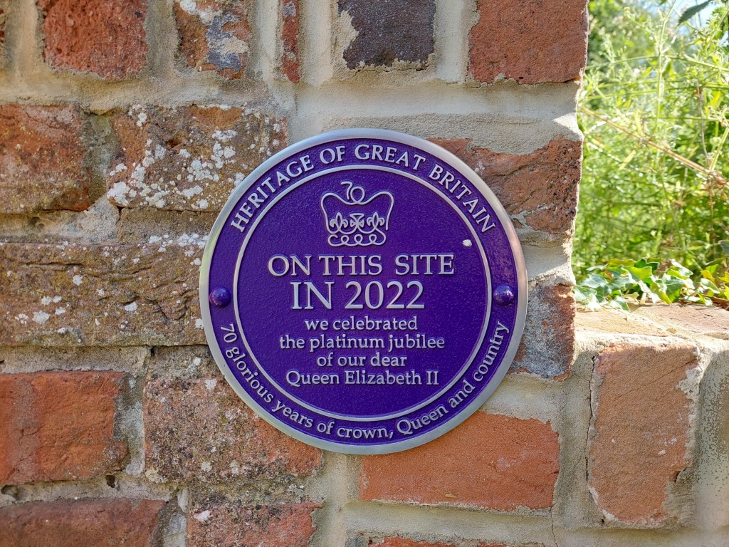


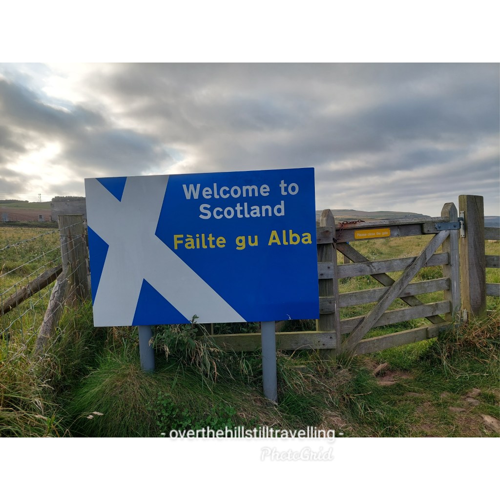


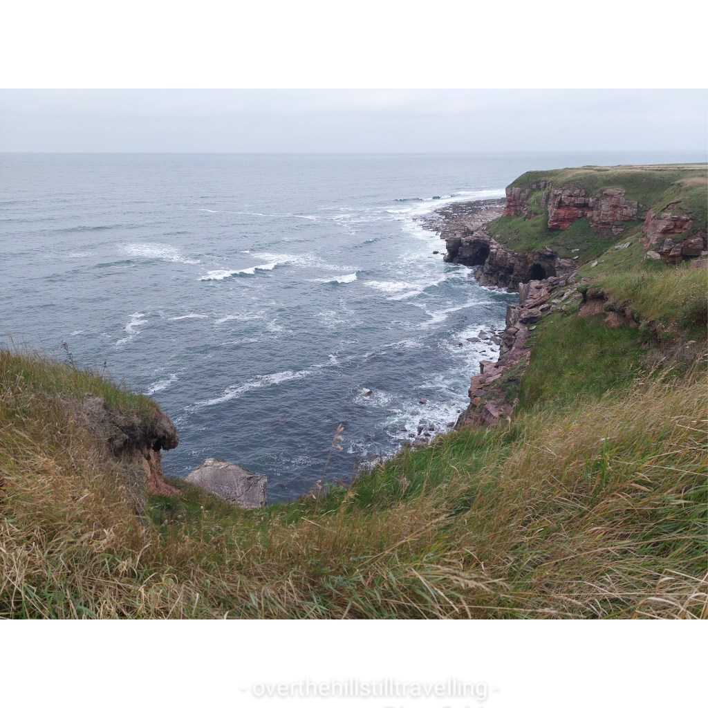


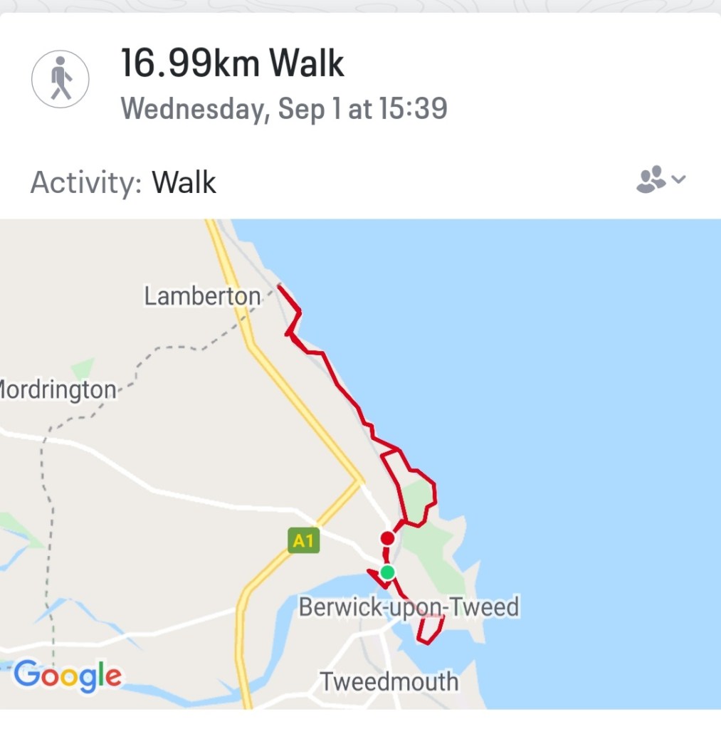

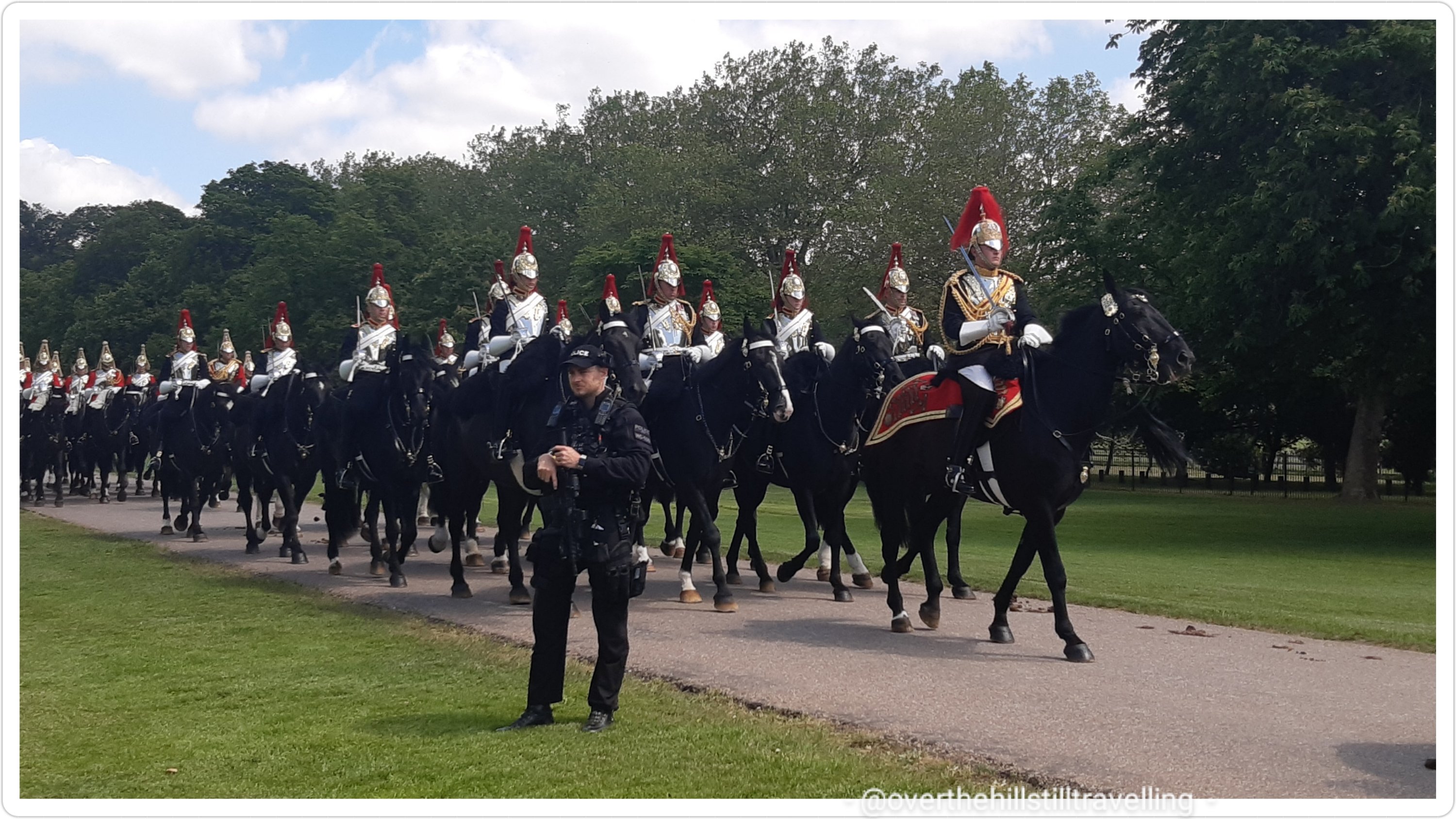
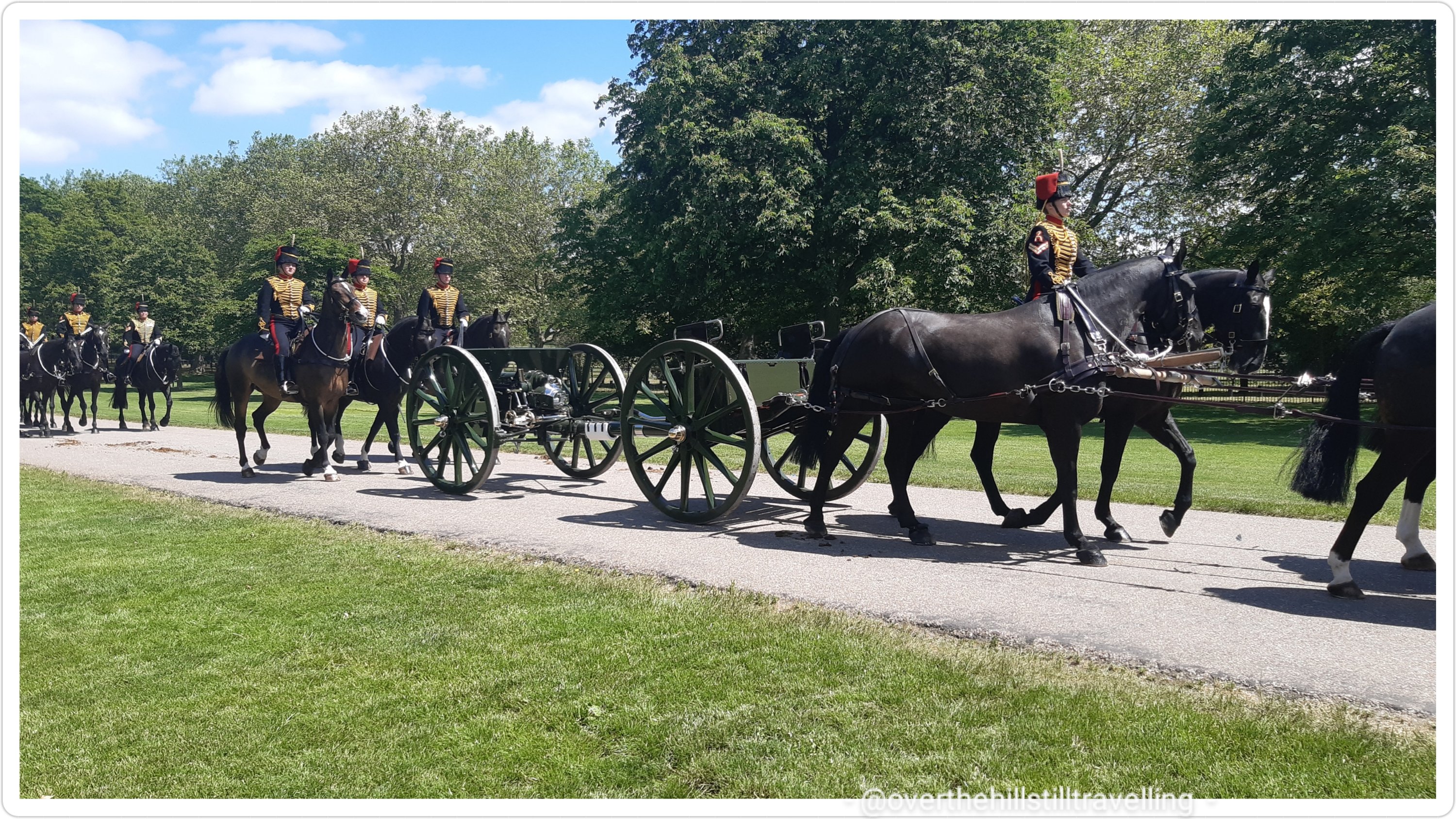

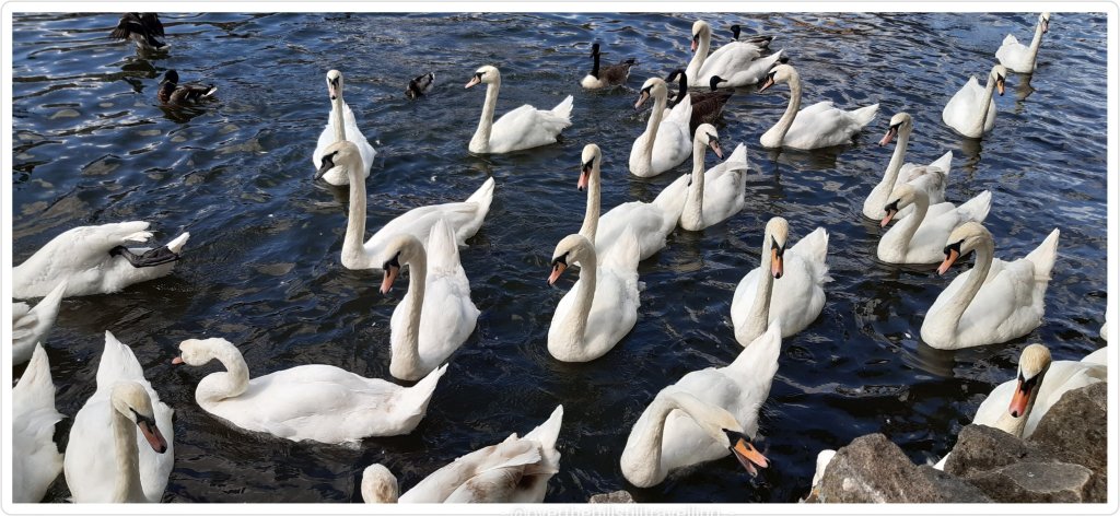


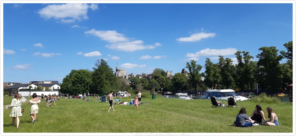
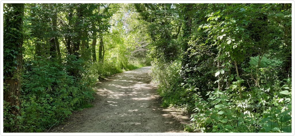


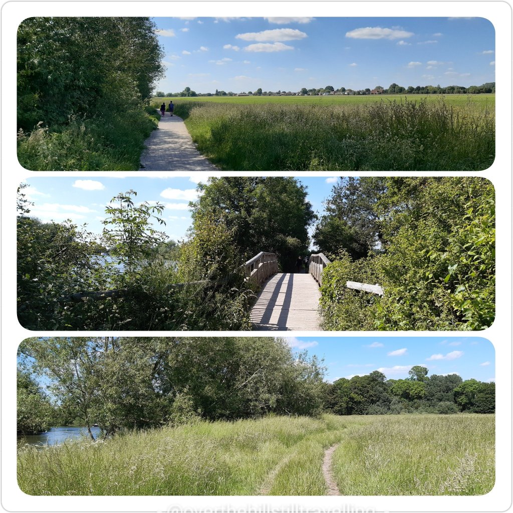


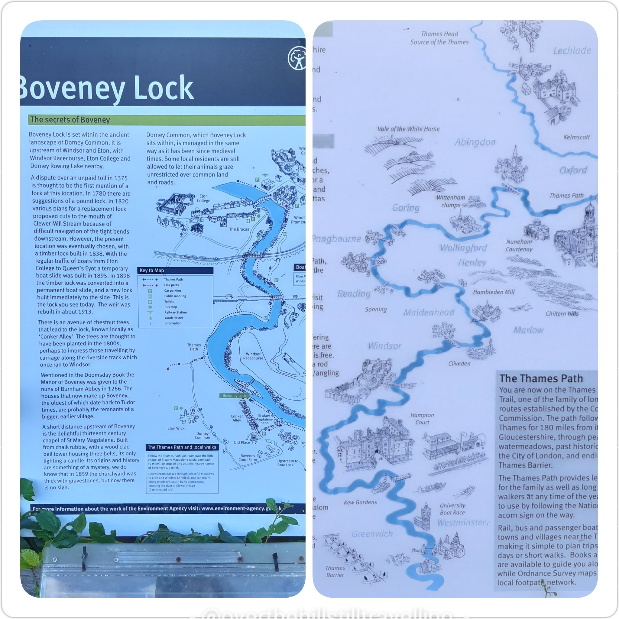


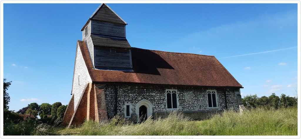
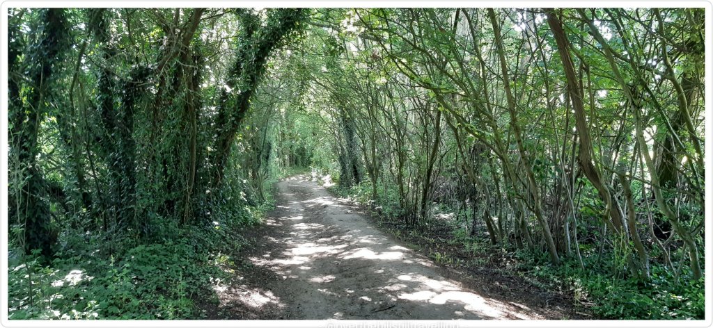
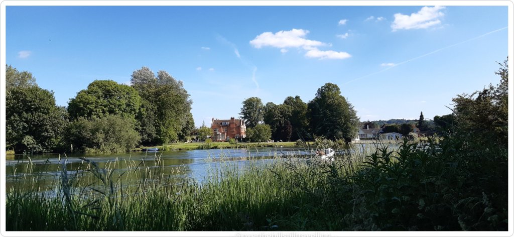
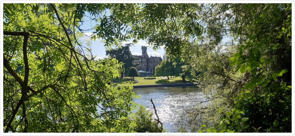
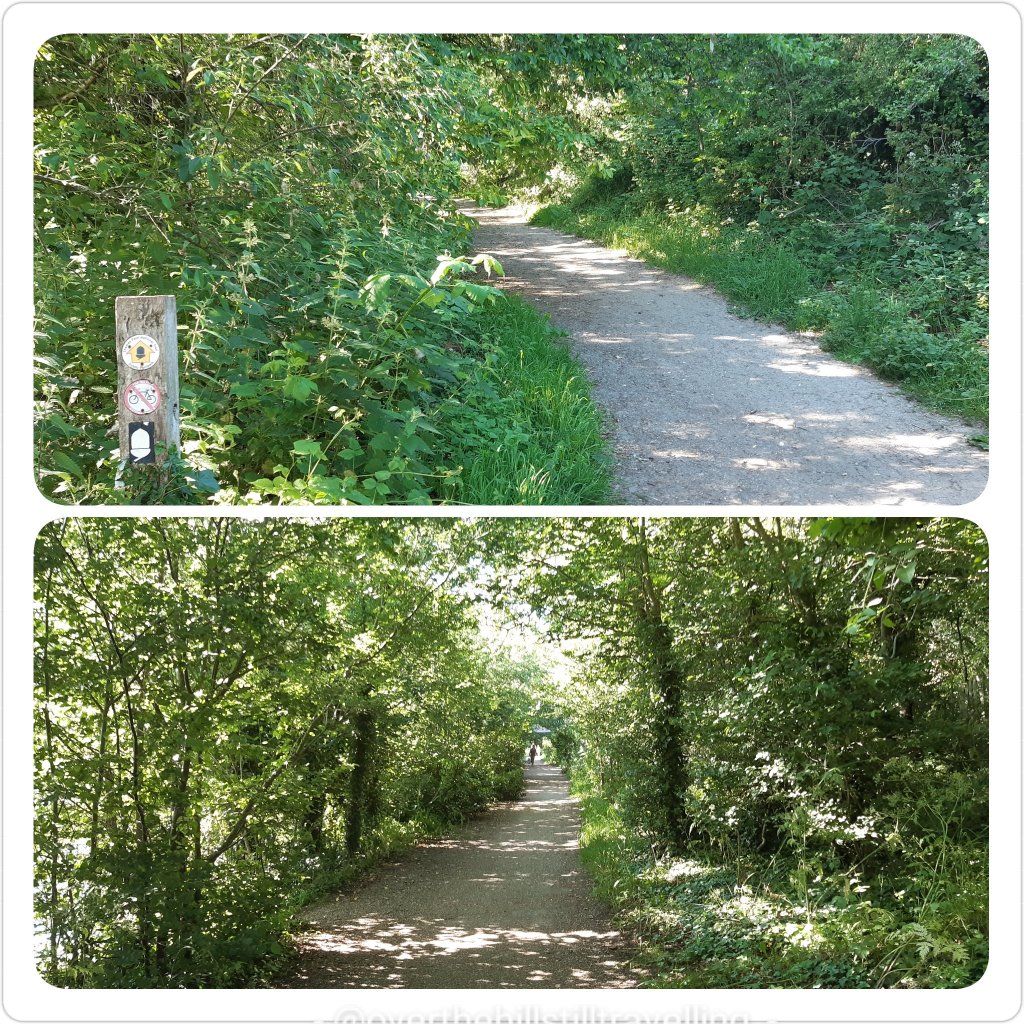


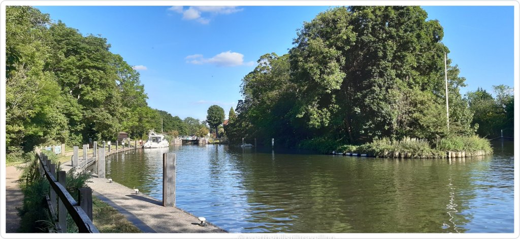

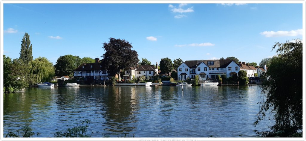

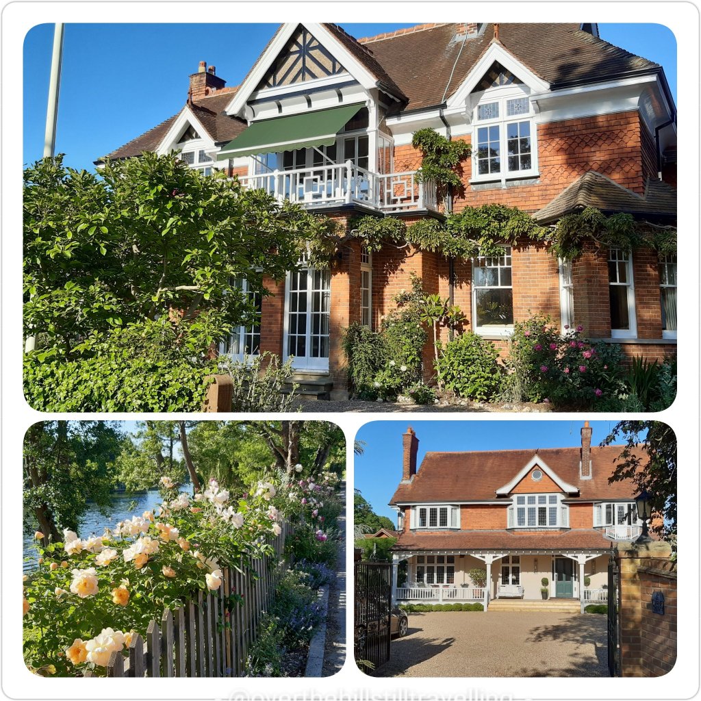

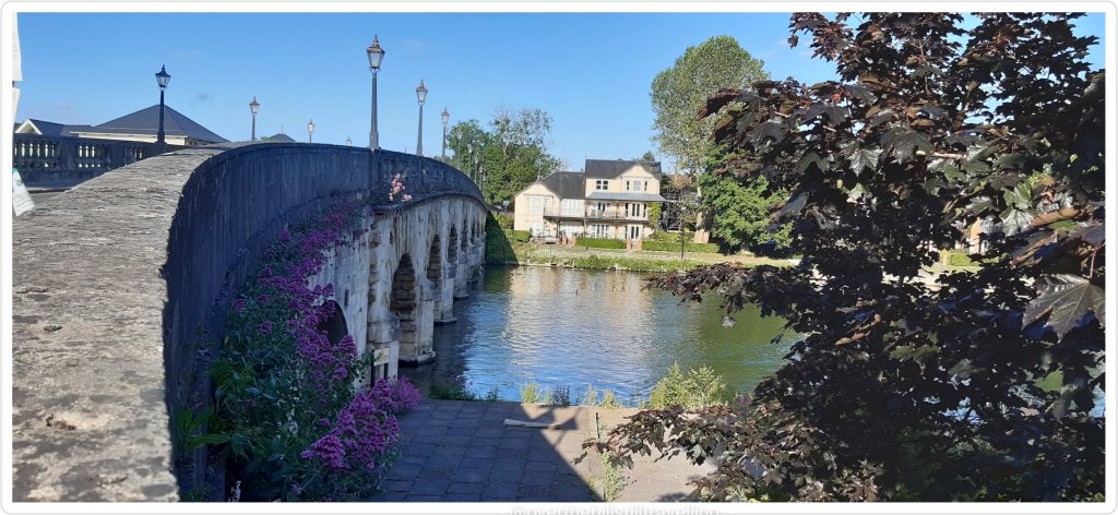
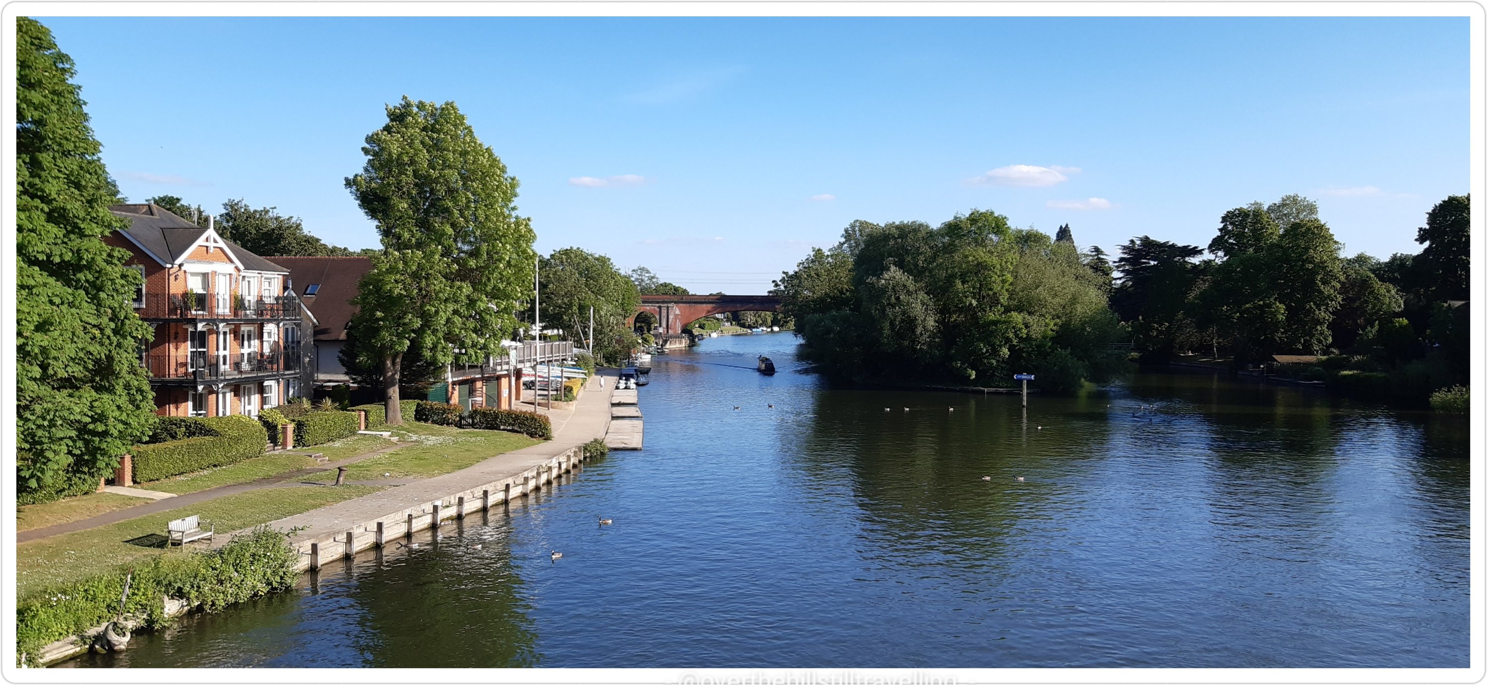
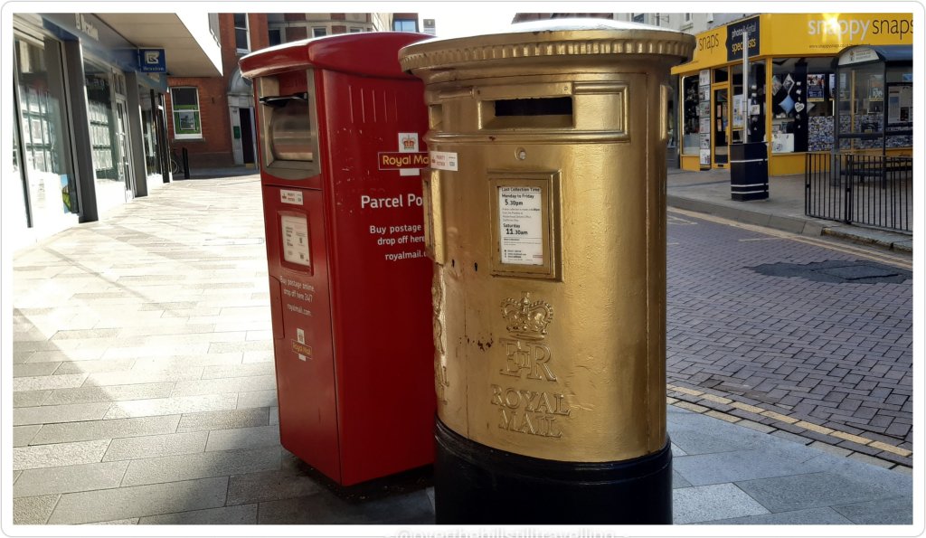
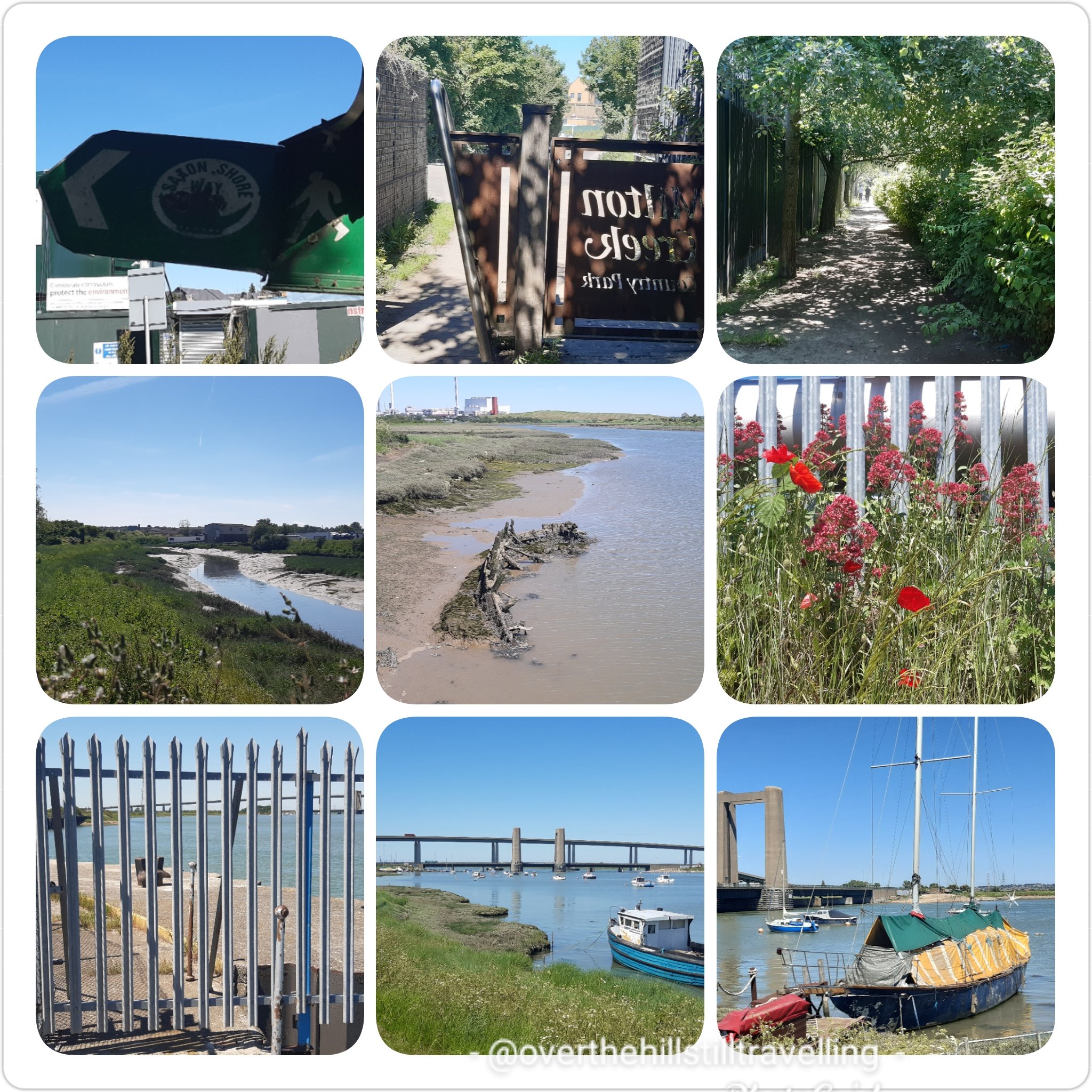


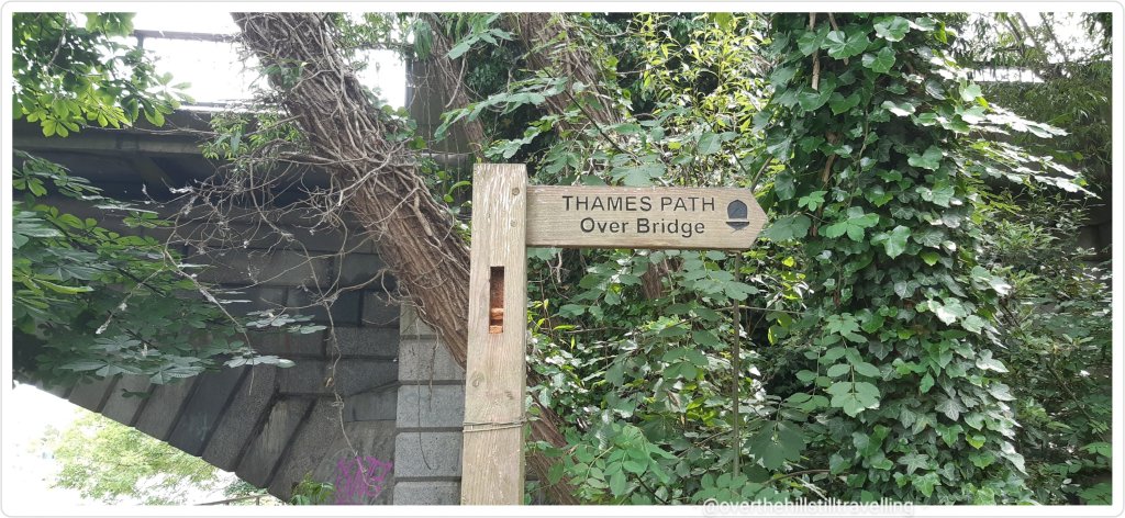
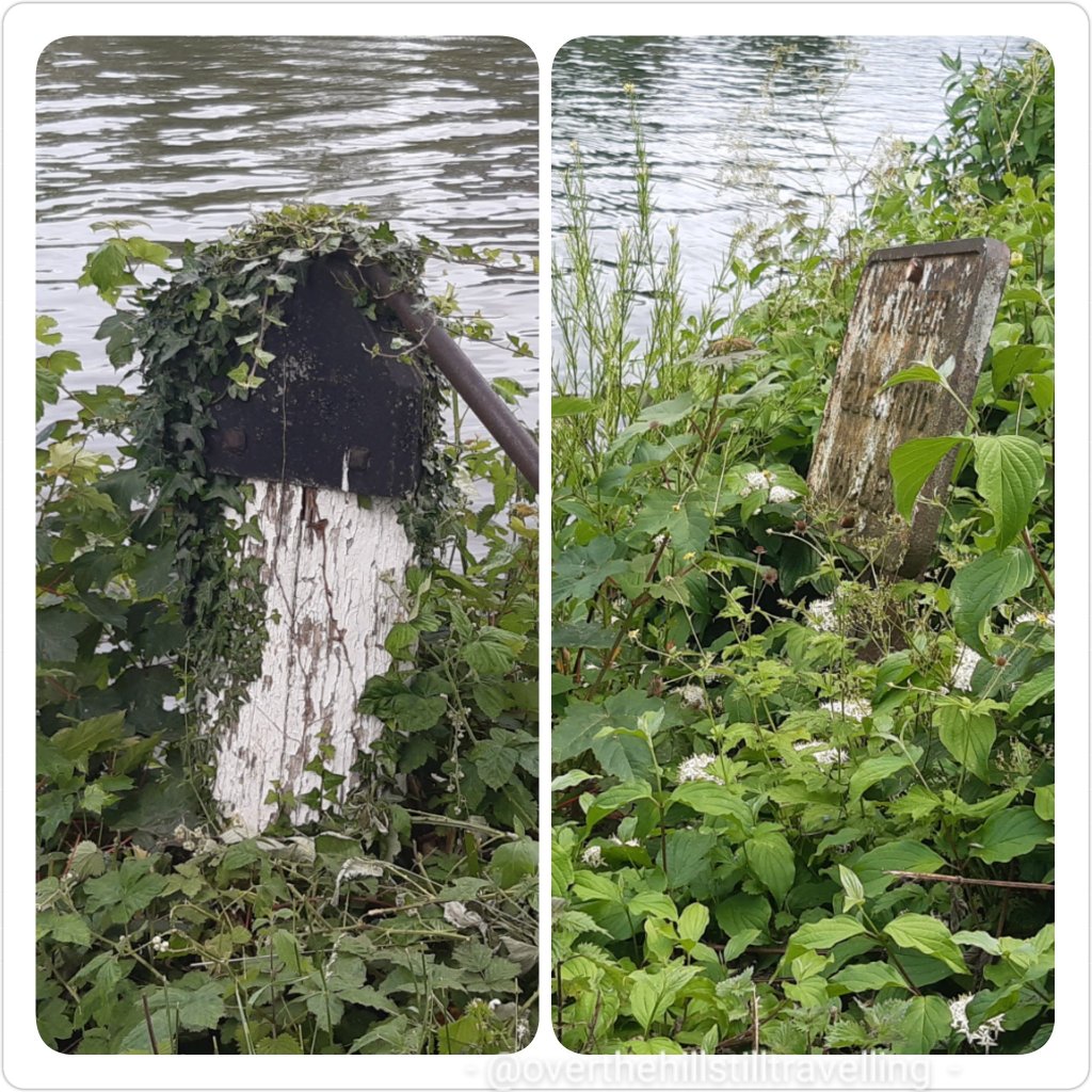


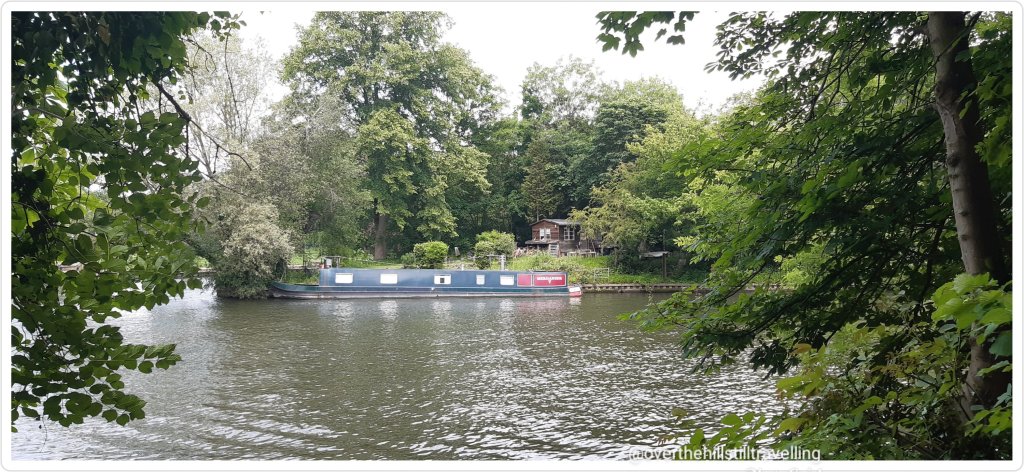
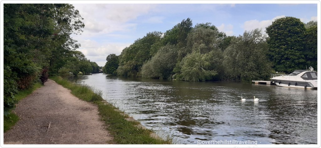
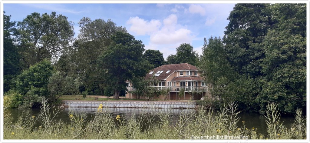
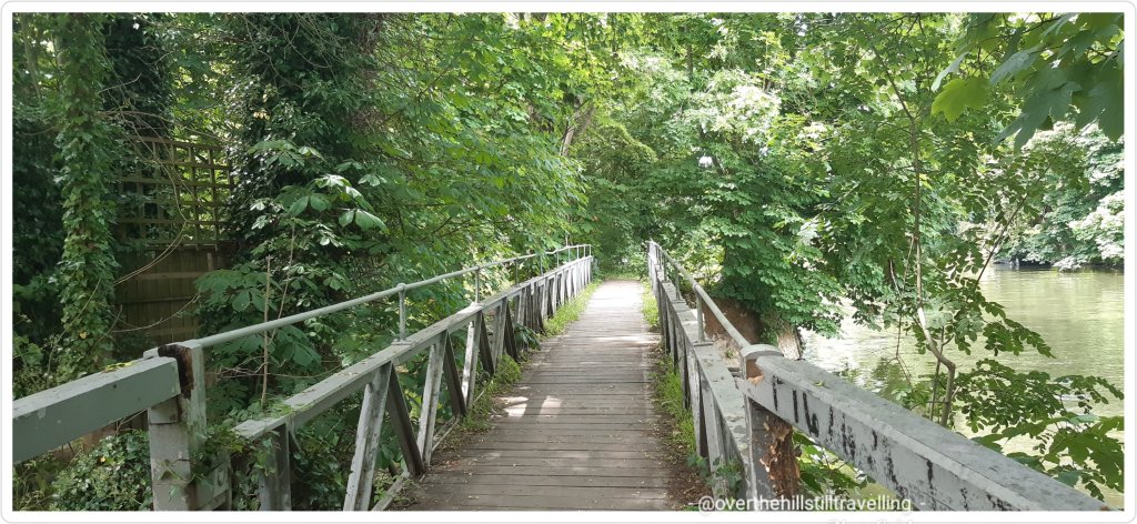


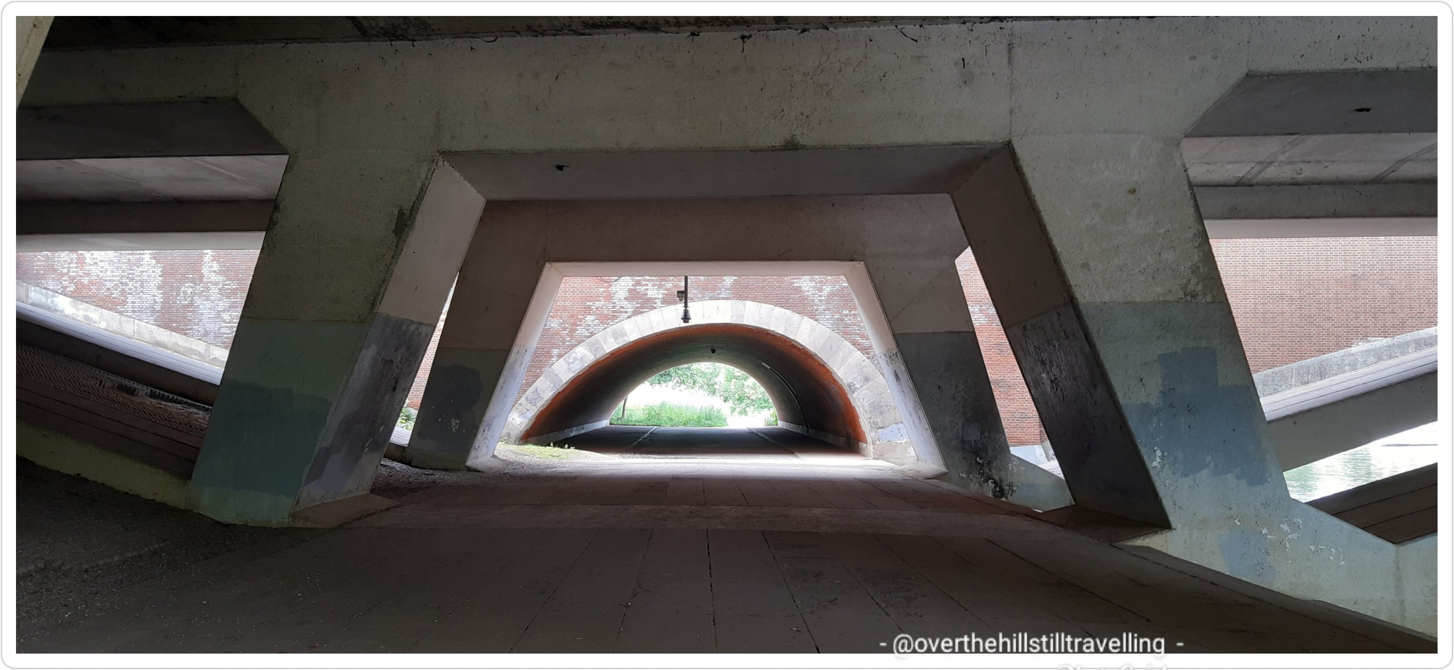

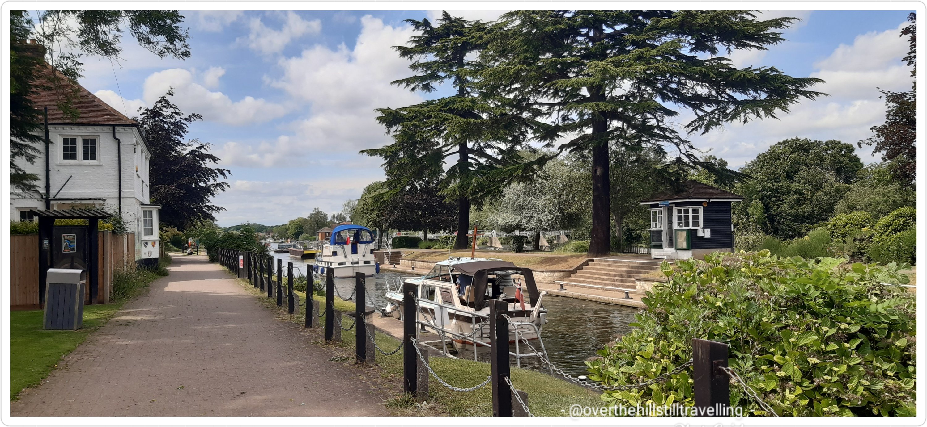


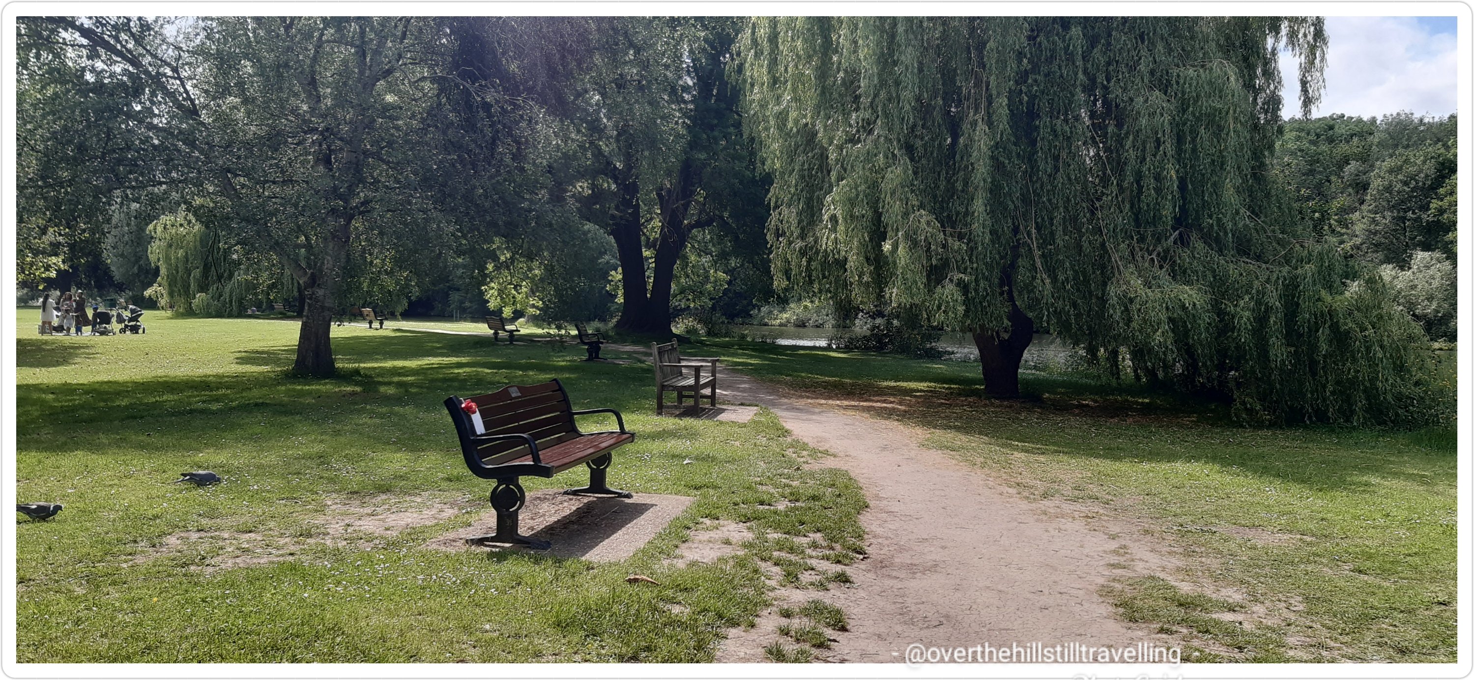
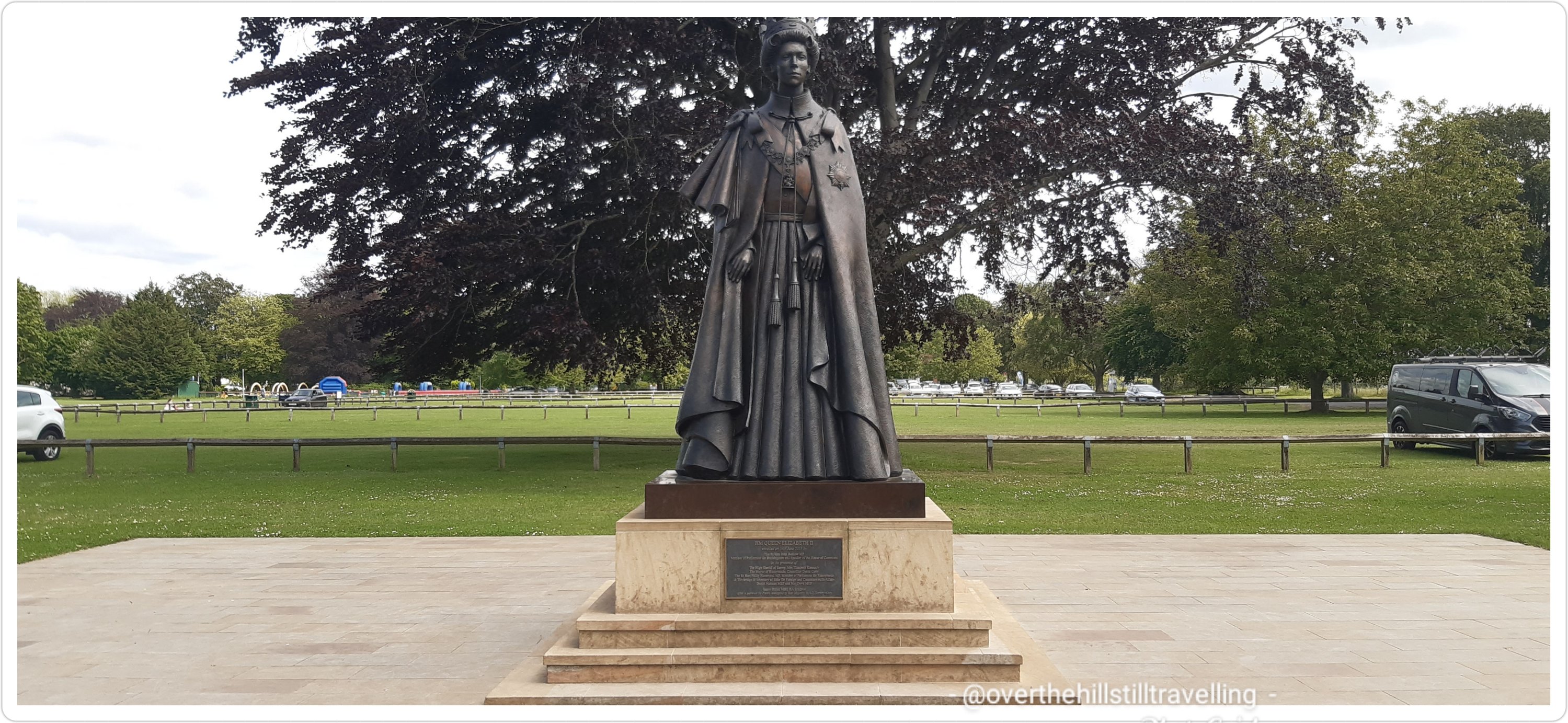
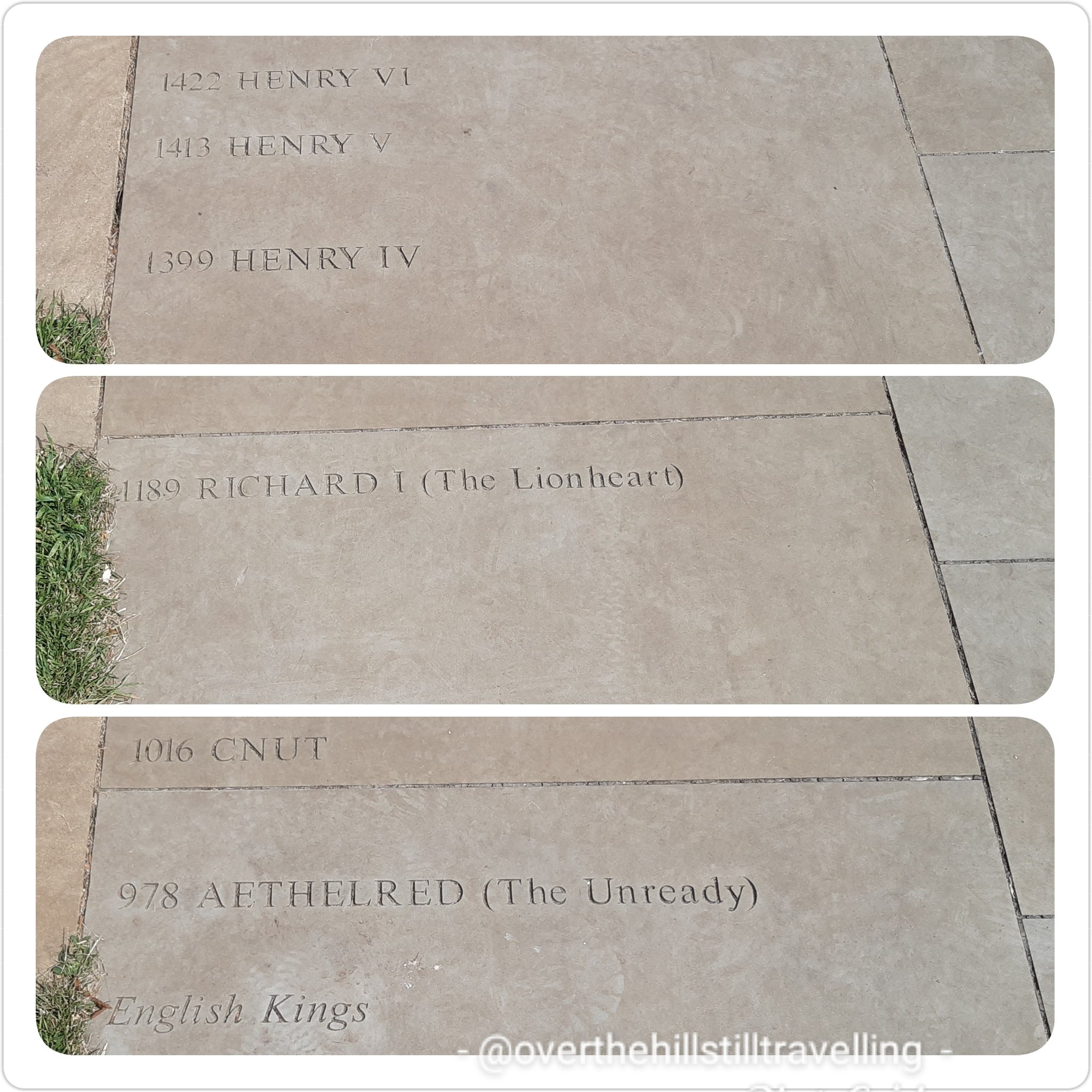


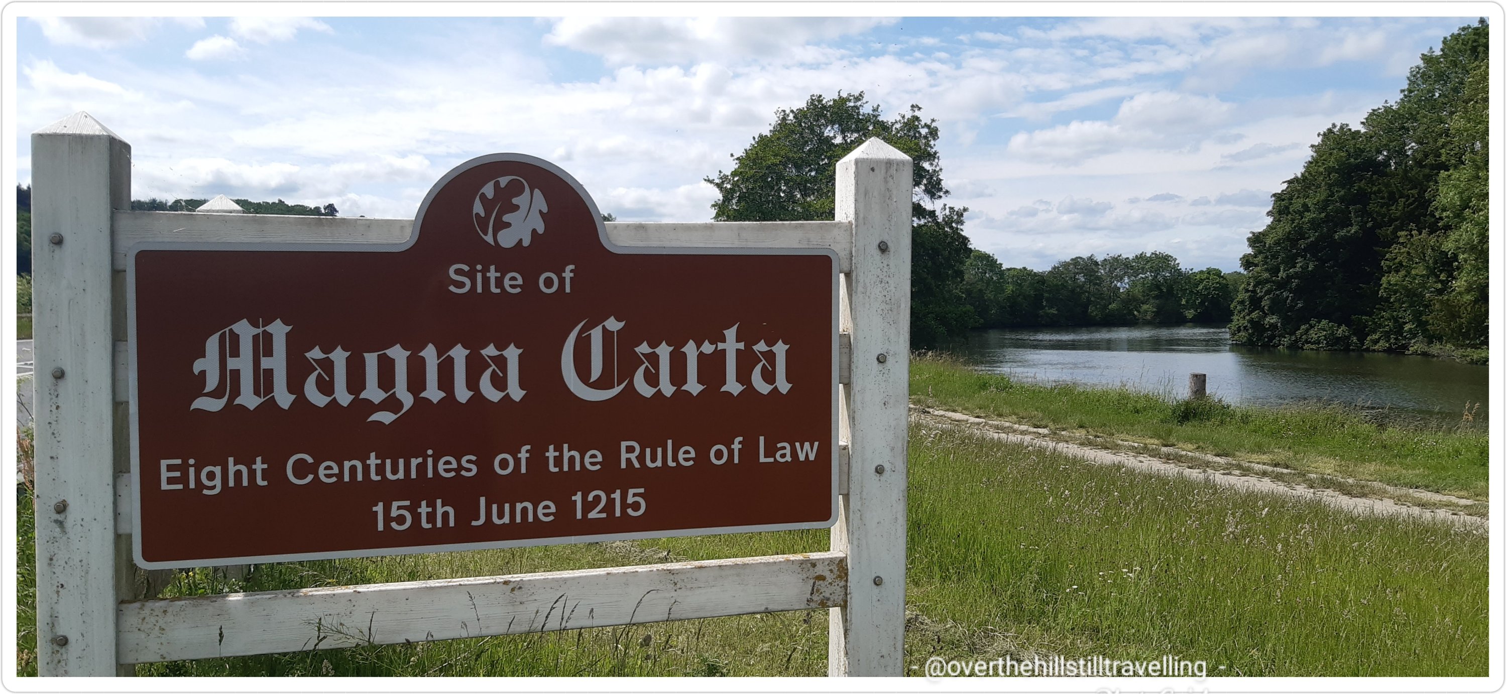


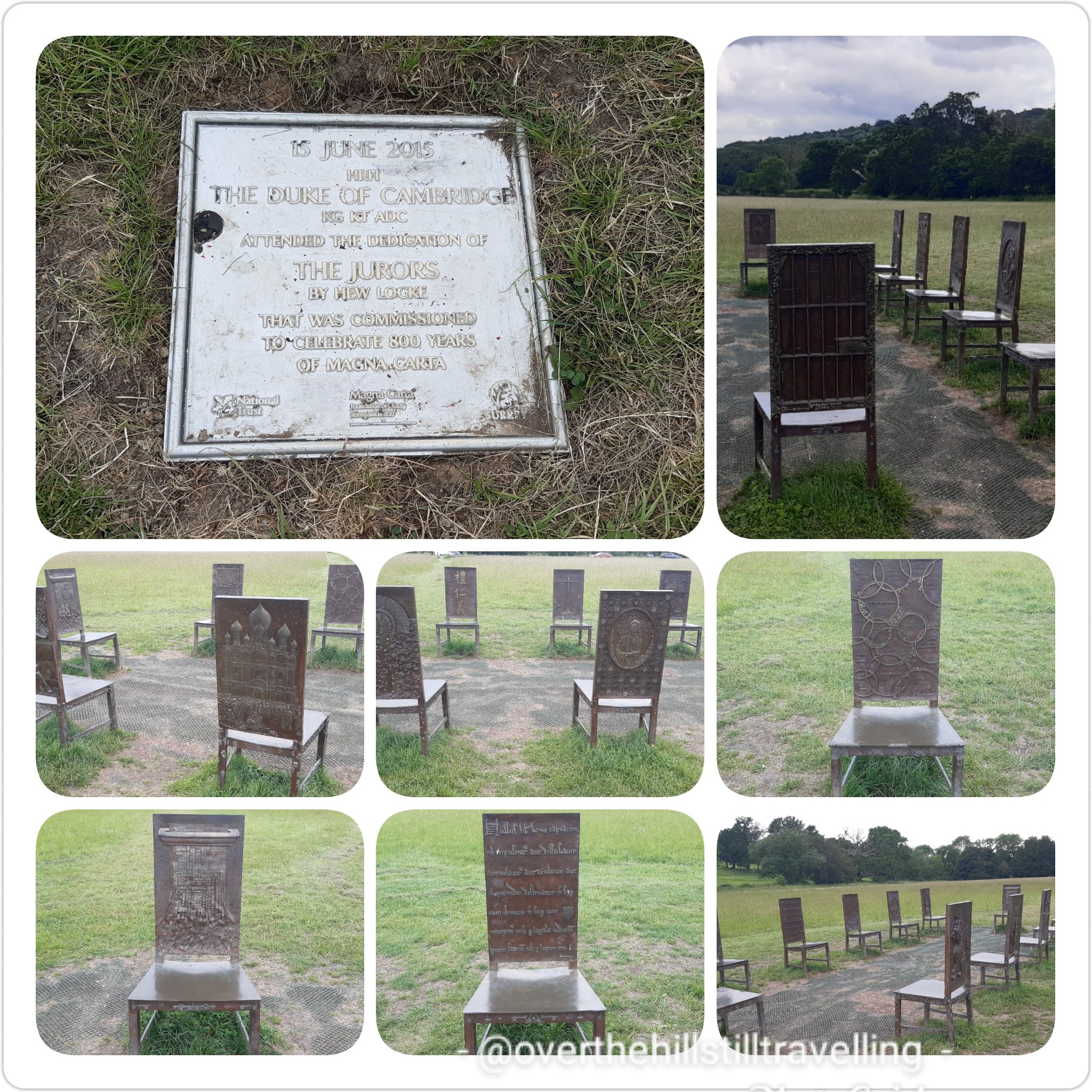
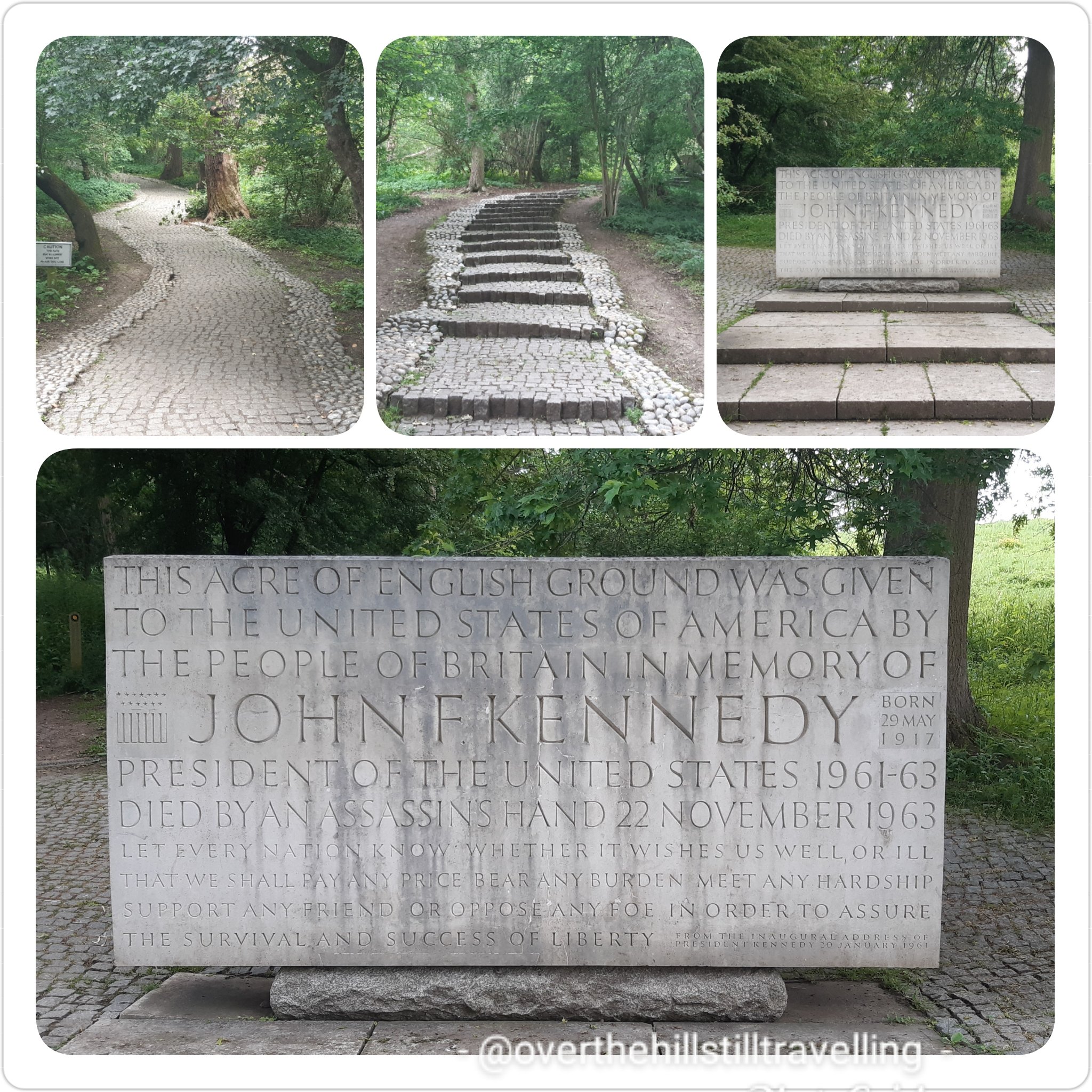


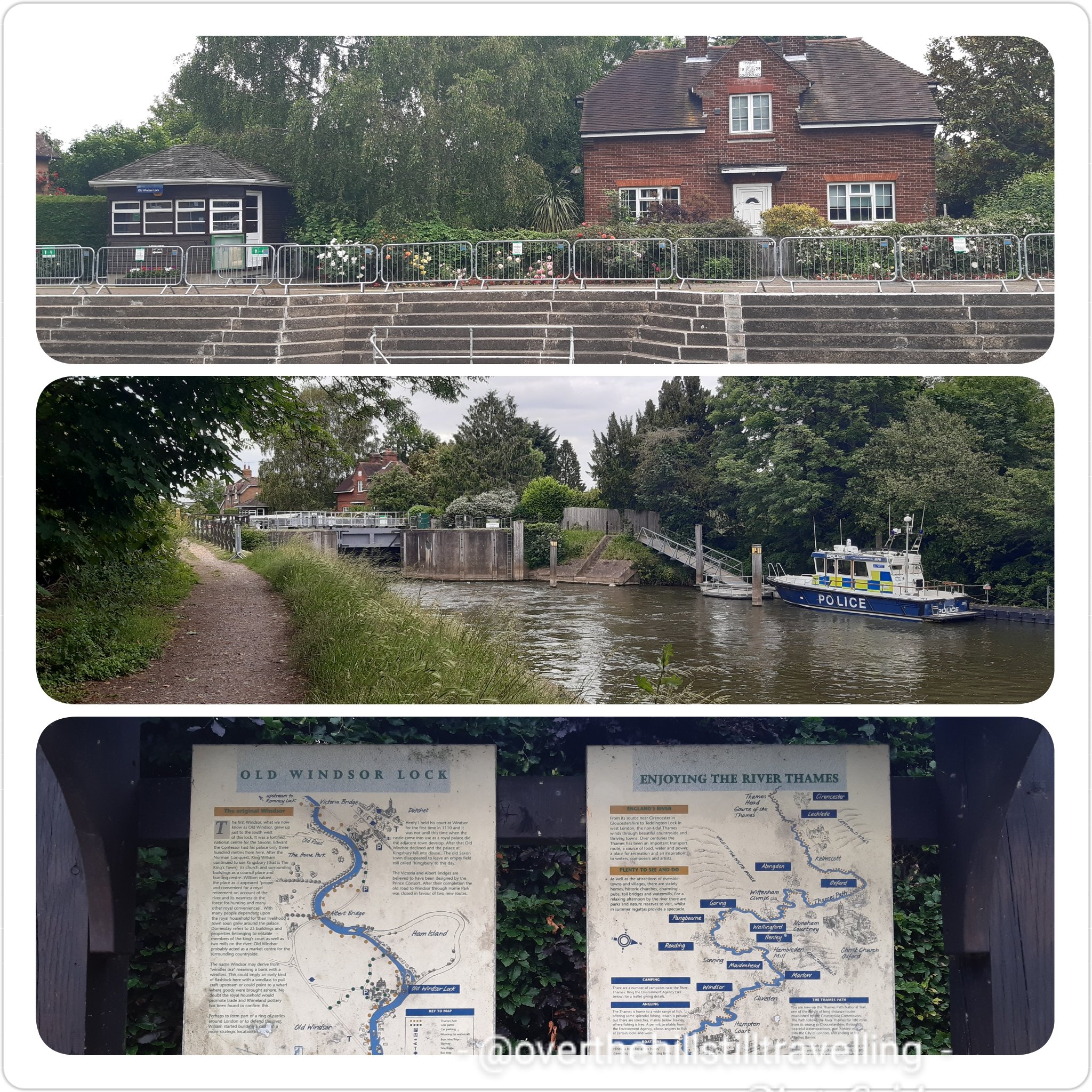
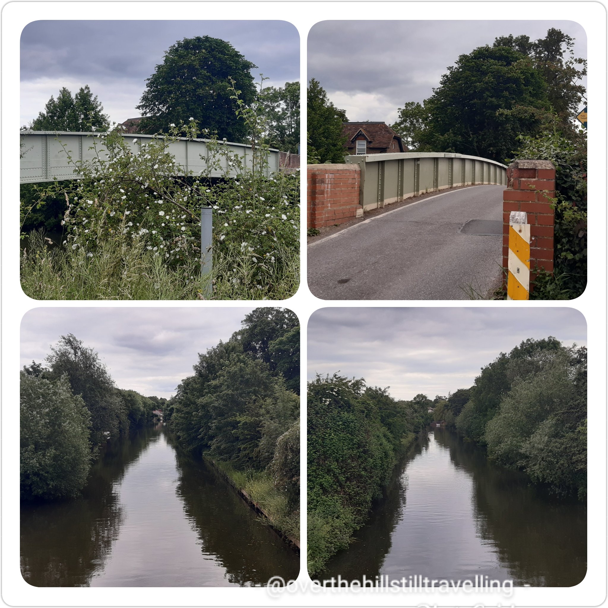
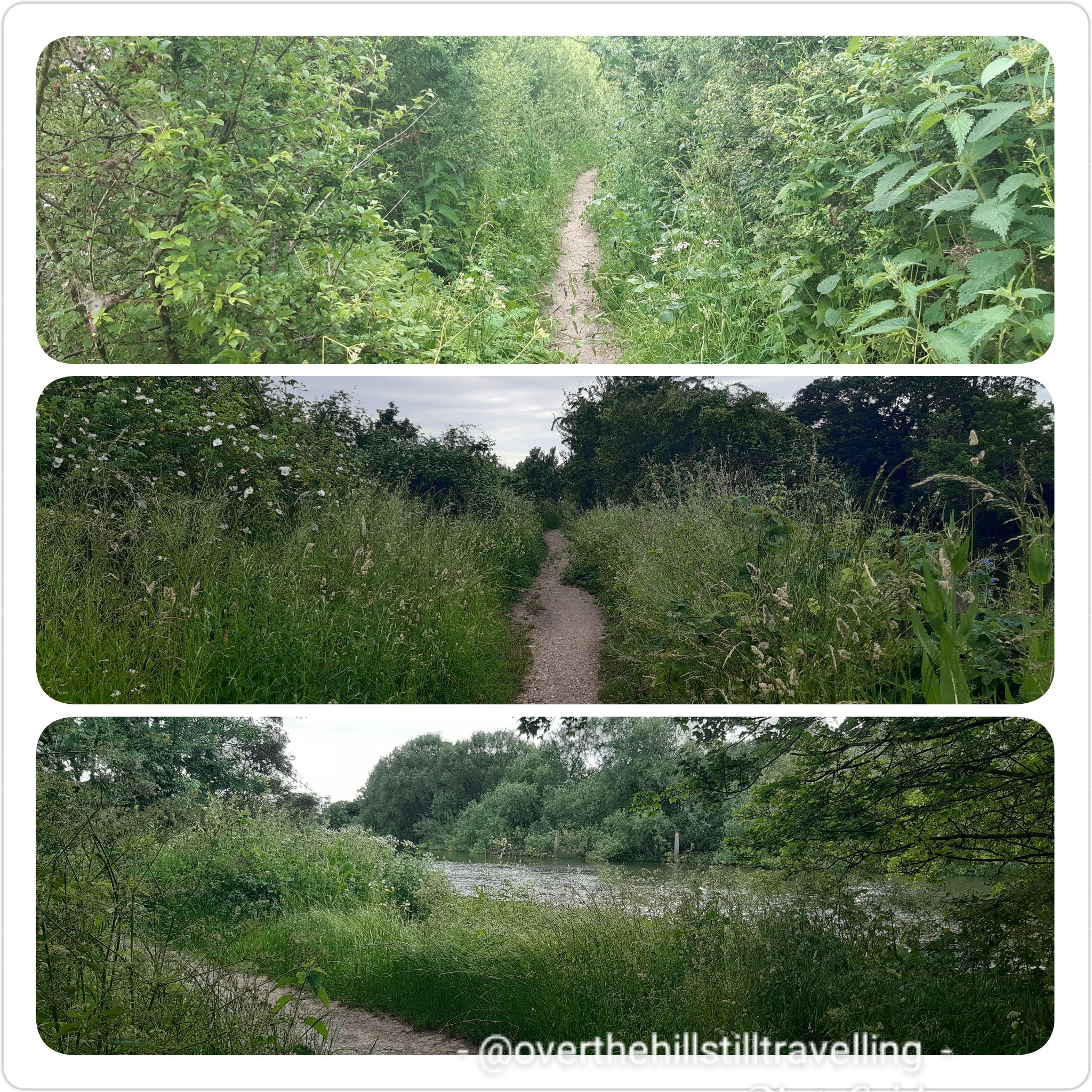


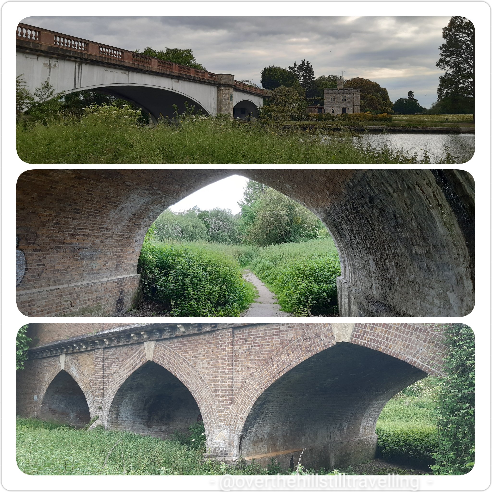
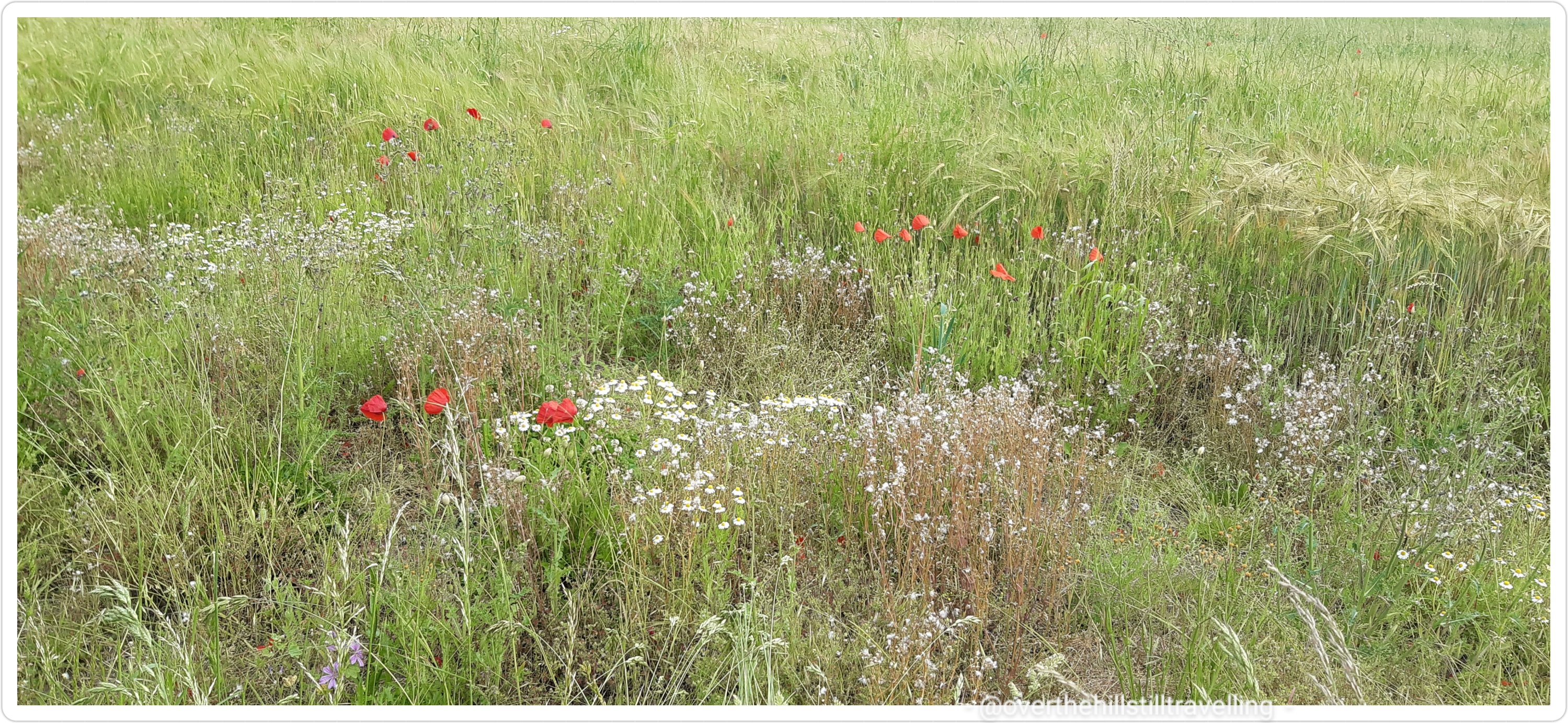

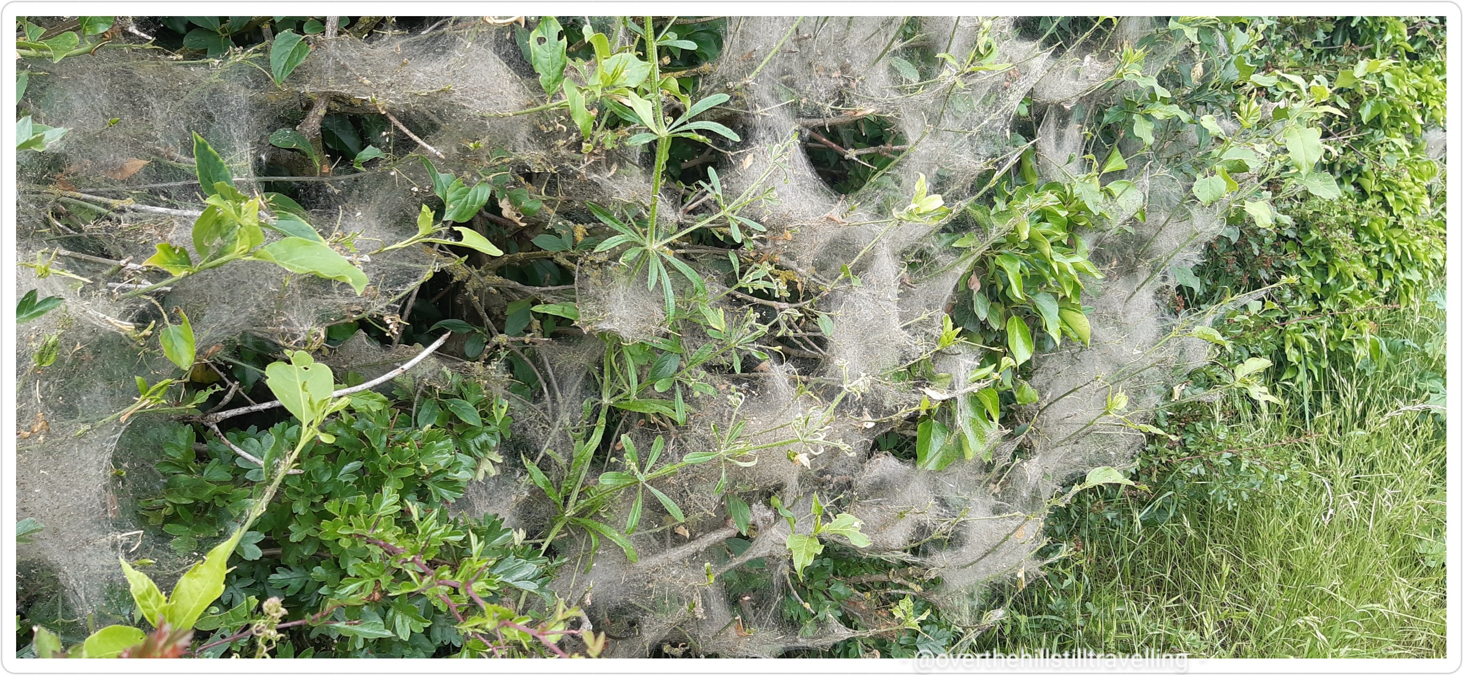


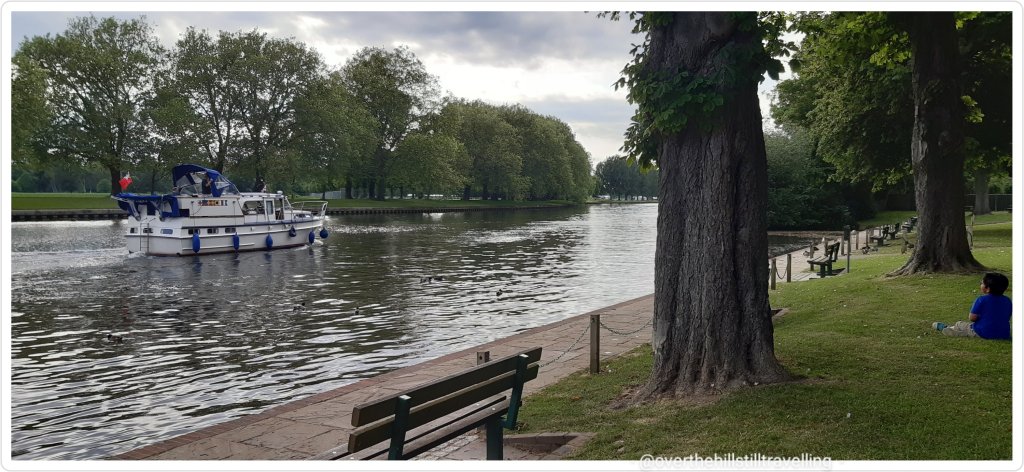
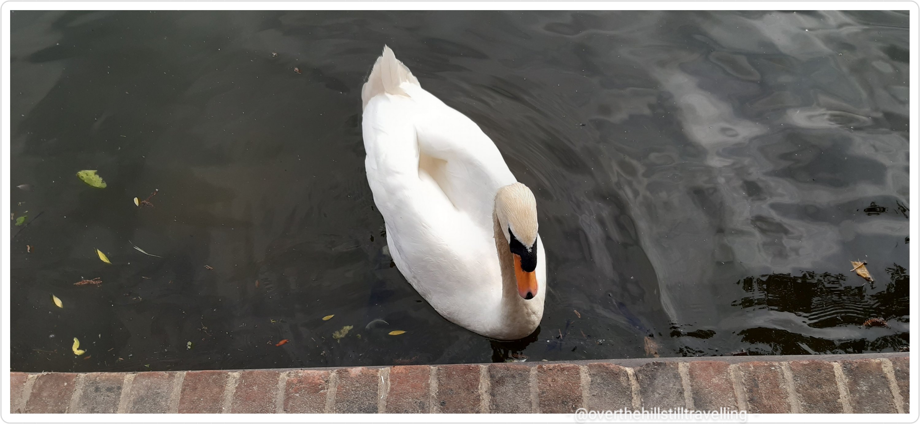


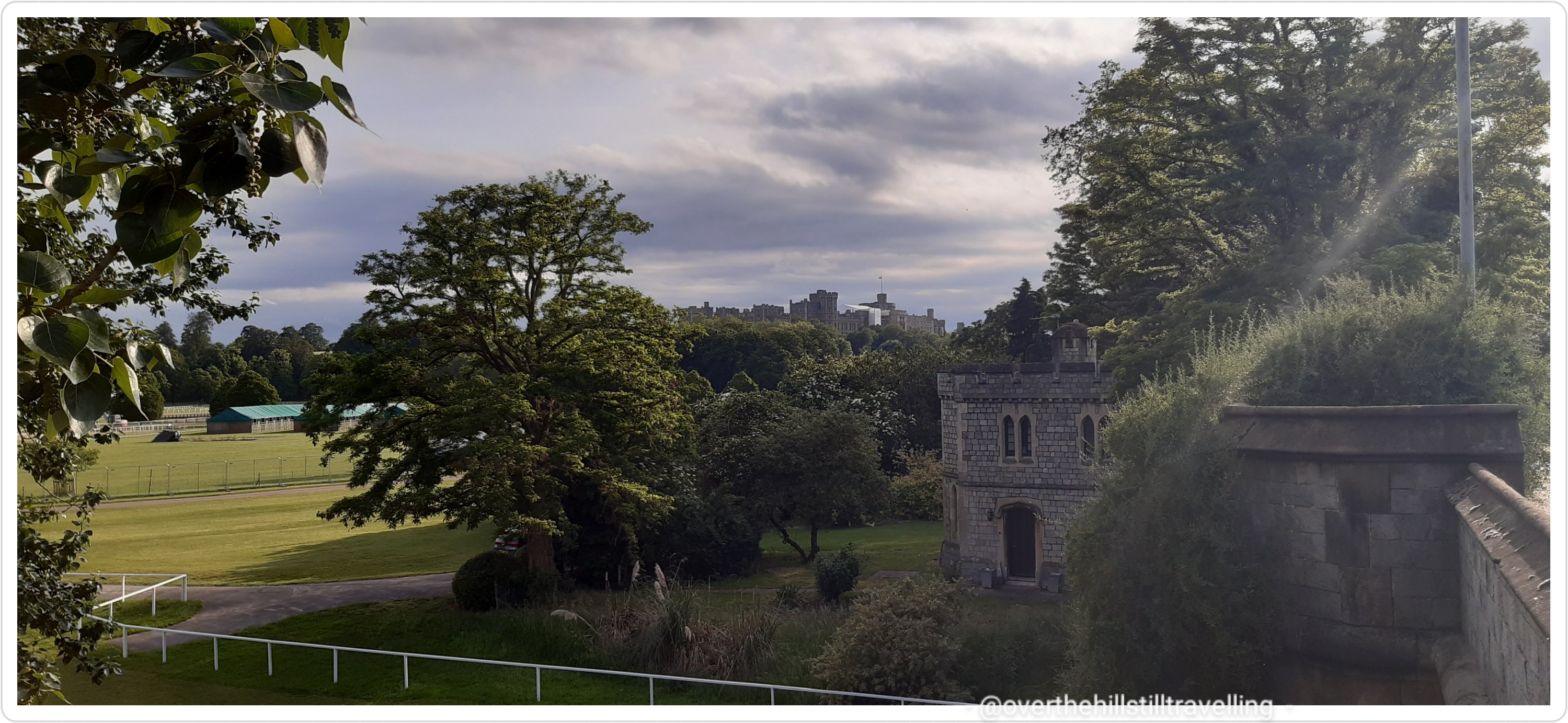
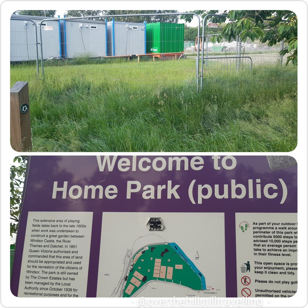


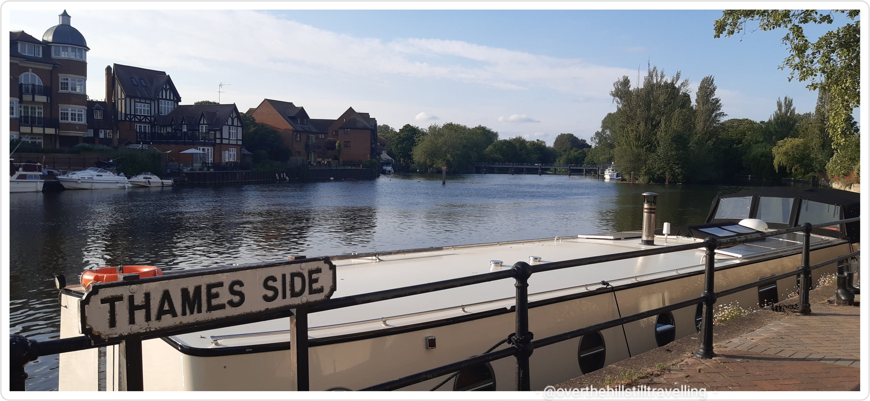

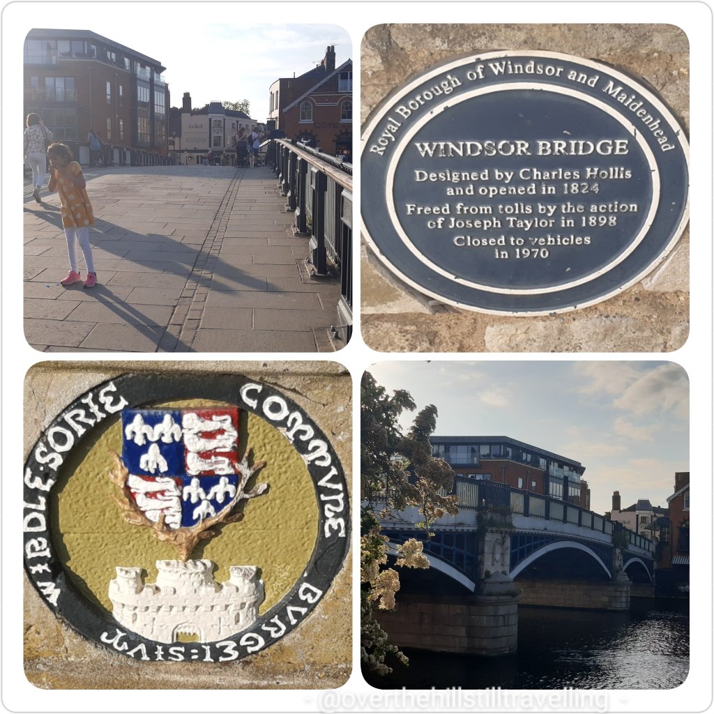
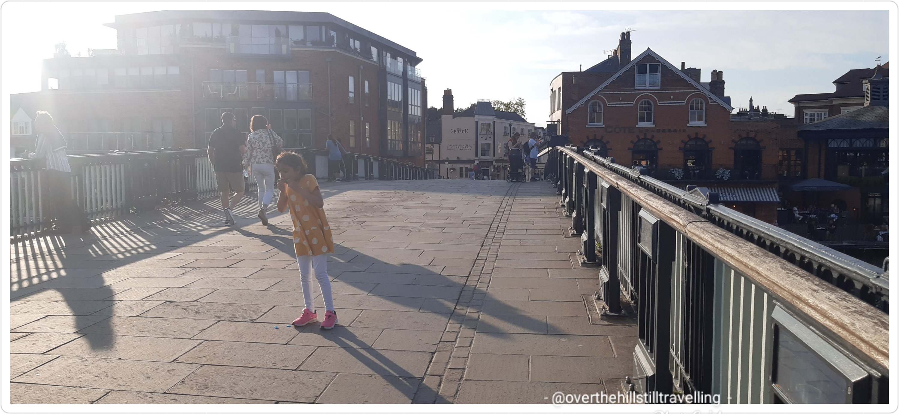

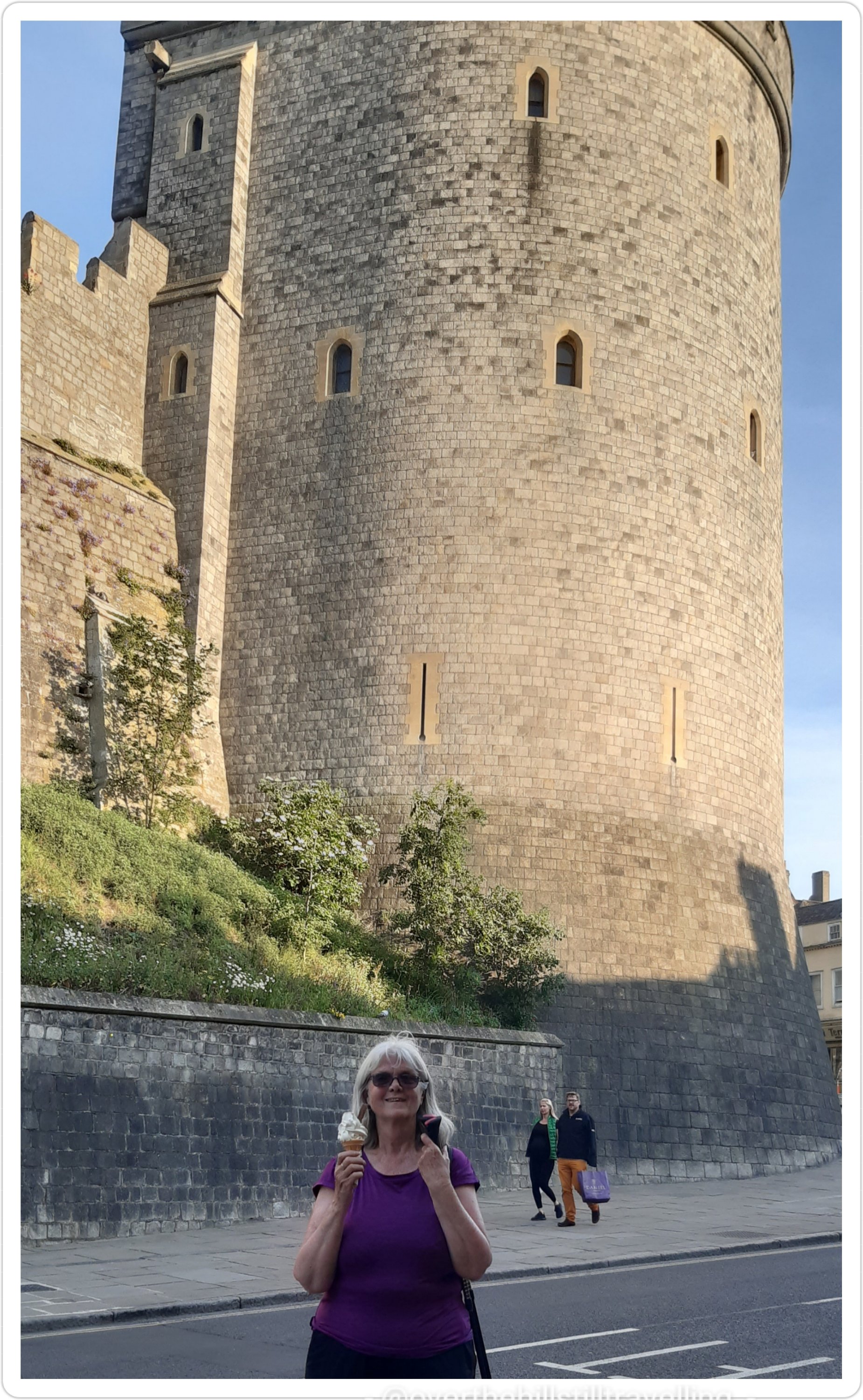


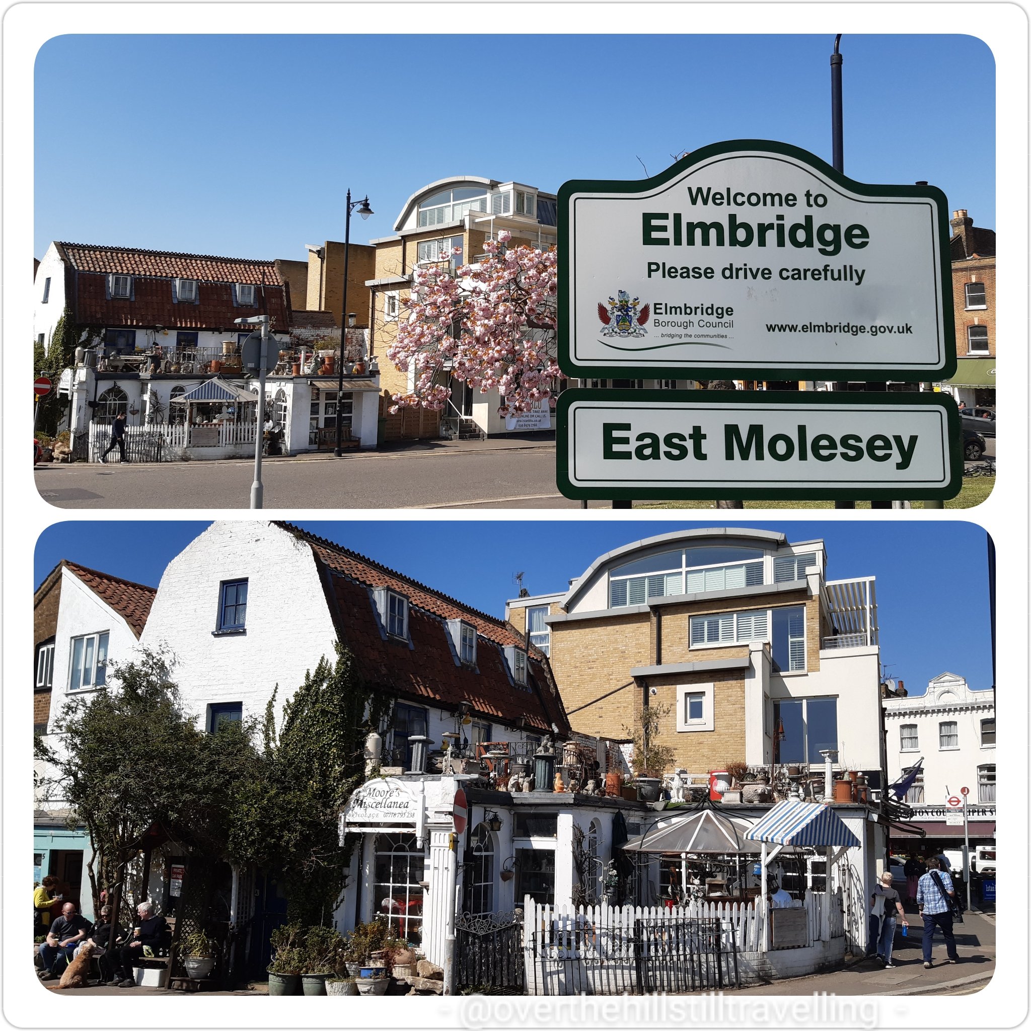
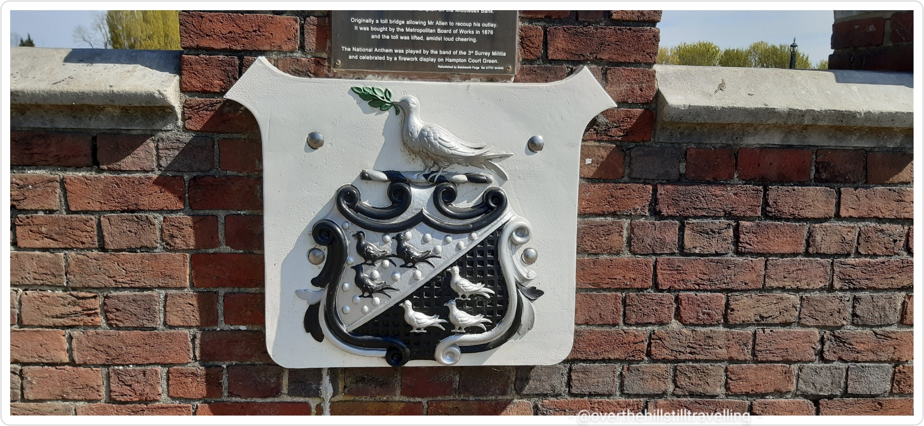
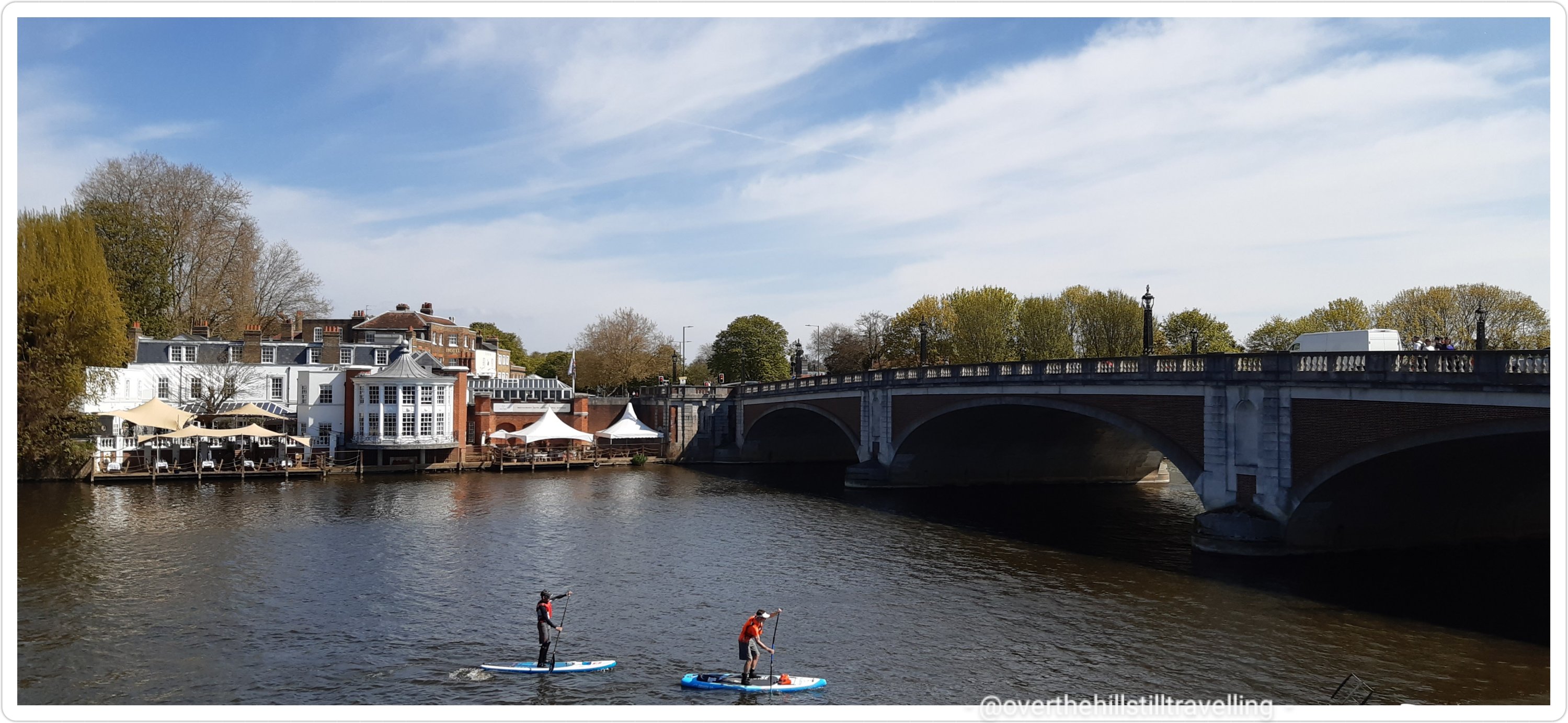

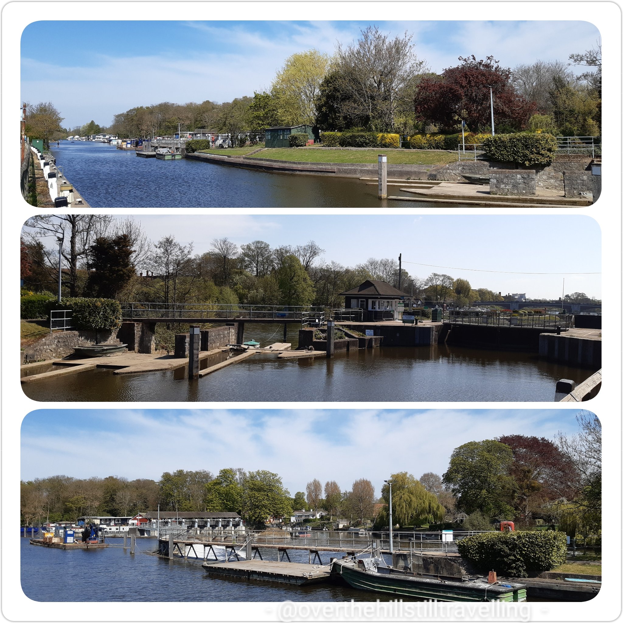
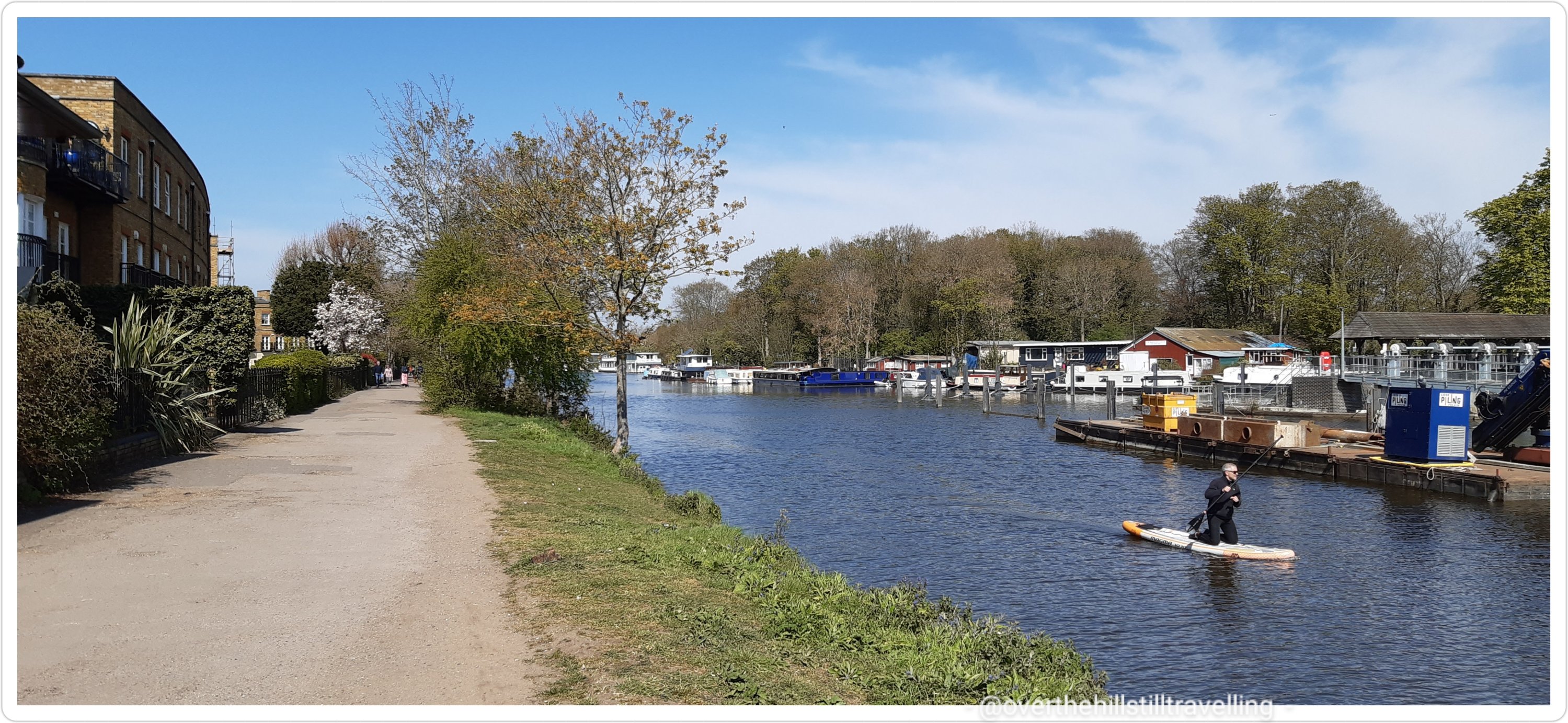

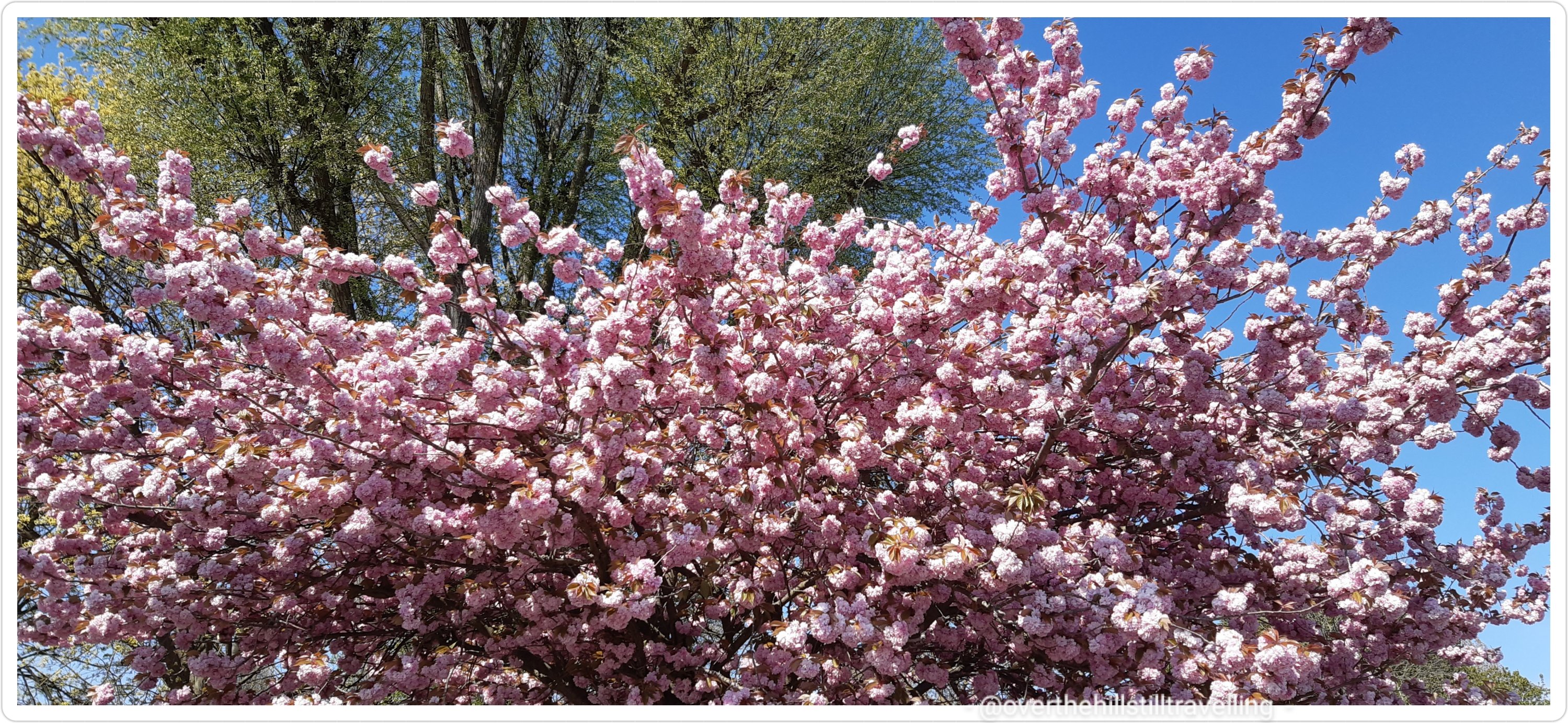


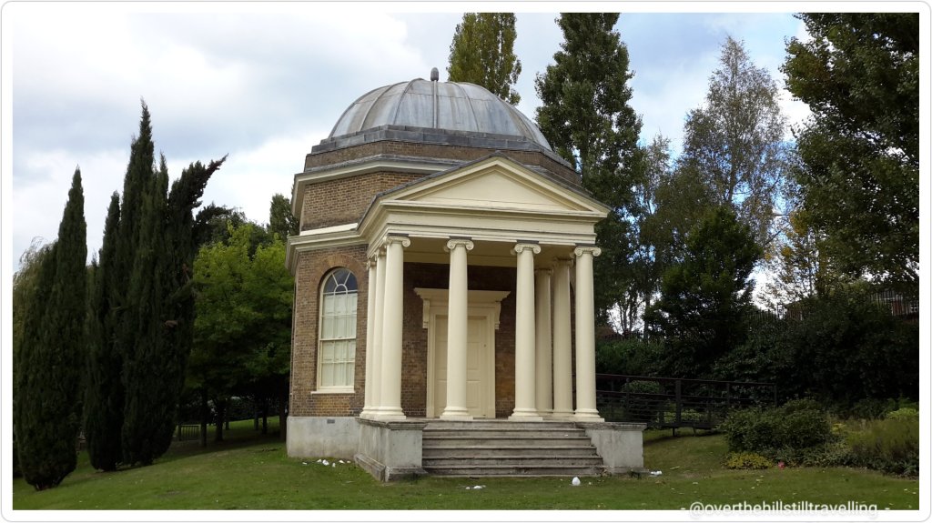


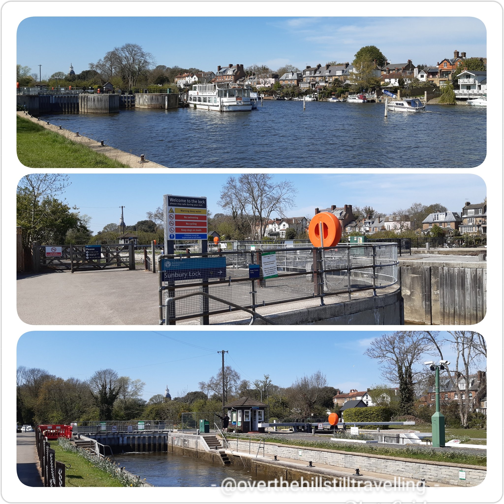


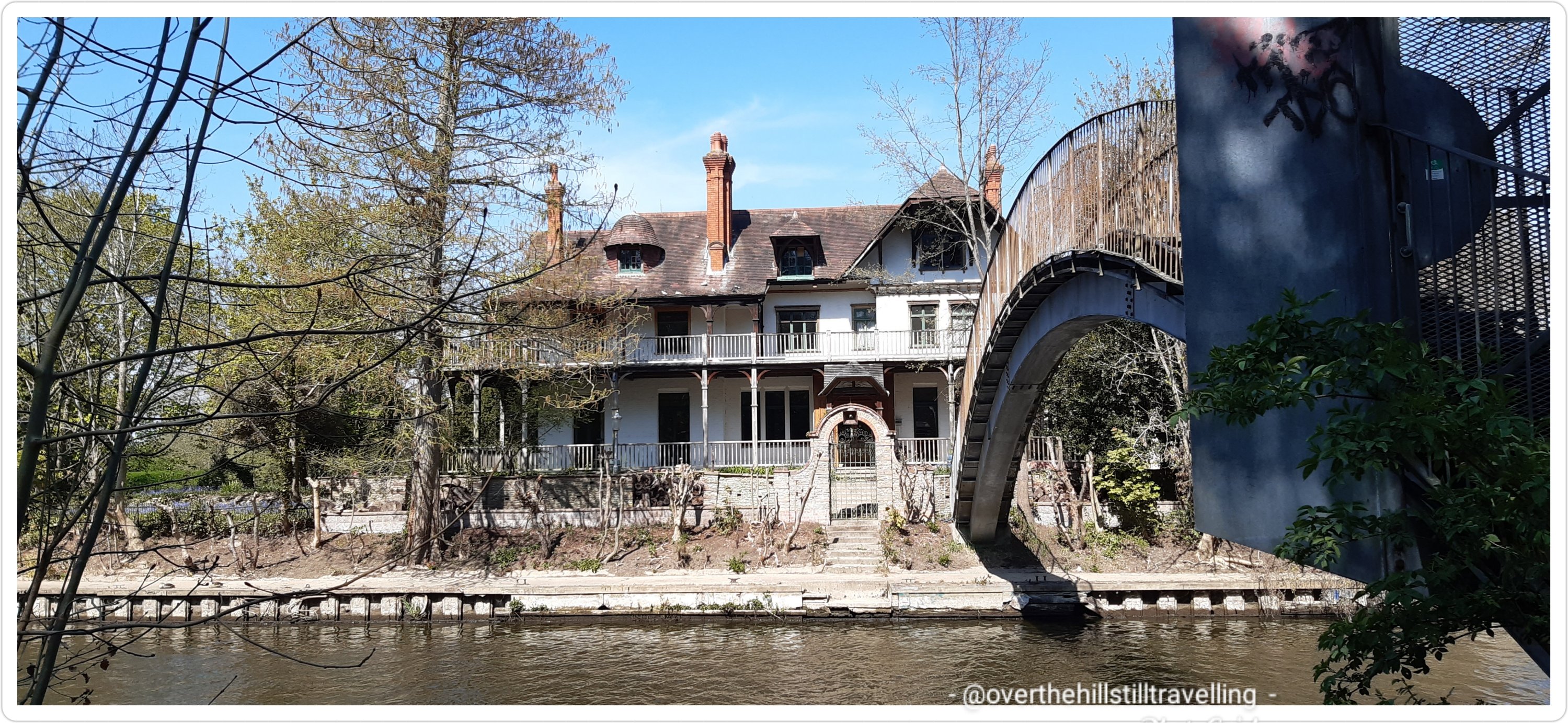


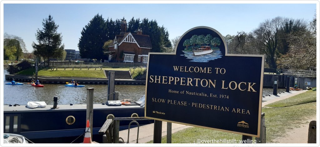


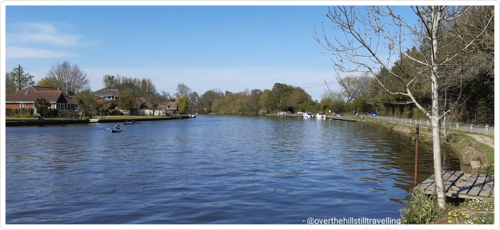
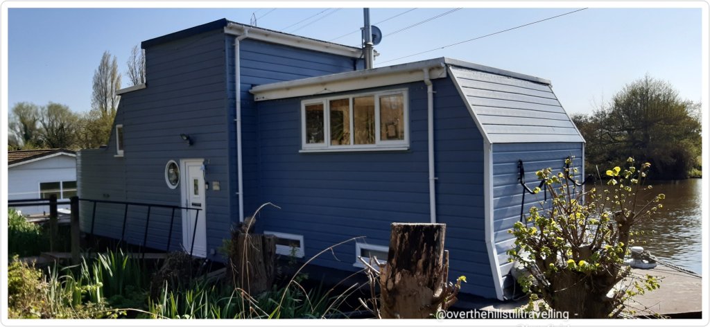


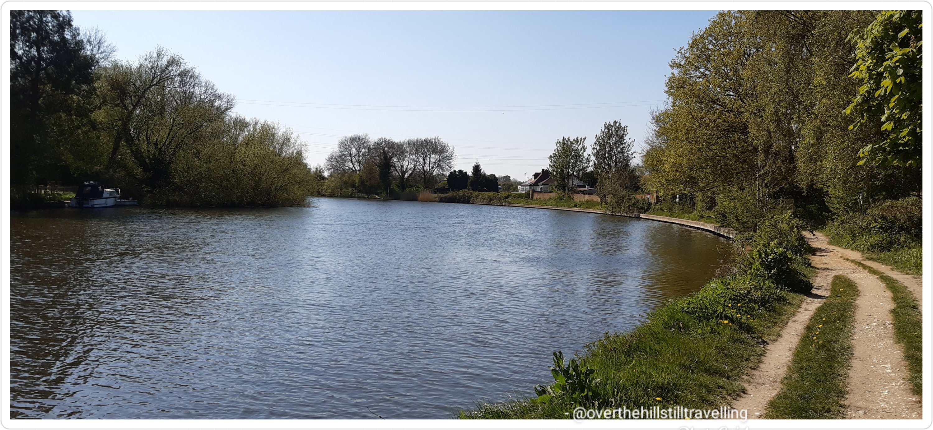
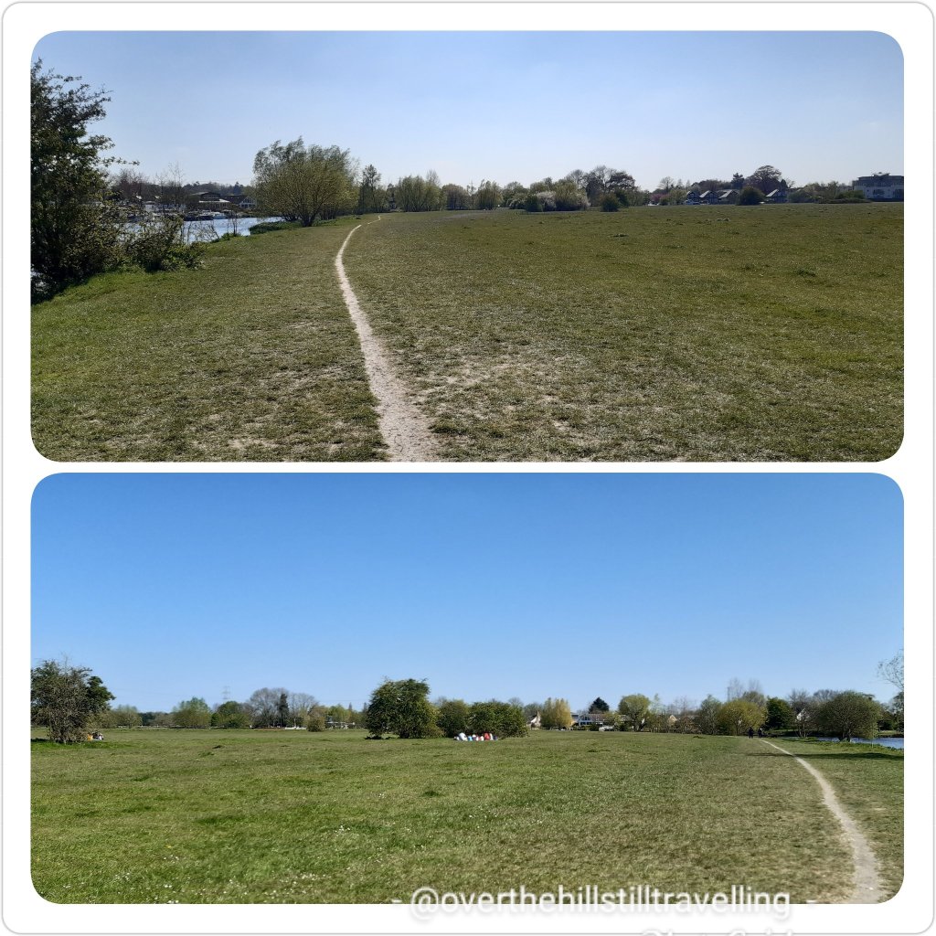

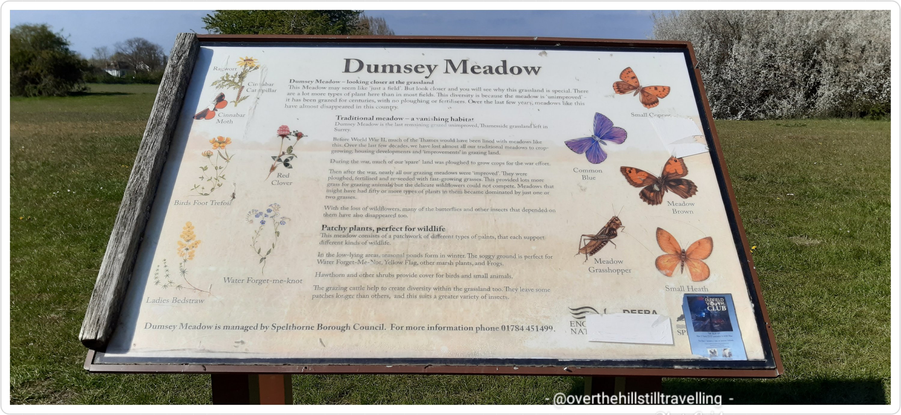


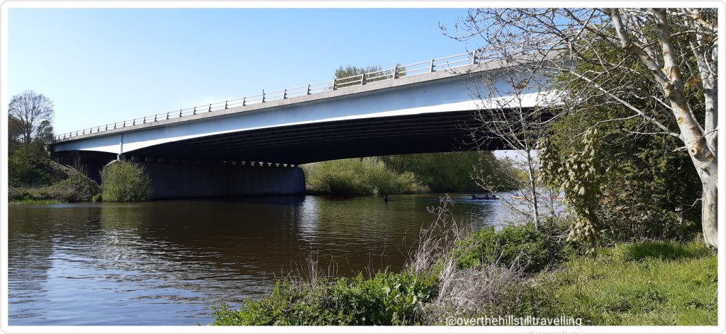


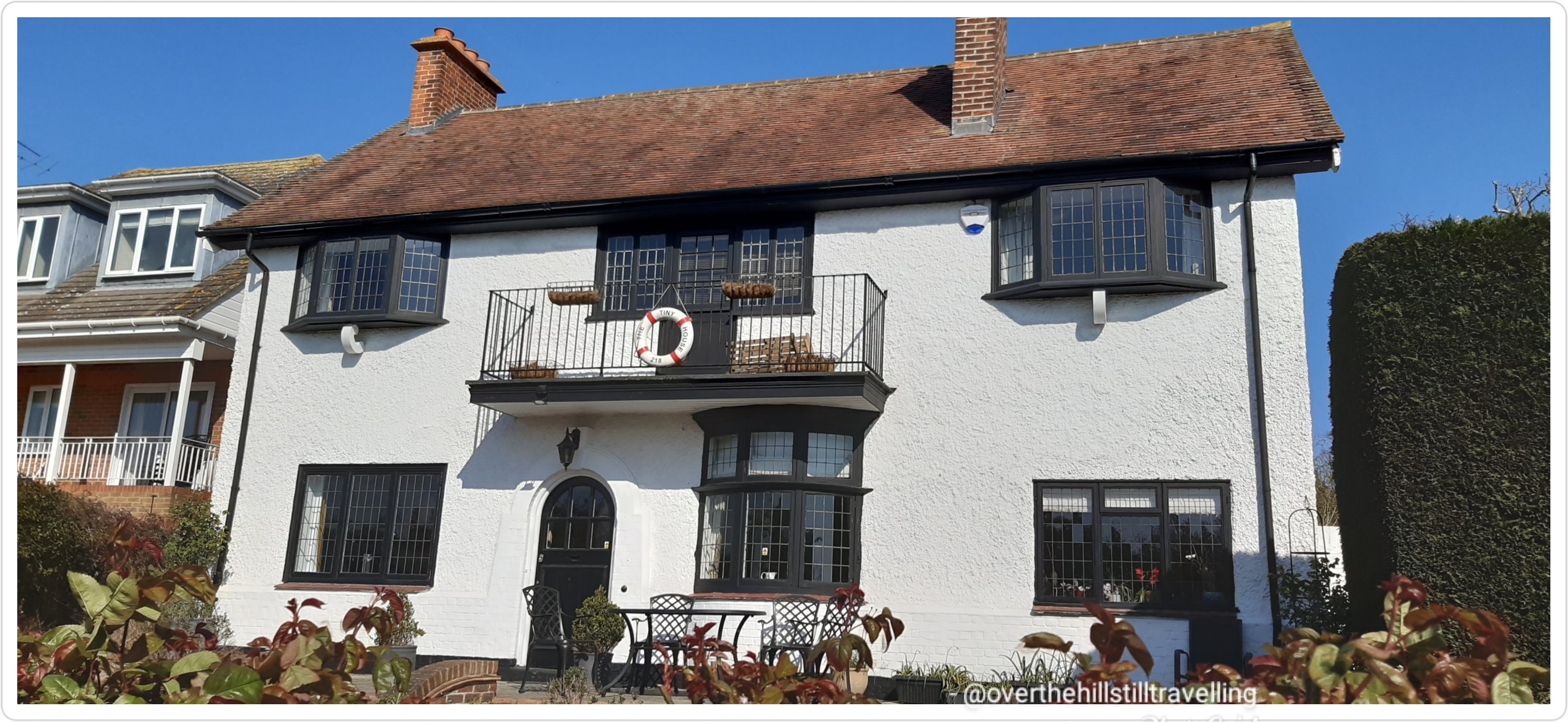


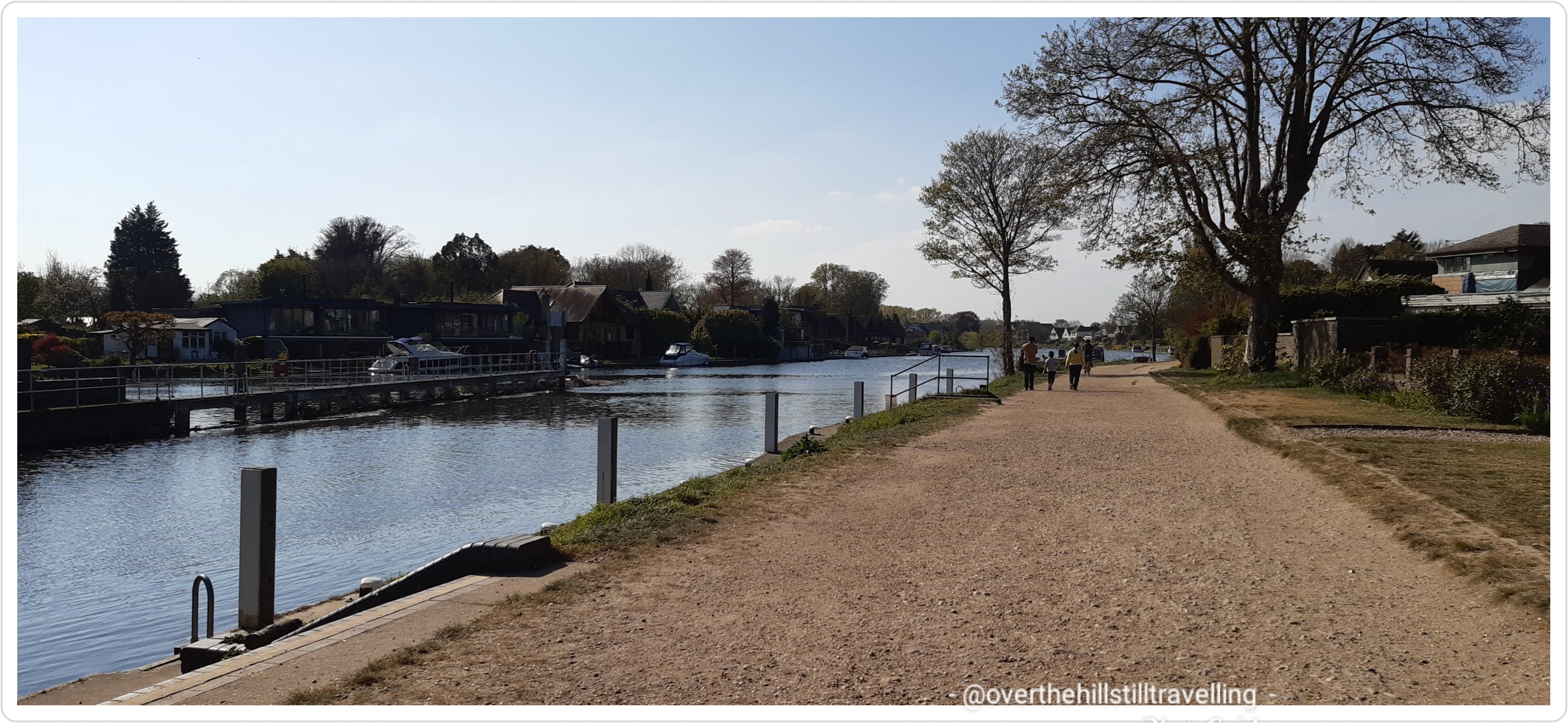


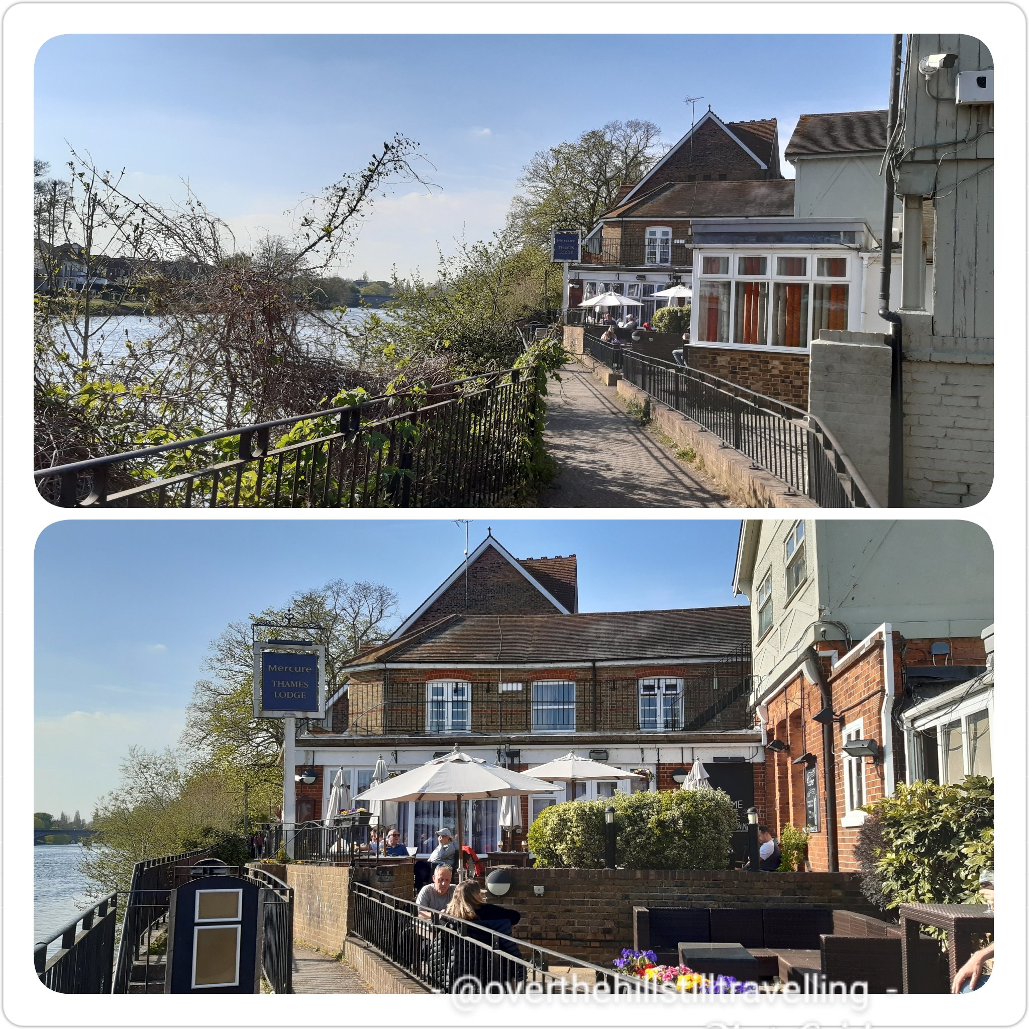

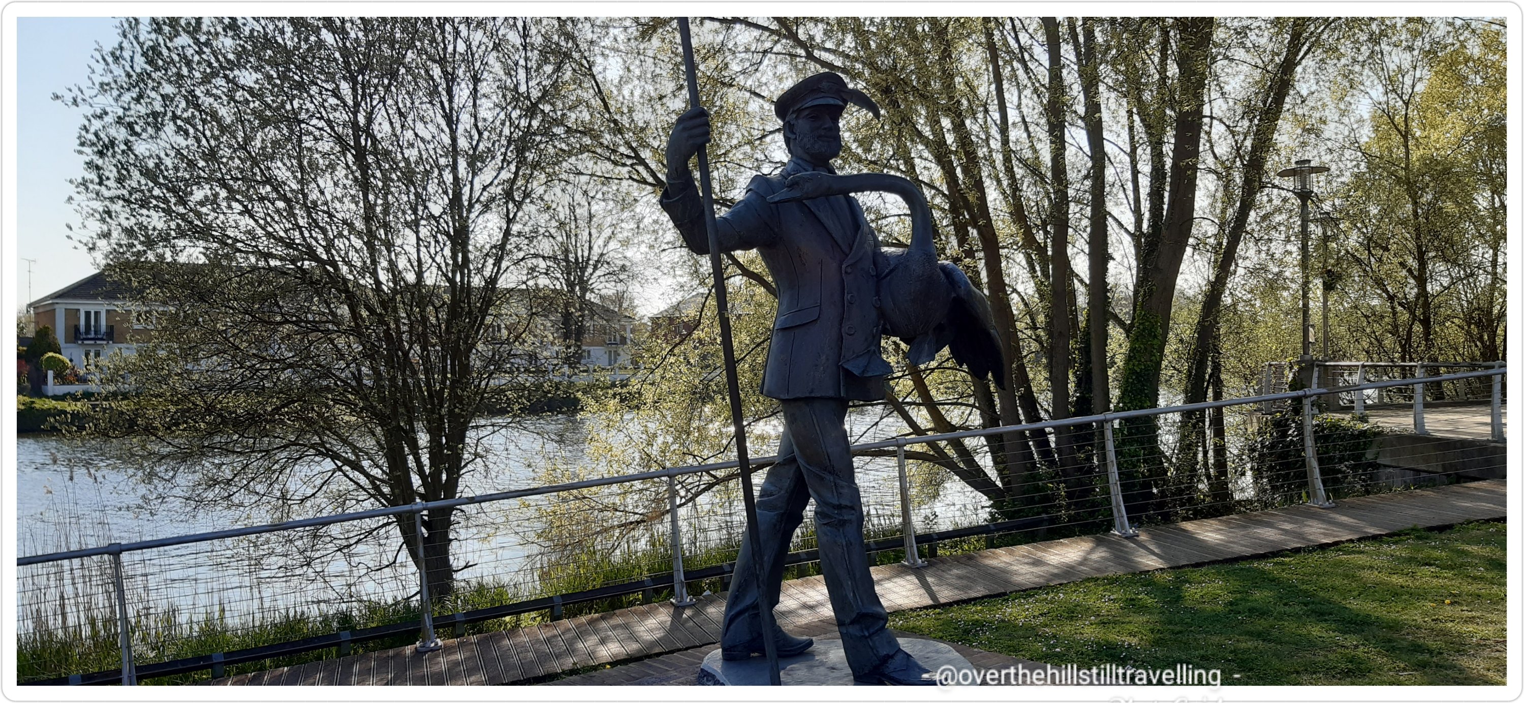

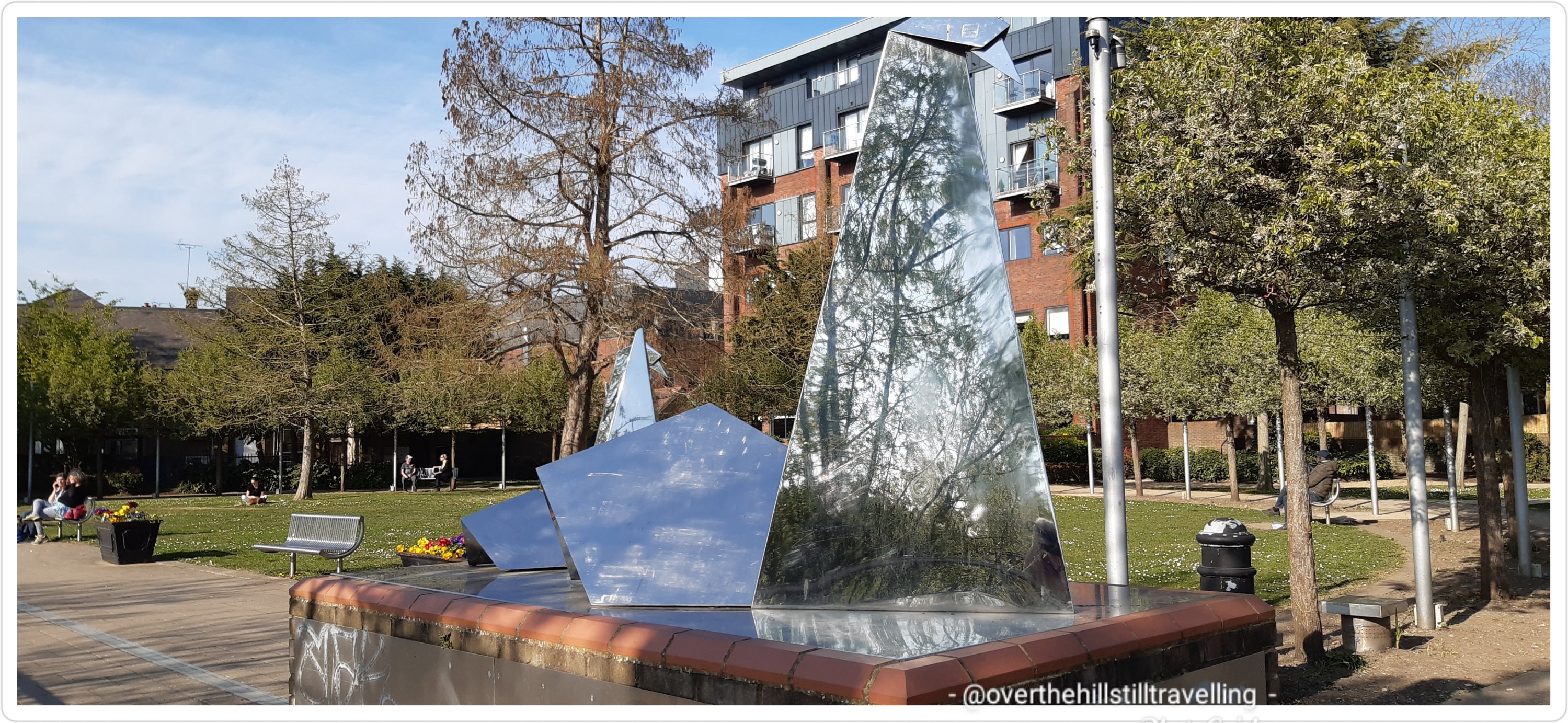


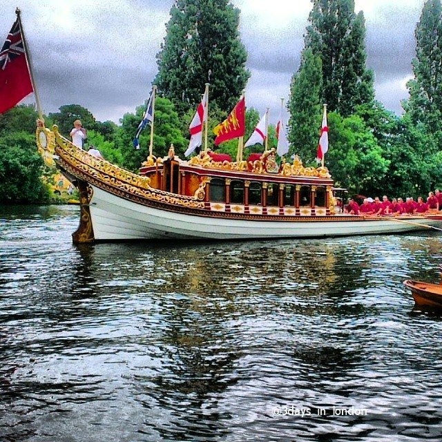

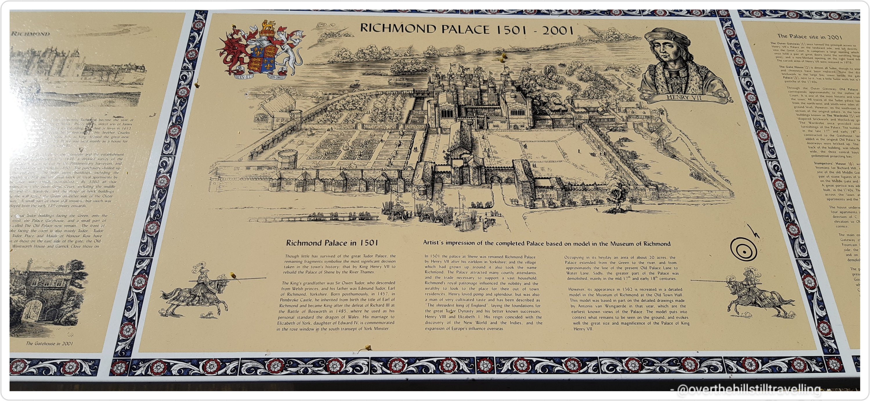
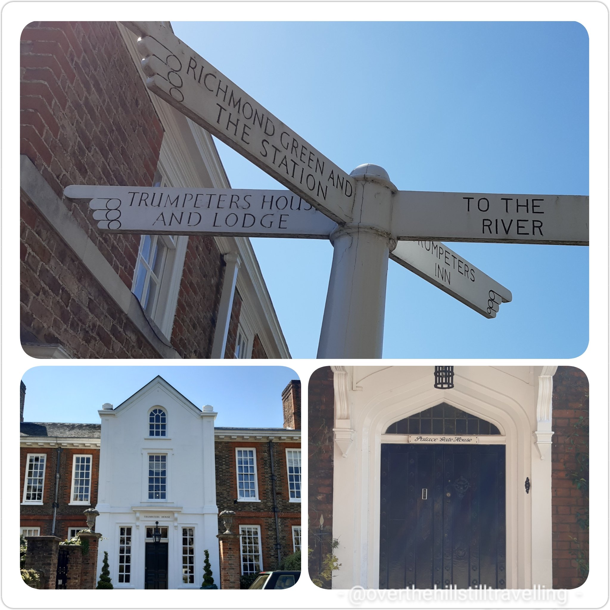

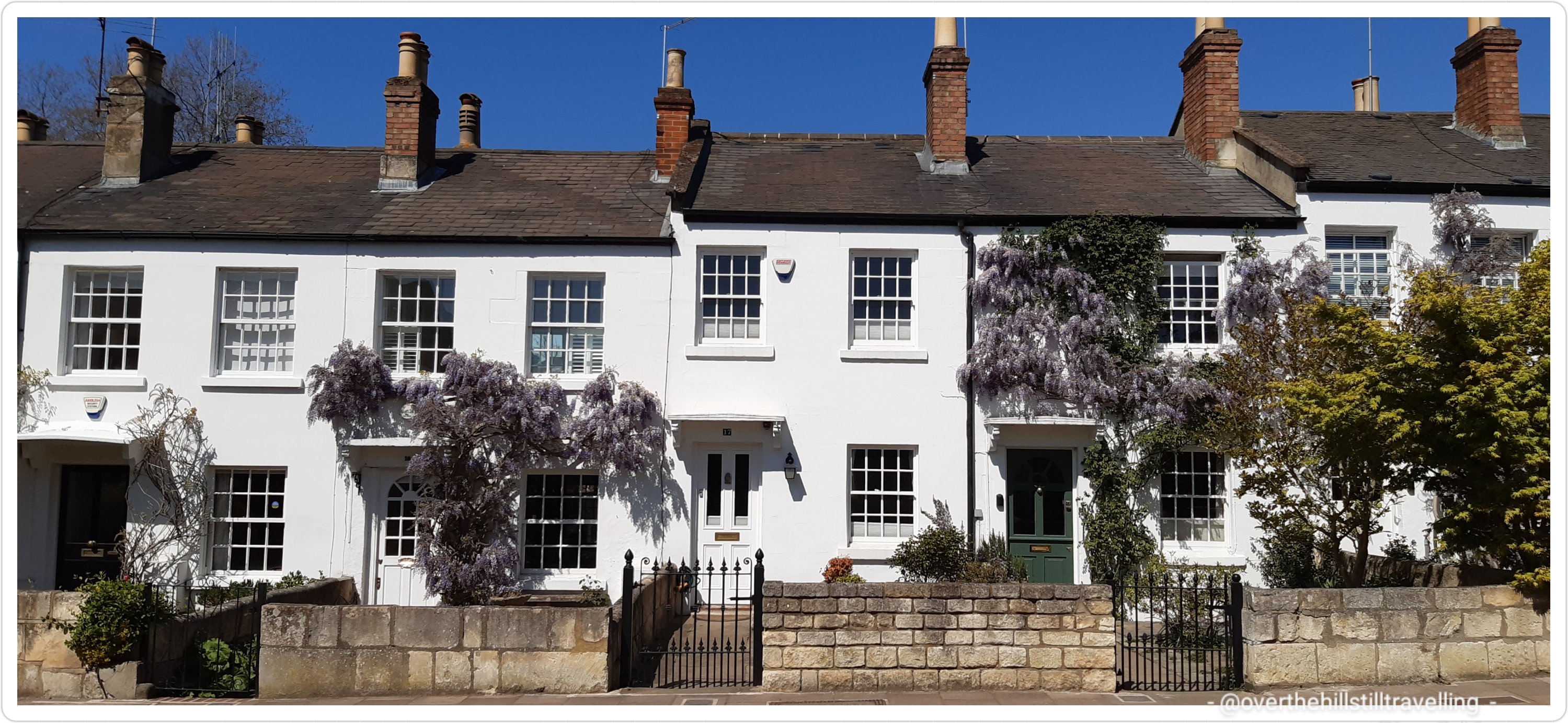


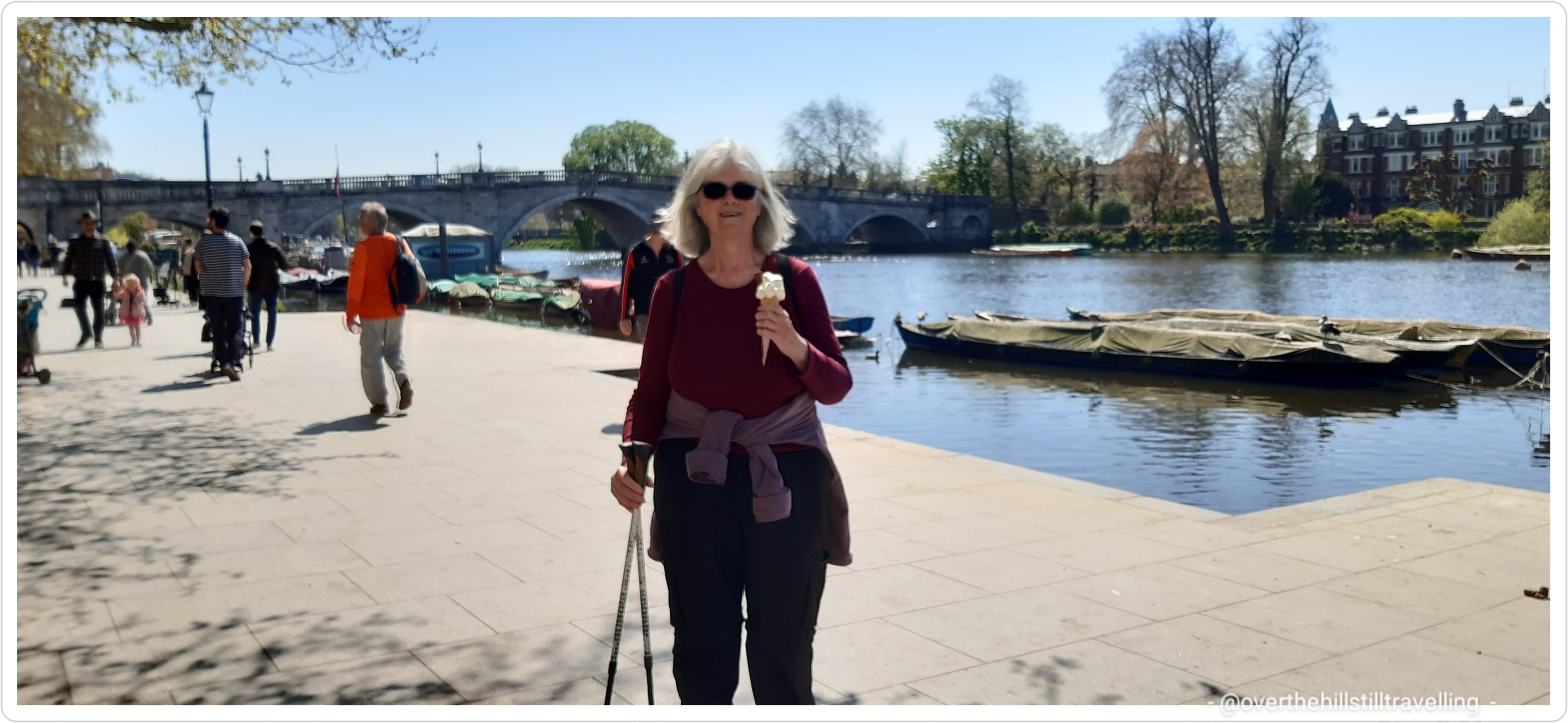


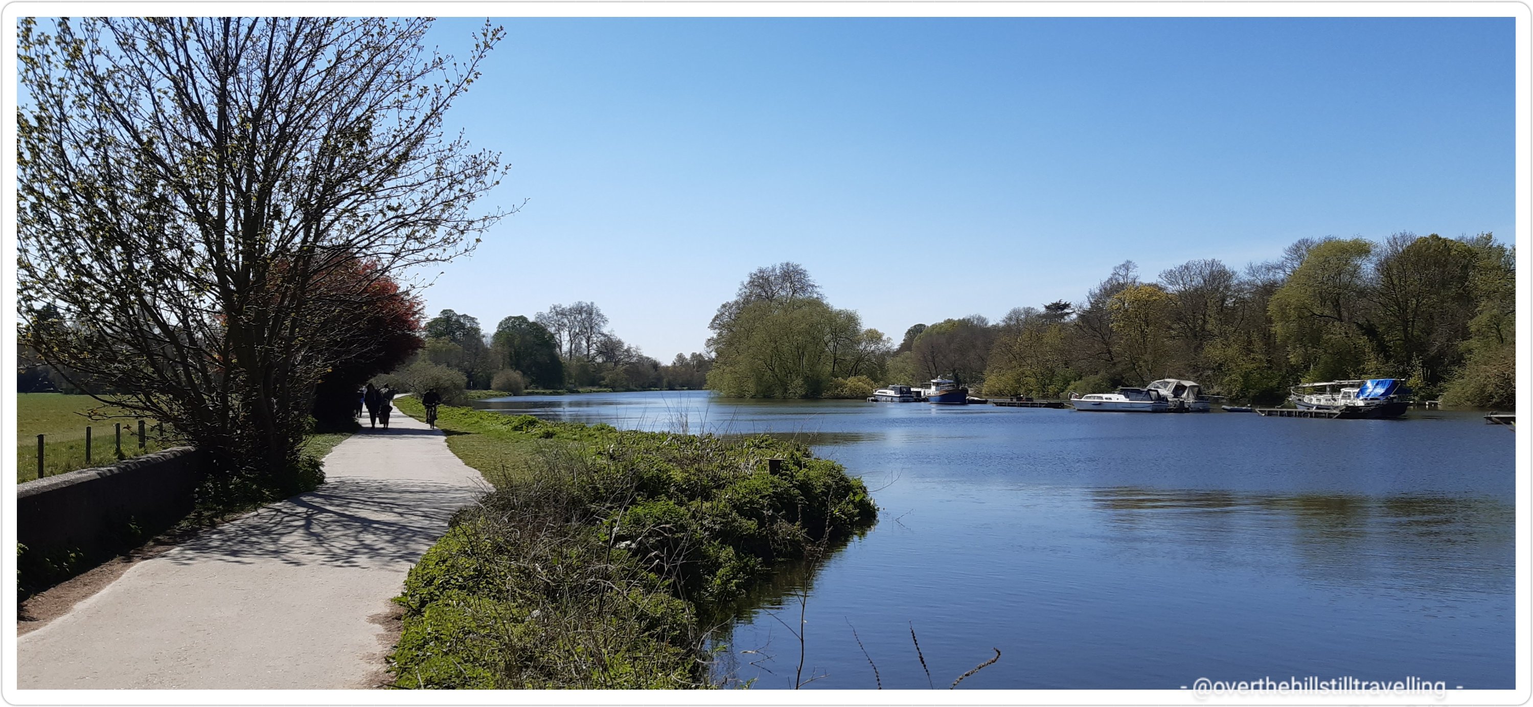


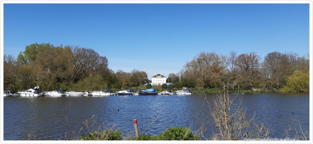


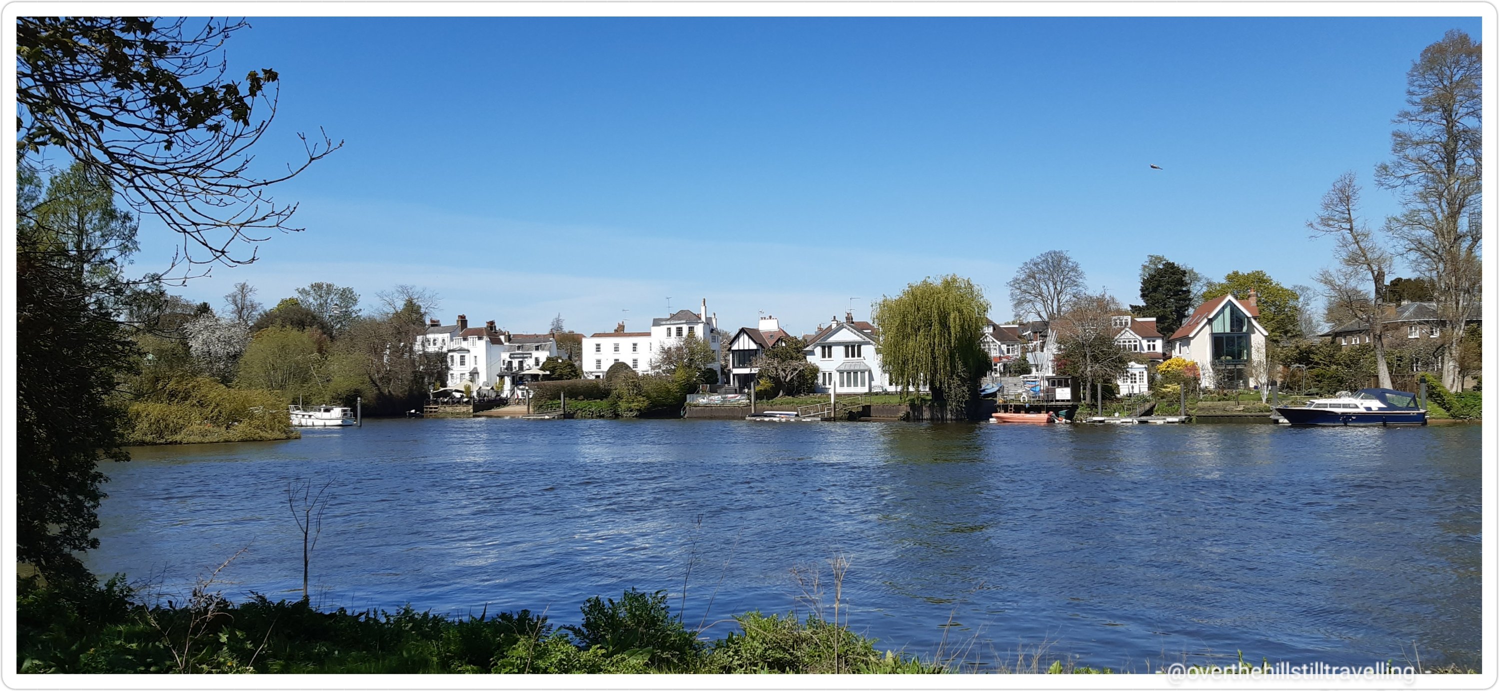


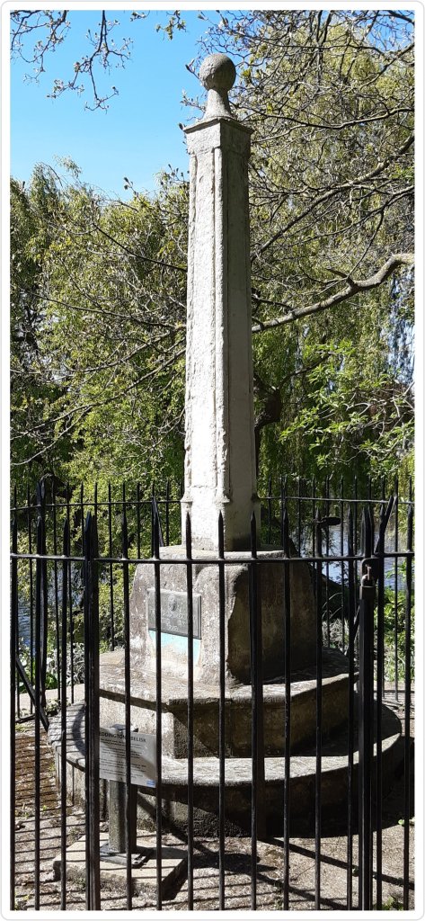

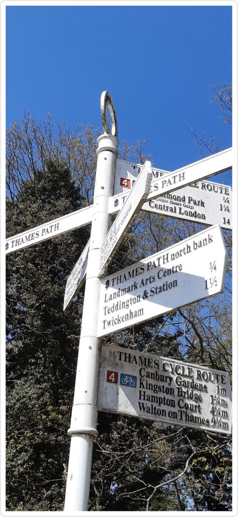

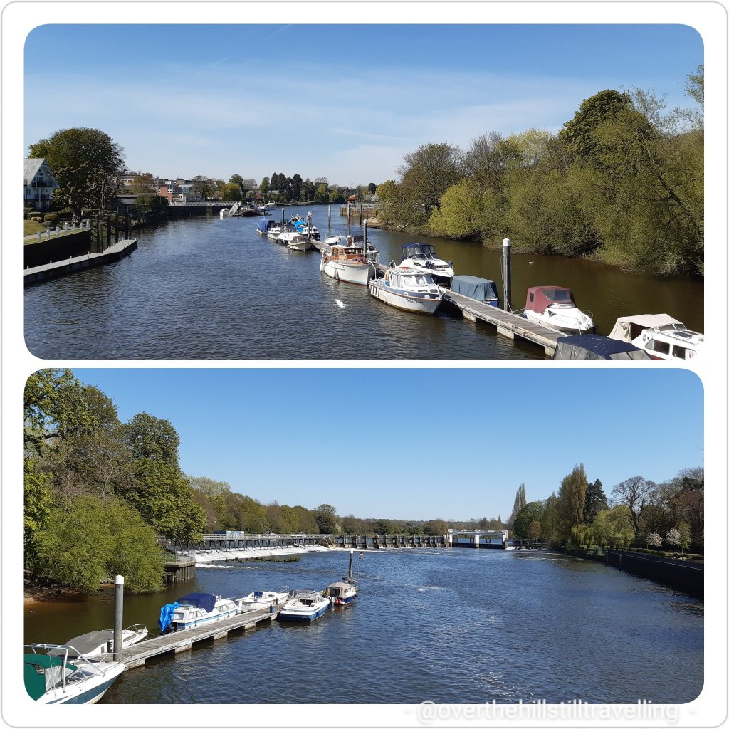

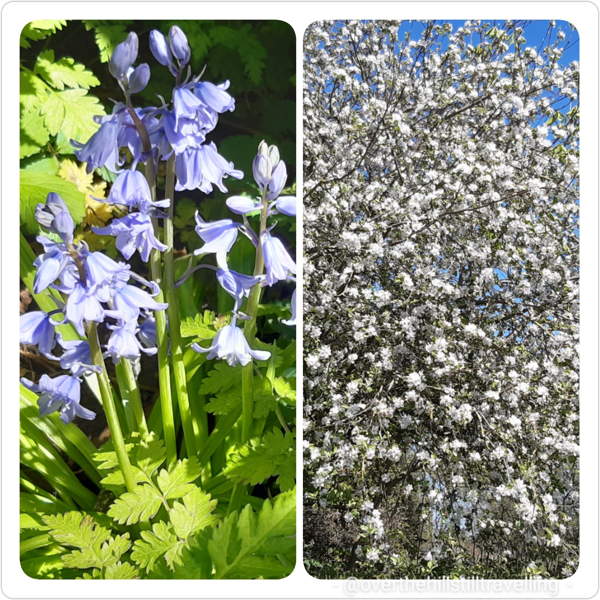

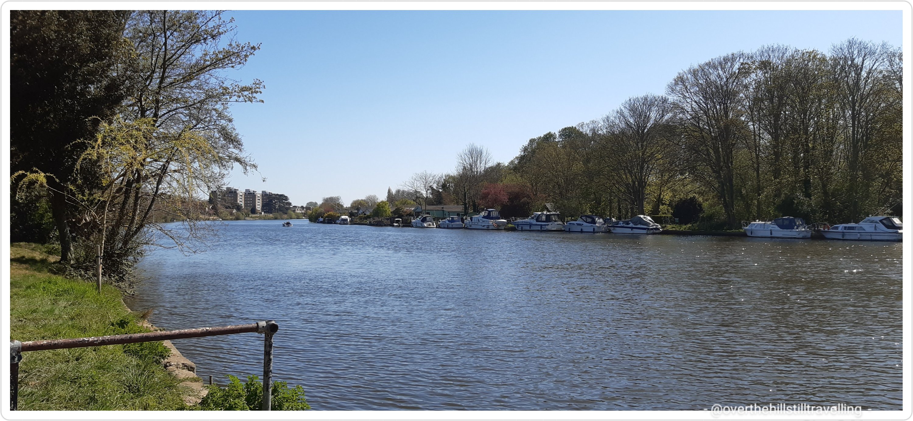
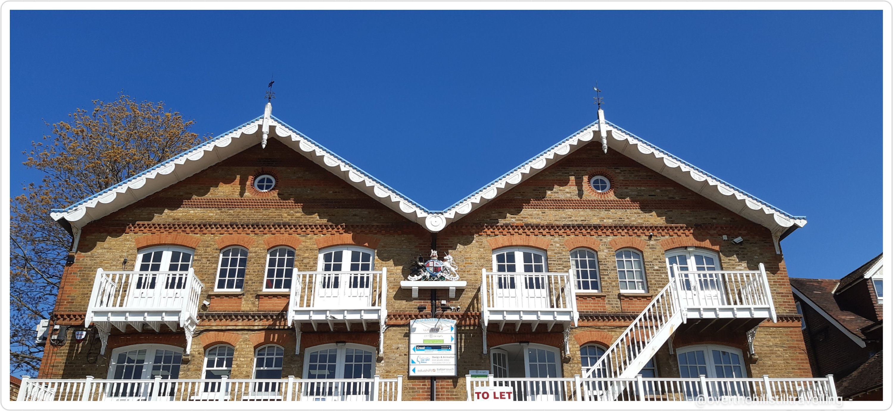

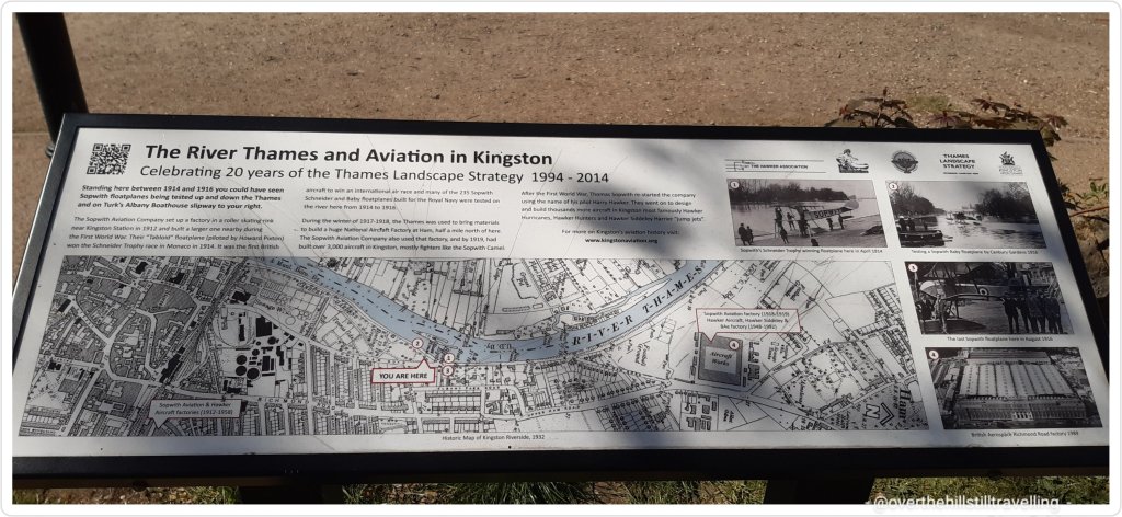


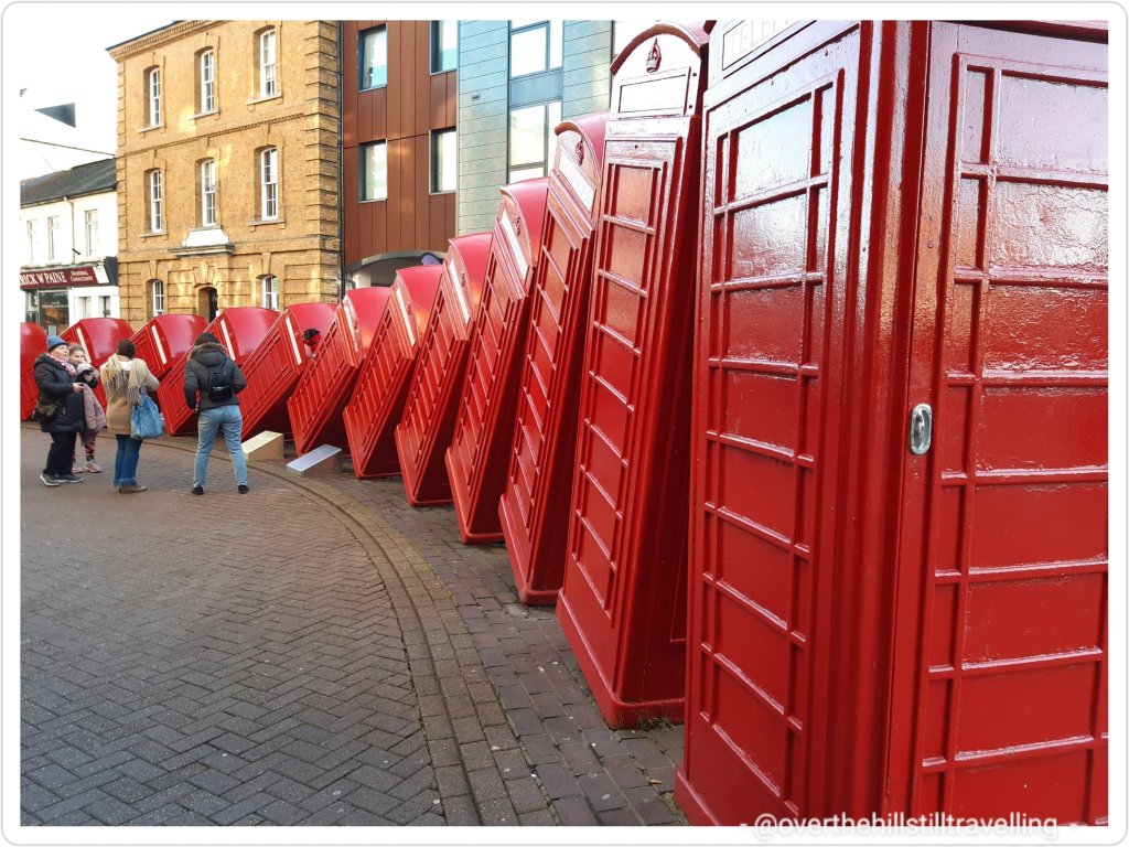


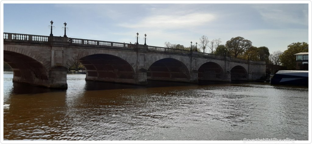


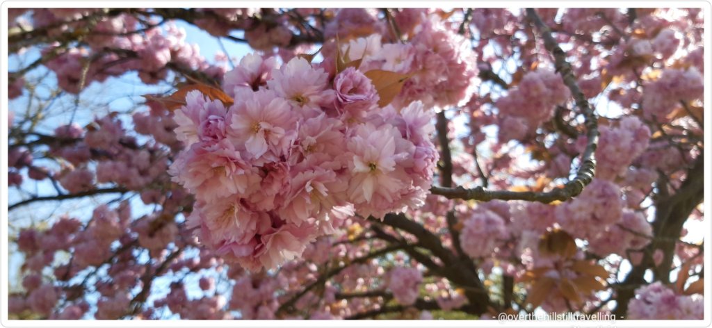


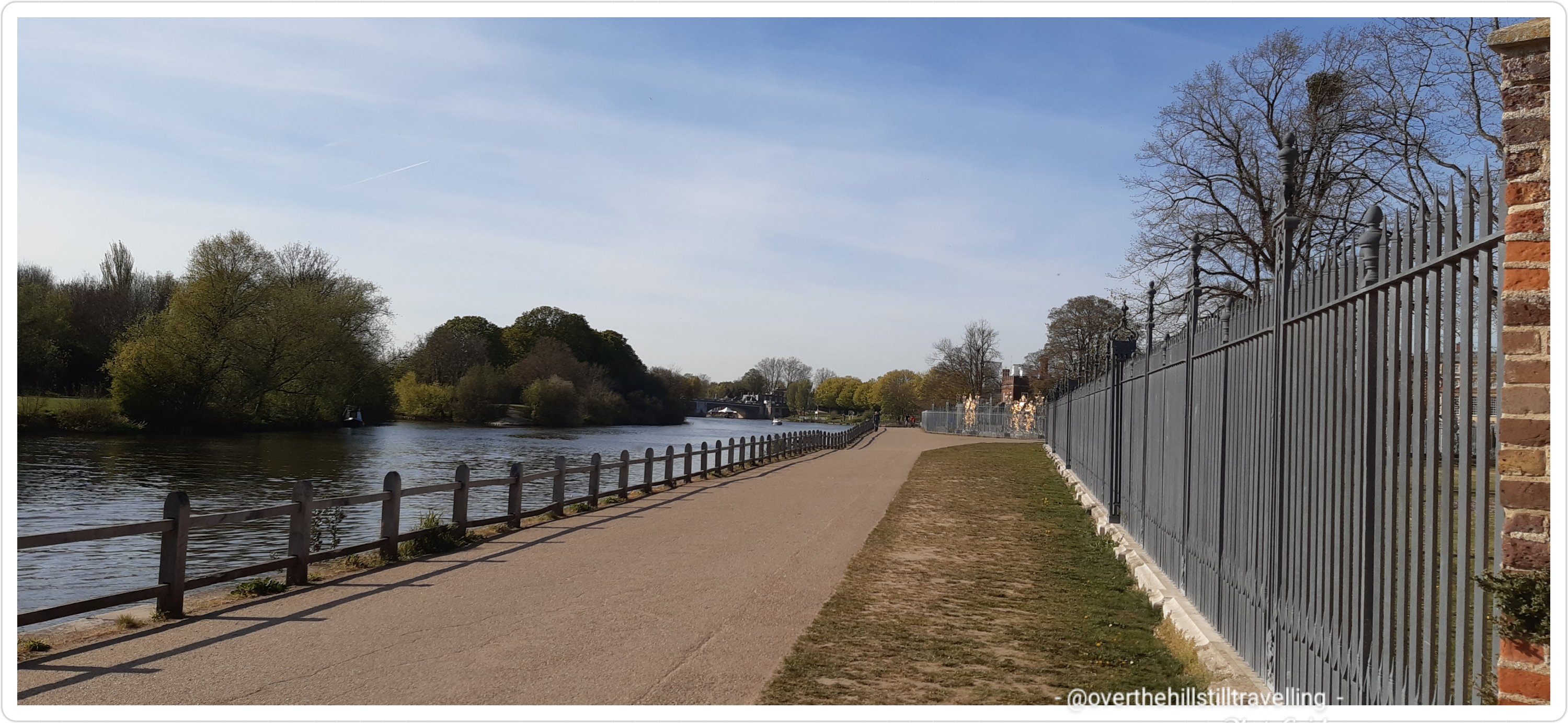


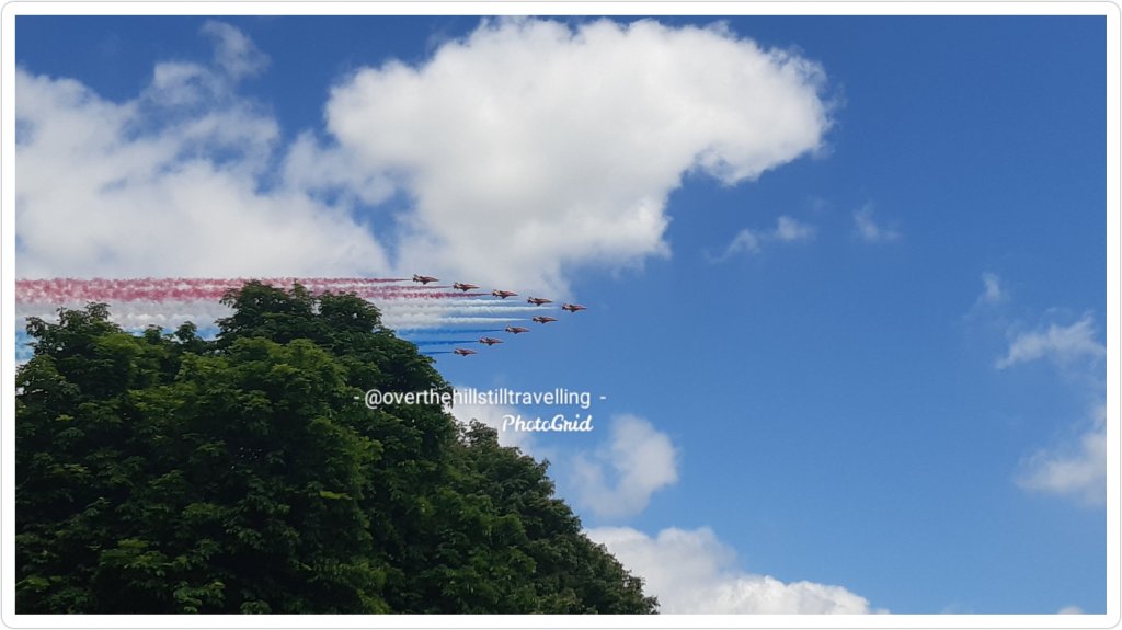
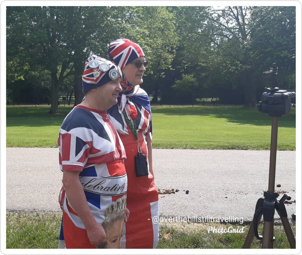


You must be logged in to post a comment.