Feeds:
Posts
Comments

Archive for the ‘project 101’ Category

In my line of work I travel a lot and often get to stay in fabulous, centuries old houses in quirky villages, many of which are mentioned in the 1086 Domesday Book.

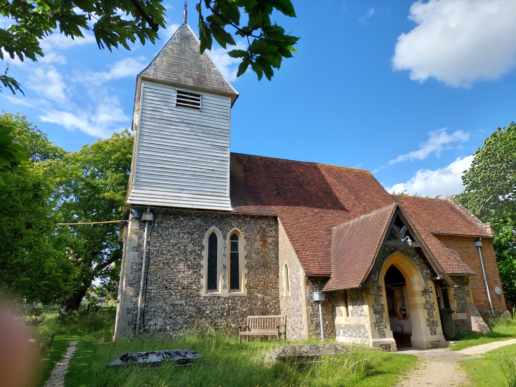
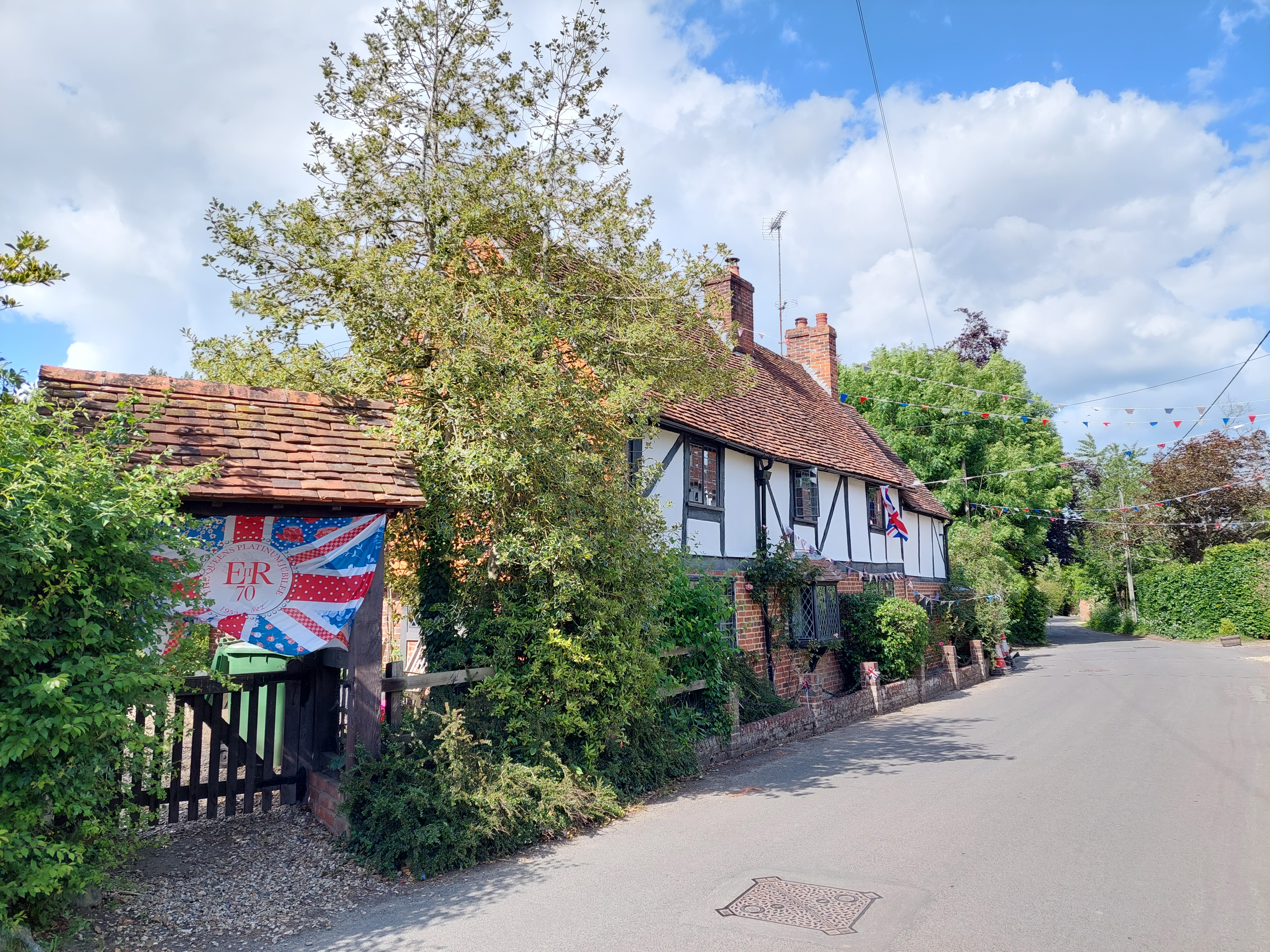
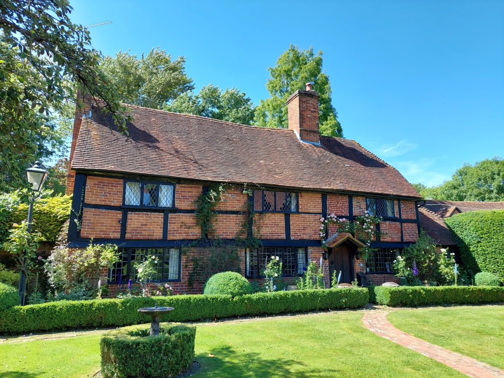
I’m currently working and staying in this fabulous 16th century, listed house. The main part of the house is in this image; a quintessential English house. The rest of the house which leads off to the right is added onto and a converted barn.

A pretty little house

It’s a twisty, winding type of house with long passages and rooms leading off; the exterior replicates the original house. It’s just gorgeous

The village nearby is indeed a Domesday Book village with a fantastic old church that retains vestiges of the original medieval wall paintings/decorations.

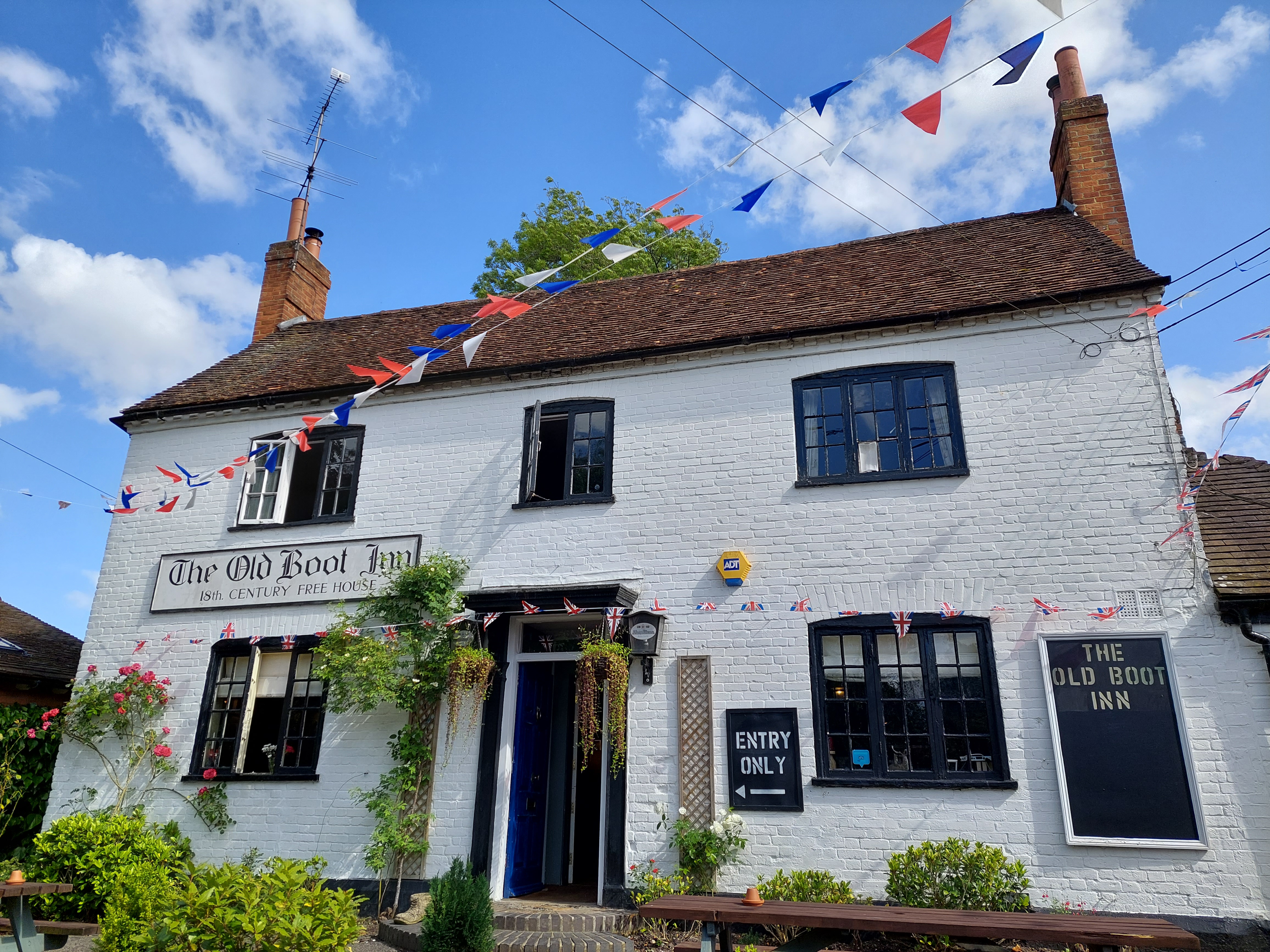
The village of Stanford Dingley is a good walk through fields of long grass awash with buttercups, and along shady woodland lanes. The village is ever so pretty under normal circumstances, but look so gay and colourful with the Platinum Jubilee bunting and flags.

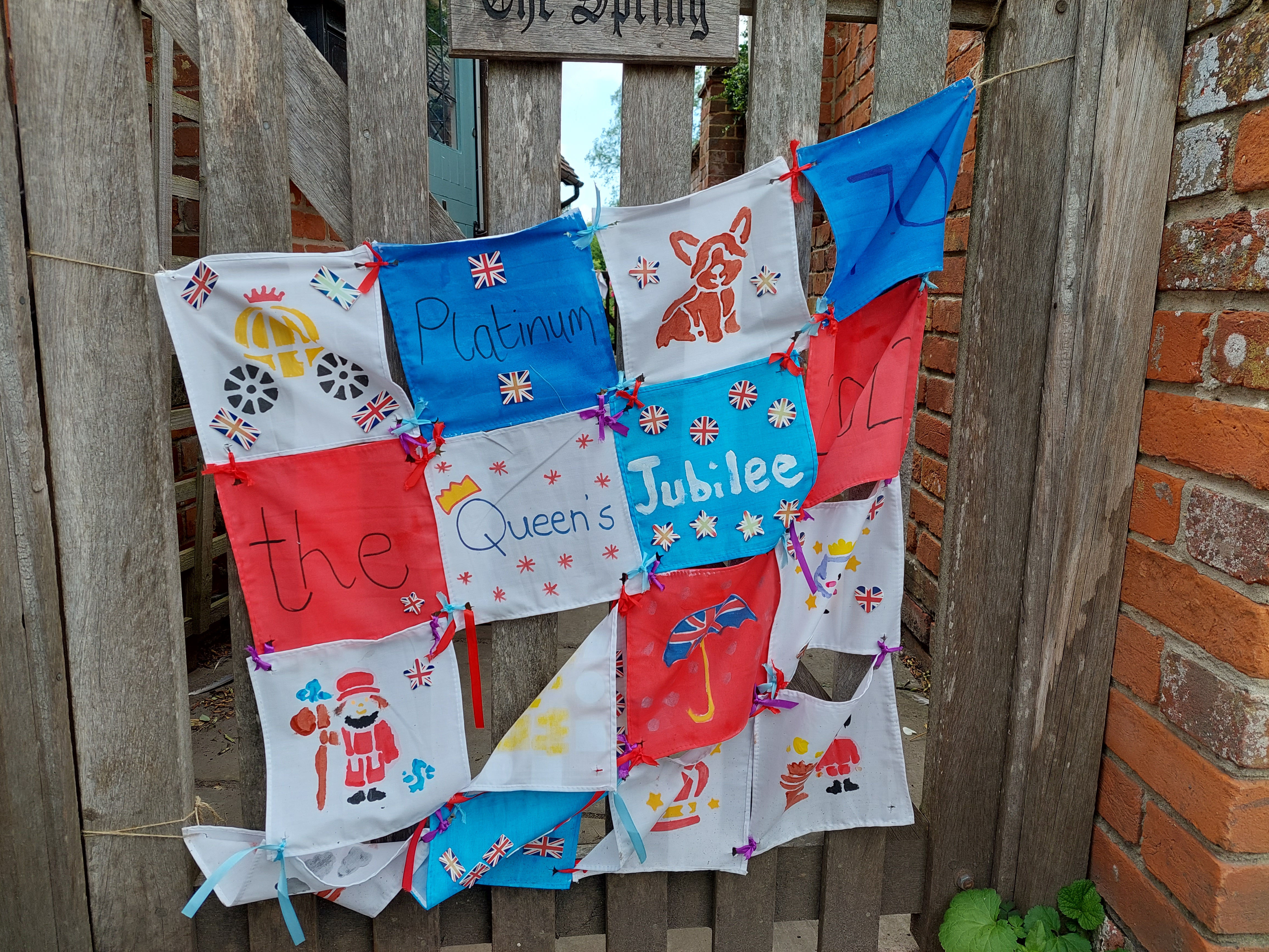
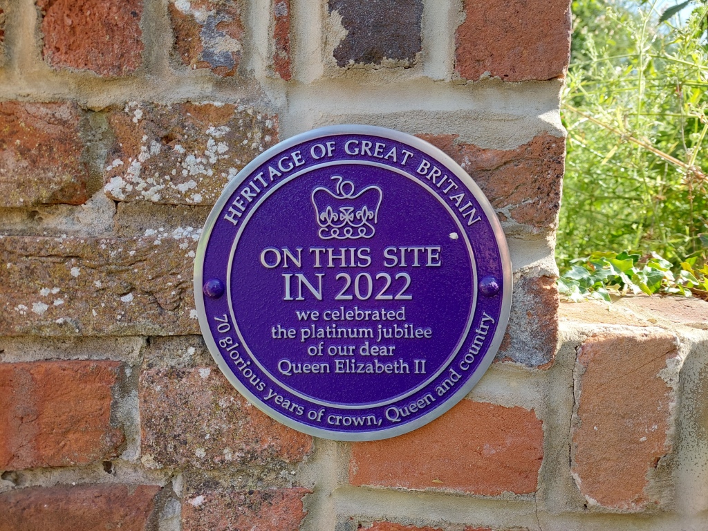
I love the plaque that’s been installed near the pub

Platinum Jubilee 2022

Read Full Post »

I’m working near to Clapham Common for the next 12 days. I never knew it was so pretty.

Long Pond – formed after gravel pits were abandoned. Model yachts gave been sailed here since the mid-19th century
The autumn colours this year are quite splendid
Holy Trinity Church

This is going to be a relatively easy booking, but quite boring with nothing much to do. I may just get to start and finish (hopefully) my September blogs – it will all depend on whether or not my laptop is still operational.

From Wikipedia: At over 85 hectares in size, Clapham Common is one of London’s largest, and oldest, public open spaces, situated between Clapham, Battersea and Balham.

Clapham Common is mentioned as far back as 1086 in the famous ‘Domesday Book’, and it was originally ‘common land’ for the Manors of Battersea and Clapham. ‘Commoners’ – tenants of the Lords of the Manors, could graze their livestock, collect firewood or dig for clay and other minerals on the site“.

Whoop whoop, another Domesday Book place.

Lots of space for walking, and I’m planning on finishing the Ring Road Iceland by Wednesday next week 🤞🤞🤞 and starting the Romantic Road, Germany virtual challenge.

Tomorrow I shall go walkabout and look out for interesting architecture.

Read Full Post »

Day 1 done and dusted 😁😁 I had a completely uneventful journey, ever so quick from King’s Cross to Berwick…and boy are those trains fast!!

Arrived in Berwick to the most glorious weather and scooted quickly over to the castle ruins. I didn’t go right into the keep coz it closes at 4pm and I got there at just on 3.54…but I had a good look around and then headed back up the million steps I’d just walked down 🤪🤪 Google maps doesn’t show how steep some places are!!

The River Tweed
Tweed Castle
The Royal Bridge

The Airbnb is lovely and the host is amazing…there’s a gorgeous ginger cat and a beautiful golden labrador, so I have had lots of kisses and cuddles.

My bed for the next 3 nights

As soon as I had dropped off my backpack, I grabbed my day pack and headed north yo the Scottish border. OMG what a path!! The views were spectacular but the path was hell!! For the most part it ran right along the very edge of the cliffs with just a tuft of grass between the walker and the vertiginous cliffs that fall 100s of feet down to the sea. The North Sea in case you wondered.

Spectacular. The weather turned soon after and the clouds came in
Part of #notthecoastpath 🤣🤣

A local suggested I walk along the above ‘path’ because the real path “is a bit rough, and this is a lovely wee walk” – well he wasn’t wrong about the path, but this was no better and I crossed the edge of a potato field to the path as soon as I could. I’m thinking he’s never walked to the border before…

Now this was more like it…leading away from the Scottish border, it was a joy to see this…if only the whole route had been the same

However, despite the awful path and the daunting propect of a twisted ankle on a very narrow and uneven path, and the fading light, I’m so glad I made the effort to walk up to the border and back

Welcome to Scotland 😁😁
English border
It was so cool to cross through the gate into Scotland

The views are absolutely spectacular.

I’m standing on the path!!! A twisted ankle or a trip and you’d be in for a swim
Literally right on the edge

Once I got back to town I had a quick whizz around and walked a small section of the town ramparts, which are just amazing with awesome views of the river and estuary.

Town walls
Walking the ramparts
Fantastic views
Guarding the town

I got back to the b&b at just on 9pm and having missed the fish and chip shop, I had 2 cup a soup and a cup of tea.

In all a terrific start to my Northumberland Coast adventure. Just on 17kms covered.

My walk

I’ve added some of the history of Berwick in case you’re interested 😉

Berwick is just four miles south of the Scottish Border, but during the last 300 years, control of the town swapped 13 times between England and Scotland. Berwick’s Elizabethan town walls are the most intact in England, and were Elizabeth I’s biggest and most expensive project during her reign to keep firm control of this key town.

https://www.visitnorthumberland.com/explore/destinations/towns-villages/berwick-upon-tweed

Situated at the mouth of the River Tweed near the border of two kingdoms, the town of Berwick suffered centuries of conflict, as control of the town passed back and forward between England and Scotland until the late 17th century. Each crisis brought repairs and improvements to the fortifications, culminating in the great artillery ramparts begun in 1558. These survive largely intact and make Berwick one of the most important fortified towns of Europe.

Berwick’s town walls are its most famous piece of architecture and still stand strong today, hundreds of years after they were built. Berwick actually has two sets of walls, the first set (of which only fragments now remain), commenced by Edward I, was two miles long. The later Elizabethan Walls (which are still complete) are a mile and a-quarter in length. The ramparts completely surround the town, with four gates through which entry to the town is enabled.

Berwick’s Elizabethan Walls are the only example of bastioned town walls in Britain and one of the best preserved examples in Europe. When built in 1558 – designed to keep out the marauding Scots who regularly laid claim to the town – it was the most expensive undertaking of England’s Golden Age.

Read Full Post »

Living in the south east of England, except for a brief visit to Durham a few years ago, the northeast feels quite remote, and although I wanted to visit Berwick Upon Tweed after connecting via twitter with someone who lived there, it may as well have been the moon for all the probability that I might visit.

However a number of factors arose over the years; my walking escapades with plans to walk Hadrian’s Wall and the two Saints Ways: St Cuthbert & St Oswald, and more lately the entire English Coast, suddenly it no longer seems quite so remote. Its 413 miles in fact from Ramsgate to Berwick Upon Tweed, so not as far as the moon after all.

As soon as I had decided to walk the Northumbrian coast instead of the saints ways, I started doing some research on the county. I had read a little bit about the history in a book by Neil Oliver that I read last year, and the history is amazing and intriguing.

So here goes, some facts and figures about Northumberland:

Northumberland has come out on top as being the quietest place in England! The county has a low population density with only 64 people per square kilometre, ranking as the 16th emptiest place in the whole of the UK.

Northumberland is a ceremonial county and historic county in North East England. It is bordered by the Scottish Borders to the north, Cumbria to the west, and both County Durham and Tyne and Wear to the south.

There are 7 castles in Northumberland, I will be visiting 5 during my walk

Northumberland is designated an AONB: area of natural beauty and has designated Dark Skies areas as well as which in some places you can, if you’re lucky, see the aroura borealis (fingers crossed) Northumberland is the best place to stargaze in the UK with 572 square miles of the county having been awarded Gold Tier status.

There are 70 castle sites in Northumberland, with 7 along the coast path, of which I will visit 5:

Berwick Castle – commissioned by the Scottish King David I in the 1120s

Lindisfarne – a 16th-century castle located on Holy Island, much altered by Sir Edwin Lutyens in 1901

Bamburgh – originally the location of a Celtic Brittonic fort destroyed by Vikings in 993. The Normans later built a new castle on the site, which forms the core of the present one, now owned by the Armstrong family

Dunstanburgh – a 14th-century fortification on the coast built by Earl Thomas of Lancaster between 1313 and 1322

Warkworth – a ruined medieval castle, traditionally its construction has been ascribed to Prince Henry of Scotland, Earl of Northumbria, in the mid-12th C, but it may have been built by King Henry II of England when he took control of England’s northern counties

Islands: 3 of which I plan to visit 2

1. Holy Island of Lindisfarne – This place of worship, tranquillity and breath-taking beauty was the home of St Cuthbert, who allegedly held the power of spiritual healing.

2. Farne Islands – St Cuthbert lived on the island in a cell during his time on the island. The Inner Farne is the largest of the Farne islands group and is home to many of the breeding birds during the season, Puffins,Shags, Guillemots, Cormorants and Razor Bills : read more https://farneislandstours.co.uk/the-farne-islands/ I’ve booked my ticket for this.

Coquet Island – Every spring, Coquet Island becomes bustling with birdlife as some 35,000 seabirds cram onto this tiny island to breed. Most famously, puffins whose cute and clumsy mannerisms have earned them the nickname of the ‘clowns of the sea’, visit in their thousands. You can only visit by boat, so if I have time on that day, I’ll try take a trip

Northumberland borders east Cumbria, north County Durham and north Tyne and Wear.

Northumberland’s unique breed of cattle are rarer than giant pandas. This unique herd of wild cattle are believed to be the sole descendants of herds that once roamed the forests of ancient Britain. It is thought they have been living at Chillingham for more than 700 years.

Historical sites –

Newcastle Castle is a medieval fortification in Newcastle upon TyneEngland, built on the site of the fortress that gave the City of Newcastle its name.

A number of Battlefields, priories and iron age sites dot the Northumberland landscape. I’m not sure how many I’ll get to see on my way south, but I’ll be sure to look out for them! Other than that:

Hadrian’s Wall – I’ll be walking the wall from 11th – 21st Hadrian’s Wall starts in what is now Tyne & Wear, follows through Northumberland and ends in Cumbria.

Vindolanda Roman Fort : a Roman auxiliary fort just south of Hadrian’s Wall which it originally pre-dated. Archaeological excavations of the site show it was under Roman occupation from roughly 85 AD to 370 AD. Ref Wikipedia

Chester’s Roman Fort : The cavalry fort, known to the Romans as Cilurnum, was built in about AD 124. It housed some 500 cavalrymen and was occupied until the Romans left Britain in the 5th century. Ref English Heritage

Temple of Mithras : The temple was probably built by soldiers at the fort at Carrawburgh around AD 200 and destroyed about AD 350. Three altars found here (replicas stand in the temple) were dedicated by commanding officers of the unit stationed here, the First Cohort of Batavians from the Rhineland. ref English Heritage

Housesteads Roman Fort :  built in stone around AD 124, soon after the construction of the wall began in AD 122

Corbridge Roman Fort : Corbridge was once a bustling town and supply base where Romans and civilians would pick up food and provisions. It remained a vibrant community right up until the end of Roman Britain in the early years of the 5th century. Ref English Heritage

UNESCO World Heritage Sites:

Hadrian’s Wall is a UNESCO World Heritage site, starts in Newcastle, Tyne & Wear, runs through Northumberland and ends in Cumbria.

The historic county town is Alnwick. And the biggest town is Blyth.

Earl Grey tea originated in Northumberland.

Northumberland was once the largest kingdom in the British Isles

Over a thousand years before Northumberland was affectionately known as ‘the last hidden kingdom’, it was known as the Kingdom of Northumbria.

Lancelot Capability Brown was born in the hamlet of Kirkharle.

Northumbrian (Old English: Norþanhymbrisċ) was a dialect of Old English spoken in the Anglian Kingdom of Northumbria. Together with Mercian, Kentish and West Saxon, it forms one of the sub-categories of Old English devised and employed by modern scholars.

At nearly 580sq miles, the dark sky zone, known as Northumberland International Dark Sky Park, is the largest Gold Tier Dark Sky Park area of protected night sky in Europe.

The famous detective programme ‘Vera’ featuring Brenda Blethyn, is filmed in various places in Northumberland and Newcastle Upon Tyne.

During my ‘research’ I’ve found so many interesting places, many of which are too far off the wall route for me to visit, but I guess I can always visit again someday.

And that’s it for now. There’s much else of course, but….

Read Full Post »
With just over 2 weeks till I set off on my epic (😁😁) walk along the Northumbrian coast path and Hadrian’s Wall, I decided it was time for another test of my mettle.

I had already scheduled a walk into my diary for Monday 16th; the penultimate stage of the north-east section of the Saxon Shore Way, from Rainham to Rochester, so it was an easy decision to take Pepe along, fully loaded except for water supply, and check out how we got along.

We had a brilliant day, it was overcast and cool (I even wore a cardigan), perfect for walking but not so fantastic for photos.

I headed back to where I left off a few weeks ago, and not finding any signs to direct me, and considering it’s a residential area, I decided to just follow my nose and my intuition. After all, it’s a ‘shore’ walk, and the general direction (useful) is along the shore heading north/east…🤪🤪

I found the first sign 5 kms in, pleased to note I was on the right path.

Saxon Shore Way
Useful 😁

I discovered what a teasel is…I’ve seen this fascinating little flowers/plants all over the place but hadn’t idea what they were…now I know 😉

I came across a funfair and was reminded of one of the most terrifying fairground rides of my life…I took my daughter (8 years old) and sister on one of these many years ago in South Africa. It went wayyyy higher than I knew and she nearly slipped off the seat and under the rail. O was holding onto her and my handbag that contained my whole month’s salary in cash. 😳😳

Pirate swing
The funfair

In all it was a very successful walk, I frequently forgot Pepe was on my back..ergo, its comfortable and not too heavy, which was my main goal – how comfortable will it be? Fortunately I’m now aware of those little straps that work loose, so checked them every time I stopped for a break (every 5 kms) and pleased to say the corner of the bag didn’t dig a hole in my hip like it did on the final stages of the Pilgrim’s Way.

Enroute is an island near Chatham; St Mary’s island that I simply had to visit; its there, how could I not? And for good measure, and totally unnecessarily, I walked virtually the whole perimeter thereby adding over 2.5 hours and 4.42kms to my journey 🙄🙄 But now I can add that to Project 101…another island done and dusted. Saw a gorgeous sculpture

St Mary’s island
St Mary’s island
The Mariners
And saw Upnor Castle…didn’t realise it was so close

I did however find the history of how the island came to being rather disturbing. Built on the backs of 19th century convict labour from desolate Marsh wasteland, the convicts lived on rotting hulks on the shore and were marched daily, 1000 strong chained together, to work on building the island. Ghoulish history.

So, I had a very comfortable 22.46km walk on Monday with very little discomfort except for the usual spots, which I’ll resolve with fleece.
But the weight is good and as with the Camino and Pilgrim’s Way, I mostly forgot it was there. Although I was tired without doubt from 16km onwards, and ready for bed.

So pretty…seen in Rochester

I slowed down quite a lot in the last 6kms.

Seen in Chatham
Seen in Chatham
Seen in Chatham

Feet no worse than usual,  in fact, better than usual in recovery, hardly any pain in my heel, just a couple of twinges and no blisters. My 2 toes on my left foot as usual were red and sore, which is totally bizarre since there’s loads of space in the front of the shoe and no obstruction. My right foot toes never have the same issue… weird 🥴🥴

So all good. Ready to go 1st September. I even got to test my poncho. Conclusion: it kept the rain out = waterproof. But…my arms got wet coz the sleeves are so short, and I’ll need to finesse the hood so it stays snug around my face instead of either covering my eyes, or blowing off the back of my head 🙄🙄

In all a pleasing day.

I will of course give this stage of the Saxon Shore Way a proper write up when I do those articles, but I’m well pleased with my progress so far.

Read Full Post »

So my lovelies, the time is almost nigh!! At 10:07 on 1st September; 3 weeks from today (whoop whoop), I’ll be on the train heading North. Destination Berwick Upon Tweed.

I start walking the Northumberland coast path that same night, albeit staying in Berwick for 3 nights…I’ll explain later.

Then in exactly 1 month from today, I start my official walk along Hadrian’s Wall. 4 years to the day from when I started my Portuguese Camino 😊😊

So bloody excited. I can’t tell you 💃💃💃 = my happy dance.

So wow, suddenly it’s only 3 weeks to go and I’m on my way.

The dates have been identified, there and back travel tickets booked, all accommodation is booked, Airbnb hosts contacted and confirmed, the routes identified, daily kilometres from here to there measured (repeatedly 🤪🤪), what to see noted, where to go planned, what to do listed, ferry trip booked, where to get my passports stamped noted.

Pepe is packed, Gemini and I have been practicing like mad – getting fit, which shoes to wear decided on, budgets calculated and as much planning as I can possibly do, done!!!

And just because, after weeks of planning and noting the route each day on the Northumberland Coast Path with the relevant distances, yesterday I only decided to rejig days 4-7 and fiddled about with the distances. But now it is a lot smoother, with one day shorter and another longer.

I confirmed yesterday that I can use my senior bus pass on all the bus routes that I need to use between end of day’s destination and return the next day. I’m going to be doing quite a bit of bouncing back and forth due to accommodation on the NCP.

I’m copying everything into an old-fashioned method of keeping records – a notebook 😁😁

Northumberland Coast Path here’s looking at you, and finally 🤞🤞 after a whole year of waiting Hadrian’s Wall…I see you!!

Now it’s a waiting game; 21 days and counting.

As for you Covid-19 with all your variants…..you know what you can do…😂😂😂

Read Full Post »

Now that the plans have been laid, and the bookings made, the excitement begins!! On waking up this morning my first thought was Oh My Gosh!!! it’s exactly 1 month to the day till I leave on my September ‘walking holiday’!! 31 days…

Although why it’s called a holiday is anyone’s guess since it’s hard work and not a relaxing pastime…well, it is relaxing some times, most times it’s just bloody hard work LOL and a holiday it is not! I usually come back from my long-distance walks exhausted and in need of a….you guessed it…. a ‘holiday’!!

But….whoaaaa 1 month! when I say it like that, it induces a sense of both terror and excitement. But I can barely wait for the time to pass so I can go already!!

Time to get excited

As you may well know from a previous post, I’ve done loads of research on the Northumberland Coast Path more recently and last year on Hadrian’s Wall (postponed to 2021 due to covid lockdown 2 days prior to my setting off) and I’ve scoured google maps to work out exactly how far it is from place to place so that I could plan my days accordingly.

Most days will be straightforward: get up, dress, eat, walk from here to there, eat, shower, hopefully blog, sleep and repeat the next day. But due to my accommodation issues, I’ve had to plan a couple of days where I will end at one point, take the bus to my overnight stop, then take the bus back to the previous days end point and walk to where I started…..sounds confusing eh! Yeah, it was and so I had to really focus on my day to day planning to ensure that a) I walked the whole route b) that I didn’t have days that were too long, c) that there were in fact buses from point a to b and back again.

And so it has all come together, along with a fair amount of stress, but I do believe I have done it.

Fortunately all the Hadrian’s Wall planning happened last year, so except for the 2 nights of AirBnb accommodation I cancelled outright due to the hosts not having the manners to reply to my messages, and that the route from all accounts is fairly straightforward, the plans for that walk needed very little adjustment.

So the gist of it is: 1st September 2021 I shall board the 10:07 bound for St Pancras, take a short walk to Kings Cross and board the train to Berwick Upon Tweed. I have planned 3 nights in BWK so that when I arrive I can explore the town, walk the town walls, visit the castle and walk to the border with Scotland at Marshall Meadows. I have also planned a day to visit Lindisfarne (Holy Island) but as a tourist, not a pilgrim (I’ll save that for when I walk St Cuthbert’s Way), then walk back to BWK from Beal thus covering the first part of the route, and a 2nd day for a visit to Bamburgh Castle and a part way walk to Seahouses, again to cover that part of the route.

Day 4 will be when I set off for real and cover those parts of the route I have not yet walked to reach my overnight accommodation.

By Day 7 I will have reached Cresswell, the end/start of the official Northumberland Coast Path, but I’m planning on walking right to the county border at Tynemouth on the River Tyne over the following 2 days which will add on another roughly 45 kms to my walk and cover the first half of Tyne & Wear which is a geographic and ceremonial county without administrative authority, and still part of the historic county of Northumberland, but neatly dissects that particular section of the English Coastal path from Northumberland to Durham.

From Tynemouth I will head inland along the River Tyne to reach Wallsend which is the official start of Hadrian’s Wall, and thence to Newcastle where I will be staying for 2 nights. I plan to visit the Newcastle castle, both the Roman forts; Segedunum in North Shields and Arbeia, a large Roman fort in South Shields, which belongs to the historic county of Durham, where I would pick up again when I continue walking the coastal path (sometime in the future).

Segedunum was a Roman fort at modern-day Wallsend, Tyne and Wear, England, UK. The fort lay at the eastern end of Hadrian’s Wall near the banks of the River Tyne, forming the easternmost portion of the wall. It was in use as a garrison for approximately 300 years, from around 122 AD, almost up to 400AD. Segedunum is the most thoroughly excavated fort along Hadrian’s Wall, and is operated as Segedunum Roman Fort, Baths and Museum. ref wikipedia

Arbeia was a large Roman fort in South Shields, Tyne & Wear, England, now ruined, and which has been partially reconstructed. Founded in about AD 160, the Roman Fort guarded the main sea route to Hadrian’s Wall. It later became the maritime supply fort for Hadrian’s Wall, and contains the only permanent stone-built granaries yet found in Britain. It was occupied until the Romans left Britain in the 5th century. “Arbeia” means the “fort of the Arab troops” referring to the fact that part of its garrison at one time was a squadron of Mesopotamian boatmen from the Tigris, following Emperor Septimius Severus after he secured the city of Singara in 197. ref wikipedia

There is much else to see and do in Newcastle, so if I don’t get to see everything, I shall plan for when I return at a future date to continue my walk south along the Durham coastline, which also happens to be the shortest English county coastline. (p.s. did you know that Devon is the only county with two coastlines? – it straddles the Cornish peninsula, which happens to be the county with the longest coastline at 1,086 kms which would take me 54 days at 20kms per day to walk 🙂 ) love that kind of trivia!!

And on the 11th September, exactly 4 years to the day from when I set off on my Portuguese Coastal Camino, I will be walking from Newcastle to Heddon-on-the-Wall and my first overnight stop along Hadrian’s Wall.

I will be walking a total of 22 days including 7 days of exploring …..the longest walking ‘holiday’ by far that I’ve ever done….the Pilgrim’s Way the longest, albeit split into 2 different sections and walked in different years, which puts the Camino in the running for the longest continuous excursion.

Still not anywhere near the kind of distances that other people have walked….but, I’m getting there.

In the meantime I’m compiling a list of ‘things to see and do’ on both these walks and hope to get to do them all.

I’m keen to calculate my various days of walking over September to see just exactly how many kms I cover over the period. I’m going to allocate all the kms walked in August and September to the Kruger National Park Conqueror Challenge which is 412kms and aim to complete by the end of September so I can get the original medal that I signed up for. They changed the distance and medal subsequent to my signing up because people were complaining that the ‘street’ view was boring LOL I mean hellloooo It’s the Kruger Park….the street view is in a national game reserve and the animals don’t come out to play just because google is there. But we have until 30 September to complete the original challenge, so I’m going to do my best.

Kruger National Park virtual challenge

Countdown has well and truly begun…

Read Full Post »

Well that didn’t take long…I guess I can now be classed as a seasoned backpack packer! Hoorah!

Packing for hiking

I remember when I packed for the Camino in 2017, I weighed every single item, no matter how small and carefully calculated exactly what I desperately needed and thought I should have in my backpack…some of it ‘just in case’. Much of it unused. I packed, unpacked, and repacked countless times rearranging everything over and over to get the optimum balance …but now have a place for everything, and everything in its place 🙌😁😁

Fortunately I have since learned just how much I can manage without, and I’ve scaled it down drastically. Carrying the backpack in Spain and then again on the first half of the Pilgrim’s Way, gave me a fair idea of just how heavy it gets after 4 or 5 hours, never mind 8!! When I packed for the Camino, the weight came in just over 11 kgs, which in reality was more than the recommended 10% of body weight by a few kgs, and lugging Pepe across England on the Pilgrim’s Way in the heat of summer in 2018 has taught me more than I care to know.

So with that in mind I unpacked EVERYTHING I had and I laid it out on the bed. I then went through the less obvious items and removed at least 1kg, but this is an extra cull after the one I did subsequent to the 2nd half of the Pilgrim’s Way in 2020. So now, I have the bare minimum (I think) and at least 5 items on the list will be on my body each day instead of in the bag. I’ve even cut down on the shampoo and conditioner because I’m going to have my hair cropped as short as I can before I leave in September, and I’m sure the AirBnb hosts and the hotels will have what I need. You know how those ‘few’ 100 gram items add up!!

Keeping in mind that not only is there an average of 8 days of rain in September in Northumberland and it will, knowing my fate, rain on at least some of the days I’m walking….(but I might be lucky…who knows), I’ve added the waterproof over trousers and gaiters. And then of course there is Hadrian’s Wall and I know for sure from the many images I have seen of other walkers that it rains quite a lot and quite heavily along the wall…

So without further ado….here is my list:

Emergency Items: Waterproof Backpack Cover with reflective chevrons. Orange emergency survival bag (plastic) with a copy of my passport folded up inside and a list of I.C.E. numbers. Silver foil emergency sheet. 1 LED emergency flashlight. A reflective safety vest. A flashing reflector light for my fanny-pack. These are items I take on every walk.

Rain gear: 1 bright yellow waterproof (I hope 🌧🌧) poncho. Waterproof breathable over-trousers. a pair of gaiters.

Cold weather clothes: ultra light Puffer jacket with hood. Pair of gloves. 1 long-sleeved jumper. 1 long-sleeved lightweight vest.

Outer gear: 2 pairs lightweight, quick-drying hiking trousers. 3 lightweight, quick-drying breathable hiking t-shirts. I should probably get myself a hat??

Underwear: 5 pairs double thick hiking socks (love these socks). 4 pairs inner wick-away socks. 2 pairs night-time underwear. 4 pairs netting pants for day wear. 2 bras. (No night-time gear – I will wear the next day’s t-shirt to sleep in).

Toiletries: SPF 50+ sunscreen (in case I remember to use it 🤪). Aloe Vera facewash. Bamboo toothbrush. Small tube toothpaste. incognito anti-mosquito (100% natural ingredients and no poisons). Tiny bottle incognito citronella oil. Hotel acquired tubes of shampoo & conditioner. Small bottle shower gel. small comb. Emery board to keep toe nails under control. Aloe Vera Heat Lotion for tired feet pre and after walking (works a treat). Lip-Ice. Hand sanitiser. Eye mask (my eyes are light sensitive and I sleep better in the dark). Sound blockers for nighttime. Prescribed Medications.

Health: a pack of paracetamol pre and after walk pain killers (my feet appreciate the thought!) Various small items for cuts, grazes and as yet no blisters. Covid Masks, surgical gloves, small plastic waste bags, plasters, vitamins (I boost my body daily when hiking to repair any damage done), gel toe guards, braces/velcro loops for hanging wet items off the backpack to dry while walking.

2 litre Hydration pack. 1.5 litre water-bottle.

To be added prior to departure: Phone charger. Emergency charger. Guide book & passport. Small travel double adapter.

Fanny pack with my Camino shell attached. Purse with passport, drivers licence, cash in case my bank card doesn’t work, driver’s license. Small note book with route places noted, AirBnb addresses and a list of ‘things to see’. My train ticket (collected yesterday hoorah!). And of course my reading and long-distance glasses…can’t leave those behind.

My Conqueror Medal for Hadrian’s Wall. I figured that since I’ve walked it virtually and will now be walking it for real, and after seeing someone on the Conqueror community group do the same, I’m going to wear mine as I walk 🙂

And that’s it! Anything I’ve forgotten? Seeing it listed, it still seems quite a lot…

Even though the reflective backpack cover is meant to be waterproof, I usually pack all my clothes into resealable plastic bags in case of a downpour since Pepe is not waterproof and rain tends to creep in anywhere it can find a gap.

I’ve removed my night t-shirt and leggings, a torch that’s quite heavy albeit small, towel and face cloth, various duplicated toiletries and relevant toiletry bag.

37 days and counting…..

Read Full Post »

After a few weeks of intensive planning and calculating distances and studying the terrain via Google satellite maps, I am almost ready to rock and roll along the Northumbrian coast as I walk the Northumberland Coast Path from Berwick Upon Tweed to Cresswell – the official route.

Of course, because I’m just that way 🙄 I’ve decided to tweak the route and add on a few kms!! After all, why not? It’s only 100 kms, I’ve done way more than that on other walks, so yeah….I’ve planned my route to include the stretch from the border of Scotland at Marshall Meadows to Berwick Upon Tweed and since I’m going that way anyway, I’ll keep walking from Cresswell to Newcastle….not all on one day mind!!!

So whew, I’m now VERY familiar with the Northumbrian coast…I know just about every town on the route and the distances between – slight exaggeration of course, but it sure feels like it.

What’s not an exaggeration is how much time I’ve invested in searching for suitable places to stay that are not too far apart and not going to cost me a month’s salary for 1 night!! Exaggeration of course but some of those places do charge more than I earn in a day…

Google maps, Booking.com, Airbnb and I have all worked overtime since I decided on impulse to leave St Oswald’s Way and St Cuthbert’s Way for 2022 when I do the Two Saints Way (different saints), and instead walk the NCP as part of my quest to walk the whole of the English Coast – since I’m up that way anyway for my other big walk.

My train ticket is booked, my accommodation is now finally booked, I’ve identified bus routes for getting to and from stop/start points, and I’ve identified some of the must see sights.

There are a lot of castles and rivers and a few islands. Plus the coastline is a UNESCO heritage site (I think???) I’m sure I read somewhere that it was, but for the life of me I haven’t been able to find where I read it, so may just have to let that go, but it looks like I’ll be adding quite a few places to Project 101.

In the interim I got my official guidebook and passport 😃😃👏👏👏 and that was well exciting.

It’s been really tedious working this plan. You’d think that with the sea to my left and heading from north to south it would be a breeze to plan my days, but no!!

Accommodation has been a huge stumbling block. I figured I would aim for approximately 20kms a day or as close as possible, but because I couldn’t find affordable accommodation in some places, a few of my days are a bit of a yo-yo.

But yesterday I finally nailed it. Hoorah!!!

So 3 nights in Berwick Upon Tweed with 2 day trips: 1 to Lindisfarne and 1 to Bamburgh Castle and some walking to cover that part of the coast inbetween, then on day 4 I hit the road, so to speak.

I’ll be adding my kms to the Kruger Park Virtual Challenge since I need to complete that by the end of September.

I’ll pop up another post in a few days with more details, but for now…

…..all I have to do is keep my fingers crossed that we don’t go into another lockdown…

Read Full Post »

When I was planning the next stage of my Saxon Shore Way jaunt I noticed that the Isle of Sheppey was very close to the route. And so, since I’m still working on Project 101, I decided to keep this particular stage short, and visit the island while I was there.

The Isle of Sheppey

So to that end, I planned to walk from Sittingbourne to Swale then hop on the train to Queenborough Station and spend some time walking around the island and exploring.

I’m not going to write about the actual walk at this stage because I want to write up the other stages from when I started, so instead I’ll share my brief excursion to my 20th island and 66th bridge of some note.

I got a little more than I bargained for; a very hot day and a very well timed, albeit coincidental event.

I really wasn’t sure about visiting the island coz of reports I’d had from previous visitors, but an opportunity is to taken up at the time. I was pleasantly surprised.

Like most of the south east seaside towns, the spirit of the High Street has been lost and its mostly charity shops and cafés and adhoc shops with a few interesting independent shops interspersed. But I wasn’t here for the shopping…so onwards

Sheerness-on-Sea High Street

The clock tower is very pretty and I enjoyed a lot of the architecture.

The Clock Tower
A church
Some lovely houses
Loved these

A bonus windmill

After a short excursion through Sheerness-on-Sea, I headed for the beach planning on first cooling my feet in the sea (my daughter suggested I strip down to my underwear and go for a swim 🤣🤣🤣🤣🤪🤪 Don’t want to scare the locals!! Instead I just stood with my feet in the water…bliss!

Cool water blissful

And then because I’m insane and generally like punishing myself, I decided to walk along the promenade till it ran out and then walk inland to Minster-on-Sea. Why? Seriously. I do have some daft ideas. It was 25degrees and blazing hot, but I may never visit again, so….

The coastline is absolutely gorgeous, albeit mostly stones and little beach – ouch!!

I had planned on walking to that little promontory in the distance
Getting closer
But ultimately I walked much further. Was delighted to see this
That water was ever so inviting. I could quite easily have gone for a swim
Facing out to sea, in case the Vikings decide to invade the east coast again, they’ll be welcome 😀
Some pretty artwork where I turned inland

The bonus surprise came just before I left the Saxon Shore Way for the train station 🚉 to Sheppey. I was sitting on a lovely bench eating my lunch when I heard the warning signal and looked behind me. I noticed a section of the bridge being raised and then I saw the tanker making its way upstream…

The bonus

It reminded me of how Tower Bridge lifts when large vessels enter London Pool. Ever so exciting to watch these innovative feats of engineering. Lucky me.

My thoughts on the Isle of Sheppey? I loved it, and will return another day and spend more time walking, especially through the nature reserve.

Read Full Post »

Older Posts »

Self Propelled

Self propelled adventures through life; blogging on cycling, touring, micro-adventures, general shenanigans, and environmental news

johnelsewhere

Thoughtful wanderer in search of virtual meaning

Things Helen Loves

Travel & Life Outdoors

Closer to the edge

Walking the coast of Britain

Short Walks ~ Long Paths

Wandering trails around the coast of Wales

Port Side Travel By Jill

My travels, photos, tips/tricks and anything else I think of!

Wonderwall

My 360: wonderwalls,theatre, travel, Sheffield, books...

Robyn's Ramblings

My Thoughts. Expressed.

Graham's Long Walk

Graham King's long walks around Britain