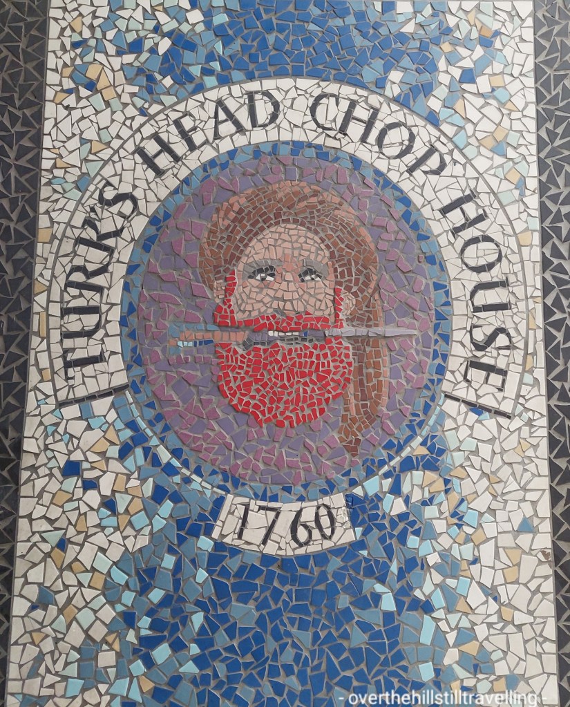
Dublin is one of my favourite places to visit. Its quirky, and colourful albeit dirty and home to one of my least favourite aspects of street life; the Dublin oyster 🤮
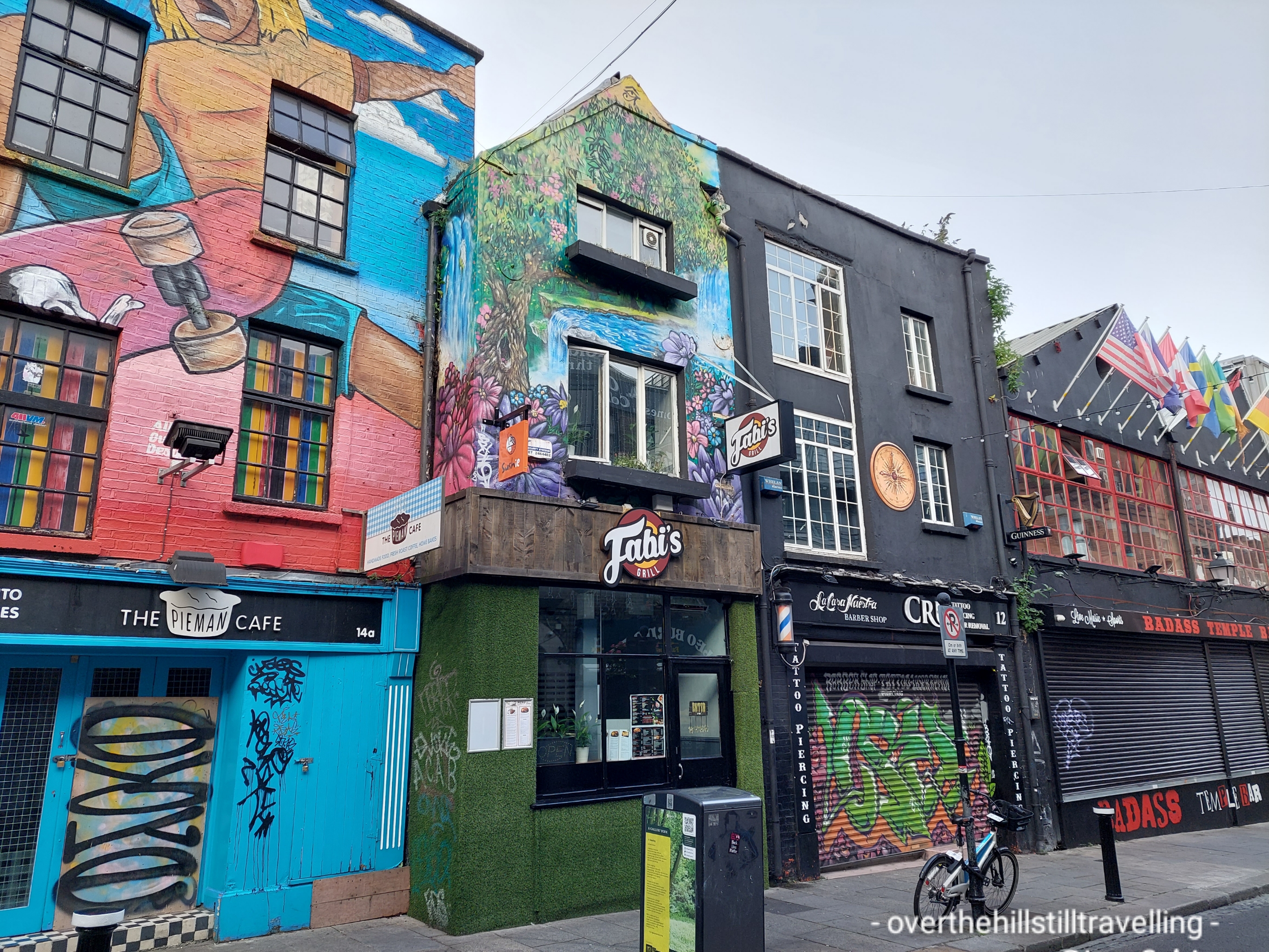
But I love the street art and the humour – the Irish are adept at poking fun at themselves, and that is a very attractive trait.
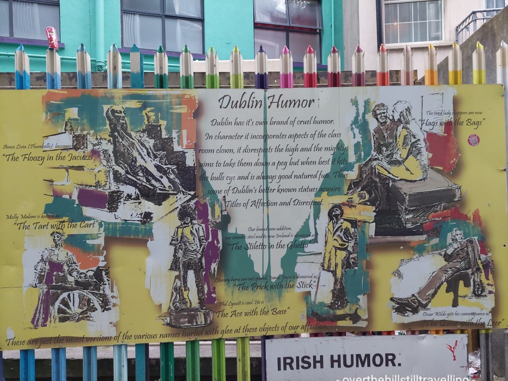
Dublin’s ability to poke fun at itself
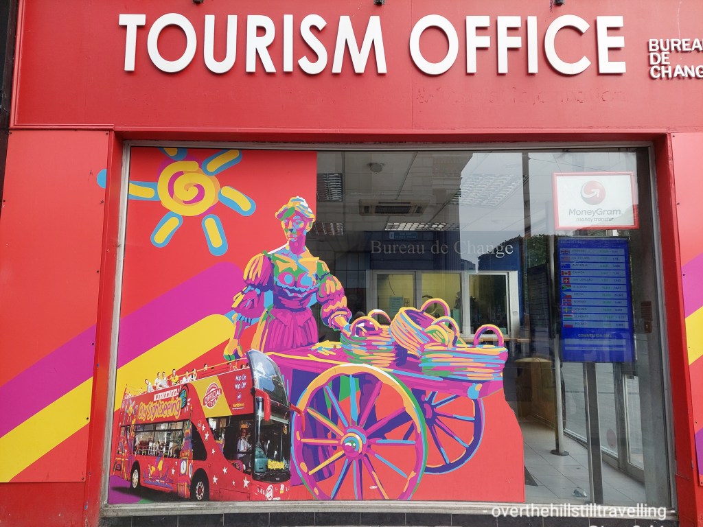
Amongst others, you’ve got; Molly Malone – The Tart with the Cart. The Hats with the Bags. The Stilleto in the Ghetto, the Queer with the Leer, the Ace with the Base.
Promoting the Tart with the Cart The Hags with the bagsThe Stilleto in the Ghetto The Ace with the Base
I captured these scenes while in Ireland for my sister’s 50th birthday 🎂 🥳 ; a fun and unexpected trip.
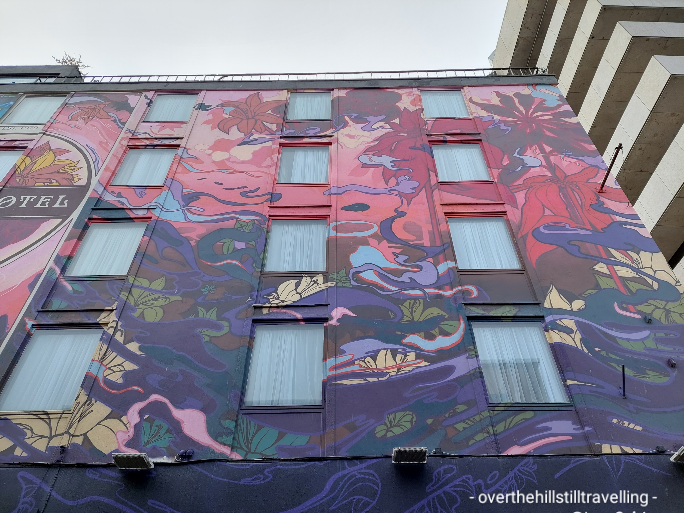
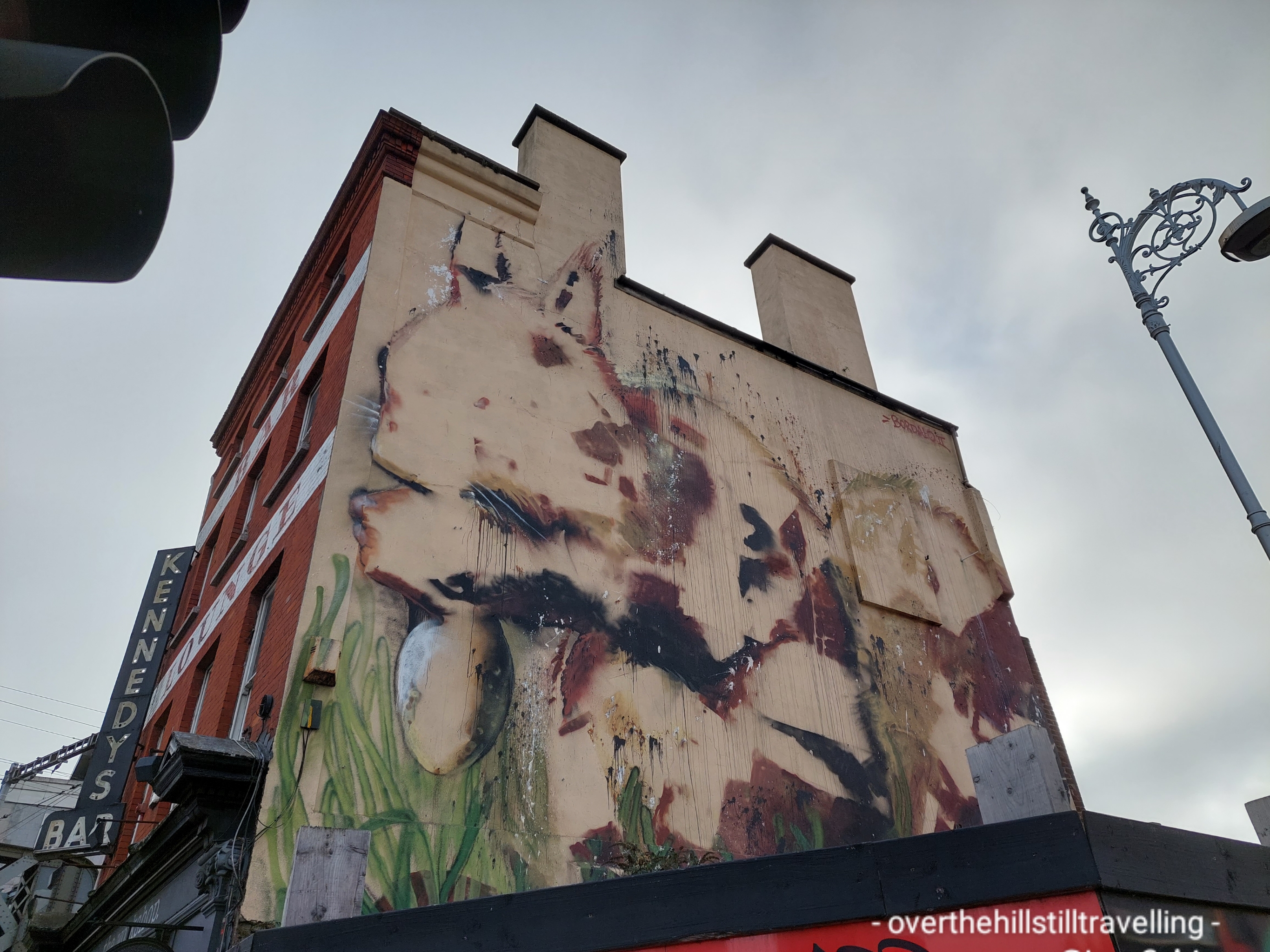
Street art
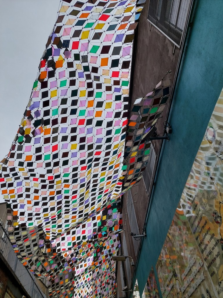
Whether you look up, sideways or down, you’ll be bound to find something somewhere…
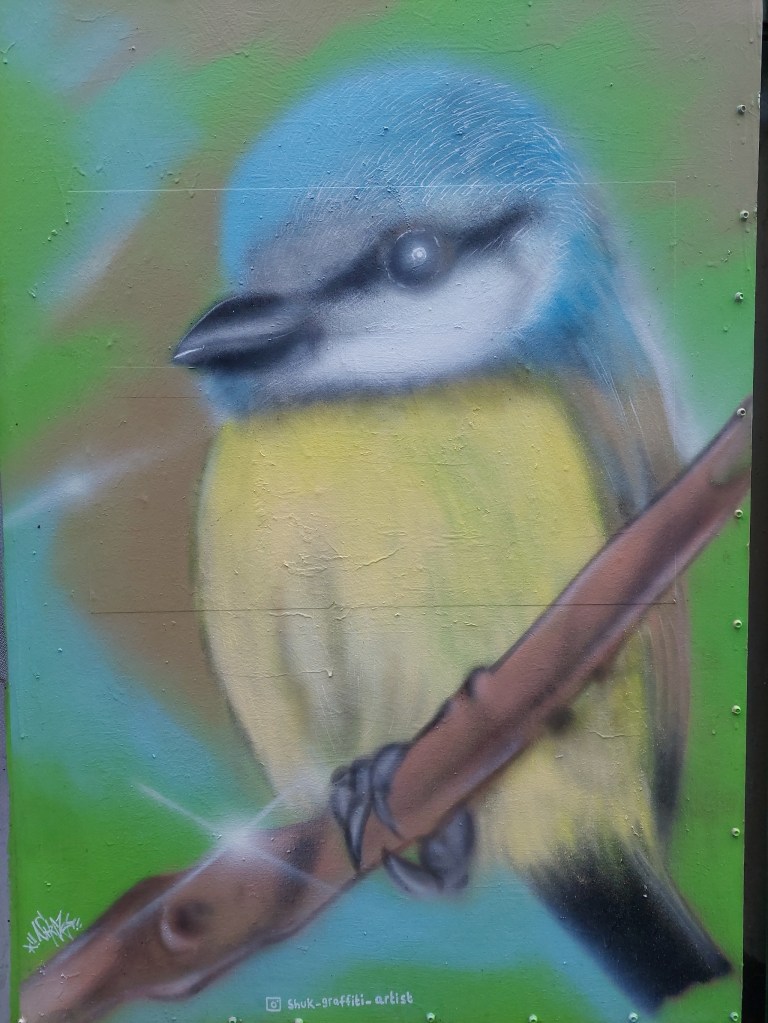
Just a random bird 🐦 A snail 🐌 A bull 🐂An elephant 🐘 A location to be avoided me thinks!!Temple Bar – preparing for Christmas in October 🤪🤪Famous figures- James Joyce The King’s Inn – where James Joyce frequented Accommodation and traditional Irish music are not a good combination for a peaceful night’s sleep 😴 How to stand out in a crowd!!! Can’t imagine what shade of yellow this is described as Pink and Blue will never do…Yup. We got it! It’s….Korky’s Down a side alley, The Icon Walk in Bedford Lane, is this gorgeous confection of coloured glass (or plastic)
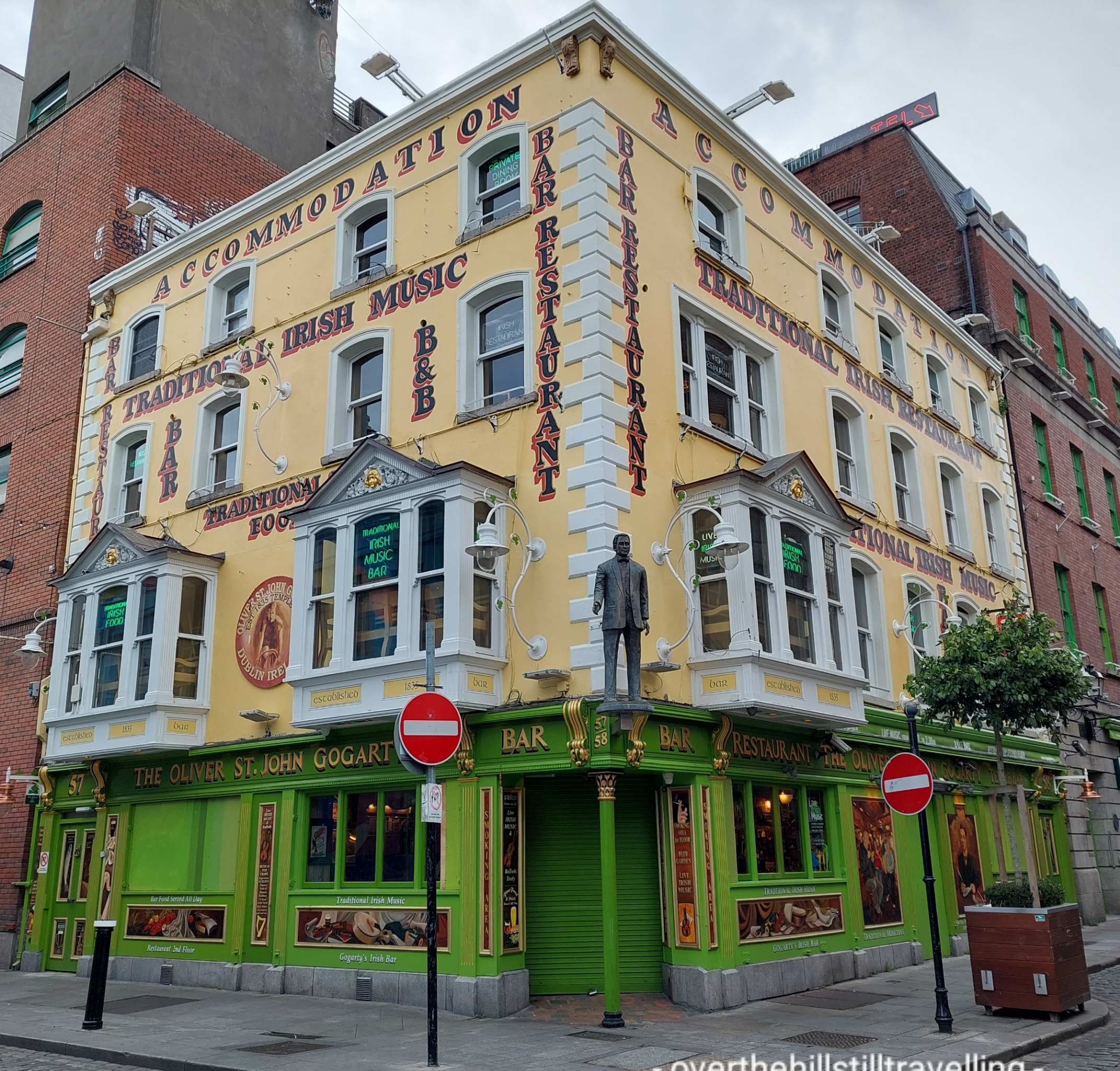
You may think that Dublin is dull and grey, but you would be mistaken.
And amongst the garish, a more sedate type of street art.
We actually stayed in Temple Bar, which as it turned out wasn’t too noisy, but then I’d never seen it so underpopulated…it’s usually heaving, day and night. I guess Covid-19 is still keeping patrons at bay.
In the thick of it…Temple Bar looking rather empty
I’ll share another post in a few days, featuring some of Dublin/Ireland’s people and history ..
I’m working near to Clapham Common for the next 12 days. I never knew it was so pretty.
Long Pond – formed after gravel pits were abandoned. Model yachts gave been sailed here since the mid-19th century The autumn colours this year are quite splendid Holy Trinity Church
This is going to be a relatively easy booking, but quite boring with nothing much to do. I may just get to start and finish (hopefully) my September blogs – it will all depend on whether or not my laptop is still operational.
From Wikipedia: At over 85 hectares in size, Clapham Common is one of London’s largest, and oldest, public open spaces, situated between Clapham, Battersea and Balham.
Clapham Common is mentioned as far back as 1086 in the famous ‘Domesday Book’, and it was originally ‘common land’ for the Manors of Battersea and Clapham. ‘Commoners’ – tenants of the Lords of the Manors, could graze their livestock, collect firewood or dig for clay and other minerals on the site“.
Whoop whoop, another Domesday Book place.
Lots of space for walking, and I’m planning on finishing the Ring Road Iceland by Wednesday next week 🤞🤞🤞 and starting the Romantic Road, Germany virtual challenge.
Tomorrow I shall go walkabout and look out for interesting architecture.
Yes, unbelievably it’s Day 17 of my walking adventure and Day 8 of my jaunt along Hadrian’s Wall, so I thought I’d pop in and give a quick update.
I had hoped to update you on a daily basis as mentioned before, but oh my gosh, the most I could manage was to eat (not even every night), shower, repack Pepe, and then bed. And repeat.
As per the title, I’m now starting Day 17 of my adventure, and Day 8 of my walk across country from North Shields; Segedunum Fort to Bowness-On-Solway, along Hadrian’s Wall. What an experience it has been. I’ve taken hundreds of photos and will share some of them in due course when I get the time, and energy to write ✍ 😁😁….so….here I am
Relaxing in bed in Brampton, watching a stunning sunrise and thinking back over the last 16 days.. it’s been a truly epic journey.
When I first planned on adding the Northumberland Coast Path to my Hadrian’s Wall adventure, I never for one minute doubted I’d be able to do it. But I also had no idea of what lay ahead. If I had, I might not have been quite so confident. But now that I’m near the end, and with the easy stretches ahead, I’m astounded I managed to get this far, and certainly amazed I’m still standing…well at the moment I’m lying down 😁😁😁
But, geez, I never imagined I would do quite as much walking as what I have. It’s been epic. Every day has brought its own joy, and pain, and laughter, and lots of “OMG that’s amazing” moments; reaching the border with Scotland, the dolphins off Farne Islands, seeing that bridge in Berwick Upon Tweed, traversing the bloody Blythe River estuary 🤪🤪, visiting St Mary’s Lighthouse, the wonderful beaches of Northumberland, the many castles – all different and unique in their own way, reaching Tynemouth, the bridges of Newcastle, visiting Arbeia Roman Fort, discovering the first section of the Wall at Heddon on the Wall, seeing the ascent and then descent as I climbed the first ridge on Hadrian’s Wall (I truly do not know how I did all those), seeing the tree at Sycamore Gap from the top of the ridge and suddenly realising what it was 😄😄, exploring the forts and carrying my backpack for 32kms on what was the hottest day of my whole journey…unreal.
I just wish I hadn’t been so tired at the end of each day, I’d have liked to write down the daily experiences…but it was all I could do just to upload some photos before crashing. I’m looking forward to calculating my distances. But one of the best aspects of this journey has been the many, many lovely people I have met along the way, especially on Hadrian’s Way…truly epic.
Day 1 done and dusted 😁😁 I had a completely uneventful journey, ever so quick from King’s Cross to Berwick…and boy are those trains fast!!
Arrived in Berwick to the most glorious weather and scooted quickly over to the castle ruins. I didn’t go right into the keep coz it closes at 4pm and I got there at just on 3.54…but I had a good look around and then headed back up the million steps I’d just walked down 🤪🤪 Google maps doesn’t show how steep some places are!!
The River Tweed Tweed Castle The Royal Bridge
The Airbnb is lovely and the host is amazing…there’s a gorgeous ginger cat and a beautiful golden labrador, so I have had lots of kisses and cuddles.
My bed for the next 3 nights
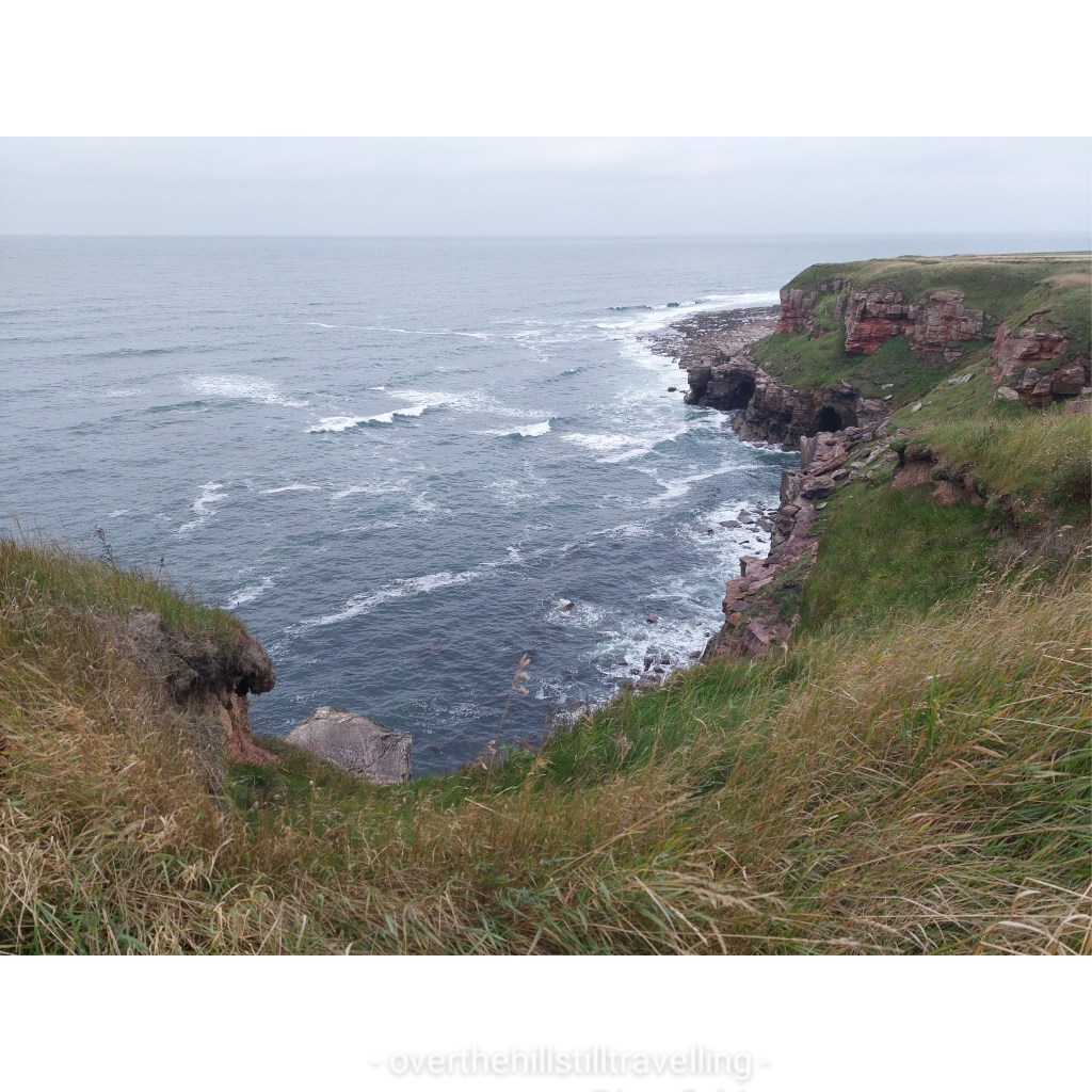
As soon as I had dropped off my backpack, I grabbed my day pack and headed north yo the Scottish border. OMG what a path!! The views were spectacular but the path was hell!! For the most part it ran right along the very edge of the cliffs with just a tuft of grass between the walker and the vertiginous cliffs that fall 100s of feet down to the sea. The North Sea in case you wondered.
Spectacular. The weather turned soon after and the clouds came inPart of #notthecoastpath 🤣🤣
A local suggested I walk along the above ‘path’ because the real path “is a bit rough, and this is a lovely wee walk” – well he wasn’t wrong about the path, but this was no better and I crossed the edge of a potato field to the path as soon as I could. I’m thinking he’s never walked to the border before…
Now this was more like it…leading away from the Scottish border, it was a joy to see this…if only the whole route had been the same
However, despite the awful path and the daunting propect of a twisted ankle on a very narrow and uneven path, and the fading light, I’m so glad I made the effort to walk up to the border and back
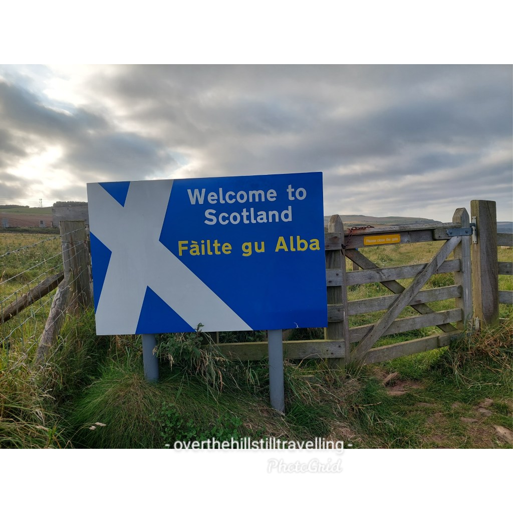
Welcome to Scotland 😁😁English borderIt was so cool to cross through the gate into Scotland
The views are absolutely spectacular.
I’m standing on the path!!! A twisted ankle or a trip and you’d be in for a swimLiterally right on the edge
Once I got back to town I had a quick whizz around and walked a small section of the town ramparts, which are just amazing with awesome views of the river and estuary.
Town wallsWalking the ramparts Fantastic viewsGuarding the town
I got back to the b&b at just on 9pm and having missed the fish and chip shop, I had 2 cup a soup and a cup of tea.
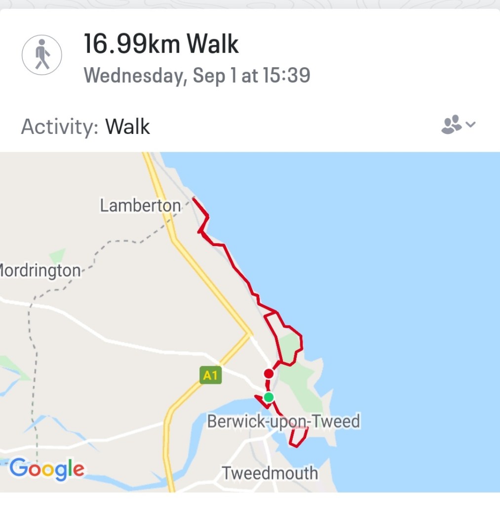
In all a terrific start to my Northumberland Coast adventure. Just on 17kms covered.
My walk
I’ve added some of the history of Berwick in case you’re interested 😉
Berwick is just four miles south of the Scottish Border, but during the last 300 years, control of the town swapped 13 times between England and Scotland. Berwick’s Elizabethan town walls are the most intact in England, and were Elizabeth I’s biggest and most expensive project during her reign to keep firm control of this key town.
Situated at the mouth of the River Tweed near the border of two kingdoms, the town of Berwick suffered centuries of conflict, as control of the town passed back and forward between England and Scotland until the late 17th century. Each crisis brought repairs and improvements to the fortifications, culminating in the great artillery ramparts begun in 1558. These survive largely intact and make Berwick one of the most important fortified towns of Europe.
Berwick’s town walls are its most famous piece of architecture and still stand strong today, hundreds of years after they were built. Berwick actually has two sets of walls, the first set (of which only fragments now remain), commenced by Edward I, was two miles long. The later Elizabethan Walls (which are still complete) are a mile and a-quarter in length. The ramparts completely surround the town, with four gates through which entry to the town is enabled.
Berwick’s Elizabethan Walls are the only example of bastioned town walls in Britain and one of the best preserved examples in Europe. When built in 1558 – designed to keep out the marauding Scots who regularly laid claim to the town – it was the most expensive undertaking of England’s Golden Age.
Andddd….breathe!!! 🤪🤪🤪 geez, I don’t remember being this tense when I set off for my Camino in 2017!! Probably coz I didn’t fully appreciate what was ahead. But now I do. 🤔🤔
My heart is racing and I’m on the edge of crying..copiously 😂😂 But I’m as ready as I can be. I’ve trained, I’ve packed and repacked, taken stuff out, put other stuff in, researched just about every inch of both routes, noted all dates, times, accommodation, excursions, reference numbers, telephone numberset etc etc so nothing left to be done, but 🚶♀️🚶♀️🚶♀️🚶♀️ Whewwww. Cor blimey!!
And so the time has come 😃😃😃 With just 37!!! days (😱) till I set off on my big adventure, Pepe needs a repack. I’ll be away working for 24 of those 37 days, so now is the time!! It’s both thrilling and terrifying…this will be my longest walk/s by far. The most I’ve walked continuously in the past has been 11 days on the Camino.
Pepe looking pretty in yellow 💛 and the colour matched poncho I bought yesterday 🤭🤭🤭
This walk will be 23 days. Naturally of course, 6 of those 23 days will be devoted to exploring the areas I’m in; Berwick Upon Tweed, Lindisfarne, Bamburgh, Newcastle, Carlisle and Glasgow, but that all involves walking 🚶♀️🚶♀️🚶♀️
So whewww, I’m ready, but I’m almost certain that my feet are not at all as excited – they’ll be doing most of the work, poor old 👣👣🥾🥾 #notjustagranny #overthehillstilltravelling
I’m going to be packing as light as possible, even lighter than the Camino, and very definitely, I am planning on using baggage forwarding wherever possible and feasible. As I have said in the past, I’m not into self-flaggelation, and walking for me is an enjoyable pastime not a penance for past sins!! Camino or not!! 😂😂😂
Tomorrow after I’ve returned the tiddler to his parental unit, I’m going shopping for new walking shoes. The asics I purchased a few months ago are not quite doing it for me, and weirdly the Salomons I tried on last week felt more like mini coffins than comfy trainers, which is toats weird since I wore a brilliant pair on my Camino. Shoulda bought 2 pairs!! 🙄🙄🙄
After a few weeks of intensive planning and calculating distances and studying the terrain via Google satellite maps, I am almost ready to rock and roll along the Northumbrian coast as I walk the Northumberland Coast Path from Berwick Upon Tweed to Cresswell – the official route.
Of course, because I’m just that way 🙄 I’ve decided to tweak the route and add on a few kms!! After all, why not? It’s only 100 kms, I’ve done way more than that on other walks, so yeah….I’ve planned my route to include the stretch from the border of Scotland at Marshall Meadows to Berwick Upon Tweed and since I’m going that way anyway, I’ll keep walking from Cresswell to Newcastle….not all on one day mind!!!
So whew, I’m now VERY familiar with the Northumbrian coast…I know just about every town on the route and the distances between – slight exaggeration of course, but it sure feels like it.
What’s not an exaggeration is how much time I’ve invested in searching for suitable places to stay that are not too far apart and not going to cost me a month’s salary for 1 night!! Exaggeration of course but some of those places do charge more than I earn in a day…
Google maps, Booking.com, Airbnb and I have all worked overtime since I decided on impulse to leave St Oswald’s Way and St Cuthbert’s Way for 2022 when I do the Two Saints Way (different saints), and instead walk the NCP as part of my quest to walk the whole of the English Coast – since I’m up that way anyway for my other big walk.
My train ticket is booked, my accommodation is now finally booked, I’ve identified bus routes for getting to and from stop/start points, and I’ve identified some of the must see sights.
There are a lot of castles and rivers and a few islands. Plus the coastline is a UNESCO heritage site (I think???) I’m sure I read somewhere that it was, but for the life of me I haven’t been able to find where I read it, so may just have to let that go, but it looks like I’ll be adding quite a few places to Project 101.
In the interim I got my official guidebook and passport 😃😃👏👏👏 and that was well exciting.
It’s been really tedious working this plan. You’d think that with the sea to my left and heading from north to south it would be a breeze to plan my days, but no!!
Accommodation has been a huge stumbling block. I figured I would aim for approximately 20kms a day or as close as possible, but because I couldn’t find affordable accommodation in some places, a few of my days are a bit of a yo-yo.
But yesterday I finally nailed it. Hoorah!!!
So 3 nights in Berwick Upon Tweed with 2 day trips: 1 to Lindisfarne and 1 to Bamburgh Castle and some walking to cover that part of the coast inbetween, then on day 4 I hit the road, so to speak.
I’ll be adding my kms to the Kruger Park Virtual Challenge since I need to complete that by the end of September.
I’ll pop up another post in a few days with more details, but for now…
…..all I have to do is keep my fingers crossed that we don’t go into another lockdown…
Last year, 2020, inbetween lockdowns, and somewhere between Sandwich and Deal, on a practice walk for my now started Thames Path jaunt, and having just finished reading The Salt Path, by Raynor Winn, I was inspired to attempt to walk the WHOLE of the English Coast….in stages – you know how I love my stages 😉🚶♀️🚶♀️
I have already walked from Broadstairs (when we still lived there) to Sandwich, and to Margate – countless times when preparing for my Portuguese Camino in 2016/2017.
Due to my job I also get to work in a variety of locations, and occasionally it’s at the seaside…so I’ve already walked a few sections of the English Coast Path accidentally. But of course, now I’ll have to walk them again, this time with purpose, and that won’t be any hardship.
I reckon it’ll take about 10 years at my current rate, and because I’m still working and following a multitude of other routes!
Actually, I recently had the good fortune to have a booking in Nether Stowey and planned a couple of days in Paignton during which time I walked from Berryhead to Torquay via Brixham over 2 days ✅✅ and I also walked as far as Dover last year. (I will eventually get to write about these walks – the scenery is just stunning, and of course the east coast is awash with history – forgive the pun!).
Although I have a penchant for just going on my walks ‘on impulse’, mostly a fair amount of planning has already gone into the ‘idea’ 😁😁 and its usually impulse meets opportunity, and off I go.
I’m walking Hadrian’s Wall in September, so decided to walk the Northumberland coast path from the border with Scotland and part of the Tyne and Wear coastal path. Since I’m up that way….
To that end I’ve ordered the Northumberland Coast Path guidebook and passport (yes!!! To my delight, I discovered that there is a passport to go with it yayyyy 🙃🙃).
The Northumberland Coast Path
And so planning has begun. Originally (2020) I had planned on walking St Cuthbert’s Way and St Oswald’s Way, both of which are in Northumberland/Scotland, but there are 2 other Saints walks I want to do, and since I have the St Francis’s Way Conqueror Challenge still waiting in the wings, I’m going to try plan those for 2022, and put the mileage towards that challenge. 😀
I better plan a trip soon…I joined this challenge in December 2020!!
Part of the enjoyment of these walks is the planning. I love to set up the spreadsheet, decide on suitable dates, identify the distance and then start my research : transport, accommodation, weather, food stops, and of course affordability. I usually budget for £100 a day all told because accommodation costs are quite expensive. There’s a HUGE difference between the UK prices and Portugal/Spain. Its wayyyy cheaper to travel the Camino than plan a walk in the UK, unless you wild camp, which I have not yet had the courage to do.
First I had to identify all the main towns along the route, which is 100kms +- from Berwick Upon Tweed to Cresswell, and onto Newcastle. Identified and noted – spreadsheet updated.
Then I broke the distance down into ideally 20km walking days to see the how long and where to stay places. Towns/places noted. Some days will be longer than other!!!
Next up: transport. Hmmm. There’s a railway line but it appears to goes direct from Berwick to Newcastle 🤔🤔🤔 and buses? Also a direct route, and no stops from what I can see (on closer inspection I found a few stops 🙄). So possibly basing myself in one place and hopping back and forth like I’m doing with the Thames Path and Saxon Shore Way! Tricky!
Next up: accommodation! I had a look on Airbnb and Booking.com. I nearly had heartfailure at the prices!! Even the YHA in Berwick Upon Tweed are charging £99 for 1 night! Restyled as a Hilton then?? Jeez. A more indepth search is required.
What I found during my searches is that accommodation is in short supply, and few and far between, and if available – very expensive!! Gosh, I hope the guide book is waiting for me when I get home!!
So I contemplated the possibility of ‘wild camping’ 🏕 🥴🥴 I’ve seen loads of people who do this on their long distance walks, but tbh I can’t even consider the idea of carrying a tent, sleeping mat and sleeping bag!! I carried a sleeping bag on my first day of the Pilgrim’s Way and the extra weight nearly destroyed my will to live.
I’ve been toying with the idea of just roughing it and sleeping with my jacket on under my emergency blanket…but I asked myself “what if it rains?” and of course there is this: Wild camping is not allowed in England, so please do not pitch your tent unless you have sought the permission of the landowner. What if I don’t have a tent? LOL
But ‘just in case’ I decided to check the weather patterns for September on the Northumbrian coast… very encouraging. Of course those 8 days, could coincide with my 6 days 😂😂😂😂 so perish the thought!!
I hope my trip coincides with those 22 days… Q. Weather Northumberland September? A. On average, it is maximum 16° in september in Northumberland and at least around 10° degrees. In september there are 8 days of rainfall with a total of 8 mm and then it will be dry 22 days this month in Northumberland’.
Not sure which year this was, but I hope it rings true for 2021 too!! Loving the average temperature!!
Sitting here on Saturday morning waiting for my client to wake up and scrolling despondently through the World Wide Web 🌐🕸 I had the bright idea to ask the community on the Long Distance Hiking page on Facebook 😁😁
Voila…I’ve had some lovely responses so far, but not much about accommodation. So, patience being a virtue, I’m keeping my fingers crossed 🤞 and hoping someone has relevant information.
If not, then I’ll have to just wait for the guidebook and hope for the best….other than that, I’ll just wing it. I have a limited amount of time to book my advance rail ticket…
So that was in the morning…. meanwhile I’ve had a few people respond with more information about accommodation and bus routes that I did not find during my searches – change the keywords and success! It seems there are indeed local bus services that ply the coast between towns (of course 🙄🙄 silly me, I had wondered how people get around).
I then had the bright idea (yes, I do wake up occasionally) of going back to the Northumberland Coast Path site from which I ordered my guide book, and hey presto! Guess what??? They have a whole section dedicated to the different stages and surprise surprise….accommodation options. However, on closer inspection some of the accommodation listed is well beyond my price range and when there are no prices listed….don’t even bother going there!
So back to the drawing board and fingers crossed by tomorrow I’ll have my route sorted and accommodation identified and booked.
Hot on the heels of Stage 4 between Richmond and Hampton Court, from here on I was breaking new ground. Except for brief forays along the banks of the Thames at Windsor, Oxford, Henley-on-Thames and Reading when visiting those places or working there, I have never walked along the banks of the river beyond Hampton Court. A whole new adventure awaited; places to go and things to see!
As mentioned in Stage 4, it was now taking longer and longer to get to my starting point and the train tickets were getting to the point where it would cost more or less the same to stay in an AirBnb overnight as pay for a daily ticket. So after this stage I will continue my journey in 2 day increments or more…probably a 4 day stint would be good at some stage.
I arrived at Hampton Court Station just after 10:40 having discovered via a very helpful station assistant in Ramsgate, that if I bought a same day return, I could in fact leave before 09:35, and also…today was Saturday, so I could leave much earlier than usual; which I duly did.
Good morning Hampton Court Bridge
Because it was still relatively early I decided to have a short excursion onto the little promontory for a quick sandwich and some tea; Cigarette Island Park, juts out into the Thames and offers superb views of the river and the palace. Not sure I like the name of the park…but still, it’s pretty and cool and green.
Fab view of the palace and river for breakfast
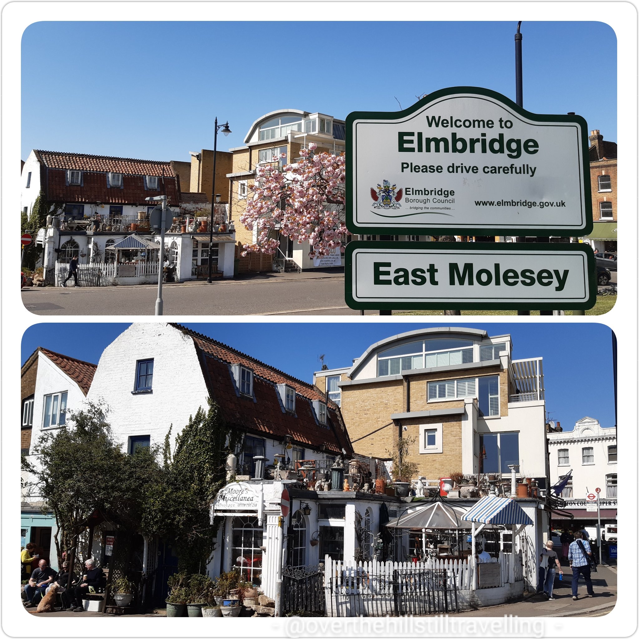
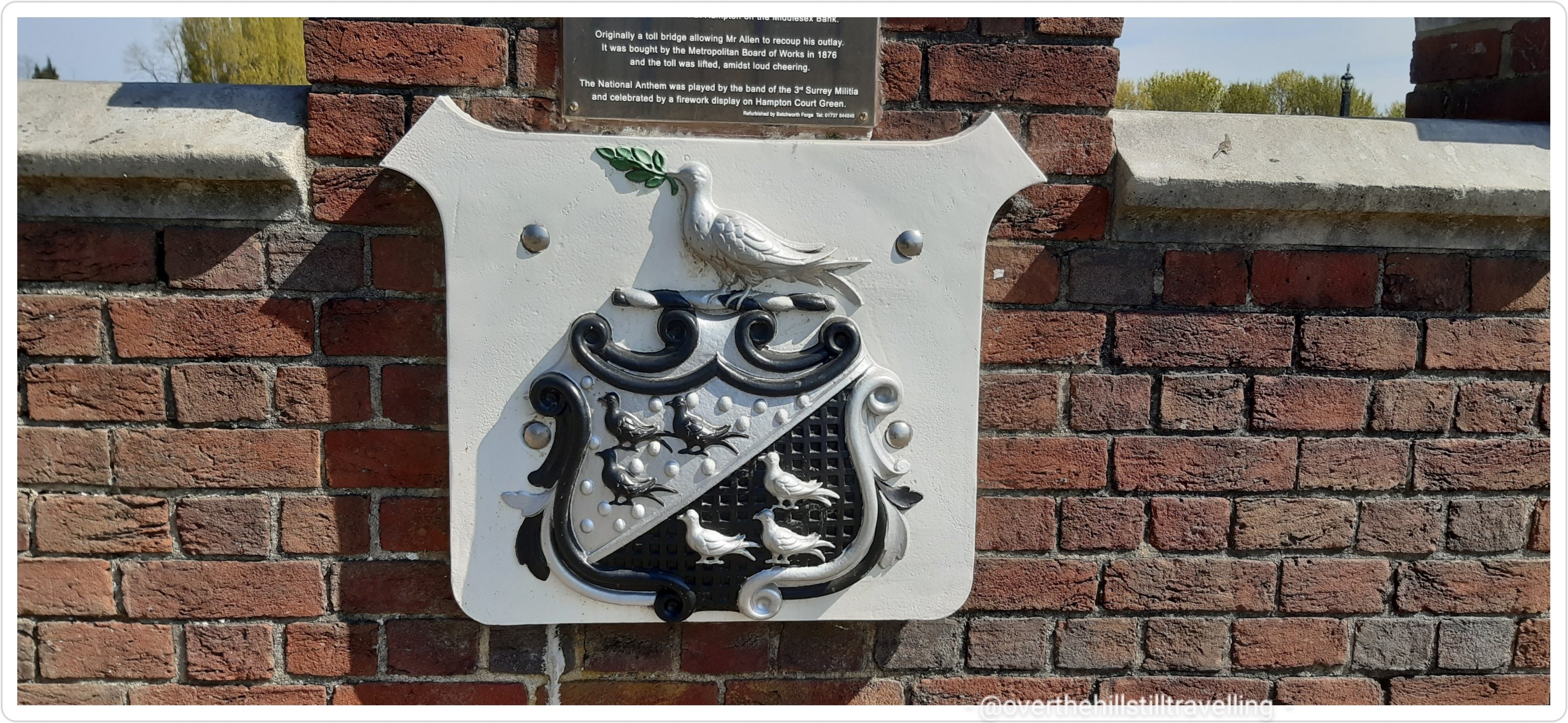
Now in East Molesey on the south bank of the Thames, after my tea and yum yums, I set off into the wild blue yonder…what will I find? First off some photos of the area, and a brief history…Hampton Court Bridge was opened in 1866 at the expense of a local man who lived in the area, Thomas Newland Allen (his coat of arms adorns the bridge). Originally a toll bridge, allowing Mr Allen to recoup his outlay, it was bought by the Metropolitan Board of Works in 1876, and the toll was lifted…I believe the locals were pleased – the National Anthem was played by the band of the 3rd Surrey Militia and there was a firework display!! I can’t imagine them doing that today!!
East Molesey – I just love this little house/storeCoat of Arms – Thomas Newland Allen. Love this design
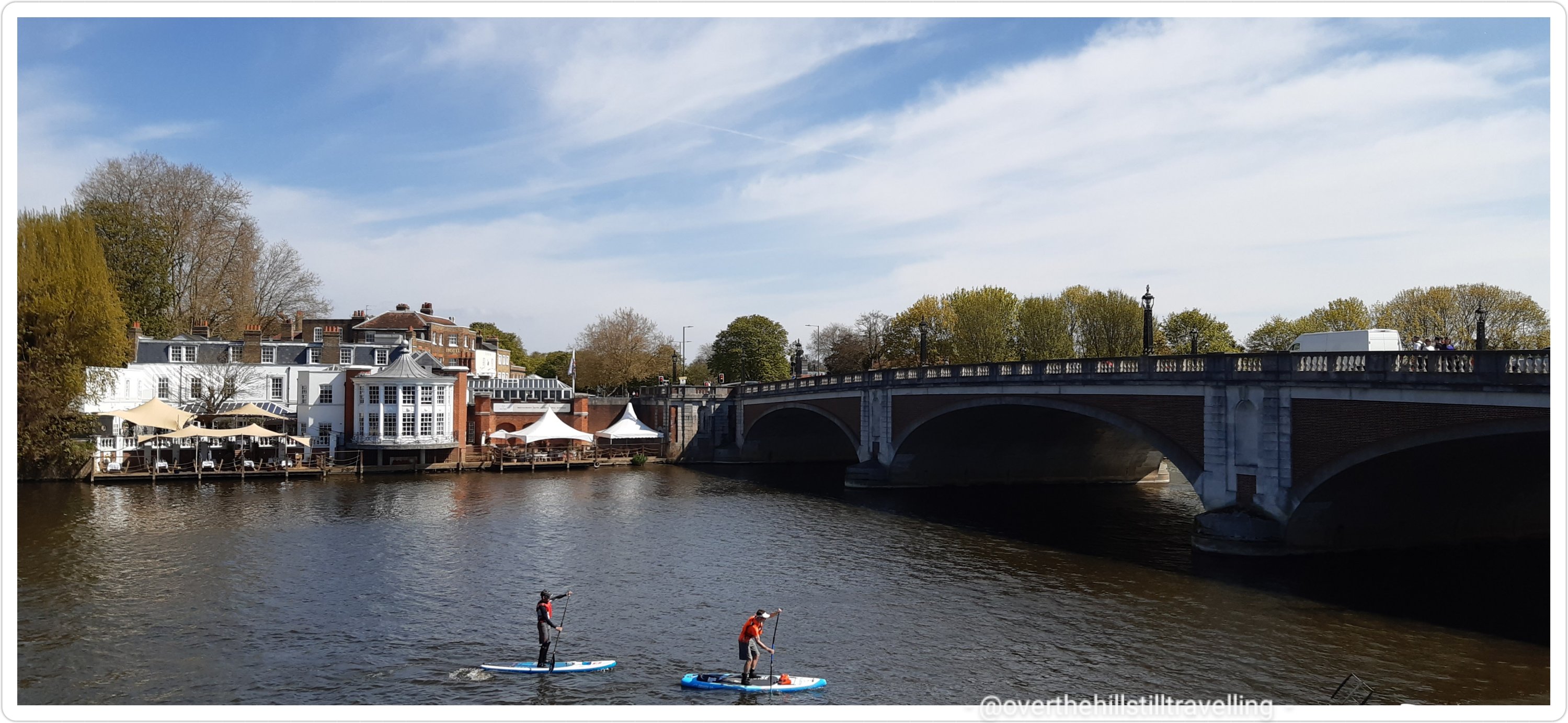
Looking across the bridge to the Mitre Hotel (I had tea and scones with jam and cream there one day), I was reminded of the history of the hotel : the all new Mitre Hotel where quirky British sensibility meets elegant authentic luxury on the banks of the Thames…as it says on their website 🙂 Origins date back to the reign of Henry VIII. The building has been reconstructed since 1665 and is Grade II Listed as a mid-18th century edifice by Historic England. It is widely reported that The Mitre was built in 1665 at the direction of Charles II as a ‘hostel for visitors to the Palace’. The Mitre is on the site of The Toy, which originally stood on the opposite side of the road, near the Trophy Gates of the Palace… and is mentioned in 1653 in the Parliamentary survey of Hampton Court as a Victualling House. This house was famous for the convivial meetings held there by the “Toy Club”, of which William IV, then Duke of Clarence, was President. ref wikipedia
Mitre Hotel
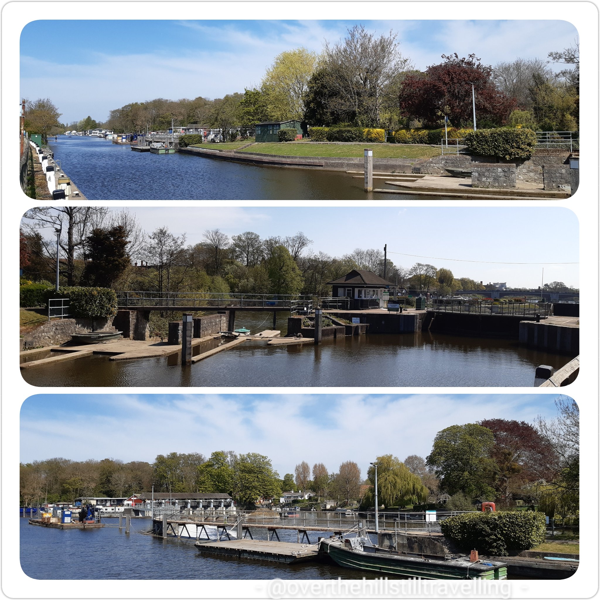
Moving on, within a few paces I encountered my first lock of the day; East Molesey.
Molesey Lock
A stone’s throw from Hampton Court Palace is Molesey Lock, built relatively recently in 1815 by the Corporation of London. Before this lock was built, Hurst Park (on the south bank by the lock) was known as Moulsey Hurst. During droughts, the Thames was liable to become too shallow for river craft to pass through. The heavily laden barges were held up, sometimes for weeks at a time while the bargemen waited for the weather to turn. When it did, the higher water levels allowed the barges to float through. The lock’s 1905 rebuild was carried out to accommodate the long 200ft naval craft built at Platt’s Eyot, just upstream of the lock. Between the 1800s and early 1900s, Molesey was probably the most popular lock on the Thames – on summer Sundays. ref their site
Molesey Lock
I was ever so lucky to have another fine spring, almost summer’s day with blue skies, puffy white clouds and a soft breeze that kept me cool for most of the day.
Lovely open pathway makes for easy walking
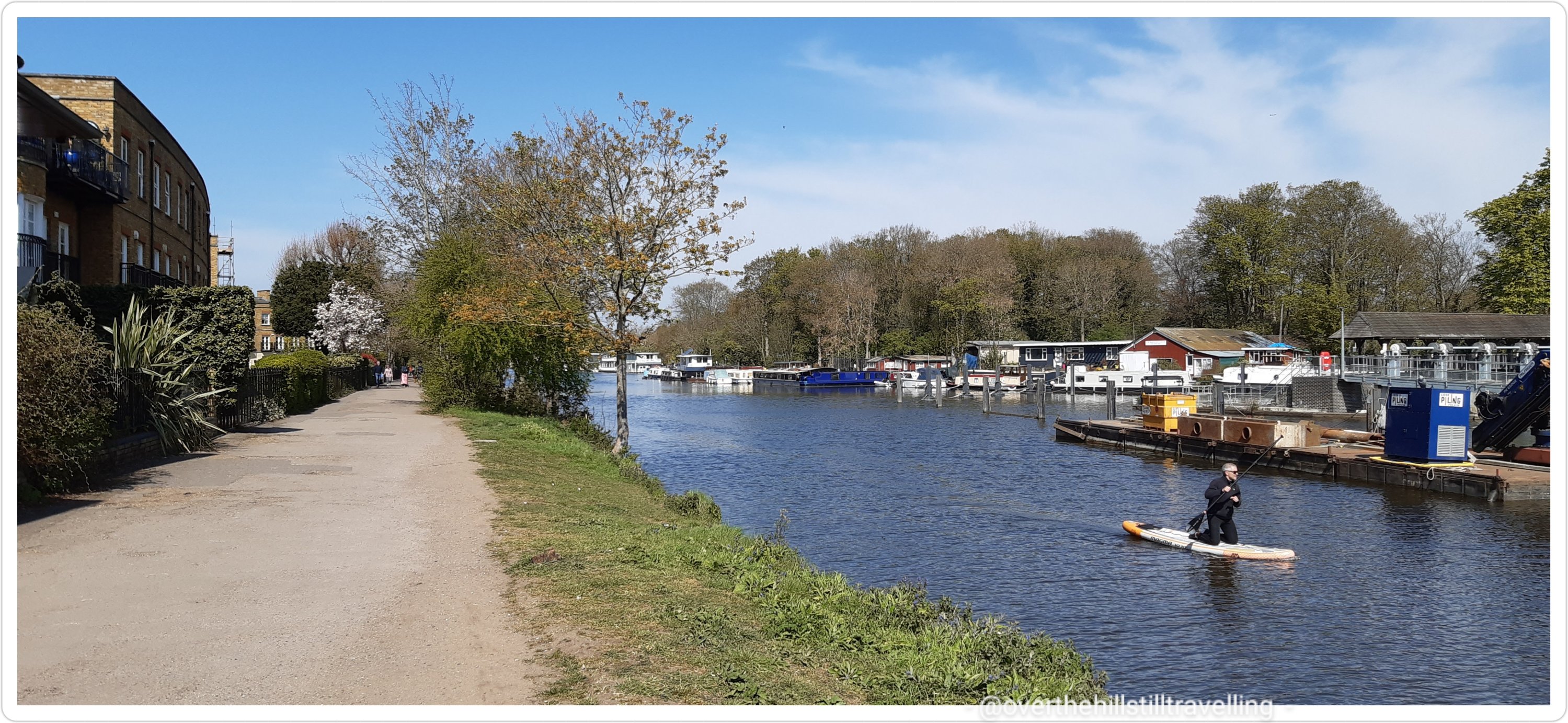
Heading towards Walton-on-Thames, the path is wide and very rural. I don’t often have ‘house envy’ having already owned a couple of houses back in South Africa and all the accompanying headaches, but oh my word….look at those houseboats! whoa. It looks heavenly, although I’m sure it’s probably quite noisy living on the river.
Fab.U.lous houseboats
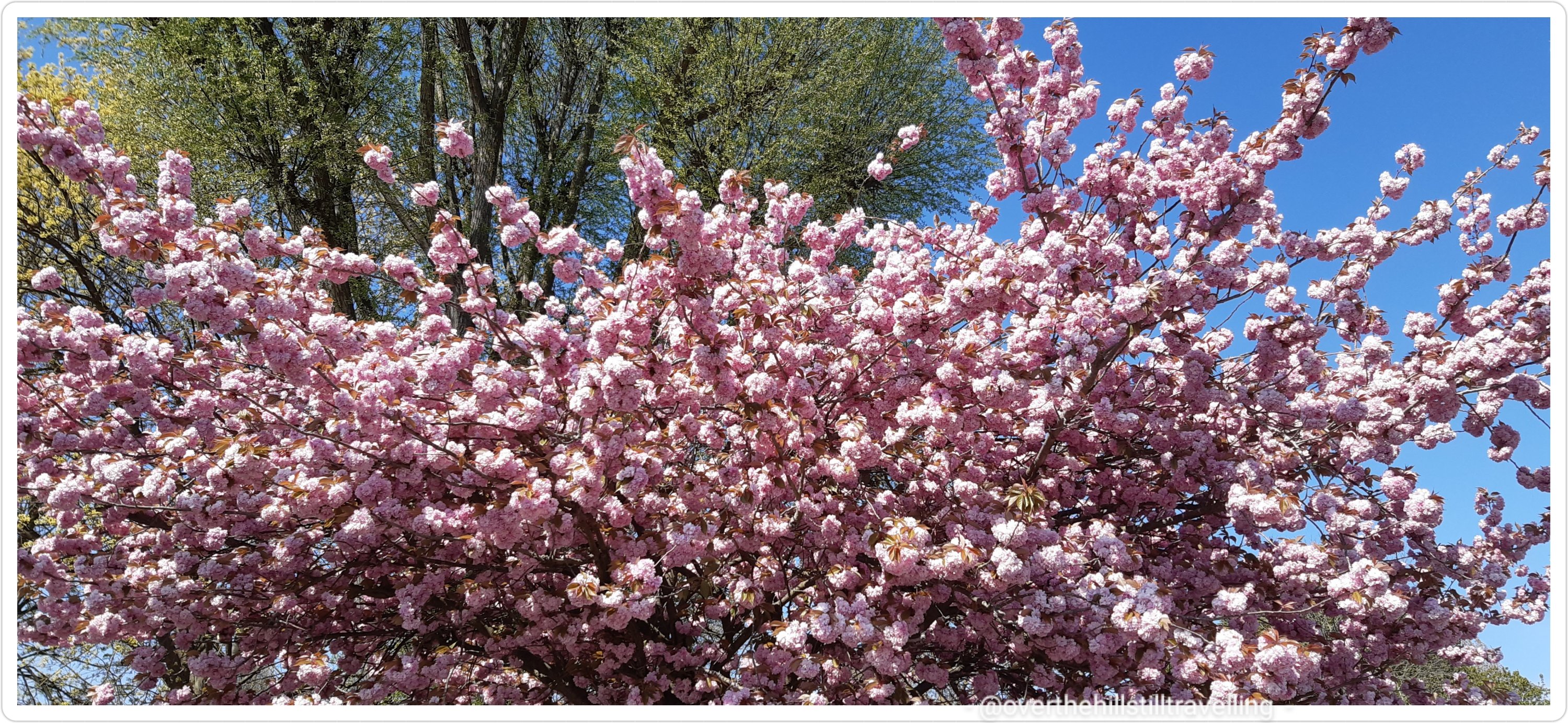
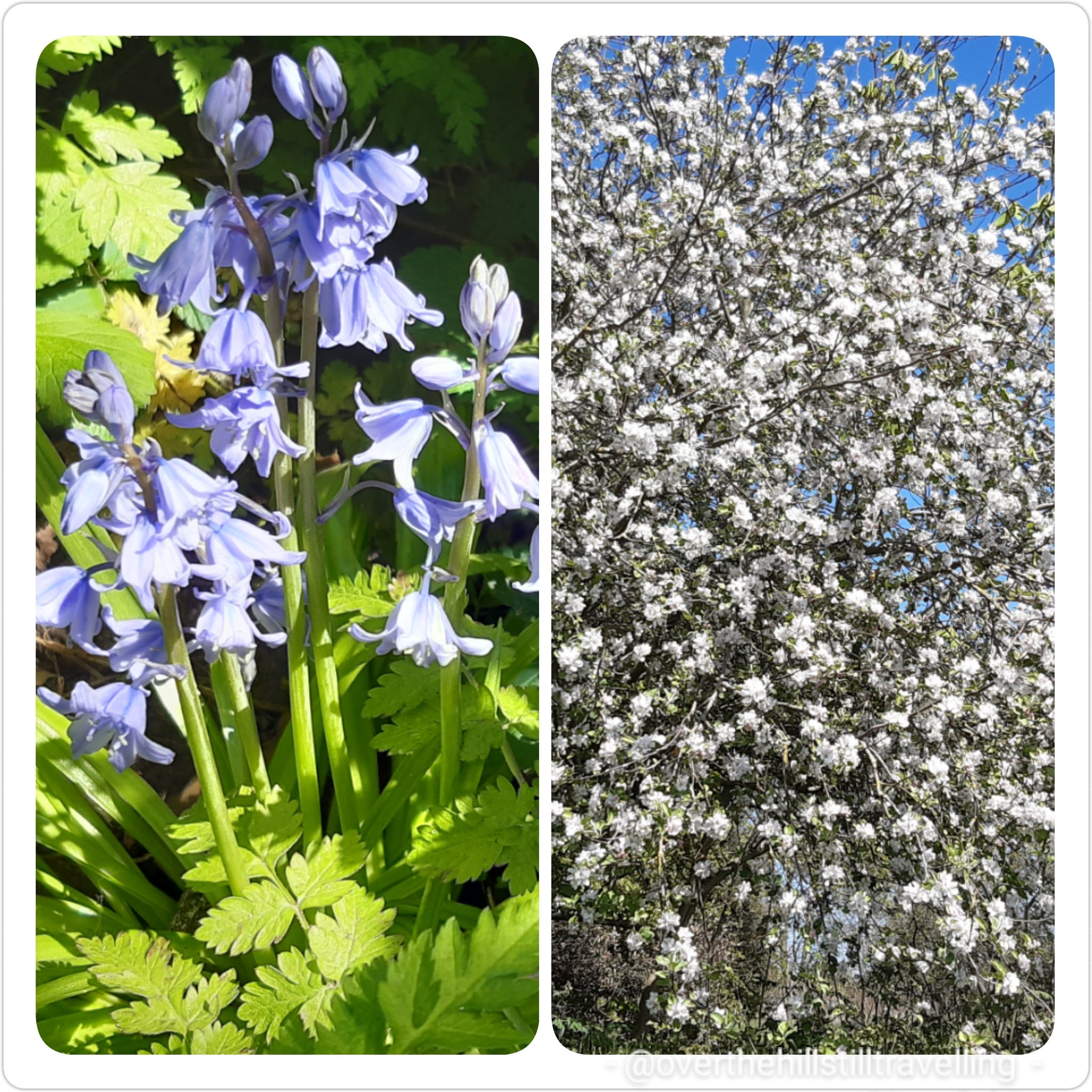
Again I was enchanted by the fabulous cherry blossoms and the many bluebells along the route. They really are gorgeous, just a shame they don’t last long.
Cherry Blossom 🌸lots of wonderful bluebells have flowered along the path…
I passed alongside Hurst Park and stopped briefly to look at what to expect ahead
Hurst Park – you are here! 😃 – heading upstream, river to my right
A little further on and I was amused by the antics of a little browney beige dog. He was splashing around in the river, then bounding out, running ahead of his entourage, hiding behind overgrowth on the river banks and when his ‘servants’ neared, he would bound into the river, splash about and jumping out run ahead and do the same all over again. It was ever so cute and went on for quite a while. He had so much fun! Lucky dog, I wished I could just jump in and splash about….approaching midday, it was getting quite hot.
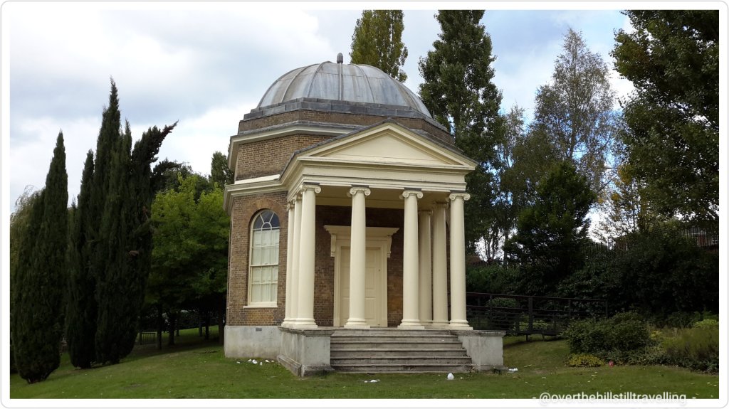
Cute dog 🐕😍 had so much fun
At the next Thames Path direction marker, I could see Garrick’s Temple to Shakespeare across the river. I worked in Hampton once some years ago, so had the pleasure of visiting that little park on one of my many walks. Nearby is Garrick’s Villa where he lived : David Garrick became the lessee in 1754 and then bought the property in October that year, making it his country retreat and a place of recreation where he and his wife frequently entertained their friends. He embarked on extensive alterations inside the house and, either now or at a later stage, employed Robert Adam to re-design the facade in the classical style then in vogue. The house has a fascinating history if you’d like to learn more.
Garrick’s Temple to Shakespeare
Garrick’s Temple to Shakespeare, Hampton
David Garrick lived here – we don’t last as long as (some) bricks and mortar
The path runs alongside the river here without too much urbanisation, but with terrific views across the waters to Hampton. Garrick’s Ait on my right, I could see St Mary’s Parish Church across the river.
St. Mary’s Church, Hampton
Not much further along and I discovered the remarkable Memorial Sundial in Buckingham Gardens in West Molesey. I spent some time here reading as many of the plaques as I could see. The sun was right overhead and almost blinding, but it looks absolutely fascinating. Did you know that the Vikings sailed this far up the river!?? Apparently to raid Chertsey Abbey! Wow. Seriously, after all the stuff I’ve read about the Thames and London etc, I never knew that they travelled so far inland. I have not been able to find much information beyond this website about this amazing memorial, but there are some super images on the web.
Memorial Sundial West Molesey
Sundial
Vikings sailing up the Thames
Sundial
Hurst Park has a fantastic variety of wild life; fish and birds in particular. The river upstream of London is so much healthier for them.
The path too is super, wide and open albeit without much shade, which is always appreciated on a hot day. I got sunburned despite lashings of sunscreen.
So easy to follow…
A little further on and across the river from me was Platt’s Eyot, which sadly just 10 days later suffered a terrible fire that destroyed the warehouses and boat yard. Sadly one of the boats destroyed was one of the last remaining Dunkirk evacuation vessels.
Platt’s Eyot – no idea at the time it would burn to the ground in just a few short days
I loved all the canal boats tied up alongside the banks of the river…it must be such a different lifestyle living on a boat on the river. I think I’d like to try it out for a few months at some stage – perhaps when my grandson is older, then he can come visit and stay too ☺💙
Loved the canalboats…so quirky Lots of trees…no proper shade
Although you can’t really see it from the Thames Path, to my left are a lot of bodies of water…the Molesey Reservoirs Nature Reserve, Queen Elizabeth II Storage Reservoir, Bessborough Reservoir, Walton Advanced Water Treatment Works and Island Barn Reservoir, and across the river Sunnyside Reservoir and the Thames Water Hampton Water Treatment Works…..I was ignorant of all until I started looking at my photos on google maps LOL.
There are a lot of islands along this stretch of the river…and locks, and weirs. The path is well marked and you will see frequent direction markers.
Ya can’t get lost!!Secretive islands. That water looks incredibly tempting!
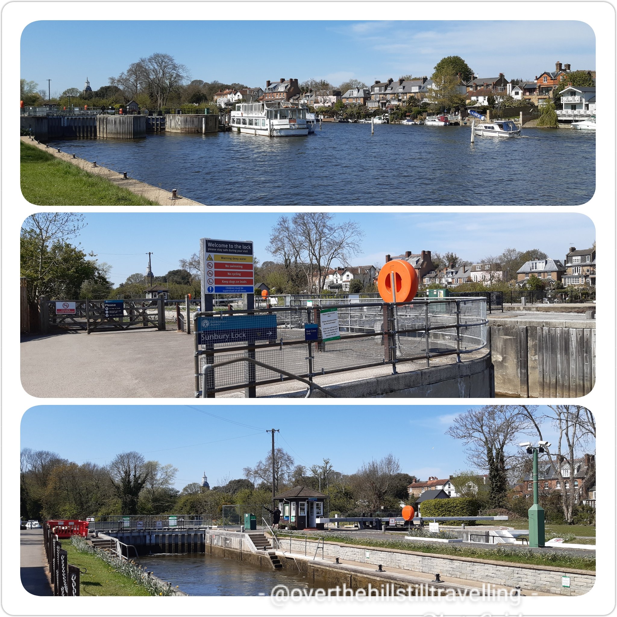
Next up was Sunbury Lock and weir. First built in 1812 Sunbury Lock is a lock complex of the River Thames near Walton-on-Thames, the 3rd lowest of 44 on the non-tidal reaches.
Sunbury Lock
I do love the lock masters houses! They are so pretty and so quaint. I spent a few minutes at each lock and for sure it’s a busy job being a Lockmaster! One of the qualities you would truly need is patience!! Did you know that they’re on duty from 9am to 6pm each day with an hour for lunch between 1pm to 2pm!.
Sunbury Lock..such a quaint house
I didn’t stop much along this stretch and I didn’t take many photos…mostly because the scenery was much the same; a long open path, few trees, and the river. A rare spot of shade and a bench…time for break
the guardians of the path – I really enjoyed the Thames Path along this section…wide and easy walkingA bench is always a good place for a rest..
There are a lot of really fancy houses along this stretch, on both sides of the river, some with gardens that stretch right down to the waterside. Oh and a pub! I was tempted to stop for a coke, but since I had refreshments I carried on till I found a bench under a shady tree and stopped there.
The Weir Pub – tempted to stop for a coke The Weir
Nearing Walton-Upon-Thames I noticed a lot of swans on the river. They seem to be more prolific the closer you get to Windsor. Did you know that Queen Elizabeth II owns all the swans in England. According to the official Royal Family website, the Crown has held the right to claim ownership of all unmarked mute swans swimming in open waters across the country since the 12th Century. Some of the swans are owned by the Vintners and Dyers, but are marked by those companies.
All the Queen’s swans? Swans galore
I continued beneath the lovely Walton Bridge and along the Desborough Cut. Manmade and formed alongside the Thames in order to ‘cut’ out a lengthy double bend in the river…I felt a little bit cheated really. LOL I will probably go back one day and walk that section..🚶♀️🚶♀️
Walton Bridge
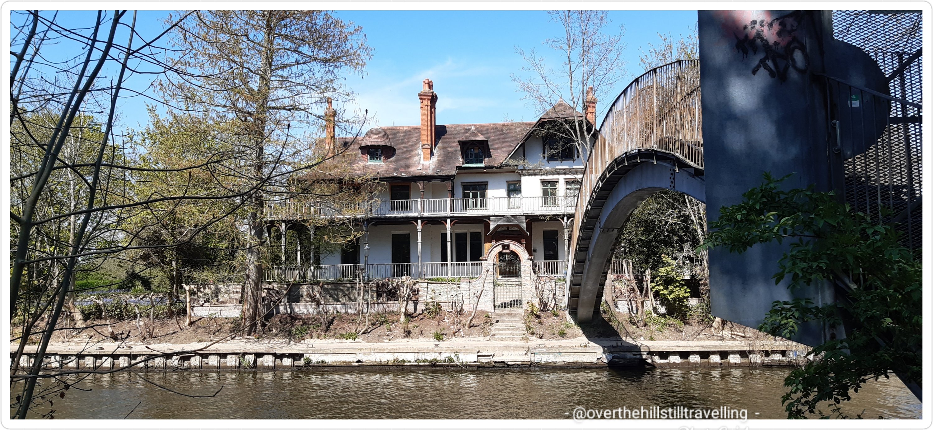
As I neared the ferry I noticed a stunningly beautiful, albeit dilapidated house (a 13-bedroom mansion actually), on a small island….this was D’Oyly Carte Island I had read about in the guide book. I chatted to someone about the house and apparently it’s recently been bought and will be restored to it’s former glory. Quite right too, it’s beautiful. If I were a rich (wo)man, I’d buy it…. The house has links to Gilbert & Sullivan : Richard D’Oyly Carte, born in 1844, was a London theatre impresario who brought together dramatist WS Gilbert and composer Arthur Sullivan. A key theatreland figure in the latter part of the Victorian era, he built the Savoy Theatre in London and founded the D’Oyly Carte Opera Company.
D’Oyly Carte Island – my dream house
After oohing and ahhing and just dying to cross the footbridge that leads to the island, I continued on my ‘wey’ LOL (get it…wey 😉) and soon reached the juncture where the River Wey joins the Thames and at this point took the ferry across to the north bank and Shepperton.
If you look at the river on google maps at this point it’s like spagetti junction with the two rivers joining forces and weaving around islands and locks.
Spagetti Junction.. Walking the Thames Path
It was good fun…I love crossing the river by ferry and take every opportunity to do so. I arrived at the ferry point at the same time as a family with two children. They read the notice that said you had to ring the bell to summons the ferry from the opposite bank, but they were a bit timid and didn’t ring it very loudly…so I humoured them and rang it vigorously 😁😁 they nearly had hysterics! But, it worked…the ferry crossed over and picked us up. Hoorah!
the ferry to Shepperton at spagetti junctiondon’t pay the ferry man till he gets you to the other side…safely across the Thames, now in Shepperton
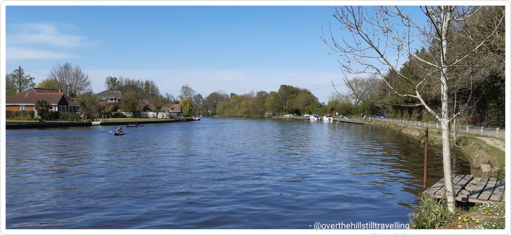
Safely across the river I headed upstream on what was now the north bank…my ultimate destination: Staines-Upon-Thames.
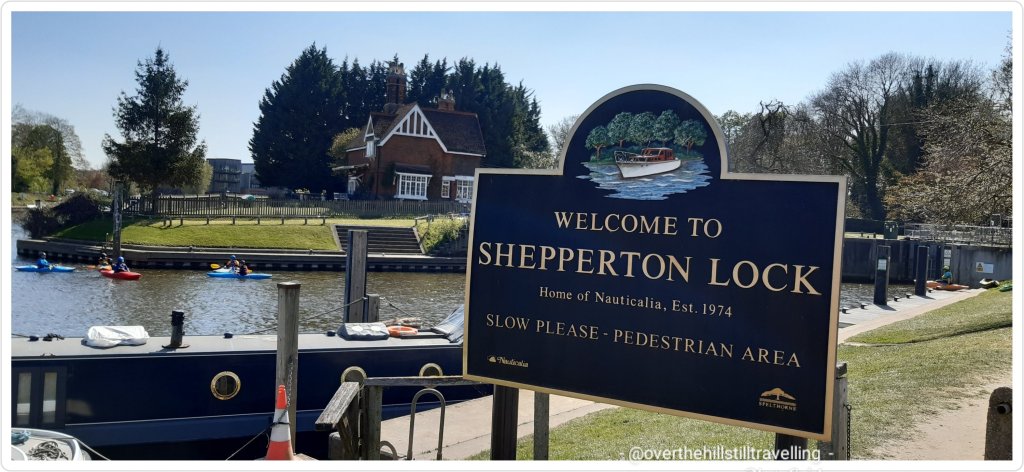
I passed Shepperton Lock on the left and felt sad that due to covid the tearoom was still closed, I would have stopped for tea for sure. I remember having tea there once many years ago…the view of the river is superb.
Shepperton LockStory of the river – when sorting through my images and reading these boards more closely, I was amused to note that they also called this section ‘spagetti junction’
I passed Pharaoh’s Island, so named after it was purchased by the Treasury to give to Admiral Nelson after the Battle of the Nile (1798). It’s fantastic how some of these islands got their names. It used to be called Dog Island, but Pharaoh sounds much more interesting.
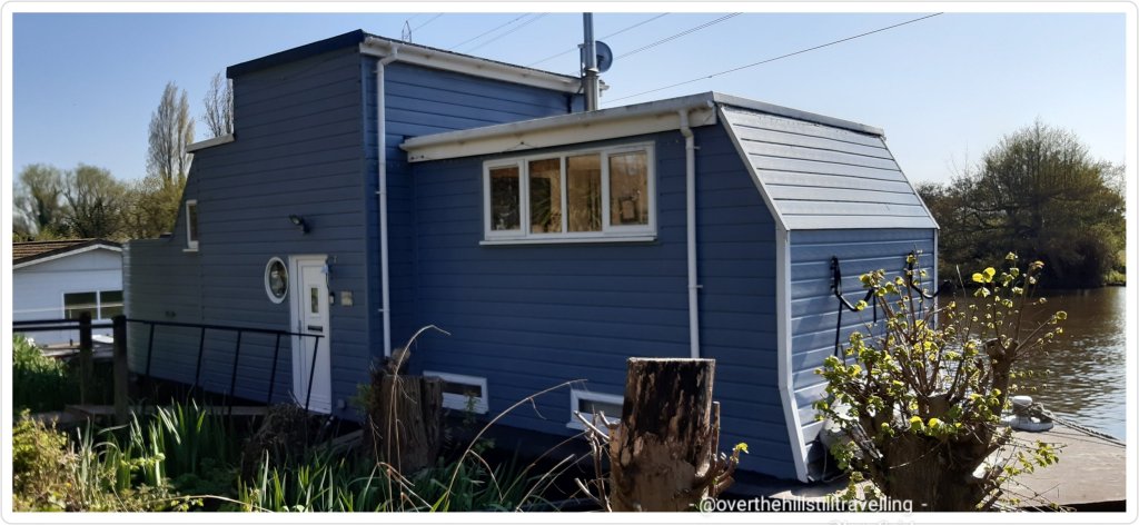
love, love love this houseboat..moored alongside Pharaoh’s Island the river is now on my left hand side till Staines Upon Thames
Reaching Ryepeck Meadow Moorings I saw some fantastic boathouses…oh my gosh. Stunning. Lots of beautiful flowers lined the banks
another fantastic houseboat. I wonder what draws people to this type of lifestyle? It’s compact..a glorious splash of colour…so glad April is spring in the northern hemisphereFantastic houseboat – I’d live here 😀
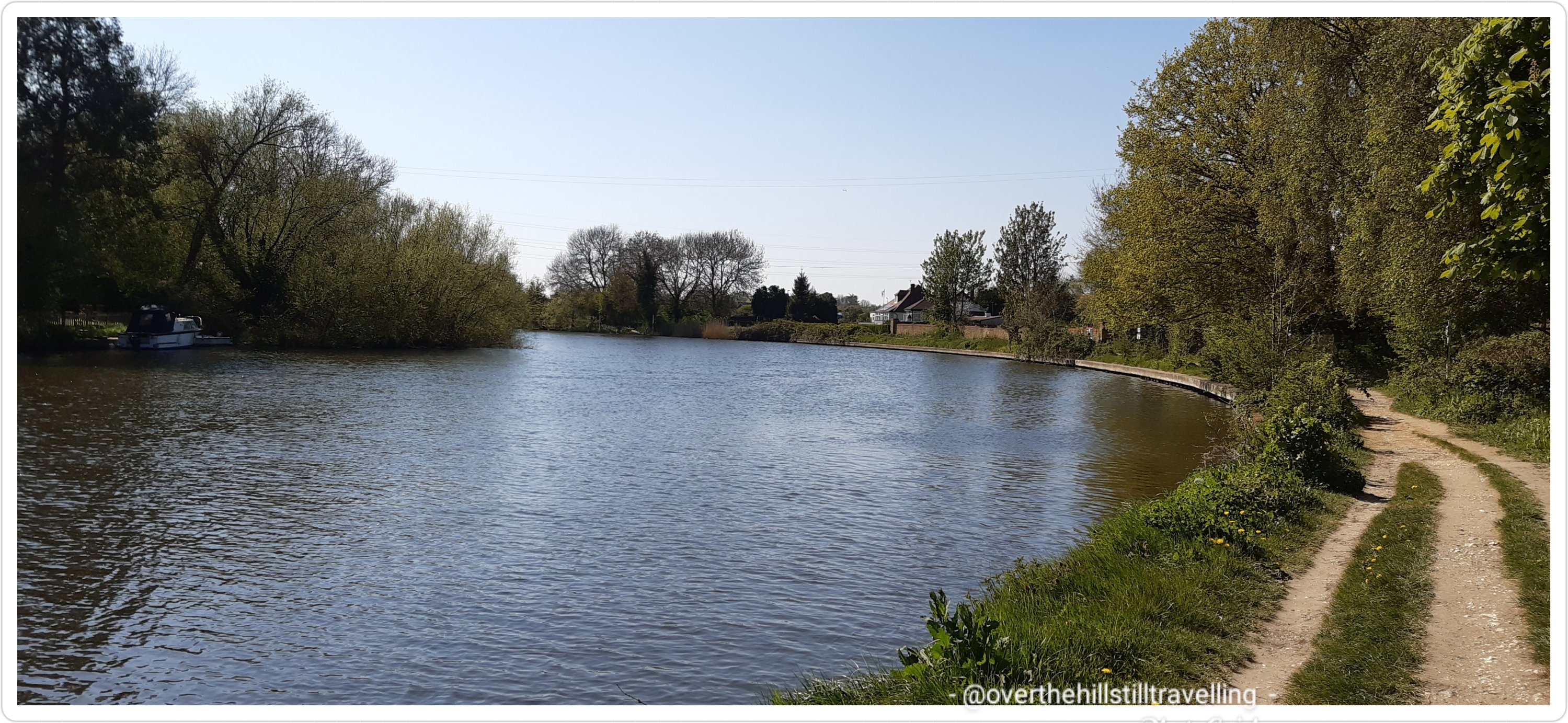
The river curves and winds it’s way along, the path so close you could sit and dangle your hot, tired feet, in the cool, refreshing water…if only!! Maybe next time…although in reality, the water was quite a way down and I would have had to have long legs, which I don’t 🙄🙄
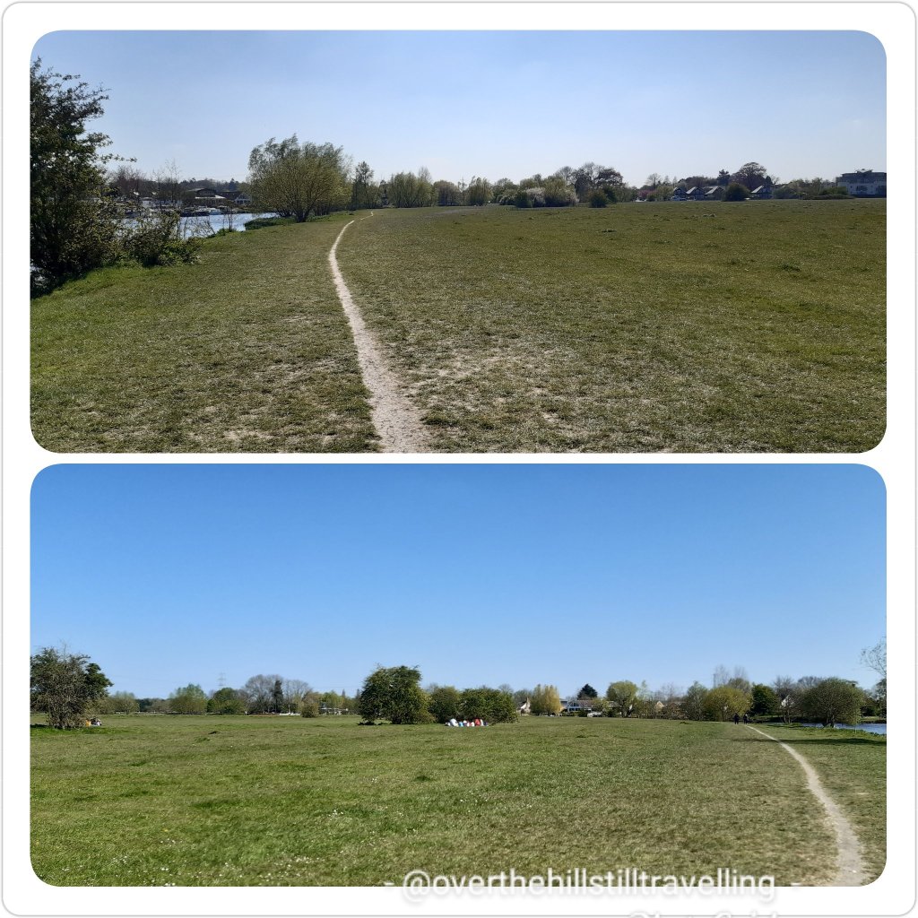
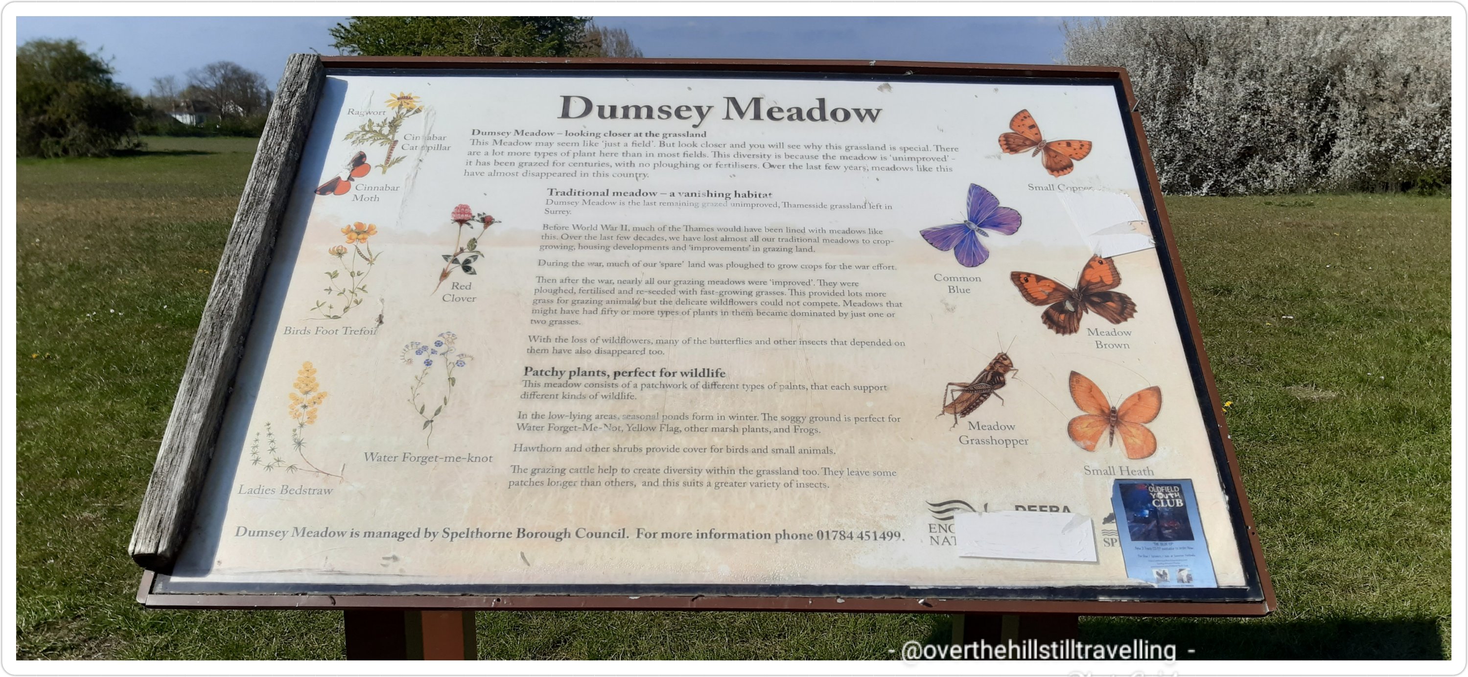
Ahead was a lovely green open space; Dumsey Meadow, but sadly few trees for respite from the baking sun. Mad dogs and Englishmen and all that springs to mind!
Dumsey Meadow – I was hoping for a shady break…
the birds of Dumsey Meadow – I love that they have these dedicated spaces to thrive
sadly I didn’t see any butterflies – they are really scarce this year
Hoorah! Chertsey Bridge…offered a brief respite from the sun! They need to put a couple of benches here..I’m sure they’d be well used.
Chertsey Bridge offered a brief respite – a couple of benches would be lovely
Follow the acorn!! Back to suburbia and a busy road – although I managed to get most of the way past before any traffic.
back to suburbia
And ahead Chertsey Lock and weir.
Chertsey Lock and weir
I soon passed under the M3
M3 I believe…although very noisy, at least it offered a brief respite from the sun
Ahead of me Laleham Park where I stopped for a short while to rest my poor feet, get some relief from the sun and have something to eat and drink. As I was walking towards the park a few horse and carts came clopping past.
absolutely beautiful animals…
I was a bit slow on the uptake and only managed to capture a very short snippet of film as they went past
but I did see the horses further up in Laleham Park cooling down in the river.
having a well-deserved swim at Laleham Park
Back to urban living and the often metalled surfaces that are so hard on the feet! Gosh, there are some gorgeous houses here. There are loads of direction markers too, so you can’t get lost.
another direction marker, another metalled surface, on the outskirts of StainesLarge houses…Laleham!
Hoorah! Staines 1.3/4 miles (2.8 kms) my feet rejoiced 🤭🤭
Staines!! Not too far to go
Penton Hook Lock soon hove into view (who makes up these names?) – I asked for a top-up of my water, but no-one had any taps available. There’s a huge marina here on the opposite side of the river… water water everywhere and nary a drop to drink! Bah humbug to covid. Penton Hook Lock, at 266 ft (81m) is the 3rd longest lock on the river, the 6th lowest lock of 44 on the non-tidal reaches of the River Thames. It faces an island which was, until its construction, a pronounced meander (a hook) and located on the site of its seasonal cutoff. It is against the left bank, marking the church parish medieval border of Laleham and Staines upon Thames in Surrey, for many centuries. Until 1965 their county was Middlesex.
Penton Hook Lock
Although the next few kilometres were quite residential, the houses were mostly set in large gardens and didn’t intrude on the path, which was lovely and wide and easy to walk on. I much prefer gravel to metalled surfaces.
Lovely wide gravel path
I passed a lovely old church; St Peter’s that I simply had to photograph…love these buildings.
St Peter’s Church, Staines-Upon-Thames
I was now on the outskirts of Staines, and nearing my destination….time 16:56 and I had been walking pretty much non-stop for 5 hours, except for brief stops as mentioned, which are seldom more than 10 minutes at a time.
2 minutes after passing St Peter’s Church I had my first view of the Staines-Upon-Thames railway bridge! Hoorah – soon I’d be crossing that bridge on my way home!
Staines Railway Bridge!! I could just see the Staines Bridge in the distance…whoop whoop
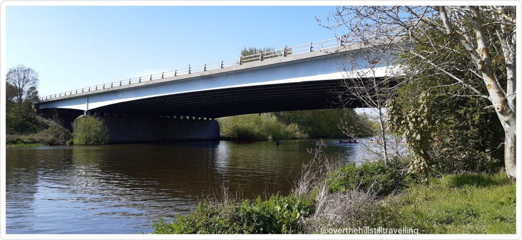
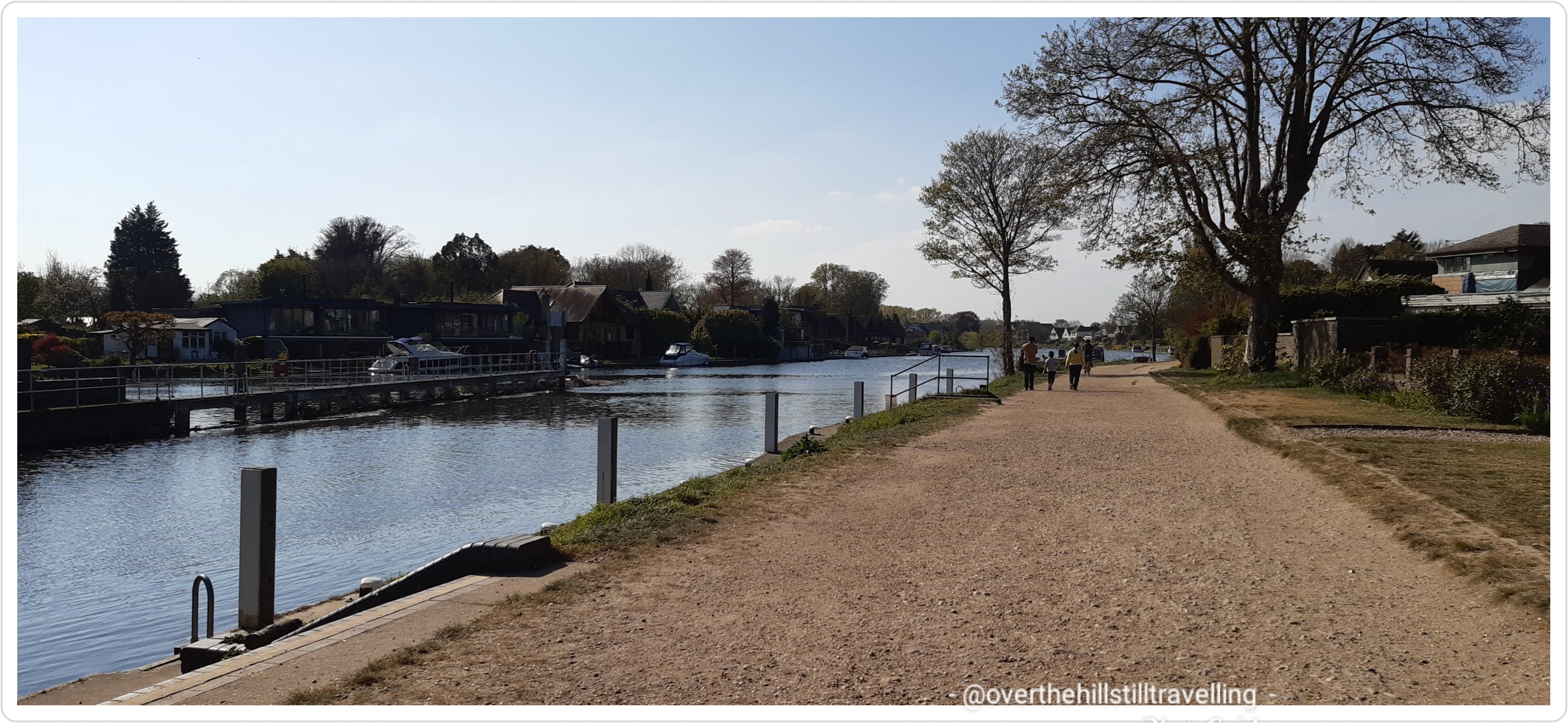
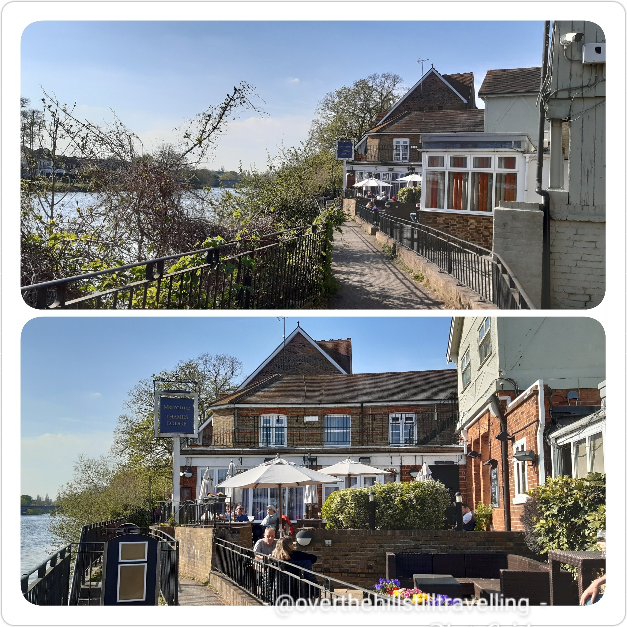
Back on urban territory I was soon in the thick of things, traffic, metalled surface etc etc….albeit a very pretty environment I must say. Enroute along the riverside path I passed by the Mercure Thames Lodge where I was meant to have stayed before the reality of the lockdown restrictions still in place hit home, and I had to cancel all my bookings 😦 It’s a gorgeous location, but ever so pricey over the period after lockdown.
where I was meant to stay if my plans had worked out…ahhh but lockdown rules! urgh
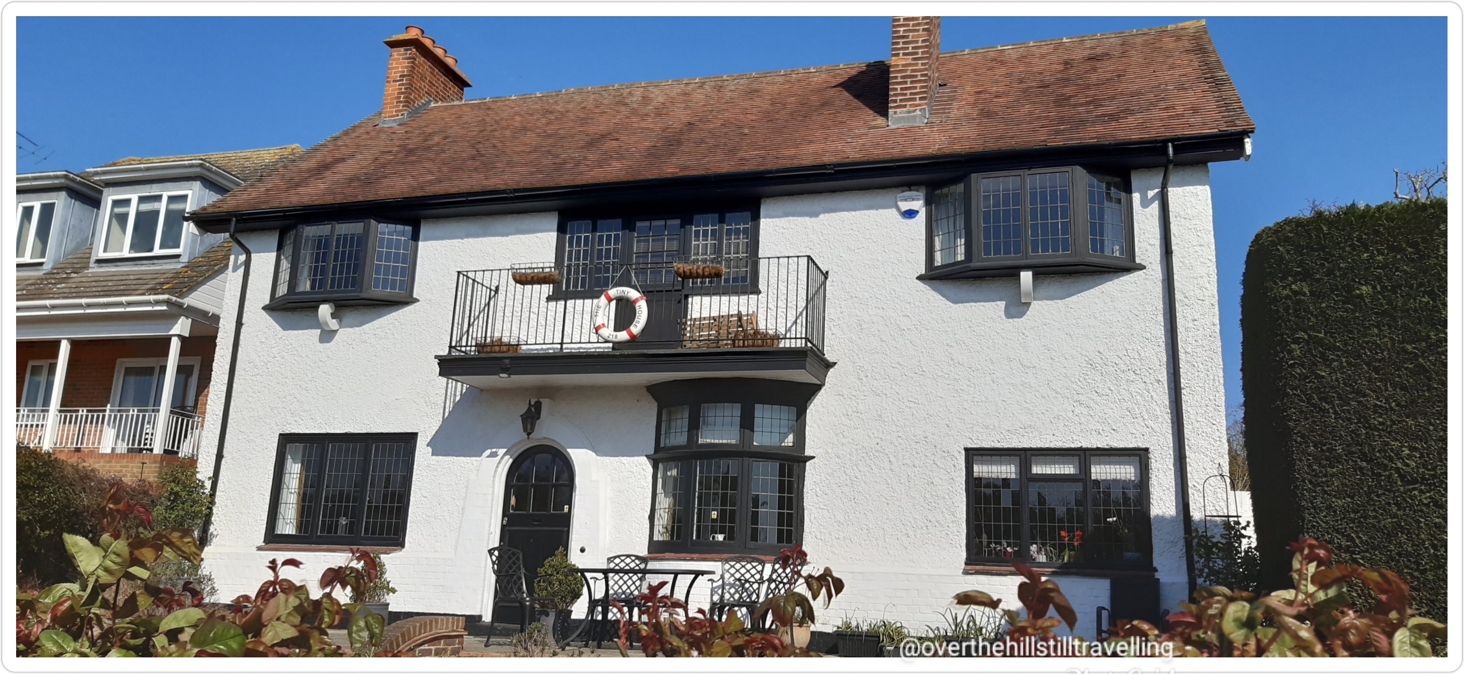
I walked by some absolutely gorgeous houses that reminded me of Bermuda…love those balconies and the flowers – just stunning. And finally…Memorial Gardens and so very near the end of today’s journey; Stage 5 of Walking the Thames Path!
I was well excited by now…soooo close to journey’s end
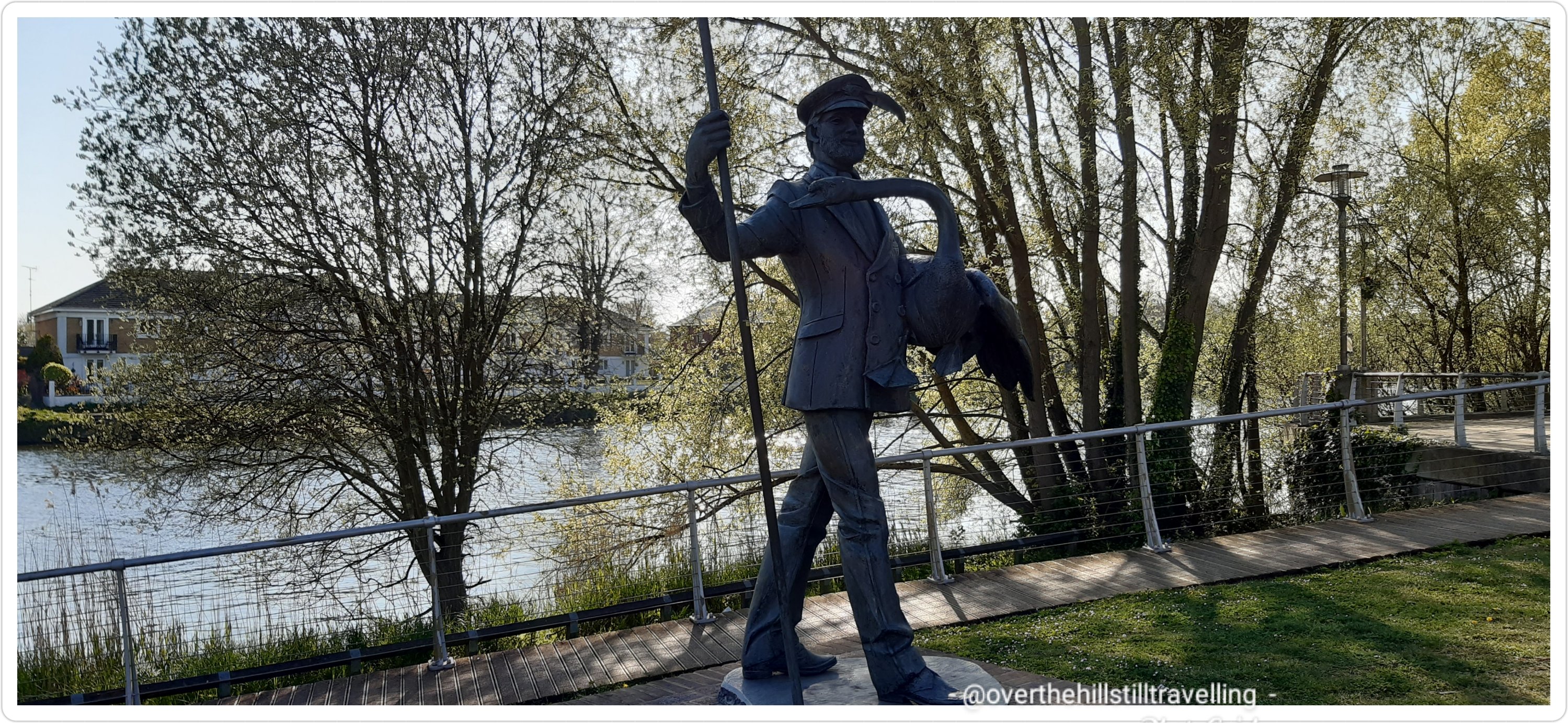
In the memorial gardens I saw a fabulous statue; The Swanmaster – he who counts the swans for The Queen during Swan Upping, a totally bizarre word for a really tricky job. Swan Upping still takes place once a year on the River Thames. The Swan Uppers weigh and measure the cygnets and check them for any signs of injury, commonly caused by fishing hooks and line. The young cygnets are ringed with individual identification numbers that denote their ownership if they belong to the Vintners or the Dyers livery companies; the cygnets’ ownership is determined by their parentage. However, all Crown birds are left unmarked. The Queen retains the right to claim ownership of any unmarked mute swan swimming in open waters, but this right is mainly exercised on certain stretches of the River Thames. ref their website. If you’d like to know more about swan upping, have a look at their website. It’s really interesting. I’ve been to both the the Worshipful Company of Vintners’ and the Worshipful Company of Dyers’ Halls during Open House in September. If you ever get a chance to go, do, it’s well worth the trip. The Vintners’ Hall in particular is absolutely stunning.
The Swan Master 1983 Staines-Upon-Thames by Diana Thomson FRBS
The Dancing Fountains – this must look gorgeous when the waterfountain is on
Dancing Fountain
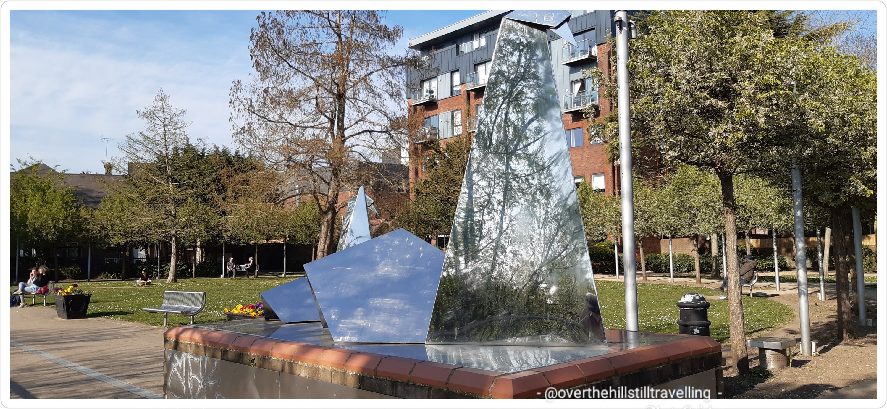
Abstract sculpture of a swan – trying to save on battery by now, I didn’t stop to look at who the artist is, I figured I’d find it on the www…but no, not yet! Do you know who the artist is?
Interesting sculpture…I think it’s mean to depict a swan
The London Stone!! I had waited a long time to see this!
The London Stone – ever since I first got the guide book, I’ve looked forward to reach this point
What an amazing day! I had it all; history, fabulous view of the river, an amazing sundial, stunning houseboats, mysterious islands, quirky canal boats, locks and weirs, a ferry ride, passed through some terrific parks, saw interesting sculptures and the London Stone! a mostly amazing path – easy to navigate, blue skies, sunshine, a soft breeze from time to time, 172 photos, and boo hoo no ice-cream LOL I literally didn’t see any ice-cream vendors the whole way from East Molesey to SuT.
It was lovely to see so many people out and about enjoying the sunshine. The Thames Path is very much a shared path and along this section there were a number of places where families could have picnics, kiddies could run about and play, and enjoy the fresh air and our fabulous river. Watersports on the upper reaches of the Thames are hugely popular and you will often see kyakers, canoeists, rowers and of course all the fancy speedboats. You can take a ride along the river on a commercial ‘steam’ boat at a number of places along the river pretty much from Richmond. And you will frequently see canal boats chugging by…I’m often tempted to call out and ask for a ride LOL Of course with spring in the air, there was much flitting about and trilling songs from the birdlife and since the river is so much less polluted here, you will spot many a heron in the shallows, amongst much else…swans in particular are plentiful. It’s just wonderful.
I’m ever so pleased with my progress and sooo grateful for the fabulous weather! Long may it last!
I managed to get the 17:38 train and home by 9pm. hoorah. So Stage 6 and 7….when shall I do those I wonder?
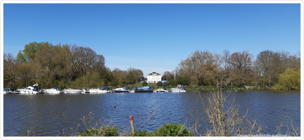
As with Stage 3 I was on what felt like home ground today…
When I planned my day trips I saved this section especially for today; from Richmond to Hampton Court…my 2 most favourite places. When we lived in St Margaret’s, a stone’s throw from Richmond, I used to practically live at Hampton Court Palace. I was a member of the Historic Royal Palaces, and Hampton Court was an easy bus ride away….
This was also the shortest distance I’d planned. Initially I had planned to meet up with my daughter and family and spend the day in Hampton Court, but of course lockdown changed all that, besides which the rail tickets were exorbitant (🤣🤣🤣my autocorrect said: extortionate!! – too right!).
I was well excited for this section – I’ve walked this section so many times and it was all so very familiar to me…which made it more special – pretty much both sides of the river actually.
I’ve also had the joy and privilege of having travelled along the river on one of the boats in the 2014 Tudor Pull flotilla and on one of the boats following the 2012 Olympic Torch from Hampton Court to Kew (where the boat I was on returned upriver). Incredibly exciting.
The Stela at Hampton Court palace
GLoriana
Gloriana processing towards London
The 2014 Tudor Pull
Three cheers for the Gloriana – Tudor Pull 2014 the copyright for this video belongs to myself
Setting off really early from Ramsgate I arrived at Richmond station at just after 12noon. I set MapMyWalk and headed back towards Richmond Green. I planned on walking through the palace grounds enroute to the river.
The Green, Richmond – in summer you can watch a game of cricket or many other events that take place
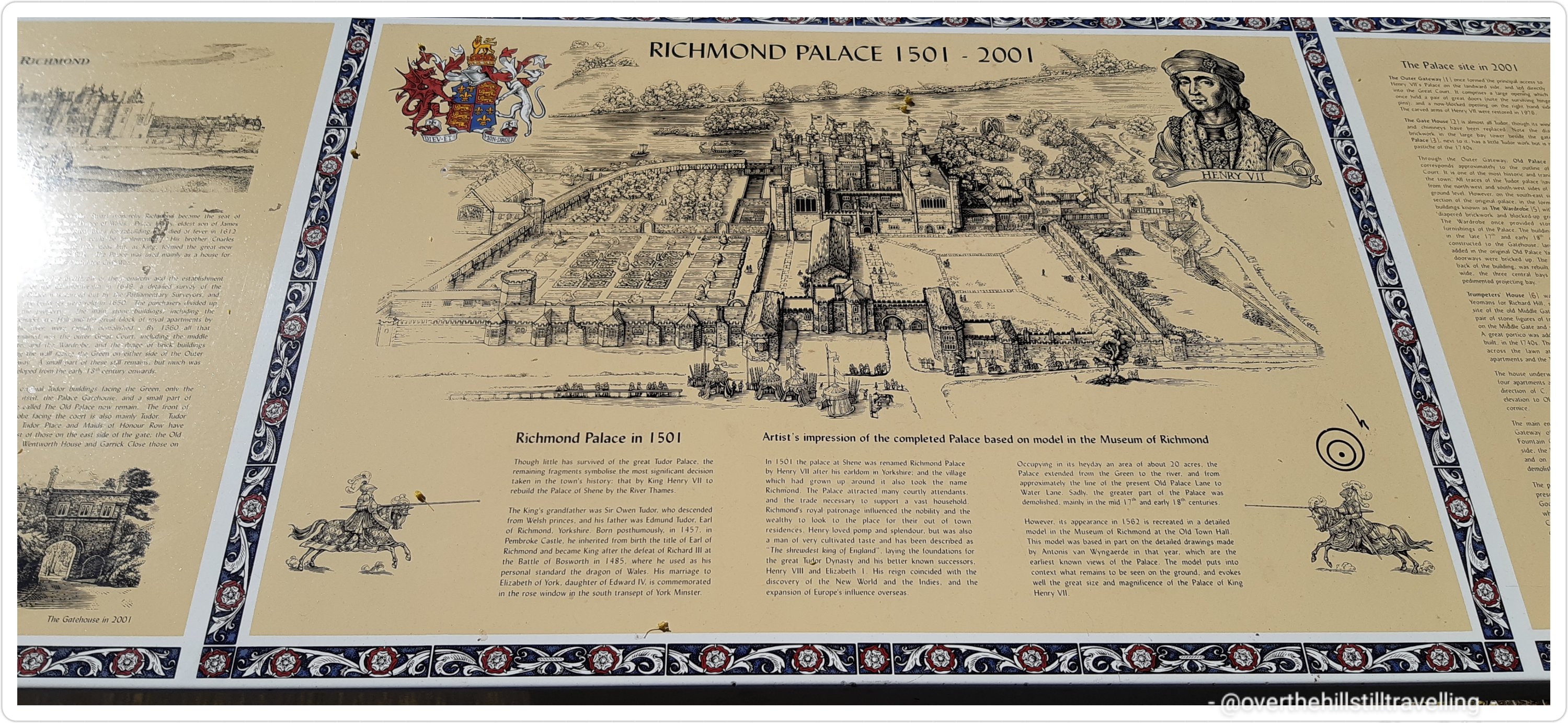
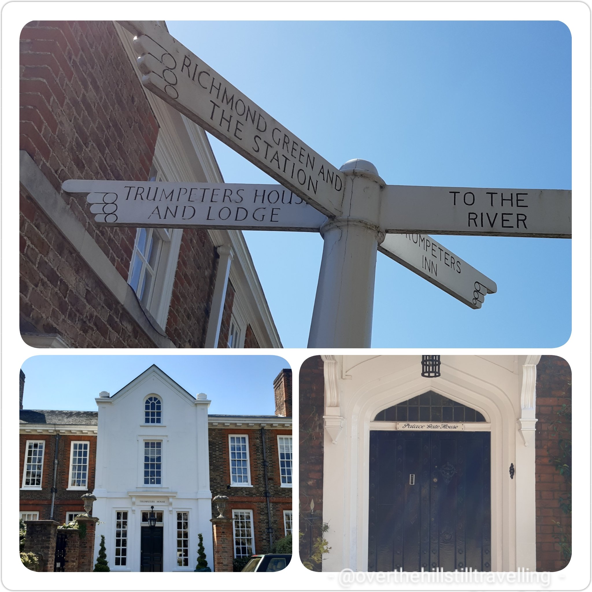
The palace has such an extraordinary history and much I like did when we lived in the area, I walked through the grounds as often as possible. Although the current buildings are but a shadow of their former glory, it is still a thrill to walk through the same gate as did kings and queens of England.
Richmond Palace
The buildings are now privately owned, but hark back to more regal times; Palace Gate House, The King’s Wardrobe, the Trumpeter’s House & Lodge, Trumpeter’s Inn, the road I was on: Old Palace Yard. Just thrilling 🙂
Walking the Thames Path, Richmond Palace Richmond Palace, home to kings and queens of yore
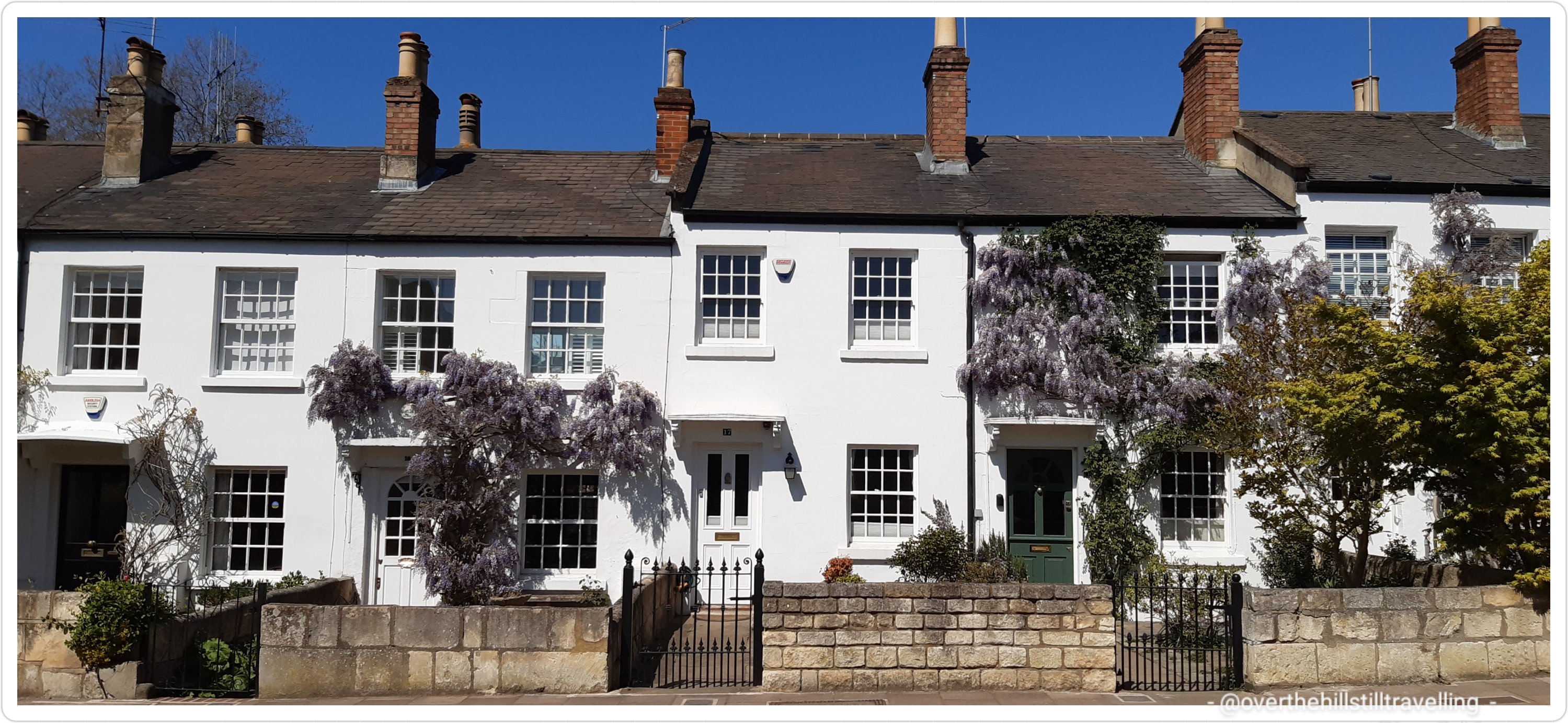
Following Old Palace Lane I passed the ever so popular row of cottages dating back to the first half of the 19th century. They’re all painted white and on the whole have a splendid display of wisteria adorning the walls. It’s almost an attraction in itself.
Beautiful houses in Richmond; hung with wisteria – an attraction in itself
Back on the Thames Path
Goodbye Kew, hello Richmond, see you soon Ham House
Reaching the river, I set off upstream along Cholmondeley Walk towards the bridge.
Cholmondeley Walk, Richmond – heading upstream
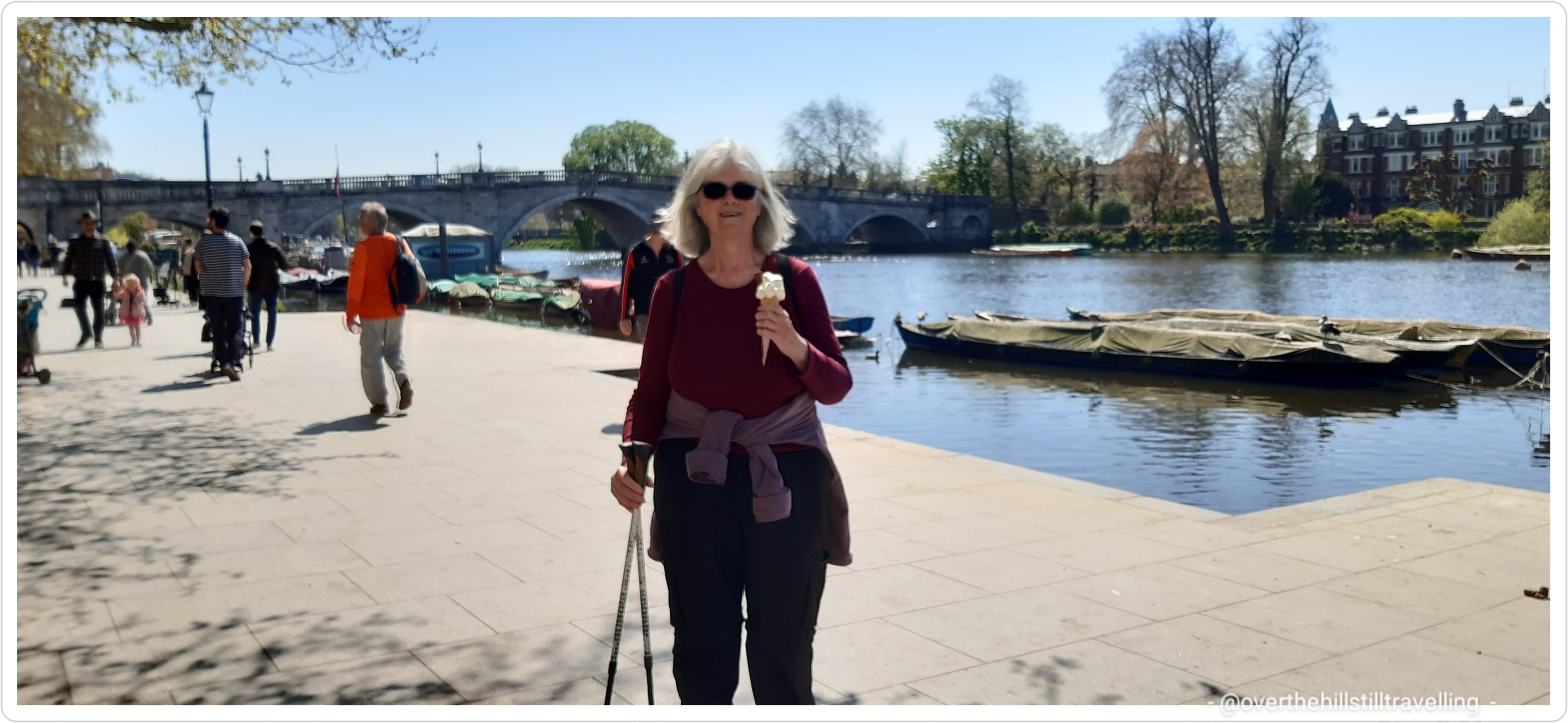
As I reached the riverside an ice-cream van beckoned …so of course, since it was already midday, I bought myself a soft-serve with a flake…after all, why not? I stopped a couple of young ladies and asked them to please take a photo… Richmond, my favourite place outside of the City of London (well one of my ‘many’ favourite places LOL).
start the day with an ice-cream? why not, it’s my birthdaySt George’s Day – happy birthday from the days when I still had my 3 Days in London business 🙂
Knock knock… I always tap each bridge at the end of my walk to say hello…I’ve arrived at my destination.
Looking back at Richmond Bridge – upstream side
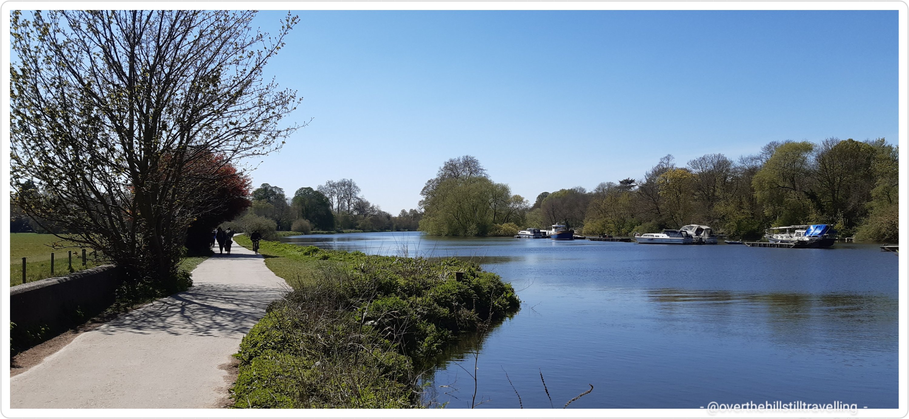
Of course I stopped to take some photos and the I was off….from this point onwards the path becomes very rural and you pass fields of cows, grassy parks, lots of leafy green trees and a long swathe of woodland.
islands in the stream – passing Petersham meadows on the left, heading upstreamriverside walking – the path gets very rural along this stretch
Not too far along and you will reach the magnificent Ham House.
Old Father Thames lounging about in front of Ham House; a fabulous 16th century mansion – a must visit
Ham House, a 17th-century house set in formal gardens on the banks of the River Thames was completed by 1610 by Thomas Vavasour, an Elizabethan courtier and Knight Marshal to James I. It came to prominence during the 1670s as the home of Elizabeth (Murray) Maitland, the Duchess of Lauderdale and Countess of Dysart and her 2nd husband John Maitland, the Duke of Lauderdale. Managed by the National Trust, it is claimed to be “unique in Europe as the most complete survival of 17th century fashion and power” – the house retains many of it’s original Jacobean features and furniture. I have visited on a couple of occasions in the past, and can highly recommend a visit if you are in the area. It is magnificent, as are the gardens. Ham House has featured in quite a few films, namely; The Young Victoria (2009), An Englishman in New York (2009), Anna Karenina (2012) and Downton Abbey (2019) to name but a few. A statue of Father Thames, designed by the sculptor John Bacon in 1775, resides on the lawns at the front of the house leading up to the front door.
The view from the main gates stretches along a narrow road towards the river, and as I headed back to the Thames path I was lucky enough to mythical beast being led past.
mythical beasts haunt the byways – what a beauty
Across the river, and almost opposite Ham House is Marble Hill House. Another magnificent historical house. A Grade I listed Palladian villa, located in Twickenham it was built between 1724 and 1729 as the home of Henrietta Howard, Countess of Suffolk, mistress of King George II when he was Prince of Wales, who lived there until her death in July 1767. Marble Hill House is a museum and managed by English Heritage. Also so well worth a visit. You can reach that side of the river via the Hammerton’s Ferry – a fun ride across the river….
Marble Hill House, Twickenham
which way shall I go?
Don’t pay the ferryman till he gets you to the other side….a fun ride across the Thames to Twickenham
Although I couldn’t see it from the Ham side of the river, you will also find Orleans House Gallery – Orleans House was a Palladian villa built by the architect John James in 1710 near the Thames at Twickenham for the politician and diplomat James Johnston. It was subsequently named after the Duc d’Orléans who stayed there in the early 19th century. And if you have the time and venture further inland (so to speak) you will find the extraordinary Strawberry Hill House (booking essential, oh my gosh….it’s exquisite). Strawberry Hill House’s story begins in 1747, when Horace Walpole discovered and purchased ‘Chopp’d Straw Hall’, one of the last remaining sites available on the banks of the Thames in fashionable Twickenham. He set about transforming what was then a couple of cottages into his vision of a ‘little Gothic castle’ with pinnacles, battlements and a round tower. Thus Strawberry Hill House was born – the House became a tourist attraction in Walpole’s lifetime and beyond.Independently owned, this house is a must visit if you’re in the area and have the time.
an overview of where I was and what there is to see – Richmond
And now that I’ve given you a virtual tour of these most magnificent houses, back the the Thames Path and some more lovely houses and a superb pub across the river
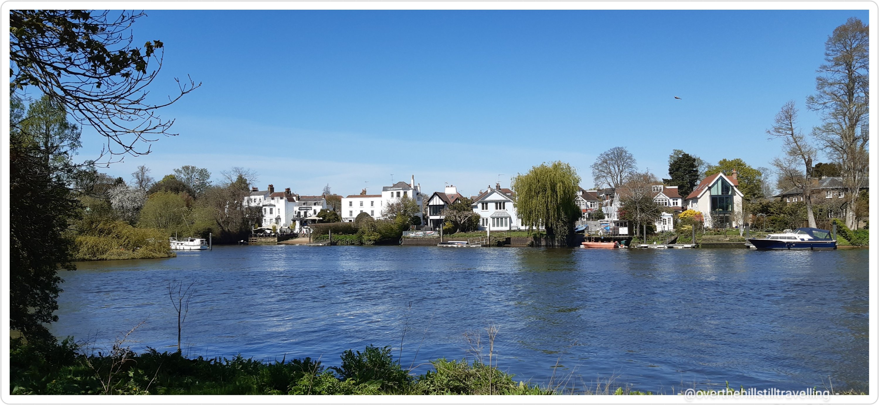
looking across the river to Twickenham – The White Swan Pub is a super place for outdoor dining
On my right hand side (on the day, looking upstream) and fronting Twickenham old town is Eel Pie Island, a dual purpose island with a small nature reserve and boat yards, a number of houses, an eclectic mix of people amongst whom are a number of artists and was once famous for being the site of the Eel Pie Island Hotel, originally a genteel 19th-century three-storey building that later hosted ballroom dancing during the 1920s and 1930s, various jazz bands and then, in the 1960s, rock and R&B groups; including The Rolling Stones, The Who, Pink Floyd and Black Sabbath and Genesis, amongst many others. If you’re interested there’s loads of info on wikipedia.
Eel Pie Island on the left looking downstream towards Richmond
I once lived in a gypsy caravan on the banks of the river on Eel Pie Island…only for about 4 months, but it was ever so amazing, and noisy LOL – besides the people at the pubs, the geese and ducks in the morning…woww! The island can be accessed via footbridge from the Twickenham side of the river and every year the artists open their studios for visitors.
Onwards…the path along this section is so beautiful and peaceful, with greenery everywhere you look. I was lucky to have the most amazing weather and the river ran cool and blue to my right as I marched along…..at peace with the world. At 13:40 I found a shady spot to relax and enjoy some tea and a sandwich.
easy walking and shady trees on a hot day
there is no shortage of lovely places to relax and have a break
my view while relaxing at the riverside
To my left and stretching from Richmond as far as Teddington Lock and ending just before Kingston are the Ham Lands Nature Reserve; this beautiful 72-hectare nature reserve lies in the bend of the River Thames between Richmond and Kingston. The site is a mix of habitats, mainly woodland, scrub, grassland and wetlands that contain a diversity of plants and animals, including numerous rare species that are hard to find in London. There are meadow wildflowers that attract bees and butterflies and the reserve is teaming with bird life.
huge swathes of land are left wild and natural for nature to enjoy
Heading towards Teddington Lock I passed a small branch of the Thames where I spotted some youngsters enjoying an outings on canoes; one of the Forest Schools – Little Squirrels at Thames Young Mariners. I’d love for my grandson to go to a Forest School.
Forest Schools and water activities
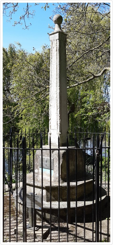
On the right hand side I spotted the Teddington Obelisk and suddenly there it was; Teddington Lock.
Teddington Lock, 2nd of many locks you find upstream between Richmond and the source of the Thames
so many places to go….
How did I get there so quickly? LOL From Richmond Green to Teddington Lock (dating to 1857) took just 1.5 hours! Much quicker than I expected. Unfortunately access to the lock was closed so instead I climbed up to the bridge and viewed the lock from both the lock and the weir sides of the river. If I had crossed right over I would have found The Anglers Pub, a mid-18th century pub where I have enjoyed a good meal in the past. But not today….time was marching on, and so should I.
looking upstream and downstream from the footbridge at Teddington Lock – on the Ham side of the river
looking downstream and upstream to the weir on the footbridge on the Teddington side of the river
Back on the path I noticed one of the Port of London Authority motor boats go by. The River Thames is managed by the PLA from source right up to Teddington Lock; the river is considered to be the tidal right up to this lock; ergo part of the North Sea. Below Teddington Lock (about 55 miles or 89 kilometres upstream of the Thames Estuary), the river is subject to tidal activity from the North Sea. Before the lock was installed, the river was tidal as far as Staines, about 16 miles (26 km) upstream. Brooks, canals and rivers, within an area of 3,842 square miles (9,951 km2), combine to form 38 main tributaries feeding the Thames between its source and Teddington Lock. ref wikipedia
Port of London authority taking care of the lock
The PLA’s responsibility extends from a point marked by an obelisk just downstream of Teddington Lock (the upstream limit of the tidal river) to the end of the Kent/Essex strait of the North Sea (between Margate to the south and Gunfleet Lighthouse, near Frinton-on-Sea, to the north,) a total of about 95 miles (150 km) ref wikipedia.
All the way long the Thames Path from Richmond (and in fact pretty much from Putney the previous day) I found trees abloom with spring blossoms and flowers. The bluebells in particular seems to be wantonly prolific this year.
besides the gorgeous weather, the fields were abloom with colour and blossoms
This whole area is just stunning and with the glorious weather I felt on top of the world.
like the Camino, you learn to spot even the smallest sign that you’re going in the right direction
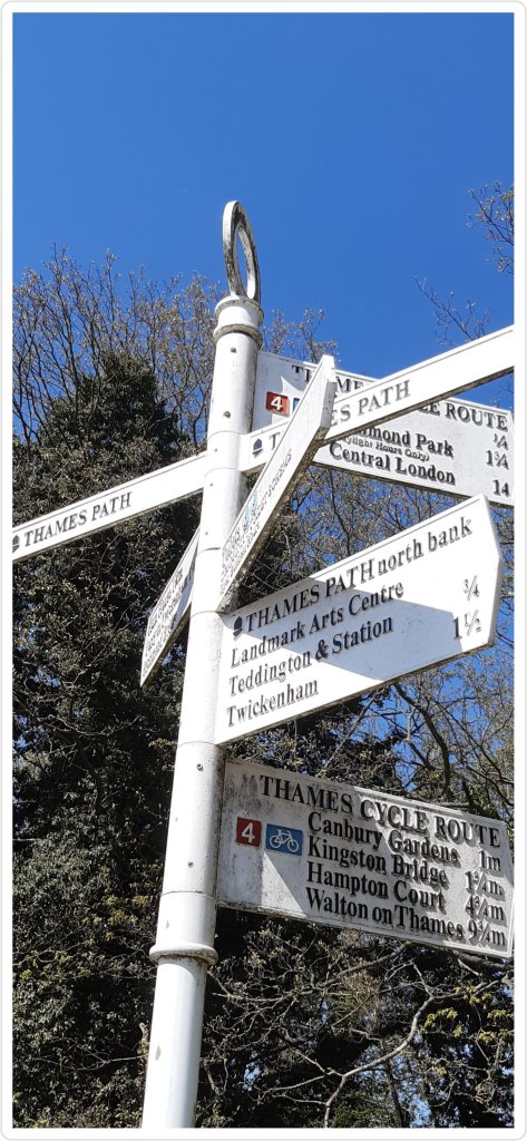
I spotted a direction marker on high : Kingston 1/4 mile and Hampton Court 3 miles. Bring it on!
nearing Kingston
I passed a beautiful old building on my left with the British Coat of Arms adoring the wall, but I didn’t think to stop and look at the building properly to find out more. (if you happen to know what this is or was, please leave a comment 🙂 )
wish I knew what this building is
Suddenly and without further ado, the greenery ended and I was back in concrete and suburbia. I had reached the outskirts of Kingston. Just past the building above I noticed a mama and papa duck guiding their babies 🙂 sweet
Mummy and Daddy herding the kids… what a ruckus they made 🙂
I stopped off for a quick 10 minute rest in the Canbury Community Gardens. I’ve visited these lovely gardens previously when at a booking in Surbiton. It was now just on 14:50 and seriously I was amazed at how quickly I had reached Kingston.
Kingston; so much history
time for tea and a sandwich
A fantastic town to visit, Kingstonwas built at the first crossing point of the Thames upstream from London Bridge and a bridge still exists at the same site. It was this ‘great bridge’ that gave it its early importance in the 13th century. Kingston was occupied by the Romans, and later it was either a royal residence or a royal demesne.There is a record of a council held there in 838, at which Egbert of Wessex, King of Wessex, and his son Ethelwulf of Wessex were present. In the Domesday Book it was held by William the Conqueror. Kingston was called Cyninges tun in 838 AD, Chingestune in 1086, Kingeston in 1164, Kyngeston super Tamisiam in 1321 and Kingestowne upon Thames in 1589. The name means ‘the king’s manor or estate’ from the Old English words cyning and tun. It belonged to the king in Saxon times and was the earliest royal borough. According to the Anglo-Saxon Chronicle, two tenth-century kings were consecrated in Kingston: Æthelstan (925), and Æthelred the Unready (978). There are certain other kings who are said to have been crowned there. The town of Kingston was granted a charter by King John in 1200, but the oldest one to survive is from 1208. The ancient market is still held daily in the Market Place, including today such produce as fish, jewellery, exotic foods, local foods and flowers. ref wikipedia We’ll be hearing more about bad King John later on in the journey; Stage 6 when I reach Magna Carta Island (which isn’t actually an island) enroute to Windsor.
an alternative throne! Canvey Gardens, Kingston
I love Kingston, it’s history is absolutely fascinating. There is so much to see here if you are a history fanatic, as well as some wonderful modern features. Continuing on my way I passed a beautiful memorial to a young girl; Rosie Mitchell, just 15 years old.
in memorium 😦
I passed some hoardings and stopped to photograph the stunning artworks that adorned the walls. How talented some people are!
fabulous street art, Kingston
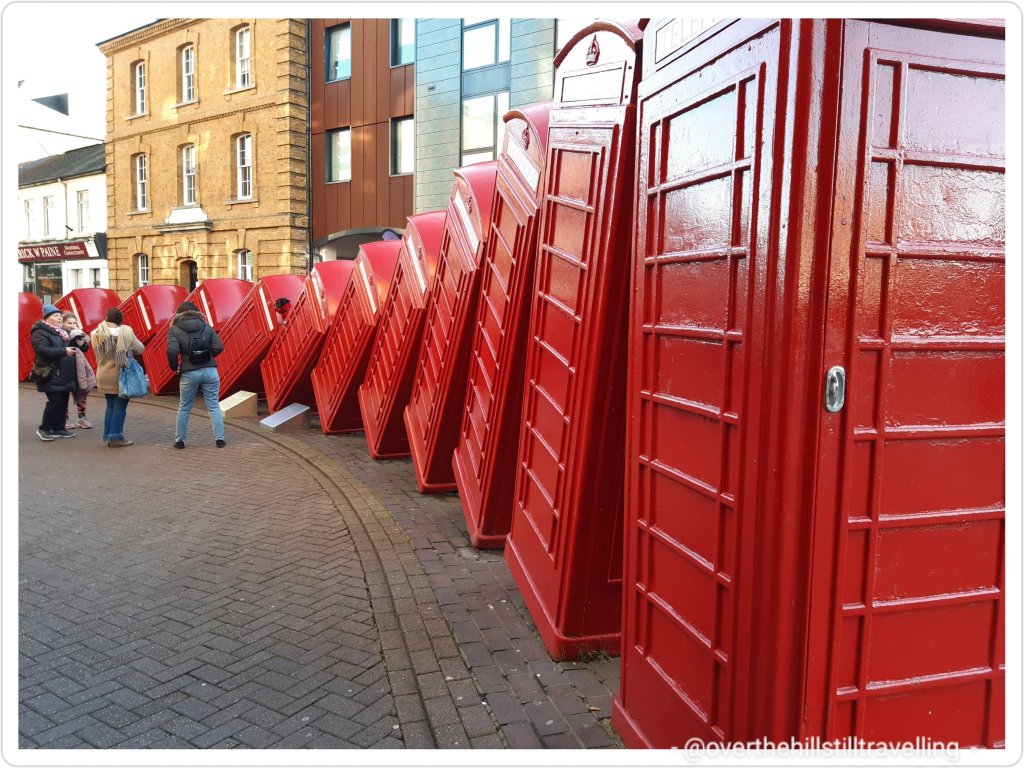
Within the town, but not too far from the river, you will find Out of Order by David Mach, a sculpture in the form of twelve disused red telephone boxes that have been tipped up to lean against one another in an arrangement resembling dominoes.
Out of Order sculpture, best known as the 12 tumbling phone boxes in Kingston – by David Mach
Out of Order sculpture, best known as the 12 tumbling phone boxes in Kingston – by David Mach
Passing John Lewis building and just before the bridge is small plaza where on your left you can see a fabulous mural of Kingston and just before the bridge in the basement of John Lewis, a preserved 14th century undercroft (cellar) – a beautiful chequer board pattern of chalk blocks and flints, with half of its roof still surviving.
a pretty mural on the John Lewis building
14th century cellar in a corner of the John Lewis building – riverside
It’s at this point that you want to be crossing the river to the north side….back into Richmond-Upon-Thames. The reason for that is because if you stay on the south bank of the Thames Path you will once again encounter a lot of diversions….namely the Thames Sailing Club and Hart’s Boatyard and a minor reservoir and you’d have to walk along the very busy Portsmouth Road, as well past as a long row of houses.
fun on the river at Kingston
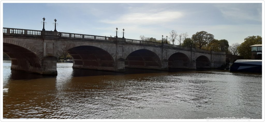
Kingston Bridge aka Horse Fair Bridge
So since I did not wish to walk along that road I crossed over via Kingston Bridge; aka Horse Fair Bridge and then left onto Barge Walk, which would take me along a lovely rural and shady route right up until Hampton Court Palace. Until Putney Bridge was opened in 1729, Kingston Bridge was the only crossing of the river between London Bridge and Staines Bridge. According to 16th-century antiquarian John Leland, the bridge existed in the centuries when Anglo-Saxon England existed (after Roman Britain and before 1066 Norman invasion).Kingston is known to have had a bridge as early as 1193; a flimsy wooden structure replaced by the current bridge in 1828.
Kingston – looking upstream
I guess I shall have to visit the twinned towns too 🙂
The Barge Walk, a lovely wide riverside path, runs for 5 kms and follows a curve in the river offering lovely views of the river and the opposite bank, taking you from Kingston Bridge all the way to Hampton Court Bridge, enroute passing Raven’s Ait Island on the left (many a wedding reception is held on the island), and Hampton Court Home Park on the right. This historic towpath has been part of the Hampton Court estate for 500 years!
‘You are here’ – bottom left hand side – where I was near Kingston Bridge…
There was a quicker way to reach the palace…diagonally across from Kington Bridge is Hampton Court palace 🙂
hoorah! Nearly there
Barge Walk on the Hampton side
It was wonderful to be able to stretch my legs and just walk. Although the Barge Walk is a shared path, there is plenty of space for everyone.
Barge Walk – alongside Home Park; Hampton Court Palacering for the ferry – Surbiton on the opposite side of the river
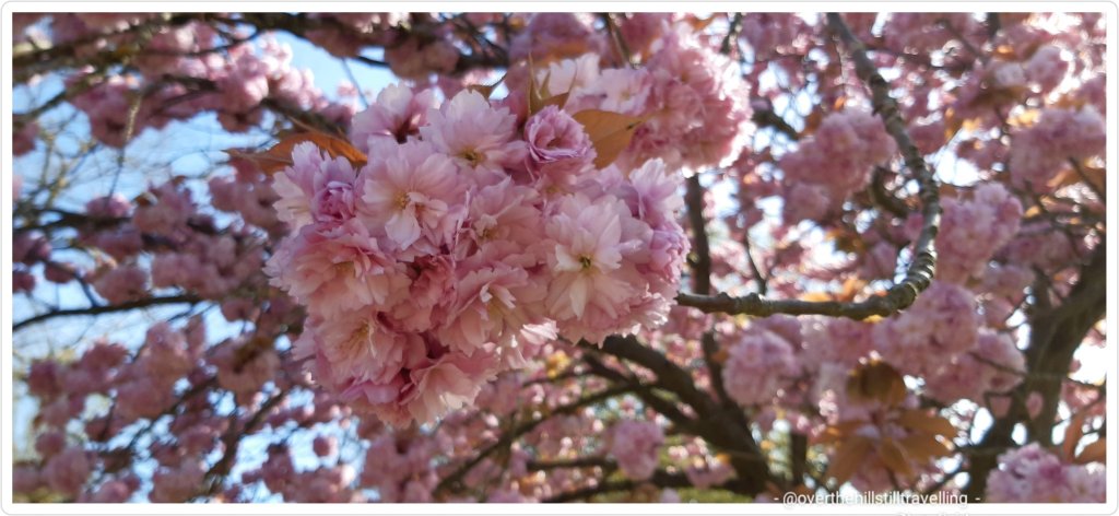
Lined with trees and natural habitat, Barge Walk takes you right into the bosom of nature with birdsong from every tree, butterflies and bees flitting here and there, cherry trees heavy with pink spring time blossoms.
The Barge Walk heading upstream to Hampton Court
pretty pink blossoms on the Barge Walk
Cherry blossoms
looking across the river to Surbiton and the reason you want to walk on the Hampton Court side of the Thames PathYou are here (on the right near the island) – Home Park map, Hampton Court Palace
About midway there is a small gateway above a short flight of steps that will take you into the Home Park. I recall a most embarrassing incident that occurred here one fine day on one of my many walks along this section of the river… involving my bottom and stinging nettles – the operative word being ‘stinging’!! I’ll leave it to your imagination to figure out what happened!! LOL
Home Park, looking a little bereft of greenery
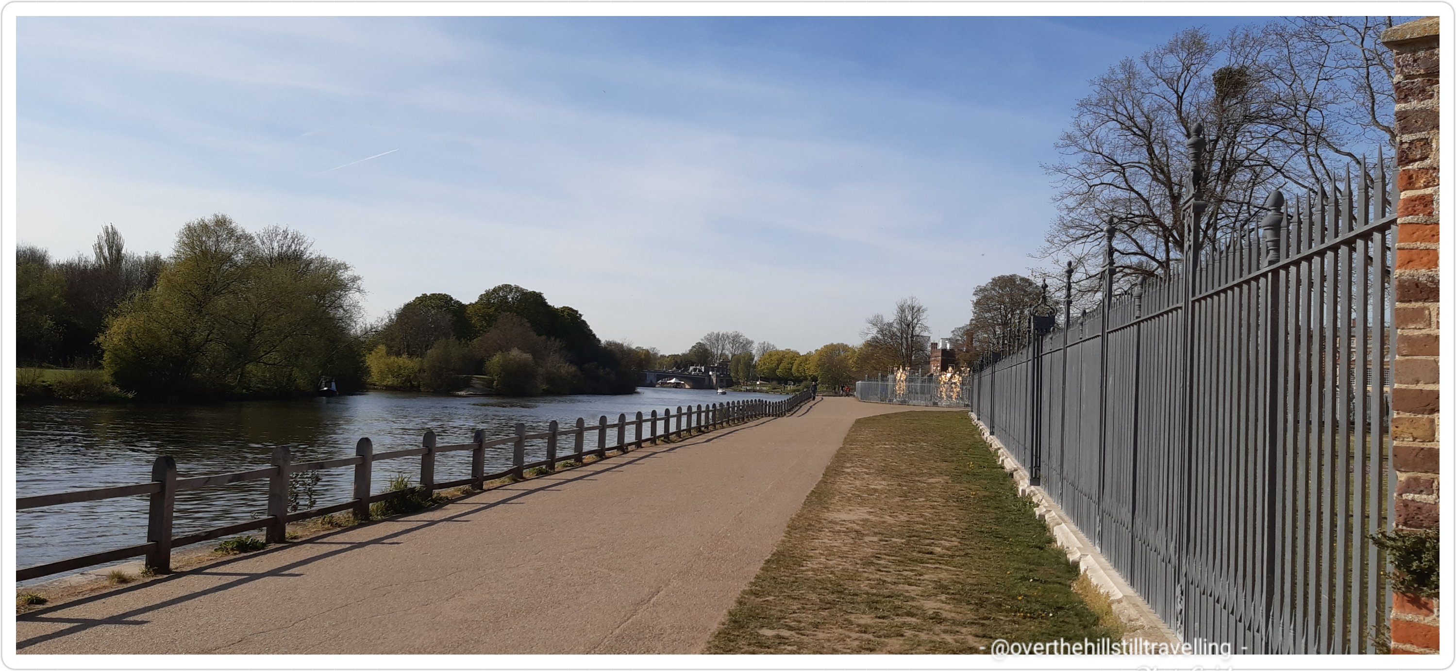
Soon I reached the perimeter of the palace proper….a lovely red brick wall that led to the magnificent Tijou Screen, designed by French master blacksmith, Jean Tijou in 1690.
beautiful trees provide shady respite on a hot day, the Barge Walk at Hampton Court – nearing the palace nowapproaching the Tijou Gates at Hampton Court Palace – in the distance Hampton Court Bridge
Finally, what I had looked forward to the whole day; first view of the beautiful Baroque palace and gardens.
The Baroque Palace at Hampton CourtThe stunning Tijou Gates at Hampton Court Palace
Hampton Court Palace is a Grade I listed royal palace in the London Borough of Richmond upon Thames. Building of the (old) palace began in 1514 for Cardinal Thomas Wolsey, the chief minister of King Henry VIII. Although it seemed like such a very long way it is only 12 miles (19.3 kilometres) upstream of central London. Along with St James’ Palace, it is one of only two surviving palaces out of the many the king owned. Managed by the Historic Royal Palaces charity, the palace is currently in the possession of Queen Elizabeth II and the Crown. King William III’s massive rebuilding and expansion work, which was intended to rival the Palace of Versailles, destroyed much of the Tudor palace. His work ceased in 1694, leaving the palace in two distinct contrasting architectural styles, domestic Tudor and Baroque. King George II was the last monarch to reside in the palace.
So near now to my journey’s end, it was just on 16:50 when I rounded the final corner to behold the extraordinary Tudor Palace; the wonderful Tudor Great Gatehouse. In the forecourt of the palace is where the Tudor Pull begins it’s historic journey downstream to the Tower of London. As I mentioned earlier, I had the great good fortune, via my dear friend Joe, Captain of the Trinity Tide, to participate in the flotilla one year. It was amazing. I must try to find some of the photos…they are all uploaded to an external hard-drive somewhere in my storage.
Hampton Court Palace – the extraordinary Tudor Palace
The history of the palace is longer than my arm, so I won’t go into too much detail, suffice to say, it is magnificent and next to the Tower of London and Dover Castle, it is my absolute favourite palace in England and I practically lived here I visited so often. Do have a look on wikipedia if you want to find out more, it’s absolutely fascinating.
Hampton Court Bridge 🙂 hoorah
Heading up onto Hampton Court Bridge I stopped off at the ice-cream cart to buy my 2nd soft-serve and flake of the day! Only 2 you might say…..well I didn’t really have time for more LOL – it took me exactly 4 hours from bridge to bridge.
a very bad selfie LOL – end the day as I started it, with an ice-cream
looking back – downstream from Hampton Court Bridge
I quickly checked the train times and since I had a bit of time available I stopped on the bridge to admire the view…and then it was homeward bound. I was ever so keen to make the most of the glorious weather and just keep walking, but then I would only have gotten home on the last train….tomorrow would have to suffice.
stunning poppies in the forecourt of Hampton Court Station
Did I ever say how much I love walking?
He who feared he would not succeed sat still
There is no fear that I will ever sit still…..unless I’m watching a movie of course, or reading a book….although I don’t have much time for those atm. LOL
Stage 5; Hampton Court to Staines to follow shortly. What I was now finding is that it was taking me half the day just to reach my start point, so after Stage 5 I’m going to plan two-day stages and sleep over wherever suits best on the 1st day. I’m hoping to do Staines to Windsor on one day and Windsor to Maidenhead on another. Dates to be determined.
In case you missed the start of my journey as I walk the Thames Path from sea to source….


You must be logged in to post a comment.