Good morning from a grey overcast Dover, Kent, England, UK 🇬🇧 😀 😉
Geez, I do wish this weather pattern would move on over now and we can finally get going with summer. It’s still very chilly with a sharp wind blowing, and feels more like autumn than spring/summer!
Last night, after my client had gone to bed, I watched a TV programme – for the first time in months!! ‘The World’s Most Scenic Railway Journeys’ on Channel 5. Its narrated by Bill Nighy who has such a beautiful voice.
I was so excited to see the route; the train left from Yorkshire and travelled through Durham and into Northumberland!!! It called in at some of the places where I stopped on my jaunt along the Northumberland Coast Path in 2021, albeit going from south to north, via Newcastle, Berwick-upon-Tweed and into Scotland and ending in Edinburgh.
It stopped in Craster and near Lindisfarne, and into Berwick-upon-Tweed.
I love the little snippets of history that they talk about and learned something last night….the expression ‘on tenterhooks’ comes from the fish industry and making kippers. The fish, crasters, are filleted and hung up on hooks before being hung up in a shed for smoking, and producing smoked kippers. Pretty neat eh! Never too old to learn something new 😉
It was thrilling to see all the places I had visited during my walk. Happy memories
After a few weeks of intensive planning and calculating distances and studying the terrain via Google satellite maps, I am almost ready to rock and roll along the Northumbrian coast as I walk the Northumberland Coast Path from Berwick Upon Tweed to Cresswell – the official route.
Of course, because I’m just that way 🙄 I’ve decided to tweak the route and add on a few kms!! After all, why not? It’s only 100 kms, I’ve done way more than that on other walks, so yeah….I’ve planned my route to include the stretch from the border of Scotland at Marshall Meadows to Berwick Upon Tweed and since I’m going that way anyway, I’ll keep walking from Cresswell to Newcastle….not all on one day mind!!!
So whew, I’m now VERY familiar with the Northumbrian coast…I know just about every town on the route and the distances between – slight exaggeration of course, but it sure feels like it.
What’s not an exaggeration is how much time I’ve invested in searching for suitable places to stay that are not too far apart and not going to cost me a month’s salary for 1 night!! Exaggeration of course but some of those places do charge more than I earn in a day…
Google maps, Booking.com, Airbnb and I have all worked overtime since I decided on impulse to leave St Oswald’s Way and St Cuthbert’s Way for 2022 when I do the Two Saints Way (different saints), and instead walk the NCP as part of my quest to walk the whole of the English Coast – since I’m up that way anyway for my other big walk.
My train ticket is booked, my accommodation is now finally booked, I’ve identified bus routes for getting to and from stop/start points, and I’ve identified some of the must see sights.
There are a lot of castles and rivers and a few islands. Plus the coastline is a UNESCO heritage site (I think???) I’m sure I read somewhere that it was, but for the life of me I haven’t been able to find where I read it, so may just have to let that go, but it looks like I’ll be adding quite a few places to Project 101.
In the interim I got my official guidebook and passport 😃😃👏👏👏 and that was well exciting.
It’s been really tedious working this plan. You’d think that with the sea to my left and heading from north to south it would be a breeze to plan my days, but no!!
Accommodation has been a huge stumbling block. I figured I would aim for approximately 20kms a day or as close as possible, but because I couldn’t find affordable accommodation in some places, a few of my days are a bit of a yo-yo.
But yesterday I finally nailed it. Hoorah!!!
So 3 nights in Berwick Upon Tweed with 2 day trips: 1 to Lindisfarne and 1 to Bamburgh Castle and some walking to cover that part of the coast inbetween, then on day 4 I hit the road, so to speak.
I’ll be adding my kms to the Kruger Park Virtual Challenge since I need to complete that by the end of September.
I’ll pop up another post in a few days with more details, but for now…
…..all I have to do is keep my fingers crossed that we don’t go into another lockdown…
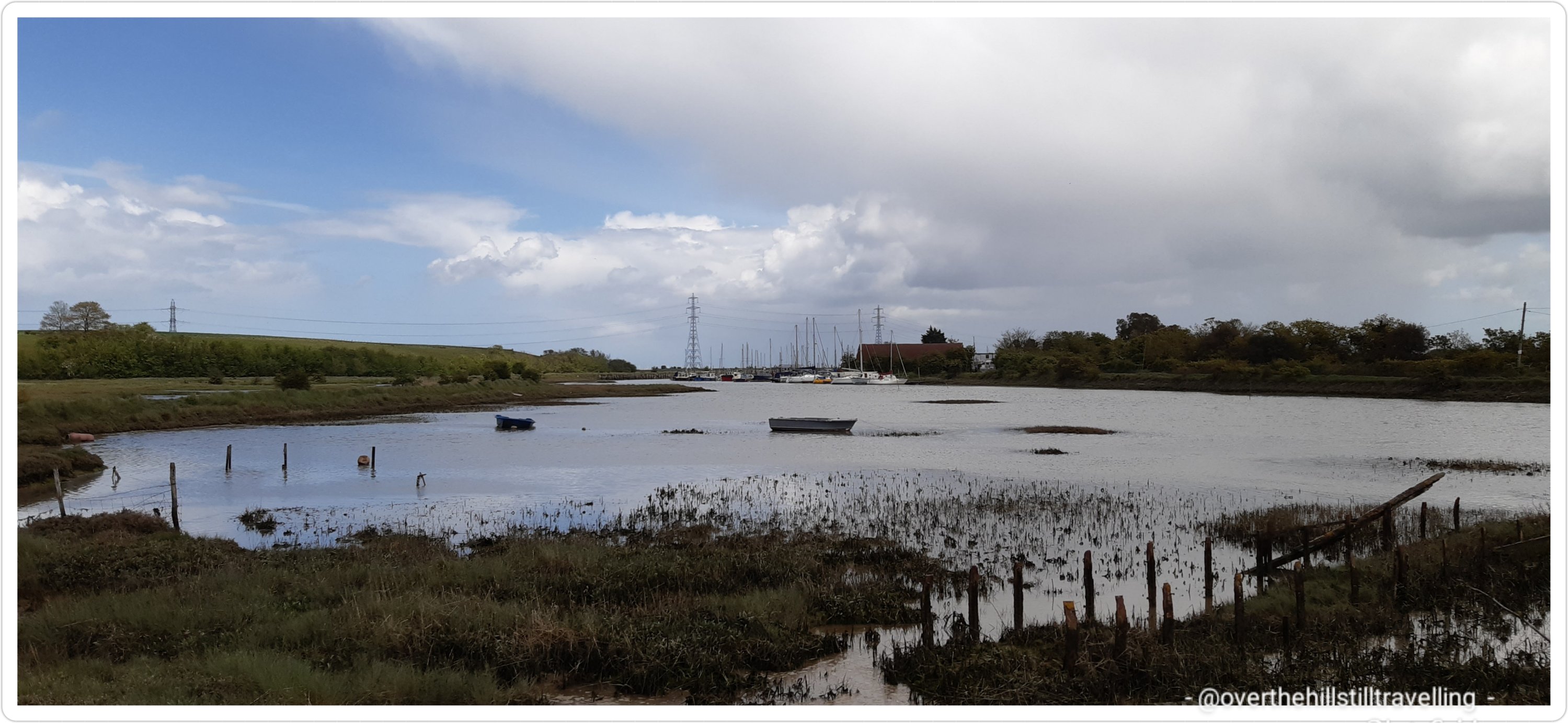
So hey….I did it!!! Yesterday; Faversham to Sittingbourne along the Saxon Shore Way 😁😁😁 9 hours. 30.06 km. Holy moly what a long day. If I add on the distance from home to the station and back, I can add on another 2.5 kms. The last time I walked 32km on any one day was 4 years ago on the Portuguese Camino in Spain…destination: Caldas de Reis. I swore to never do such a long walk ever again 🤪🤪🤪 Hah. I’m very comfortable with 16kms, so this is a bit of a stretch, but hey, it’s done. Now I can concentrate on the next section; Sittingbourne to Rochester….
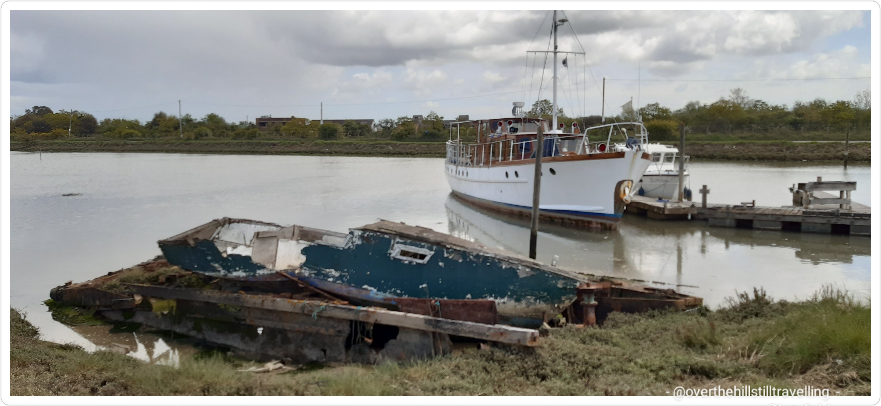
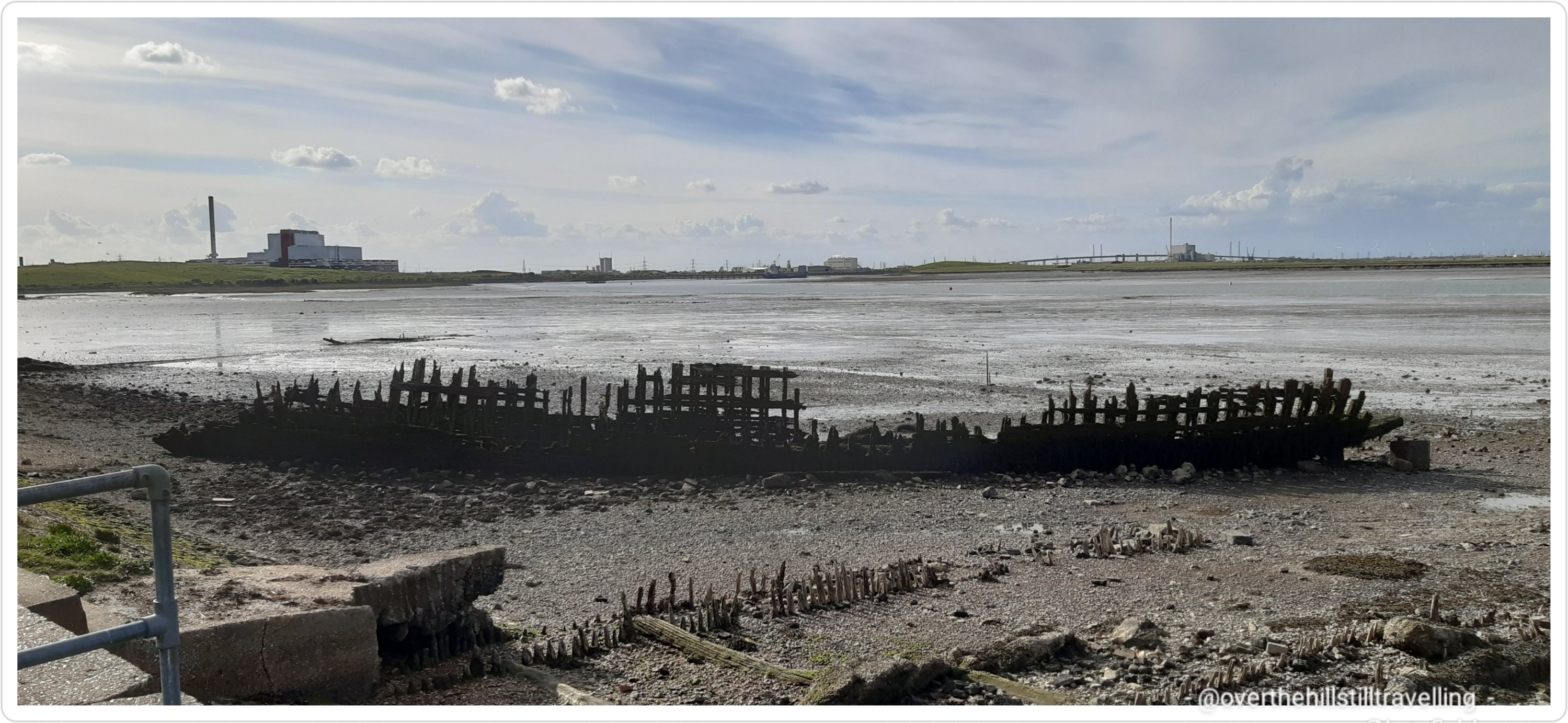
I’ll do a proper write up in due course, but for now, what I really wanted to tell you about were all the abandoned boats I saw along the way; boats of all sizes, their rotting carcasses littering the creeks.
I wondered why they were abandoned? Who abandoned them? What were their names before being dumped, and why have they been left there to rot.
They are beautiful in their various stages of decay, but how sad. I’m sure they were beautiful craft at some time, sailing proudly along the channels, brightly painted, flags fluttering in the wind, decks alive with chatter.
And now, they’re lying there, forlorn and forgotten….too sad. This post is to honour all boats that get dumped and forgotten. In order of appearance, these boats were seen in Faversham Creek, Oare Creek, The Swale, Conyer Creek and Milton Creek.
I’d love to know their provenance and how long they’ve been lying there….
Long may they rest in pieces and provide food and homes for the fishes.
Extra image of previous two boats from a different angle.
I’ll try get my post up as soon as I’ve caught up with the Thames Path posts, the Pilgrim’s Way posts (2 years ago 😱🤪🤪) and the initial stages of the Saxon Shore Way I’ve already walked. 🤞🤞🤞 Thank you for your patience 😁😁
And yes, after walking 30 kms, I’m feeling every. single. one. of. my. years. 😂😂😂 but lots of vitamin C, Aloe Heat Lotion paracetamol and feet up…I’ll be right as rain…😉
Hahaha, yes, after my blithe words yesterday about being pragmatic about plans changing…guess what??
Yeah…..that….can I bite my tongue?? 🤪🤪🤪
So after hours working out the route, checking the days/dates over and over to make sure they were correct and I didn’t miss any, calculating the distances to make sure the days are not too long, researching accommodation, then booking the dates, and double checking the dates, I got an email this morning confirming my booking but….
“Good afternoon,
Though most restrictions are lifted from 12th April, unfortunately for public who intend to stay in hotel for leisure are allowed only from 17th May. Till this time only key workers are permitted to stay overnight in hotels. Kind regards”
Don’t you just love a big old ‘but’? Although ‘butt’ would be more appropriate now, coz I’m kicking mine…😝😝
I understood from the government website that from 12 April Members of the same household can take a holiday in the UK in self-contained accommodation.
Couldn’t the government have been a little more specific andadded “you may not stay in hotels “. For people like me 😁😁😁
Apparently hotels do not fall under that category 🤨🤨🤨 Who knew?? 🤣🤣🤣 I think I misinterpreted that little clause because I am fed up now with not being able to travel, and want to do my walk.
I know there are still Covid related issues, but seriously, the hotels and places like that are taking so many precautions and they are sterilising their premises and following guidelines for masks etc, that I think its quite ridiculous that we can’t yet travel locally. I get all the overseas restrictions and precautions etc, but the virus is invariably spread by close contact in enclosed environments, big crowds, or feckless people not taking precautions, and you’re seldom in close contact in a hotel. Especially the bigger chains.
So yeah, that’s my little whinge 😏😏😏
I have a headache 🤕🤕🥵 Ugh. I had other plans for today. Or maybe I shouldn’t use the word ‘plans’ for the foreseeable future.
Note to self…
I’m now in the process of reworking all my dates, because I have my actual work dates to reschedule as well.
I guess my previous Walking the River Thames post would count as Stage 1 since that’s when I did more research on the river and the route itself….
In which case, getting it down on paper (so to speak) would be the next stage; Stage 2…and that I have done! Hoorah. I spent nearly all my free time yesterday setting up the spreadsheet, doing further research on the actual walk itself and planning my distances. It’s a good thing it was raining heavily so I didn’t feel guilty about not getting out to walk.
I found 3 amazing websites by people who have walked the Thames Path and written about it, and conveniently also posted images of the walk. The usefulness varies in as much as they say how far they walked each day, approximately how long it took, transport links, but not where they stayed. I also found 2 official websites; the Thames Path is one of 16 National Trails in the UK – they note the trail can be walked over 16 days, so I’m happy with my 19, 1 of which includes the section from Erith to the Thames Barrier.
Planning the distance and number of days has proved to be quite tricky because a lot depends on accommodation available. And it is NOT cheap. So far my estimates are £1300 for 19 days. I could do 2 caminos in Spain for that!! The accommodation is outrageously expensive and I am going to have to do some further research. I did find some nice places on booking.com and what’s useful about that is you have a decent amount of time, for a small price increase, to cancel if needs be. I’m ever so pragmatic about things like having to cancel trips…because you know… Covid and things like that.
One of the most useful aspects though of walking in the UK is the transport links. Albeit very pricey, if you have any accidents it’s easy enough to get home. Also there are numerous little towns along the route, so I won’t have to carry my weight in water…LOL I remember in Spain the constant daily fear of running out of water… although it only happened once and I managed to convey my need for “aqua por favor” to a delightful little old Spanish couple, who reprimanded me soundly…although I didn’t understand a word they said, their tone and expressions made it very clear 🙂 But they filled up my bottle. It was one of those days when it was scorching hot and I sent my water bladder ahead with my backpack by accident…
So the spreadsheet is up, the dates/days are estimated, the travel costs are determined, the food costs will be like I did on the camino….I existed on fruit and sandwiches and occasional bowls of soup or omelettes, and the accommodation has been identified and priced (ouch) and 75% booked. I’ve mostly booked all the places I found via booking.com and then do a further search on airbnb. Either way, I have to make a final decision before month end on dates etc.
Also, besides the 1st stage from Erith to the Thames Barrier planned for 21/03, I’m also going to do stages 2 & 3 on separate days; namely 15/04 & 18/04 and travel back home. It will be cheaper than overnight stays and means I can take a few days break between each stage before the big push which will begin from Hampton Court on 24th. I’m also planning on spending the day in Hampton Court and hopefully meeting up with my family and visiting the palace on the 23rd.
Of course, like all plans, it is subject to change, but once I make the bookings, that’s it…..Cindy travels again. I’m really excited about this walk and also a little trepidatious because my body is 2 years older since I finished the Pilgrim’s Way (talking of which, I really need to finish those posts!!) and not as robust as it was 4 years ago when I walked the Camino. I haven’t hoisted my backpack onto my back for nearly 2 years!!! I think I’m going to travel light!! LOL
Be that as it may, I shall keep walking as long as I have life in me old legs. So I’ve listed the websites below that I discovered in the event they are of interest to you dear reader.
I enjoyed reading about Jason’s journey, although he started at the source, and I was excited to discover someone else who had walked the Saxon Shore Way https://www.macadder.net/walking/thames_path/stage01.html He also mentions Offa’s Dyke and The Fosse Way, both of which I’m interested in. Jason does mention the distance walked and his figures more or less correlate to mine…whew! I’m looking forward to reading all his other days; 13 in all. I was well impressed to note that he has done 28 walks!! That’s quite extraordinary. A couple of them are familiar to me, and a few piqued my interest. I guess I’ll just have to add them to the list LOL I mean who wouldn’t want to do the 1066 Country Walk, or St Swithun’s Way, St Michael’s Way or the Strawberry Line Path (I so love this one) – anyone say ‘cheese’?
2. Then there’s Brian’s Walks – he appears to have walked the same direction as which I am going to; from sea to source. http://www.brians-walks.co.uk/thames-path-cricklade-to-kemble.html Brian did this walk over 9 days so I suspect he put in some serious distances each day; as in roughly 35kms…which I do not plan to do. My maximum distance before it gets unbearable is 28kms, and I only have 2 days when I will walk that distance. His blog is amazing in that he lists his daily statistics (of which I shall make careful note).
3. With this site I was unable to find a name (perhaps as I read further I may discover it) but I loved the name of the blog http://www.tamesis-fluvius.co.uk/index.php I was highly amused by his comment “During the course of the two weeks, I took well in excess of two thousand photographs and a selection of them are included on each page“. Oh my goddess, if that doesn’t sound like a kindred spirit then I don’t know what does. 🤣🤣🤣 I am a demon when it comes to taking photos and I invariably only share possibly 5% of the photos I take on each walk. They did the walk over 15 days, so my already 19 days is not too bad.
I also stumbled upon what appears to be an ‘official’ website. https://www.thames-path.org.uk/thames_cricklade_source.html I found quite a lot of useful information here as well as transport links….especially for the upper reaches of the Thames near the source.
The National Trail website lists all trails in the UK and if I had enough time and money, I’d do them all…don’t you just love what they have to say about the Thames Path – it sounds so romantic…
“The Thames Path is a long distance walking trail, following England’s best known river for 184 miles (294 Km) as it meanders from its source in the Cotswolds through several rural counties and on into the heart of London. On its way the Trail passes peaceful water meadows rich in wildlife, historic towns and cities and many lovely villages, finishing at the Thames Barrier in Woolwich just a few miles from the sea”.
Can I go now please ☺☺☺
I’ll be following the Cabot Trail virtual challenge while walking the Thames Path coz its very conveniently 299.4kms which is almost the same distance…although I’m sure my kms will be more than what they suggest it is…294kms.
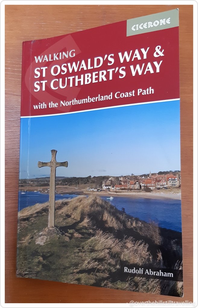
Just had to share this with you quickly…I’ve started planning my September walks (thanks to lockdown 2020, they had to be postponed) and of course the first guide under the spotlight is St Cuthbert’s Way.
This was my initial planned walk with a couple of others, but now that I’m rereading the guide I’ve decided to include walking St Oswald’s Way as well, and while I’m there, I may as well walk the whole of the Northumberland Coast Path as well before heading into Newcastle.
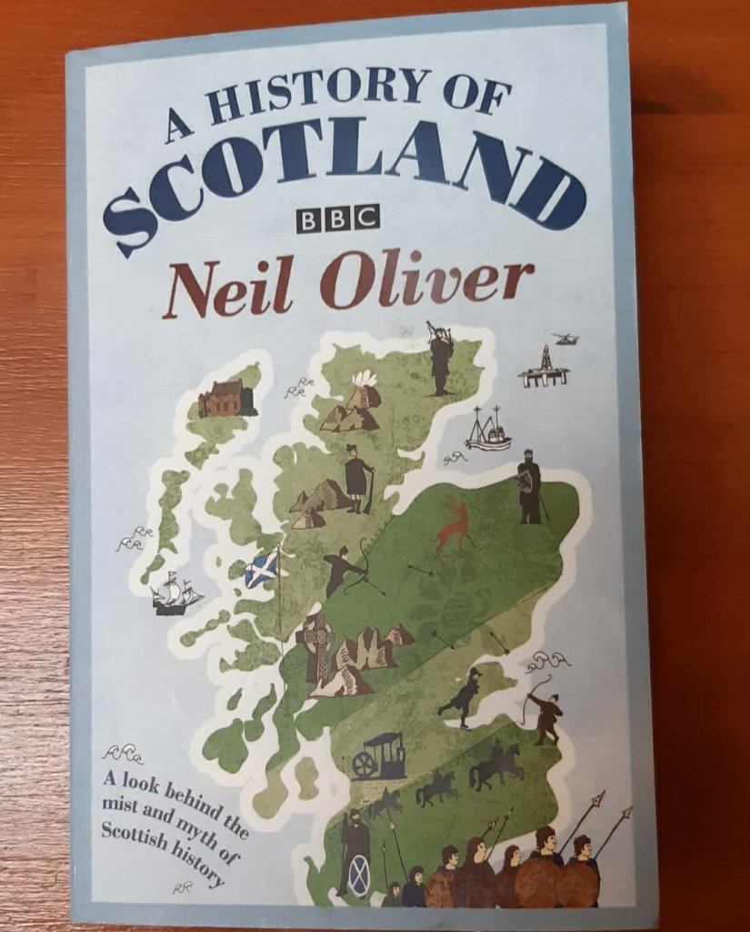
I recently started reading Neil Oliver’s BBC A History of Scotland and to my delight, I recognise a lot of the place names he mentions in the book. The area is redolent with history. How will I tear myself away. 😁😁 I will however be visiting quite a few of those places enroute along the two routes.
An absolutely amazing book
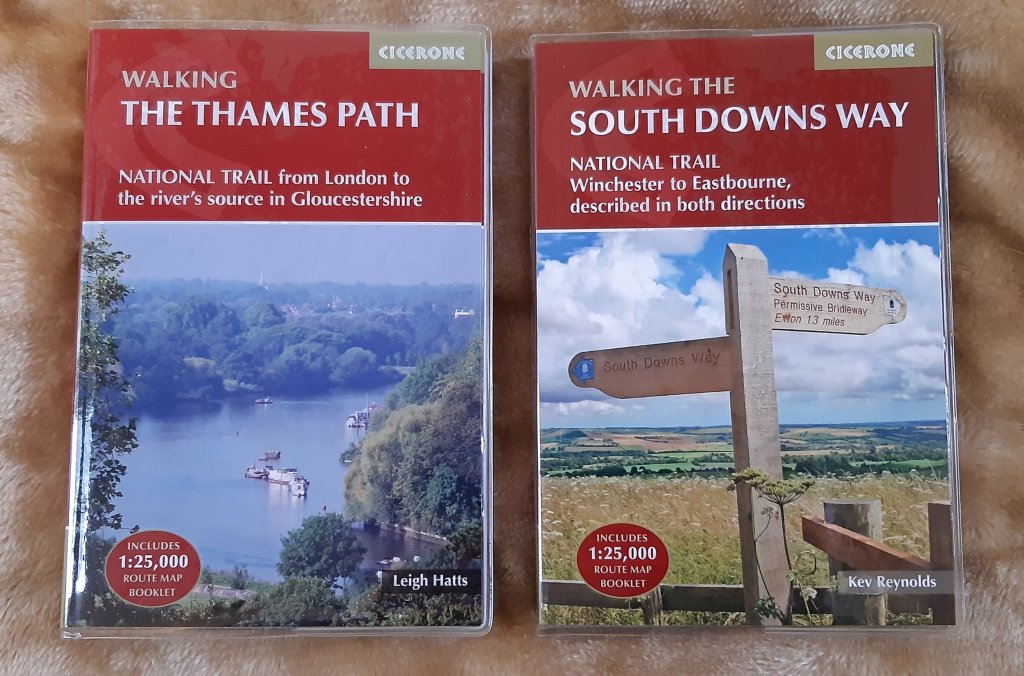
Of course I’m still planning on walking The Thames Path for my birthday, and the South Downs Way if I’m kicking my heels and need another long walk before the year is out…
Meanwhile, I’ve discovered that I will need a compass 🧭 to find my way at some points 🧐🕵️♀️🔎🚶🏻♀️🚶🏻♀️ This is going to be reallyyyyyy interesting. I have no idea how a compass works really. I know the principles, but I usually rely on mapmywalk and Google to get me out of a pickle, so I guess a compass tutorial and some map reading is in my future 🔮
Meanwhile I’m finding it really difficult to put the guide book down and focus on something else…its so interesting and I love the snippets of information that the writer has included in the book. Its giving me itchy feet….
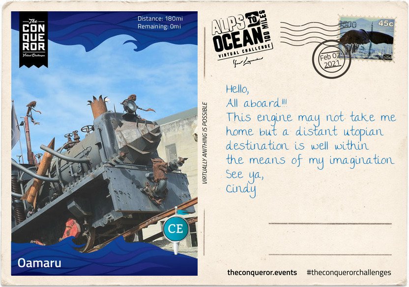
And tah dah!!!! I’m done! I reached Stage 9 and the end of my Alps to Ocean challenge on 2nd February. Hoorah.
Finally here I am 180miles (290km) later, having travelled from the alps of Mount Cook, along multiple lakes, countless connecting rivers, past seven Waitaki Hydro power stations, various mountain ranges, through tussock grasslands, beside electric fences (do not touch) to arrive in the urban town of Oamaru on the shore of the Pacific Ocean.
Oamaru is the largest town in the region and renowned for its Victorian precinct. A commercial streetscape, the Neoclassical architecture is a result of Scottish architect and engineer, Thomas Forrester, who emigrated with his family to NZ in 1861. Arriving in Oamaru to supervise the construction of the Bank of Otago, Forrester stayed on and shortly afterwards was integral to the construction of the Oamaru Harbour. Taking samples from the harbour floor, he deduced that the seabed could be dredged permitting the development of a deep water anchorage. This in turn allowed large ocean-going vessels to safely steer in and out of the harbour. Forrester then changed direction and together with his business partner, over a period of three decades, designed and built the various commercial buildings that still stand today. The precinct bustles with cafes, antiquity shops, bookshops and galleries. Each year it conducts the Victoria Fete, a one day fundraising event with stalls, music, food and period costumes. The funds raised go towards the ongoing care and restoration of the Victorian buildings.
For steampunk enthusiasts, inside one of the Victorian buildings is Steampunk HQ showcasing a collection of quirky items in retro-futuristic sci-fi style whilst outside is a full size train engine spitting fire and billowing smoke. Promoting sustainability and recycling Steampunk HQ collaborates with like-minded artists on projects to continue expanding the collection. Wish you could join me for a steampunk-Victorian era inspired dress-up and for a time feel like we have been transported into an alternative 19th century England.
At the north end of the Victorian precinct is the oldest public garden in NZ. When the town was surveyed in 1858 an area of 34 acres was set aside as a public reserve. Eighteen years later in 1876, the Oamaru Botanical Gardens was opened. Besides the flower beddings, bushes and trees the garden is dotted with various attractions such as the Japanese red bridge, Oriental garden, croquet lawn, sundial, aviary, peacock house, an Italian marble fountain and the Wonderland Statue made by the famous Scottish sculptor Thomas J Clapperton which he donated to the children of Oamaru in 1926. Thomas also made the bronze soldier sculpture on the World War 1 Memorial in Oamaru and is famous for his Robert the Bruce sculpture adorning the entrance of Edinburgh Castle, Scotland.
As I stand on the end of the pier and look across the expanse and vastness of the Pacific Ocean, I wonder at its hidden stories, sunken ships and deep trenches. I wonder what Portuguese explorer, Ferdinand Magellan was thinking when in 1521 he sailed across the Strait of Magellan into the Pacific Ocean and was inspired to name it Mar Pacifico which translates as Peaceful Sea. It’s certainly questionable when you consider the heavy swells, the earthquakes, volcanoes and tsunamis that have battered many Pacific islands and sometimes obliterated complete towns. When I consider the depth and perpetual darkness of the Mariana Trench or the Pacific Rim with the highly active Ring of Fire, peaceful is not something that comes to mind but it is intriguing and fascinating.
This has been such a fascinating journey, it is indeed intriguing. I mean snippets like this are just awesome: Mar Pacifico which translates as Peaceful Sea, although I’m not too sure about the earthquakes et al.
Albeit a virtual journey, it’s made more exciting with the postcards and the information you receive as you reach each stage, and how much I’d love to see that train!! I’ve learned more about New Zealand than I ever knew, as well as from my previous challenges: Mt. Fuji in Japan, The Great Ocean Road in Australia, Ring of Kerry in Ireland etc They’ve all been so interesting.
So far I’ve completed 9 challenges which includes the Conquer 2020 challenge which was a sum total of all my challenges and more in 2020. My favourite so far has been Hadrian’s Wall and I never did get to blog about it…I only thought about sharing these challenges on my blog while I was doing Mt. Fuji because it was so fascinating. I’ll try to blog about the others, but I’ll stick with the shorter ones otherwise it gets too tedious for everyone….anyway, The Ring Road in Iceland is 1,332kms long and I imagine has lots of postcards LOL and the St Francis Way is 503 kms…so likewise.
But I’m starting the Mt. Everest challenge next, and then the Giza Pyramids challenge after I’ve done The Cabot Trail in Canada, so I’ll share that at the time. Of course I may just change my mind and blog about The Cabot Trail too 😉 And here is my certificate. Seriously, within seconds of updating the app, the final postcard and certificate land in my mailbox. I’m going to make books from all of them for each walk….will be fun to look back on one day when I’m older, and infirm and unable to walk far….if I live that long LOL
You have received a new postcard! 🙌 its ridiculous how excited I get when I post a day’s mileage to my app and within seconds I hear the ping of a new email 😃😃 I reached Stage 8 on 28th January, and
It’s with mounting excitement that I realise I’m nearing the end of my virtual journey on the Alps to Ocean route in New Zealand. I started off the challenge on 30th December 2020, and except for a few days along the Kent coast, the majority of my walking has been in the countryside of Throwley, near Faversham – still in Kent.
I’ve been hard put to get my kms in because I only get a 2 hour break each day and some days due to weather I’ve not been able to walk at all. I set my initial goal at 5 weeks but was hoping to complete the challenge in 4 weeks. However, that plan was scuppered when the booking was extended for 3 weeks. 🤔🤔🤔 Nonetheless, I’m not complaining, I’ve enjoyed my stay in Throwley and with another 10 days to go till I leave (as of the 28th), I’m hoping to finish the Alps to Ocean challenge and start on the Giza Pyramids…meanwhile
Stage 8
The small farming-town of Duntroon is home to around 120 residents. It’s main economy is largely sheep farming and crop growing such as wheat and barley.
The town was bestowed its name by one of a handful of Robert Campbells that emigrated from the United Kingdom to Australia and New Zealand. It took quite a bit of unravelling and genealogical construction to discover which of the four generations of Robert Campbells was the relevant one associated with Duntroon. It seems that the name Robert was greatly favoured in the family.
The first Robert (#1) was a grand-uncle from Scotland who was the first merchant in the 1788 British colony New South Wales (Australia) and later a politician. Having built a private wharf at the time he is now referred to as “Campbell of the Wharf”. He had a son named Robert but his brother, John, also had a son named Robert (#2).
This nephew, Robert (#2), arrived in Sydney in 1806 and by 1818 he was the Director and afterwards the President of the first formal bank in Sydney, the Bank of NSW, today known as Westpac. Having also built himself a mercantile business on Bligh Street, Sydney, he became known as “Campbell of Bligh Street”. This Robert, unsurprisingly had a son also called Robert (#3), who was born in Sydney but chose to return to England and became a Member of Parliament from which he was unfortunately unseated threes month later. To distinguish him from previous Roberts’ he was given the appellation “Robert Campbell Tertius” meaning the third.
Finally the relevant Robert (#4), son of Robert Campbell Tertius, who was born in England in 1843, travelled to New Zealand early 1860s to either buy or lease land on behalf of the family. Robert became a successful sheep farmer, property owner and later politician. Together with his father, he owned a sheep station in the Waitaki District upon which they built a small town they named, Duntroon, a Scottish name possibly as homage to their ancestry and their ties to Clan Campbell of Argyll, Scotland.
Robert’s (#4) wife, Emma, bequeathed £6,000 to the parochial district with instructions to build a church for the benefits of Church of England members. The result was St Martin’s Anglican Church in a 14th century Gothic style, built out of limestone quarried in a nearby region. The side church door bears the Clan Campbell coat of arms. Sadly both Robert and Emma died childless and within a few months of each other.
By 1875 much of the acquired Campbell lands became plagued by rabbits that were imported in the 1830s and released for sport. Unable to curtail their rapid reproduction rate, by the early 1880s the pastures were depleted and hillsides eroded. This in turn produced lower quality wool thereby affecting the prices of wool. In the end, the devastation wrought in the region forced many sheep station owners into bankruptcy and the Campbell’s businesses in NZ were eventually wound up and ceased operating by 1920.
Just off the main highway is the Vanished World Heritage Centre, a fossil and geology museum that includes the fossils of two species of extinct genus of large penguins from around 27-28MYA. Known as Archaeospheniscus, the species is about the size of an Emperor Penguin. There was a third species, albeit a smaller one, in this genus that was discovered in Antarctica. These three species are the only ones currently existent in this genus.
Having left Duntroon, I’ve parted ways from Waitaki River which has been my companion since the Waitaki Dam and moved in a south-east zig-zag direction until I stopped at the Rakis Railway Tunnel, an old disused railway line. During the 1880s depression era the construction of the railway provided much needed unemployment relief. The 11mi (19km) line was in use from 1887 to 1930. Today the tunnel is only 330ft (100m) long and although it can be explored, a torch is needed because halfway in the tunnel curves cutting out all source of natural light.
Today will be by far my longest route of this entire journey, hence writing this letter on one of my rest stops. I look forward to rolling into my final destination, Oamaru.
Interesting information provided…..and therein lies the foolishness of history. You can’t just import alien species into a country for whatever reason and expect it to have a happy outcome. If you read history, you’ll discover that there were dozens of similarly stupid and foolish mistakes made by the invaders (of the people kind, not the animal or plant kind) of these islands as well as in Australia and various other countries around the world; the British Empire!! Geez. Well I have to admit that I have no sympathy for the unfortunate Campbells, shooting rabbits for sport – how cruel…and talk about a lack of imagination. With the huge variety of names on offer, could they not come up with something a little different…I mean I like the name Robert on the whole, but surely a little variety wouldn’t have gone amiss?
I do like the Elephant Rocks though and the Vanished World Heritage Centre, sounds like an awesome place to visit.
Anyway…. I’m rapidly reaching the end of my Alps to Ocean NZ challenge!! I always feel a little sad really when they reach the last few miles…..they become friends eventually LOL Okay, okay, don’t say it…I know, it’s daft.
Didn’t take any photos of the area this day because, seriously I have so many already, but I did spot that gorgeous iris hiding under a hedge and the snowdrops are in bloom. So pretty..I love this time of year when the first snowdrops appear…
And because I didn’t faff around too much taking photos, I managed to clock up 11.44kms in 2.5 hours 👏👏👏😁
This challenge is 289.7 kms, takes considerably longer to complete if you’re walking short distances each day weather depending, and can sometimes be a bit wearying as you plod along every day building up the miles/kms. But it’s all worthwhile when the next postcard pops up. How awesome it must have been to glide over the NZ landscape for 15 hours. The views must be stunning from that height.
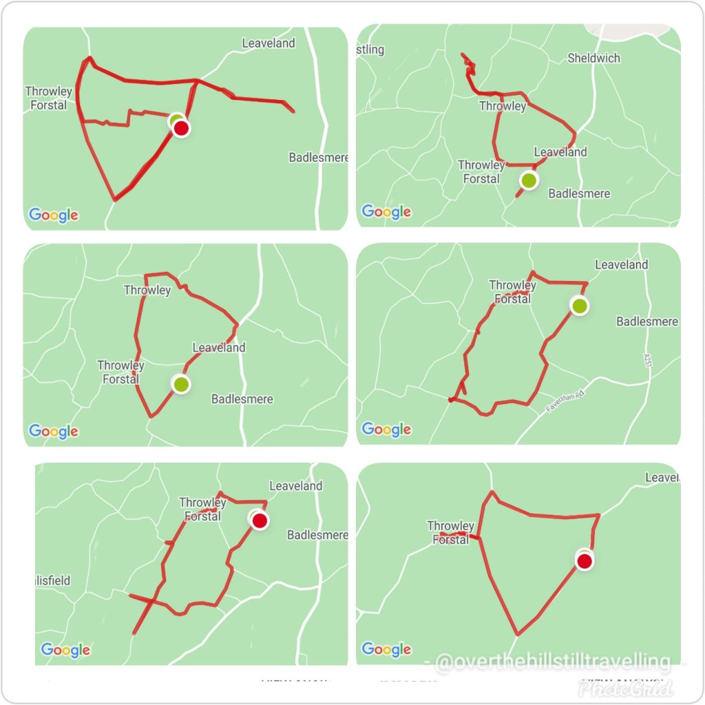
The days have been mostly grey, overcast and lots of rain, but I managed to get out nearly every day between 10th and 17th, explored a few public footpaths (big mistake – they’re mud baths in the current weather), and created some interesting configurations 😄😄
I try to vary my route each day and create more shapes
Meanwhile, on my virtual journey I covered 47kms, and am just on 18 kms over halfway through my challenge/virtual journey. I plan to finish by 3rd February. 🤔🤔🤞🤞🤞
Here we go Stage 5, which I reached on 17th January, done and dusted…
Having left the alps and peaks behind, the town of Omarama marked the halfway point of my journey. Although a small rural town, mainly a service centre for locals and nearby residents, Omarama had a few surprises up its sleeve.
Disney’s 2020 movie release of Mulan was entirely shot in New Zealand with scenes filmed at the Clay Cliffs just outside of Omarama.
Stage 5
In 2009, NZ pilot Terry Delore set a new world record in his 87ft (26.5m) wingspan glider. Taking off from Omarama, Terry travelled 1,491mi (2,400km) up and down NZ for 15 hours reaching speeds of up to 93mph (160kph) before landing back in town. Omarama has strong gliding conditions making it a popular destination for gliding pilots. Omarama hosted the 1995 and 2007 World Gliding Championships of which Kiwis took first place in the 1995 open category and third place in 2007.
For the weary soul like myself a Hot Tub soak the night before to rejuvenate my muscles and unwind was just what I needed. The Hot Tub was located outside in a private setting within a tussock and rock landscape. The tub was filled with fresh mountain water without any chemicals added. The business reuses the water for irrigation. A submersible firebox allowed me to adjust the water’s temperature. As I settled in, I watched the Milky Way appear and spill across the night sky with its millions of stars.
Eastward bound, I left Omarama refreshed and ready to tackle the next half of the journey. The trip was relatively easy and short when compared to previous days. The first half of the trail was off-road running parallel to the State Highway on the right. Crossing at Chain Hills to the left of the highway I began my descent alongside Lake Benmore, the largest artificial lake in NZ. Lake Benmore was created in the 1960s as part of the Benmore Dam construction. The lake is split into two arms. The largest is fed by three rivers, Tekapo, Pukaki and Twizel plus the Ohau canal with Waitaki River flowing right through the lake, whereas the smaller arm is fed by Ahuriri River.
It is this smaller arm that I travelled along to Pumpkin Point, a grassy beach area, for a break and a splash in the lake, then onto Sailors Cutting where the off-road trail terminates and I join the highway for the rest of today’s trip. Not the most relaxing part of the journey as I braved the high-speed highway with an upward climb to Otematata Saddle. The views of Lake Aviemore and the valley beyond was a lovely compensation until I continued on the busy highway downhill all the way into Otematata.
Not the most relaxing part of the journey.…reminds me of when I walked the Portuguese Camino…there were quite a few occasions I had to brave a high-speed highway 🤪🤪
I did a quick Google search tonight and discovered that the Alps to Ocean route is actually a dedicated cycling route 🤣🤣🤣🚴♀️🚴♀️🚴♀️🚴♀️ so no walking then 🤨🤨 damn. I’ll have to do more research. I’d really love to walk the route, it looks awesome
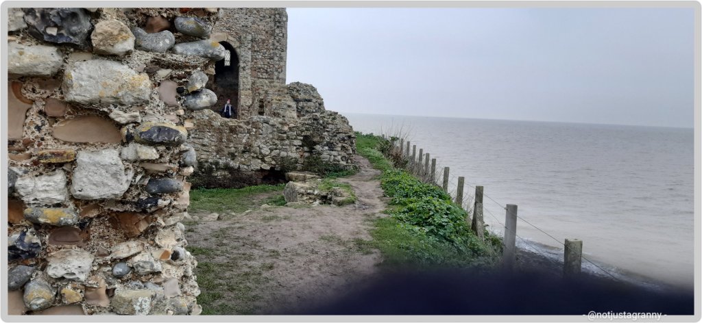
Following on from my recent walk from Margate to Whitstable via Reculver, researching the Roman fort uncovered the information that Reculver too had been mentioned in the 1086 Domesday Book. 😃😃👏👏 Roculf: Archbishop of Canterbury. Church, mill, 5 salthouses, fishery.
By no means a huge number, and considering that 13,418 (settlements) : cities, towns, villages and hamlets are mentioned….150 is not that many, but it’s way more than most have visited.
It’s still astounding to discover that many English people who have grown up in the country, have no idea of its existence.
1086 is only one of the most significant dates in English history following on from the 1066 Battle of Hastings, and yet…..
My original intention was to visit 101, but it seems that my travels and my job will take me to many more than I anticipated.
I’ve wanted to walk to Reculver from Broadstairs ever since we first visited the place some years ago, but never seemed to find the time, it also did not seem doable. But now with my crazy decision to walk the entire English coast over the next 5 years, it became doable ….😁😁 and in comparison to the distances I’ve since covered on my various walks, it was easy peasy
When I set off from Margate last week I could see the ruins of the church farrrrr away in the mists of time and remember thinking ” oh gosh, it’s so far, will I be able to do it ?” But it was easier than expected, and voila
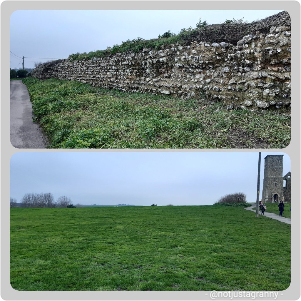
St. Mary’s Church, Reculver
St Mary’s Church, Reculver, was founded in the 7th century as either a minster or a monastery on the site of a Roman fort at Reculver, which was then at the north-eastern extremity of Kent in south-eastern England. In 669, the site of the fort was given for this purpose by King Ecgberht of Kent to a priest named Bassa, beginning a connection with Kentish kings that led to King Eadberht II of Kent being buried there in the 760s, and the church becoming very wealthy by the beginning of the 9th century. Ref wikipedia
Will this too be eaten by the ever encroaching seaA Roman fort, now long gone The remains of the Roman wall, and where the fort once stood
It’s a fascinating place and I’m certainly going to follow up on more of the history and I feel another visit is warranted. I noticed on my way to Reculver that there is a walk along the River Wantsum; which once cut off the Isle of Thanet from the mainland.
The River Wantsum
I 🔮 another walk in the future 😉😄😄 except it will not be in winter!! And I’m not walking across any mudflats….more of that later 🤪🤪


You must be logged in to post a comment.