In my line of work I travel a lot and often get to stay in fabulous, centuries old houses in quirky villages, many of which are mentioned in the 1086 Domesday Book.
I’m currently working and staying in this fabulous 16th century, listed house. The main part of the house is in this image; a quintessential English house. The rest of the house which leads off to the right is added onto and a converted barn.
A pretty little house
It’s a twisty, winding type of house with long passages and rooms leading off; the exterior replicates the original house. It’s just gorgeous
The village nearby is indeed a Domesday Book village with a fantastic old church that retains vestiges of the original medieval wall paintings/decorations.
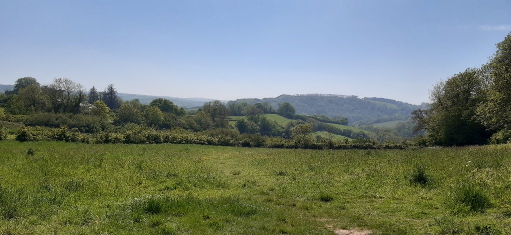
The village of Stanford Dingley is a good walk through fields of long grass awash with buttercups, and along shady woodland lanes. The village is ever so pretty under normal circumstances, but look so gay and colourful with the Platinum Jubilee bunting and flags.
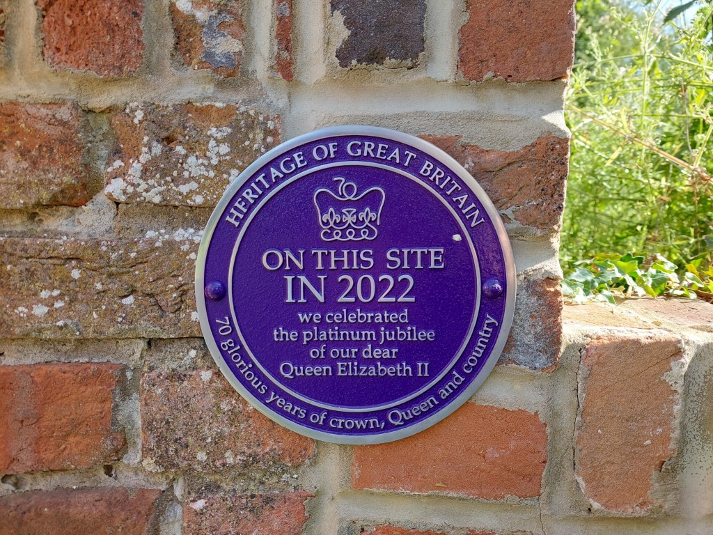
I love the plaque that’s been installed near the pub
I’m working near to Clapham Common for the next 12 days. I never knew it was so pretty.
Long Pond – formed after gravel pits were abandoned. Model yachts gave been sailed here since the mid-19th century The autumn colours this year are quite splendid Holy Trinity Church
This is going to be a relatively easy booking, but quite boring with nothing much to do. I may just get to start and finish (hopefully) my September blogs – it will all depend on whether or not my laptop is still operational.
From Wikipedia: At over 85 hectares in size, Clapham Common is one of London’s largest, and oldest, public open spaces, situated between Clapham, Battersea and Balham.
Clapham Common is mentioned as far back as 1086 in the famous ‘Domesday Book’, and it was originally ‘common land’ for the Manors of Battersea and Clapham. ‘Commoners’ – tenants of the Lords of the Manors, could graze their livestock, collect firewood or dig for clay and other minerals on the site“.
Whoop whoop, another Domesday Book place.
Lots of space for walking, and I’m planning on finishing the Ring Road Iceland by Wednesday next week 🤞🤞🤞 and starting the Romantic Road, Germany virtual challenge.
Tomorrow I shall go walkabout and look out for interesting architecture.
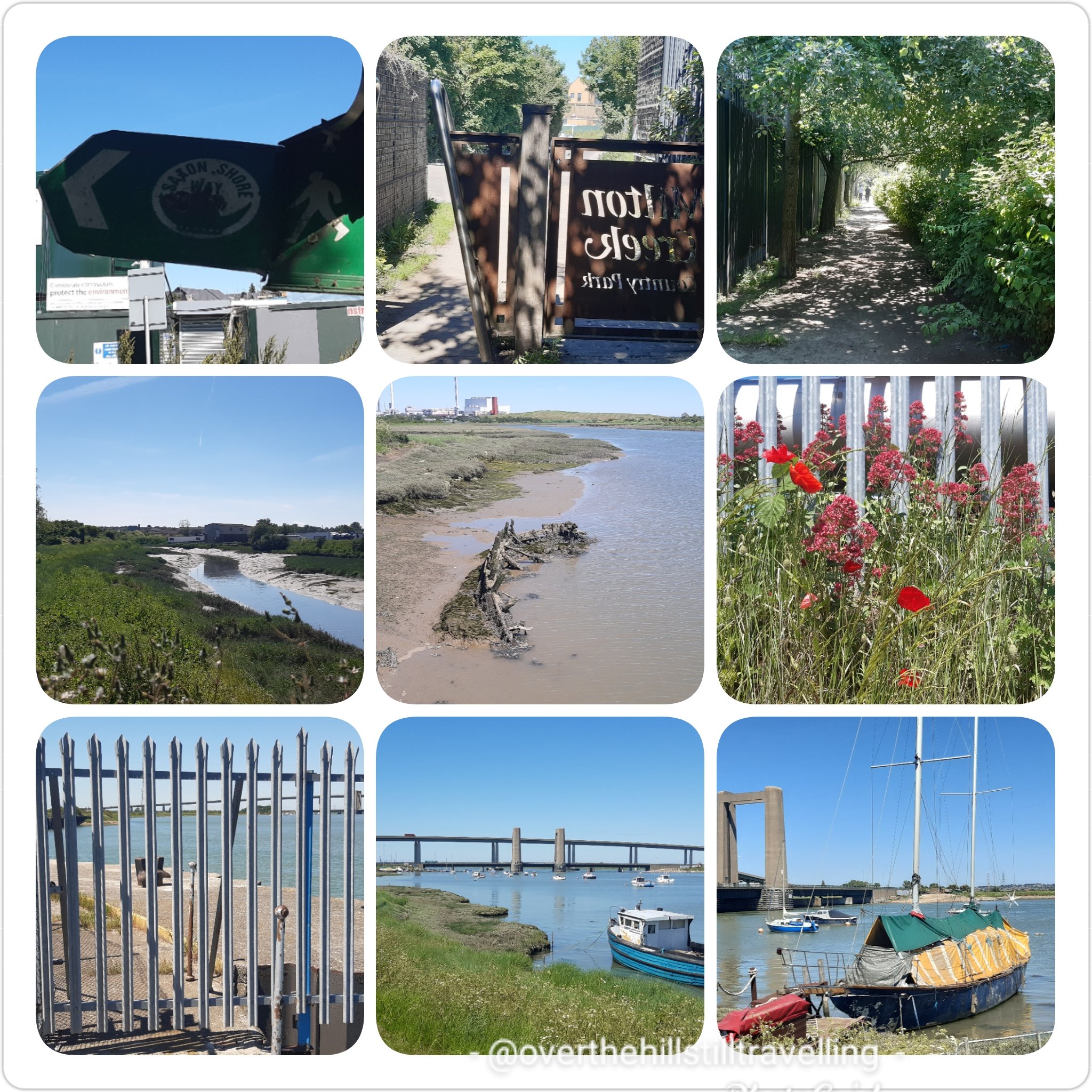
After a really hectic week of walking and taking my grandson on outings, plus a 19 km jaunt along the Saxon Shore Way and a brief visit to Sheppey Island, on Thursday 10th June I impulsively decided to walk another 2 stages of the Thames Path! I had planned on going up to London on Saturday 12th for Trooping the Colour, but fortunately I thought to check their website, only to discover that due to the continued lockdown, they had decided to hold the ceremony in Windsor again this year. And at that moment I decided to do the next 2 stages of the Thames Path; Staines-Upon-Thames to Windsor on the 11th and Windsor to Maidenhead on the 12th. Change of plans…
Walking the Saxon Shore Way
I quickly rejigged my calendar and rearranged my weekend plans, then a mad scramble to book accommodation ensued and at literally just on 9pm Thursday night I secured an Airbnb booking close to The Long Walk. I hastily packed my backpack with the absolute minimum requirements and prepared some food for the next day. Hoorah! I was off on the next 2 stages of my adventure. As mentioned in Stage 5, it was taking longer and longer to reach my starting point (the end point of my previous stage) and made more sense to stay overnight on day 1 and pick up again on day 2. The idea this time was to walk Stage 6: Staines to Windsor, stay overnight, watch as much of Trooping the Colour as I could see
after which I set off at approximately 1pm for Maidenhead, planning/hoping to arrive there relatively early for the long trip home. However, due to faffing around at the Three Store in Windsor for 2 hours, I missed the earlier train! LOL
The plans of mice and (wo)men….do not always work to plan! But that’s what I love about my life…I can change my plans any time I like 🙂
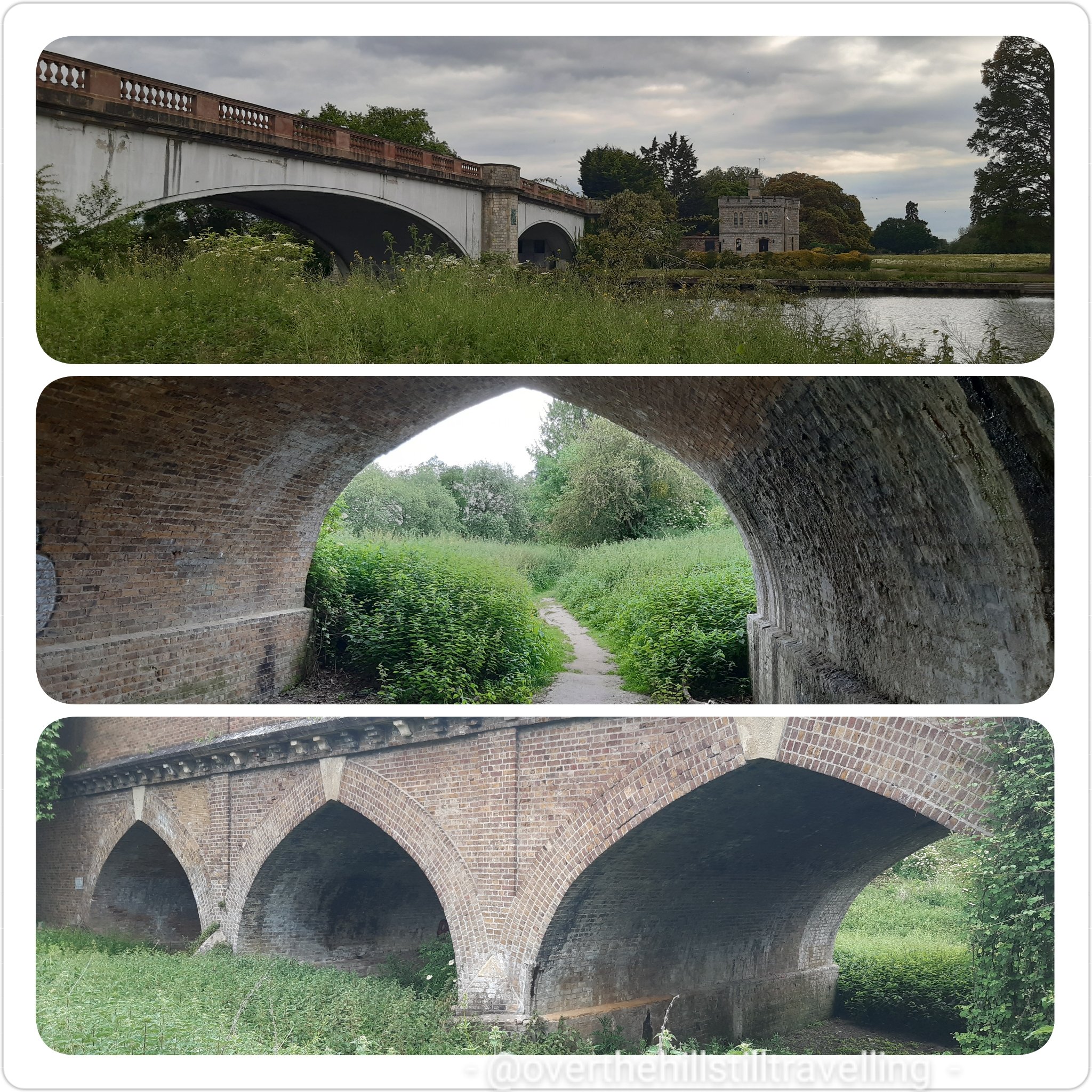
I left home early to get the 09:25 train as advised previously by the station attendant, and travelled to Staines via Vauxhall. Here things went a little awry…trains were either late, cancelled altogether or didn’t stop at the station. Total chaos reigned. Eventually sometime after 12noon, I finally boarded a train bound for Weybridge, stopping at Staines and arrived at just after 1pm. I made haste towards the river, reaching the railway bridge at 13:11 (now 34 minutes behind schedule!)
Staines Railway Bridge
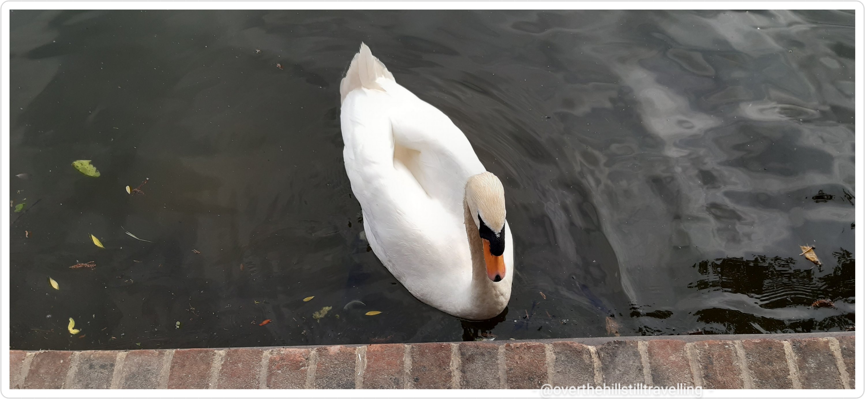
Staines was the end of the tidal Thames until 1812 when the downstream locks were built.Staines Railway Bridge was built in 1856 and painted with yellow stripes in 1995 to stop swans from flying into it. ref Cicerone guide book.
Following the same route as when I first reached Staines on the 24th April at the end of Stage 5, I stopped to photograph the houses by the riverside that I passed at that time
So pretty, and there’s Staines Bridge in the distanceReminds me of Bermuda, so gorgeous and a fab view
Then a quick photoshoot (of course 😁😁) of all the interesting sculptures and the London Stone
The London Stone
The London Stone marks the end of the City of London’s river jurisdiction (1197-1857) and although it has been moved a few times in the area, it has stood in Staines-Upon-Thames since 1285. The Lord Mayor of London made an annual visit to touch the stone with a sword. (the London Stone at Staines, built in 1285 marked the customs limit of the Thames and the City of London’s jurisdiction– the Corporation acquired these rights from the Crown in 1197 in the reign of King Richard I and held them until 1857 when the Thames Conservancy was formed).
After saying hello to the bridge, I meandered along the north bank and found a shady spot opposite Church Island to have my lunch.
Perfect view, Church Island to my right and the opposite bank where I’ll soon be walking
It was so relaxing just sitting watching the river and the world go by, that I could have stayed all day.
Top pic behind me. Bottom pic looking towards Church Island
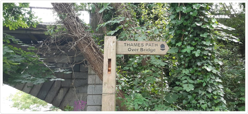
I didn’t tarry too long, time was passing and so I set off back to the bridge
Thames Path Over Bridge – sounds like the title of a book 😄
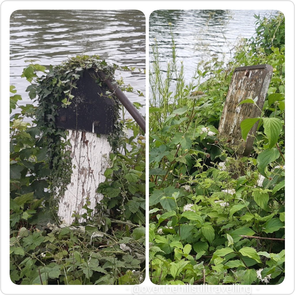
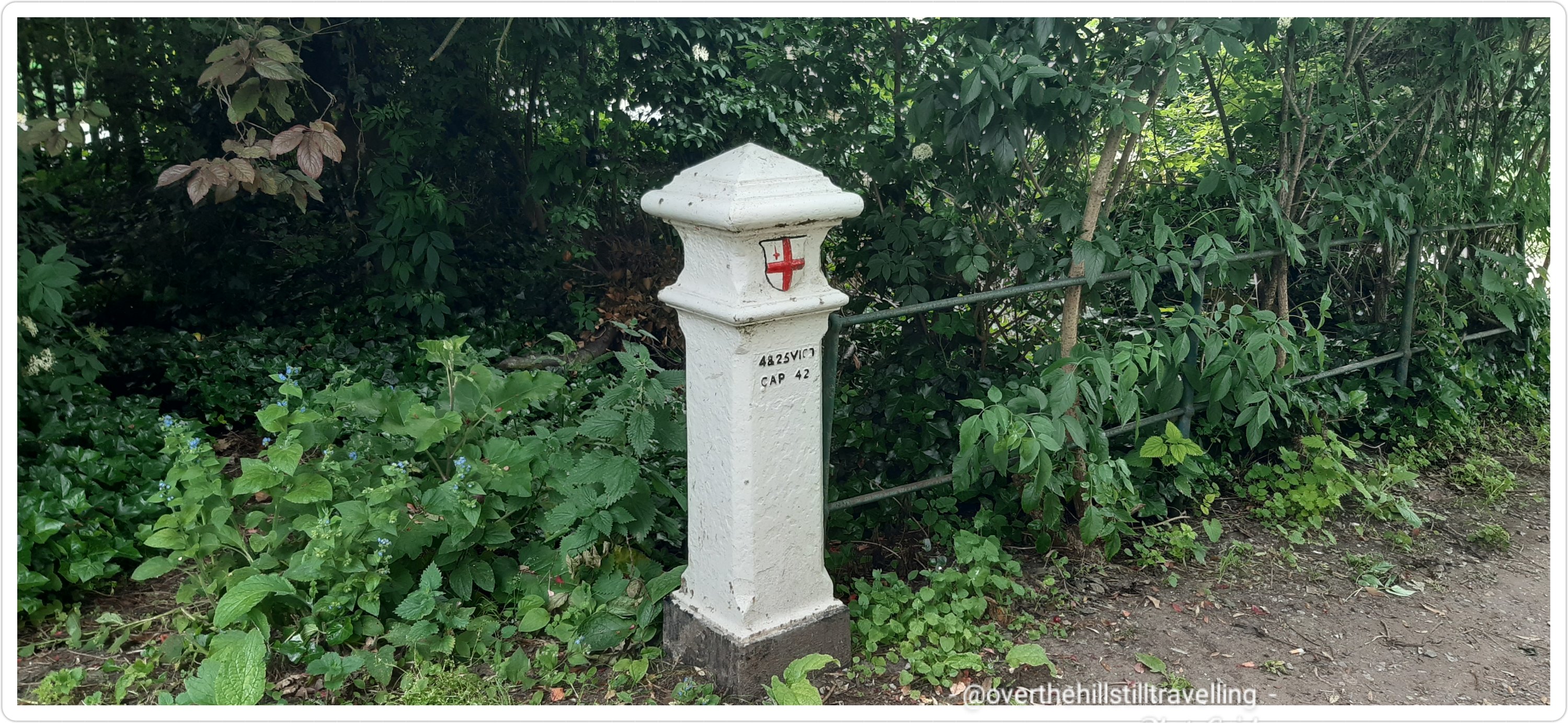
Following the instructions in the guide book I crossed over to the opposite bank and went in search of a City of London coal tax post, which the author said was opposite the London stone…it wasn’t…I used up 2.92 kms and 30 minutes searching for it before giving up and continuing my walk – but not before photographing a couple of items that could possibly have been it, but weren’t….
#notthecoaltaxpost
I did eventually come across what I suspect is what he was talking about….but it wasn’t opposite the London Stone!! it was in fact, a way further upstream of the bridge on the south bank, whereas the London Stone is downstream of the bridge on the north bank. Hmmm
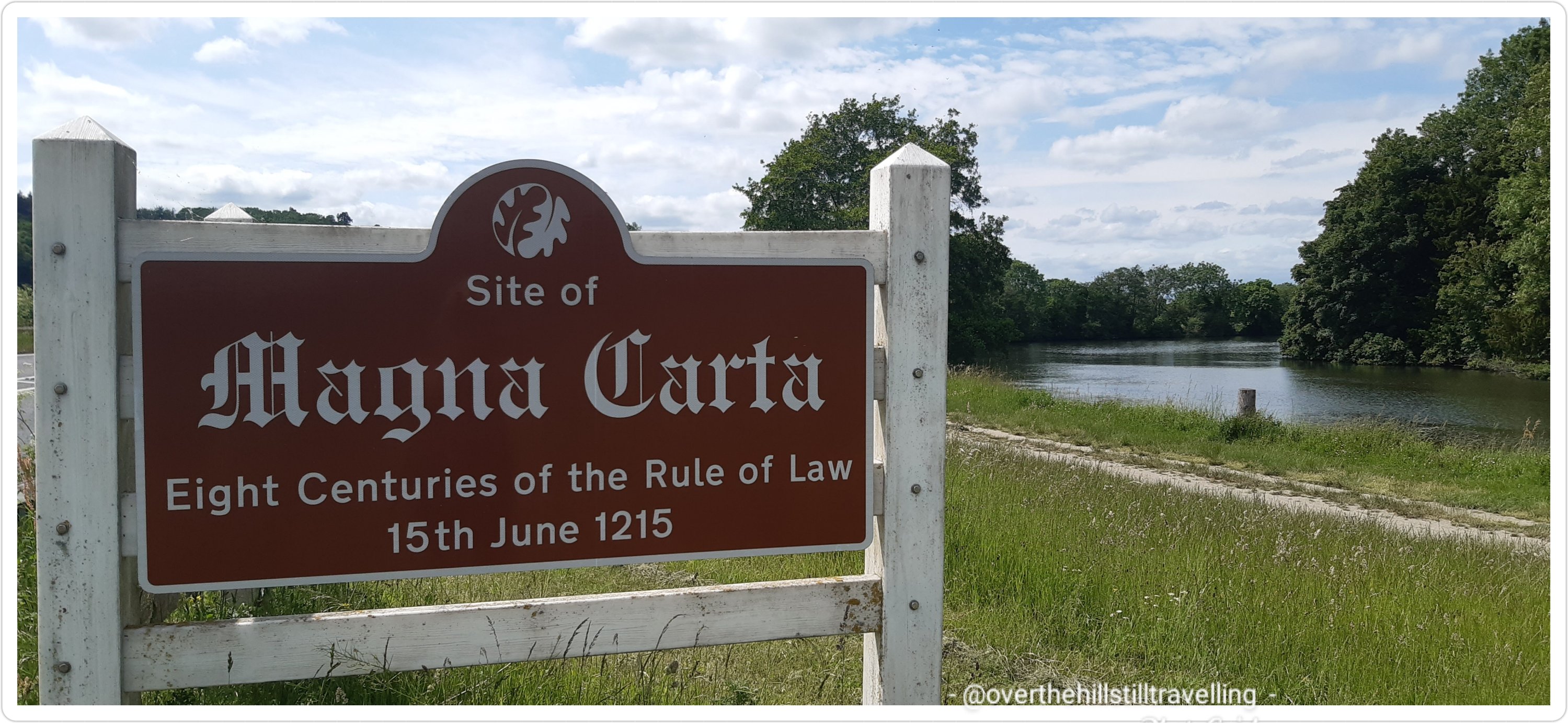
I was really excited to be walking along this section and looking forward to visiting the Magna Carta memorial…which I thought was on an island but wasn’t. It was actually very easy to visit once I knew how!! LOL As with all things you read in the guide books, the reality is very different to what you imagine it would be like. But that was still to come…also a lot further along than I imagined.
I would also be passing from Surrey into Berkshire on this stage, the 4th county since I started my journey at 1. Erith in Kent 2. Greater London 3. Surrey and 4. Berkshire. Of course there are a greater number of boroughs that I passed through.
Even though Staines is quite far from London, especially if you follow the course of the river, there is still a tremendous amount of history alongside the banks, and as I had discovered at Walton-Upon-Thames, the Vikings travelled the distance to plunder the abbeys. In 871 Vikings, from the word vikingr meaning raider or explorer, attacked Reading before making their way along the Thames to London at the end of the year. Setting off from Staines across the fields they sacked Chertsey Abbey, setting fire to the buildings and stealing valuables. It is said that Abbot Beocca, Presbyter Ethor and 90 monks were murdered, however, it is unclear whether the deaths all occurred in the 871 raid, or whether the number is a total from three attacks on the abbey. ref Chertsey Museum
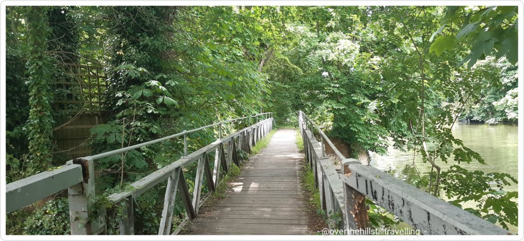
The brick path from the bridge to the river’s edge is lovely and quite decorative. The path from here onwards is also very rural with lots of beautiful green trees and rich undergrowth and I passed through many shady copses and open fields, as well as alongside cultivated gardens that ran right down to the riverside.
The paved pathway leading to the river and the Thames Path Onwards….Windsor, I’m on my way!!
Crossing a lovely arched bridge over a little inlet
You can now see Church Island on the right from a different angle – LOVE that house!
a minute later I plunged into a world of leafy green foliage and shade.
Blissful walking environment
This continued for a few minutes and lo and behold….the City of London Coal Tax post…at least I think it was! I did a bit of research and found this on wikipedia Coal–tax posts are boundary marker posts found in southern England. They were erected in the 1860s and form an irregular loop between 12 and 18 miles from London to mark the points where taxes on coal were due to the Corporation of London. There were originally around 280 posts of which around 210 remain. So yes, I do believe this was (possibly) the coal tax post…
Coal Tax post me thinks!
The path continued with the river in close proximity through leafy green glades, past islands, across bridges, past creeks and canal boats. Tall trees abounded and provided the most glorious shade as the gravel path wound it’s way; turning this way and that way (reminded me of the nursery rhyme that my grandson loves)
in order of progress along the path….the bridge before the bridge…the hum of traffic from the M25 was already quite loud
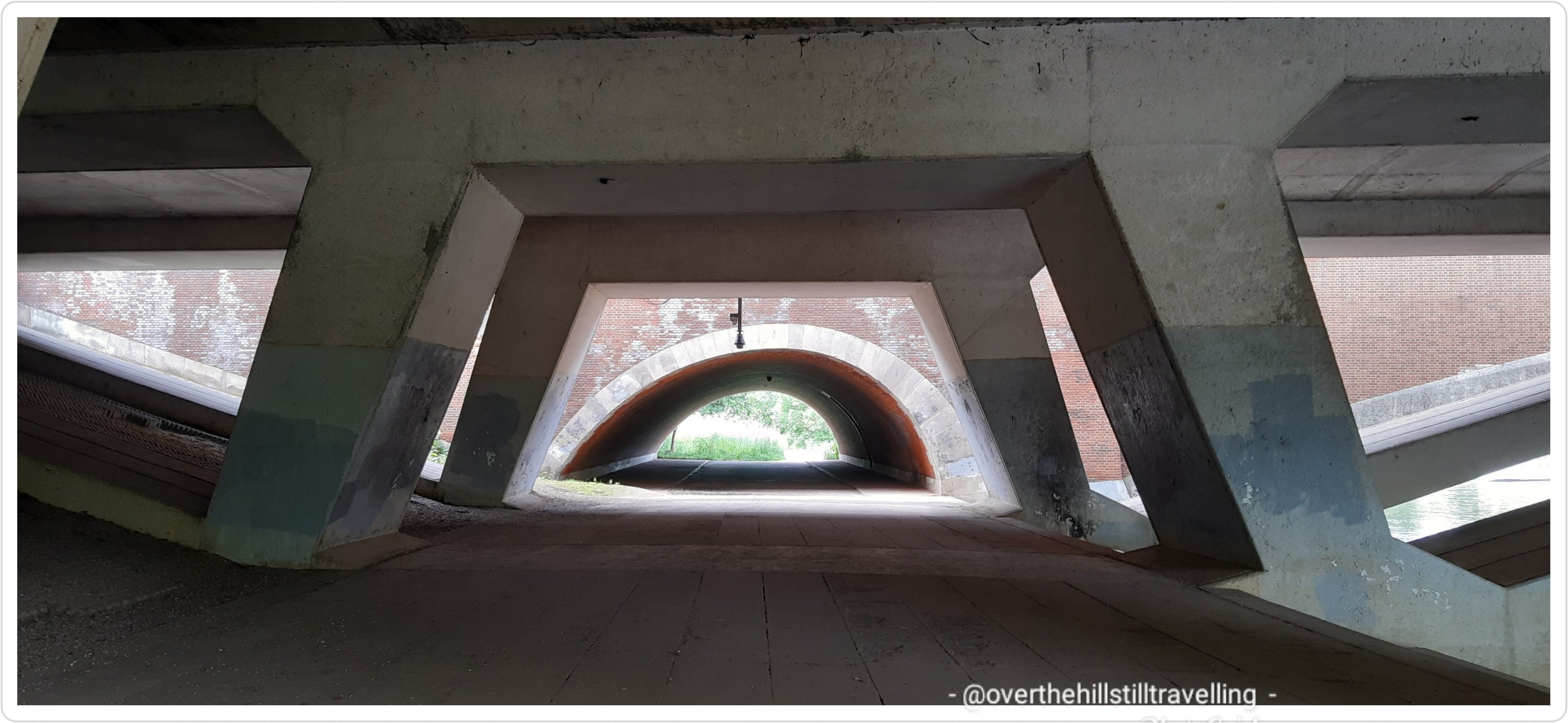
I soon reached and passed beneath Runneymede Bridge and the M25….the traffic noise was astounding and jarred on the senses. I did though enjoy the image presented by the architecture of the underpass.
I saw an information board that told me about a Bronze Age Settlement that has been discovered in 1975 during development of the M25 motorway. Fragments of pottery dating to 750BC were spotted by local archaeologists. Before the Runnymede Bridge excavations, little was known about late prehistoric South East England prior to the Iron Age. From the artefacts discovered, it is clear that the river played a fundamental role in the lives of our Bronze Age ancestors. Excavation has shown that the site includes a large number of post holes and a wattle and daub spread including a double row of in-situ pile driven timber uprights forming a river frontage. The finds recovered include part of a spearhead and socketed axe fragment, pins, ‘buttons’, rings, possible pommel, two pairs of tweezers, amber beads, spindle whorls, a loom weight and worked bone objects. This bronze assemblage was dated to the 9th-8th century BC.
now just a field of wild flowers…but haunted by the spirits of our ancestors
Absolutely fascinating! It gave me goosebumps to look out over the field of wild grasses and flowers and try to imagine the people who lived there so many centuries before. Magic
A short few paces on and I passed the first of the locks on this section; Bell Weir Lock – a pretty little island. The lock is named after its very first lock keeper, Charles Bell, who was employed by the Thames Navigation Commissioners in 1917. He earned a good wage of £4 per month, but for this he had to provide his own residence. He already owned a house close by, so he had no problems. Charles fought in the first World War but sadly, he didn’t return. His wife was believed to have taken over the job. Several years ago a rare bald eagle was sighted here. At the same time an Irish landowner had lost one and discovered it was the same bird! He travelled to Bell Weir, caught the bird and took it home to Ireland.
Bell Weir Lock
Imagine my delight when I spotted the fantastic Magna Carta mural on the wall of the Lockmaster’s house – brought back many wonderful memories of being a part of the Magna Carta flotilla from Datchet via Windsor to Runneymede meadows back in 2015! Again thanks to my very special friend Joe Lane who invited me along to join them on the Trinity Tide. A magical day and a great honour to be part of the celebrations. I was in a daze of delight the whole day!
Magna Carta
Prominent in my thoughts the whole day was how I was going to reach the Magna Carta Memorial – I could be forgiven for being confused when looking at the picture board!! It caused just a little bit (a lot) of stress…in fact I thought I had bypassed it altogether! but no….if I had but studied the board a little closer, I would have seen that the memorial was still to come and very accessible.
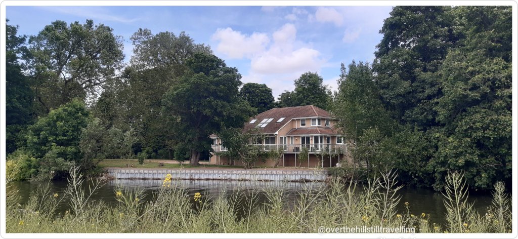
Across the river I spotted a really beautiful building, looked like a hotel really, and what appeared to be a weir with probably a pump house….but no matter how much searching I’ve done on google maps and the web, I am quite unable to find out what it is….intriguing and more than a little frustrating to not know what it is!.
what is this place?
As with the Stage 5, there are some stunning houses on very large properties along this section of the river. I saw one in particular that I just loved!
oh my word…how much I love this house
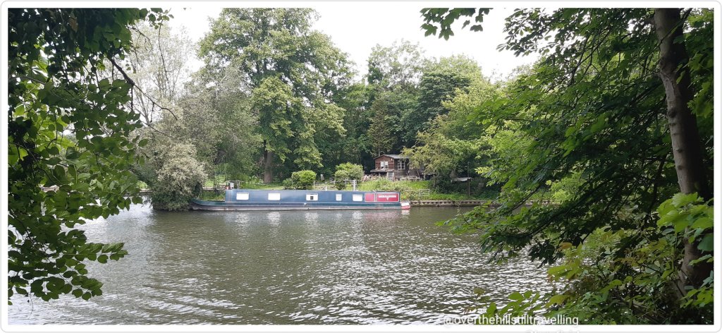
Near the Runnymede Boatyard I saw a number of quirky canal boats moored alongside the banks…absolutely gorgeous. Clearly they are more permanent residents if the gardens are anything to go by. They provided a stunning array of colours and designs. Apparently there is a mile of these boats along this stretch. Woww.
It looks so quaint and quirky, each boat completely different to the nexthow different a lifestyle this must be…away from the noise of civilization, but close to your neighbour!
Here the path changes again and runs alongside the river across from ‘The Island’ which according to google maps is not a complete island….there were however some gorgeous houses that fronted the river…wow. That side of the river is Wraysbury. It looks really lovely.
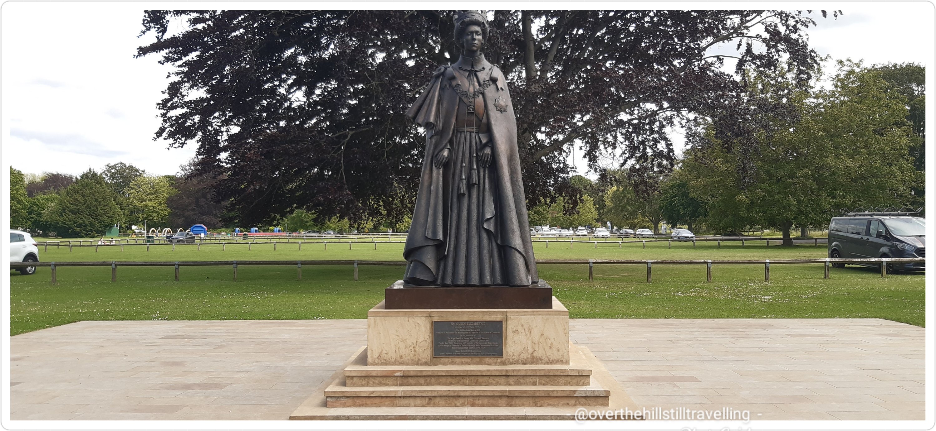
I soon reached the Runnymede Pleasure Grounds and rather than taking a shortcut across the field to the statue of Queen Elizabeth II, I followed the path as it rounded a rather large bend in the river. One thing for sure that I’m learning about this river; The Thames, is that it is anything but straight!!
Runnymead Pleasure Grounds
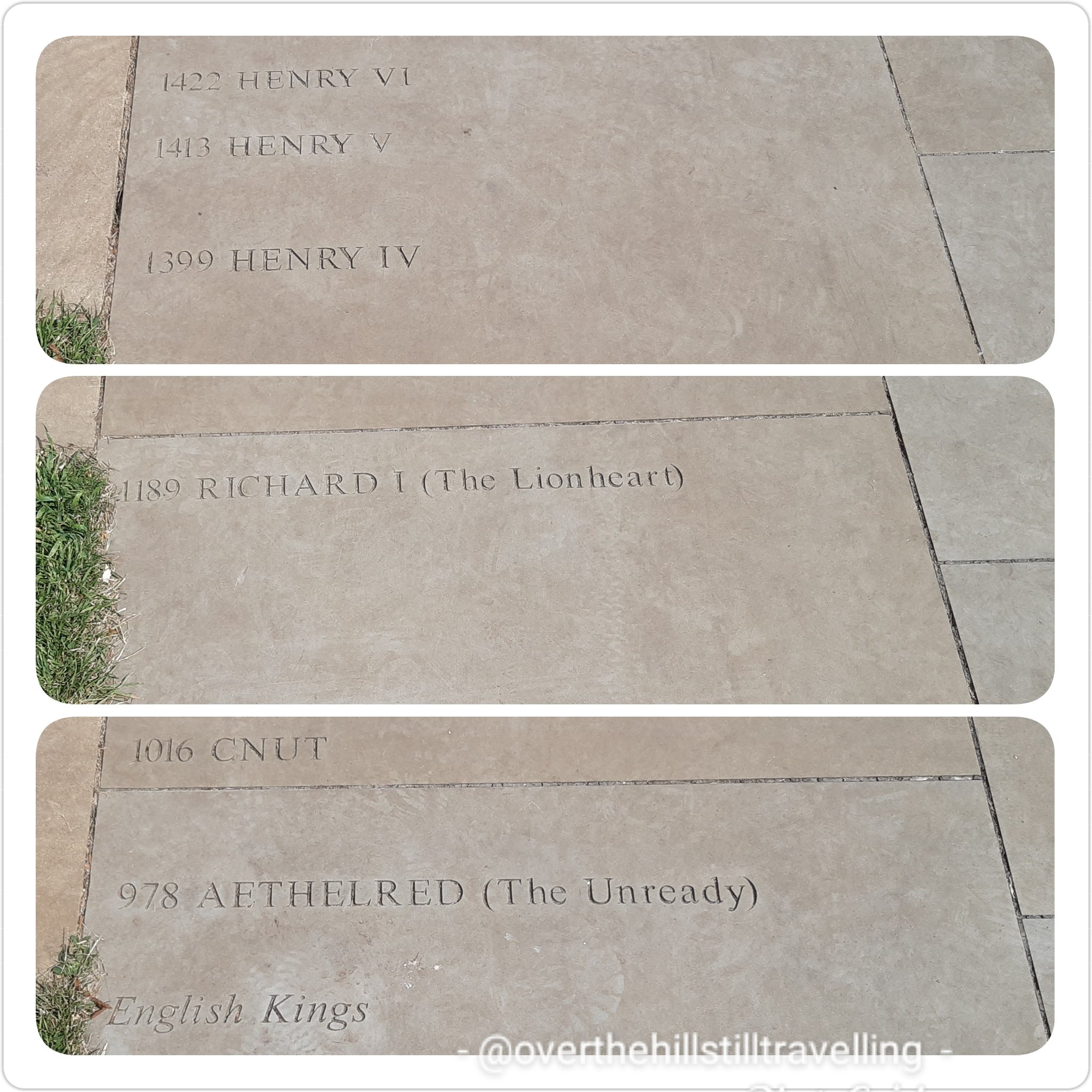
It is an incredibly beautiful stretch (kind of a horse-shoe shape) and by and by I reached the QEII statue. I loved the history timelines engraved on the flagstones and endeavoured to photograph them all…hah!
Looks more like Princess Anne than Queen Elizabeth IIthe dates freak me out LOL Magna Carta – meaning: Great Charter. I love how French sounds so exotic, but translated into English…so simple (boring LOL)
I’m not entirely sure that the essence of the Magna Carta is upheld today…
leaving Runnymead Pleasure Grounds behind me
Runnymede – I was getting closer to the memorial, but still for the life of me I could not see it. I didn’t dare use my google maps function on my phone coz it chews battery life, and even though I had a spare charger, I have a fear of losing battery power….so I just carried on and hope for the best. I needn’t have worried.
If you haven’t yet been to the Magna Carta Memorial and you happen to be walking the Thames Path, and wondering where the memorial is and how to get there…it is a lot easier than I thought.
I got really excited when I saw this sign!!
When the barons gathered here in 1215 to meet King John on Runnymede, they had to ford the river at Staines – the first bridge was built 7 years later. ref Cicerone guidebook.
Across the river I could see a small section of the Ankerwycke Abbey. But sadly not the Yew Tree…I’ll have to go back and approach from the other side of the river some other time.
the ruins of Ankerwyke Abbey
Meanwhile….I was getting closer to achieving my dream of visiting the Magna Carta Memorial….6 years is a long wait!
And finally, there it was. And so easy to get to LOL after all my stress of missing it.
Simply cross the road at the traffic lights by the National Trust buildings and a short walk across the fields and there it was
cross here 🙂follow this path
It was ever so worth the extra 2.5 km walk there and back. I met a delightful couple who were visiting the site, and we ended up chatting for well over 30 minutes while they asked questions, and I regaled them with snippets from my many journeys around the UK on the Camino. The lady of the couple said she was really keen to take up with long distance walking but didn’t want to go on her own….and I’m like “OMG that’s my ideal scenario!” She was already a member of Ramblers, but wanted to try something a little less crowded. She happened to say that one of the things with walking in a big group, is that you have to keep to their schedule…and that is exactly why I walk on my own. If I want to go off on a tangent to explore or spend an hour in a particular spot…then I am answerable to no-one.
Back to the memorial….it was everything I imagined and more. I got very emotional standing there and thought of my friend Joe (he has no idea just how very grateful I am that he invited me along, it was certainly one of the highlights of my life in the UK).
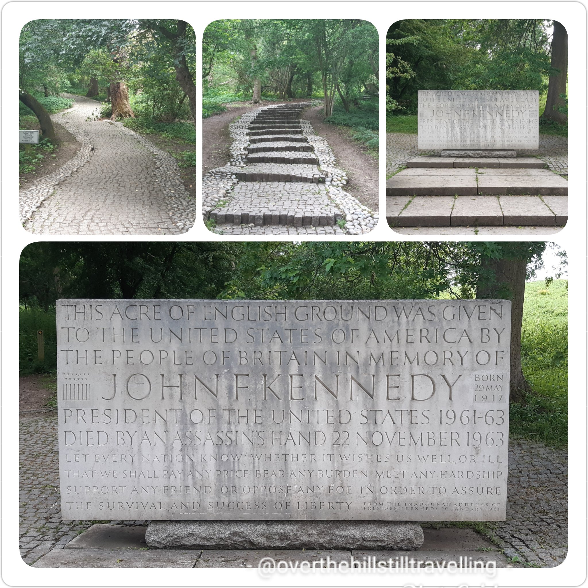
The Magna Carta Memorial – Symbol of Freedom Under Law
I took my time to read the information boards at the gate, walked around the memorial in a clockwise direction and mounted the steps to read the engravings. Absolutely thrilling.
enroute to the Magna Carta memorial is this amazing oak tree planted in 1987 with soil from Jamestown, Virginia
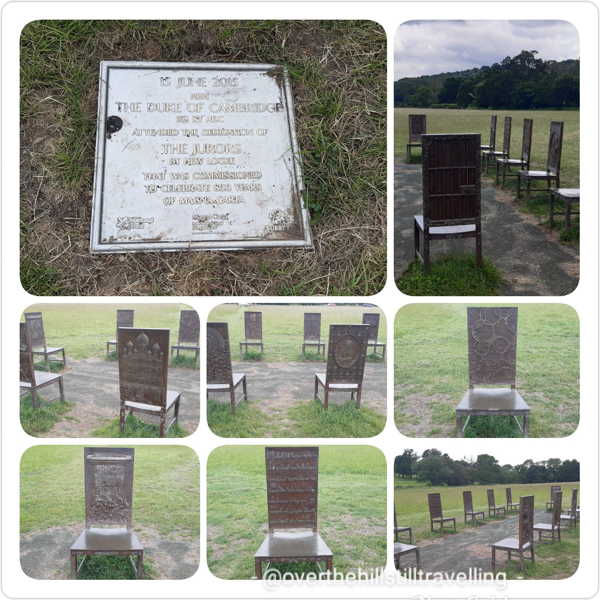
From there, and on the way back to the road I first stopped to admire the sculpture in the field; the 12 chairs depicting the barons at their meeting with King John…they are terrific
a lovely ensemble of decorative chairs representing the barons
And then I visited the J F Kennedy Memorial which is beautiful and worth the fairly steep climb.
a tiny piece of America in England
On my way back to the gates I noticed a lot of yellow ribbons tied to the branches of some trees, fluttering in the wind. Intrigued I walked over for a closer look, and as with the memorial on the Albert Embankment on Stage 2 through London, my heart contracted and I was close to tears. Each ribbon depicts someone who has died from Covid-19. Oh my gosh, so so sad…and really heart-wrenching to see the hundreds of ribbons each with a name and a date. I saw a ribbon lying on the ground all spattered with mud, so picked it up and dusted it off as best I could, then tied it back onto the branch. These memorials really bring home the reality of the staggering number of people who have died since March 2020.
incredibly poignant, and a real whack to the heart
Feeling pensive, and grateful for my health, I meandered over to the National Trust tearoom, only to find them locking the door!! LOL my luck., I should have stopped there first…but then I will have missed that lovely couple I chatted to earlier. Cést la vie. I used the facilities instead and hope I could find some water somewhere…it was another hot day and I had already used up all my supplies.
Back at the river, at the boatyard, as I walked past two gentlemen sat on the riverside, I asked if they knew where I could top up my water…what a gentleman….he gave me a bottle of water 🙂 I could have kissed him…but then he might have turned into a frog! I was delighted to spot a wee bunny in a field to my left…I had to backtrack to get a photo to show my grandson, and amazed that the bunny actually stayed put and allowed me to snap away… I thought for sure it would bound off into the undergrowth at my approach. But the fence…
the rabbit, the boat and the willow tree – a story in there somwhere?
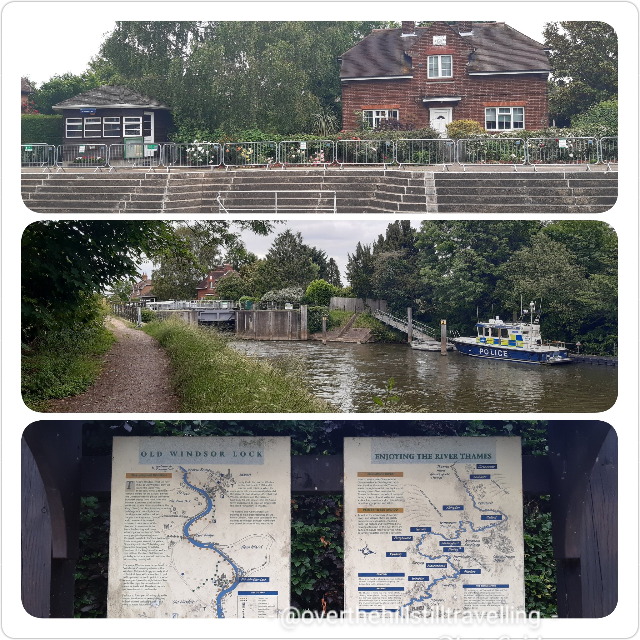
Boom! Suddenly I was in Old Windsor. whoo hoo!! time 16:47 and I had been walking and exploring for nearly 4 hours. I had wanted to visit the old church mentioned in the guide book, but frankly I was quite tired by then, so decided to leave it for another time.
Old Windsor
The first Windsor, what we now know as old Windsor, grew up just to the south west of this lock. It was a fortified, national centre for the Saxons. Edward the Confessor had his palace only 3oo meters from here. After the Norman Conquest, King William continued to use Kingsbury, its church and surrounding buildings as a council place and hunting centre. The name Windsor may derive from ‘windles ora’ meaning a bank with a windlass.
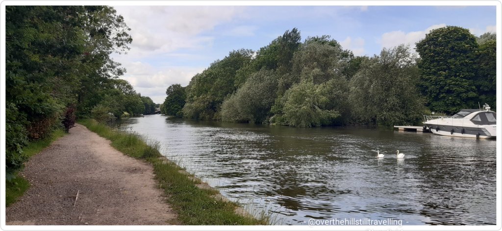
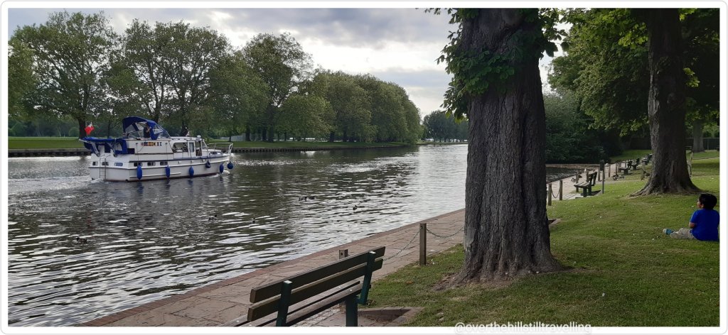
The path ran right alongside the river here and there were some splendid boats moored up on the opposite bank of the river.
Dark gloomy clouds hung heavy on the horizon and I hoped that I wasn’t going to be subjected to a shower (not yet anyway).
I’ve said this before….and it’s worth repeating, the Thames Path is varied!!
Check this cute little canalboat…in the background on the opposite bank is a capsized boat. Poor old thing. I saw quite a few dilapidated and abandoned boats alongside the river bank. I often wonder why they have just been left there to rot.
Up and down, around and switchback, the path is a bit like a rollercoaster, and took me through some beautiful green areas.
Suddenly I reached Old Windsor Lock…getting closer to ‘new’ Windsor!!
Old Windsor Lock – look at the diagram of the river LOL twisting and winding
Continuing on my way I passed what I mistakenly thought was the Albert Bridge – it was in fact Ham Lane leading to Ham Island, which on closer inspection via google maps appears to have been created by another cut-through to avoid a large bend in the river… another section to try and walk at some stage then! Apparently I was walking in an area called Saint George’s Farm – okayyy, cool!
I walked over to the middle of the bridge to capture the scene upstream and downstream – looks the same either way.
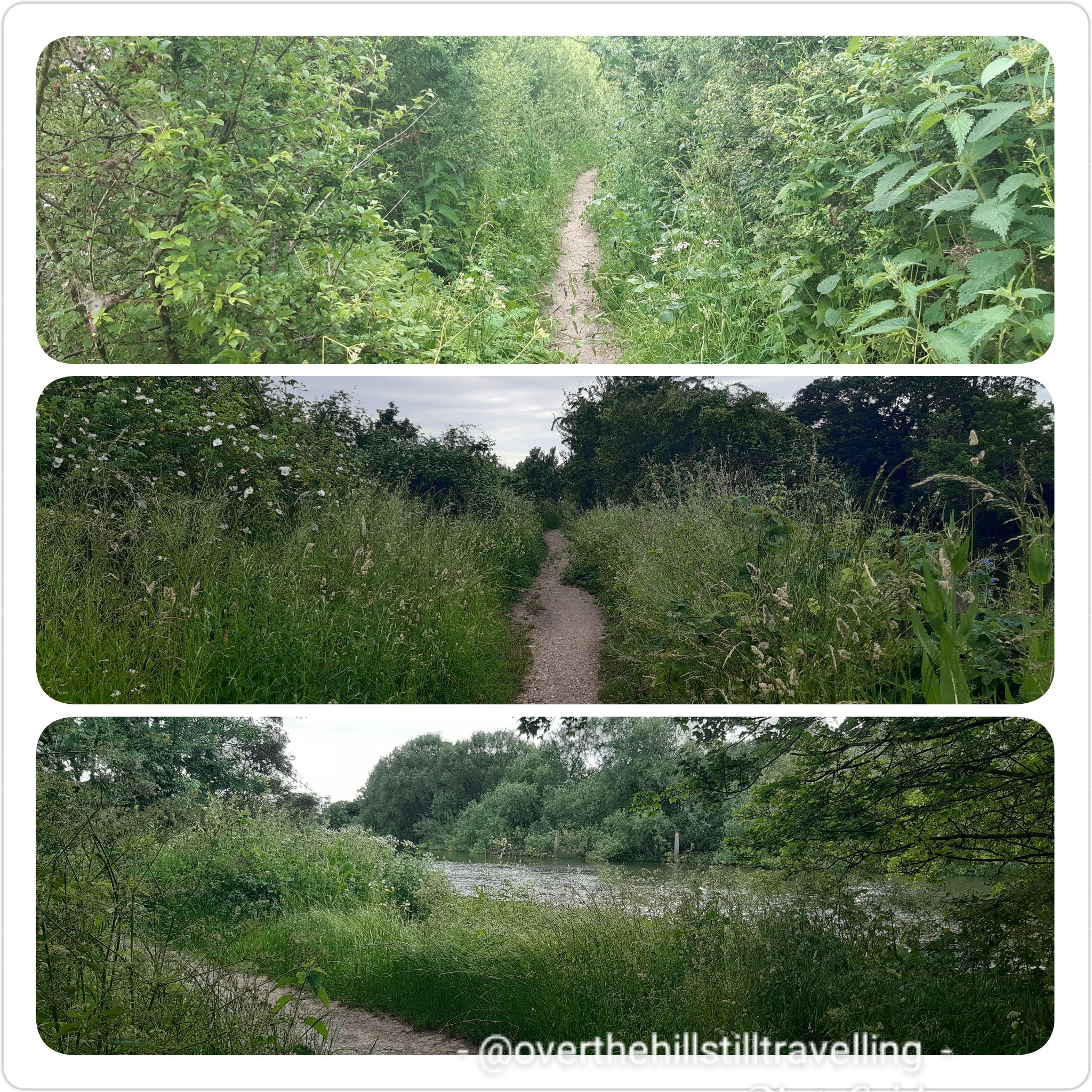
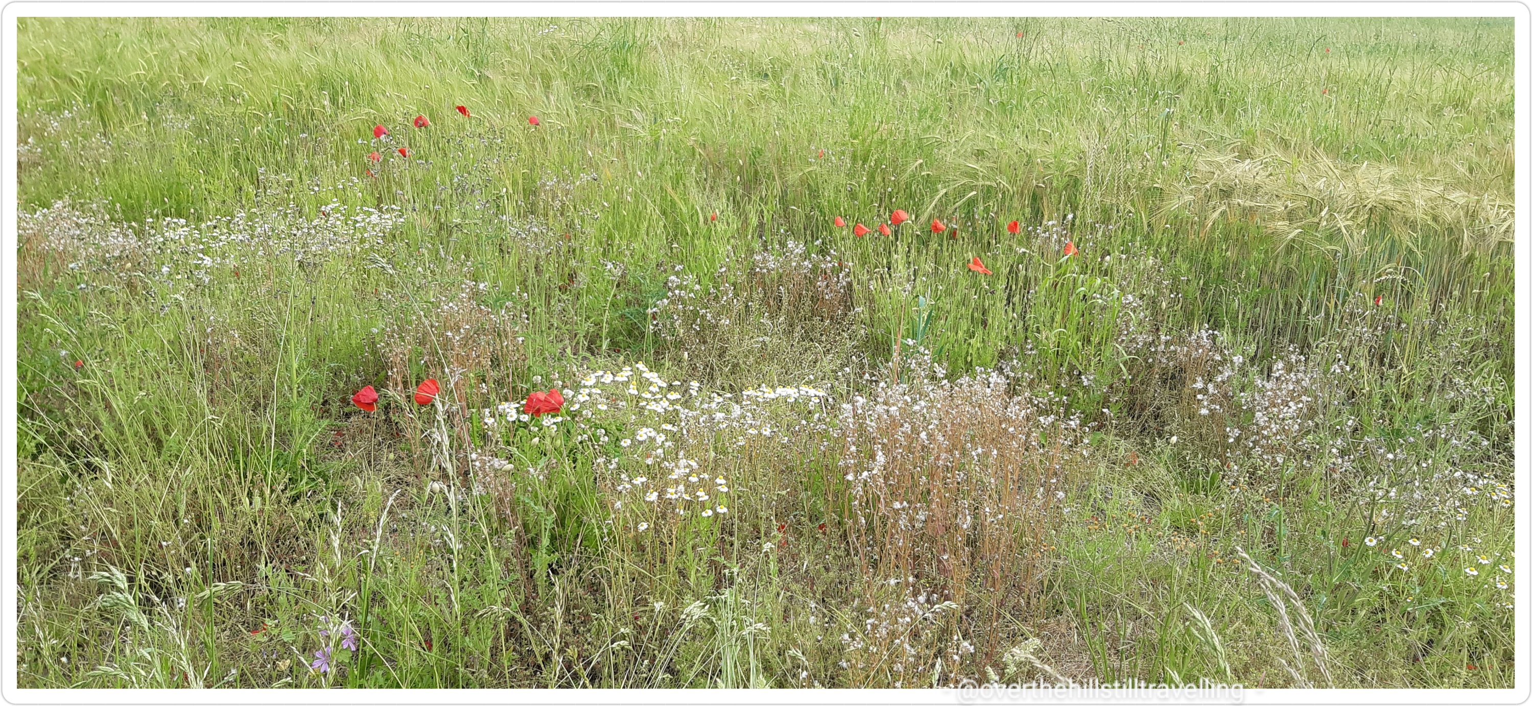
This section of the path wound it’s way through shoulder height grasses and wild flowers – a home for the bees and butterflies. Magical.
I was just about to sit down at this bench when a little black and white spaniel came bounding out of the underbrush trailing all manner of greenery and nearly gave me heart-failure LOL It bounded off along the path and joined an elderly gentleman I had seen walking ahead of me – one of very few people I encountered on the path.
I spent a few minutes at the bench relaxing, enjoying some welcome tea and sandwich and soaking up the tranquillity…birdsong the only sounds.
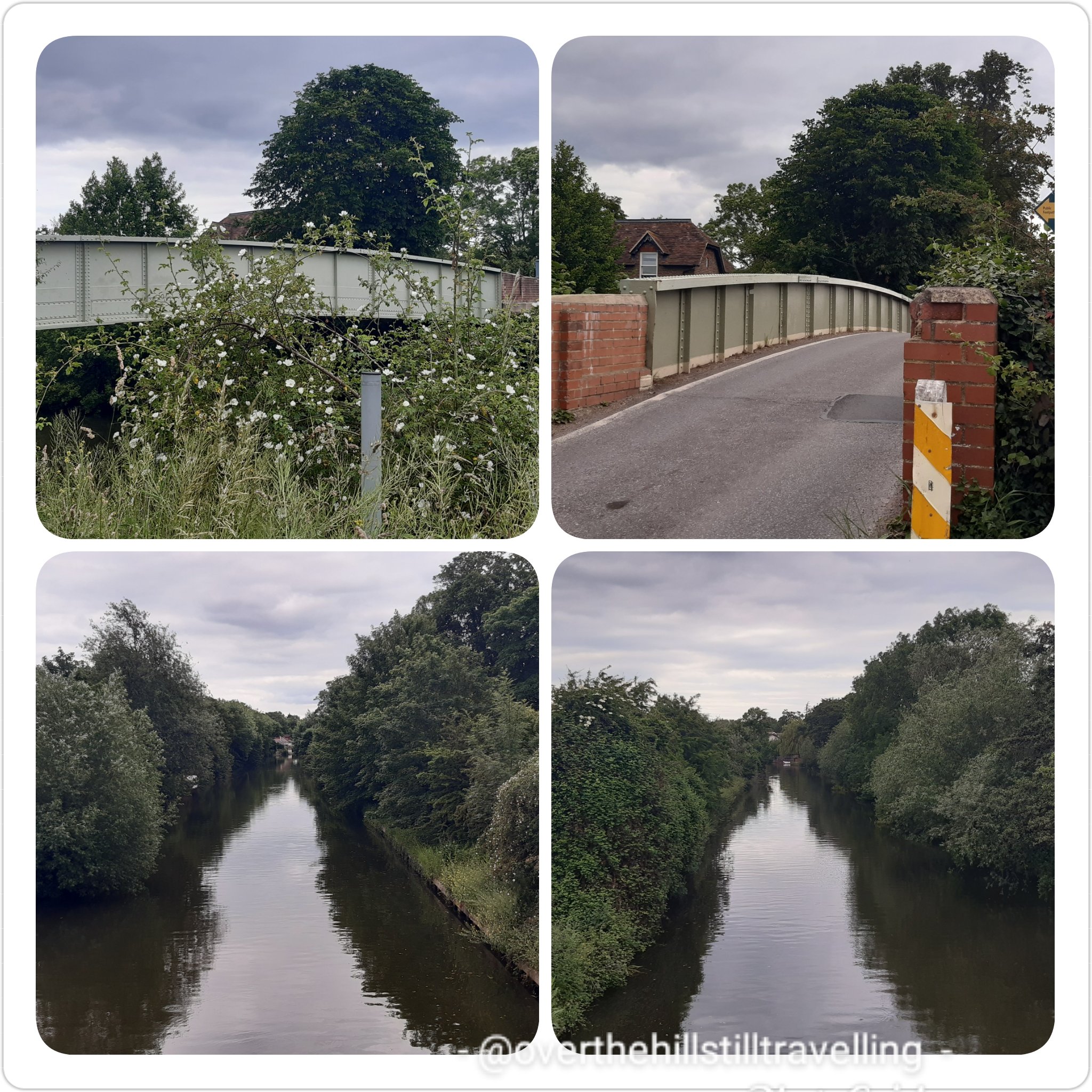
Albert Bridge. Here I had to cross over to the north bank once again because her Maj owns the next section all the way into town…so there! Prince Albert’s Walk m’dear!
I stopped at the top of the bridge to photograph the river, it’s so beautiful and looks so tranquil. Just around that bend, and another larger loop in the river, but not too far upstream is Windsor Castle and my bed for the night. Hoorah!
Around that bend…and the next 😉
Down and around and under the bridge I was now on the north side of the river. The bridge design is really pretty.
Albert Bridge
After crossing beneath the bridge the path meandered along past overgrown edges, a veritable plethora of plants. Over the fence a farmers field edged with a corridor of wild flowers for birds, bees and butterflies and all our wonderful wildlife that need this kind of habitat to thrive. Poppies waved their bright red heads, a stunning palette against the multi-colours of green.
In the distance I could see the red tiled roof of the farmhouse of Southlea Farm (Slough) … I’m nearing Datchet now.
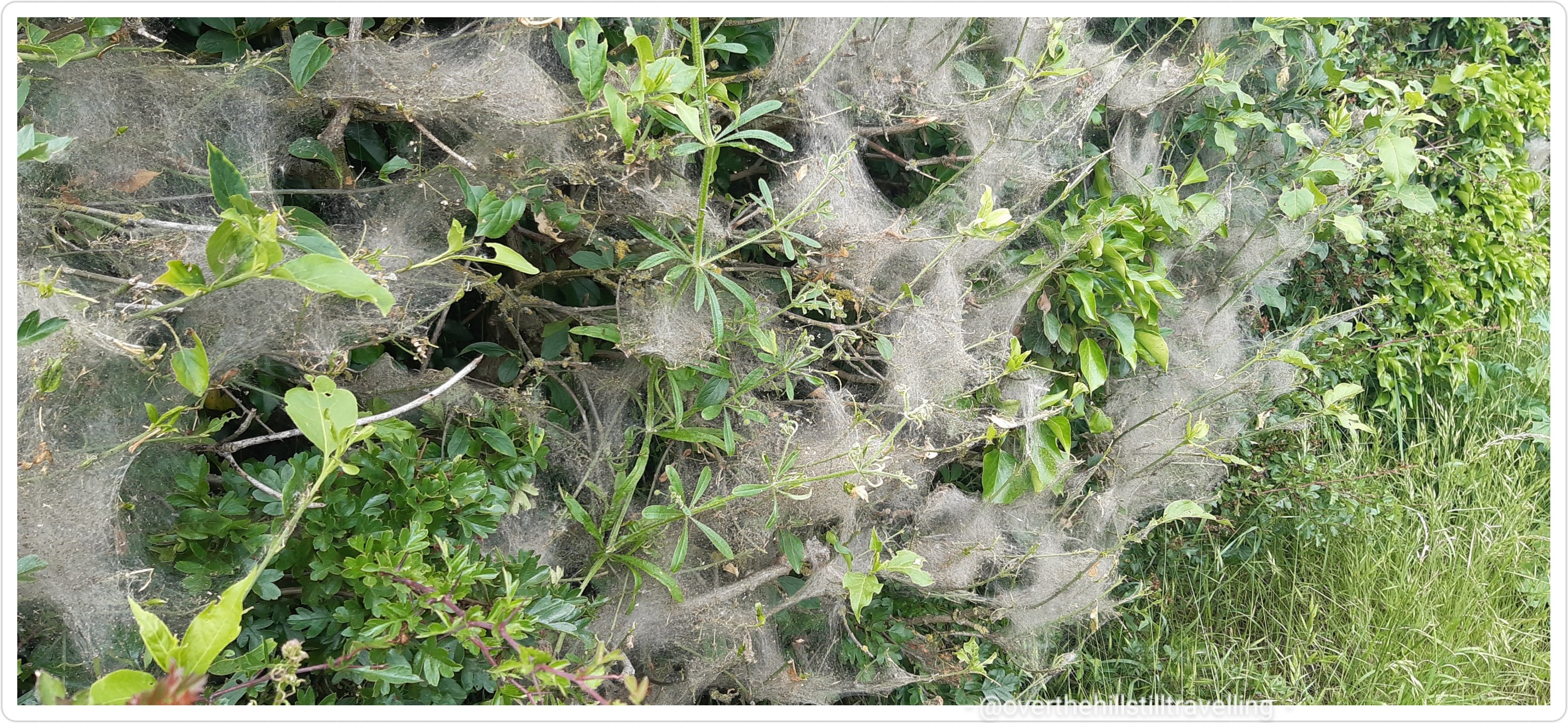
On my left a thick line of shrubs covered in spider webs…a bit like a dusty cloak. I’ve always been intrigued by these webs so did a bit of research…as it turns out, it’s caterpillars that build these webs. Who knew 🤔🤔
Soon the path turned away from the river, although along this short section I couldn’t really see the river anyway the undergrowth and overgrowth was so thick…but I knew it was there. Just before the B3021, the path took a sharp left (do not go through the gate said the guidebook, but turn left) and so I walked into Datchet.
It was horrible, lots of traffic, a very narrow pathway, overgrown hedges almost pushing you to step onto the roadway.
I ended up skirting a very very narrow verge since I hadn’t been able to cross the road. The guidebook didn’t say anything about crossing over so I carried on assuming the sidewalk would continue….it didn’t. Fortunately no big trucks came past and I managed to reach safety without mishap.
looking back – not fun to walk on what turned out to be the wrong side of the road…but I got through
A brief excursion onto The Green, which was not on the official Thames Path, but it looked pretty and offered brief respite from the traffic.
From there I did cross over the road, only to have to cross back over again not much further on. The guidebook could be updated here with more information. As it is, I just navigated by my nose until I spotted a direction marker pointing me in the right direction.
check out that traffic….I had to squeeze my way across
Along a short path, across a wee bridge alongside the Dachet Golf Club and once again I was plunged into a world of green, the traffic now barely a whisper.
Across the river, now visible again, I could see her Maj’s secret hideaway LOL
Do you think Her Majesty hides away here sometimes?
Anddd another flight of stairs..this time onto Victoria Bridge, and once again I returned to the south bank of the Thames. Looking back downstream from the top of the bridge the difference in vegetation between the two sides of the river is quite remarkable. On the left: an overgrown jungle of trees, shrubbery, flowers and grasses, and to my right her Maj’s perfectly manicured lawns, the trees marching in an orderly row evenly paced as they disappear around the bend. Someone needs to tell herself that we need wildlife corridors for the birds and the bees!
Her Majesty’s Lawns vs Nature
Hoorah!!! My first glimpse of Windsor Castle! From Victoria Bridge
I followed the directions in the guide book, although it wasn’t really necessary…but
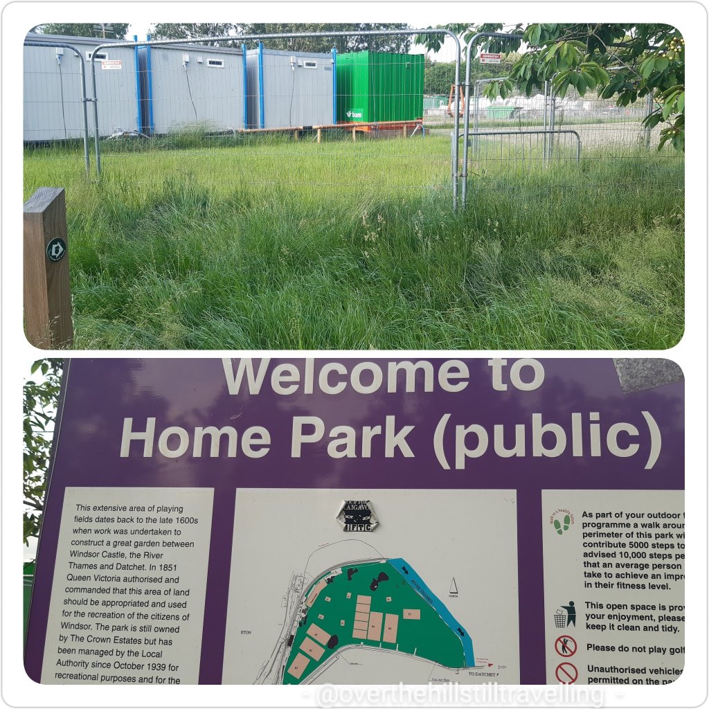
Then things took a turn for the worse…actually not really, it just felt like that at the time. By this time I was tired and footsore, desperate for a cup of tea and in no mood to be redirected around construction sites. How inconsiderate of them to go and put up fencing and stuff.. LOL grumpy granny was out her box!!
Home Park….and here I had to force my way through a jungle of overgrowth my panga swiping left and right to forge a way through….LOL sorry my mind went off on a tangent there. As you may well imagine, my vocabulary once again took a turn for the worse…if I were a witch, workmen would be dropping around me like flies! Turns out they’re repairing Black Potts Ait bridge.. or something like that.
Diversion is the spice (chilli 🌶) of life
Once past the fencing I made my way diagonally across Home Park to the river and met up with the Thames Path once again. Very pretty along this section…so much green and so tranquil.
I walked beneath the railway line just as a train rumbled past. So glad I don’t have to rush to catch a train home tonight!
still going in the right direction!
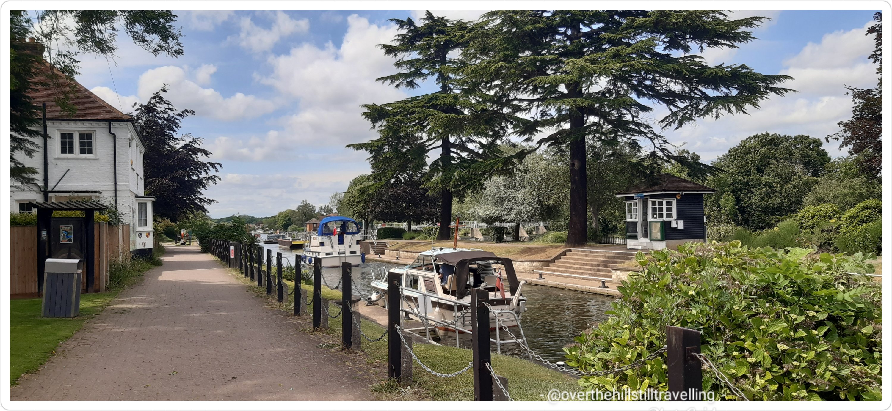
I passed Romney Lock, but from the state of it I’d say it’s not in much use anymore.
Romney Lock
A metalled road soon took over from the lovely gravel pathway and hey ho, back in the urban jungle once again.
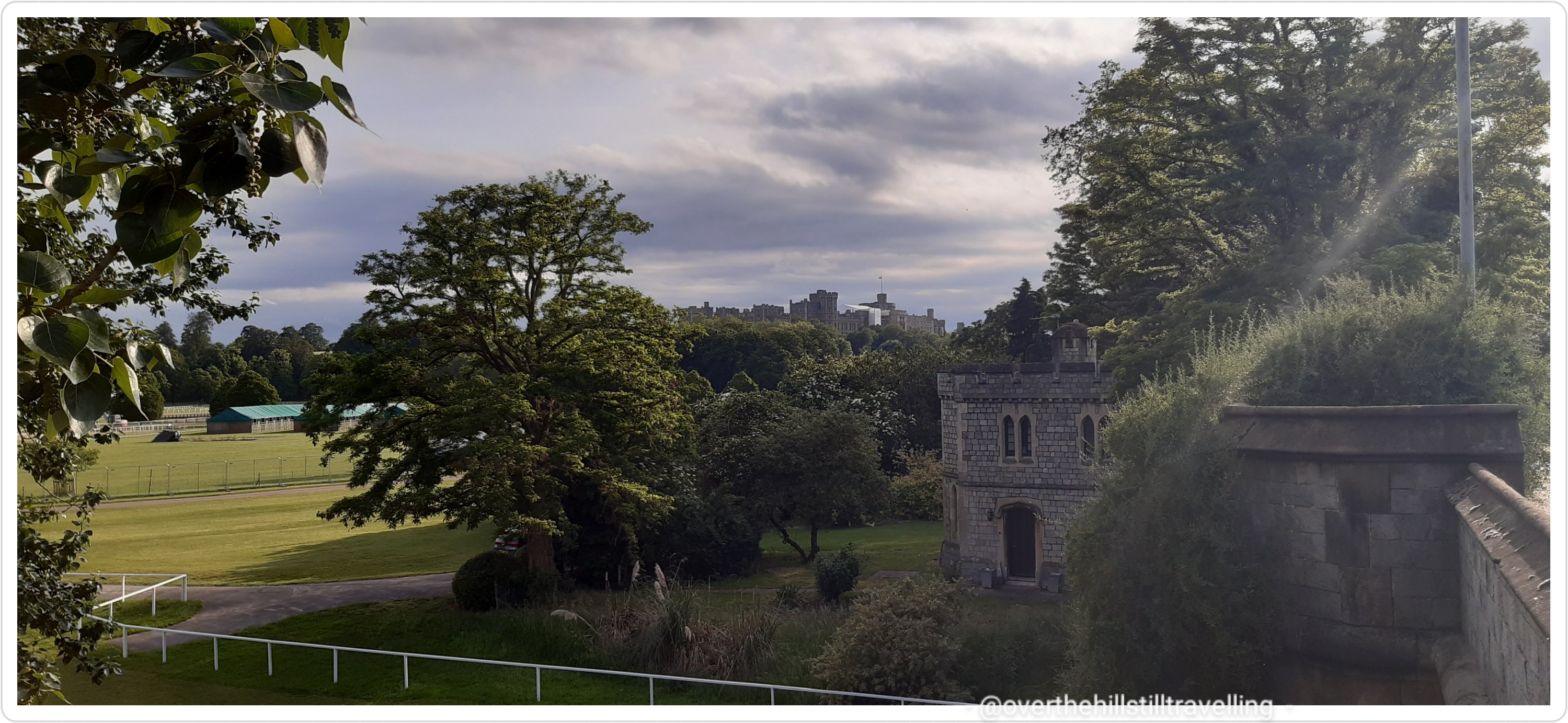
And there just ahead of me!!!! Wheyyy heyy heyyy my next sighting of Windsor Castle!! Hoorah.
Relax Lizzie, I’m almost there, put the kettle on sweetie 🙂 So exciting to finally see the towers of the castle. But first I had to traverse this metalled road and pass some ugly industrial sites/sights!!
The path suddenly veered away to the right and thankfully I was once again surrounded by green with a small canal to my right. After looking at google maps I can see that it’s a small cut-away from the main river that splits around Romney Lock.
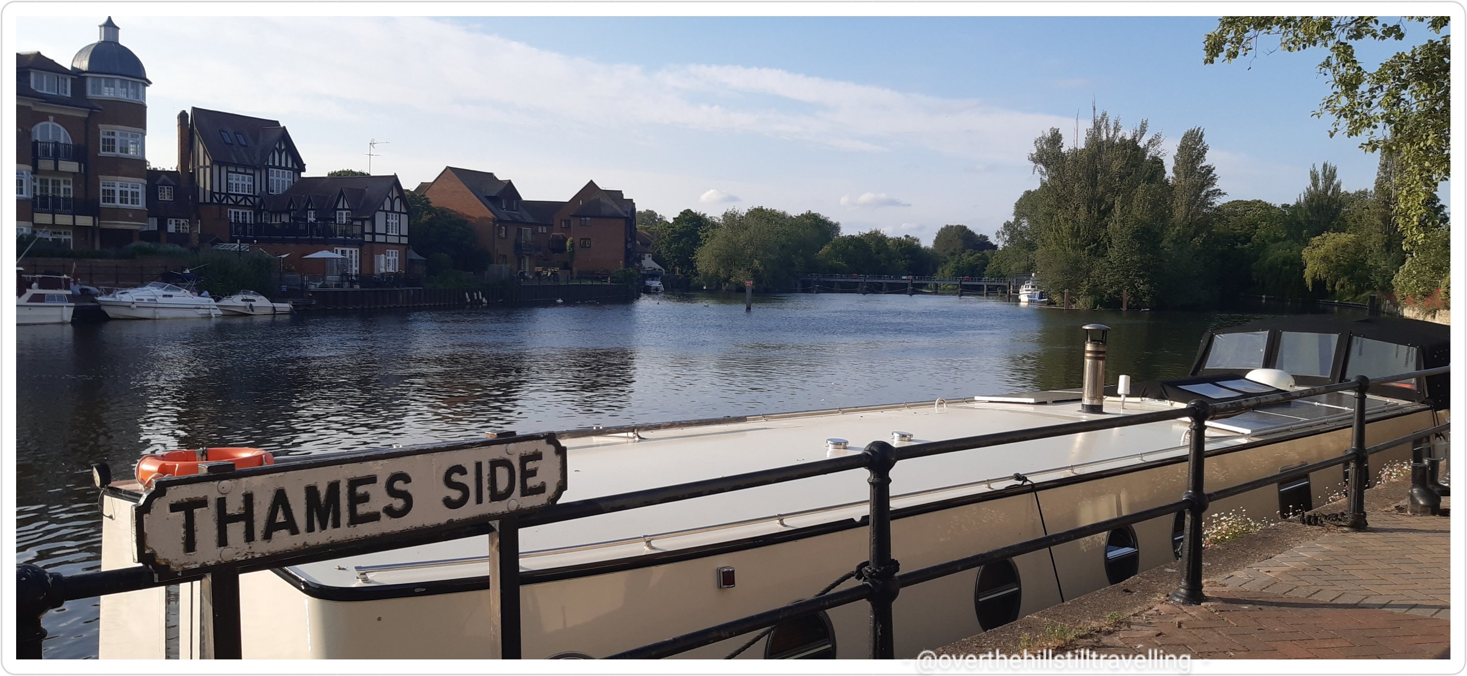
Walking alongside the Thames (Thameside) I could see Windsor Bridge in the distance…not long to go now!
Windsor Bridge in the distanceStopping to look back from whence I had come…the railway bridge in the distance
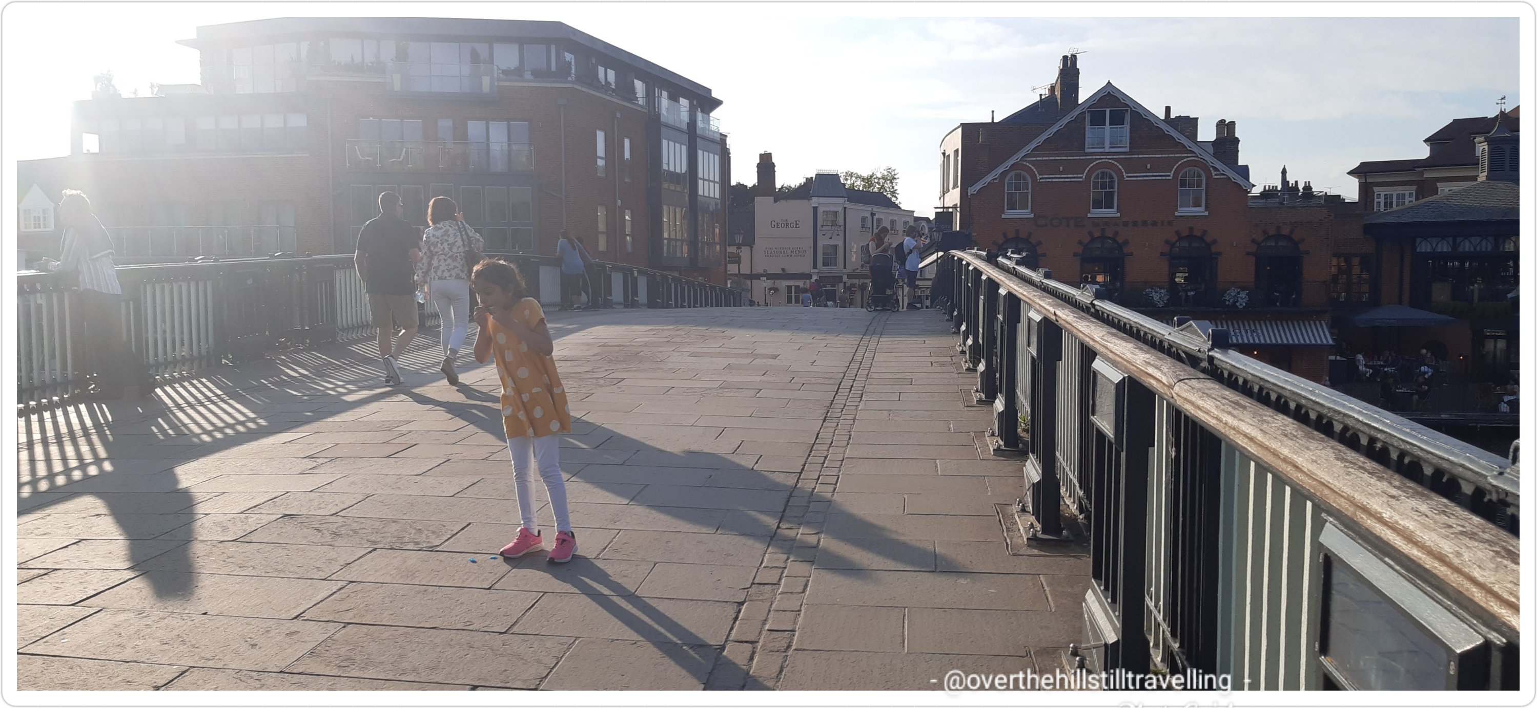
Lookie lookie!!!! What can I see? Without further ado, I was there…in Windsor. Glimpses of the castle as I walked towards the bridge
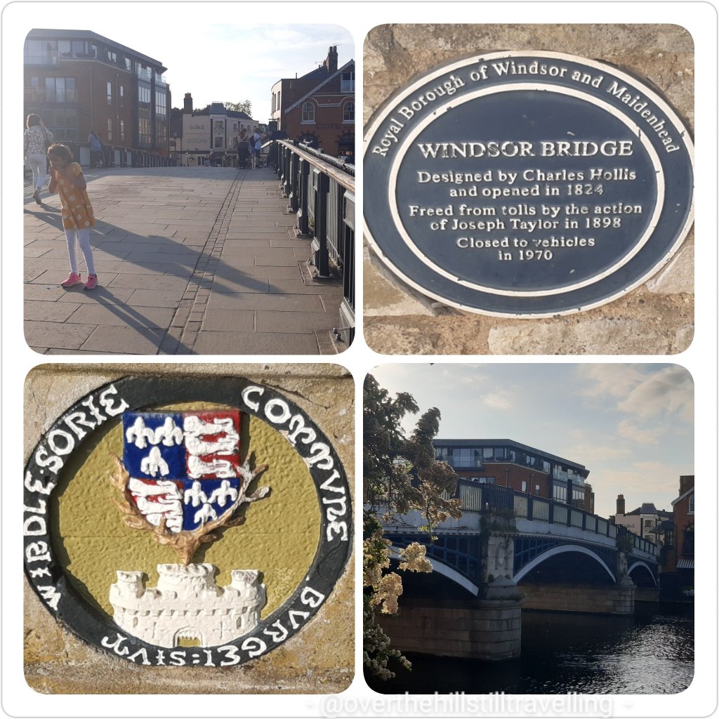
Knock knock! I’m here…..journey’s end! Hoorah. Windsor Bridge: designed by Charles Hollis and opened in 1824. Freed from tolls by the action of Joseph Taylor in 1898. Closed to vehicles in 1970. How sensible.
Windsor Bridge
Just across the bridge is Eton where our bonnie Princes William and Harry attended college. I mean why not? Granny’s pad was just up the road…makes sense really.
Looking towards Eton
I passed this really gorgeous old building on my way in…
Bell and The Dragon – serving food since the 11th century
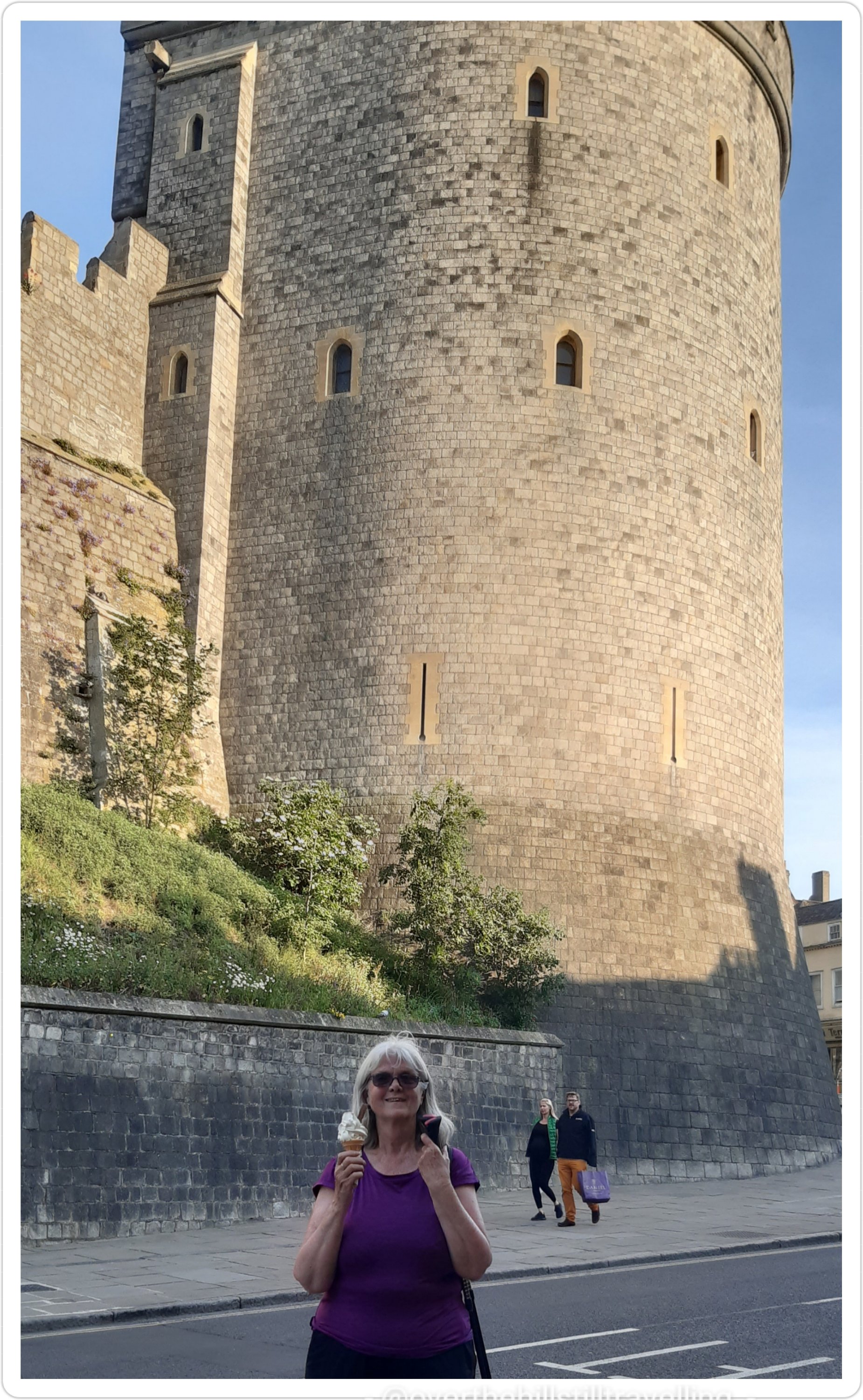
And still light enough to have a bit of an explore and and ice-cream – come on! you knew there would be an ice-cream at the end of this! Actually, I asked a chap walking by if he would please take a photo of me with my ice-cream, in front of the castle… as you know, my selfies are not that good. But I’m not quite sure he got the idea of a good photo…and much of the pavement, my feet and legs are in the pic, but not much of the top of the castle. Oh well. I did a selfie anyway…rubbish as always. I might concede defeat and get one of those gadgets that allows you to take selfies when you have short arms. Oh wait! I have one. My daughter bought it for me. I hate it! LOL
if I look like I’m grimacing, it’s because I was – come on already, just take the photo!!
Windsor Castle. As castles go, this one is superb! Talk about intimidating! But it’s also beautiful and I love it! A quick few pics and then it was time to find my Airbnb.
Windsor Castle : Windsor Castle is the oldest and largest occupied castle in the world. Founded by William the Conqueror in the 11th century, it has since been the home of 39 monarchs. Today The Queen spends most of her private weekends at the Castle. In fact she was home this weekend for her Official Birthday Parade and to meet President Joe Biden and Dr Jill Biden.
I had messaged my host ahead to say that I would be there about 7pm, as it turns out I got there just on 8pm! Usually when I get to a ‘new’ place I always check in and then go out and explore…but not tonight! My fabulous host made me a much appreciated cup of tea and I had my cup-a-soup and a slice of bread. Then sat in her garden for 30 minutes or so just to unwind, after which I bade them goodnight, had a shower and fell into bed….absolutely knackered!
Another fantastic day! Gosh I do love walking. Even though my feet ache and I feel like I’ve been run over by a truck by day’s end, I love to discover new places, sights and scenes. Once again I had it all; fantastic weather, wonderful scenery – albeit very different to stage 5, pretty bridges, a few locks, and a historic and world-famous castle at the end of the day…and an ice-cream. I am just a bit put-out though…Lizzie forgot I was coming and made other arrangements. So rude!
What a wonderful day!!
May I add as a caveat to what I said about walking on my own…the only exceptions I’m prepared to make are walking with two of my younger sisters who are both seasoned long-distance walkers/cyclists/hikers and understand the dynamics.
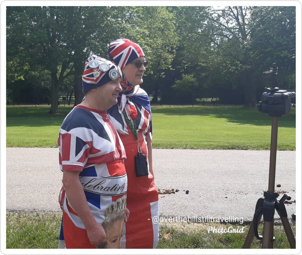
After walking Stage 6 of the Thames Path on Friday I stayed overnight in Windsor to watch the Queen’s Birthday Parade on Saturday morning.
Arriving in Windsor…time for an ice-cream 😁
Albeit a muted affair in comparison to the usual London events, it was still very exciting to see the Queen’s Horse Guards, the Blues and Royals and of course my favourite; the King’s Troop Royal Artillery.
Horse Guards King’s Troop, Royal Horse Artillery
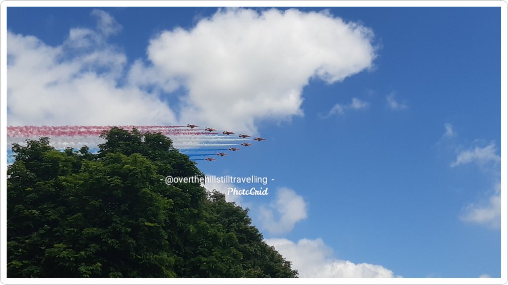
A massive bonus was the Red Arrows flypast – as always just thrilling and wowwed the crowds. It’s so endearing how there’s a collective scream of excitement and much cheering as they approach and clapping after the planes have flown over.
The Red Arrows – always a favourite at these events
I had decided to walk back into town via The Long Walk and find a good vantage point to watch.
It was just luck that I was on the Long Walk. When I got there I saw all the police lined up along the route and after chatting to one of them I discovered that the troops were not going through the town as I thought, but along the Long Walk…so I stayed. Major awesome.
I also got interviewed by LBC but not sure if they used the footage…however these 2 were pure gold!! So serious, so patriotic and very very clearly absolute Monarchists. Loved The Queen, they even sang happy birthday….😄😄😄❤
God Save The Queen 👸❤
After all the excitement, I went searching for a 3G store to have them charge my phone before I set off to Maidenhead on Stage 7….and not only did I have my phone charged (the battery on the Samsung A40 has always been pathetic, but I ended up with a new contract; Samsung Galaxy A52 and a tablet with dock and Alexa built in 😂😂😂
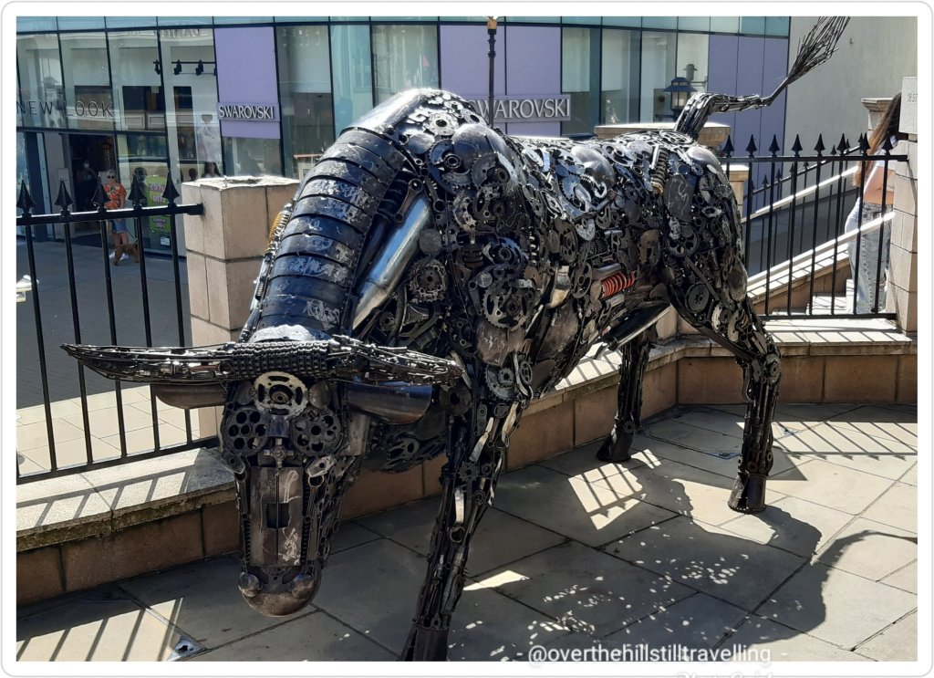
Did I really need this?? 🤪🤪 the tablet will make a huge difference to my life – as soon as I figure out how it works 😁😁The lopsided house – used to be a tea-room A quirky bullAll The Queen’s Swans
I had a brilliant visit, chatting about conspiracy theories, the Pyramids and secret societies…the staff 3 Store at Windsor are just amazing and really friendly. Meanwhile they transferred all my data to the new phone, but I left so late that I missed my connection at Maidenhead and only got home at 22:45 🙄🙄😴😴
A long but brilliant day. The mileage for these two stages will ho towards The Cabot Trail virtual challenge…looking forward to the next postcard. Meanwhile the last postcard was gorgeous
Today I’m in Deal with my grandson 💙 (who is currently fast asleep in his pram) to visit Deal and Walmer Castles, both of which are open today…hoorah.
It’s a gorgeous day in Kent, I hope it’s good wherever you are. Enjoy your day.
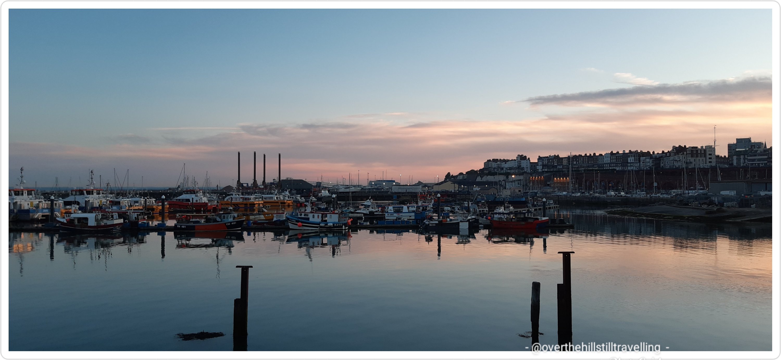
LOL I couldn’t resist the title. Inspired by my walk the night before, last night (Monday) I decided to make the most of the glorious summer evening weather we’re having at the moment and walk to Dumpton Gap and back.
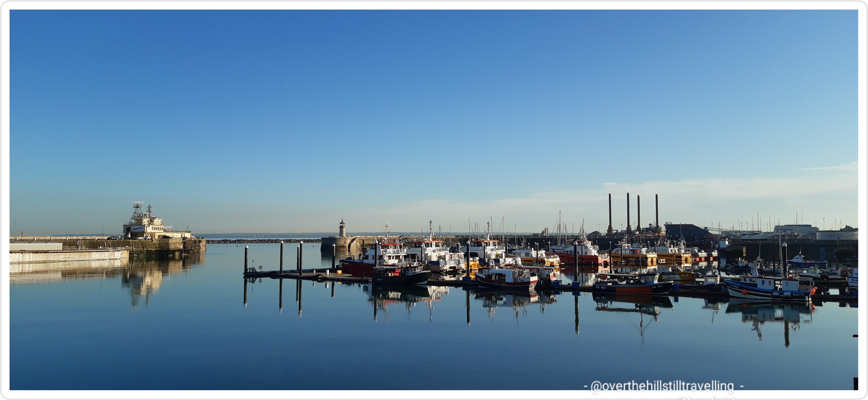
The harbour looked absolutely stunning, the water like a mill pond with the boats reflected in the still water.
Ramsgate Royal Harbourlike a mill pond
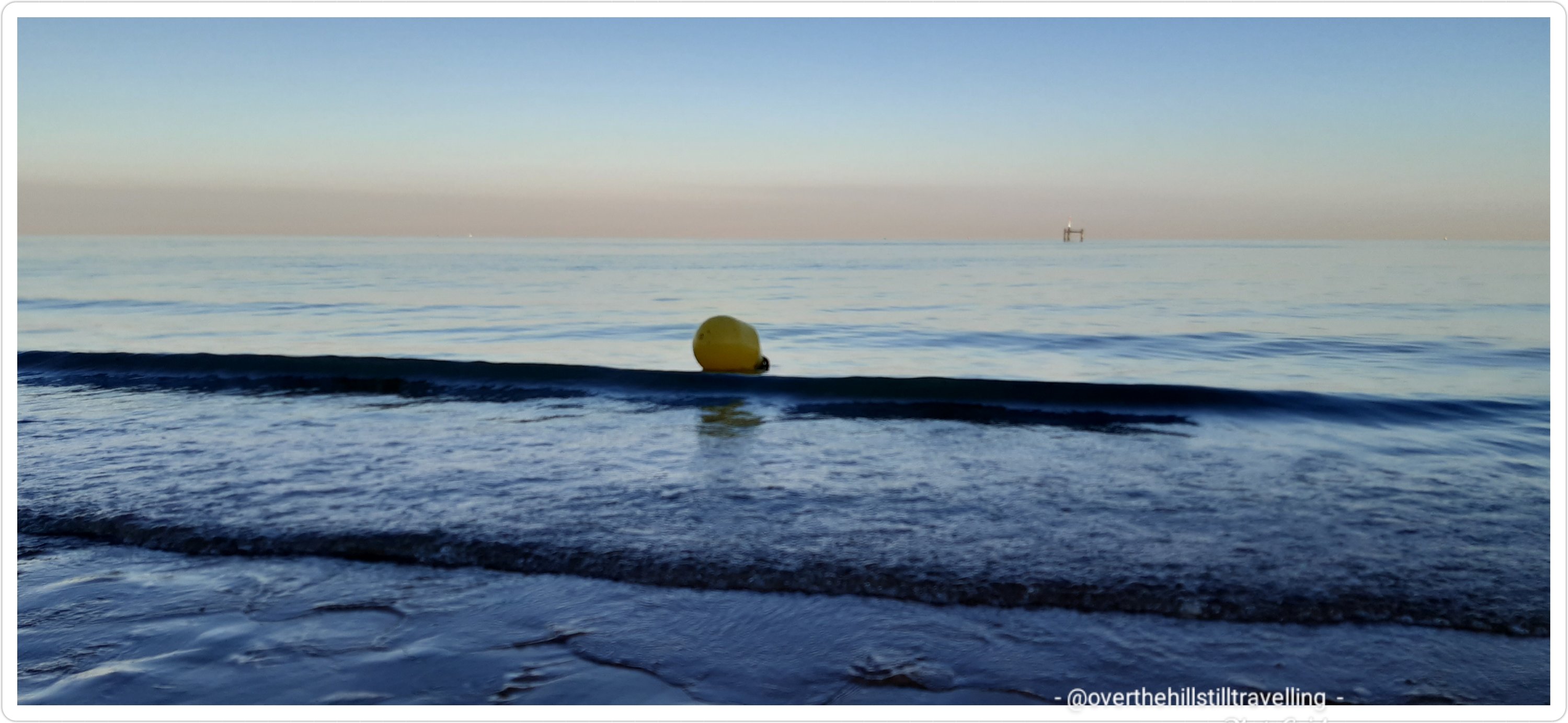
There were few people on the beach which was surprising considering the weather, but hey…I’m not complaining. I love it when the sea is so still. When it’s like this I’m almost tempted to go out swimming…but looks are deceiving.
the endless sea
We are located on what is known as the Isle of Thanet. Harking back to a time approximately 500 years ago when we were in fact still an island, separated from the mainland by the River Wantsum.
The Isle is formed almost wholly of chalk, a soft pure white limestone of Cretaceous age, specifically the Margate Chalk Member (Santonian to Campanian) traditionally referred to simply as the ‘Margate Chalk’, and sometimes as the ‘Margate Member’. The Isle of Thanet first came into being when sea levels rose after the last glacial period, around 5000 BC. The North Sea encroached on the land which is now the estuary of the River Thames, and southwards to reach the higher land of the North Downs, leaving behind an island composed of chalk in its wake. Eventually the sea broke through river valleys in the North Downs to the south (Middle Chalk) and finally today’s English Channel was opened up. Archaeological evidence shows that the area now known as the Isle of Thanet was one of the major areas of Stone Age settlement. A large hoard of Bronze Age implements has been found at Minster-in-Thanet; and several Iron Age settlements have also come to light.
Right along our coastline, whole swathes of the island face the North Sea, and like Dover we have our own white cliffs. Every time I walk past these cliffs between here and Margate, I marvel at how they were made…..millions and millions of marine life over aeons of time have built up into what we can see today. Most of the fossil debris in chalk consists of the microscopic plates, which are called coccoliths, of microscopic green algae known as coccolithophores. In addition to the coccoliths, the fossil debris includes a variable, but minor, percentage of the fragments of foraminifera, ostracods and mollusks. The coccolithophores lived in the upper part of the water column. When they died, the microscopic calcium carbonate plates, which formed their shells settled downward through the ocean water and accumulated on the ocean bottom to form a thick layer of calcareous ooze, which eventually became the Chalk Group. I mean seriously…isn’t that just awesome!!! For more about this marvellous stuff we call chalk…. https://en.wikipedia.org/wiki/Chalk_Group
chalk cliffs on the Isle of Thanet
The tide was on the way in as I left, but still a fair way out. It wasn’t on the way back LOL I was trying to walk as far along the beach as possible before the waves came right up the beach, but the tide caught me out. I thought I would be clever (?) and walk along the edge of the promenade…not bright, it was a slippery as all hell, and when I got to the end, it was the end…and besides that the water was already well in, the ‘path’ didn’t continue, ssssssso I had to turn around and navigate my way back across the slippery seaweed. I eventually made it back onto the beach.
deciding to be brave or stupid?caught out by the tide
By the time I got back at 9pm the sun had set and the sky was ablaze.
Harbour entranceRamsgate HarbourRamsgate Harbour
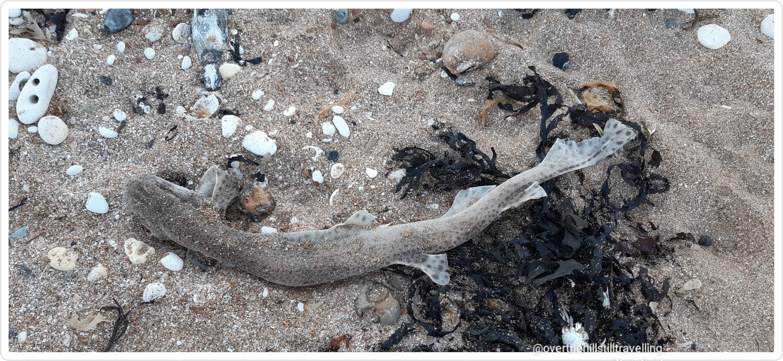
Sadly I often see these lovely fish along the shore when I’m walking. It saddens me to think about how they met their fate and wonder if they’re not discarded by the many fishermen we see along these shores…
a dead dog fish
I managed a good 7.4 kms and thoroughly enjoyed being out walking again. I may just have found the ‘m’ in my mojo 😉 On the back of this I have decided to get my feet facing in the right direction and take up on the Saxon Shore Way where I left off in May. If I continue to dither and dilly dally, I will never get it finished and I still have a long way to go.
I’m also toying with the idea of picking up another 2 stages along the Thames Path this weekend.
So finally, after vegetating for 3 days, I got myself out the house for a walk.
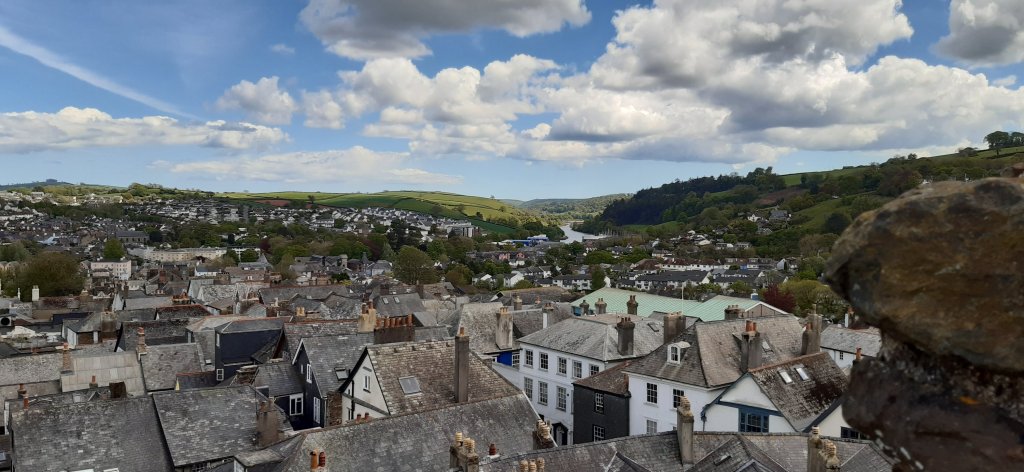
I haven’t done much walking since 19 May when I spent the day in Totnes before my booking in Stoke Gabriel.
Totnes from the castle ramparts
I’ll write more about Totnes at a later date…it’s a super little place; mentioned in the Domesday Book.
I had planned on walking every day while in Stoke Gabriel but it rained every day for a whole week after I arrived, and on the one day I saw a gap in the rain and went out, it caught me halfway through and I got soaked, which resulted in a nasty bug that laid me low for the rest of my stay, although I did get out for a couple of short walks just before I left.
Just before the heavens opened 😌Our green and pleasant land – Devon
Since being home I’ve been cat and fish sitting for my daughter en famile, binge watching Marcella on Netflix on Friday, attending a whole day Stocks and Trading course with Marcus de Maria via zoom on Saturday (I hate zoom), and today I read a book from beginning to end in one sitting; Pyramid. Awesome concept.
At the end of which I decided to go for a walk and chase the sunset. The family are home tomorrow, so I’ll be heading back to my bolt hole then.
Meanwhile…
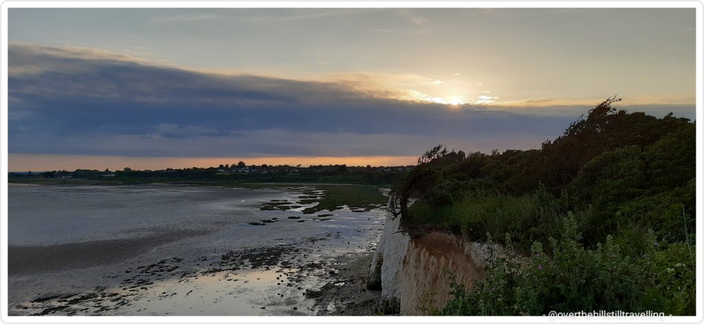
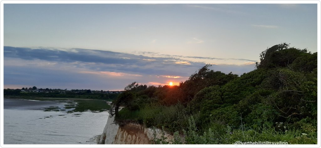
Across Pegwell Bay to DealPegwell Bay – my favourite view point Pegwell BaySt Augustine’s story
Augustine, a monk from Rome, was sent by Pope Gregory to bring Christianity to Britain. He landed in Pegwell Bay, Kent in AD597 with 40 followers, and set up his mission in Canterbury.
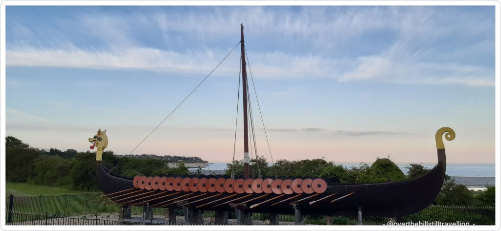
CliffsendJubilee Beacon – will be lit again in June 2022The Hugin Viking shipAmong the fields of barleyStopping to look back along the English Coast PathSunset – a fiery ballA perfect picture
On the way back I stopped in the clifftop Park for a swing
Having a swing
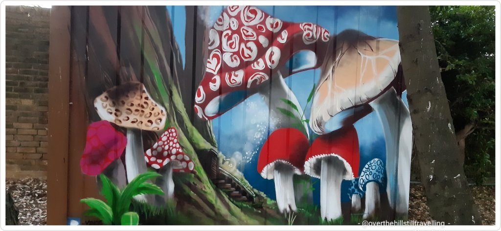
And then took a turn past the fairy houses where I noticed a new addition painted by Vince Pugh on the side of a shipping container. Isn’t it just gorgeous
Mushrooms in Fairy Land
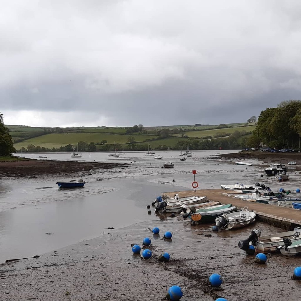
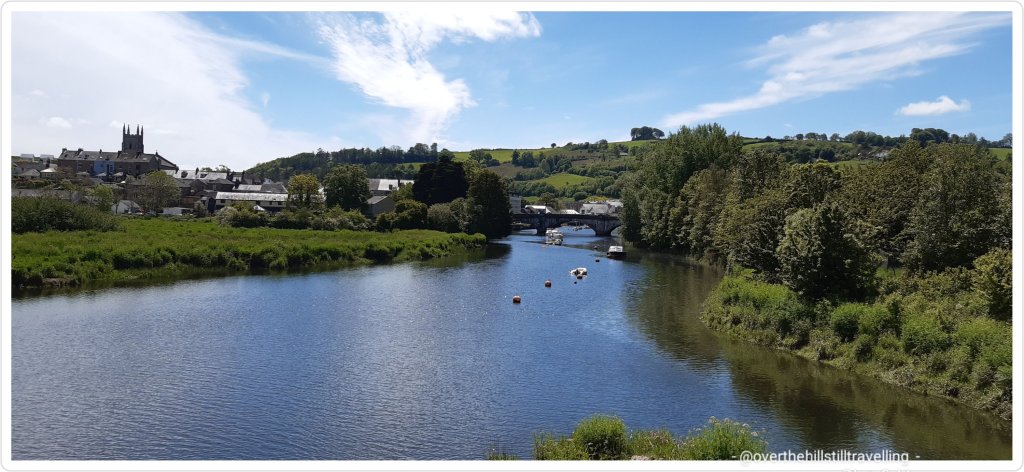
I managed 7kms which is more than I’ve walked since last week Thursday when I spent 2 hours walking along the River Dart in Totnes before my train departure.
River Dart, Totnes
I had planned on walking another 2 sections of the Saxon Shore Way this weekend, but my lungs are still tight and I’m not feeling well. So I’ll pick up again perhaps next week.
I’m hoping to finish writing up the last 2 stages of the Thames Path this week.
One of my favourite and most prolific categories in Project 101 is visiting places named in the 1066 Domesday Book; a survey undertaken by William the Conqueror after he invaded England and defeated King Harold and his forces during the Battle of Hastings in 1066.
The Norman Conquest (or the Conquest) was the 11th-century invasion and occupation of England by an army made up of Normans, Bretons, Flemish, and men from other French provinces, all led by the Duke of Normandy later styled William the Conqueror. Ref wikipedia
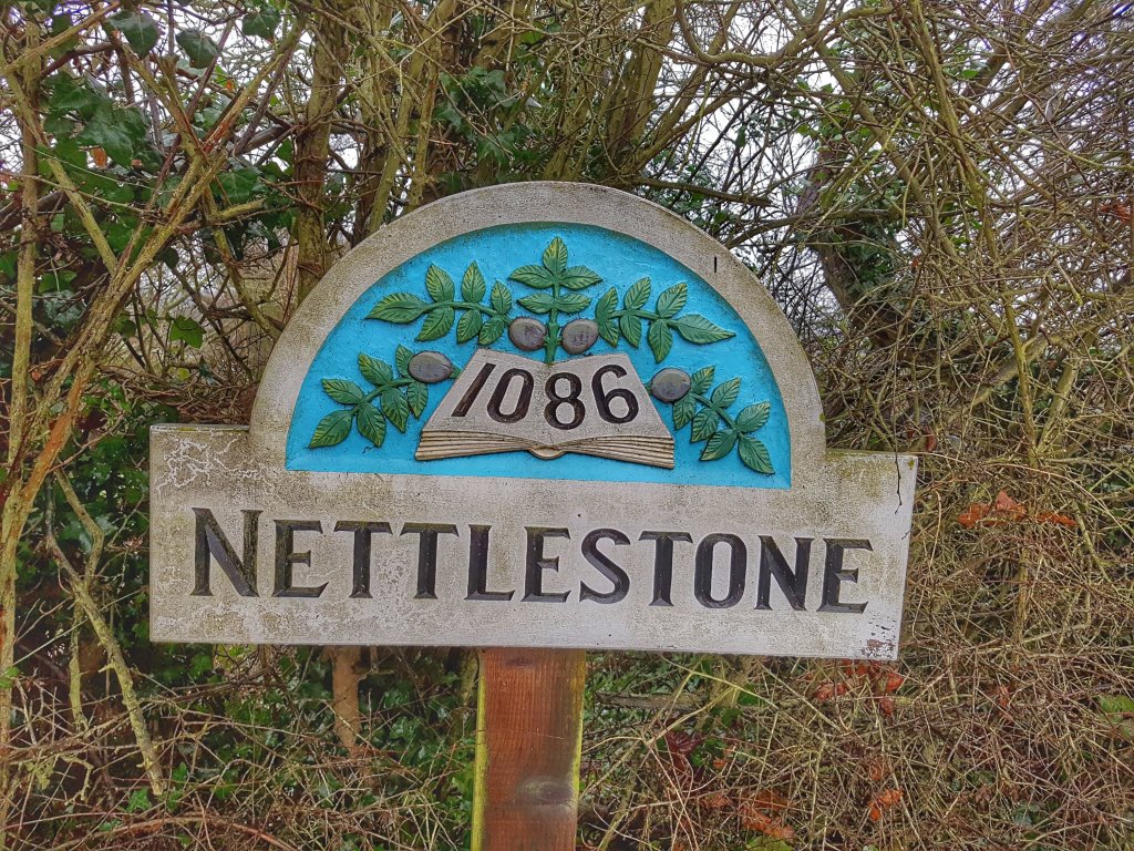
Usually I find that the towns and villages especially, have some way of advertising their links with 1066, either in the form of a village sign or remnants of their links are noted in a book or some historical objects.
Nettlestone, Isle of Wight
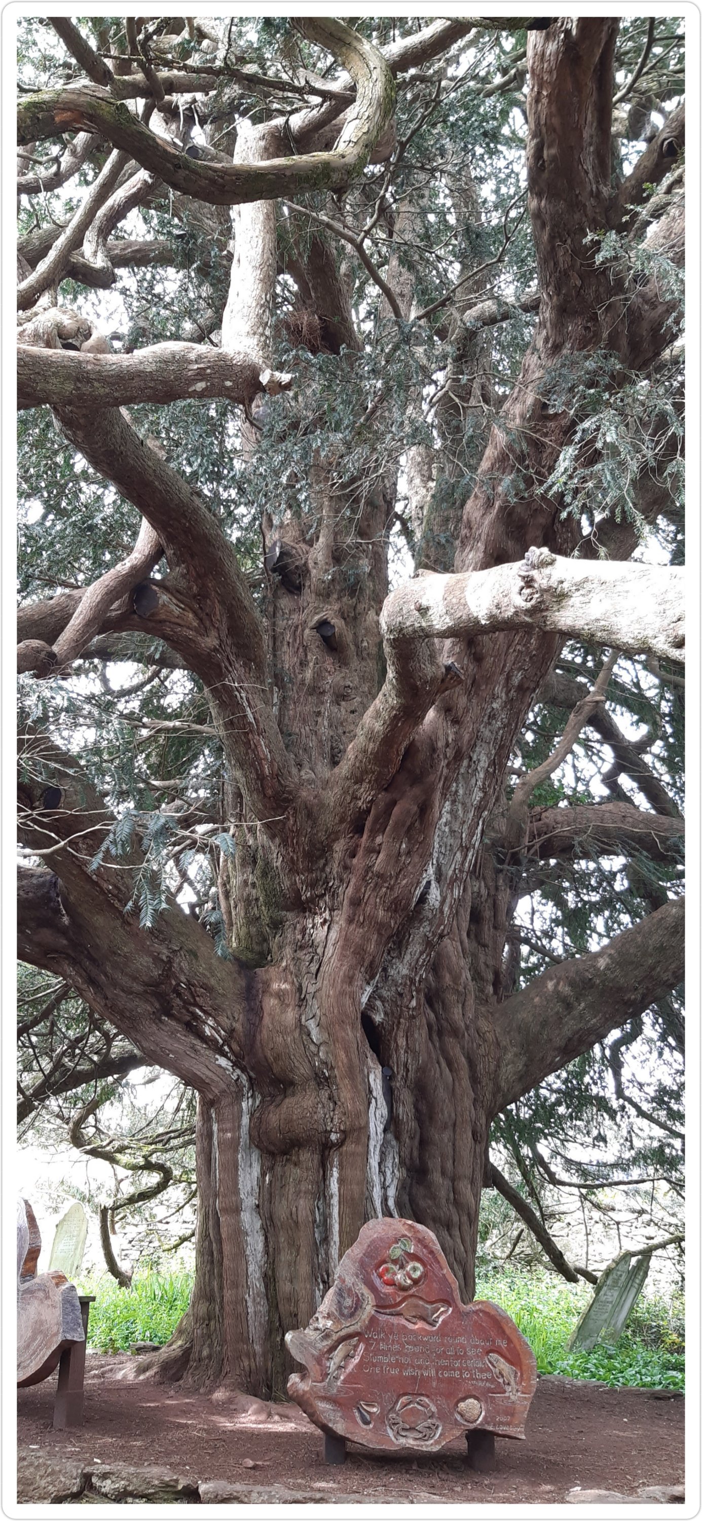
In the case of Stoke Gabriel, its a tree – a first! I initially noticed this on Google when I was researching the village prior to my visit a few months ago.
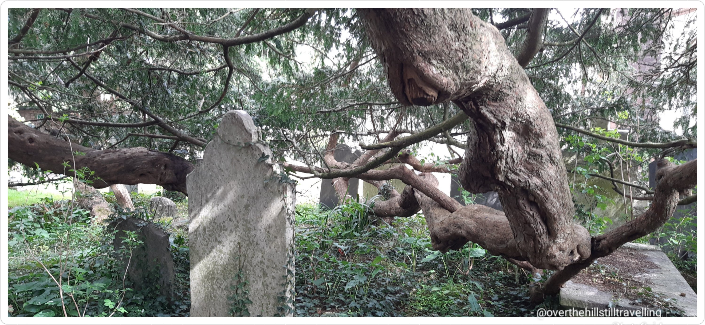
Domesday Book tree – alive before the 1066 Norman Invasion Domesday Book tree, St Mary & St Gabriel Church, Stoke GabrielDomesday Book tree
Of course as soon as I could, I made haste to see this for myself. Its quite extraordinary to be in the same proximity as a living, breathing creature that was already well established before the invasion even took place nearly 1000 years ago.
How you might wonder is it that much a thing remains….so
Domesday Book tree
Why does every churchyard have a Yew tree? The answer has to be that the early Christians built their churches on the ancient Druid and Pagan sites of worship and the planting of yew trees in modern churchyards reflects the early assimilation of the old religions into the new religion.
I’m guessing that because they live in churchyards they’ve survived progress by living on sacred grounds. I found a fascinating article about yew trees that you might enjoy, and from which I noted the information above in italics : why does every churchyard have a yew tree Their contemporaries were not as lucky…and as usual were destroyed by progress….
The longbow (so called because it is 6’ in length) was the premier weapon of the middle ages and made from yew. The volume of yew wood needed for war archery from the early 13th to the late 16th century was far too great to be supplied by from trees grown in churchyards. After all of the yew stands in Britain and Ireland had been depleted, the English crown began to import yew wood from all over Europe including Austria, Poland and Russia.
Nevertheless, this marvellous creature remains to remind us of history and our mortality…whether it does or does not thrive on the bones of the dead is irrelevant, its here for us to enjoy and be amazed.
Domesday Book tree – arms spread wideDomesday Book tree, thriving on the bones of the dead ☠☠
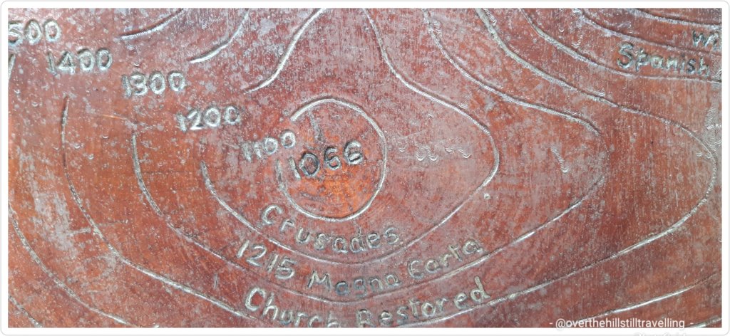
Some of the events this tree has lived through:
Domesday Book tree – it has seen historical events come and go
I followed the instructions, but unfortunately no-one was there to witness my endeavour
Walk ye backward round about me 7 times…
In fact the tree is even older than the church by a few centuries…
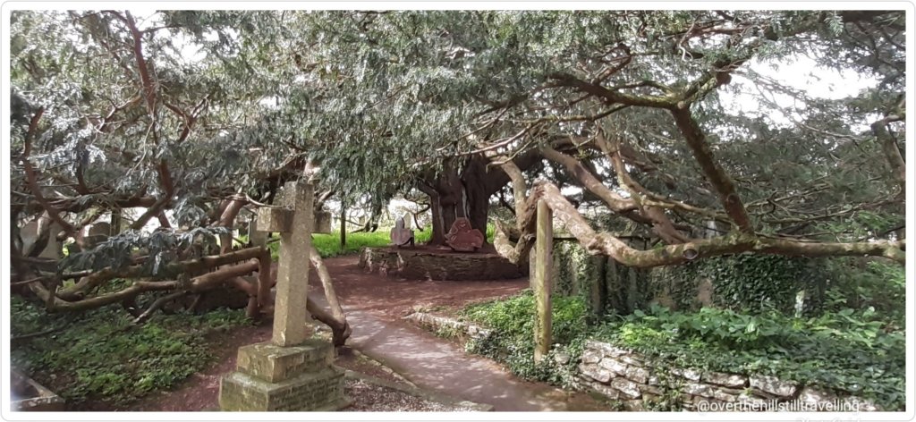
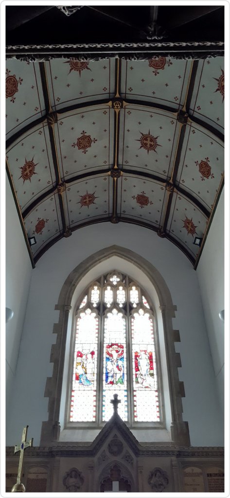
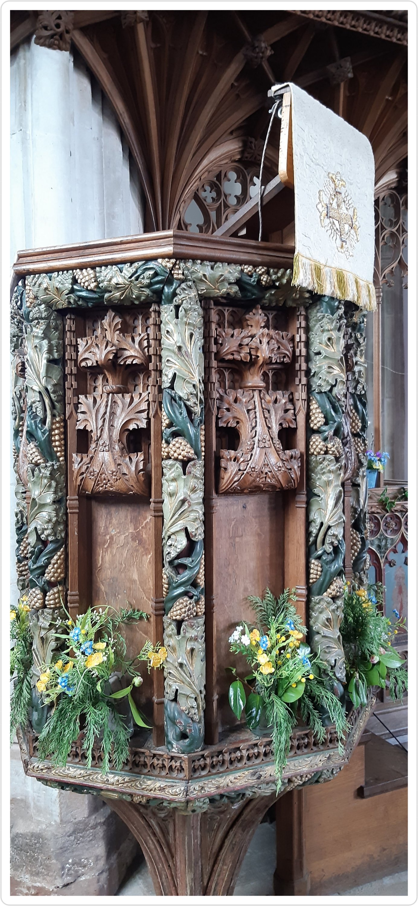
The interior of the church was no less interesting
Church of St Mary and St Gabriel, Stoke Gabriel Beautiful carving on the pulpitChurch of St Mary and St Gabriel, Stoke Gabriel Church of St Mary and St Gabriel, Stoke Gabriel, Devon
The church building was originally constructed in the early 13th century, of which only the Norman tower survives today. In 1268, Bishop Bronescombe of Exeter dedicated the church to St Gabriel, resulting in the name change of the parish from “Stoke” to the more distinctive “Stoke Gabriel”.
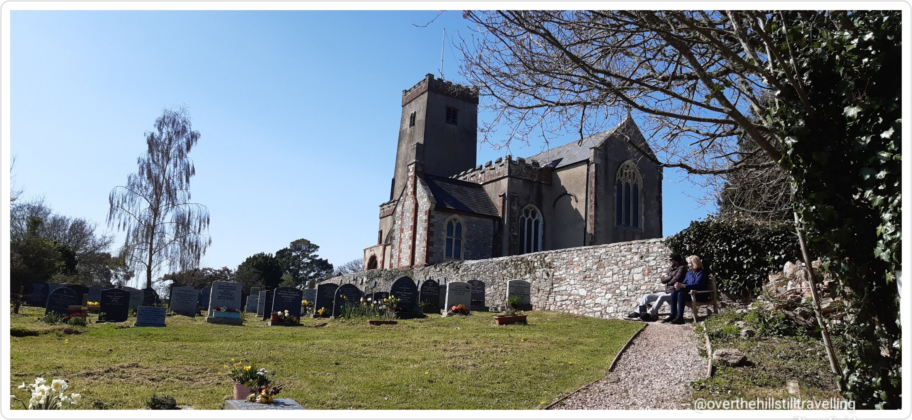
I often included the churchyard in my many daily walks around Stoke Gabriel and occassionally I forgot about adding kms to my virtual challenges and instead I just sat on one of the benches or under that glorious, ancient tree and enjoyed the peace and quiet.
And I shall once again include it in my walks when I return to SG later this month…
Just popping in quickly to share a photo from this morning’s sunrise.
I’m currently in South Devon, started a new booking today, but travelled here on Monday and spent 2 nights and a day in Paignton, with a visit to Torquay and Brixham and a walk along the South West Coast Path (more on that to come).
Meanwhile I went down to the seafront at 6am to watch the sunrise and I was not disappointed
You can just see the 2 cruise ships to the middle and far right
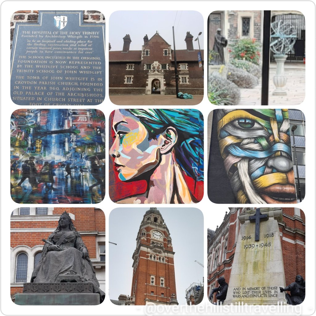
Last week I ventured into a different part of Croydon than I’d been before.
There’s some super cool street art that I could see. Dome days I wish I had more time to explore. The top 3 images are of The Hospital of the Holy Trinity founded 1596. Wowww. K thought Croydon was a ‘new’ purpose built town, but no, it’s got history going back as far as 960AD!!
Right then, after years and years of thinking about it, I’m now in the actual planning stages of walking the Thames Path – from sea to source.
Edit: 09/03 – I realized I should have titled this post as ‘Walking the Thames Path’, not river…I don’t have the right shoes for walking the river 😉
I mentioned in an earlier post that I was keen to walk it for my birthday; that comes up in April. So since the government have decreed (at this juncture), that from 12th April: UK domestic holidays away from home permitted….I’m off!! I’m also grateful to note that hairdressers will be opening too….I really need to chop my hair off, it’s working on my nerves, mostly because it has no style due to the fact that I HAVE been chopping it off for the last 15 months!! LOL
Anyway, back to the Thames Path. When I finally decided to do this walk, I bought the book and immediately started reading. Unfortunately the guide takes us from sea (almost) to source and not the other way around. So to that end (as mentioned in said earlier post), I have decided that I shall temporarily, purely to suit the occasion, reinvent myself as an adventurer who has stumbled across this great big river and want to find the source….a bit like Levison Wood except in reverse…and he of course explored the Nile….at 6,650kms, that’s a different kettle of fish (no pun intended). The Thames’ 346kms is just a Sunday stroll in comparison.
So, what is the River Thames!? According to Britannica: “River Thames, ancient Tamesis or Tamesa, also called (in Oxford, England) River Isis, chief river of southern England. Rising in the Cotswold Hills, its basin covers an area of approximately 5,500 square miles (14,250 square km). The traditional source at Thames Head, which is dry for much of the year, is marked by a stone in a field 356 feet (108.5 metres) above sea level and 3 miles (5 km) southwest of the town of Cirencester.
However, there is some dispute, and apparently, “some think a tributary, the River Churn, has a better claim to being the source; it rises near the village of Seven Springs (700 feet [213 metres] above sea level), just south of Cheltenham”.
Seven Springs features in the long-running argument over the true source of the River Thames. Two plaques at the site read “Hic tuus o Tamesine Pater septemgeminus fons” (Latin for “Here, O Father Thames, is your sevenfold spring”). Seven Springs is further from the mouth of the Thames than the medieval-preferred source at Thames Head near Kemble. In 2012 Coberley Parish Council posted a notice, on site, that “Seven Springs is certainly one of the sources of the River Thames and is held by many to be the ultimate source.” ref wikipedia
So, I guess I shall have to visit both…or shall I walk there? Hmmm. I think I’ll decide closer to the time depending on how footsore and weary I am after walking for 14 days – with a backpack. It’s an extra 33+kms which will add an extra 2 days to my journey, and the River Churn on google maps looks quite small, but after visiting google earth last night I determined that there are pathways pretty much along the whole length, barring a few farmers fields, some roads and a the odd house that appears to border the river….If I decide at the time to walk that extra 33kms (20.6 miles), then I’ll just go and deal with whatever confronts me when I get there – pretty much like I do on all my walks….just go! Of course that sometimes requires detours etc, but it’s the journey…
Meanwhile, I’m putting in loads of walking by following my Conqueror Challenges, and reading up on the route. There are loads of fantastic villages and towns along the route, some of which I have already visited and of course as mentioned in that article I have walked a large section of the Thames Path, the tidal section between Gravesend and Teddington Lock and further afield to Hampton Court.
I’ve kinda toyed with the idea of ‘maybe’ skipping out the tidal section since I’ve ‘been there, done that’, but it doesn’t feel right somehow…so I guess I shall just have to plan to walk the whole thing. I often read about people who do some walks, like the French Camino, in sections over the years, but I just know that’s no good for me…I likely won’t get back to finish off. There’s always something else to do. Mind you having said that, I did finally manage to complete The Pilgrim’s Way, but only because I made a spur of the moment decision to just do it….or else it would still be outstanding….which is was… outstanding that is 😁
So a little more about the River Thames:
The River Thames is England’s longest river at 346 kms (216.25 miles) – (albeit disputed coz of the tributary) the River Severn at 354km is the longest in the United Kingdom. So if they did add the River Churn’s 33kms (20.62miles), the Thames would indeed be the longest.
The River Thames flows from the source at Thames Head near the hamlet of Kemble in an easterly direction and after 366.4 kms (229 miles) it flows into the North Sea into the Thames Estuary near Southend-on-Sea. Now, kindly note that I am not about to walk from Southend-on-Sea as this adds on an extra 20km which would require ANOTHER 2 days….and I don’t have all the time in the world. I’ll simply add that section to when I walk the Essex coast (which as a matter of interest is 560 kms (350 miles).
The River Thames flows through 8 counties: Gloucestershire, Wiltshire, Oxfordshire, Berkshire, Buckinghamshire, Surrey, Essex, and Kent.
Besides all the smaller towns, the River Thames flows through or alongside: Lechlade (where you can find the famous Father Thames sculpture), Oxford, Reading, Henley-on-Thames (famous for the annual regatta), Maidenhead, Windsor (where the Queen sometimes lives) and Eton (famous for it’s posh totty school), Molesey (near Hampton Court). Including the smaller towns and villages…26 in all.
In Greater London the Thames passes Hampton Court Palace, Surbiton, Kingston Upon Thames, Teddington (where the tidal Thames ends at the lock), Richmond, Kew, Chiswick, Barnes, Hammersmith, Fulham, Putney, Wandsworth, Battersea (where my paternal grandfather was born) and Chelsea.
Continuing through central London: Pimlico, Lambeth, Vauxhall, it then passes the Palace of Westminster and the London Eye amongst many other landmarks of the City of Westminster, then between The City of London and Southwark till it reaches the world-famous Tower of London.
Into the lower reaches: the river passes through some of the most historic areas: Bermondsey, Wapping, Shadwell, Limehouse, Rotherhithe (from whence the Mayflower carrying pilgrims to the New World set sail), Millwall, Deptford, Royal Greenwich (where Henry VIII was born – the Palace of Placentia as were his daughters Mary & Elizabeth, while his son was born at Hampton Court Palace) and home of the Prime Meridian and Greenwich Mean Time, then Blackwall, Charlton and Silvertown and finally through the Thames Barrier – which is where the Guidebook starts the journey, and onto the the sea. The Thames Barrier is the largest moveable flood barrier in the world.
The River Thames is crossed by over 200 bridges, 27 tunnels, six public ferries, one cable car link, and one ford. There are 30 bridges from Tower Bridge to Teddington Lock – arguably the most famous of those being London Bridge (the first bridge to cross the Thames built by the Romans in 50 AD which was a wooden structure), and Tower Bridge (often misnamed as London Bridge).
There are around 180 islands altogether on the Thames, 45 of which are inhabited – some of the islands have animal, bird or food names; Monkey Island, Frog Island, Lower Horse Island, Buck Island, Swan Island, Heron Island, Raven’s Ait, Ham Island, Eel Pie Island (I briefly lived in a gypsy caravan on Eel Pie Island in Richmond in 2011), there’s even a Pharoah’s Island and Queen’s Eyot, and the famous Magna Carta Island.
The Thames has frozen over at least 23 times between 1309 and 1814, and on five occasions the ice was strong enough to hold a fair on the river, the first known ‘frost fair’ on the River Thames was in AD 695. There are a few famous paintings depicting the frost fairs on the Thames in London from the 17th century.
The River Thames is also known as the River Isis in Oxford.
Many species make the River Thames their home; birds, fish, eels, seals (Thames estuary)and even dolphins
A number of famous painters have depicted the Thames in their paintings: Turner, Monet, Canaletto and Whistler, amongst others.
The River Thames began its life in the Jurassic Period – between 170 and 140 million years ago, has changed it’s course over millenia and once flowed into the River Rhine in Germany. Courtesy of wikipedia: For most of the Early Pleistocene the Ancestral Thames was the main river with, at its maximum extent, a catchment area that extended into Wales alongside the Chiltern Hills, through southern East Anglia and finally into Doggerland (now the North Sea), where it joined the ancestral Rhine.
I’m still dithering about whether to start my journey at The Thames Barrier or from Gravesend. If I do start from Gravesend it will mean adding on an extra 2 days, whereas I could rather add on those 2 days at the end to follow the River Churn to Seven Springs. I’ve already walked from Southwark to Gravesend when following Chaucer’s Canterbury Tales route to Canterbury…..so, I need to make a decision and soon… my start date is 19th April!!
I’m really looking forward to discovering more about the places along the river from Hampton Court onwards to the source.


You must be logged in to post a comment.