When I was planning the next stage of my Saxon Shore Way jaunt I noticed that the Isle of Sheppey was very close to the route. And so, since I’m still working on Project 101, I decided to keep this particular stage short, and visit the island while I was there.
The Isle of Sheppey
So to that end, I planned to walk from Sittingbourne to Swale then hop on the train to Queenborough Station and spend some time walking around the island and exploring.
I’m not going to write about the actual walk at this stage because I want to write up the other stages from when I started, so instead I’ll share my brief excursion to my 20th island and 66th bridge of some note.
I got a little more than I bargained for; a very hot day and a very well timed, albeit coincidental event.
I really wasn’t sure about visiting the island coz of reports I’d had from previous visitors, but an opportunity is to taken up at the time. I was pleasantly surprised.
Like most of the south east seaside towns, the spirit of the High Street has been lost and its mostly charity shops and cafés and adhoc shops with a few interesting independent shops interspersed. But I wasn’t here for the shopping…so onwards
Sheerness-on-Sea High Street
The clock tower is very pretty and I enjoyed a lot of the architecture.
The Clock Tower A church Some lovely housesLoved these
A bonus windmill
After a short excursion through Sheerness-on-Sea, I headed for the beach planning on first cooling my feet in the sea (my daughter suggested I strip down to my underwear and go for a swim 🤣🤣🤣🤣🤪🤪 Don’t want to scare the locals!! Instead I just stood with my feet in the water…bliss!
Cool water blissful
And then because I’m insane and generally like punishing myself, I decided to walk along the promenade till it ran out and then walk inland to Minster-on-Sea. Why? Seriously. I do have some daft ideas. It was 25degrees and blazing hot, but I may never visit again, so….
The coastline is absolutely gorgeous, albeit mostly stones and little beach – ouch!!
I had planned on walking to that little promontory in the distance Getting closer But ultimately I walked much further. Was delighted to see this That water was ever so inviting. I could quite easily have gone for a swim Facing out to sea, in case the Vikings decide to invade the east coast again, they’ll be welcome 😀Some pretty artwork where I turned inland
The bonus surprise came just before I left the Saxon Shore Way for the train station 🚉 to Sheppey. I was sitting on a lovely bench eating my lunch when I heard the warning signal and looked behind me. I noticed a section of the bridge being raised and then I saw the tanker making its way upstream…
The bonus
It reminded me of how Tower Bridge lifts when large vessels enter London Pool. Ever so exciting to watch these innovative feats of engineering. Lucky me.
My thoughts on the Isle of Sheppey? I loved it, and will return another day and spend more time walking, especially through the nature reserve.
Stage 3 : Battersea Park to Richmond 21.04.2021 – 27.02 kms – 6 hours 24 min – 40,316 steps – elevation 82 meters
Battersea Park to Richmond – what a joy. I was totally excited about this section of the Thames Path because it passes some of the places I love so much.
I left home fairly early and caught the train to Battersea Park station and retraced my steps to Rosery Gate.
Gatehouse Battersea Park – back where I ended..
Once in the park I followed the signs for the Thames Path till I reached Chelsea Gate and stopping only to take a photo of the bridge.
The Thames Path 😝😝 through Battersea Park
, I set off along the Sri Chinmoy Peace Mile. What a splendid section of the path, wide open space and stunning views of the river (in my opinion, the whole path should be like this 😉)
The Sri Chinmoy Peace Mile – I forgot to actually take a photo of the mile 🤔🤔
As you head upstream with the river on your right you will arrive at the magnificent London Peace Pagoda. This beautiful structure is worth a few minutes of your time. Walk right around it to appreciate the sheer magnificence of this wonderful place – the Pagoda is dedicated to the realisation of Universal Peace. It’s beautiful.
The London Peace Pagoda London Peace Pagoda
Never one to follow a straight route, I often go off-piste to explore and today, after viewing the Peace Pagoda i walked across to the fabulous fountains, and then back again.
Fountains in Battersea Park
Next up the stunning Albert Bridge – another of my favourite bridges, it looks ever so pretty when lit up at night. I stopped to take a pic of the guard house – Albert Bridge Notice ‘All troops must break step when marching over this bridge’ – that always gives me a chuckle when reading it….
Albert Bridge All Troops must break step….
The path along this section is really lovely, well paved and clean as it passes office and apartment blocks on the left. I crossed a wee creek; Ransome’s Dock, via a footbridge, then stopped to look at the fabulous Atrate barge/sailing ship moored alongside the banks. I soon reached Battersea Bridge where I briefly stopped to photograph the beautiful swan sculpture by Catherine Marr-Johnson, these very naturalistic swans are captured in the act of taking flight…across the Thames…
AtrateSwans taking flight…
The next Thames Path signpost read: Wandsworth Park 2.5 miles (4km) – okay so another hour then. Passing through an open space is another interesting sculpture: ‘In Town’ of a man, woman and child by John Ravera.
In Town – John Ravera
The pathway along this section is beautifully paved, wide and clean, passing a number of apartment blocks on the left and a view across the river to Chelsea Harbour Pier from whence Queen Elizabeth II set sail along the Thames for her Diamond Jubilee in 2012 (OMG!! that was 9 years ago…feels like just recently… where does the time go?).
The varied path…
Going strong at this stage I passed some fabulous houseboats moored alongside the banks and soon reached St. Mary’s Church Battersea, made famous by JWM Turner who painted scenes of the church from the opposite banks of the river.
St. Mary’s Church, Battersea
Parked in front of the church was a little coffee and sandwich trailer – @thefeelgoodbkry : The Feel Good Bakery – For every Feel Good sandwich you buy, a child in need of food will receive a free meal. That’s it. Simple. ‘One Small Sandwich for man, one giant sandwich for mankind’. I stopped to buy some coffee and a sweet treat, and got to chatting to the chap managing the show who told me more, so I did a bit of research and found more information on their website: We are a charitable bakery and youth development programme creating job opportunities for young people in South West London, simultaneously feeding children in Kenya and Romania one sandwich at a time through our “one-for-one” scheme. What a brilliant scheme.
The Feel Good Bakery
The church was open, so never one to miss an opportunity I popped in for a quick look around. St. Mary’s is the oldest church in Battersea and the original church was built around 800AD, the current church completed in 1777, designed by Joseph Dixon. The church has strong connections with art and literature through the artist and poet William Blake, who married Catherine Boucher there on 17 August 1782. ref wikipedia The interior was quite simple in relation to some of the churches I’ve visited, and the stained glass windows are exquisite. One such window commemorated Benedict Arnold who was ‘Sometime General in the arm of George Washington. So a strong American connection and the window depicts the American flag alongside the British flag.
St Mary’s Church Battersea
Outside, the view across the river from the little park is so peaceful. I could have stayed the day, but instead I sat on one of the benches for a short while to enjoy my coffee and pastry.
View from the porch of St. Mary’s
Setting off again I stopped a bit further on to look back and the tide was well out. Next up Battersea Railway Bridge…onwards
Looking back…
I passed the London Heliport which brought back joyous memories of my 60th birthday when my daughter surprised me with a helicopter flight over London for my birthday. It also brought back a memory of my father; it was the last time I spoke to him. He died a few years later. As I got back to the riverside after the diversion round the heliport and the hotel, I was treated to a helicopter coming in to land. 🙂
London Helicopters
The path was still beautifully wide and paved, with attractive residential apartments lining the route. I don’t mind the type of development where the designers et al have had the courtesy to leave the path unhindered and free for walking.
Battersea Reach. It’s many years since I walked along this section of the river and I was pleasantly surprised. Besides the lovely ‘pathway’, the Thames Tidal planting added a wonderful element of nature to the area; the planting has seen the reintroduction of native plant species by planting them into the new river bank.
Tidal planting on the Thames
I passed Wandsworth Bridge and followed the path until my route was once again blocked by a great big industrial site. Ugh. And so another diversion, this time around the Western Riverside Waste Authority complex and then heading back to the river after crossing the River Wandle; it wasn’t very pretty and looked dark and forlorn with the tide out.
Poor River Wandle
The sign suggested that the next section was called ‘Riverside Walk’, but it was closed off for some dortbif construction. Instead, I meandered between high-rise apartment blocks and business premises passing some interesting sculptures.
Highrise living in Wandsworth
And then Wandsworth Park at the far end of which I had another diversion around a row of residential houses that lead right down to the banks of the river a small church and so to Putney Bridge. The route took me past some lovely houses and through an interesting open space.
Diversion in Wandsworth Park The acorn sticker shows the way Putney Bridge is in view
Wandsworth Park; a Grade II listed Edwardian park, is lovely, albeit not as lush as some of the parks you find dotted along the Thames. I did find the magnificent avenue of Lime and Plane trees absolutely stunning and stopped to puzzle over the sculpture – Pygmalion by Alan Thornhill. One of a number of similar sculptures dotted around on the Putney Sculpture Trail. I can’t say that they are they type of sculptures that appeal to me, but I’m guessing some people may like them.
Trees Wandsworth Park Sculptures by Alan ThornhillSt Mary’s next to Putney Bridge – love the sundial
Once passed Putney Bridge the Thames Path became more rural with a lot more trees and greenery and gravel instead of paving or metalled surfaces. Its wonderful walking along these sections; fresh air, birdsong, flowers and peace….blissful.
Rural Thames path
I passed the Steve Fairbairn memorial on the Mile Post; a stone obelisk popularly known as the Mile Post, is exactly one mile from the Putney end of the Championship Course. I thought about my friend Joe who is Captain of the Trinity Tide for Trinity House in London. I’ve often watched the various London races he and his crew participate in on the Thames.
Memorial to Steve Fairbairn
Ahead of me I could see a gorgeous red-brick building with a domed tower….intrigued I wondered what it was – it’s a Harrods furniture depository LOL Such a fancy word and building for storing furniture…but hey it’s Harrods!
Harrods furniture depository
I saw lots of rowers on the river at this stage, many of the rowing clubs line the banks of the Thames from here on. The waters are a LOT calmer than in central London, with a lot less traffic so it makes a suitable environment for practising, and I could hear the various megaphones amplifying the coach’s voices. I love watching rowers on the river, but with time marching on, I had to march on too: it was already 3pm by now. I did however stop for my 2nd short break to eat and replenish.
Putney
The beautiful, albeit fragile Hammersmith Bridge is currently closed to all traffic due to structural weakness and repairs going on. The 133-year old bridge is made of cast iron which is brittle and can shatter. So for the forseeable future it is structurally unsafe. She is quite old after all; built in 1824!!
Hammersmith Bridge
Welcome to Richmond Upon Thames – why thank you!!! Yes!! At 15:18 I finally reached the border of Richmond. Whoo whoo not long to go now till journey’s end and my favourite place in Greater London. Richmond U-T is twinned with Fonteinebleau in France, Konstanz in Germany and Richmond, Virginia USA. Across the river I could see some of the pretty Georgian and Victorian houses that face the river. Richmond is an area with a rich tapestry of history.
Welcome to Richmond Upon Thames
On my walk, at various places, I noticed quite a few sad little memorials: remembering people who had drowned in the river. The Thames is deceptive and on the surface does not give an indication of the dangerous and fast currents just below. I’ve seen a large car being lifted up and carried off from a slipway in Richmond before…..the river is tidal and powerful and sometimes people forget that…with tragic consequences. Just across from that memorial is a sad little memorial to Freddie the Seal who was viciously attacked by a dog off it’s leash.
Memorial to Freddie the Seal
Dog owners KNOW that they are meant to keep their animals on a leash, but no! “oh, he’s never done that before” or “oh, my dog would never behave like that” until they do! And it always comes as ‘such’ a surprise!! The culprit’s owner in this instance actually got off with her misdemeanour….The owner of the dog which brutally mauled a popular Putney seal to death will not face charges, the Metropolitan Police has confirmed. Of course she won’t, she’s a barrister! Ugh. Makes me so mad. Why isn’t she facing charges…other people have??? Anyway, I digress. This type of injustice makes me furious. Stupid woman.
Back to the river…
The pathway is delicious at this stage, soft gritty gravel beneath your feet, lush green trees on both sides, Loverly!! I saw a memorial bench to David and Margaret Sharp “who did so much to create the Thames Path” Thank you 🙂
Thank you David and Margaret
All too soon though you reach urban conglomeration again LOL and boof back to the metalled surfaces…hell on the feet. With Barnes Railway Bridge behind me and Chiswick Bridge just 1.3 miles ahead it was now 16:12 and in reality I still had quite a way to go before reaching Richmond Bridge.
Urban development, not always pretty
Not long after I reached Chiswick Bridge where the annual Oxford/Cambridge race; The Boat Race, passes the finish line. Many a year have I stood near the bridge to watch the end of the race as well as the preceding Watermen’s Race. In most years over 250,000 people watch the race from the banks of the river between Putney and Mortlake.
Budweiser – excellent location for a brewery And a pub next door 😄😄🍻🍻This is the spot where I would stand to watch the race finishes – Chiswick Bridge Joe Lane Capt of the Trinity Tide and crew at the 2014 Boat Race
Not a brilliant image, I pulled it off instagram since I don’t have a copy in my storage – however….
Kew Bridge and Gardens was now just 2 miles ahead of me. I cannot tell you how many times I have walked this stretch of the river….it is beautiful. When we lived in Richmond I would often stroll along the banks of the Thames from Richmond Lock to Chiswick Bridge, just because I could. This stretch of the river as well as from Richmond Bridge to Hampton Court is so familiar to me and it felt really good to be walking here again.
At Kew Pier I noticed a concrete key-shaped sculpture….on investigation I found it is called ‘Cayho’ by Marc Folds. It’s really quite odd that I’ve never seen it before although it’s been there since 2000. I guess we see different things at different times. According to the sculptor, it’s called CAYHO, the AngloSaxon name for Kew – ‘key shaped piece of land’. How cool is that!
CAYHO
The Thames Path is a mostly shared space and you will cross ‘paths’ with fellow walkers, joggers, runners and cyclists, dog-walkers, parents pushing strollers or running after escaping toddlers.
Along this stretch of the river is where you will start to see some of the many little islands in the stream…there are dozens of islands dotting the path of the Thames; large and small, unoccupied and residential/business islands, eyots or aits. Many offer a refuge for wildlife, which personally I think is the best use for them.
Islands and rowers
Hello Kew! So nice to see yew!! 🙂 Oh how much I love Kew.
The Pink Palace – Kew Gardens. My heartbeat escalated…yayyy I’m nearly there. By now it was 17:03 and I had been walking since 12:05pm. I have to say this again – this section of the river is absolutely gorgeous..any time of the year. Lush leafy trees, thick green grass, and heavenly views of the river…sunset on a clear night from this area is fab.u.lous! Its equally gorgeous in winter when the trees have shed their foliage, and of course spring and autumn are splendid.
Kew Palace – the Pink Palace
Kew Palace is the smallest of all the royal palaces, originally built as a fashionable mansion for wealthy London silk merchant, Samuel Fortrey in 1631. In the 1720s, the royal family, George II and Queen Caroline and their children arrived and took leases on the palace and several other houses in the near vicinity. It was a place where they could be private, domestic, and live normal lives unencumbered by the trappings of ceremony and deference. The gardens were cultivated as an idyllic pleasure ground. Later the house became a refuge for George III, when he fell ill and was thought to have become mad.
Kew Gardens is absolutely magnificent with so much to see and do. Their annual orchid festival is a feast of colour, you could never imagine there were so many varieties of orchids. I really must visit again. At this point the pathway is wide with edges m’dear! Ever so posh territory now! Hah! Here too, gorgeous clumps of bluebells decorated the verges…seriously, I’m sure the colours of the flowers are more vibrant this year! All flowers and blossoms….they all seems so much brighter.
A peek at Kew Gardens near the riverside
I stopped briefly to look back and in the far distance I could see the apartment block towers of Putney, or is it Barnes? Across the river is Syon House, not visible from here, but you can see the pretty pink structure that is the Old Pavillion in Old Isleworth, close to Syon Park.
Across the river, the Old Pavilion
Within a few minutes I was walking past Richmond Lock – the first of the locks on the tidal Thames, it controls the river at high tide and prevents, mostly, flooding of Richmond and higher places upstream. However…if you lived in Richmond, Twickenham or St Margaret’s, you’ll know for sure that at high tide, cars that are parked along the riverside get swamped, and I’ve even seen a car lifted up by the river from a slipway and sent sailing off towards the sea…it would likely get stuck at the lock, but just imagine your car sailing down the river and through London central!!
I’ve had some hilarious moments at high tide, and one time had to be rescued off the metal barrier after I decided it would be a good idea to walk along it to access the bridge. I very quickly realised the folly of my endeavour hanging precariously over the top rail till the gentleman who lived in the nearest barge waded through the water in his knee high wellies and carried me off. My daughter captured the incident on camera for posterity 🤪🤪🤪🤪 Although she was laughing so much I’m surprised she was able to keep the camera steady.
Richmond Lock
Then I was crossing the Greenwich Meridian line that runs across through the Old Deer Park (a fragment of the land connected to Richmond Palace, named from the hunting park created by James I in 1604) and marked with a metallic strip across the path so you don’t miss it. The King’s Observatory, located in the Old Deer Park, Richmond Surrey, was commissioned in 1769 by King George III, a keen amateur astronomer. The Observatory cupola, housing its telescope, is now the oldest of its type in the world.
Old Deer Park, hunting ground of Kings and QueensGreenwich Mean Time
I soon passed The Swan Pub and Asgill House and remembered so many happy evenings and days in this area; sitting on the edge of the riverside, legs dangling towards the river and watching as it rose quickly, higher and higher till it touched your feet and you had to move pretty pronto or get a wet bottom LOL I also remember walking, no shoes on, along this section of the path wading through the water at high tide. Many of the businesses that line the path have high water marks on their doors where the high tide had intruded.
The Swan Pub, Richmond and Asgill House
That path, Cholmondeley Walk, in the bottom left image is sometimes under 2-3 feet of water at high tide.
I had planned to meet a friend from instagram at the bridge at 6pm, and it was now just after…so I hurried along, passing a couple dancing to flamenco music…the charms of the Richmond Riverside. Always something musical happening.
Dancing at Richmond Riverside
And then…journey’s end!! Hoorah! At exactly 18:04 I touched the bridge…..I had made it. Stage 3 done and dusted.
Richmond Bridge
I was glad though that it wasn’t high tide right then or I’d have had to make a big diversion through town. Veevs and I connected at last and because it was already quite late, we headed for the station via The Green, but first a short diversion to go past Richmond Palace.
Richmond Palace
Richmond Palace is a fantastic place, albeit a lot smaller than it was originally, once a royal home erected about 1501 by Henry VII of England (n 1509 Henry VII died at Richmond Palace), Richmond Palace was a favourite home of Queen Elizabeth, who died there on 24 March 1603. It remained a residence of the kings and queens of England until the death of Charles I in 1649 after which it was sold and eventually fell into disrepair. Only vestigial traces survive, most notably the Gatehouse, the King’s Wardrobe, The Trumpeter’s House etc…all now private residences. It even has connections to Chaucer: In 1368 Geoffrey Chaucer served as a yeoman at Sheen. Queen Mary I, after her marriage to Phillip II of Spain, spent her honeymoon there. Richmond Palace was one of the first buildings in history to be equipped with a flushing lavatory, invented by Elizabeth I’s godson, Sir John Harington. There is so much history attached to the palace and I can’t possibly list it all, so I’ve added a link to wikipedia in case you’re interested to read more than just the snippets I’ve included above.
I bought my ticket home and we had just enough time for a quick chat while I quenched my thirst with a hot chocolate 🙂 of course. I think I deserved it.
Battersea Park to Richmond. What a terrific walk and section of the river. Although I was squeezed for time and didn’t have much chance to dilly dally, I did stop a few times for short breaks. The riverside from Putney onwards is so inviting and if you can find a free bench to sit on, there are lots of little spaces and hollows where you could find a fallen log or boulder to sit on and while away the time.
Stage 2 : Greenwich to Battersea Park 18.04.2021 – 22.01 kms – 6 hours 20 min – 38,376 steps – elevation 102 meters
As mentioned in my progress report this stage too was longer than I originally planned, but I wanted to push through as far as possible and thereby get further along and also shorten a later day’s journey.
I left home at 07:50 for the 08:16 train to London via London Bridge and onto Greenwich arriving at Greenwich station by 10:40. As I left the exit of the station I noticed an interesting art installation; a number of bicycles had been attached to the roof above my head! Cool idea!!
interesting idea for unused bicycles
I set MapMyWalk and off I went…. back to the riverside for the next stage of my walk along the Thames Path, heading upstream.
First a quick visit to Cutty Sark and of course another photo LOL a daytime pic of the foot tunnel entrance and a view upstream – I’m on my way!!!
Cutty Sark and a merry go round
Greenwich foot tunnel
Just because 😊😊tide is out – I’m heading upstream
Having planned on walking as far as Vauxhall, due to my extra section to Greenwich yesterday, by the time I reached Vauxhall Bridge it was still relatively early so I pushed on to Battersea Park….a place I love and the District area where my paternal Grandfather was born (hence my ability to get British citizenship).
Today’s walk was no less winding and twisting than yesterday’s and there were a lot more diversions…it looks like I was drunk if you look at the gps trail LOL
When you see this configuration, you can be sure of a diversion
I was VERY pleased to note than since the last time I walked this section (2017) there was now a walkway directly along the Thames Path; and the Greenwich Reach Swing Bridge has been added to cross Deptford Creek, without having to divert along the A200. I subsequently had a look on google and apparently it was opened in 2015 (?) – but I genuinely don’t remember it being there in 2017….maybe it was closed on the day, because I do remember having to divert and walk along the busy road.
I stopped at the wonderful statue of Peter the Great and had a photo done!! 😃 we have Russian heritage from my maternal grandfather, so yeah, maybe we’re related 😉
Peter the Great and Cindy the Elder 😁
Across the river was Canary Wharf. It’s amazing how often you get a view of that area as you traverse the path. Tower Bridge 4.25miles 🙂
Thames Path and Canary Wharf
Looking back I could see the masts of the Cutty Sark faintly visible on the skyline.
There were numerous diversions, one of which took me well away from the riverside and past ‘Twinkle Park’ 🙂 cute name and very pretty.
Twinkle Park on the Thames Path
From there you take a huge diversion through Deptford and eventually walking through Sayes Court Park, Lower Pepys Park and Pepys Park where you finally meet the river again. Ugh.
The Thames Path doesn’t always run alongside the Thames River
On closer inspection it would appear that the original route has more recently (?) been bricked off?? I wish I could remember the route from 2017.
I’m pretty certain I remember walking through a gap in the wall, then going right along a very narrow pathway before turning left again towards Twinkle Park – perhaps I’m mistaken.
There’s a lovely tree in Sayes Court Park that I noticed; a mulberry tree believed to have been planted in John Evelyn’s garden in 1698 by the Russian Tsar, Peter the Great, who stayed in Sayes Court during his trip to England, as art of the Grand Embassy. Amazing that it hasn’t been sacrificed on the altar of progress!!
Mulberry Tree
Mulberry tree
Planted by Peter the Great ☺☺ phenomenal history
Deptford is one of the most historic areas of greater London, and so well worth a visit. a snippet: the small fishing village of Deptford became an important supply centre for the Royal Navy in the 16th century after King Henry VIII established a shipbuilding dockyard there. Around 350 Navy vessels were built in Deptford between 1545 and 1869. They wouldn’t recognise the place now!
Deptford history
At St George’s Square I noted an information board about Sir Francis Drake: Explorer Sir Francis Drake is best remembered as the first Englishman to circumnavigate the globe in his ship The Golden Hinde. Drake’s three-year voyage around the world from 1577-1580 made him one of the most famous men in Western Europe. Upon his return to Deptford, he was knighted by Queen Elizabeth I. The flight of stairs leading from the river to Foreshore are consequently known as ‘Drake’s Steps’. I had a quick look and they are quite unattractive.
Drake’s steps
You can see a replica of the Golden Hinde near Southwark Cathedral.
And on I went, zig zagging back and forth through industrial, maritime and residential areas diverting back and forth. The river Thames may be 215 miles (346 km) long, but the path I’m sure, is a LOT longer!!!
Another diversion
On I went passing South Dock Rotherhithe. Rotherhithe is another incredibly historic area and worth exploring when you have the time.
I soon reached Surrey Docks Farm – it’s ever so cute and with the partial lifting of lockdown, there were a lot of people visiting and sitting out in the sun drinking tea and eating cake and things. Kids ran around and the animals seemed bewildered at all the noise after the relative quiet of lockdown. I will take my grandson here to visit in 2022.
Surrey Docks Farm, Rotherhithe
There are so many interesting places to see along this stretch of the river with lots of little creeks and docks to be navigated, and I crossed numerous small bridges.
Bridges and diversions
The bridge at Lavender Pond Nature Reserve was quite fancy and I was grateful that these crossings allow you to traverse these places without having to divert. Like Deptford, Rotherhithe has so much history it’s quite extraordinary. You will also find sculptures and maritime relics dotted at various places along the path.
Then I passed Salt Quay and was reminded of the times I’ve stayed at the YHA nearby on many of my previous trips to London. It’s a perfect location for fantastic views of the river, and very close to Tower Bridge should you decide to walk alongside the river into central London.
Salt Quay, Rotherhithe
Here, beneath your feet you will find the Rotherhithe Tunnel, although you don’t actually see it since it passes below ground. I was excited to reach Cumberland Wharf Park because I knew what I would find; one of my favourite sculptures – The Pilgrim’s Pocket. An adorable sculpture of a Man (pilgrim) and a boy reading the Sunshine Weekly. Needless to say I took a lot of photos….I have lost count of how many photos I have of this sculpture!! There are story boards telling more about the history, well worth a read.
The Pilgrim’s Pocket, Cumberland Wharf
The Pilgrim’s Pocket, Cumberland Wharf
The Pilgrim’s Pocket, Cumberland Wharf
Next up the Brunel Museum. A small but fascinating museum, and especially if you go on the tour of the shaft. I remember when it opened many years ago, I was one of the first to visit with the rest of the group. We had to climb down some rickety stairs and scaffolding. Quite the adventure, but ever so much fun. Not for the fainthearted or people with a fear of heights. The Midnight Apothecary was open for bookings…socially distanced of course. Also a fun event if you’re with a good crowd.
Brunel Museum, Rotherhithe
Just a few metres along is the famous Mayflower Pub. It is said that the pilgrim fathers sailed from a dock nearby on the ship of the same name; The Mayflower. Mayflower was an English ship that transported a group of English families known today as the Pilgrims from England to the New World in 1620. After a gruelling 10 weeks at sea, Mayflower, with 102 passengers and a crew of about 30, reached America, dropping anchor near the tip of Cape Cod, Massachusetts, on November 21, 1620. ref wikipedia
Mayflower Pub, Rotherhithe
And then a short walk and opposite is St Mary’s Rotherhithe. I stopped to say ‘hello’. Master Christopher Jones Jr. Captain of the 1620 voyage of the Pilgrim ship Mayflower. He did however die in Rotherhithe, 5 March 1622 (52 years of age) and is buried in the church. After Christopher Jones died in 1622 the Mayflower lay idle on the mud flats of the River Thames near Rotherhithe and was reported in many books to be a “rotting hulk”. A sad end for a famous ship.
St. Mary’s and Master Christopher Jones
Back at the riverside you can see Tower Bridge (hoorah), The Shard, the the towers of London, as well as the bloody awful Walkie Talkie building. What a monstrosity. urgh. At this point I decided that since it was 1pm my feet deserved a rest and my belly some food. I tend to not eat much when walking, and neglect to feed the old belly. I had literally just reached the King’s Stairs Gardens where I could see lots of people stretched out on the grassy knoll, all sensibly socially-distanced of course, so made my way to the top of the mound and reclined on the grass, shoes and socks off and jacket under my head. I enjoyed my small picnic – same fare as the day before. Then I had a quick shut eye.
Is there anything more pleasant than lying on the grass in the sunshine
Setting off again at 2pm I made my way past The Angel Pub and stopped (for the gazillionth time) at the remnants of King Edward III’s Manor House. It’s super awesome to find these links with the past and brilliant that they survive and have not been ripped up for a block of flats.
King Edward III Manor House
Then I paid a visit to Dr Salter and family…a very sad story; his only daughter Alice died in 1910 at the age of 8 from scarlet fever. If you’ve never heard of Dr. Alfred Salter, it’s worth reading up on him and his wife…amazing couple.
Doctor Salter’s Daydream
From here again we have various diversions due to industrial development at the riverside, but in this instance it gives you the opportunity to walk past The Old Justice pub where Sir Paul McCartney, MBE, musician & songwriter, used the interiors and exteriors of this public house as locations in his film “Give My Returns to Broad Street” and for the music video to his hit single “No More Lonely Nights”.
Old Justice Pub & Paul McCartney
I occasionally encountered the Thames Tideway Tunnel construction sites and not too far along was another such. They’re mostly boarded up, but there are terrific information boards telling you about what they’re doing and why. Moving sewerage is the short answer!! LOL It’s quite an enormous enterprise really, but then Greater London does host quite a lot of people. I stopped to study the maps for a bit and to marvel at just how long the Thames River is.
The Harpy Houseboat looked resplendent in red and blue as I whizzed on by, eager now to reach Tower Bridge. The crossing at St Saviour’s Dock was thankfully open or I’d have had another diversion to navigate.
And voila Butler’s Wharf. A truly superb place with lots of little restaurants, interesting sculptures, maritime relics and of course a fab view of Tower Bridge, and when the tide is out, a little beach to do some mud-larking.
Butler’s Wharf and Tower Bridge
Hiding away in Courage Yard is the delightful sculptural fountain – ‘Waterfall’ by Antony Donaldson. Shad Thames is another fantastic place to while away the time.
Waterfall, Courage Yard
Finally I reached the bridge and promptly bought a much needed soft-serve ice-cream with flake – of course LOL. The time was now 14:35 and I had left Greenwich Station at 10:40. 3 hours of walking….not too bad eh.
Tower Bridge – 1st of many bridges from London to Hampton Court
A short video showing various features along the Thames Path between Greenwich and Tower Bridge.
After a short break I set off once again. How lucky I was to have such amazing weather!!
From here I pretty much photographed ALL the main attractions and ALL the bridges LOL I won’t share them all (“Whew”, I hear you say 😁😁)…instead I’ve created a short video so you can see some of the amazing places along the banks of the Thames from Tower Bridge to Lambeth Bridge.
Of course I had to stop and capture an image of another of my favourite London sculptures; The Navigators, David Kemp at Hay’s Galleria.
The Navigators, Hay’s Galleria
Approaching London Bridge I chose to walk the back streets and past Southwark Cathedral, but first my favourite quote:
“There are two things scarce matched in the universe; the sun in heaven, and the Thames on the earth.” Sir Walter Raleigh.
By now I was walking through another favourite area; Southwark – soooo much history it’s mind-blowing. Southwark Cathedral, The Golden Hinde, Winchester Place, The Clink Prison, The Anchor Pub (from whence Samuel Pepys observed The Great Fire of London in 1666), The Globe Theatre and then Tate Modern. By now I had a fab view of St Paul’s Cathedral. I was dying to cross the river for a quick visit….but time was marching on, so I did too. Next time.
St Paul’s Cathedral, City of London
An ever so popular area in front of the Tate Modern where you can usually catch a busker or watch the chaps with their bubbles, which the kiddies love.
We all love bubbles
I tried walking along the South Bank, but it was incredibly busy and I felt quite crowded out. I got as far as Waterloo Bridge before deciding I’d had quite enough of the crowds thank you – but first a photo of the famous open air book market.
Waterloo Bridge book market – not much social distancing going on there!
Crossing the river to the north bank
Downstream from Waterloo Bridge
I snuck into the Victoria Embankment Gardens. Ever so glad I did…..it was a haven of tranquillity and ablaze with splendid colour. The flower beds here in spring time are absolutely marvellous with hundreds of colourful tulips.
Tulips in Victoria Embankment Gardens
Victoria Embankment Gardens
I stopped for a brief respite and to snack while enjoying the late afternoon sunshine and peace, another of my favourite sculptures nearby; The Memorial to Arthur Sullivan by William Goscombe John. It’s ever so beautiful.
Alfred Sullivan memorial in Victoria Embankment Gardens
Then off again…still on the north bank till I reached Westminster Bridge where I returned to the South Bank. Along the way passing two of my favourite memorials; The Battle of Britain and Boudicca, and the White Lion sculpture at Westminster Bridge.
Battle of Britain Memorial
Battle of Britain Memorial
Bouddicca
Embankment Lion
I stopped to take a pic of Big Ben but it’s mostly covered with cladding…oh well. I’ve got ‘hundreds’ of photos of the tower!!
Once more across the river, opposite, the Houses of Parliament / Palace of Westminster looked dark and menacing – the sun was at just that angle.
Houses of Parliament, Westminster
I then followed the Albert Embankment towards Vauxhall Bridge.
Just outside St Thomas’s Hospital I noticed hundreds of hearts with names and dates painted along the wall of St Thomas’s Hospital boundary and thought “oh how lovely” without realising the significance. I was struck dumb and reduced to tears when I realised that is was a Covid-19 memorial and all those names I could see were of people who had died from the virus. It was shattering 💔💔💔
Covid-19 memorial, Albert Embankment
Covid-19 Memorial, Albert Embankment
Covid-19 Memorial, Albert Embankment
After pausing for a few minutes to pay my respects, I continued towards Lambeth Bridge where I passed Lambeth Palace; home to the Archbishop of Canterbury. That never makes sense to me…..he lives in London? – Canterbury is in Kent near the coast?? Like the Palace of Winchester in Southwark?? Daft.
Lambeth Palace
I was now passing through Nine Elms and making good progress. Passing the International Maritime Organisation I stopped for a quick pic of the International Memorial to Seafarers – Sculpture by Michael Sandle at the International Maritime Organisation.
International Memorial to Seafarers
At 16:51 I reached Vauxhall Bridge.
Diversion at Vauxhall
Due to the path being obstructed by apartment blocks, MI6 and of course further along the old Battersea Power Station on the next section of the river, I crossed over the river to the north bank at Vauxhall Bridge
MI-6 – where James Bond and ‘M’ work
North side of the river
I had a fab view of MI6 – you know James’s Bond’s old haunt!! Back in the City of Westminster I popped into the small Pimlico Gardens where I saw an interesting sculpture; The Helmsman – by Andre Wallace. These sculptures always fascinate me…the mind of an artist!!! How they visualise these things is just amazing.
The Helmsman
Not too much further and I was passing Battersea Power Station. I have to admit that I find it really strange to look at now with all the new developments that surround it.
Ex-Battersea Power Station
And boom!!! 17:27 and I could see Chelsea Bridge just ahead of me! Looking back I had a fine view of the downstream skyline as well as the Battersea Power Station and the Grosvenor Railway Bridge.
Chelsea Bridge
And then finally I was crossing the river towards Battersea Park and reached the Chelsea Gate at just on 17:36 ! Hoorah. To my surprise the Thames Path makes it’s way through the park, so following the signs I made my way towards Rosery Gate and the station…home time!!!
Looking back from Battersea Park
Thames path wends through the park
Gatehouse at Rosery Gate, Battersea Park
I switched mapmywalk off when I reached the platform: 6 hours, 19 minutes and 46 seconds LOL
The Shard, London Bridge – I’m on my way home
What a terrific day. Boy my feet were sore….. but although my feet were aching (38,376 steps!!) my heart was full of joy! I just love London and the day was absolutely glorious. I could not have wished for a better day. Stage 2 done and dusted. I then had a two day break; time with the family, before picking up again on 21st for Stage 3…..watch this space 🙂 Battersea Park to Richmond.
Leaving the Thames Barrier at just on 15:13 I made my way through the covered walkway, the barrier to my right. Along the concrete wall of the walkway they have noted some interesting facts and show the level of the river with the barrier closed, on 2 particular dates. Further along is a carved mural, ‘A Profile of the River Thames’, showing the many names of towns, bridges, locks and places of interest from sea to source along the River Thames with the relevant elevation above sea-level. I tried to photograph as many as I could. It was so cool to see the names of places I had already passed and the names of places still to come….most of which as I’ve mentioned in previous posts, I’ve already encountered. After Staines the elevation increases quite substantially.
LOL I just had a look for some information on Google maps, and the barrier is described as “Giant moveable dam with a visitor centre”. OMG seriously. Google you need to get educated!! If you go to wikipedia you will see that: The Thames Barrier is one of the largest movable flood barriers in the world… not a ruddy dam!! The Thames Barrier spans 520 metres across the River Thames near Woolwich, and protects 125 square kilometres of central London from flooding caused by tidal surges. Ref http://www.gov.uk
The Thames Barrier – walking the Thames Path
I soon left the tunnel and the first of many markers along the route told me that it was 4.5miles (7.2kms) to the Greenwich Foot Tunnel. The barrier really is a remarkable construction. A couple more photos of the barrier as it receded into the distance and my history, and all too soon I reached the Tarmac Charlton Asphalt Plant. Ugly industrial plant with unattractive fencing and lots of metal shutes jutting out into the river. This is a very industrialised section of the path; much like downstream near Erith.
Ugly concrete works next to the Thames Path
The Thames Barrier was now 1 mile behind me and Cutty Sark 2.25miles ahead. Whoo hoo, not that far. But I was beginning to flag, my feet were starting to make uncomfortable noises and I still had the O2 peninsula to traverse.
Well marked route – you cannot get lost
Along this section of the river too there are a lot of information boards providing snippets of history and information about the area in relation to the river
Story board telling you more about the area and features of the path
I passed the ever so pretty and welcome Greenwich Peninsula Ecology Park; a tiny piece of watery paradise. I strolled along a couple of the boardwalks for a closer look and then…onwards
Greenwich Peninsula Ecology Park – a delightful haven of nature
Occasionally I stopped to look back at how far I had come. Looking ahead I could see the Greenwich Cable Car structure in the distance…and whilst I walked debated the folly/fun of stopping for a ride across the river. When I got closer to the entrance, the queue of people waiting to get on decided me – another time. I’ve ridden it a few times in the past, so not missing out on anything. But it would have been lovely to share an aerial view of the river with you.
as I got closer I toyed with the idea of having a ride….I didn’t LOL
A very well marked path
useful to know the distances to the next place
I could see Anthony Gormley’s ‘Quantum Cloud’ in the distance getting closer with each step. That man sure does get around, but at least it’s not another image of his naked body and bits!! LOL
Quantum Cloud – Anthony Gormley
I passed some more storyboards showing a timeline of the history of the river from 8,000 BC till more current times, and included interesting snippets of events worldwide that occurred during the same period. It’s fascinating to read these boards and I wished I had more time to stop and read them all, but the clock was moving forward at a pace, so I had to up my pace if I wanted to actually get to Greenwich in time for a train to get me home before midnight!!
There are a lot of new residential developments in Greenwich and as I neared the O2 I passed a very large complex of new (to me) high-rise buildings, in front of one of which was a stunning sculpture of a Mermaid and what looks like a sea-dragon wrapped a round her, but on closer inspection appears to be the sea rolled around her form. It’s absolutely beautiful. Apparently it is one of Damien Hurst’s sculptures and is located on The Tide (a free-to-visit five-kilometre elevated walkway) – and an improvement on some of the stuff he’s done in the past.
absolutely stunning sculpture
Soon I reached the O2 arena and had a quick look around. Not much has changed here except that the fountains were not playing. I stopped briefly to photograph a couple of the flagstones that are inscribed with information like: 4282 km to the North Pole – Across England sea and ice. Or By the time you have read this the earth will have spun you 1450m.
By the time you have read this…
And At 11:06hrs on the 17th May each year the mast shadow is centred on this stone. Of course I had to photograph ‘The Mast’ too; a tall swirling spike steel sculpture about which I have not been able to find ANY information regardless of my numerous Google searches. If you happen to know…please leave a comment. Also, I’m not entirely sure it is The Mast, but since I couldn’t see anything else that looked like a mast…
I wonder what they’ll do if the earth shifts on it’s axis? move the stone?
I could see there was a line of people climbing the O2 which reminded me of when I climbed the O2 some years ago – a gift from my daughter, it was amazing. I wonder if I could still climb it today LOL I’d love to take my grandson up.
Climbing the O2 – a brilliant outing if you have a head for heights and strong legs LOL
I then passed a really weird looking sculpture ‘Liberty Grip’ by Gary Hume. It was while researching this particular image that I found a site listing all the sculptures that these sculptures are part of: The Line – London’s first dedicated contemporary art walk. It looks amazing and I shall have to visit again and do the walk (of course). I’ve included the link here if you are interested in finding out more about these sculptures on the Greenwich Peninsula
there are plenty of sculptures along the Thames Path, some fab some weird
The Thames Path along these sections is brilliant; well paved, clean, attractive, lots of beautiful buildings, green lawns, trees and tidal terraces alongside the edges of the river – I found this really interesting link if you’re keen to find out more Estuary Edges along the River Thames. It seems that the powers that be are starting to take more care of the river and the wildlife that inhabit it.
much needed regeneration of the Thames Banks and riveryou can see the reeds beds to the right. It’s really interesting how they install them
Another decorative National Cycle Route marker
I love these cycle route markers…I have a whole collection of them photographed
Not long after I left the O2 Arena area I came upon an open tarmac area next to the Greenwich Peninsula Golf Range, and congregated thereupon was a massive group of cyclists, of varying ages; teens to tweens I’m guessing. All very boisterous, crowding and shoving and shouting, and there in the middle were 2 young girls in skimpy outfits doing a ‘Grease’ scenario, right down to the colourful handkerchiefs… and at the far end a row of cyclists lined up – I chuckled to myself as I made my way through the throng, heckled every step of the way for not observing their desire to race along the pathway, and not getting out the way. Sorry boys, places to go, things to see.
Grease is the word LOL
The next Thames Path marker told me that I was now 1.25 miles from the Cutty Sark and the Foot Tunnel and 6 miles from Tower Bridge – I was tempted to keep going to Tower Bridge, but it was late and by now I was seriously footsore.
Tower Bridge 6 m! should I? or maybe not!
The path twists and turns as it winds it’s snaking way through all manner of landscape. If nothing else, the path offers a varied landscape.
shared space; walkers, cyclists, joggers, runners….and a narrow corridor..
I saw someone fishing, very comfortably too I might add from a bench, and just around a leafy green corner I spotted a young woman sitting on an open space just over the fence and on the banks of the river…it looked so tranquil and perfect that I could have happily joined her. A terrific place to sit and read a book.
the perfect place to chill and read a book
And yet another variation, around every corner a surprise
I love it when the path is wide and well-paved
Looking back I could see the O2 Arena now some distance behind me and across the river the Towers of Babel aka Canary Wharf.
looking back is an optical illusion. The O2 looks close as the crow flies
And thennnnn…whoo hoo – Greenwich!!! I had made it. I reached the Cutty Sark Pub at 17:03:54 🙂 And now it was getting really busy. People thronged the path, now a wide boulevard rather than a path, strollers, dog-walkers, parents with strollers, kiddies running around screaming, joggers, cyclists (trying to weave their way through the throng), all out enjoying the lovely afternoon sunshine. It was truly one of London’s best days.
whoo hoo not far to go now. Love the old buildings in Greenwich – just look at that datelovely to see so many people out again
I passed a brick wall with some intriguing sculptures telling a story about a boy named Sam – I did some research and found that it’s ‘A Thames Tale’ : Wall art by Amanda Hinge in Greenwich. It’s really lovely and I wish I’d had more time to read it all.
the mind of an artist must be an interesting thing to study
I loved this wall sculpture near Greenwich
A Thames Tale – Amanda Hinge
I then passed the diminutive Trinity Hospital with the towering Greenwich Electric Power Station just behind it. Apparently named the ‘Heavenly Twins’ for the two great chimneys…although there are in fact 4 chimneys.
nearly 5.10pm and look it’s still light…best time of the year to walk
I meandered along a narrow cobbled pathway between old brick houses; looking for all the world like I had stepped back in time to the Victorian ages. You could just imagine the gas lamps flickering and fluttering at night in the wind. Did I ever say how much I love Greenwich?
Imagine living on a street that looks like it’s straight out of Mary Poppinscolourful painting on the Trafalgar Tavern wall
I soon passed The Trafalgar Tavern and a statue of himself; Horatio Nelson, hero of the Battle of Gibraltar. The Battle of Trafalgar took place on 21 October 1805 during the Napoleonic War (1803–1815), as Napoleon Bonaparte and his armies tried to conquer Europe. Unfortunately Nelson met his Waterloo at this battle and was shot by an enemy sniper when he stepped out on deck to survey the battle. ref wikipedia.
Hello Nelson! how nice to see you…means I’m nearly at journey’s end
Once again I stopped to look back at how far I had come. Distance is an optical illusion at many points along the River Thames as is coils and winds it’s way through London, and although you cover many miles from point A to B, the distance looks less, due to the shape of the river. Apparently, due to of the bends of the river, the Greenwich waterfront is as long as 8.5 miles.
Far away downstream…
Royal Greenwich! Oh how much I love this place. One of London’s 4 UNESCO World Heritage sites, Greenwich has a history as long as your arm or longer…. it has seen kings and queens, pirates and heroes, played a part in WW1 and WW2 and hosted a palace where one of England’s most notorious kings; Henry VIII was born. There are scant remains of the Palace of Placentia, and today the fabulous Royal Naval College stands above the area.
Hoorah! Greenwich – oodles of history on that direction marker
Royal Greenwich is home to time; the Greenwich Meridian – the location of the Greenwich prime meridian, on which all Coordinated Universal Time is based. The prime meridian running through Greenwich and the Greenwich Observatory is where the designation Greenwich Mean Time, or GMT began, and on which all world times are based. I’ve met the Meridian Line in a couple of places, namely; Oxted – a market town in Surrey, along The Pilgrim’s Way on the North Downs, and near Richmond on the Thames Path.
Royal Greenwich, with a plethora of Grade 1 and Grade 2 listed buildings, museums, the Royal Observatory (Christopher Wren and Robert Hooke), The Naval College (designed by Christopher Wren), The Queen’s House (by Inigo Jones), and the Cutty Sark along with dozens of other places of interest, has so much to offer that you need multiple visits to make the most of it all. It even has 2 castles nearby: Vanbrugh Castle, and Severndroog Castle and a palace: Eltham Palace (fabulous place, you must visit). There are numerous churches to visit, one of which, designed by the famous architect Nicholas Hawksmoor, is St Alfege. In Charles Dickens’s novel Our Mutual Friend, Bella Wilfer marries John Rokesmith in St Alfege Church. The medieval church which stood there before the current 18th century church was dedicated to St Alfege who was martyred by the Danes on 19th April 1012. Henry VIII was baptized there in 1491.
where once staood a palace…Royal Naval College, Greenwich
History enough to satisfy any history buff.
a superb museum if you’re visiting. absolutely brilliant maritime objects they have
The evening was absolutely beautiful and it was so lovely to see some many people about…
perfect evening to be relaxing at the riverside
And then the beautiful, most famous, sometimes ill-fated, and celebrated tall-mast sailing ship; the Cutty Sark, a Victorian tea clipper – sitting resplendent above her glass enclosed dome – looking for all the world as if she is sailing the open seas once more.
the ever so beautiful Cutty Sark, an icon
Nearby are the famous glass-domed Greenwich Foot Tunnels constructed between 1899 and 1902; still used today and linking Greenwich with Millwall on the opposite bank of the river. It’s a must visit, even just for the thrill of walking beneath the riverbed.
If you can’t walk over it, walk beneath it
It was now 17:19, the sun was beginning to set, so I decided at this juncture to end my journey here and pick it up again on the morrow.
The Greenwich Foot Tunnel
I meandered a bit taking photos of the things I’ve photographed dozens of times before LOL and then I went on the hunt for food…although there are a number of brands; coffee shops and restaurants scattered about, I am loathe to use the big chains for my meals whilst walking and prefer instead to use independents or smaller chains.
First I wandered through the food market on the raised area near the Cutty Sark but saw nothing that was of interest, so strolled along the streets until there, at the traffic lights near the market I spied Jack the Chipper! I am an old fashioned girl at heart when it comes to food, and love nothing more than a hefty portion of fresh hot chips, and that is just what I got – the chips had literally just come out of the fryer, so I ordered a ‘small’ box of hot chips to go. I got more than I bargained for and there was enough for two….but guess what? I ate them all LOL nothing like walking for 6 hours to build up and appetite.
I made my way to St Alfege’s church which was just around the corner and there I sat in the graveyard, the setting sun warm on my shoulders and enjoyed my delicious box of hot chips. Yum! Thus ended Stage 1 of my journey along the Thames Path; in a graveyard…but not permanently LOL
Jack the Chipper…..whenever I visit Greenwich I will be sure to buy my meal here
By the time I finished eating it was just after 6pm, so I set off for the station…time to go home, have a hot shower and fall into bed.
Enroute to the station I quickly dashed across the road to photograph the rather marvellous sundial on the corner and then it was off to the station where I caught the 18:17 train home via STP.
in the mean time; Greenwich Mean Time 🙂 loved thisGreenwich Mean Time – love a good sundial
Stage 1 done and dusted – What a marvellous day and I’m SO glad that I decided to walk onto Greenwich from the Thames Barrier, it was a most satisfactory day/distance and brought my total from home to station (and the reverse) and station to station Erith to Greenwich to: 27.08 kms (16.93 miles) – 6 hours 47 min – 41,812 steps – elevation: 46 meters to be precise. Not too shabby really.
Stage 2: Greenwich to Vauxhall Bridge (or further if I can) – post to follow shortly
Postscript: I had planned on doing 6 stages from Erith to Staines-Upon-Thames, but by adding on the section from The Thames Barrier to Greenwich, and again for Stage 2 going further from Vauxhall to Battersea Park, I managed to the distance in 5 stages from Erith to Staine-Upon-Thames. But more on that to follow.
Quote: “If you go to London now, not everything is beautiful, but it’s amazingly better than it was. And the Thames is certainly a lot better; there are fish in the Thames”. Freeman Dyson.
Stage 1a : Erith to the Thames Barrier 17.04.2021 – 15.37 kms – 4 hours 13 min – 26,049 steps – elevation: 46 meters
Lunch packed, Gemini (walking poles) ready to go with their new feet
I left home in time to get the 08:20 train from RAM to Erith by 10:27, although we arrived a few minutes earlier at 10:20. It’s a long, slow journey and unfortunately not the High Speed with it’s phone charger adaptors, so I sat back and stared out the window…😝😝
Arriving at Erith station I set MapMyWalk to start recording and made my way to the riverside. The walk took me through the suburban jungle, but all was quiet and I only saw a few other people about. Lockdown is still clearly in effect in Erith.
I reached the riverside in about 7 minutes and took some time to photograph the pretty little park and the deep channels forged into the mudflats.
Scenes of the River Thames at Erith
The tide was out so the riverbed was exposed in all it’s glory….or not. The trash as I mentioned in my previous post was there for all to see as it made it’s way out to sea. Ugh
heading upstream – finally I am on the Thames Path; Thamesmead, Woolwich, Greenwich
Heading upstream (of course) I followed the well-marked, albeit ugly concrete pathway that wound it’s tortuous way past rotting jetties, old dilapidated buildings, urban dwellings, construction works, razor wire fences and the many industries that rely on the river for their business…whatever that may be. These concrete and metallic surfaces are not good for the feet (or shoes – I’m on my 2nd pair in 6 months! At £70 a pop…I feel like I’m working to buy shoes 🤪🤪)
a tortuous path of concrete and metal
The tediously grey landscape was relieved by a couple of colourful mosaics, sadly damaged, that told of a ‘wildlife superhighway’ and depicted the variety of creatures that make the edges and the waters of the Thames their home.
a pretty, albeit damaged mural depicting the wildlife that live in and on the banks of the River Thames
A few modern windmills (turbines) dotted the landscape and the Crossness Nature Reserve offered a welcome relief to the grey industrial landscape. I spotted a bird-watcher walking around with a enormous camera and tripod over his shoulder.
Crossness Nature Reserve – a welcome relief from the brutal industrialisation
And then the Gadwells as mentioned in my prelude…they really looked as if they were having a wonderful time.
Gadwells enjoying a chemical bath – you can barely see them, but there were dozens
I passed very few walkers or cyclists and a few passed me by. The cyclists do race along, and you can’t walk around a blind corner without checking that a boy racer isn’t about to slam into you! At least most of the regular cyclists ring their bells to warn you of their approach. 🙌🙌🔔
boy racer – cyclists can be a menace, they do race along at speed
I absolutely loved the sketches that hung on the walls at intervals, they provided an interesting view of the river over the centuries. The Crossness Pathway information boards too were so interesting to read.
development of the Thames over the centuries
The sewerage farm is best left unspoken about LOL but I loved the apparently abandoned Victorian building on the site. Clearly progress has been made! or not? Built by Joseph Bazalgette in 1865 it contains the largest rotative beam engines in the world and is a Grade I listed building (probably a good thing or progress would have bashed it down by now). It’s function was not that great…it used to pump south London’s untreated sewerage into the Thames 🤮🤮 – the old Crossness Pumping station. This was built as part of the development of London’s sewer systems and operated from 1865 until the 1950s. The engines used to pump sewage directly into the Thames at high tide, the idea being the tide would then carry the sewage out to sea as the river level reduced in the city centre. Ewwww. Good idea…feed it to the fishes that we then eat. 🤢🤢
sewerage plant – new and oldSludge incinerator, Crossness Sewage Treatment Works
The trash dumped alongside the edges of the river is quite simply appalling. Perhaps the new London Mayor can be petitioned to get a crew in to clean it up!! Although Lord knows it’s an never-ending issue, the more you clear away, the more the numbskulls dump their trash…wherever they please.
pollution on the riverbanks of the Thames…so sad
The nature of the path changes continuously and whilst I didn’t photograph each and every difference in the path, I captured a few for interest….
The closer I got to the Thames Barrier and Greater London, the more greenery made it’s appearance and occassionally I walked alongside trees and grass which provided a welcome relief from the grey dull concrete.
Suddenly as I rounded a bend in the river, there in the distance, on the horizon, I could see the towers of Babel…I mean Canary Wharf! Hoorah!! I’m getting closer. The river up to the Thames Barrier is really wide and with the tide out you could probably walk along sections of the riverbed. Although after my experience with the mudflats at Faversham, I wouldn’t recommend it 😁😁
This seemed like a good place to have a snack, so I spread my eats out and rested here for a while, just enjoying the view and the sunshine.
a good place to stop for a snack – Canary Wharf in the distance
I passed an apartment block at Thamesmead that had a row of four cannon mounted on a ledge leading down to the path. I love seeing these remnants of London’s past history.
warding off the enemy? Cannons at Thamesmead
Next up, the navigation light at Tripcock Ness, and this is where navigation takes on a more serious element and the area has a tragic history; in 1878 Tripcock Ness was the site of the sinking of the Princess Alice after a collision with another vessel that resulted in the loss of over 650 lives.
Tripcock Nesslife on the river gets serious from here onwards
The opposite side of the river is no less industrialised and wherever you look there are jetties jutting out into the river with large container ships moored alongside, tall cranes and buildings line the banks.
the river is wide, the river is deep….the tide was coming in by this stage
As previously mentioned I passed a number of National Cycle Network markers. They are all individually decorated and show distance to places behind or in front of you. Useful if there are no Thames Path markers… albeit not much use when they tell you how far it is to Inverness!!! 😉
National Cycle Network – very useful for distances and directions 🙂 and they’re all so decorative
From this point on, Thamesmead, the area became more residential than industrial and frankly some of the places were so lovely I wouldn’t mind living there myself…the views across the river must be amazing, and a terrific vantage point for watching events like the Tall Ships arriving, or cruise ships leaving.
the path wends it’s way through a suburban jungle
Soon I arrived at Royal Arsenal/Woolwich. One of my favourite places along the Thames Path and I’ve visited a number of times in the past, as well as walked past on my Chaucer’s Canterbury Tales walk from Southwark Cathedral to Canterbury Cathedral in 2017.
Royal Arsenal, Woolwich – fire power; remnants of history
There is so much to see in Royal Arsenal Woolwich, with an incredible history, and you could easily while away the day here. Sadly the fantastic Firepower Museum is no longer located here and has been move to a site close to Stonehenge in Wiltshire. If ever you are out that way, I can recommend a visit….it’s marvellous. But I digress.
Guard Houses at Royal Arsenal, Woolwich
I didn’t tarry long and after taking a few photos of the many cannons and big guns littering the historic waterfront, Anthony Gormley’s ‘Assembly’ and the 1815 Riverside Guardhouses (Guardhouses were built at points on the perimeter; one at the main gate (1787–1788) and a pair by the new wharf circa 1814–1815 are still in place today). One is now a small restaurant and the other a flower shop.
– Anthony Gormley at Woolwich
I continued upstream on my journey towards the Thames Barrier.
There was an interesting little sculpture on top of a wall ‘Elephants are people’. I saw quite a few of these as I progressed. Heading over to Google I entered a few key words and voila, found this site elephants are people
Elephants are People
I noticed a beautiful plaque inserted in the paving ‘Millenium Heritage Trail’. I love discovering little features like this.
Historic Woolwich – a fantastic place to explore
Next up, a (new since I was last there), development of apartment blocks. At least the developers have gone some way to making it look attractive with an array of fountains in the forecourt. On the opposite side are another set of many-storied apartment blocks being built.
Urban landscapes along the Thames Path
Soon I passed the ferry and encountered my first annoying diversion: ‘footpath closed’. Ugh!! I loathe those developers that buy up tracts of land right up to the riverside and build something or other right at the edge…so inconsiderate and I cursed them 😤😤🧙♀️ This closed footpath required a diversion along a busy road (by the amount of traffic, you could tell – lockdown is well and truly over in Woolwich).
Don’t pay the ferry man till he gets you to the other side?? – I wonder if that would work?ugh.
Back at the riverside, I stopped briefly to chat to a couple of ladies who were walking jauntily along. I asked them where they were heading, and where they started….Erith!! Crikey. They left more or less the same time as I did, how did I not see them before? Anyway, they had decided that morning, on impulse, to walk to Greenwich from Erith. No prior training and wearing sandals. LOL eish. I would not want to know how they felt the next day…
Then to my delight not much further on I spied the world famous Thames Barrier – still a fair way off but getting closer.
the river is wide, the river is deep
I had to pass through an industrial estate, but fortunately they had some marvellous storyboards lining the building…so I stopped briefly for a read. At this point the Thames Path winds it way through residential and industrial.
dull, ugly industrial landscapes
And at 14:16:40 I arrived at the Thames Barrier! Hoorah! After searching for the public toilets, thankfully open, I made my way to the benches that line the grassy area in front of the riverside facing the Thames Barrier and had some lunch.
Hoorah! The Thames Barrierlunch at the Thames Barrier
Afterwards I made myself comfortable on the benches next to the building that houses some of the mechanics of the barrier, removed my shoes and socks, put my jacket under my head and had a 30 minute snooze. Bliss.
The day was absolutely gorgeous and since I was still well early and not in the mood to head home just yet, I decided there and then to continue to Greenwich, or as far as my feet would take me. So to that end at 15:13:16 I captured the immortal sign: ‘Thames Path National Trail – 180 miles from the Thames Barrier to the river’s source’ – and then some, if you count the dispute about where the true source is: Kemble or Seven Springs. I’m going to opt for both and after I’ve been to Cricklade/Kemble (eventually) I’m planning on walking the next 31 miles over 2 days to Seven Springs.
walking the Thames Path – 180 miles form Thames Barrier to the river’s source
Without further ado, I set off towards Greenwich. It had been a most satisfactory day so far and I was pleased with the distance I had travelled: 15.37 kms (9.6 miles) – 4 hours 13 min
Walking the Thames Path – Stage 1b to follow shortly : Thames Barrier to Greenwich.
postscript: I had planned on putting my ‘mileage’ towards my Mt. Kilimanjaro (Tanzania – 97.1km) Virtual Challenge, but by the end of Stage 5, because I had walked so much further than expected, I put the km towards The Cabot Trail (Canada – 299.4km). So, although I didn’t walk the full length of the Thames Path (294kms/184miles) this time around, I will add my walks along the Saxon Shore Way and the English Coast Path when I get to do them.
One thing I do want to note in retrospect is that walking the Thames Path sounds very romantic, and you mostly see images on the net or blogs of previous walkers, showing the pretty rural villages and meadows or attractive cities that the Thames flows through, from source to sea, but you seldom see the reality of the downstream areas. You kinda get this idea that the path is a pretty, perhaps dusty but attractive route that follows the river as it wends it’s way downstream…and on the upper reaches it certainly does pass through some gorgeous villages, but without doubt there are a lot of residential and business properties too, and there are some really ugly and very unpleasant areas as you near the estuary.
walking the Thames Path is not always pretty
Quote: Below us the Thames grew lighter, and all around below were the shadows – the dark shadows of buildings and bridges that formed the base of this dreadful masterpiece. Ernie Pyle
You do occasionally get a little splash of colour to relive the grey…nature always finds a way
Hello…and welcome. Thanks for dropping by. I ‘may’ have mentioned before that I planned to walk the Thames Path to celebrate my 66th birthday, retirement age in the UK and the start of the next phase of my life. Not that I’m planning on actually retiring, but the government does start to give me some of my NI money back 😉 and I do plan to work less and spend more time with my grandson and travelling….gradually the two will be combined.
Ever since my daughter and I lived in Richmond I’ve dreamed of walking the full length of the River Thames, or as much of it as is possible.
“There are two things scarce matched in the universe, the sun in heaven, and the Thames on the earth.” Sir Walter Raleigh.
Over the years I have certainly walked many, many stretches of the Thames between Woolwich and Hampton Court. But the last time I walked the lower reaches of the Thames Path was back in 2017 when I walked Chaucer’s Canterbury Tales route from Southwark Cathedral to Canterbury Cathedral. Although his actual route follows Jamaica Road, I felt that if Chaucer had the option, he would have walked alongside the river rather than clatter along a polluted road, so that’s what I did.
Further to my previous post – the Progress Report, as promised I will start posting what will be 5 posts detailing the start of my journey along the Thames Path. I will mostly share images, because seriously, this river is so gorgeous and holds a really special place in my heart, as well as which she has a long and illustrious history (which I will only touch on briefly for interest sake at certain points. Hopefully the images will give you a fairly good idea of what the Thames Path looks like. Ultimately I will share the follow on stages from Staines-Upon-Thames as and when I get to do them.
The Thames Path is listed as one of the official National Trails in the UK, all denoted with the instantly recognisable acorn symbol.
I was well impressed with the markings and sign posts along the way, and haven’t needed to use the guide book even once between Erith (pronounced Eeerith) and Staines-Upon-Thames. I did however study it to a certain extent before my walk just to get an idea of what to expect, and to try figure out how to traverse the river from south to north at Walton to Shepperton. I love swimming, but hadn’t planned on including that in my journey, although the water on a hot summer’s day looks inviting to soothe achy feet. I needn’t have worried…it was clearly marked and of course the ferry was there. It was also famously featured in H. G. Wells’ novel War of the Worlds. But unless you actually knew the Thames met with the River Wey at this point, you could end up walking the wrong river path.
I could go into more detail about the National Trails but that would take up too much space, so here is a link to their website should you wish to find out more about the National Trails of the UK. There are 16 National Trails in the UK from what I can see; and I’m really keen to walk more of them…..watch this space – we are spoilt for choice.
Although not the official start of The Thames Path, I decided to start at Erith and walk to the Thames Barrier near Woolwich and try to get in as much of the pathway along the Thames as possible. I also decided to walk from sea to source since lockdown restrictions forbade me from staying overnight in hotels until 17th May, and then it wouldn’t be a ‘walk in celebration of my coming of age’ – OAP status is now mine 🙂 LOL
Also it’s relatively easy for me to get to these earlier stages by train from home and make them day trips, albeit a tad pricey (train travel in the UK is not cheap) and long-winded….because it takes roughly 2.5/3 or 4 hours just to get to the relevant station each time to even start the walk! But be that as it may…I was determined to get started and not be put off by the limitations of lockdown, and since we are now allowed to travel farther afield….that is what I did.
I arrived at Erith station by 10:15 on 17th April for Stage 1 of ‘Walking the Thames Path’, and set MapMyWalk ready to go. I’ve been using this walking app since 2016 and it suits my needs. I don’t need much more information than how many kilometres I’ve covered, how long it takes, how many steps I’ve walked and what the elevation is…..
This was the first time I’ve been to Erith and although I didn’t have much time to explore, I can say…I probably wouldn’t want to live there. Sorry to all Erithians who are reading this 😜 I may have a repeat visit at a later stage and explore more, which may change my mind. It does however have the longest pier in London – I guess that’s something! As well as which it was mentioned in the Domesday Book as Lesnes or Lessness. Erith “alias Lysnes” has a written history that goes back to 695, and traces of a pre-historic settlement have been uncovered. So that’s another place added to my Project 101 list! As long as I have feet on the ground in a place mentioned in the Domesday Book it counts…an overnight stay is desirable, but not always attainable, so feet on the ground.
The River Thames is a maritime river and has serviced the City of London and upper reaches for centuries, and the lower reaches onto the Thames Estuary have been brutalised by progress and ‘civilisation’ – it is not pretty. There are of course small pockets of prettiness and it gets better the further upstream you go, but although the path was wide, it was mostly grey, dull and uninspiring concrete.
Gravesend
What was shocking though, albeit not surprising was the amount of trash and pollution that litters the riverbed. Oh what are we doing to this planet???
plastic pollution on the River Thames
Of course the river is also littered with boats, big and small and many a varied jetty strode out into the channel.
jetties jutting out into the River Thames – walking the Thames Path
Because the tide was out, I didn’t see any large ships go by, but a few smaller vessels made their way, either up or down stream.
ships on the thames – walking the Thames Path
In case you’re a first time reader, just to bring you up to speed….the original plan was to walk the whole length in one go over 2-3 weeks, but Covid lockdown restrictions got in the way, so I had to ‘pivot’ and change my plans. To that end I decided to do the first 6 stages between Erith and Staines by day tripping. As it turned out I did the distance in 5 stages, which is brilliant.
And so, onto Stage 1a – Walking the Thames Path : Erith to the Thames Barrier (this post will follow tomorrow night).
Yes!!! I did it again! Signed up for the next Conqueror Challenge! 🤭🤭🤷♀️
This one is set in Germany; The Romantic Road – awesome. The medal is of course, beautiful as always. 💙💚
Romantic Road, Germany – Conqueror Challenges
I just couldn’t get online quick enough to bag the number 1 vest, so I guess #42 will have to suffice. Damn!! 🤪🤪 I’m always ready, finger poised above the keyboard, card at the ready….but for some peculiar reason, I just couldn’t get the link to activate….but finally I got there.
The Conqueror Challenges – Romantic Road, Germany 431 km
So here it is. Looking at the challenge map on the app, I can see that a number of people have already started the challenge. Wow. Impressive! I’ve got another 5 waiting in line before I can start this one, so probably only in 2022. But if I do enough walking I ‘may’ just be able to start this one in 2021….we’ll see.
I’m currently walking The Ring Road, Iceland alongside my Conquer 2021 challenge for my daily perambulations, and updating The Cabot Trail with my specified walks….like walking the Thames Path, and coming soon; continuing along the Saxon Shore Way. 🚶🏻♀️🚶🏻♀️🚶🏻♀️ Got my latest postcard on The Ring Road yesterday
Ring Road, Iceland – Conqueror Virtual Challenge
I’ve got an extra 2 days at home in June before I return to this booking, so I’ll make the most of them and get some mileage in.
Anyway, in other news (and no surprise really) this is the 18th challenge I’ve signed up for!! Addicted? nahhhh
During my research of different pilgrimage routes in the UK and elsewhere, I came across this website http://www.greenpilgrimageeurope.net/ What interested me and encouraged me to read further was the mention of Canterbury.
Canterbury has been my final destination a number of times, it’s a fascinating city with an incredible history and I love visiting and exploring and especially passing beneath the West Gate at the end of my walks; Chaucer’s Canterbury Tales, the Way of St Augustine (In 597AD, St Augustine arrived on England’s Isle of Thanet upon the instructions of Pope Gregory to bring the good news of Christianity to Kent, as Queen Bertha was already a committed Christian) and The Pilgrim’s Way.
the West Gate Canterbury
The 119-mile (192km) Pilgrim’s Way from Winchester to Canterbury has been trodden by pilgrims for more than a thousand years but the origins of the pathway date back much earlier, to 1800-1400BC. The route was probably used for trade but after the death of St Augustine of Canterbury in 604, pilgrims started coming to venerate his remains at the Great Abbey. Canterbury also became an important stop for pilgrims making the long journey to Rome; Via Francigena.
After Thomas Becket was canonised in 1173, his shrine at Canterbury Cathedral became the most important in the UK. According to Christopher John Wright, author of A Guide to the Pilgrims’ Way, Canterbury was ‘after Rome… the chief shrine in Christendom’, and drew pilgrims from far and wide. Henry II is also said to travelled this route – as part of his pilgrimage for atonement for the murder of Thomas Becket.
a choral evensong service to commemorate Becket’s martyrdom 29.12.2018
Pilgrimage is one of the fastest growing movements in the world, with more than 330 million people going on pilgrimage every year. The vision of Green Pilgrimage is that pilgrims leave a positive footprint on the earth, and that pilgrim places become models of care for the environment.
Pilgrims
Besides being the final destination for the walks I’ve mentioned above, Canterbury is often the starting point for those enroute to European Pilgrimage sites such as Santiago de Compostela in Spain and the Via Francigena to Rome.
Number 7 definitely resonates with me; although I’m not a religious or even pious person and believe in evolution rather than creation, I relish the challenges I face and find that yes, in ways that I sometimes don’t even notice immediately, I am always a different person at the end of each walk.
For me it’s the journey as well as the destination, and my stages of pilgrimage are:
1. Discovering a new pilgrimage that venerates a Saint I usually have never heard of and then learning more about them.
2. Researching and planning the route; usually gives me a series of headaches LOL but it is definitely enlightening.
3. Since I usually travel solo, my interactions are invariably brief and with strangers, yet each brings their own little story and memories of so many of these interactions linger for years, and I still think of certain people I met.
4. Understanding the story is usually where I am totally honest; I walk these routes because I love walking, adventure and discovering new places. If I’m not walking for a religious reason, does that make me less of a pilgrim?
5. For me this was about finding my ‘Camino’ eyes. A weird term until you realise it’s about suddenly realising you ‘see’ the signs along the way without having to search for them. This I have found on all my walks.
6. I definitely resonate with this; there is nothing I enjoy more than just looking around me and taking it all in – hence the number of photographs I take, and why my kms are way more than the stated distance – I have to explore.
7. I’m not so sure about the ‘should‘ recognise, but I definitely do recognise the differences. Sometimes they are emotional, or mental, but without doubt they include physical. With each walk that I do, along with the challenges they bring, I find I am more courageous and less fearful of what difficulties I may find along ‘the way’. I have overcome, and will continue to overcome the challenges.
There are so many different pilgrimages around the UK and Rep. of Ireland as well as Europe, and farther afield in Japan that I would love to do. I have added them to my vision board….and sent a telegram to the Universe.
Hahaha, yes, after my blithe words yesterday about being pragmatic about plans changing…guess what??
Yeah…..that….can I bite my tongue?? 🤪🤪🤪
So after hours working out the route, checking the days/dates over and over to make sure they were correct and I didn’t miss any, calculating the distances to make sure the days are not too long, researching accommodation, then booking the dates, and double checking the dates, I got an email this morning confirming my booking but….
“Good afternoon,
Though most restrictions are lifted from 12th April, unfortunately for public who intend to stay in hotel for leisure are allowed only from 17th May. Till this time only key workers are permitted to stay overnight in hotels. Kind regards”
Don’t you just love a big old ‘but’? Although ‘butt’ would be more appropriate now, coz I’m kicking mine…😝😝
I understood from the government website that from 12 April Members of the same household can take a holiday in the UK in self-contained accommodation.
Couldn’t the government have been a little more specific andadded “you may not stay in hotels “. For people like me 😁😁😁
Apparently hotels do not fall under that category 🤨🤨🤨 Who knew?? 🤣🤣🤣 I think I misinterpreted that little clause because I am fed up now with not being able to travel, and want to do my walk.
I know there are still Covid related issues, but seriously, the hotels and places like that are taking so many precautions and they are sterilising their premises and following guidelines for masks etc, that I think its quite ridiculous that we can’t yet travel locally. I get all the overseas restrictions and precautions etc, but the virus is invariably spread by close contact in enclosed environments, big crowds, or feckless people not taking precautions, and you’re seldom in close contact in a hotel. Especially the bigger chains.
So yeah, that’s my little whinge 😏😏😏
I have a headache 🤕🤕🥵 Ugh. I had other plans for today. Or maybe I shouldn’t use the word ‘plans’ for the foreseeable future.
Note to self…
I’m now in the process of reworking all my dates, because I have my actual work dates to reschedule as well.
Right then, after years and years of thinking about it, I’m now in the actual planning stages of walking the Thames Path – from sea to source.
Edit: 09/03 – I realized I should have titled this post as ‘Walking the Thames Path’, not river…I don’t have the right shoes for walking the river 😉
I mentioned in an earlier post that I was keen to walk it for my birthday; that comes up in April. So since the government have decreed (at this juncture), that from 12th April: UK domestic holidays away from home permitted….I’m off!! I’m also grateful to note that hairdressers will be opening too….I really need to chop my hair off, it’s working on my nerves, mostly because it has no style due to the fact that I HAVE been chopping it off for the last 15 months!! LOL
Anyway, back to the Thames Path. When I finally decided to do this walk, I bought the book and immediately started reading. Unfortunately the guide takes us from sea (almost) to source and not the other way around. So to that end (as mentioned in said earlier post), I have decided that I shall temporarily, purely to suit the occasion, reinvent myself as an adventurer who has stumbled across this great big river and want to find the source….a bit like Levison Wood except in reverse…and he of course explored the Nile….at 6,650kms, that’s a different kettle of fish (no pun intended). The Thames’ 346kms is just a Sunday stroll in comparison.
So, what is the River Thames!? According to Britannica: “River Thames, ancient Tamesis or Tamesa, also called (in Oxford, England) River Isis, chief river of southern England. Rising in the Cotswold Hills, its basin covers an area of approximately 5,500 square miles (14,250 square km). The traditional source at Thames Head, which is dry for much of the year, is marked by a stone in a field 356 feet (108.5 metres) above sea level and 3 miles (5 km) southwest of the town of Cirencester.
However, there is some dispute, and apparently, “some think a tributary, the River Churn, has a better claim to being the source; it rises near the village of Seven Springs (700 feet [213 metres] above sea level), just south of Cheltenham”.
Seven Springs features in the long-running argument over the true source of the River Thames. Two plaques at the site read “Hic tuus o Tamesine Pater septemgeminus fons” (Latin for “Here, O Father Thames, is your sevenfold spring”). Seven Springs is further from the mouth of the Thames than the medieval-preferred source at Thames Head near Kemble. In 2012 Coberley Parish Council posted a notice, on site, that “Seven Springs is certainly one of the sources of the River Thames and is held by many to be the ultimate source.” ref wikipedia
So, I guess I shall have to visit both…or shall I walk there? Hmmm. I think I’ll decide closer to the time depending on how footsore and weary I am after walking for 14 days – with a backpack. It’s an extra 33+kms which will add an extra 2 days to my journey, and the River Churn on google maps looks quite small, but after visiting google earth last night I determined that there are pathways pretty much along the whole length, barring a few farmers fields, some roads and a the odd house that appears to border the river….If I decide at the time to walk that extra 33kms (20.6 miles), then I’ll just go and deal with whatever confronts me when I get there – pretty much like I do on all my walks….just go! Of course that sometimes requires detours etc, but it’s the journey…
Meanwhile, I’m putting in loads of walking by following my Conqueror Challenges, and reading up on the route. There are loads of fantastic villages and towns along the route, some of which I have already visited and of course as mentioned in that article I have walked a large section of the Thames Path, the tidal section between Gravesend and Teddington Lock and further afield to Hampton Court.
I’ve kinda toyed with the idea of ‘maybe’ skipping out the tidal section since I’ve ‘been there, done that’, but it doesn’t feel right somehow…so I guess I shall just have to plan to walk the whole thing. I often read about people who do some walks, like the French Camino, in sections over the years, but I just know that’s no good for me…I likely won’t get back to finish off. There’s always something else to do. Mind you having said that, I did finally manage to complete The Pilgrim’s Way, but only because I made a spur of the moment decision to just do it….or else it would still be outstanding….which is was… outstanding that is 😁
So a little more about the River Thames:
The River Thames is England’s longest river at 346 kms (216.25 miles) – (albeit disputed coz of the tributary) the River Severn at 354km is the longest in the United Kingdom. So if they did add the River Churn’s 33kms (20.62miles), the Thames would indeed be the longest.
The River Thames flows from the source at Thames Head near the hamlet of Kemble in an easterly direction and after 366.4 kms (229 miles) it flows into the North Sea into the Thames Estuary near Southend-on-Sea. Now, kindly note that I am not about to walk from Southend-on-Sea as this adds on an extra 20km which would require ANOTHER 2 days….and I don’t have all the time in the world. I’ll simply add that section to when I walk the Essex coast (which as a matter of interest is 560 kms (350 miles).
The River Thames flows through 8 counties: Gloucestershire, Wiltshire, Oxfordshire, Berkshire, Buckinghamshire, Surrey, Essex, and Kent.
Besides all the smaller towns, the River Thames flows through or alongside: Lechlade (where you can find the famous Father Thames sculpture), Oxford, Reading, Henley-on-Thames (famous for the annual regatta), Maidenhead, Windsor (where the Queen sometimes lives) and Eton (famous for it’s posh totty school), Molesey (near Hampton Court). Including the smaller towns and villages…26 in all.
In Greater London the Thames passes Hampton Court Palace, Surbiton, Kingston Upon Thames, Teddington (where the tidal Thames ends at the lock), Richmond, Kew, Chiswick, Barnes, Hammersmith, Fulham, Putney, Wandsworth, Battersea (where my paternal grandfather was born) and Chelsea.
Continuing through central London: Pimlico, Lambeth, Vauxhall, it then passes the Palace of Westminster and the London Eye amongst many other landmarks of the City of Westminster, then between The City of London and Southwark till it reaches the world-famous Tower of London.
Into the lower reaches: the river passes through some of the most historic areas: Bermondsey, Wapping, Shadwell, Limehouse, Rotherhithe (from whence the Mayflower carrying pilgrims to the New World set sail), Millwall, Deptford, Royal Greenwich (where Henry VIII was born – the Palace of Placentia as were his daughters Mary & Elizabeth, while his son was born at Hampton Court Palace) and home of the Prime Meridian and Greenwich Mean Time, then Blackwall, Charlton and Silvertown and finally through the Thames Barrier – which is where the Guidebook starts the journey, and onto the the sea. The Thames Barrier is the largest moveable flood barrier in the world.
The River Thames is crossed by over 200 bridges, 27 tunnels, six public ferries, one cable car link, and one ford. There are 30 bridges from Tower Bridge to Teddington Lock – arguably the most famous of those being London Bridge (the first bridge to cross the Thames built by the Romans in 50 AD which was a wooden structure), and Tower Bridge (often misnamed as London Bridge).
There are around 180 islands altogether on the Thames, 45 of which are inhabited – some of the islands have animal, bird or food names; Monkey Island, Frog Island, Lower Horse Island, Buck Island, Swan Island, Heron Island, Raven’s Ait, Ham Island, Eel Pie Island (I briefly lived in a gypsy caravan on Eel Pie Island in Richmond in 2011), there’s even a Pharoah’s Island and Queen’s Eyot, and the famous Magna Carta Island.
The Thames has frozen over at least 23 times between 1309 and 1814, and on five occasions the ice was strong enough to hold a fair on the river, the first known ‘frost fair’ on the River Thames was in AD 695. There are a few famous paintings depicting the frost fairs on the Thames in London from the 17th century.
The River Thames is also known as the River Isis in Oxford.
Many species make the River Thames their home; birds, fish, eels, seals (Thames estuary)and even dolphins
A number of famous painters have depicted the Thames in their paintings: Turner, Monet, Canaletto and Whistler, amongst others.
The River Thames began its life in the Jurassic Period – between 170 and 140 million years ago, has changed it’s course over millenia and once flowed into the River Rhine in Germany. Courtesy of wikipedia: For most of the Early Pleistocene the Ancestral Thames was the main river with, at its maximum extent, a catchment area that extended into Wales alongside the Chiltern Hills, through southern East Anglia and finally into Doggerland (now the North Sea), where it joined the ancestral Rhine.
I’m still dithering about whether to start my journey at The Thames Barrier or from Gravesend. If I do start from Gravesend it will mean adding on an extra 2 days, whereas I could rather add on those 2 days at the end to follow the River Churn to Seven Springs. I’ve already walked from Southwark to Gravesend when following Chaucer’s Canterbury Tales route to Canterbury…..so, I need to make a decision and soon… my start date is 19th April!!
I’m really looking forward to discovering more about the places along the river from Hampton Court onwards to the source.


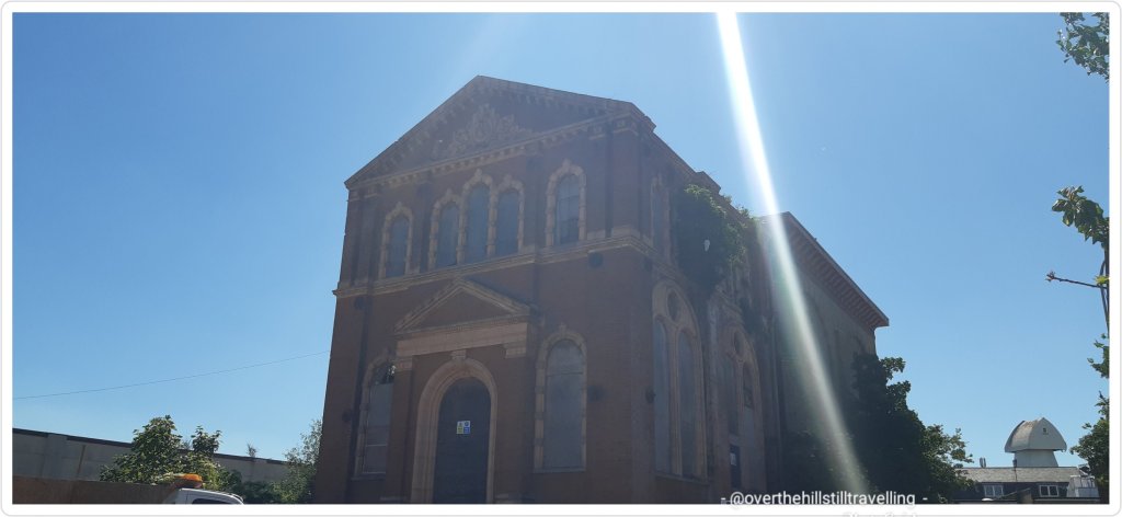

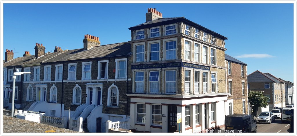
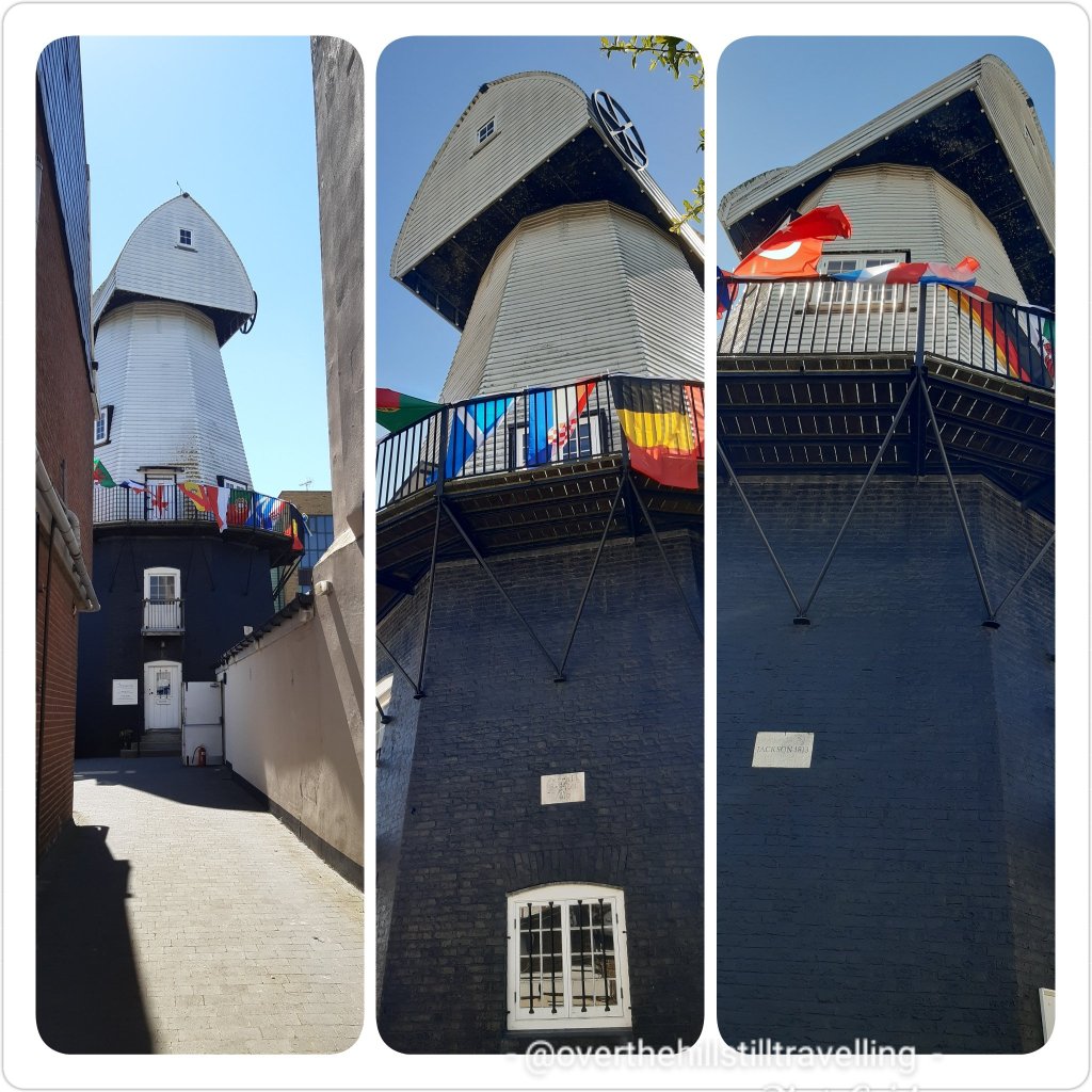
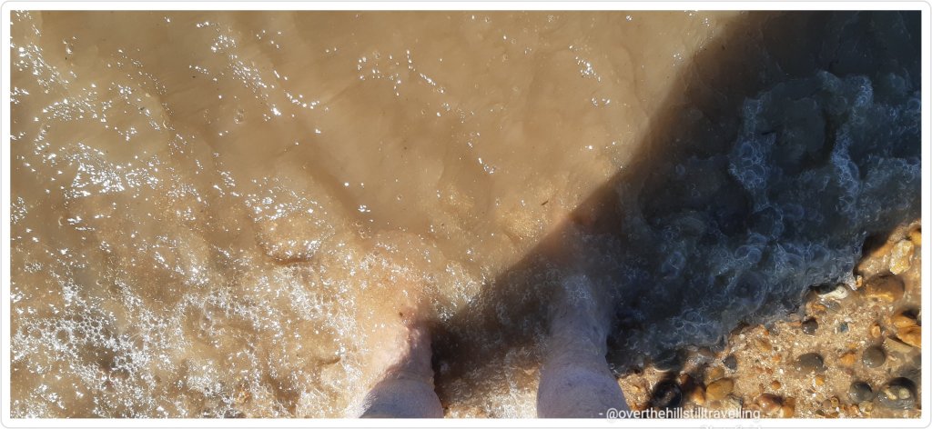
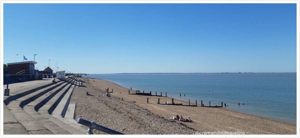
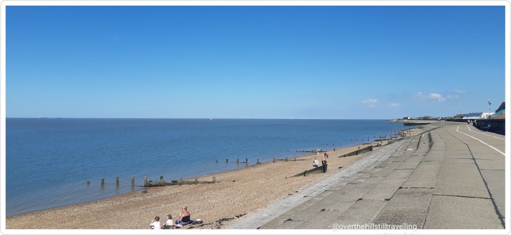

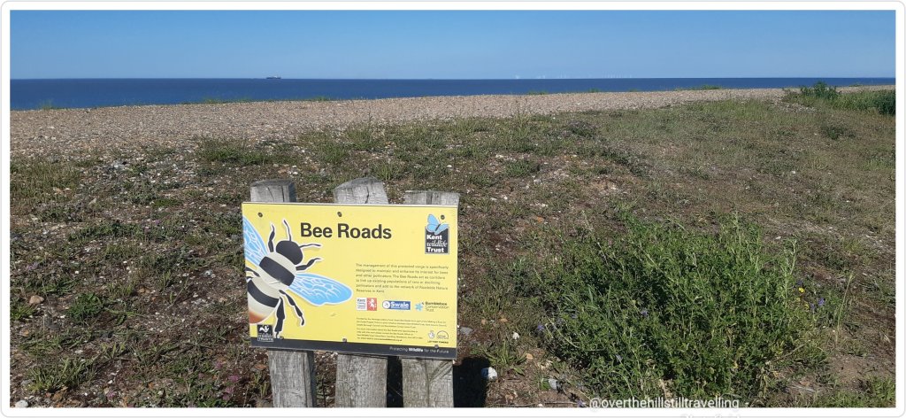


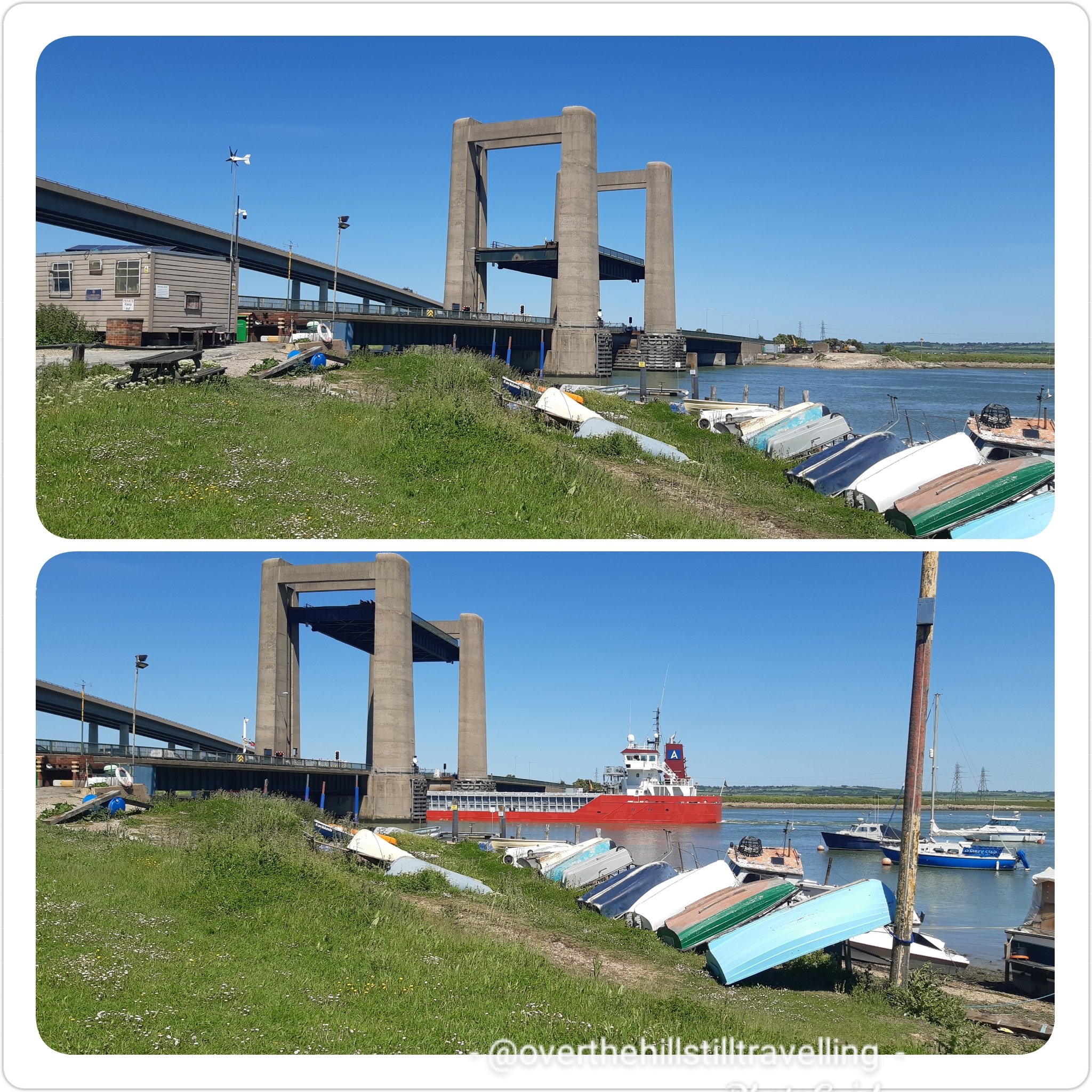
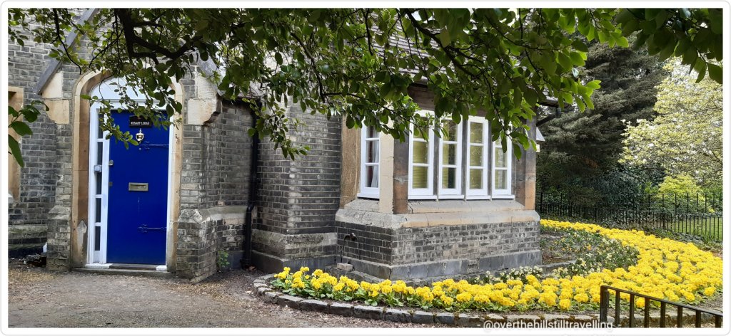

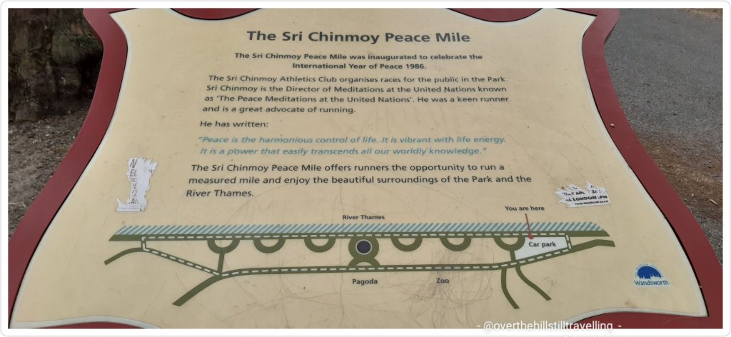


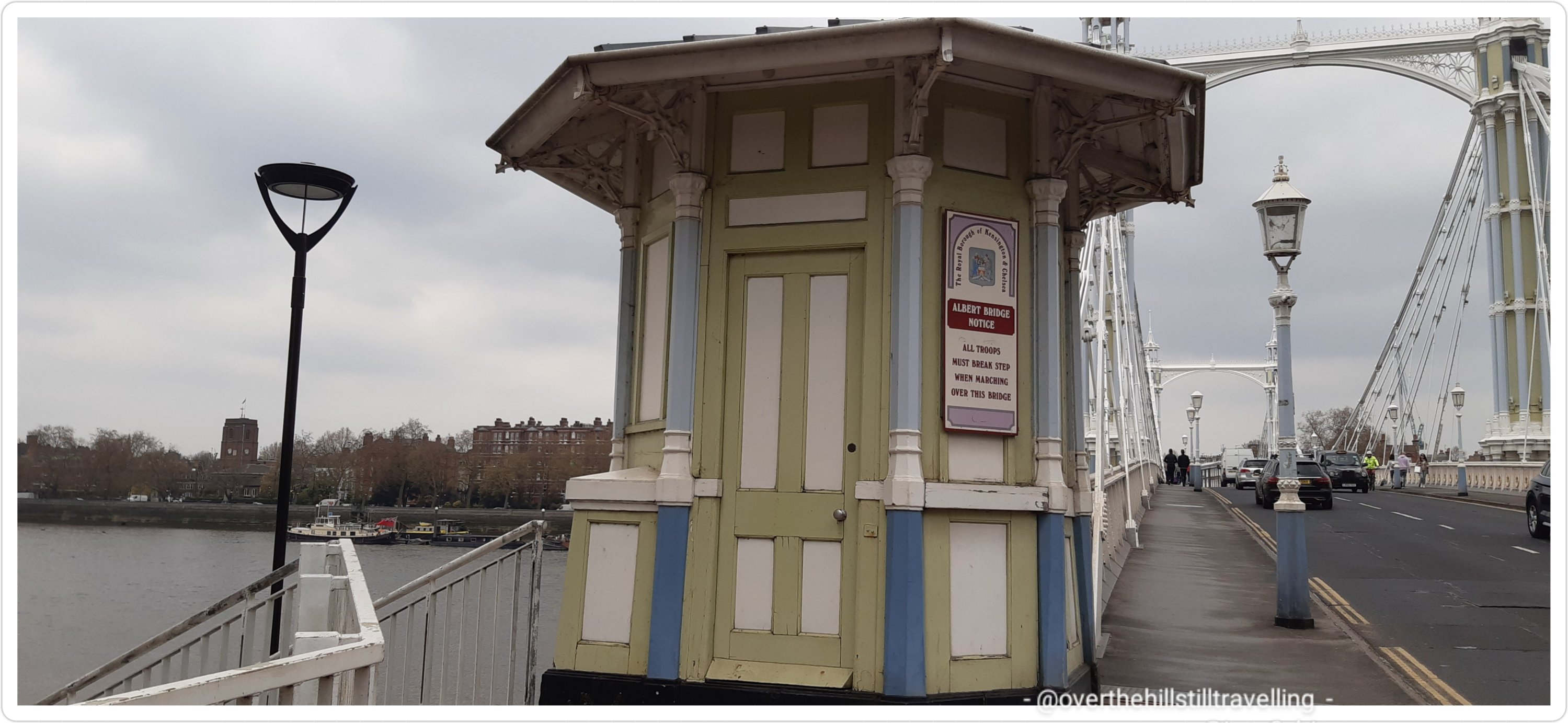


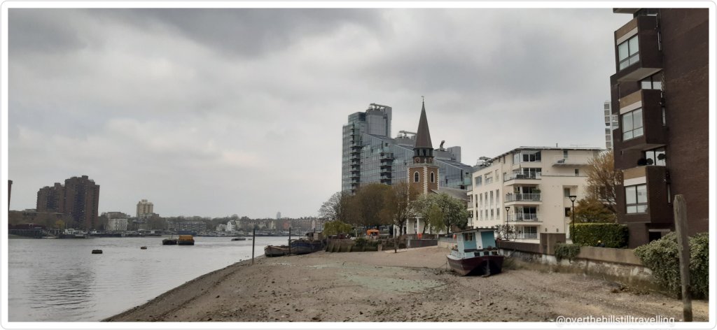


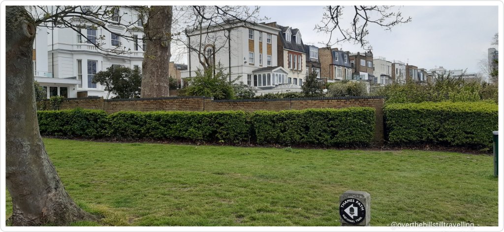


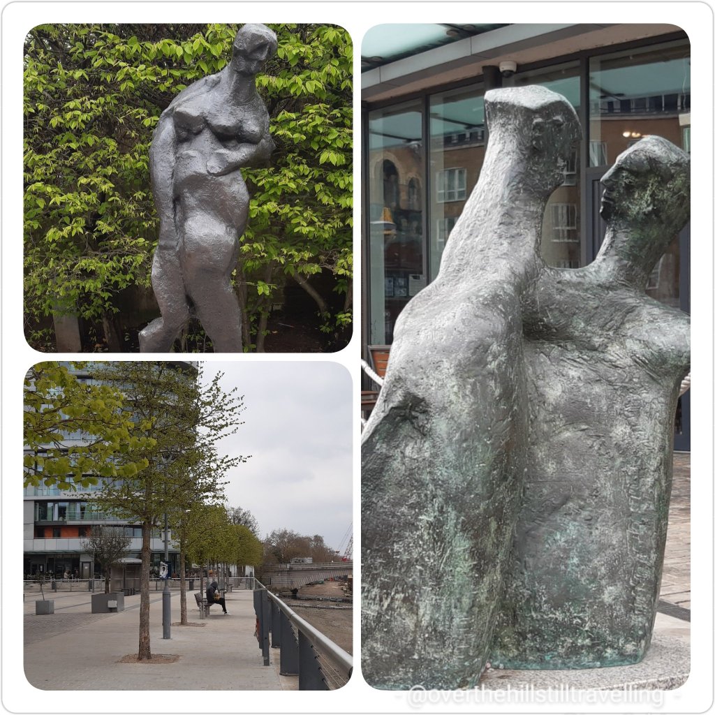


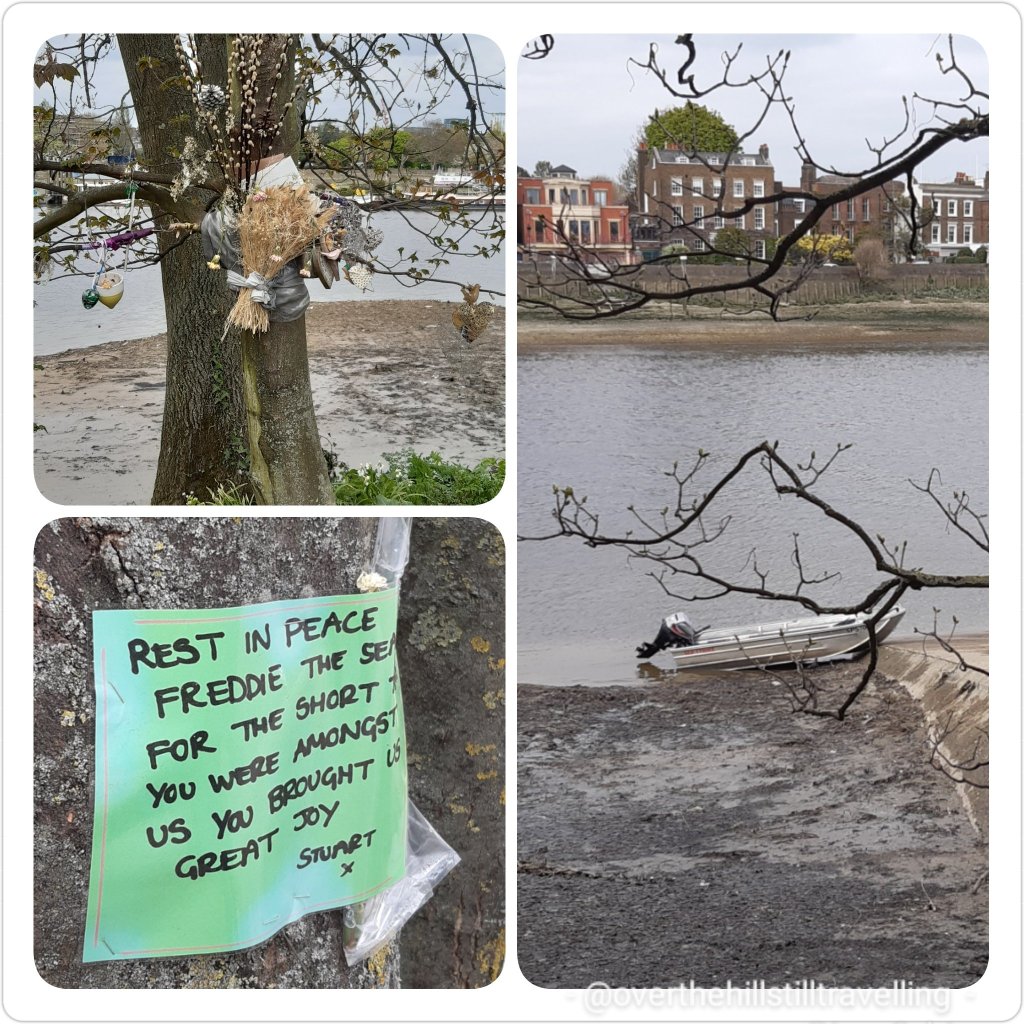


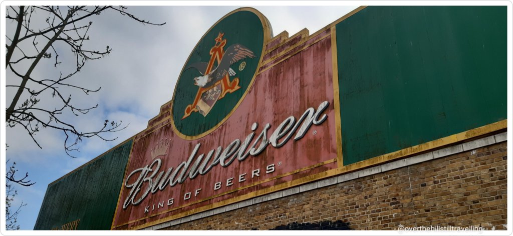


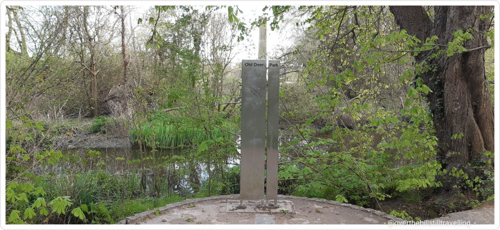

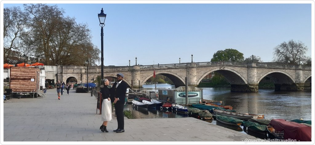
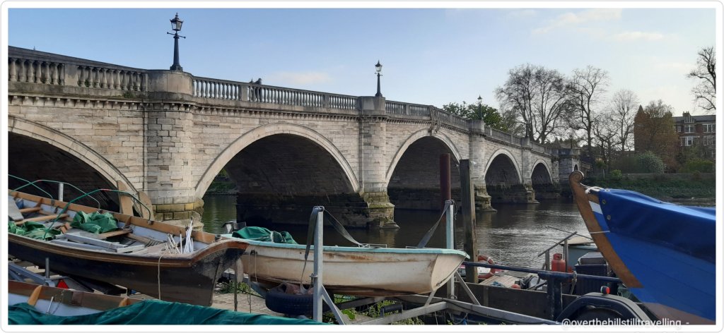
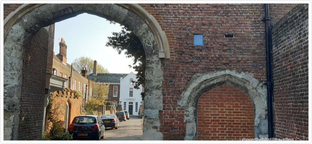

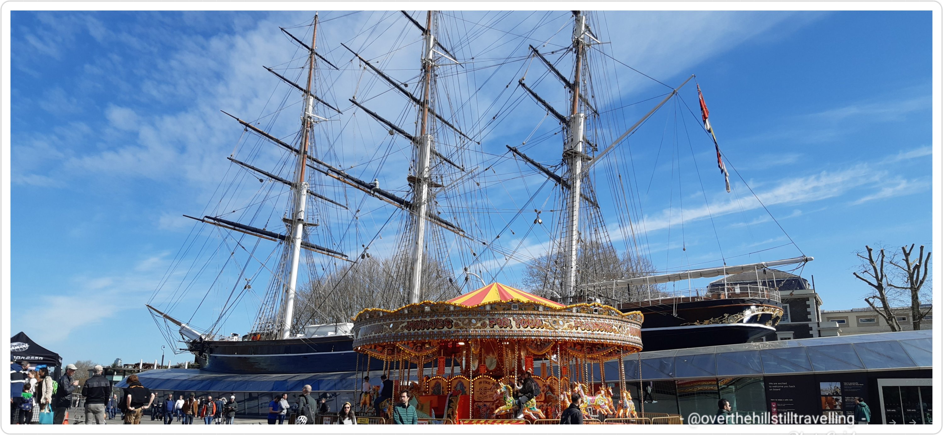


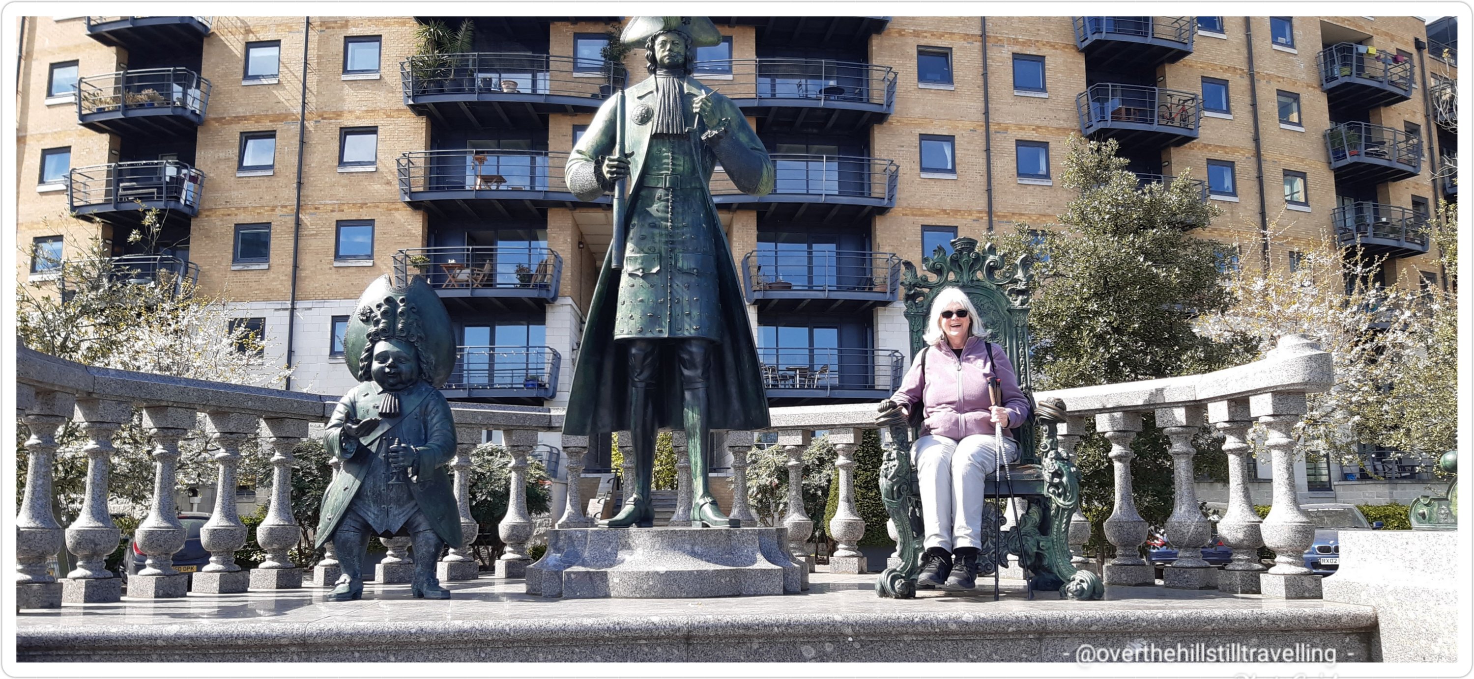

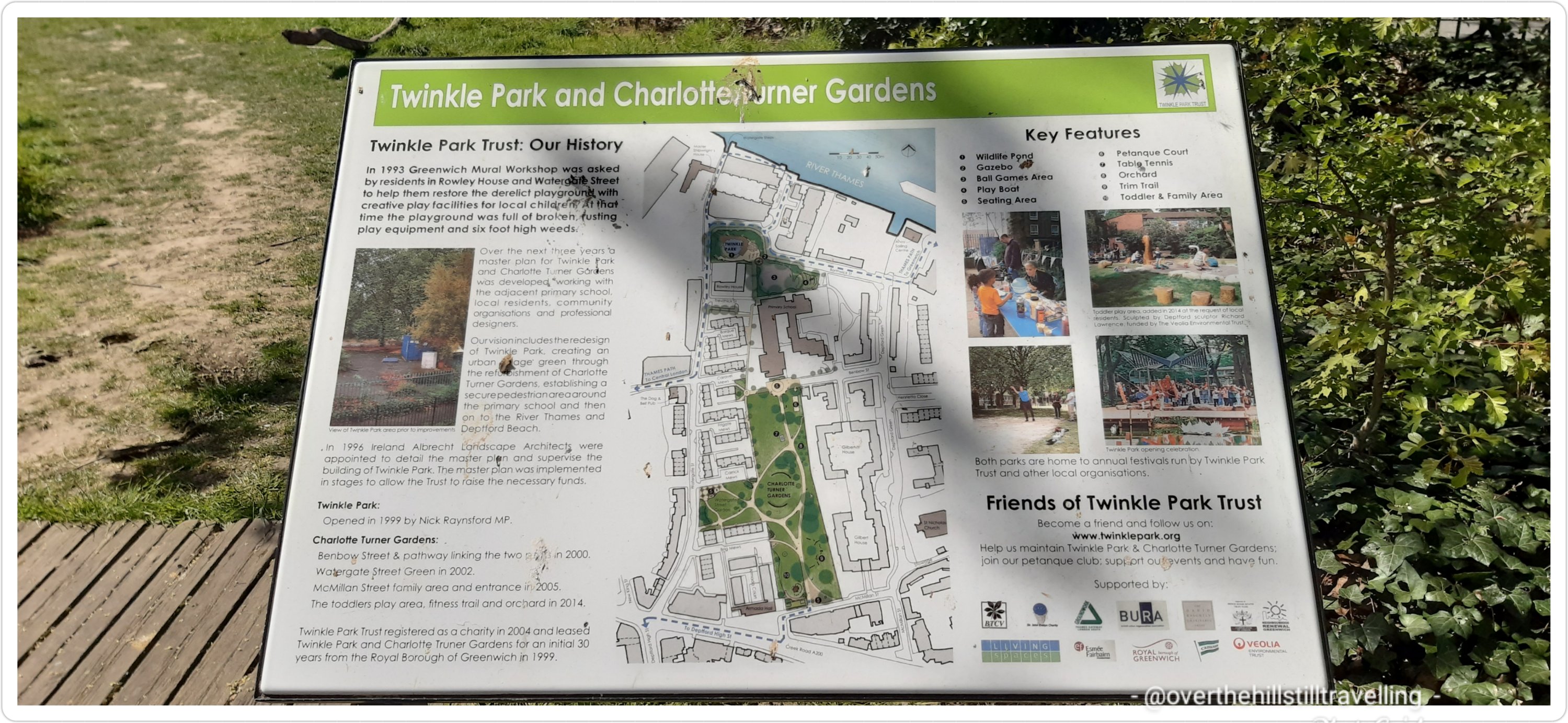
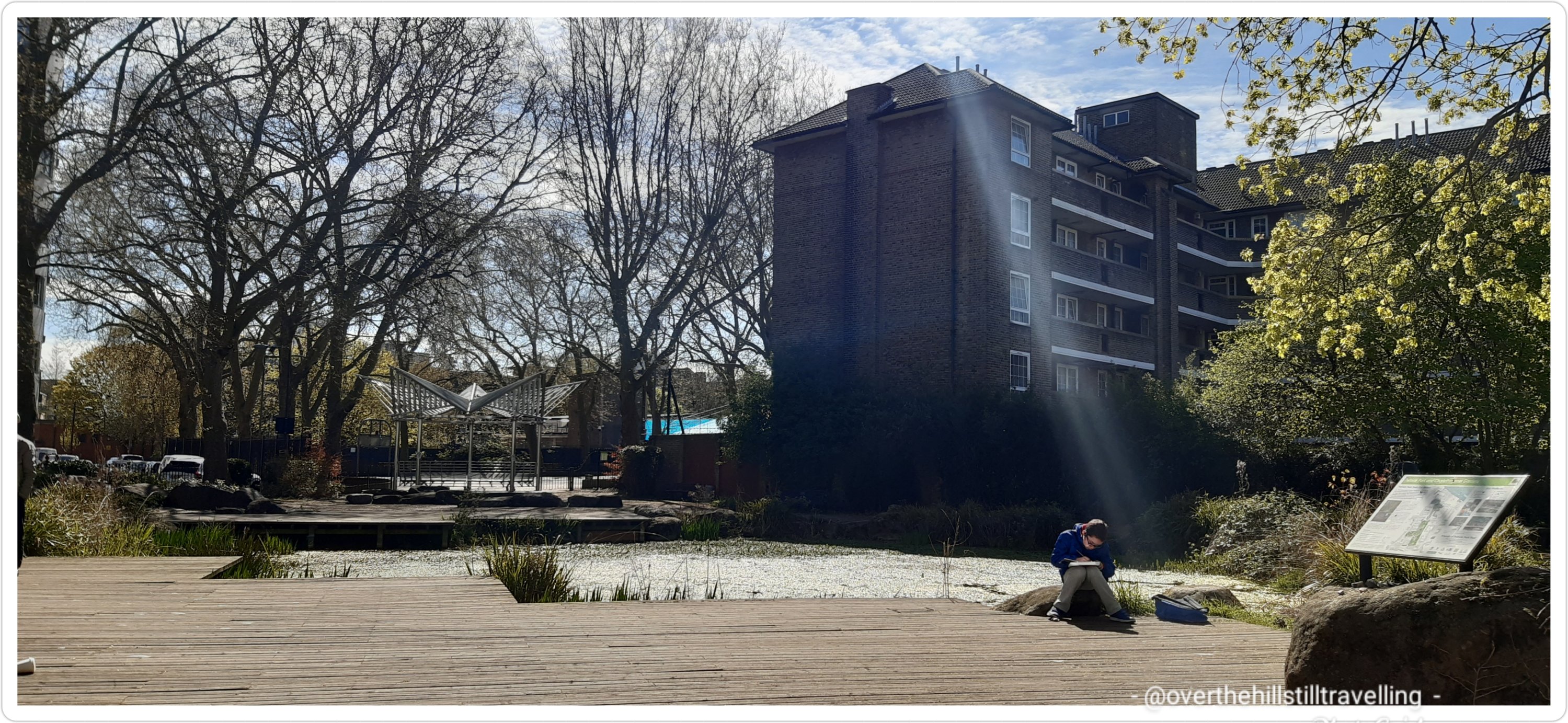


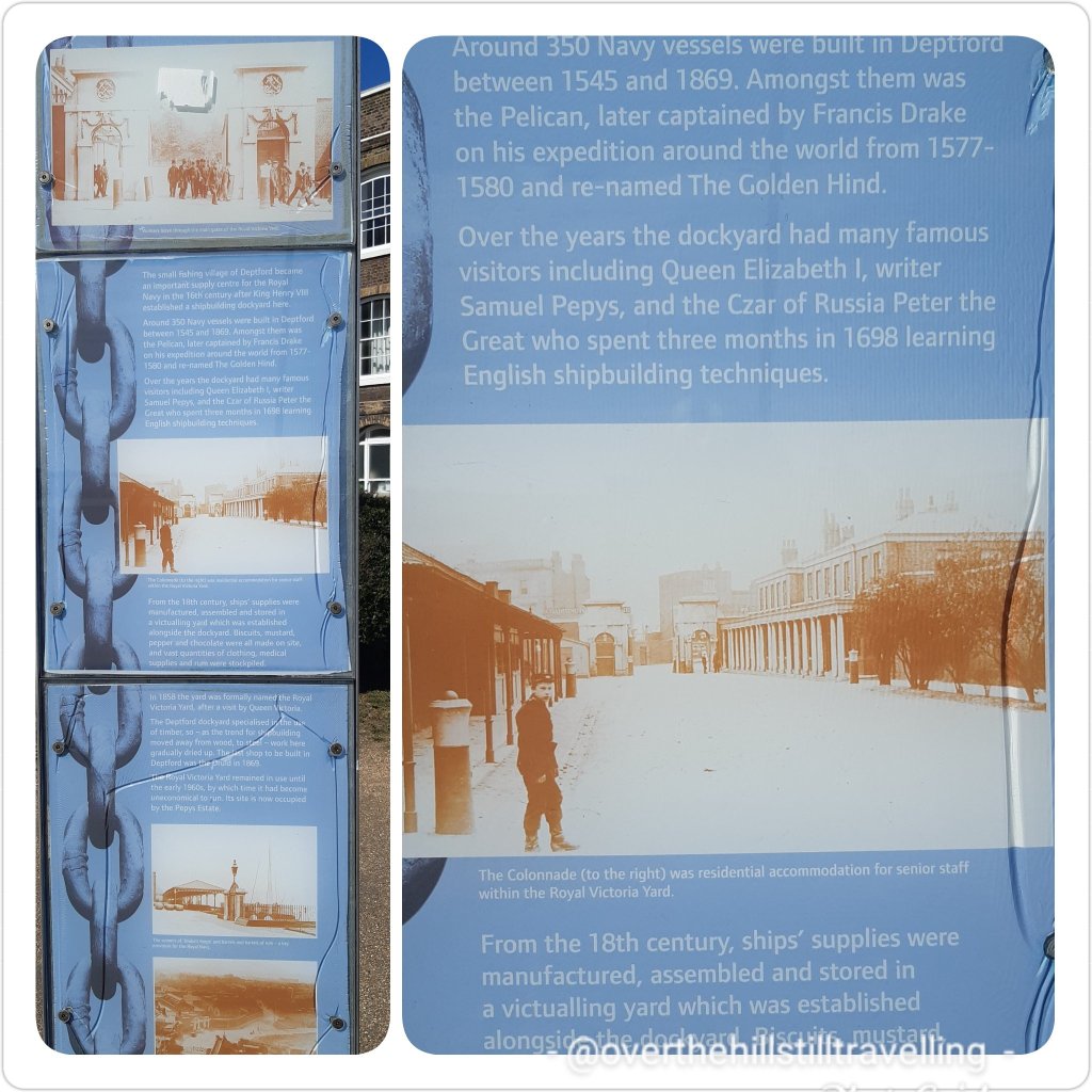


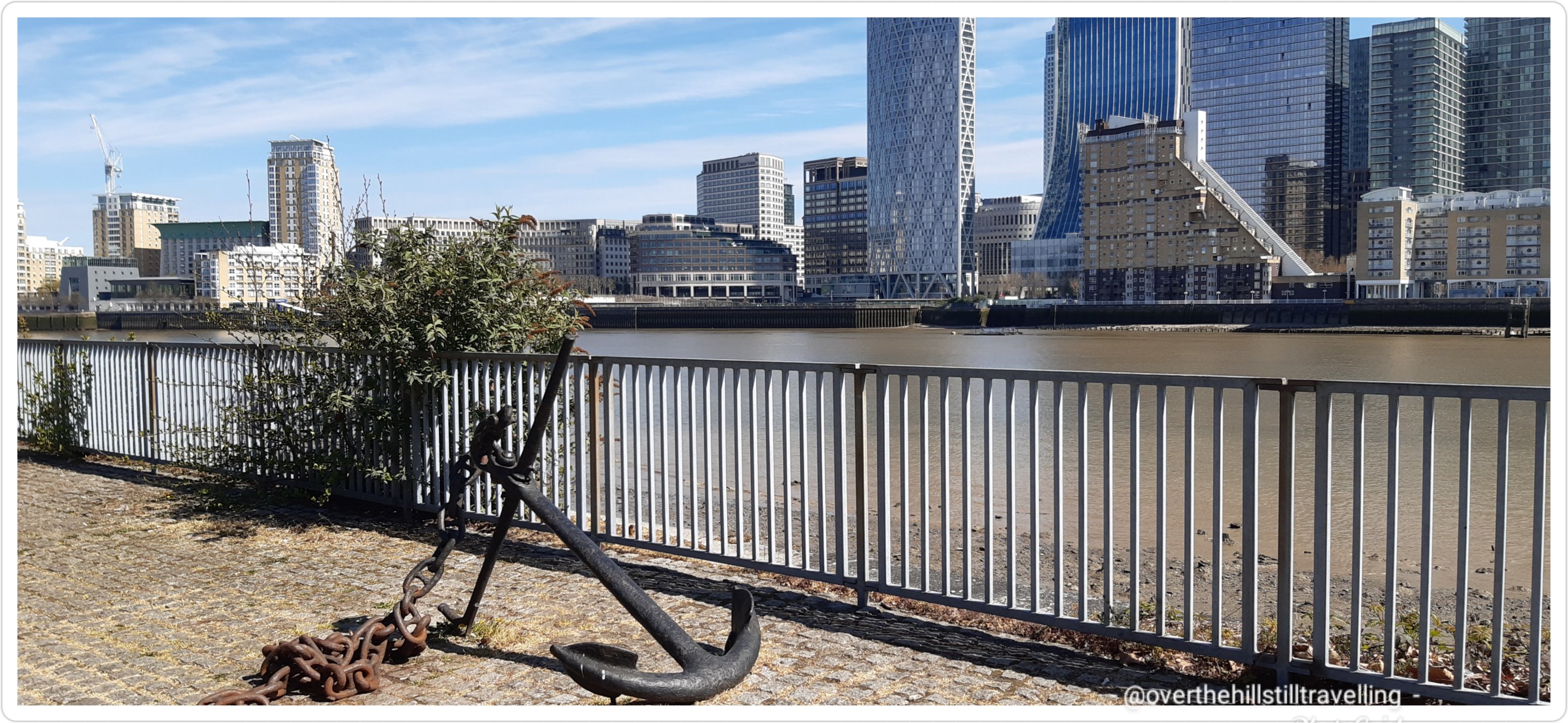


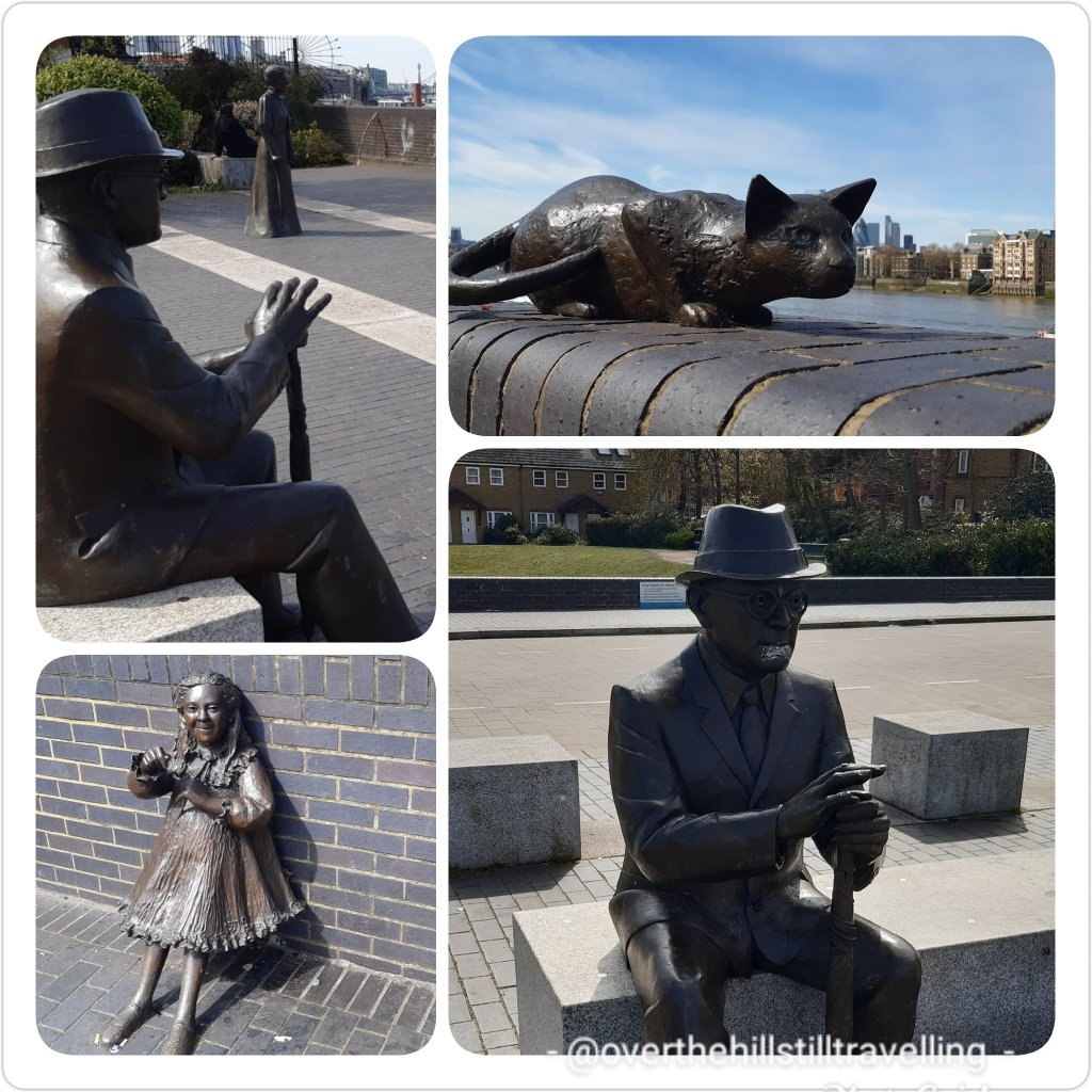
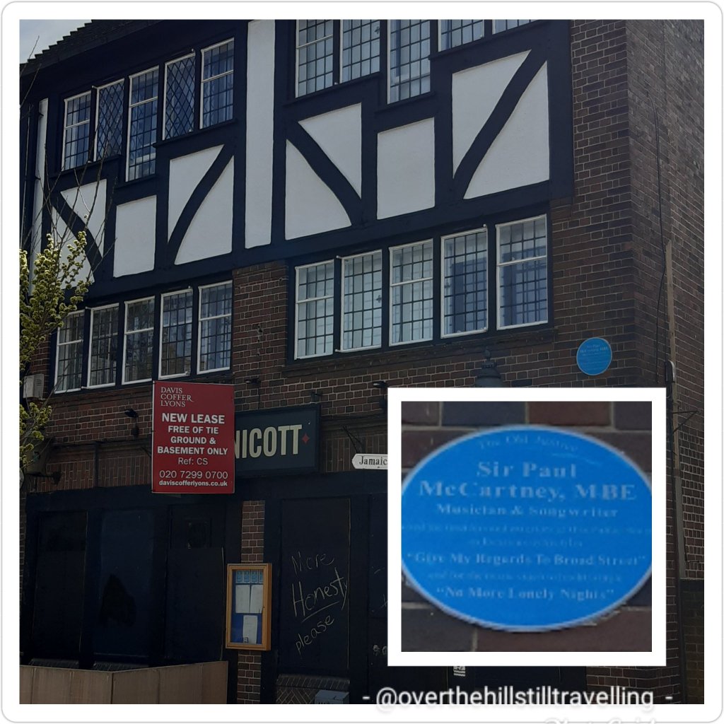

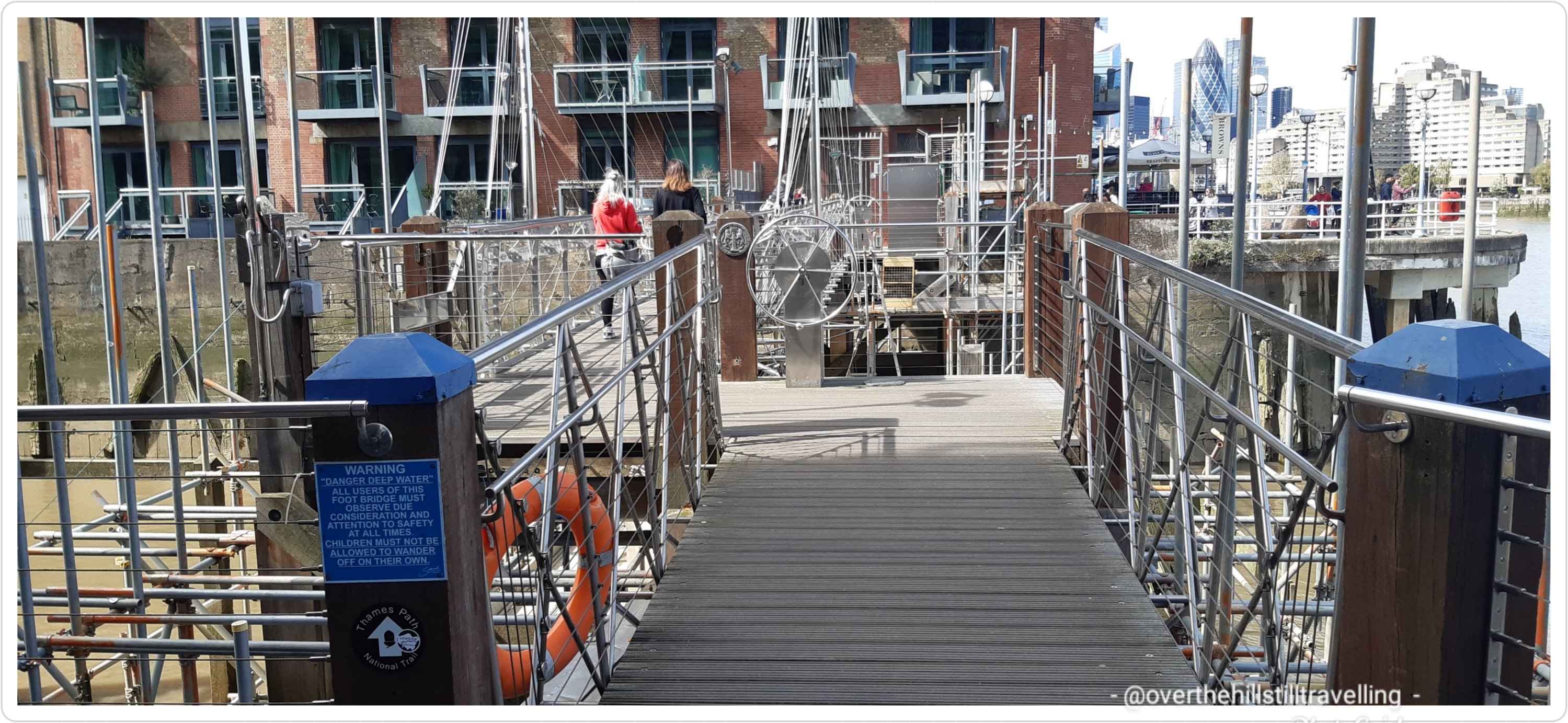


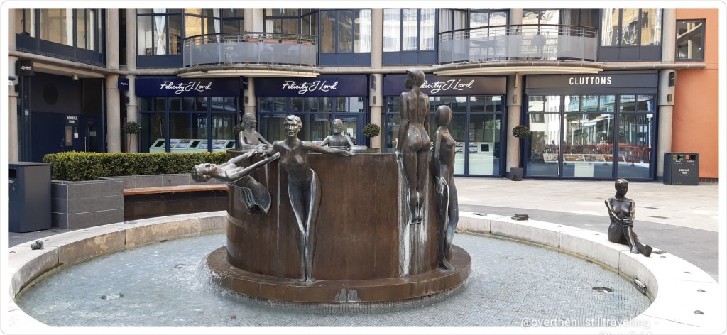


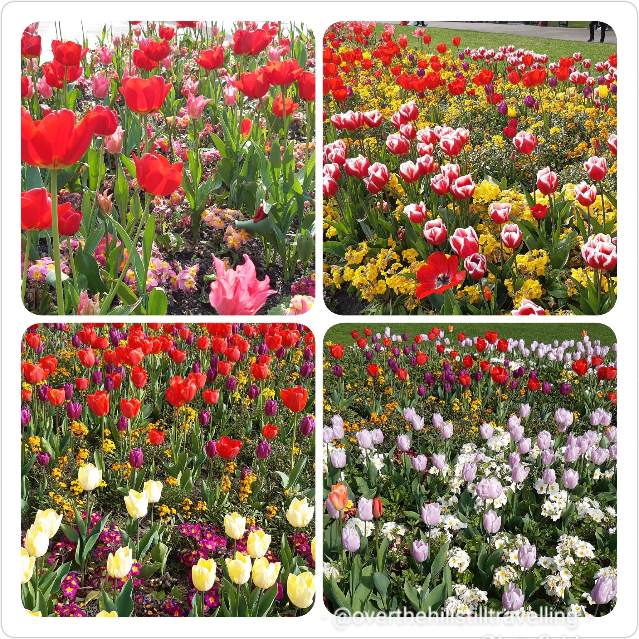


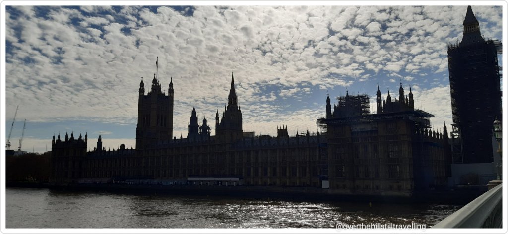

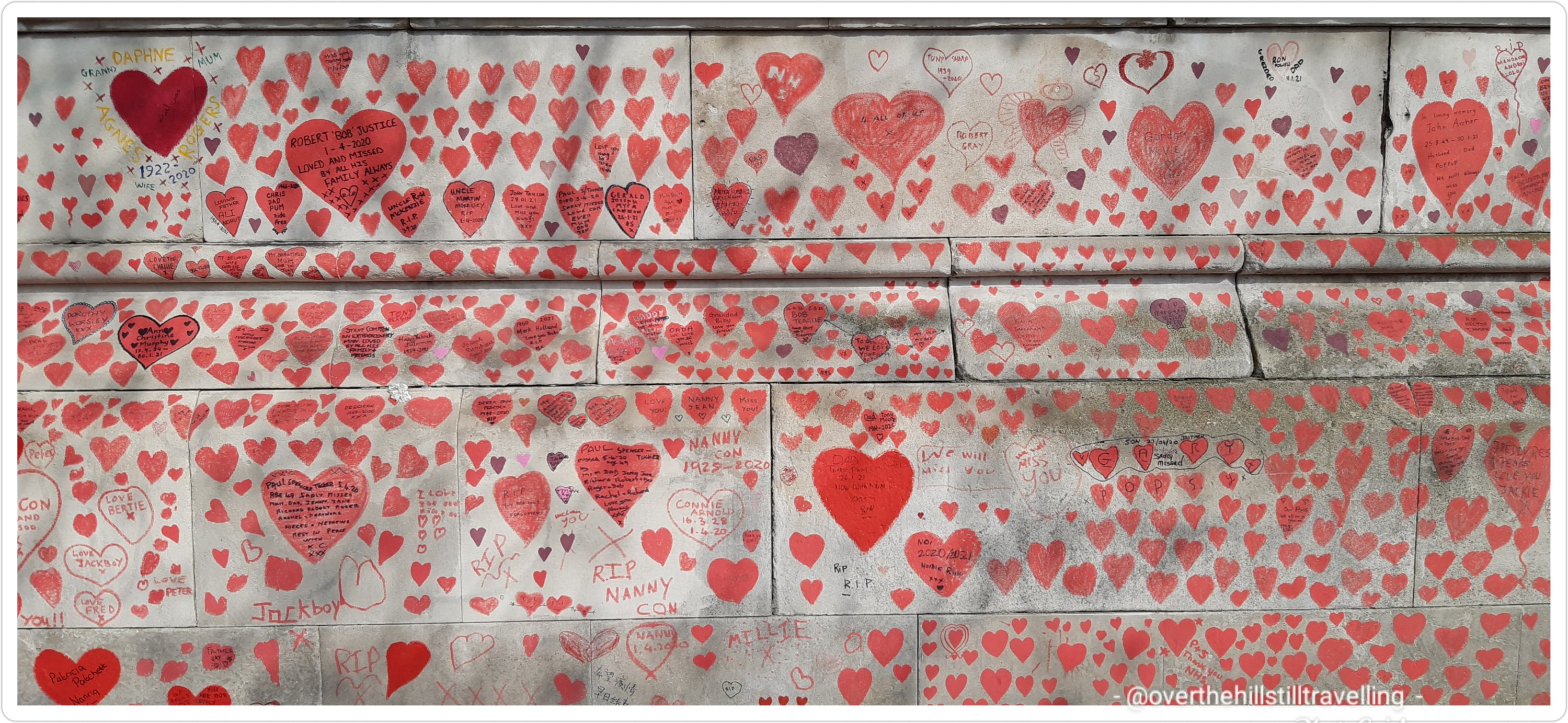


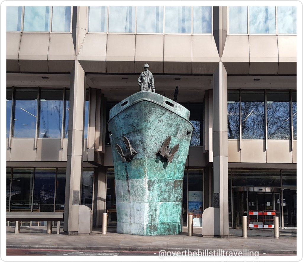


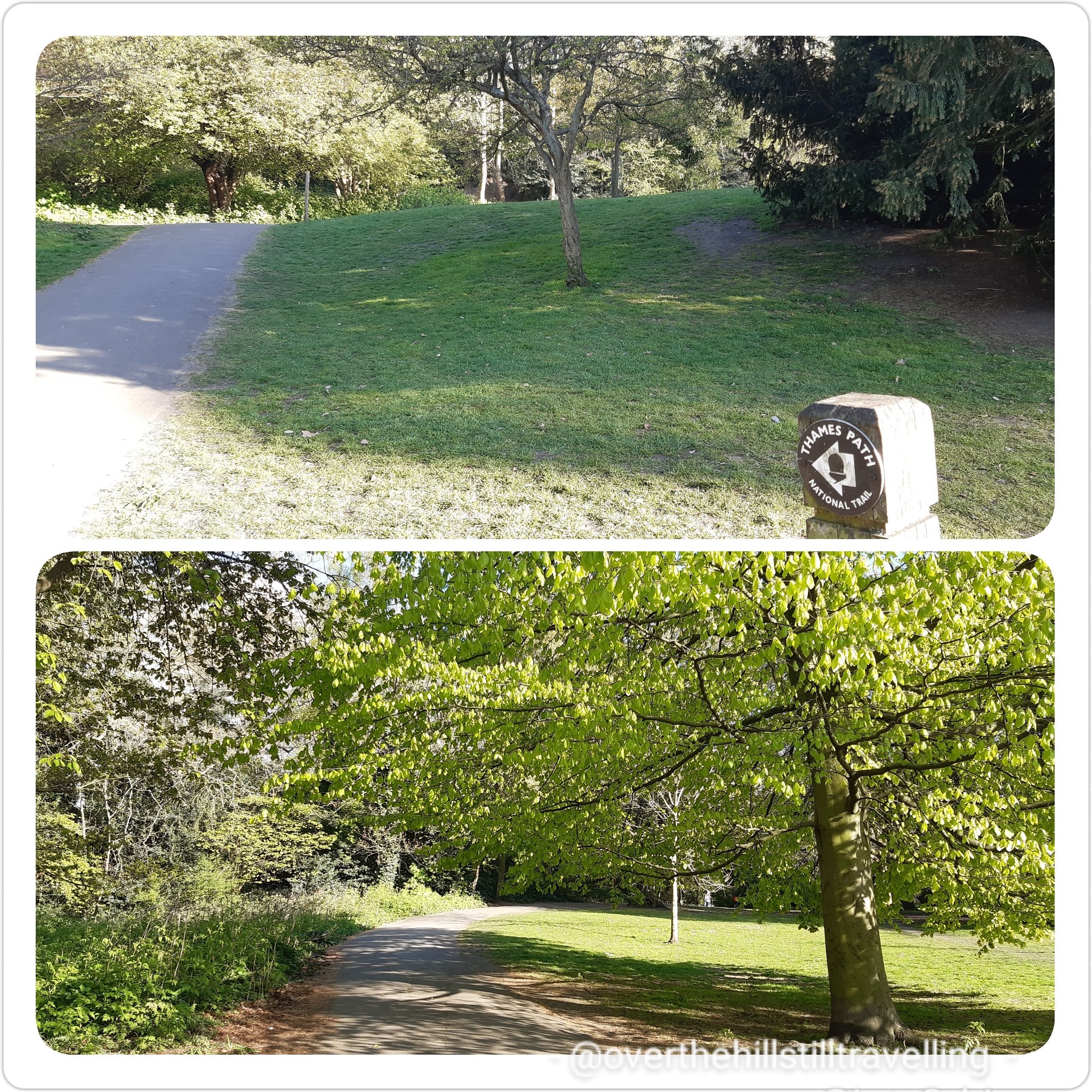


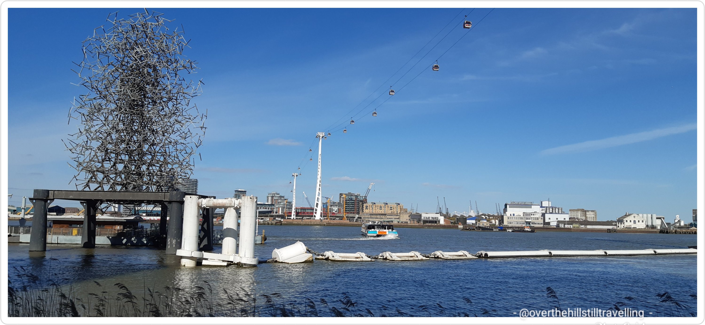
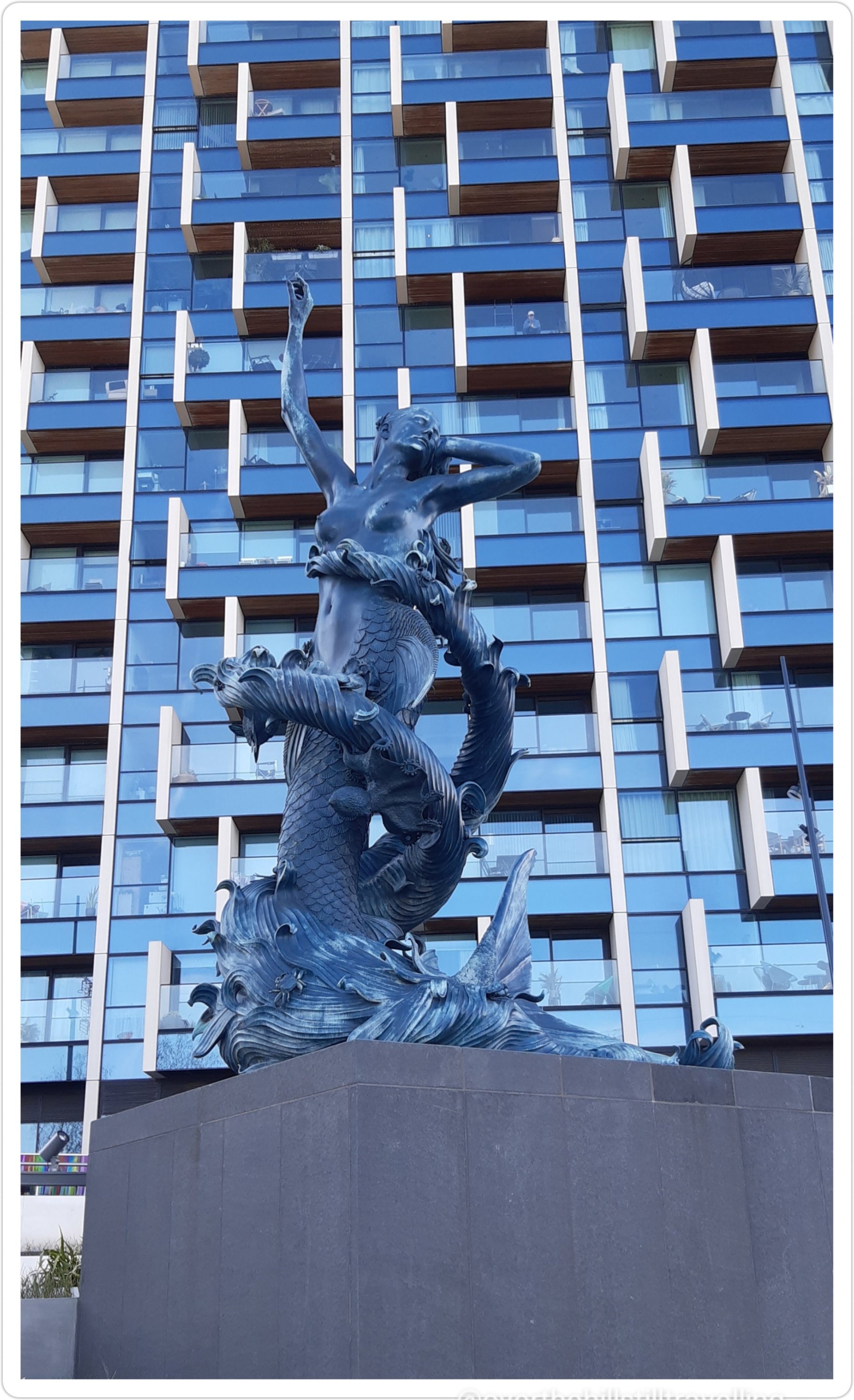


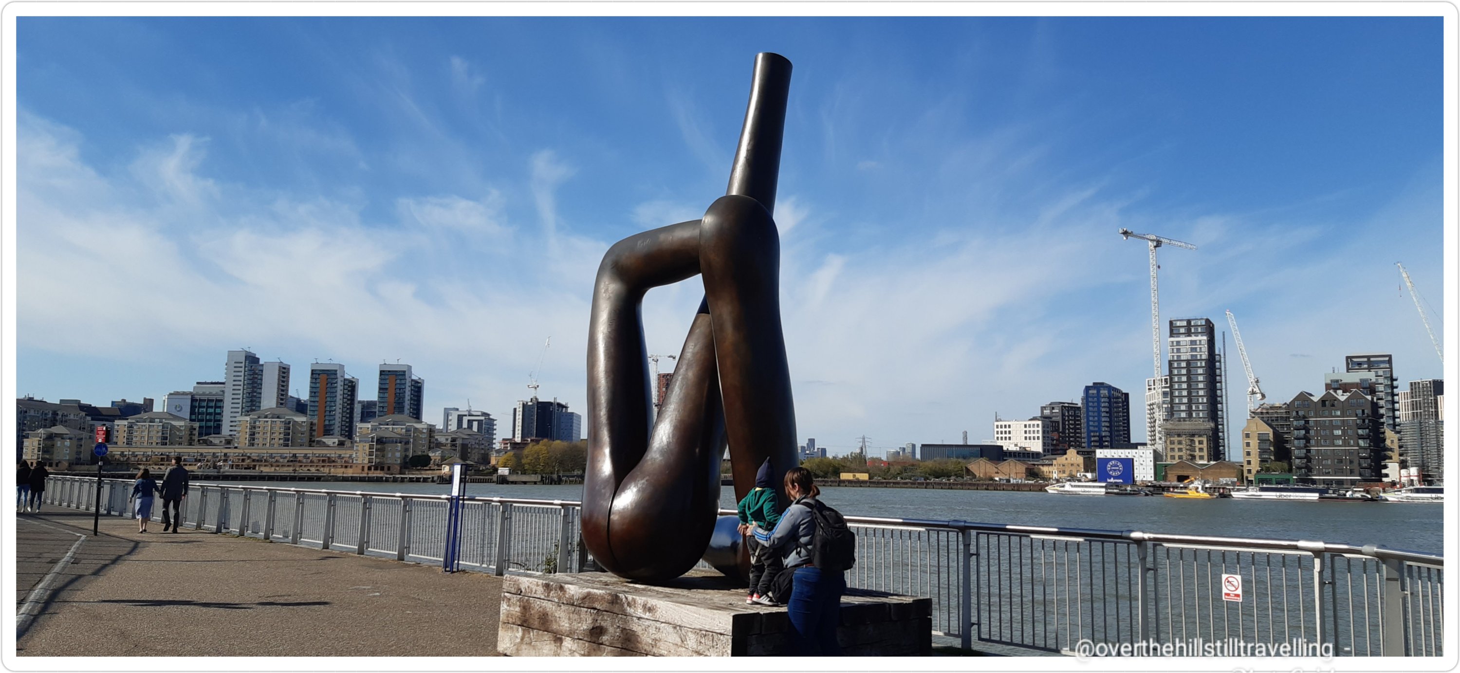


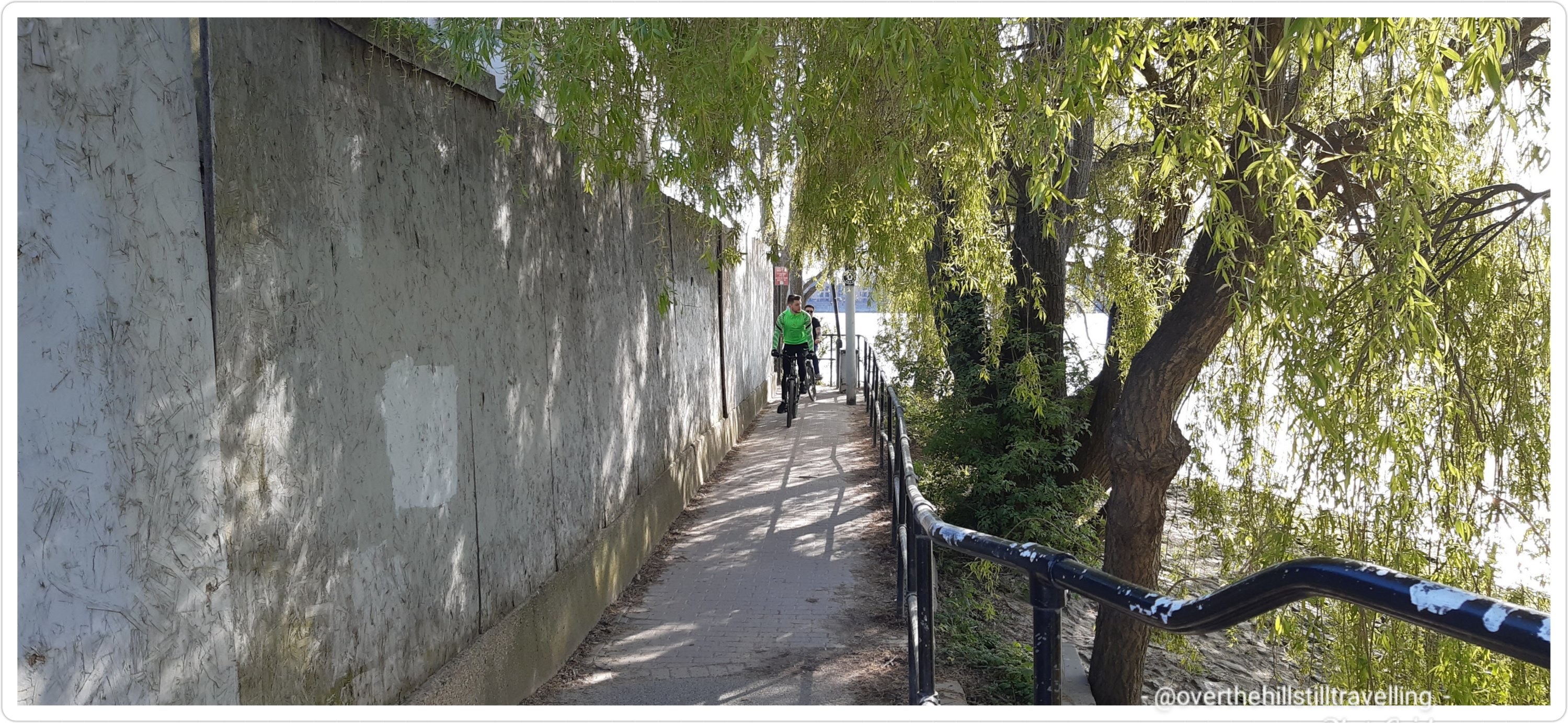
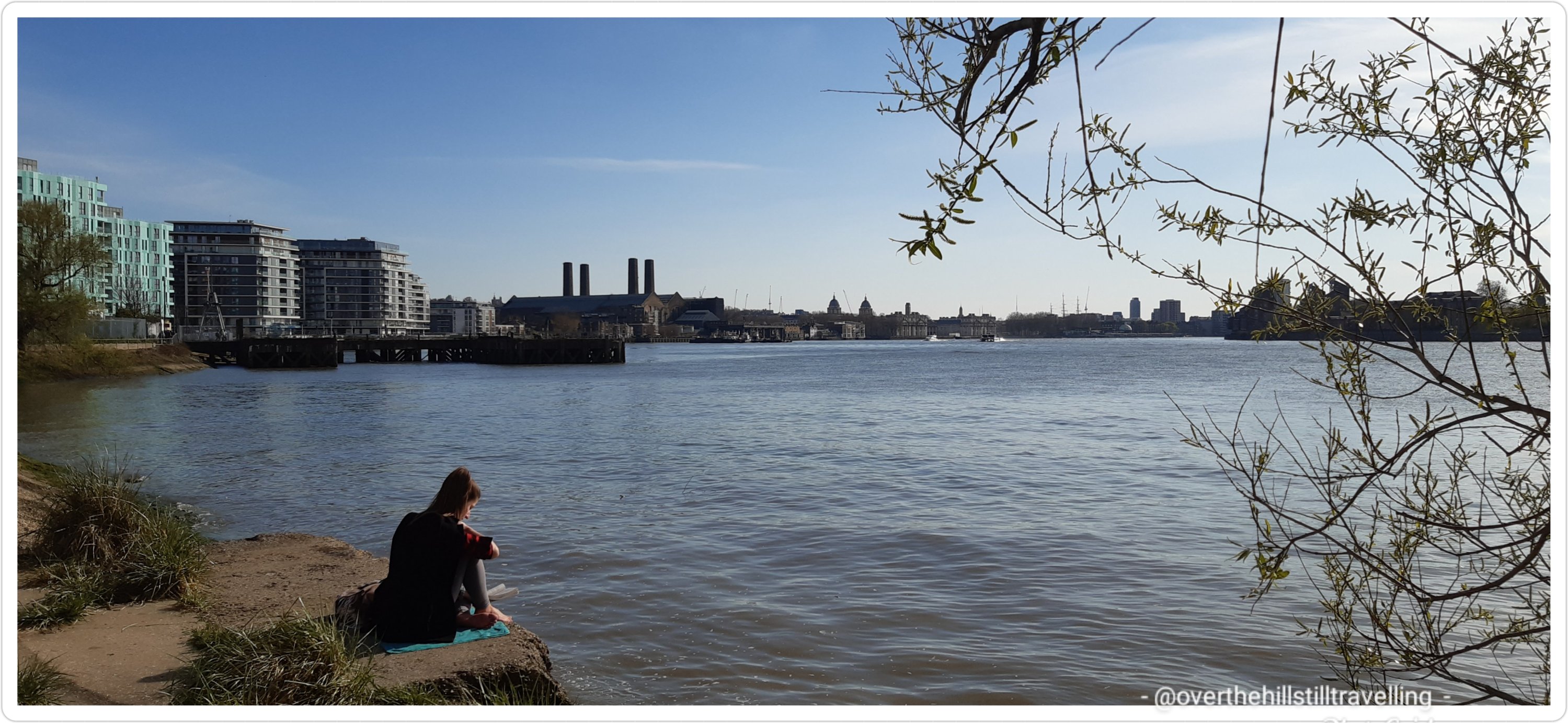

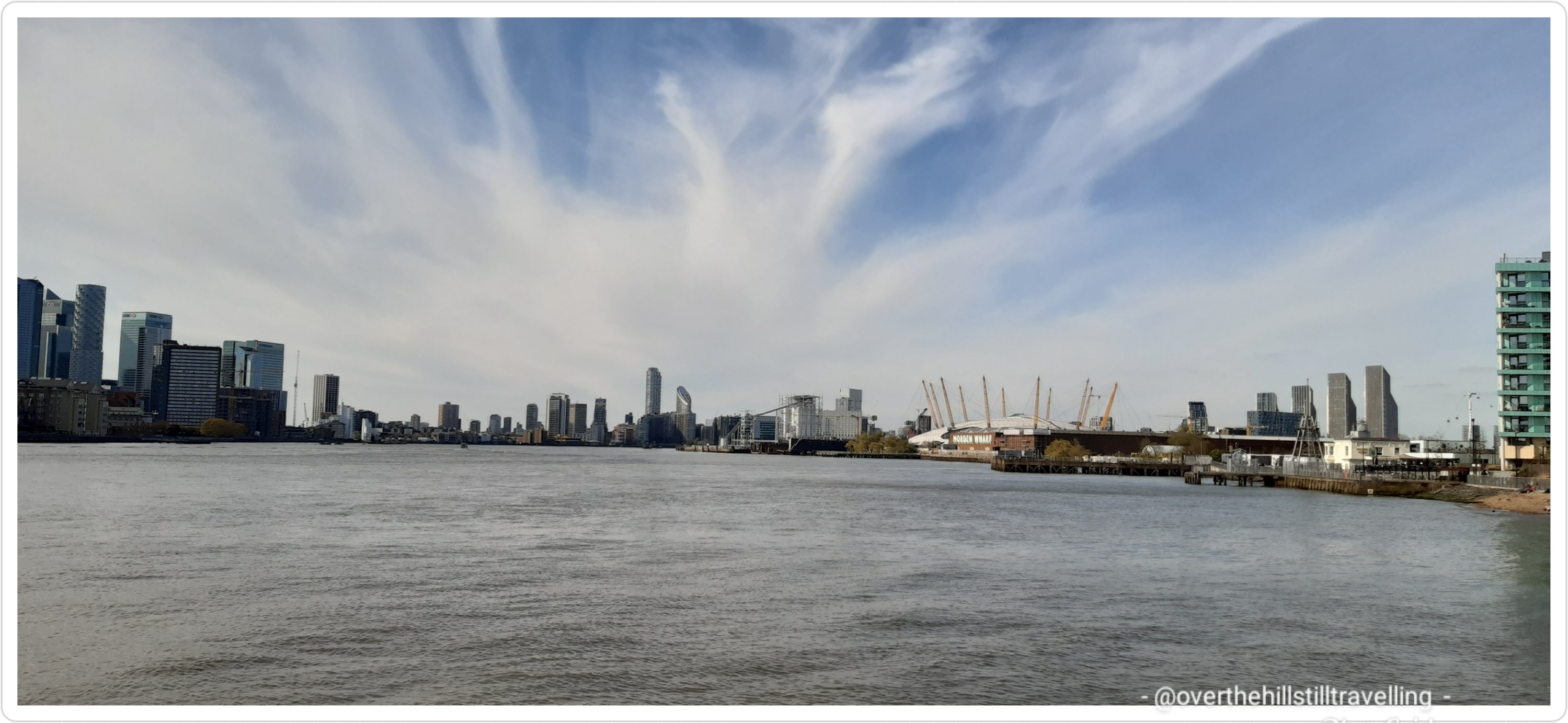

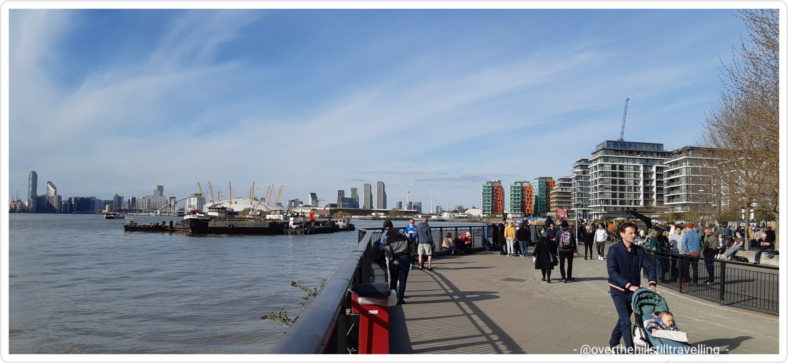


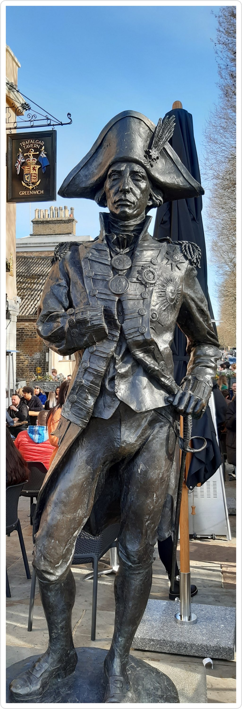


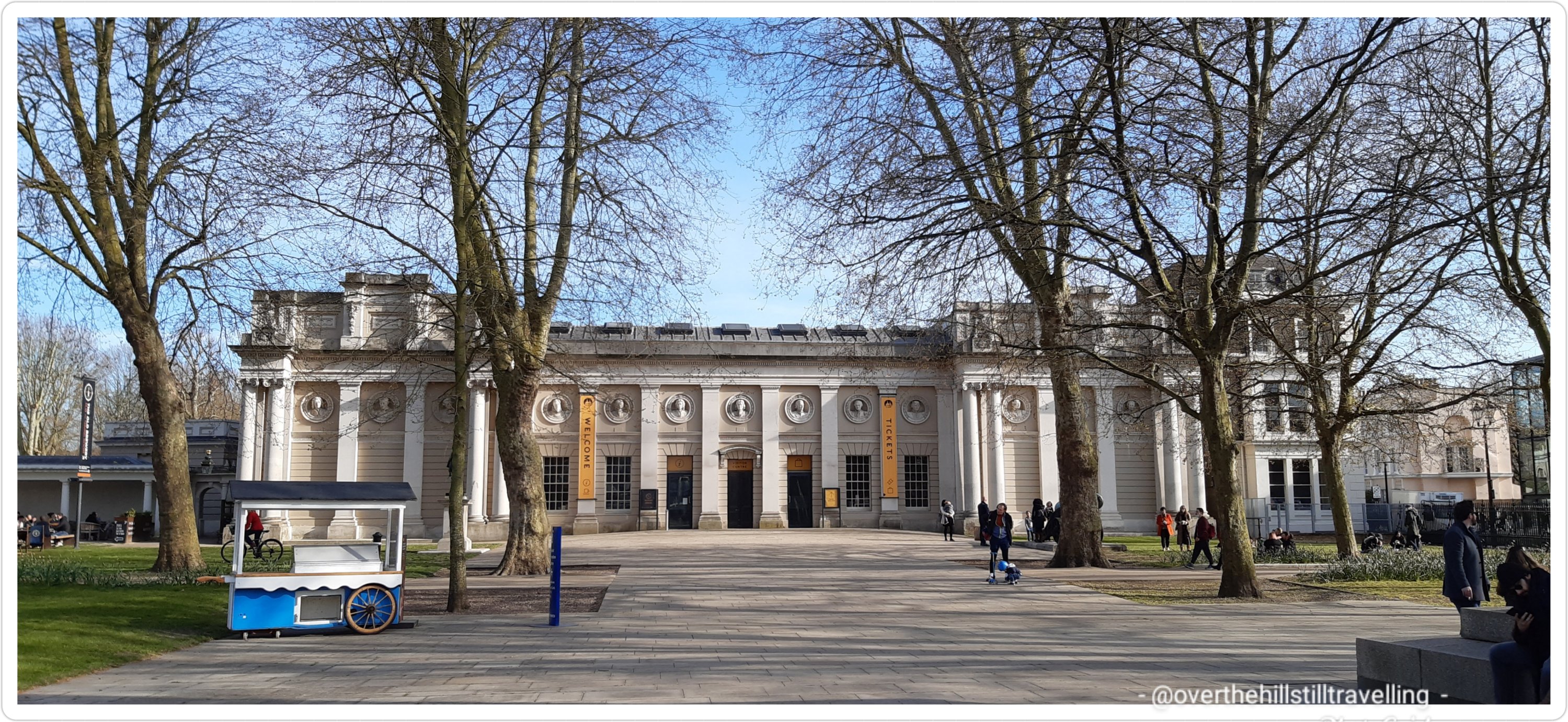


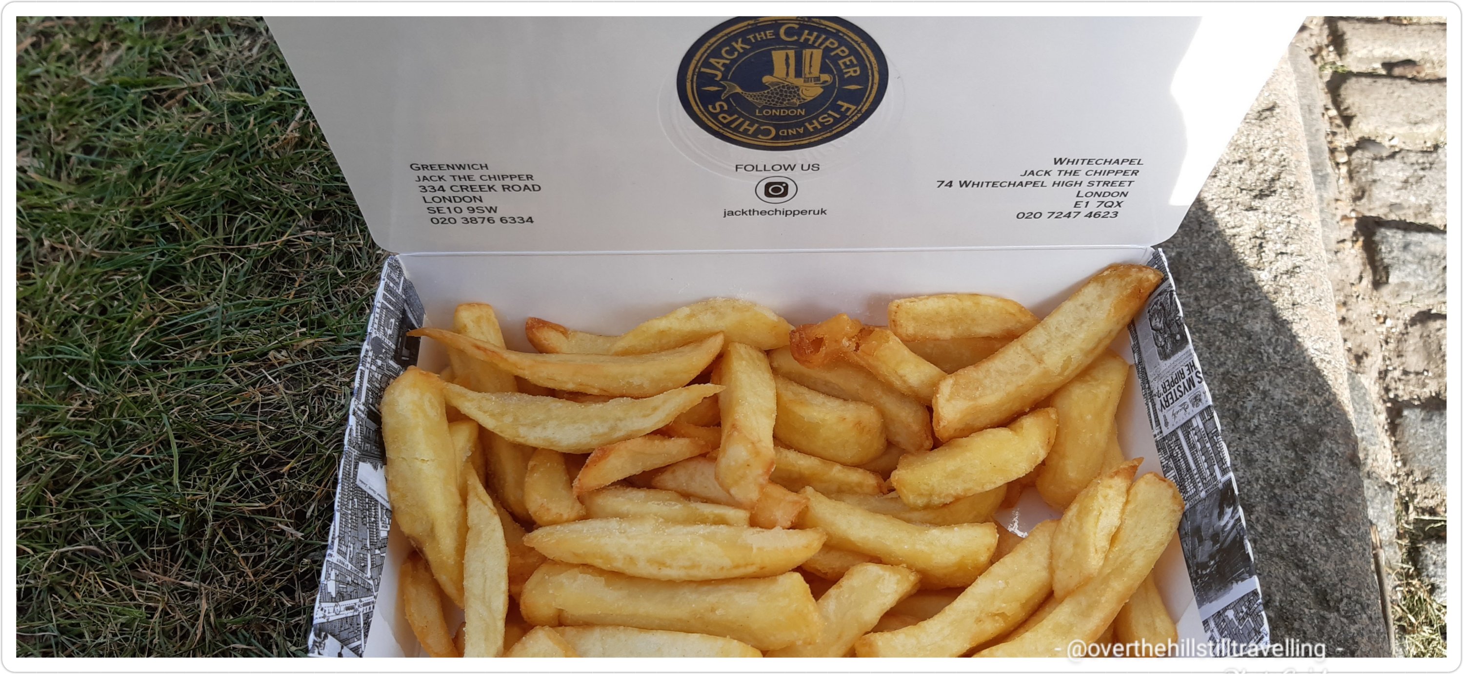


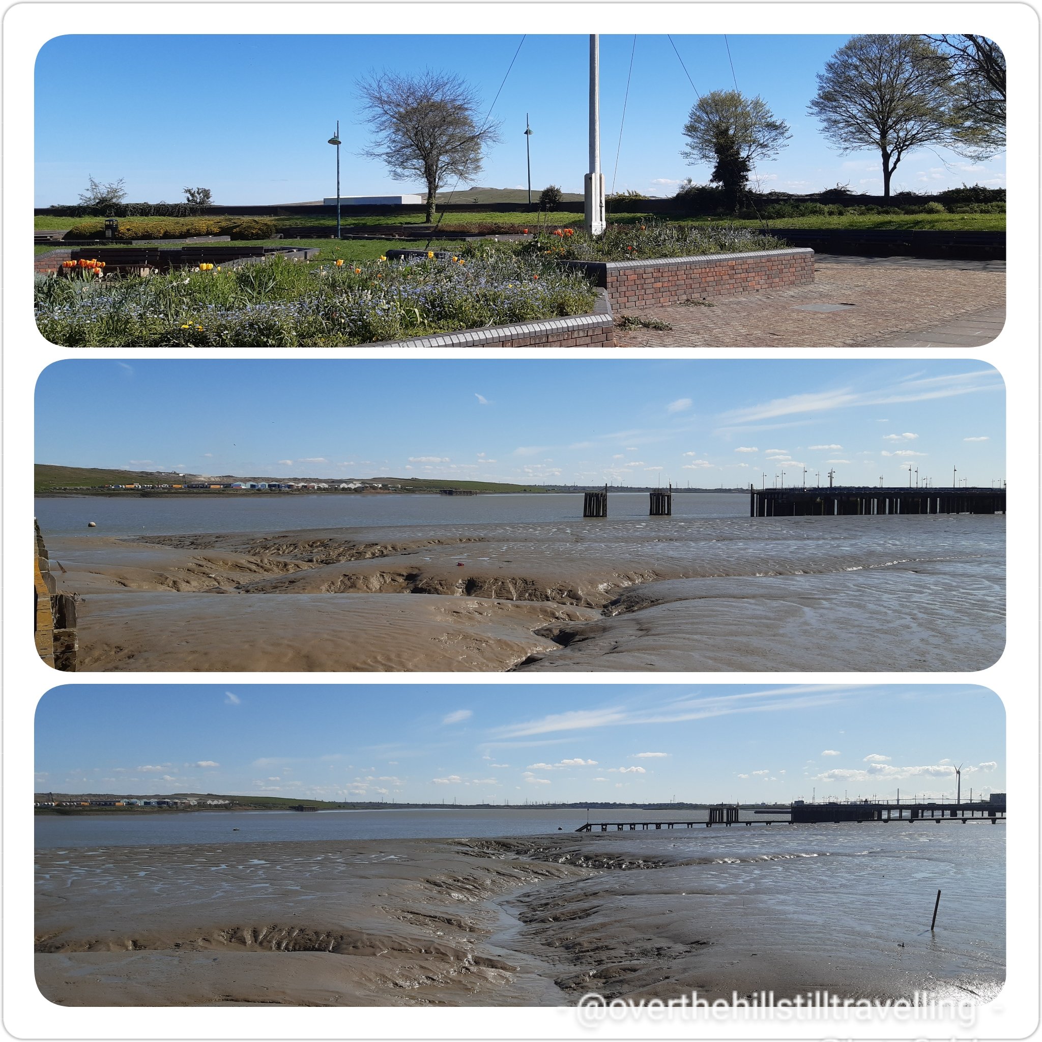
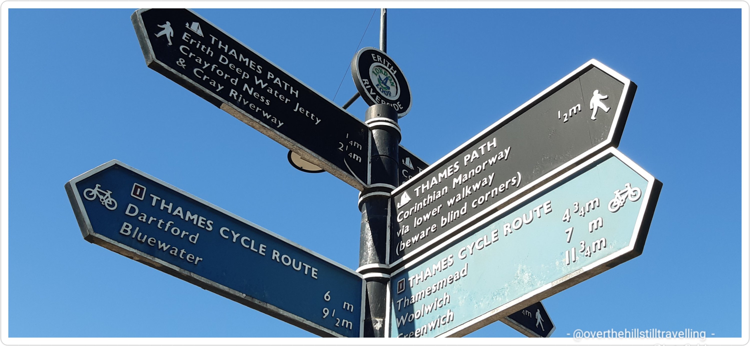
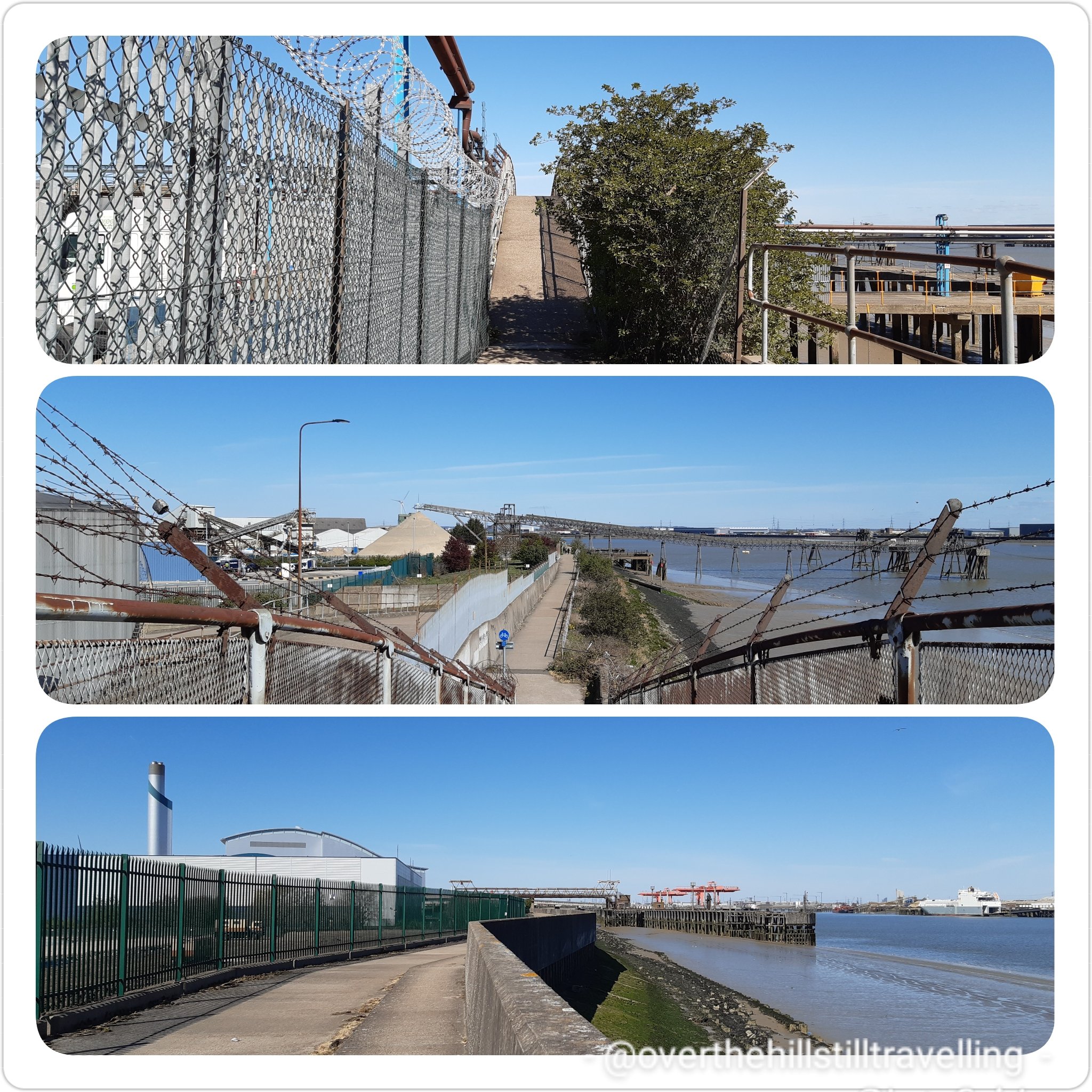


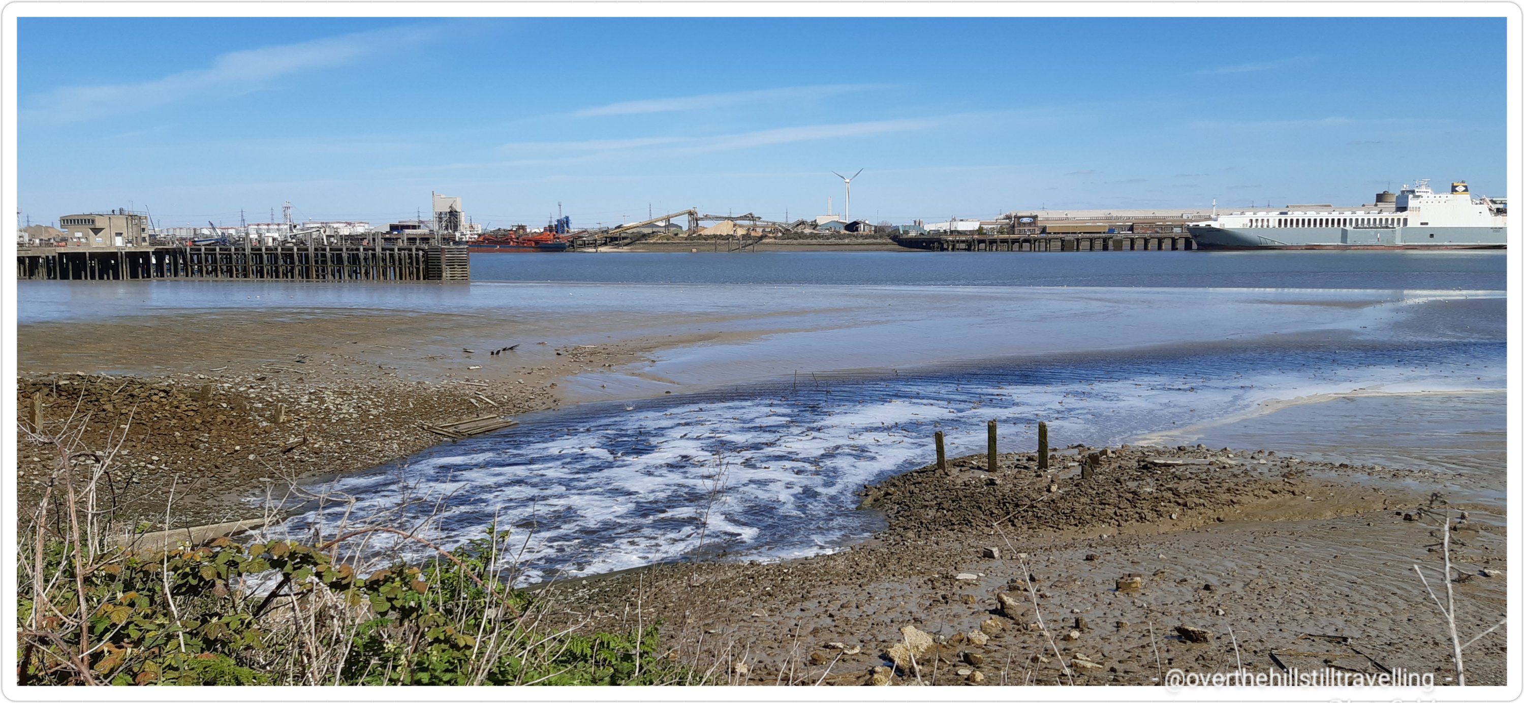


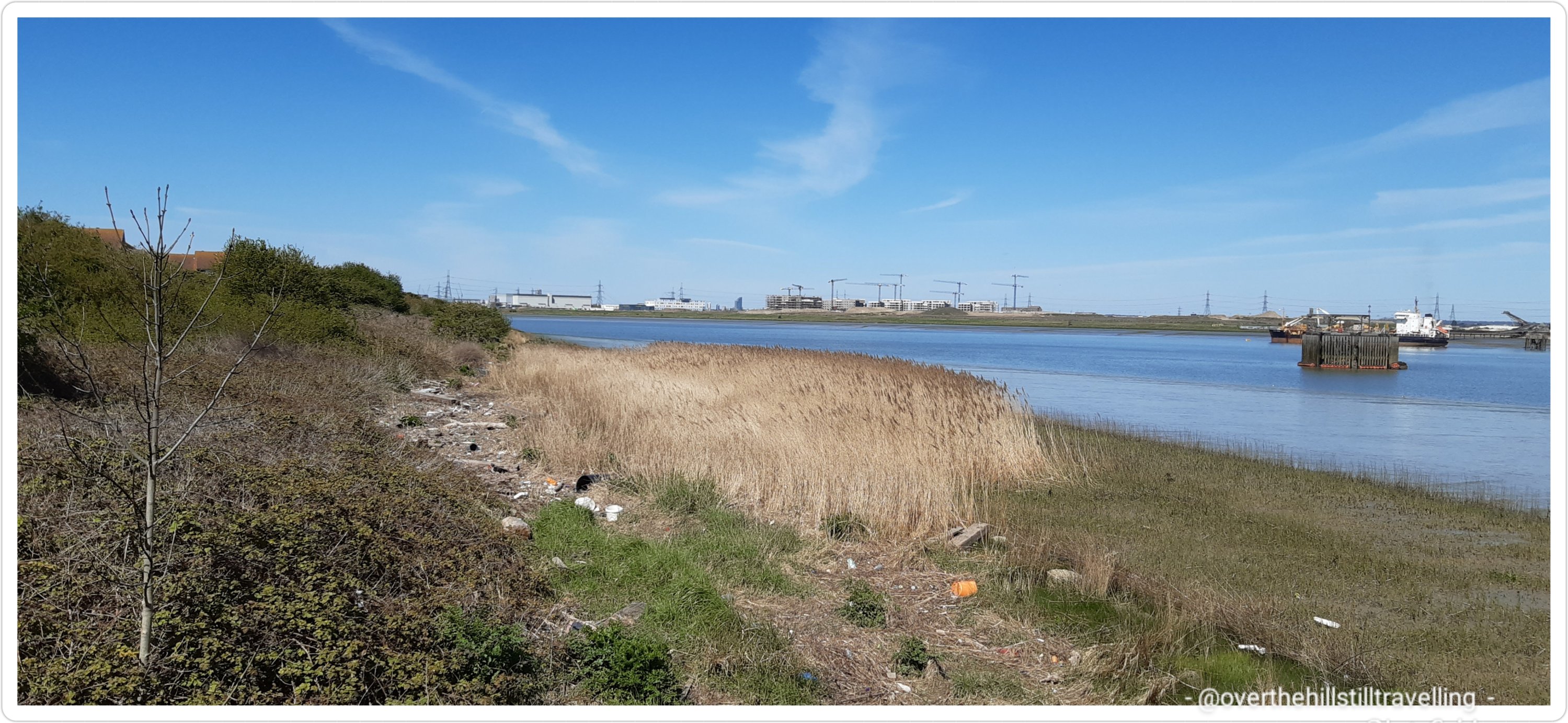


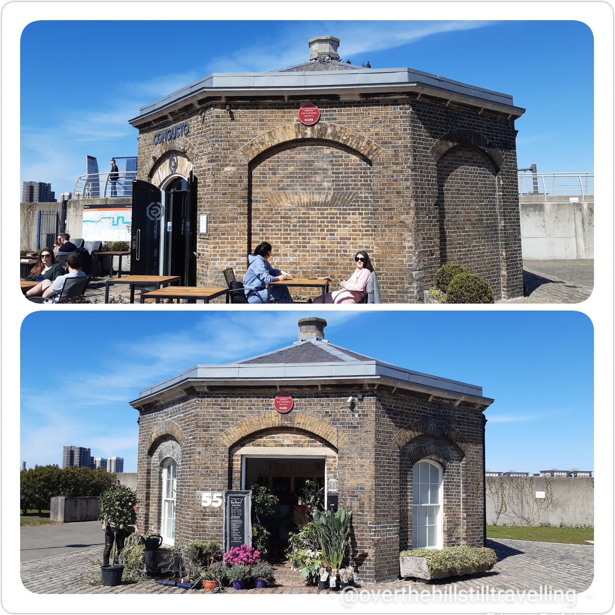


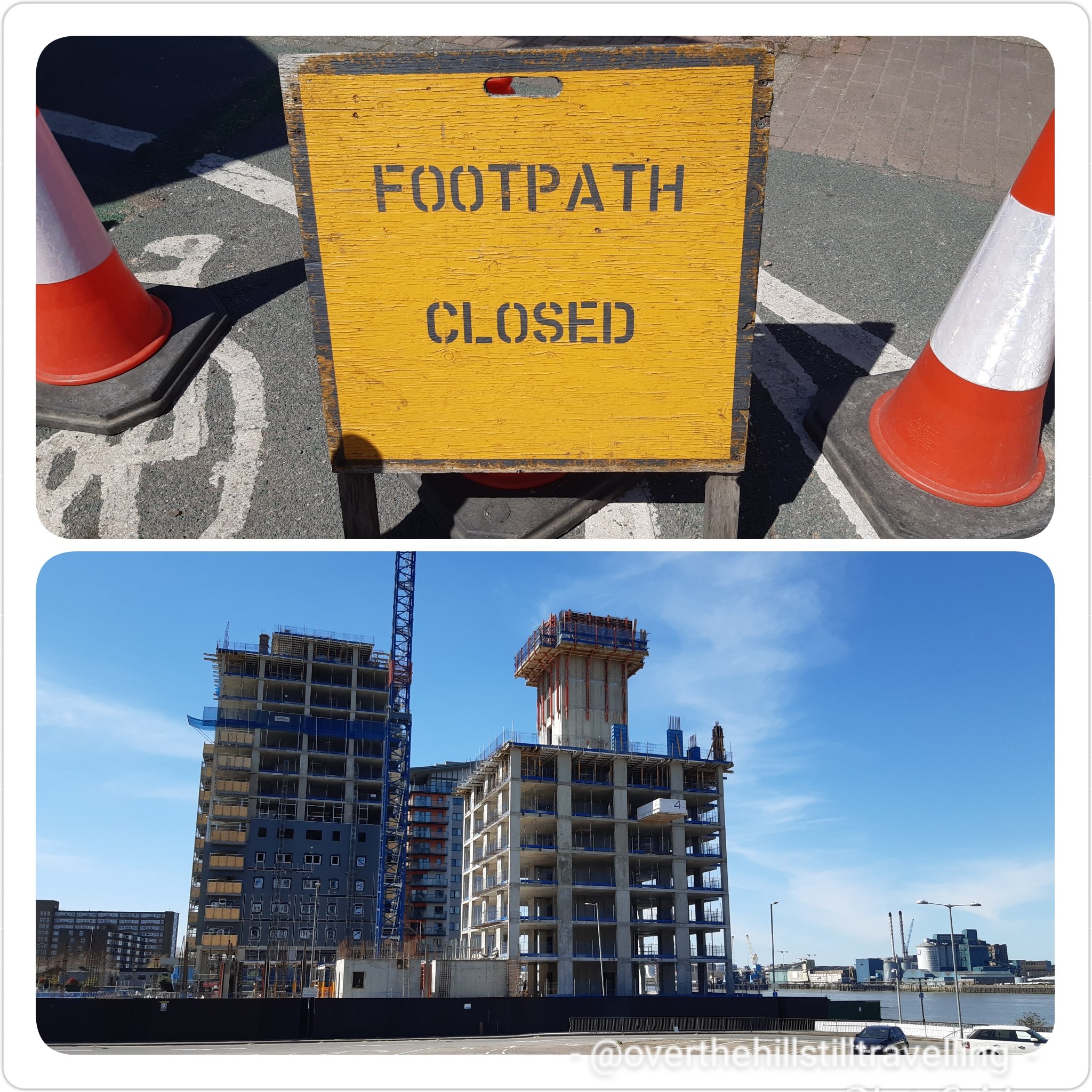
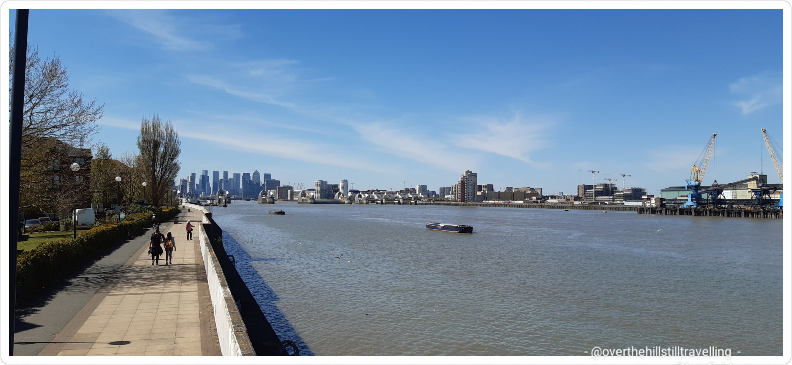


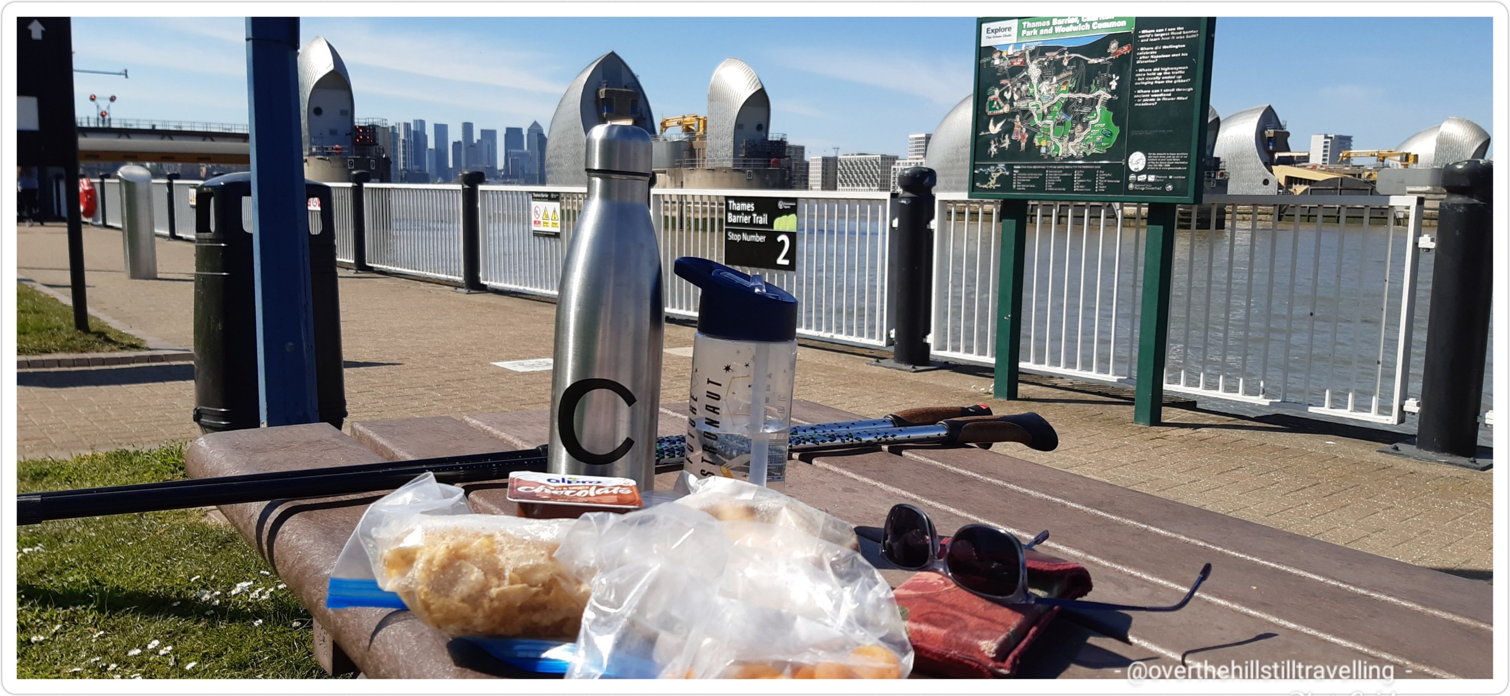

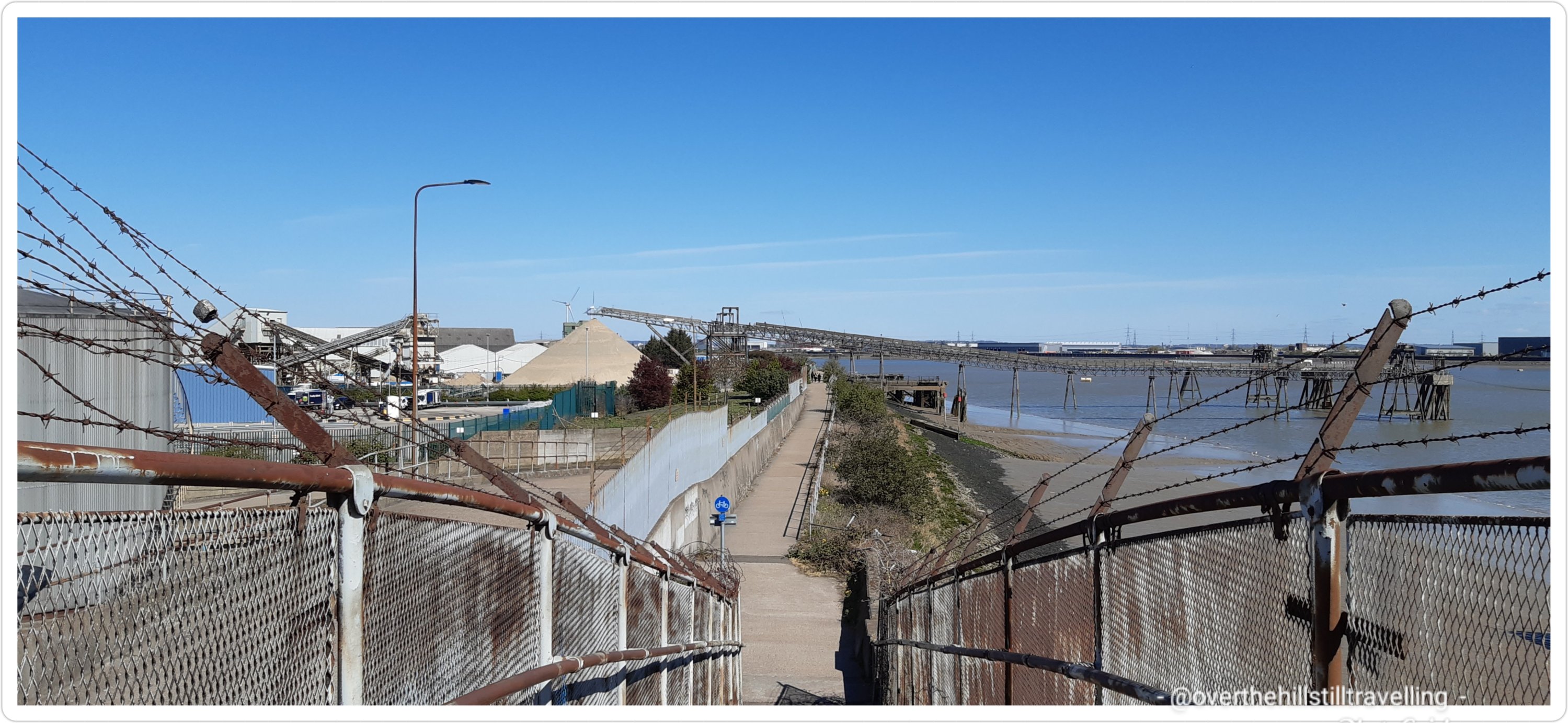

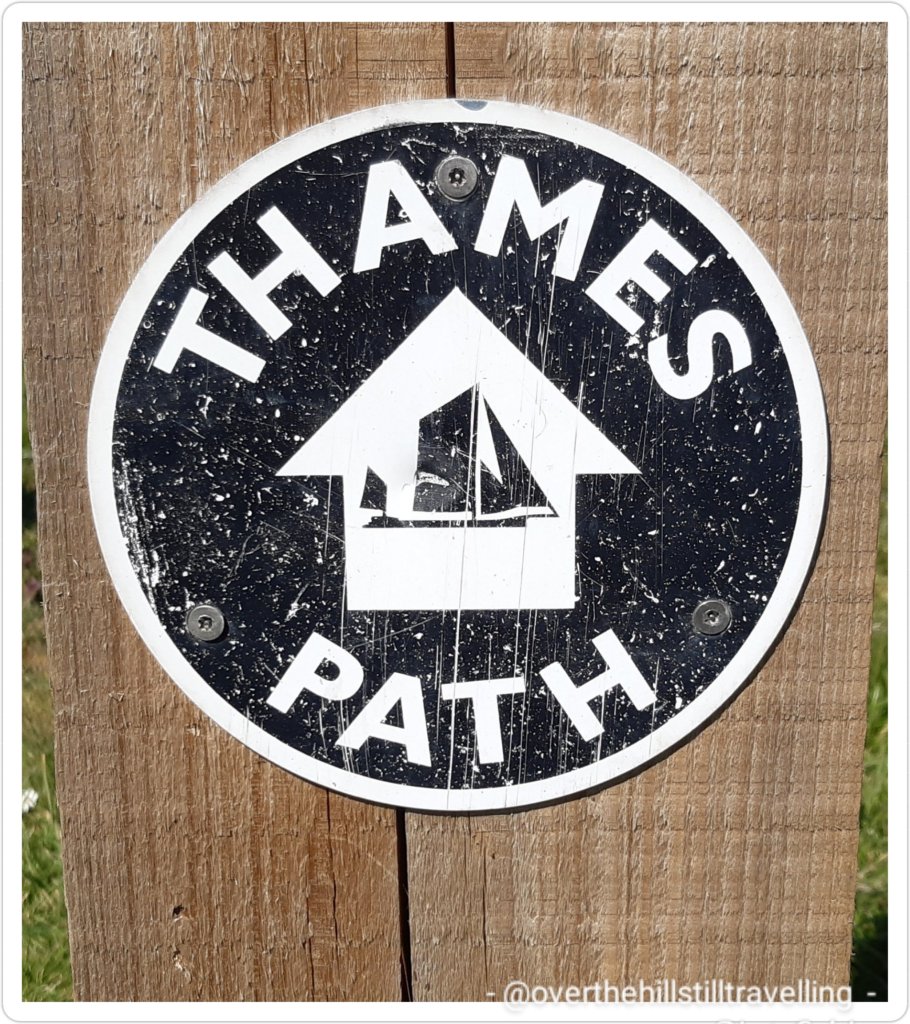


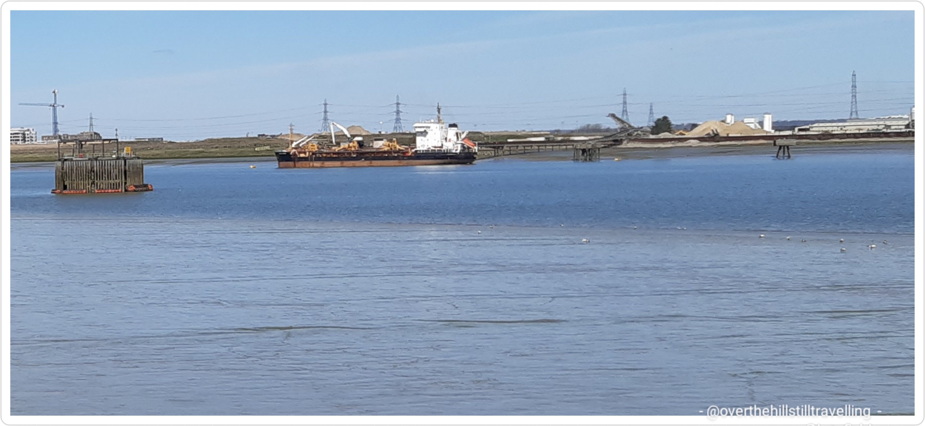


You must be logged in to post a comment.