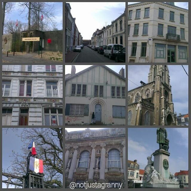
Last night I arrived in Salisbury for my next booking. Just 1 week but enough time to enjoy the area and explore. I’ve visited Salisbury and the Cathedral in pre-covid days, and love this area.
Because I only officially started work at 11am today, I was free to go walkabout last night and again this morning…. which I duly did.
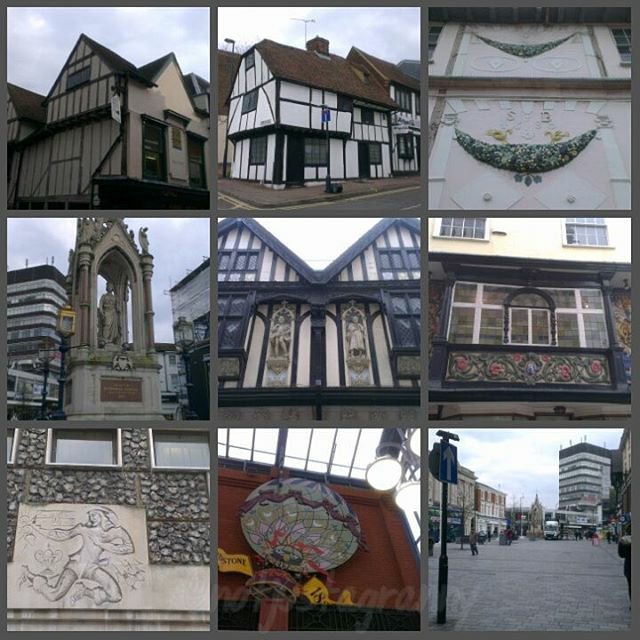
I’m working very close to the cathedral and can virtually see it from the front door of the house. Its an incredibly historic area and there’s a medieval hall within walking distance…like about 100 yards. Its amazing.
Because it was quite dark I didn’t stray too far, and didn’t take too many photos…but nonetheless, my camera was busy once again.
Here are a few images to whet your appetite
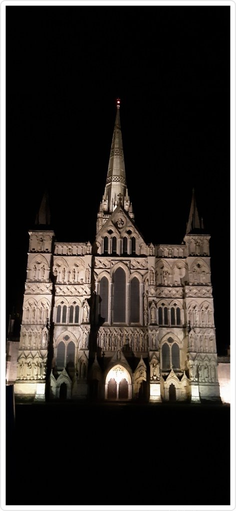
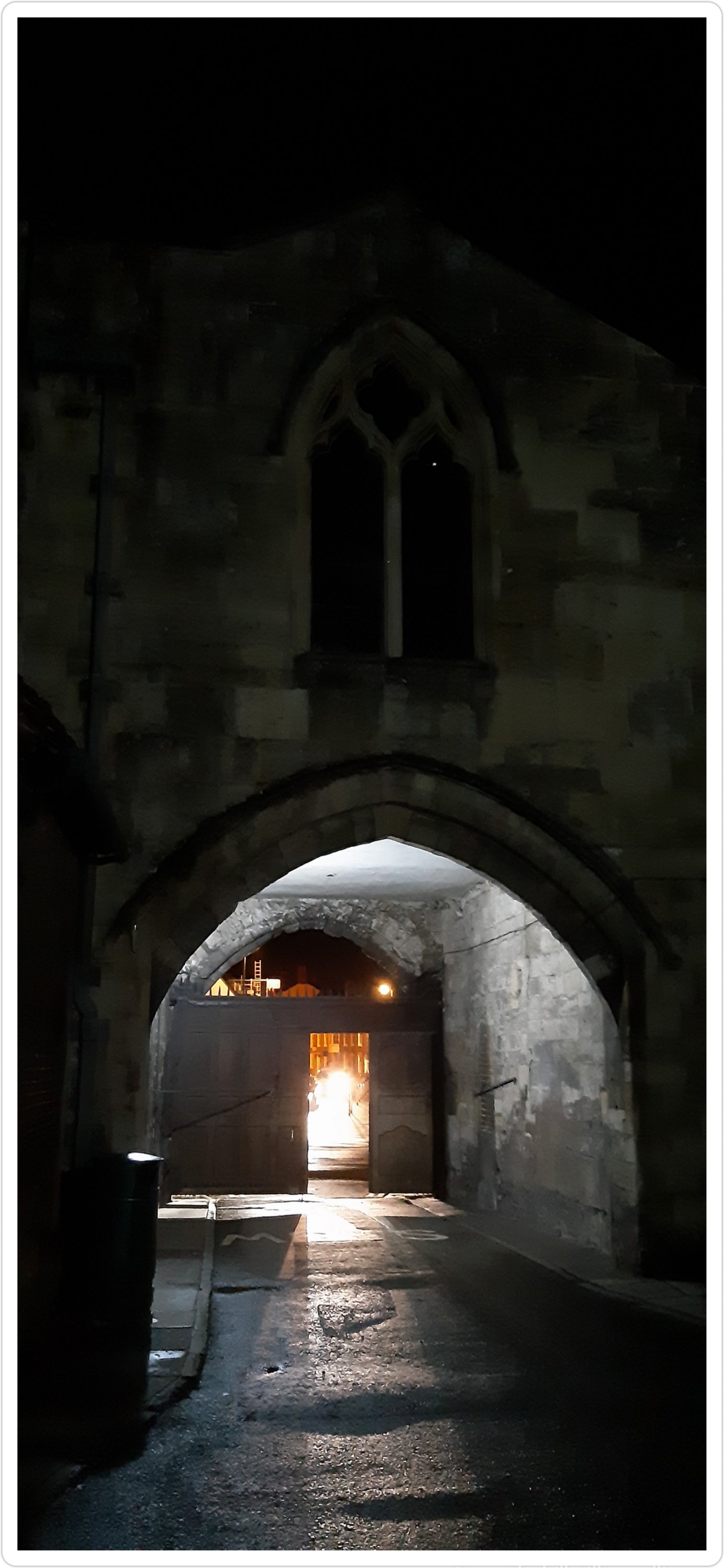
The main entrance
The original Salisbury Cathedral was completed at Old Sarum in 1092 under Osmund, the first Bishop of Salisbury. In 1220 the foundations were laid for the Cathedral at the site it is today.
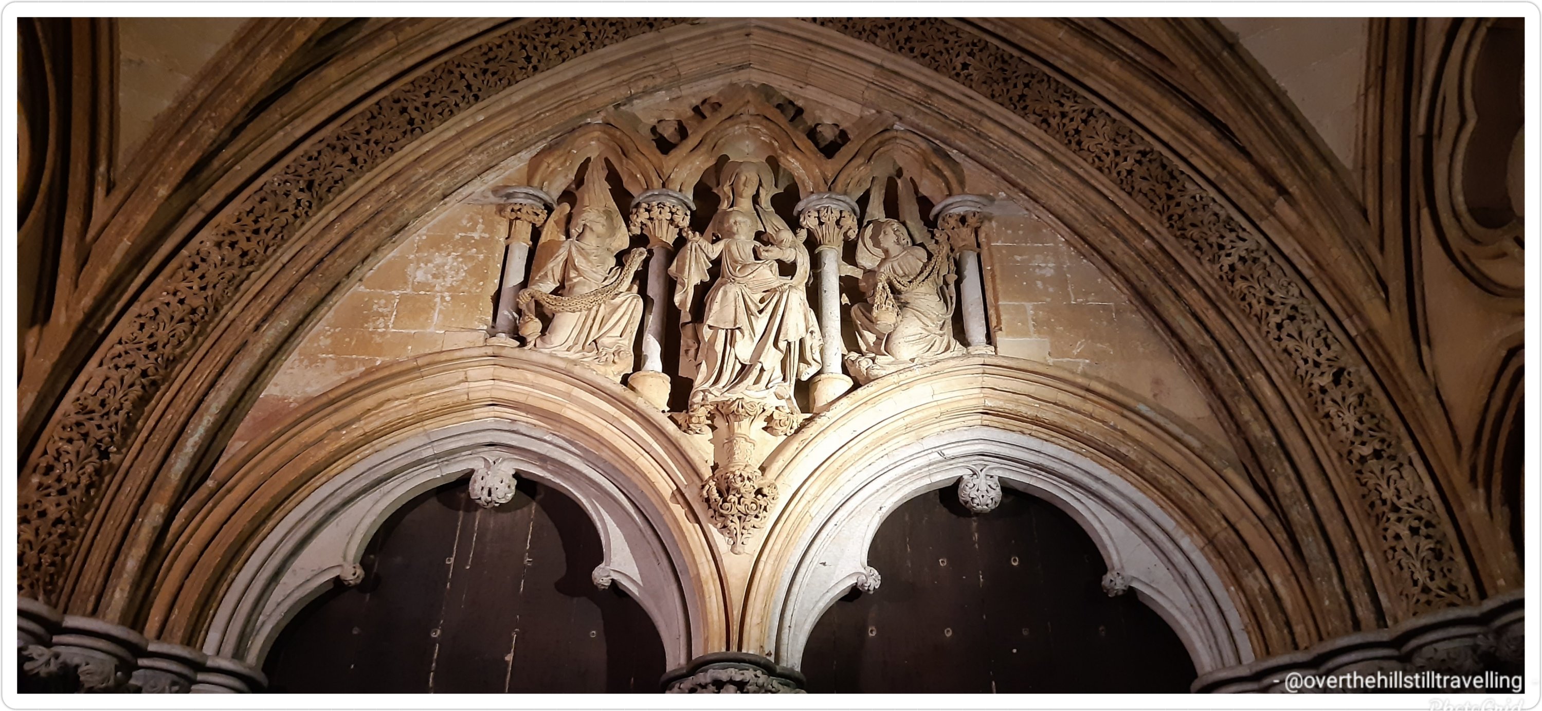
Stunning carving of Madonna and child above the entrance
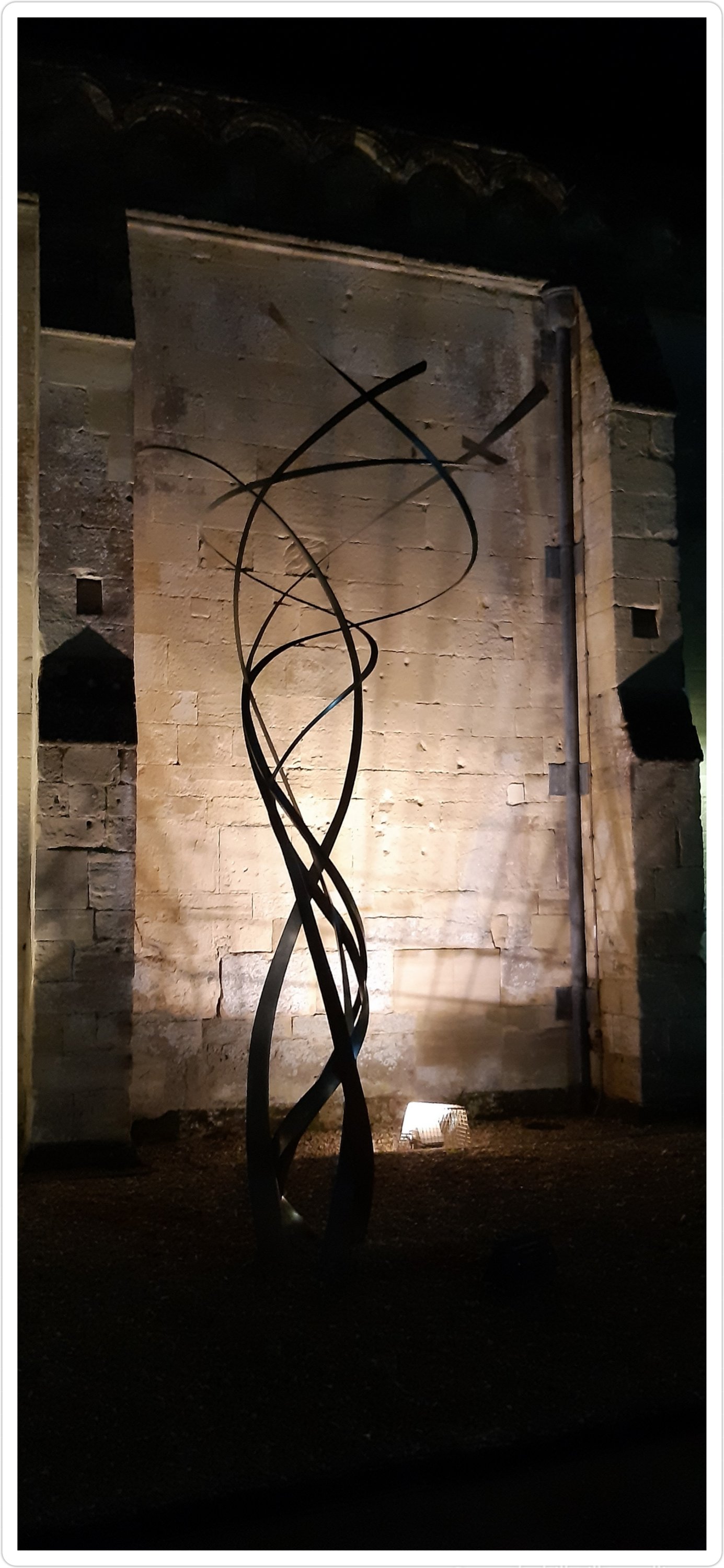
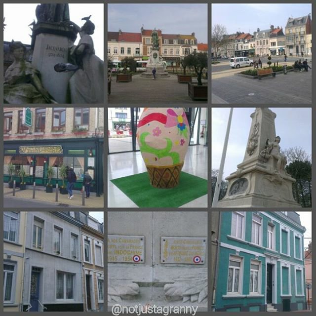
There are an amazing array of sculptures dotted around the cathedral grounds….
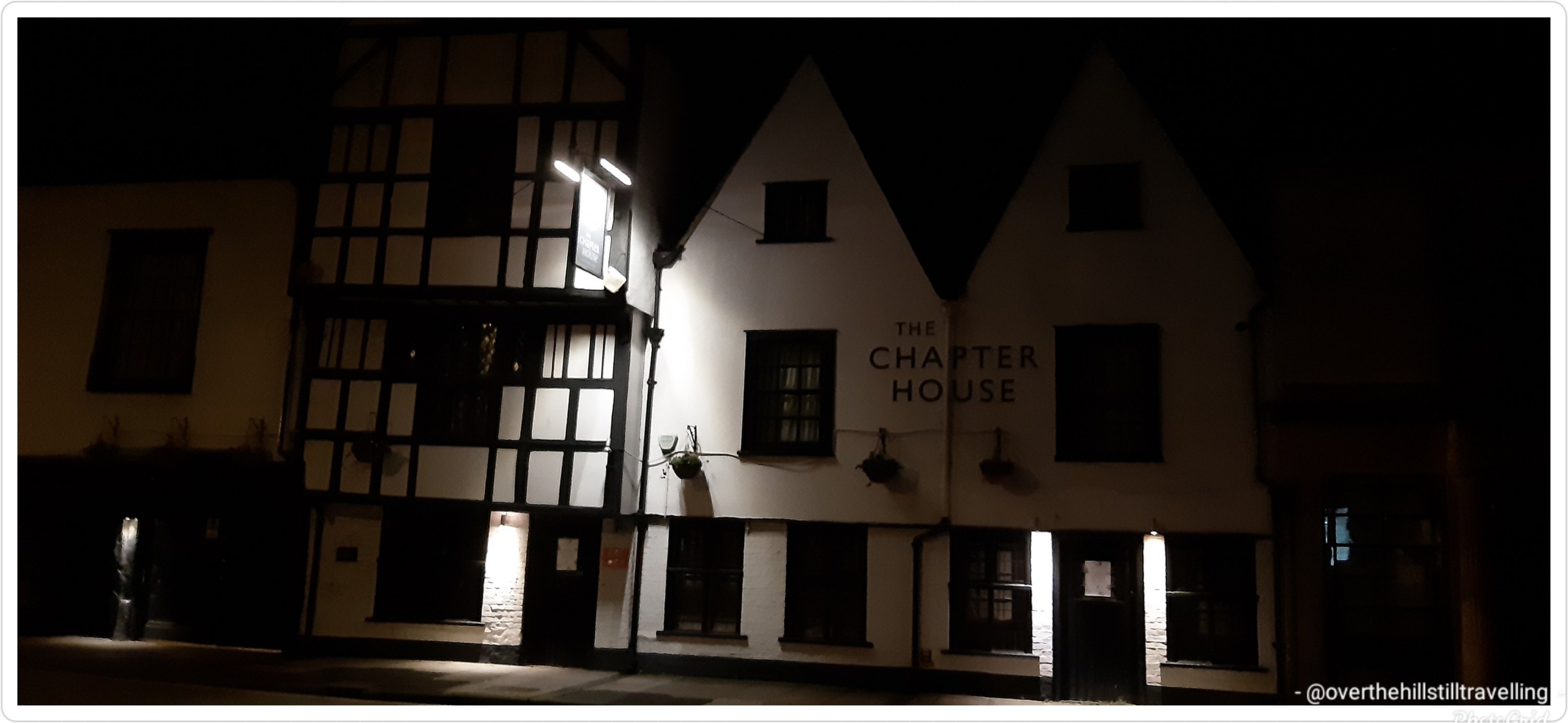
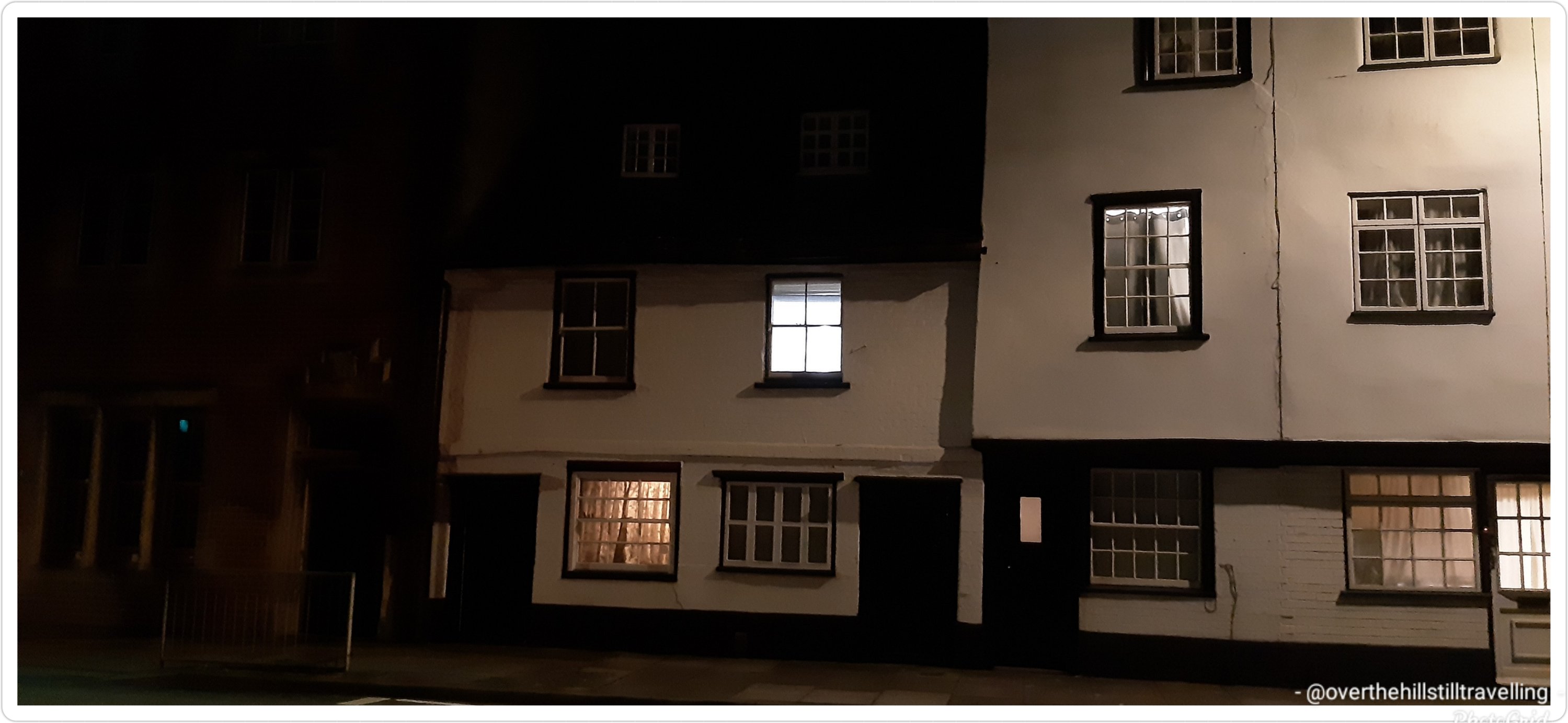
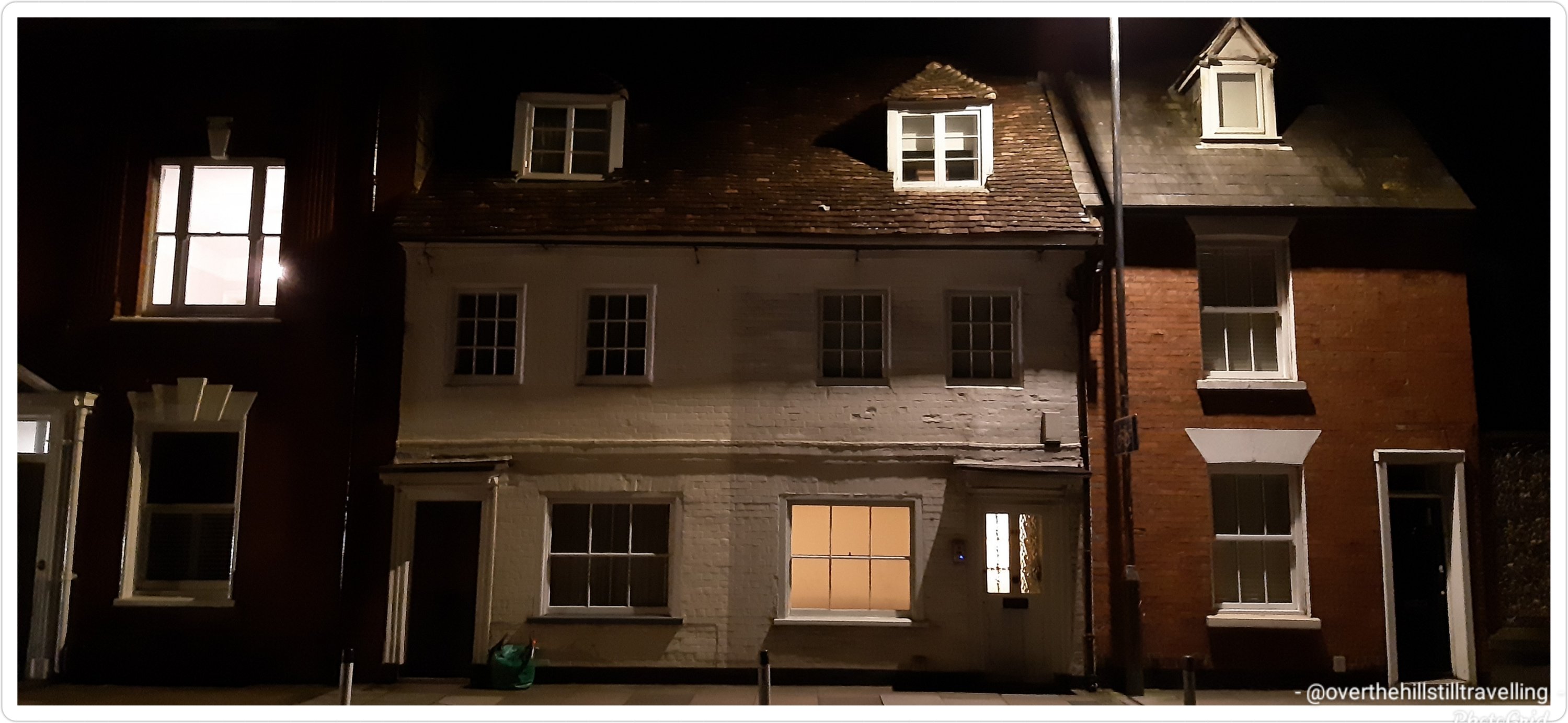
String QuartetSt Anne’s GateA bricked in door next to Malmesbury House History on the wall at Malmesbury House The Chapter House – outside the cathedral wallsOutside the cathedral wallsI’d love to know how old that house is Love love this Salisbury Cathedral looking ethereal in the dark
Salisbury Cathedral, formally known as the Cathedral Church of the Blessed Virgin Mary, is an Anglican cathedral in Salisbury, England. The cathedral is regarded as one of the leading examples of early English Gothic architecture. The main body was completed in 38 years, from 1220 to 1258.
At 80 acres, the cathedral has the largest cloister and the largest cathedral close in Britain. It contains a clock which is among the oldest working examples in the world. Salisbury Cathedral has the best surviving of the four original copies of Magna Carta. I was lucky enough to see the Magna Carta on my last visit.
In 2008, the cathedral celebrated the 750th anniversary of its consecration.
I’ll post some more photos taken this morning of the sculptures in the grounds, of which there is an amazing array, well as of the river Avon and some of the buildings in the city.
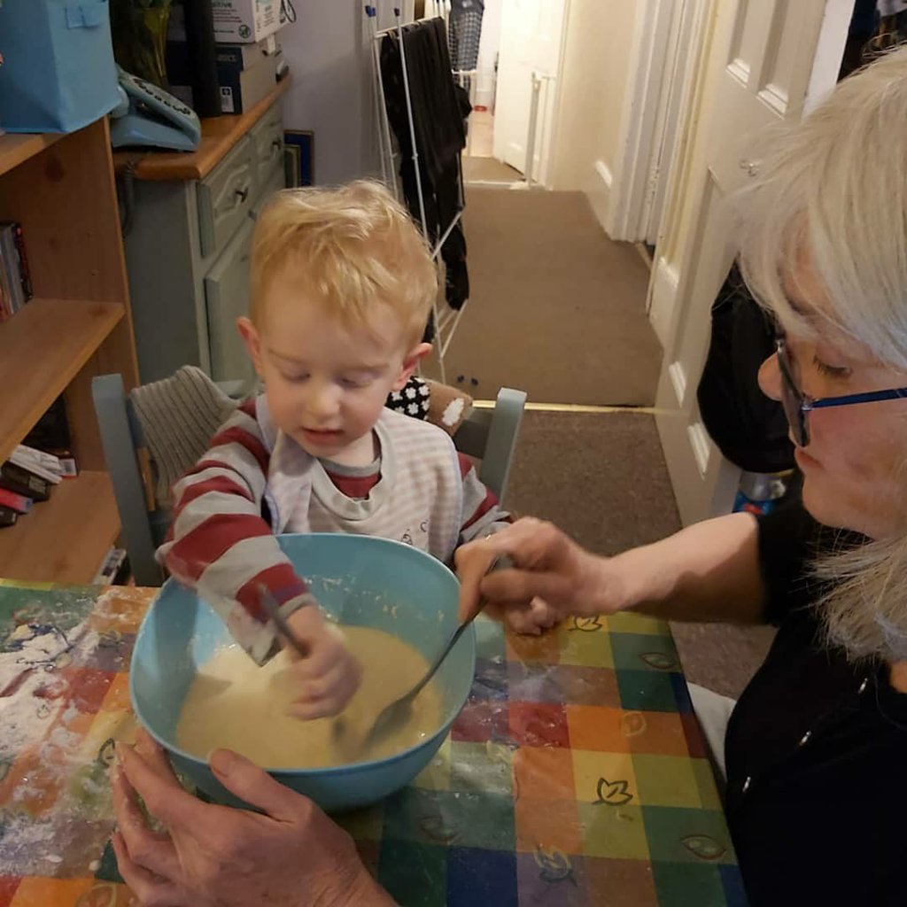
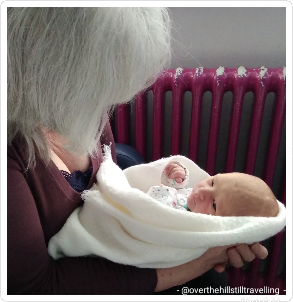
I decided it would be a good idea to make pancakes with the Boobee for Shrove Tuesday. I had an image in my mind, you know…like a gentle, calm Granny and grandson bonding…like you see in the movies – except I didn’t bank on the 2 year old having his own ideas about baking.
The picture of innocent excitement 🤔🤔
It started so well… ☺❤💙 I collected all the equipment, and gathered up the ingredients….the 2 year old getting quite excited about the prospect of ‘pancakes’ although he had absolutely noooo idea what they are, he just loved the sound of it all. 😁😁
Behind the scenes his parents were snickering, their hands covering their mouths as they tried to contain their amusement…they knew what was coming. 🙄🙄🙄
We settled down at the table and I measured out the flour, explaining what I was doing, but before I could blink my eyes…it descended very quickly into chaos, with handsful of flour on the and table flying everywhere!!! I desperately tried to keep control of the situation, to no avail.
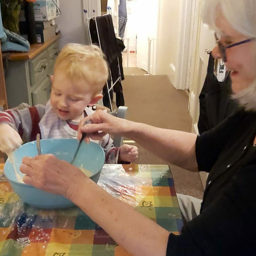
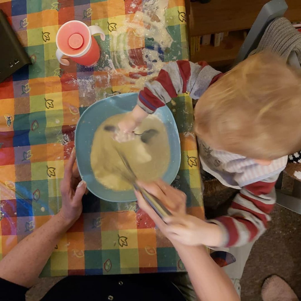
So far so good, I just added extra flour…Spoons whirling, we mixed away
Suddenly, and with no warning, he 8swooped in with his hand and lifted a gloop of batter and started painting the table 😱😱🤣🤣🤣🤣
hands in quick as a flashAt this point, I gave up and watched…and the mess is total
I was laughing so much…intially with shock and then with bemusement. It was just hilarious. The carpet will have to be washed…I eventually recovered what was left of the first batch and hurriedly decamped to the kitchen. Meanwhile the parents cleaned up the chaos and popped him in the bath – I needed a bath!! 😁😁
With the chaos reigned in (safely in the bath 🥴🥴) I prepared a 2nd batter mix and started making the first batch of a very unique blend of pancakes…a la Boobee!! 🤭🤭🤭 They were perfect…😊
Mummy had cut up some banana and strawberries, melted white chocolate and made up some sugar and cinnamon, as well as some yummy dairy free ice-cream.
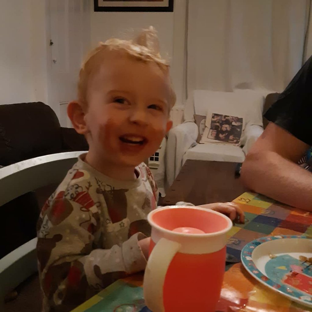
I think he enjoyed the pancakes 💙💙
He loved the pancakes and made short work of them with nutella, strawberries and bananas, and ice-cream. Of course he was quite hyper afterwards, what with all the sugar in the chocolate…good luck to the parents, I can go home 🤪🤪🤪
You just never know what you’re going to get with a 2 year-old, but I can say for sure, I haven’t laughed like that in a long time.
Just look at this child’s hair!! 💙💙💙 he was as bald as an egg when born, but we could see the haze of red coming through.
2 years later and it’s a strawberry blonde mop of curls and absolutely beautiful.
He’s developing into the cutest, funniest, most energetic ball of delight. He gets ever so excited when I visit. He’s learning to talk and the words flow like lava atm, but some sounds still defeat him…he calls me ‘Anny instead of Granny, and I love it.
I had to concede defeat today and had my first Covid vaccine jab. I’m not happy about it, but when you start hearing things like “have you had a test recently, or when will you be having your innoculation?” from prospective clients et al, along with talk of vaccine passports, you know the writing is on the wall. We are but a commodity.
So I just said, to hell with it and booked an appointment. So many people are still totally ignorant of Covid and its transmission. Having the vaccine is not going to stop me from inadvertently passing it on to someone else in the event I come into contact with it. Its seems that some folk think it’s a magic wand, and once you have the jab you’re safe. You’re not. You’re just less likely to get really ill, and even then it’s no guarantee. Even the scientists are not wholly in agreement about the efficacy and what it means. Ugh. Anyway, it’s done. I can’t afford to not work.
The process itself was painless in all respects, and the system was smooth and flowed easily. Because of previous negative responses to a flu vaccine, I stayed institu for 25 minutes after the jab, just to make sure I didn’t just keel over and die 🤪🤪 and then I was away…the staff were friendly and well organised and I was impressed with the efficiency of it all. I still, 9 hours later have had no ill-effects. In case you’re wondering, I had the Astra-Zeneca vaccine. 🤔🤔🤔
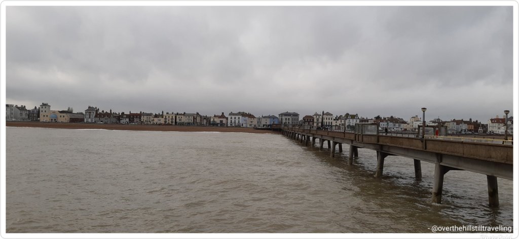
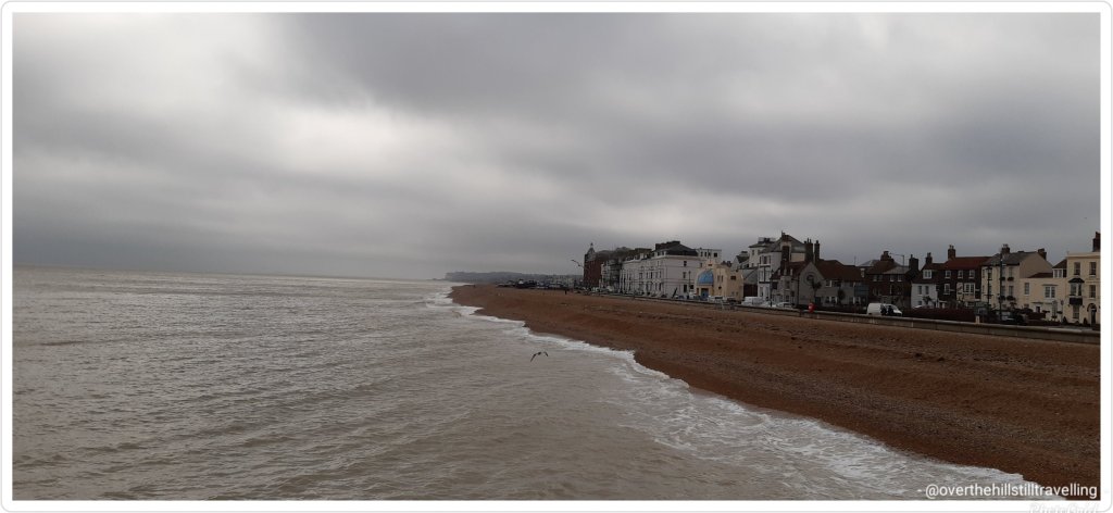
The good thing that came out of it is that I had an unexpected trip to Deal. After the jab, I set off for a walk to Walmer Castle. Its amazing how close the 2 castles are to each other…25 minutes brisk walk. But first I had a most delicious curried vegetable pie from Al’s Bakery on the High Street…totally recommended. If I’d known it would be so yummy, I’d have bought 2.
A quick walk along the pier as well, then back on the train…which remarkably, considering the delays caused by the land slip near Folkestone, arrived at Deal and stopped at exactly 14:32 (I was watching the clock) – even a Swiss train would be hard put to match that!! 😉
It’s a very long pier
Oh, and see that arrow pointing to the land in the distance in the next image… that’s the White Cliffs of Dover and last year I walked from Walmer to Dover via the cliffs…awesome walk and really beautiful
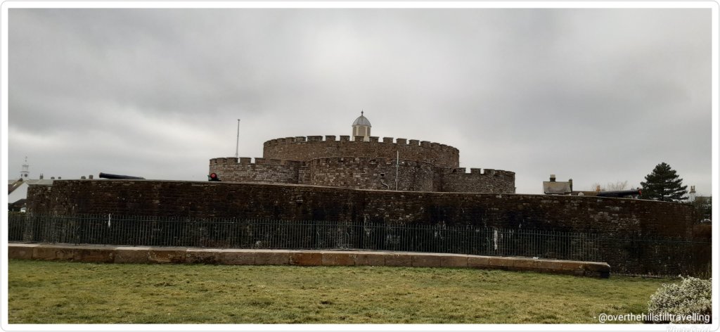
Deal Castle Walmer Castle
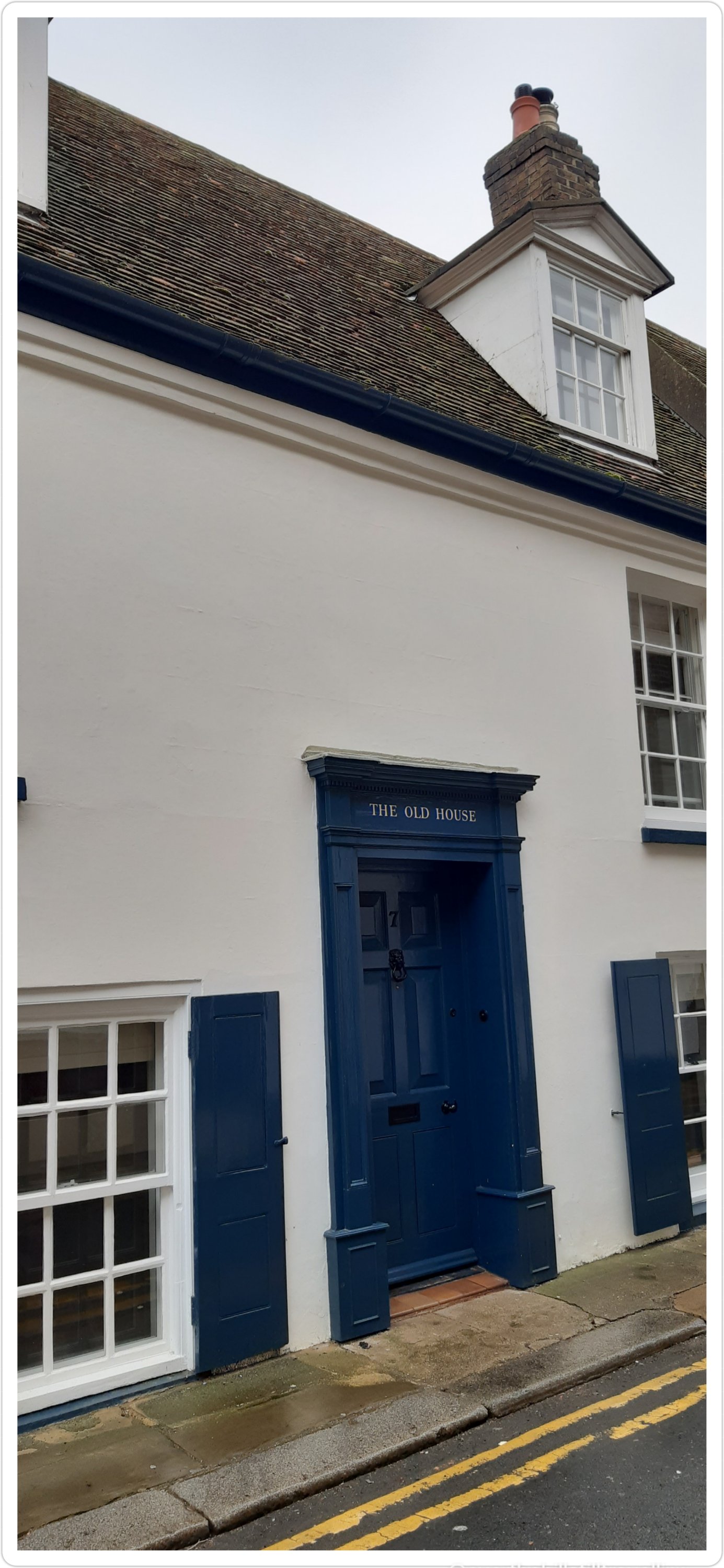
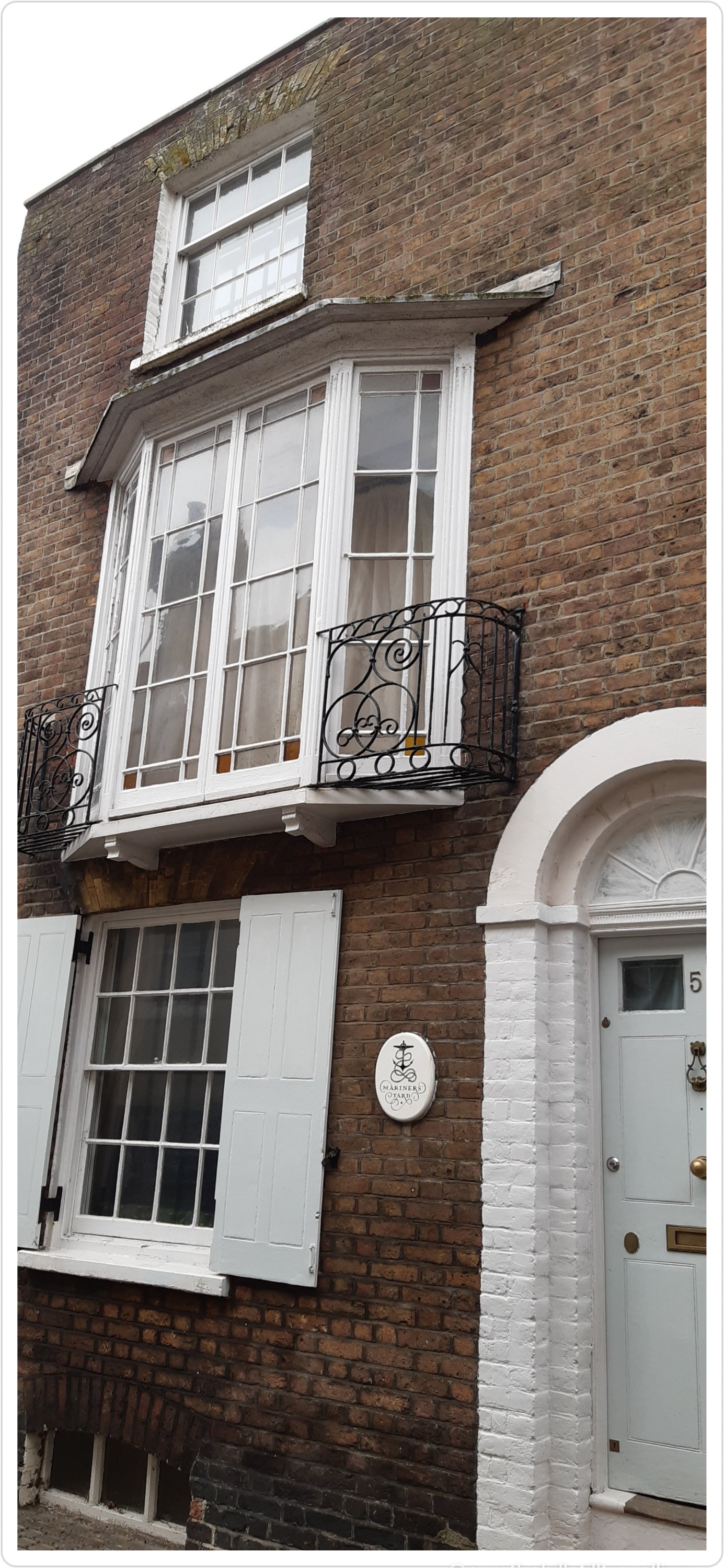
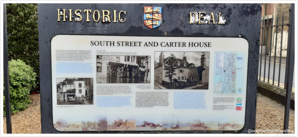
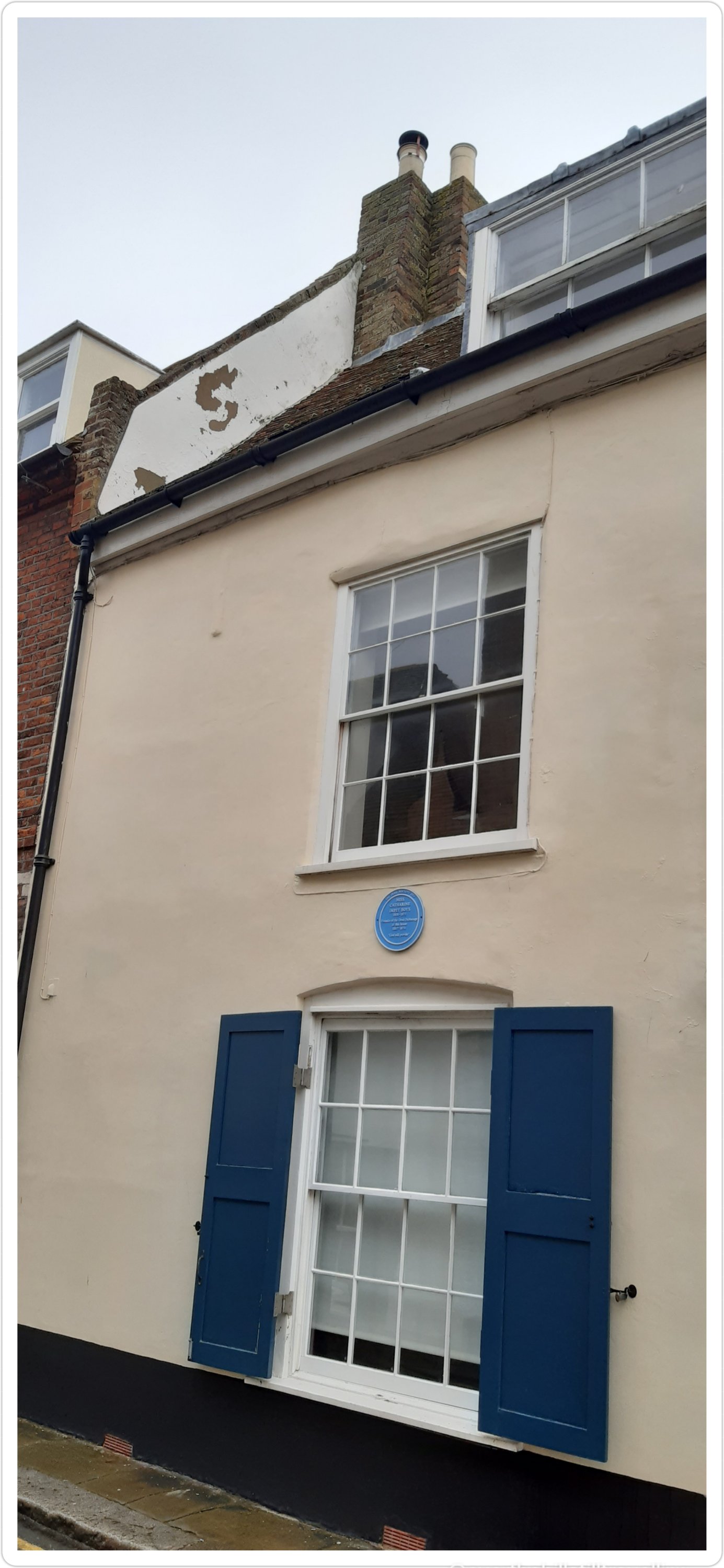
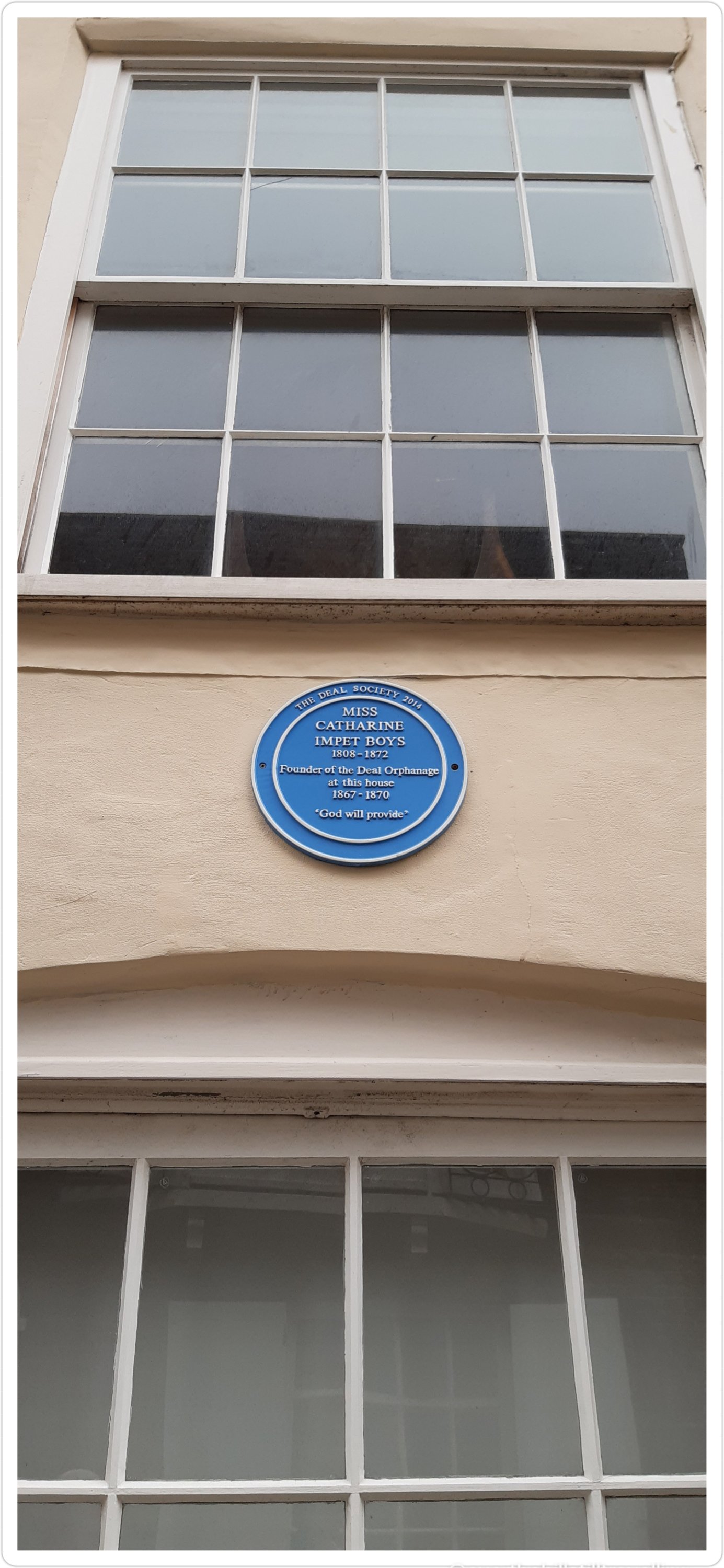
Deal is an incredibly historic town with some amazing old houses
Carter House
Although it was wet, cold and blustery, I really enjoyed my walk and as usual could have just kept going….as soon as lockdown lifts, that’s exactly what I’m going to do…
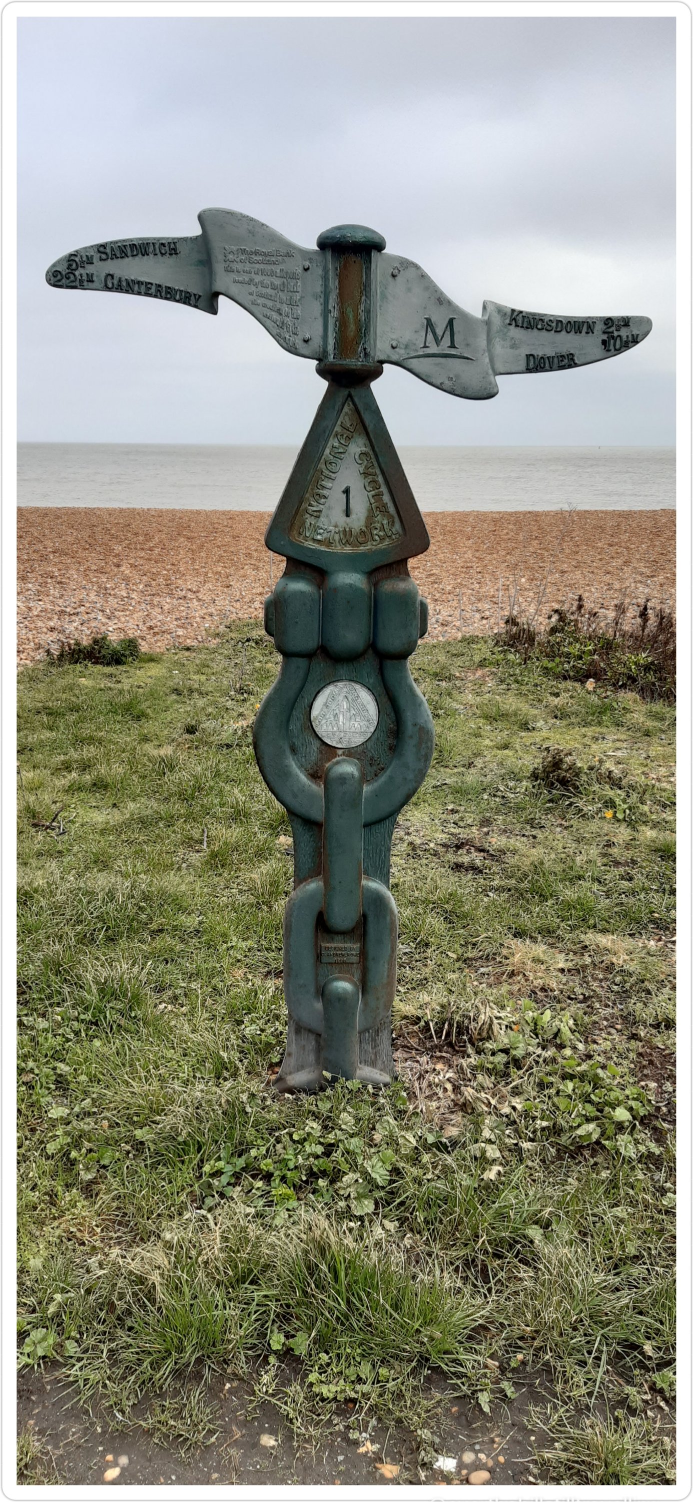
I love these cycle path signs….tempted to follow them one day 🚴♀️🚴♀️🚴♀️
Dover 10.5 miles
Dover 9 miles
I love this little square
And of course, you can’t visit a seaside town and not stop to look at the boats
A pretty fishing boat
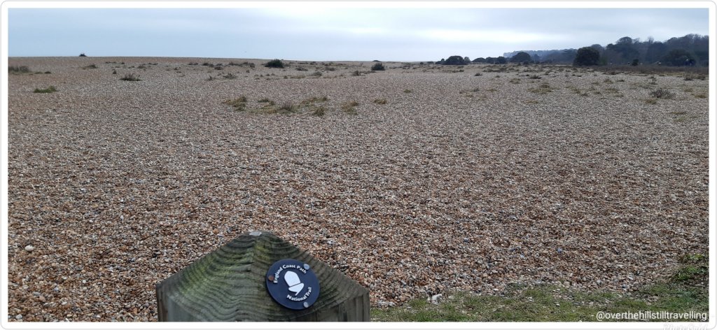
And finally, one of my favourite signs
The Acorn – symbol of the National Trails – England Coastal Path
And today’s walk added another 8kms to my Mt. Everest virtual challenge and takes me to nearly half way through the challenge 🚶🏻♀️🚶🏻♀️🚶🏻♀️👏👏👏
Both Deal and Walmer are mentioned in the 1086 Domesday Book :
Deal was a settlement in Domesday Book, listed as Addelam, in the hundred of Cornilo and the county of Kent. It had a recorded population of 31 households in 1086, putting it in the largest 40% of settlements recorded in Domesday, and is listed under 5 owners in Domesday Book.
Julius Caesar reputedly landed on the beach at Walmer in 55 BC and 54 BC. It is only one possible landing place, proposed judging from the distances given in his account of the landings in his Gallic Wars. However, recent archaeological research and digs have found that he landed at Pegwell Bay. Walmer is probably the settlement Wealemere listed in the Domesday Book.
As I mentioned….loads of history, and both castles are well worth a visit
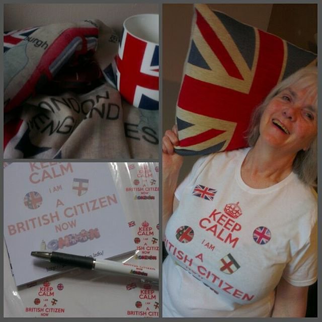
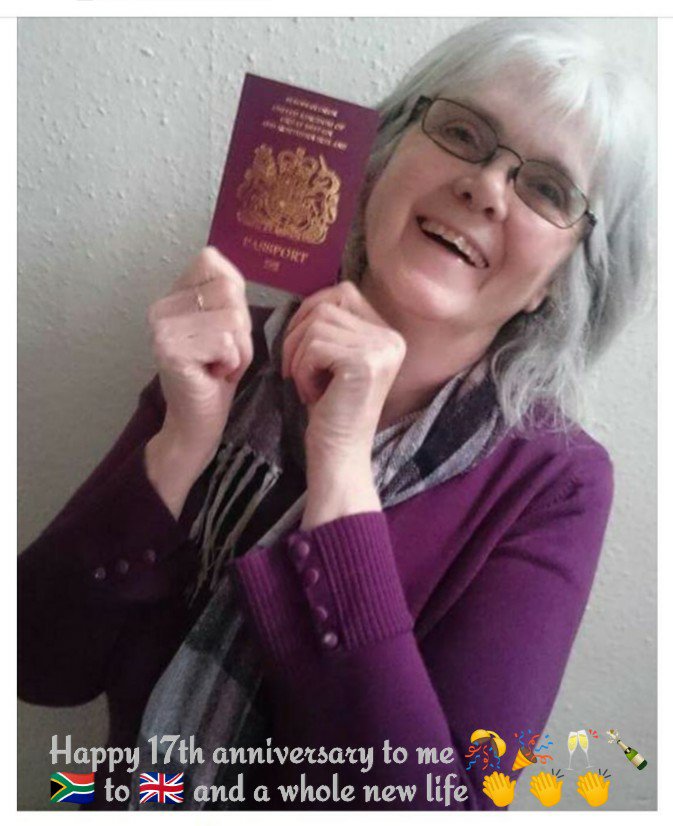
Wow, time sure does just fly by, and thank goddess for my ‘keeper of memories’ – my daughter 😍😍 who reminded me that it’s my citizenship anniversary today…5 years a good Citizen of the UK 🇬🇧🇬🇧🇬🇧 I’m not sure about the ‘good’ part, although I do try, oh and I pay my taxes 💷💸💸💸
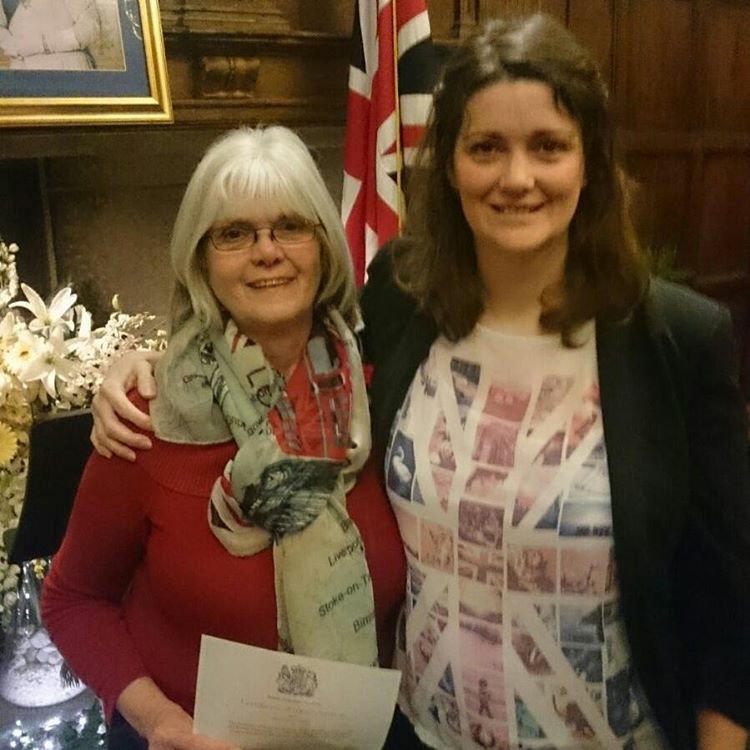
So wow, how amazing. Although my citizenship ceremony was on the 25th of February, I received the official letter in the post on the 13th. Coincidentally, and 7 years earlier, was my daughter’s citizenship ceremony on the same date; 25th February. At the time the letter arrived I was working in Bexhill-on-Sea and had to wait a few days to actually hold the document in my hands. I was also very lucky to get a place for the actual ceremony on the 25th due to a cancellation. Otherwise I would have had to wait a few months!!
Presents from my chica
The ceremony took place at the Bishop’s Palace in Maidstone, and what a beautiful place it was too. Lucky me.
The Bishop’s Palace in Maidstone
On the day we dressed up in our finery, and headed over to Maidstone by train. Very early, we meandered around the town and took loads of photos…all of which, except for a few Instagram images, were lost when UPS lost my hard drive a few years ago 😠😠 along with 10 years of photos…thank goodness I have a habit of saving my Instagram images to dropbox, at least I have some photos saved.
The Palace was absolutely stunning and although I would have loved the Queen to preside 😁😁👸🏻 I believe she was otherwise engaged and sent her apologies 😉
Queenie, I was depending on you to be there!! 😏😏😏 and yes, copyright of this image belongs to the BBC 🙄🙄
We had a superb day, and were amazed at how many different nationalities were swearing their allegiance to the Queen and new country. There were a number of South Africans, as well as people from Russia and the USA amongst a whole world of other nations.
Me and my girl ❤❤The ceremonial ‘room’
After the ceremony which frankly passed in a blur of nerves….we went off and celebrated the only way you should, and how we celebrate best….with pancakes and ice-cream 😋😋🤫🤫
The only way to celebrate..pancakes and ice-cream – is there any other way??
Once the official stuff was out the way I could apply for my UK passport, and as soon as I received it….
Received my passport in March 2016 and should have said 15th anniversary 🤣🤣🤣 never mind, I’m still here 5 years later, so somewhere along the way I had my 17th anniversary 😁😁
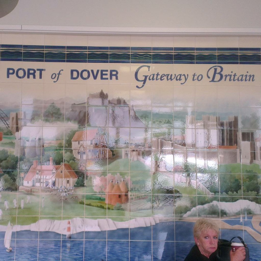
….the first thing I did was book a trip to France on the ferry so I could see the White Cliffs of Dover for real.
Just noticed that I inadvertently captured that lady in my photo 😂😂😂 doesn’t she look pleased!!
There was nothing stopping me from taking the trip before, but it just made sense to do it then. And so it was that on the 2nd April 2016 I set sail for France!! Doesn’t that sound so adventurous!! ‘Set sail for France’….invokes images of days of yore when boats had sails…in reality the ferry had engines and we didn’t ‘sail’ so much as chuggg across the channel (which I’ve now swum – virtually of course 🤣🤣🤣)
On the ferry to France 🇨🇵02.04.2016 and I finally saw the White Cliffs of Dover from the sea 😍😍
I’ve since seen them from the air from a Spitfire flight my daughter gifted me for my birthday in 2018, and walked across the top last year in September.
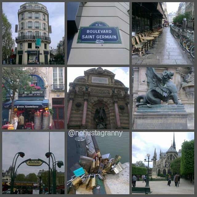
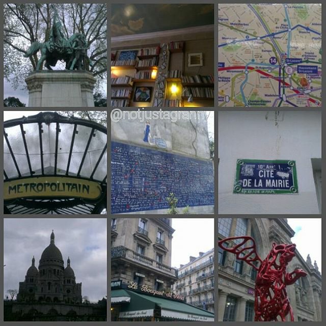
I had a marvellous day meandering the streets of Calais and explored every nook and cranny I had time for, and then I bought some French pastries and headed back to the ferry…UK bound once again. I thought Calais was charmingly tatty….and really interesting.
The cream always looks more yummy than it tastes 😝😝
Later that month my daughter and I took a trip on the Eurostar to Paris for the day.
I love Paris in the spring time…24.04.2016
It was so exciting to use my passport for the first time as a bonafide EU citizen, although sadly it’s now redundant.😪😪
Hmmmm 🤔🤔🤔🤔
And now my daughter is my keeper of memories and reminded me that it’s my 5th anniversary today….🥂🍾
And if you can bear it, a video of the White Cliffs from the ferry….I was just a tad emotional 😂😂😂☺
The White Cliffs of Dover 02.04.2016
And at the rate the east coast is being eaten away by the sea, it won’t look the same when my grandson reaches the age of 61!!!
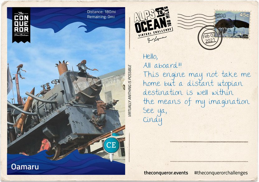
And tah dah!!!! I’m done! I reached Stage 9 and the end of my Alps to Ocean challenge on 2nd February. Hoorah.
Finally here I am 180miles (290km) later, having travelled from the alps of Mount Cook, along multiple lakes, countless connecting rivers, past seven Waitaki Hydro power stations, various mountain ranges, through tussock grasslands, beside electric fences (do not touch) to arrive in the urban town of Oamaru on the shore of the Pacific Ocean.
Oamaru is the largest town in the region and renowned for its Victorian precinct. A commercial streetscape, the Neoclassical architecture is a result of Scottish architect and engineer, Thomas Forrester, who emigrated with his family to NZ in 1861. Arriving in Oamaru to supervise the construction of the Bank of Otago, Forrester stayed on and shortly afterwards was integral to the construction of the Oamaru Harbour. Taking samples from the harbour floor, he deduced that the seabed could be dredged permitting the development of a deep water anchorage. This in turn allowed large ocean-going vessels to safely steer in and out of the harbour. Forrester then changed direction and together with his business partner, over a period of three decades, designed and built the various commercial buildings that still stand today. The precinct bustles with cafes, antiquity shops, bookshops and galleries. Each year it conducts the Victoria Fete, a one day fundraising event with stalls, music, food and period costumes. The funds raised go towards the ongoing care and restoration of the Victorian buildings.
For steampunk enthusiasts, inside one of the Victorian buildings is Steampunk HQ showcasing a collection of quirky items in retro-futuristic sci-fi style whilst outside is a full size train engine spitting fire and billowing smoke. Promoting sustainability and recycling Steampunk HQ collaborates with like-minded artists on projects to continue expanding the collection. Wish you could join me for a steampunk-Victorian era inspired dress-up and for a time feel like we have been transported into an alternative 19th century England.
At the north end of the Victorian precinct is the oldest public garden in NZ. When the town was surveyed in 1858 an area of 34 acres was set aside as a public reserve. Eighteen years later in 1876, the Oamaru Botanical Gardens was opened. Besides the flower beddings, bushes and trees the garden is dotted with various attractions such as the Japanese red bridge, Oriental garden, croquet lawn, sundial, aviary, peacock house, an Italian marble fountain and the Wonderland Statue made by the famous Scottish sculptor Thomas J Clapperton which he donated to the children of Oamaru in 1926. Thomas also made the bronze soldier sculpture on the World War 1 Memorial in Oamaru and is famous for his Robert the Bruce sculpture adorning the entrance of Edinburgh Castle, Scotland.
As I stand on the end of the pier and look across the expanse and vastness of the Pacific Ocean, I wonder at its hidden stories, sunken ships and deep trenches. I wonder what Portuguese explorer, Ferdinand Magellan was thinking when in 1521 he sailed across the Strait of Magellan into the Pacific Ocean and was inspired to name it Mar Pacifico which translates as Peaceful Sea. It’s certainly questionable when you consider the heavy swells, the earthquakes, volcanoes and tsunamis that have battered many Pacific islands and sometimes obliterated complete towns. When I consider the depth and perpetual darkness of the Mariana Trench or the Pacific Rim with the highly active Ring of Fire, peaceful is not something that comes to mind but it is intriguing and fascinating.
This has been such a fascinating journey, it is indeed intriguing. I mean snippets like this are just awesome: Mar Pacifico which translates as Peaceful Sea, although I’m not too sure about the earthquakes et al.
Albeit a virtual journey, it’s made more exciting with the postcards and the information you receive as you reach each stage, and how much I’d love to see that train!! I’ve learned more about New Zealand than I ever knew, as well as from my previous challenges: Mt. Fuji in Japan, The Great Ocean Road in Australia, Ring of Kerry in Ireland etc They’ve all been so interesting.
So far I’ve completed 9 challenges which includes the Conquer 2020 challenge which was a sum total of all my challenges and more in 2020. My favourite so far has been Hadrian’s Wall and I never did get to blog about it…I only thought about sharing these challenges on my blog while I was doing Mt. Fuji because it was so fascinating. I’ll try to blog about the others, but I’ll stick with the shorter ones otherwise it gets too tedious for everyone….anyway, The Ring Road in Iceland is 1,332kms long and I imagine has lots of postcards LOL and the St Francis Way is 503 kms…so likewise.
But I’m starting the Mt. Everest challenge next, and then the Giza Pyramids challenge after I’ve done The Cabot Trail in Canada, so I’ll share that at the time. Of course I may just change my mind and blog about The Cabot Trail too 😉 And here is my certificate. Seriously, within seconds of updating the app, the final postcard and certificate land in my mailbox. I’m going to make books from all of them for each walk….will be fun to look back on one day when I’m older, and infirm and unable to walk far….if I live that long LOL
You have received a new postcard! 🙌 its ridiculous how excited I get when I post a day’s mileage to my app and within seconds I hear the ping of a new email 😃😃 I reached Stage 8 on 28th January, and
It’s with mounting excitement that I realise I’m nearing the end of my virtual journey on the Alps to Ocean route in New Zealand. I started off the challenge on 30th December 2020, and except for a few days along the Kent coast, the majority of my walking has been in the countryside of Throwley, near Faversham – still in Kent.
I’ve been hard put to get my kms in because I only get a 2 hour break each day and some days due to weather I’ve not been able to walk at all. I set my initial goal at 5 weeks but was hoping to complete the challenge in 4 weeks. However, that plan was scuppered when the booking was extended for 3 weeks. 🤔🤔🤔 Nonetheless, I’m not complaining, I’ve enjoyed my stay in Throwley and with another 10 days to go till I leave (as of the 28th), I’m hoping to finish the Alps to Ocean challenge and start on the Giza Pyramids…meanwhile
Stage 8
The small farming-town of Duntroon is home to around 120 residents. It’s main economy is largely sheep farming and crop growing such as wheat and barley.
The town was bestowed its name by one of a handful of Robert Campbells that emigrated from the United Kingdom to Australia and New Zealand. It took quite a bit of unravelling and genealogical construction to discover which of the four generations of Robert Campbells was the relevant one associated with Duntroon. It seems that the name Robert was greatly favoured in the family.
The first Robert (#1) was a grand-uncle from Scotland who was the first merchant in the 1788 British colony New South Wales (Australia) and later a politician. Having built a private wharf at the time he is now referred to as “Campbell of the Wharf”. He had a son named Robert but his brother, John, also had a son named Robert (#2).
This nephew, Robert (#2), arrived in Sydney in 1806 and by 1818 he was the Director and afterwards the President of the first formal bank in Sydney, the Bank of NSW, today known as Westpac. Having also built himself a mercantile business on Bligh Street, Sydney, he became known as “Campbell of Bligh Street”. This Robert, unsurprisingly had a son also called Robert (#3), who was born in Sydney but chose to return to England and became a Member of Parliament from which he was unfortunately unseated threes month later. To distinguish him from previous Roberts’ he was given the appellation “Robert Campbell Tertius” meaning the third.
Finally the relevant Robert (#4), son of Robert Campbell Tertius, who was born in England in 1843, travelled to New Zealand early 1860s to either buy or lease land on behalf of the family. Robert became a successful sheep farmer, property owner and later politician. Together with his father, he owned a sheep station in the Waitaki District upon which they built a small town they named, Duntroon, a Scottish name possibly as homage to their ancestry and their ties to Clan Campbell of Argyll, Scotland.
Robert’s (#4) wife, Emma, bequeathed £6,000 to the parochial district with instructions to build a church for the benefits of Church of England members. The result was St Martin’s Anglican Church in a 14th century Gothic style, built out of limestone quarried in a nearby region. The side church door bears the Clan Campbell coat of arms. Sadly both Robert and Emma died childless and within a few months of each other.
By 1875 much of the acquired Campbell lands became plagued by rabbits that were imported in the 1830s and released for sport. Unable to curtail their rapid reproduction rate, by the early 1880s the pastures were depleted and hillsides eroded. This in turn produced lower quality wool thereby affecting the prices of wool. In the end, the devastation wrought in the region forced many sheep station owners into bankruptcy and the Campbell’s businesses in NZ were eventually wound up and ceased operating by 1920.
Just off the main highway is the Vanished World Heritage Centre, a fossil and geology museum that includes the fossils of two species of extinct genus of large penguins from around 27-28MYA. Known as Archaeospheniscus, the species is about the size of an Emperor Penguin. There was a third species, albeit a smaller one, in this genus that was discovered in Antarctica. These three species are the only ones currently existent in this genus.
Having left Duntroon, I’ve parted ways from Waitaki River which has been my companion since the Waitaki Dam and moved in a south-east zig-zag direction until I stopped at the Rakis Railway Tunnel, an old disused railway line. During the 1880s depression era the construction of the railway provided much needed unemployment relief. The 11mi (19km) line was in use from 1887 to 1930. Today the tunnel is only 330ft (100m) long and although it can be explored, a torch is needed because halfway in the tunnel curves cutting out all source of natural light.
Today will be by far my longest route of this entire journey, hence writing this letter on one of my rest stops. I look forward to rolling into my final destination, Oamaru.
Interesting information provided…..and therein lies the foolishness of history. You can’t just import alien species into a country for whatever reason and expect it to have a happy outcome. If you read history, you’ll discover that there were dozens of similarly stupid and foolish mistakes made by the invaders (of the people kind, not the animal or plant kind) of these islands as well as in Australia and various other countries around the world; the British Empire!! Geez. Well I have to admit that I have no sympathy for the unfortunate Campbells, shooting rabbits for sport – how cruel…and talk about a lack of imagination. With the huge variety of names on offer, could they not come up with something a little different…I mean I like the name Robert on the whole, but surely a little variety wouldn’t have gone amiss?
I do like the Elephant Rocks though and the Vanished World Heritage Centre, sounds like an awesome place to visit.
Anyway…. I’m rapidly reaching the end of my Alps to Ocean NZ challenge!! I always feel a little sad really when they reach the last few miles…..they become friends eventually LOL Okay, okay, don’t say it…I know, it’s daft.
Didn’t take any photos of the area this day because, seriously I have so many already, but I did spot that gorgeous iris hiding under a hedge and the snowdrops are in bloom. So pretty..I love this time of year when the first snowdrops appear…
And because I didn’t faff around too much taking photos, I managed to clock up 11.44kms in 2.5 hours 👏👏👏😁
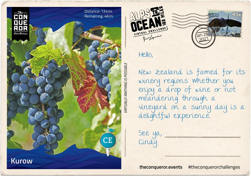
Nearing the end of my virtual journey, with just 46 miles/74 kms to go…this postcard and story about the route, popped up on 26 January….
Summer fruit orchards and wineries seem to be the economic backbone of Kurow, a small town that in the 1920s was the base for the construction of the Waitaki Dam.
Kurow sits within the Waitaki Valley, a rich limestone region with a cool maritime climate. With warm summers and long, dry autumns this region is a wonderful environment to grow grapes for wines such as pinots noir and pinot gris. The first vines were only planted in 2001, making this valley a very young winery region. I can imagine it took passionate and dedicated viticulturists to have the courage to explore new grounds and experiment with different plantings. Small scale, family-run vineyards are now dotted through the valley creating bespoke, boutique wines.
Stage 7
Just outside of Kurow is a family-run orchard growing summer fruits such as peaches, apricots and cherries. Conscious about fruit that is rejected by supermarkets due to imperfections, the family built a commercial kitchen and went about turning rejected fruit into a range of products such as jams, sorbets and baked goods. With a half dozen box of summerfruit tarts under my arms, I was ready to leave Kurow.
Joining the trail alongside the Waitaki River, I marvelled at its characteristics. This 68mi (110km) braided river begins at the confluence of Pukaki, Tekapo and Ohau Rivers with Lake Benmore atop it. The river acts like a link between the lower lakes by running through and connecting Lake Benmore to Lake Aviemore to Lake Waitaki before it freely and swiftly flows the rest of the way into the Pacific Ocean.
Between Kurow and Duntroon, I had to ford three rivers and I was grateful they were not flooded permitting me to travel beside Waitaki River and admire the mountain range behind it, instead of using a trail next to the highway. I’m also glad I read the instructions to not touch the fences along the way as many are electrically charged and not necessarily marked for information. Might’ve added an element of excitement I wasn’t really looking for.
Just before reaching Duntroon, I stopped at the Takiroa Rock Art Shelter to see the Maori art on the limestone rock that dates back to between 1400 and 1900AD. After the rock art site, I carried on through Duntroon’s Wetlands into Duntroon straight to the local pub for a feed and more Waitaki Valley wine sampling.
Seeing those grapes reminded me of when I was in Portugal on the Portuguese Camino coastal route to Santiago. The path invariably goes inland at some stages, and one day it took me through a vineyard. I shouted “Ola!! Buenas dias” to an elderly couple amongst the vines cutting down bunches of purple grapes. The lady and I got to chatting (her English was way superior to my Portuguese), and it turned out her daughter was at that time, living and working in London 😃😃😃 How cool is that. So after a long conversation, she gave me a big fat bunch of the MOST delicious, juicy, aromatic grapes you could imagine…the flavour was like heaven.
I strolled along eating the grapes with relish, and shortly afterwards met the one and only snake in my entire Camino. 🐍😱😱 It was lying there, on the path, looking for all the world like a skinny stick, and as I was hesitating, thinking “is it, or isn’t it ” – the bastard moved. 🤣🤣🤣🤣🤣🤣😱😱😱😱
It still cracks me up when I think about that…3 things happened simultaneously : I discovered that I could indeed run if I needed to, I lost most of the grapes, and peed my myself 😜😜😜😜 of course the bloody snake slithered off into the grass with an evil grin ‘gotcha’. 😬😬 not funny.
Of course, encountering that snake, thereafter put a slightly different perspective on my walk, and I never looked at a stick in quite the same way again, or crept off into the bushes without trepidation 🧐🧐🧐
Meanwhile, I’m nearing the end of my Alps to Ocean virtual challenge across New Zealand. And I’m now seriously considering actually doing this route when I visit the island. It might mean postponing my trip down south to Ozzie land for a year to save more funds, but it would be totally awesome. And of course, if I did, and since I’m going that way, I’ve pinned my ‘intention’ to my metaphorical board of walking the Kumano Kodo in Japan. I mean seriously, how awesome would that be!!
Like the Camino de Santiago, the Kumano Kodo is designated a UNESCO heritage site and would slot in nicely with my Project 101 https://www.japan-guide.com/e/e4952.html
I have essentially been homeless for nearly 18 months now, staying in b&bs and guest houses between bookings since September 2019, with the occasional sleepover on my daughter’s couch.
My belongings have been in storage for much of that time. Some of the many boxes filled with stuff I’ve accumulated since I arrived in the UK and much of it brought over from South Africa in 2016 after I obtained my British citizenship. Settling under the weight of my belongings has been tough. Walking the Camino taught me about just how little we really need to get by, but real life is not a Camino and so I find it hard to give up on ‘stuff’.
But on Monday I moved into a new place which I shall call home for the next 6 months at least. ‘Move in’ is a bit of a stretch of course since atm its just me and my suitcase 😝😝😝 Due to the snow I’ve been unable to get to the storage unit anyway even though I want to, and was supposed to on Monday afternoon.
So meanwhile I’ve had to borrow teabags, blankets and a pillow from my daughter, and a blanket, water-bottle, heater and kettle from the landlord, who also kindly bought me some milk last night when went out to Waitrose. I already have my own tea mug to hand that I take to bookings because I loathe using the client’s mugs…some of which are just manky.
Today I’m having a pj day and staying in bed till after midday…I think I deserve it after 5 weeks of getting up at 6.45 every day 😝😝😝🥱🥱🥱 although I suspect my stomach may well get me out sooner….
But, since the ‘new place’ is essentially just a big room in a shared house, with separate, shared facilities, I will only be bringing over the essentials like my backpack and some extra clothes and my groceries plus bedlinen of course, and a towel. Its going to be so good to have some of my travel books as well…just to make it look homely. Of course pride of place goes to a framed photo of my grandson that travels around the country with me. That it always next to my bedside so that he’s the first thing I see each day 🥰🥰
But the best of all is that once I’ve got all the stuff I want, to make life a bit more pleasant, I can just leave it all here when I leave for my next booking, and not have to stress about getting to the storage unit to leave or collect anything.
Its been really stressful and quite expensive having to look for a place to stay between bookings, but this place is a very reasonable rent and as I say, quite spacious. I’ve viewed so many rooms in the last 18 months and they’re all very small and expensive. My heartfelt thanks to my son-in-law who spotted the advert and alerted me to view.
So here it is…unadorned with my belongings as yet, except for a few odds and ends…the desk sold the place really…somewhere I can set up my computer – most important!!
There’s a little, unused, fireplace behind where I’m standing which I’ll fill with something decorative, and 2 small cupboards with hanging space and shelves.
So in all, and in comparison to what millions of other people around the world have to live in….its a palace…. albeit a feking cold palace atm 🥶🥶🥶 even with the heater on, its cold, which is why I’m having a pj day…with a hotwater-bottle under my feet. Roll on summer 😁😁
I got back yesterday after working away for 5 weeks and opened my vast pile of post….
It’s like Christmas really 😄😄😄
And in the pile were my last 4 Conqueror medals 👏👏👏🏅🏅🏅🏅
In order of completion, from left to right
Great Ocean Road, Mt. Fuji, Conquer 2020 and Alps to Ocean which I completed this month. Awesome 😃😃
My target for 2020 was 2,020kms and I reached that on 31 December 2020
I probably walked wayyyyy more than that, but I mostly count ‘boots on’ mileage and if I’m stuck indoors at work and unable to get out for my break on any particular day, I count my indoor walking, which extraordinarily sometimes amounts to 12kms between going on duty at 8am to 2pm when I take my 2 hour break. Mostly I try to get out to walk, but sometimes like these last few days, I get snowed in, or its pouring with rain….ergo, no good for walking if you don’t have the right gear.
I first started these virtual challenges on 26th March 2020, and the Alps to Ocean is my 9th challenge completed. I have 5 to do this year, as well as the Conquer 2021 challenge which is a compilation of all challenges walked during the year. Of course they may well introduce more…in which case 😁😁😁 and ‘boots on’ and getttt walking!!!
Also in the mail were my next two Cicerone books: The Thames Path, which I’m planning on walking in April for my birthday. Its something I’ve wanted to do for years, and years, and of course I’ve walked many miles along the River Thames between Hampton Court Palace and as far as Greenwich – not all in one go, but different sections over the years, and right along the whole length between Rotherhithe and Lambeth, also at different times.
And of course the South Downs Way is a desirable walk for this year too.🤞🤞🤞 because so many factors affect that possibility.


You must be logged in to post a comment.