Its extraordinary to realise that Salisbury has had a twice weekly market since 1227!
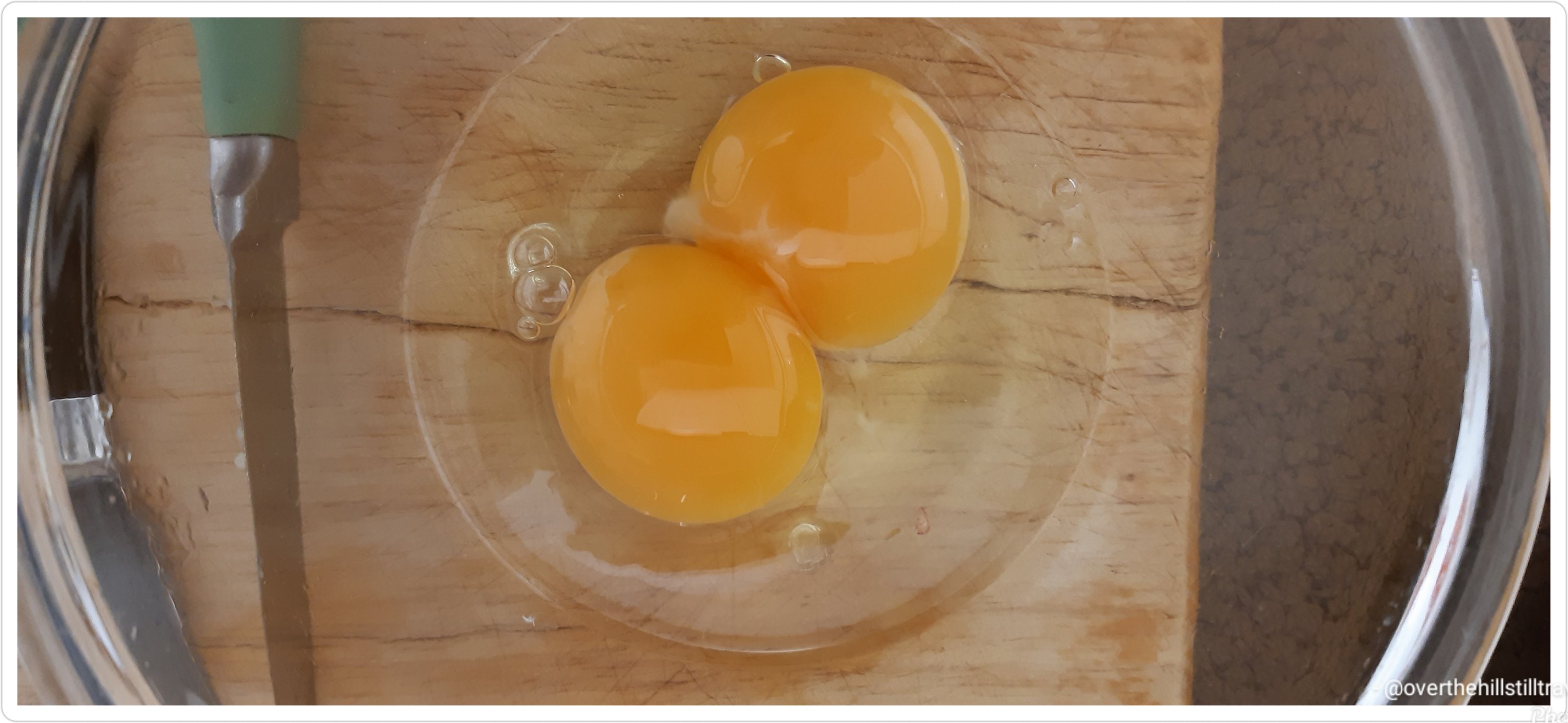
I popped over yesterday to try find some avocado but unfortunately I didn’t find any nice ones. Instead I did find some local farmers free range eggs and promptly bought a half dozen. I avoid eggs as much as possible because I don’t know their provenance and I do know that the supermarkets ‘free range eggs’ are not truly ‘free range’. I had 2 for my supper and the first one I cracked had a double yolk 😄😄
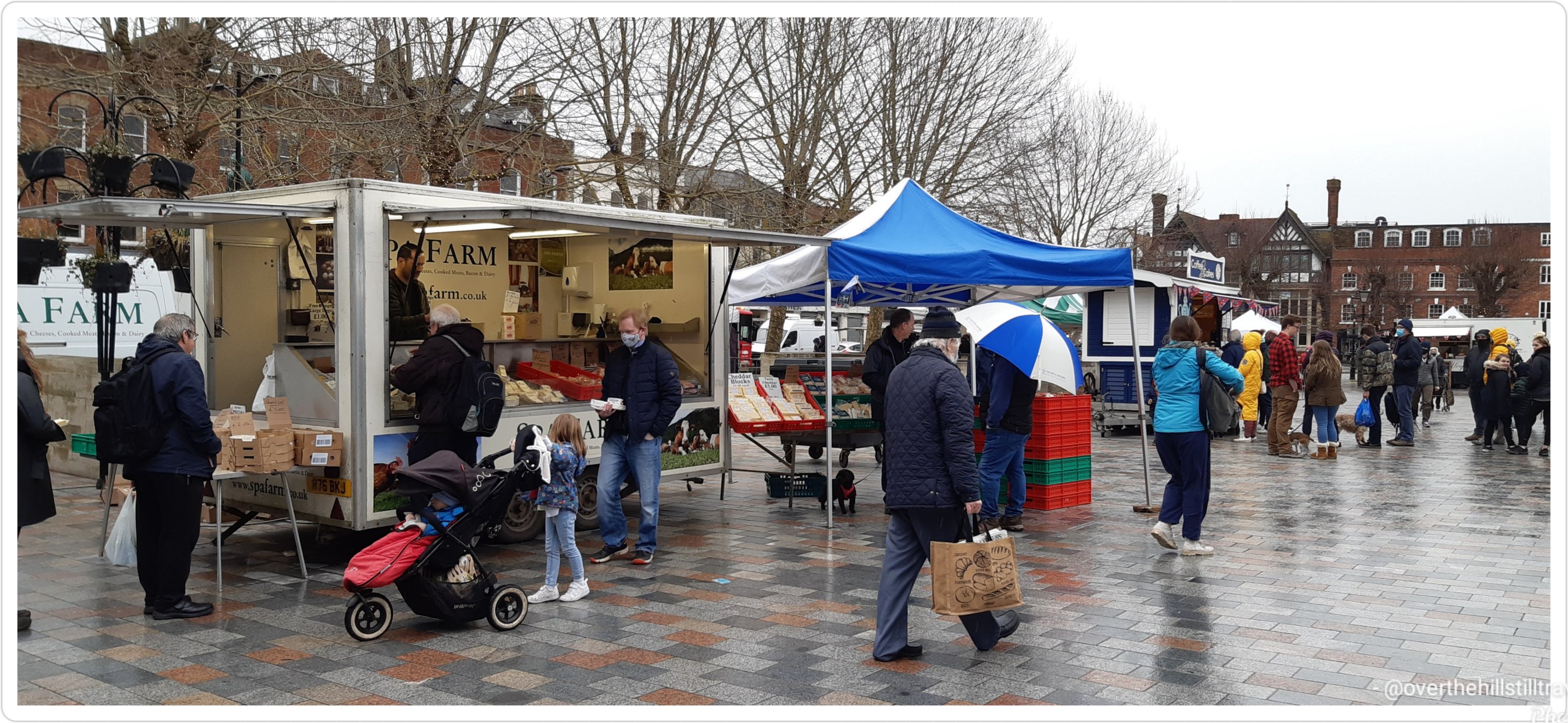
The market was in full swing when I got there, but not nearly as busy as I would have thought, but with Covid…its to be expected.
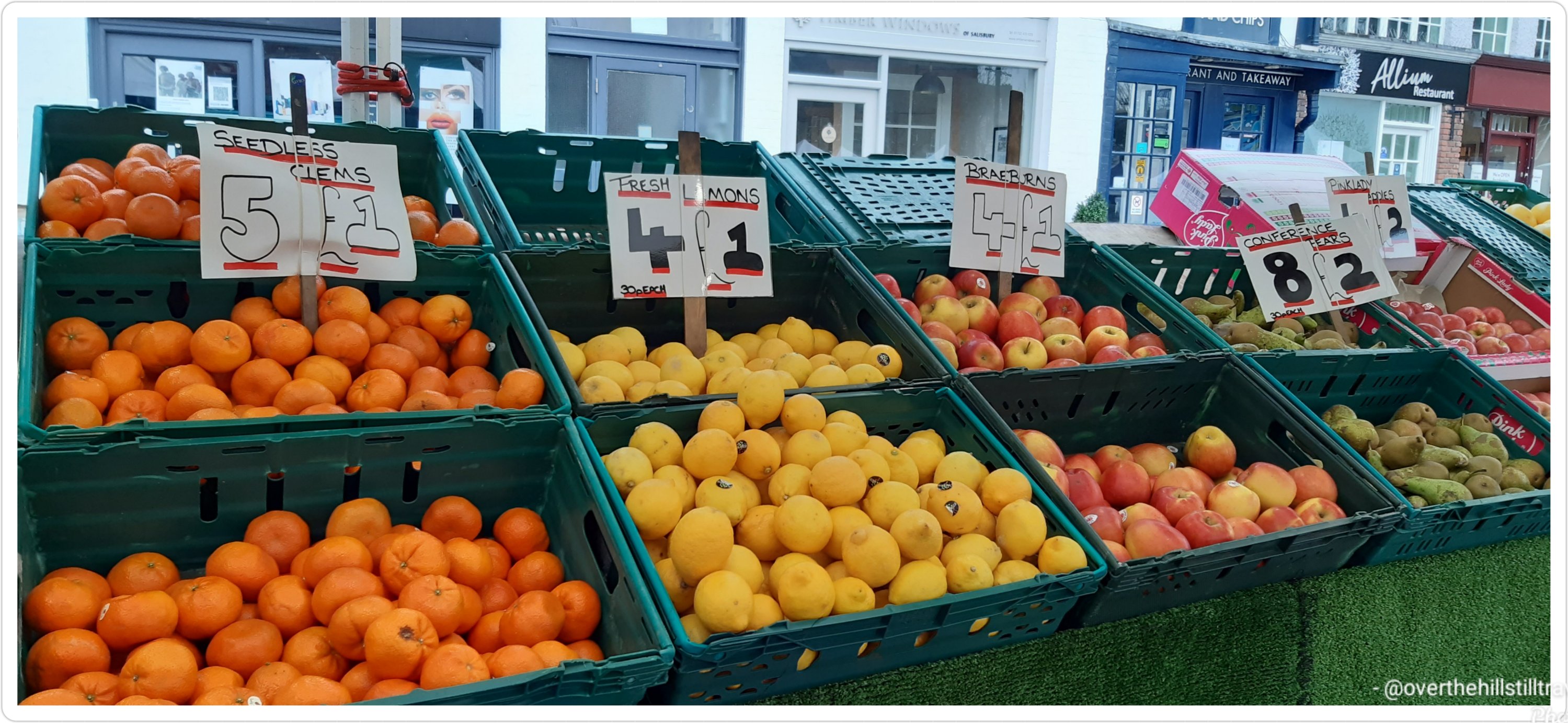
The colours on a grey day were a welcome sight, and although my time was limited, I did manage to whizz around and look at all the stalls.
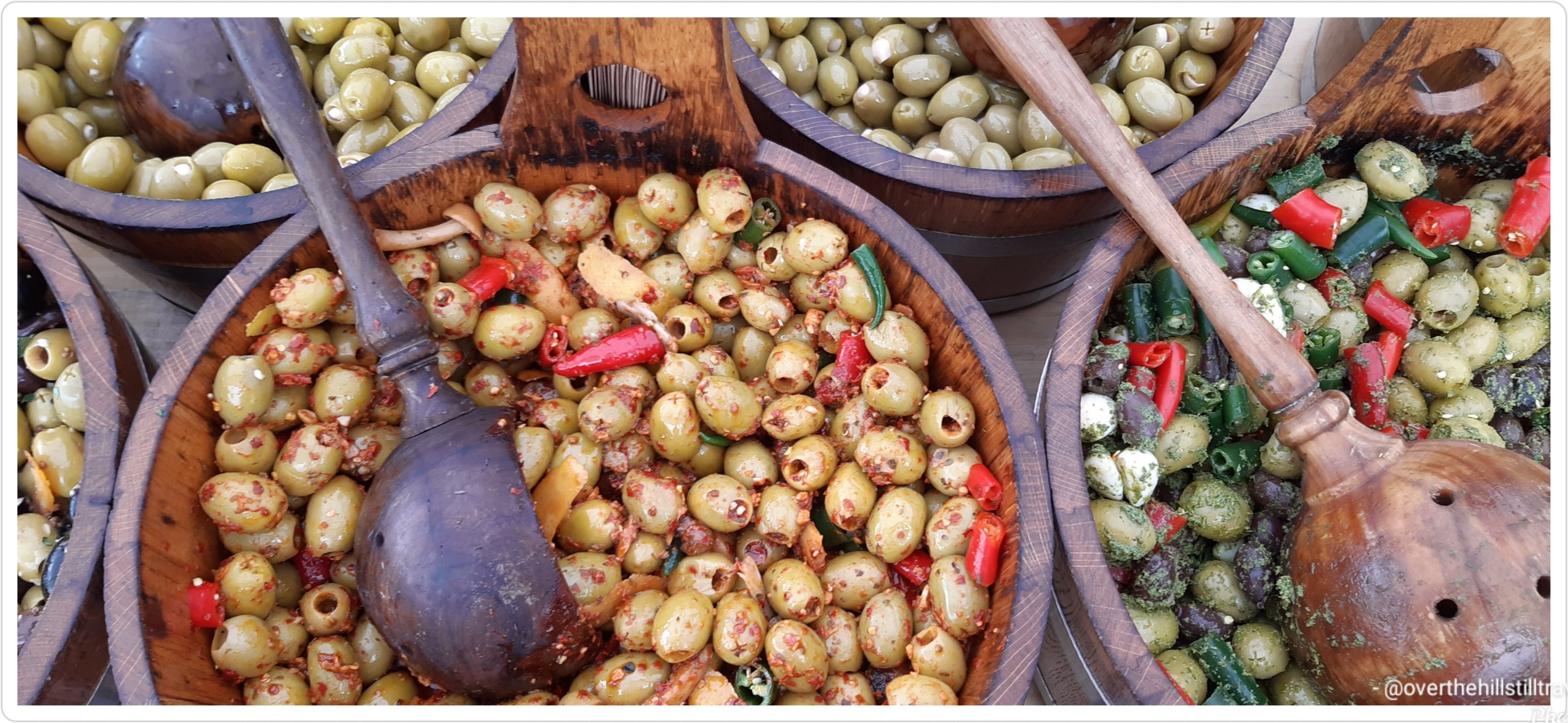
I saw these delicious olives, and was tempted…maybe Tuesday
Yummy
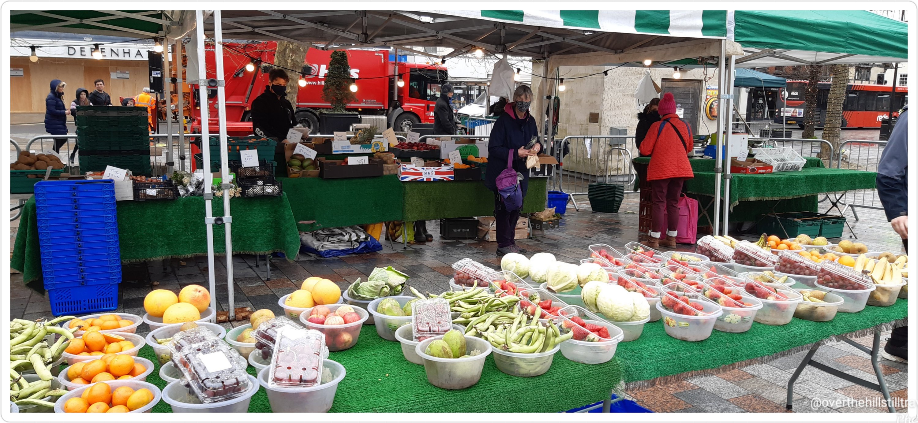
Later during my break, I walked through enroute from here to nowhere in particular, and it looked bereft…hardly anyone about. I guess the weather doesn’t help.
Intrigued by the date, I did a bit of research, and this is what I found. The market has been held in Salisbury since 1219 with the founding of the city, and the cathedral. At the time Salisbury was the largest city in the region and offered an opportunity for farmers and traders to sell their produce and wares.
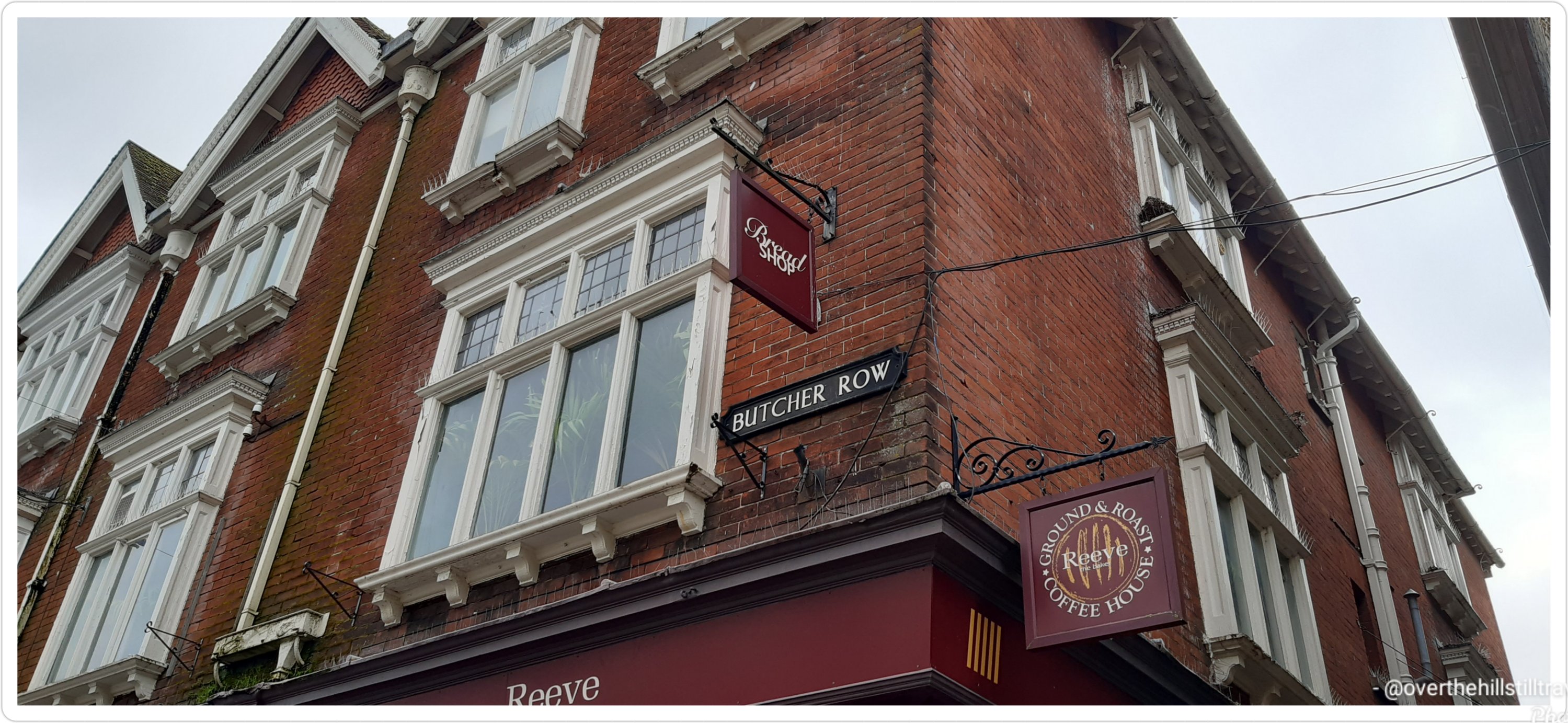
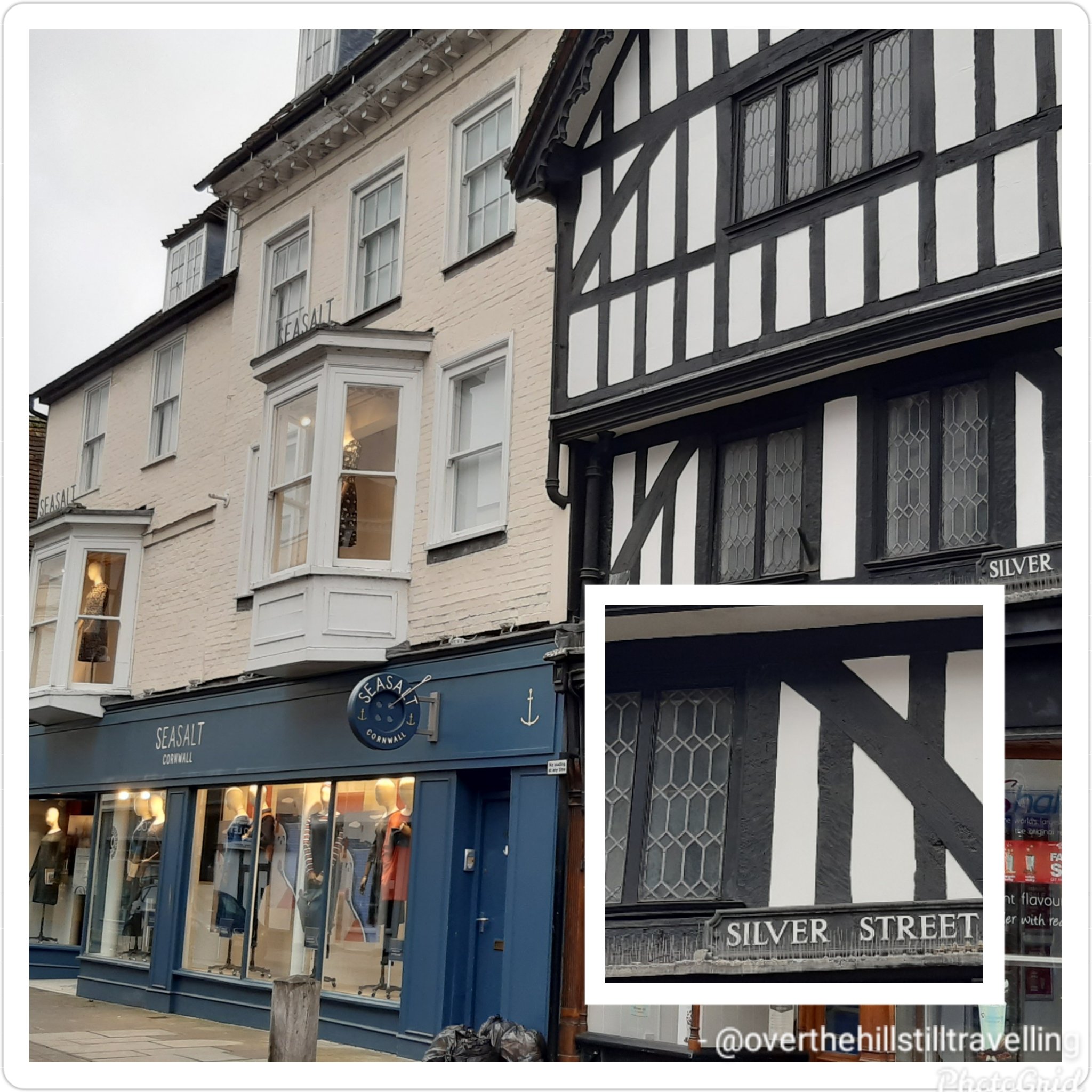
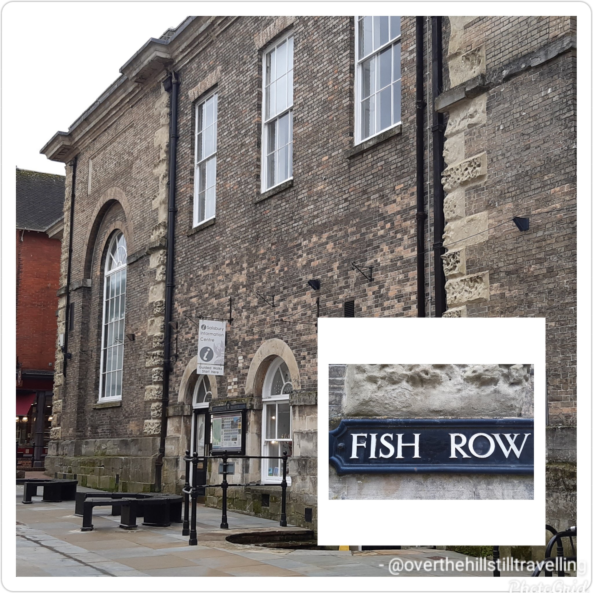
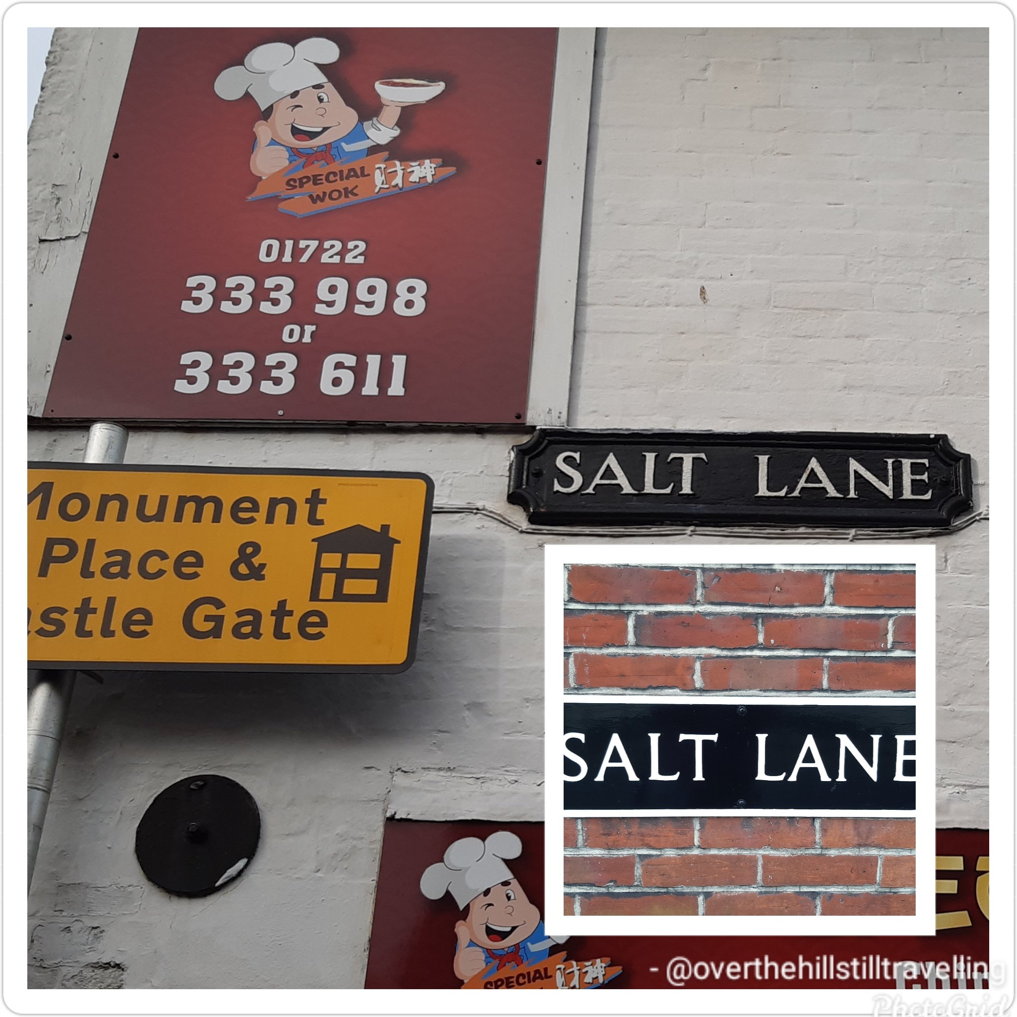
In 1361, market days were formalised and decreed to be held every Tuesday and Saturday, a tradition that continues until today. In medieval times, the market was much larger than it is today, and even spread down side streets. The streets in the area reflect the types of goods sold during medieval times; Fish Row, Silver Street, Butcher Row and the Poultry Cross.
Poultry CrossButcher RowSilver Street Fish RowSalt LaneThis intrigued me 😄😄 Chipper Lane..
I wonder, did they have the equivalent of today’s chippy…?
I’ve been fortunate enough to visit many a market in towns around the country over the years, but even so, the amazement of the history never wanes.
Salisbury was a settlement in Domesday Book, in the hundred of Alderbury, mentioned in the chapters for Wiltshire and Somerset.
It had a recorded population of 102 households in 1086, putting it in the largest 20% of settlements recorded in Domesday, and is listed under 2 owners in Domesday Book.
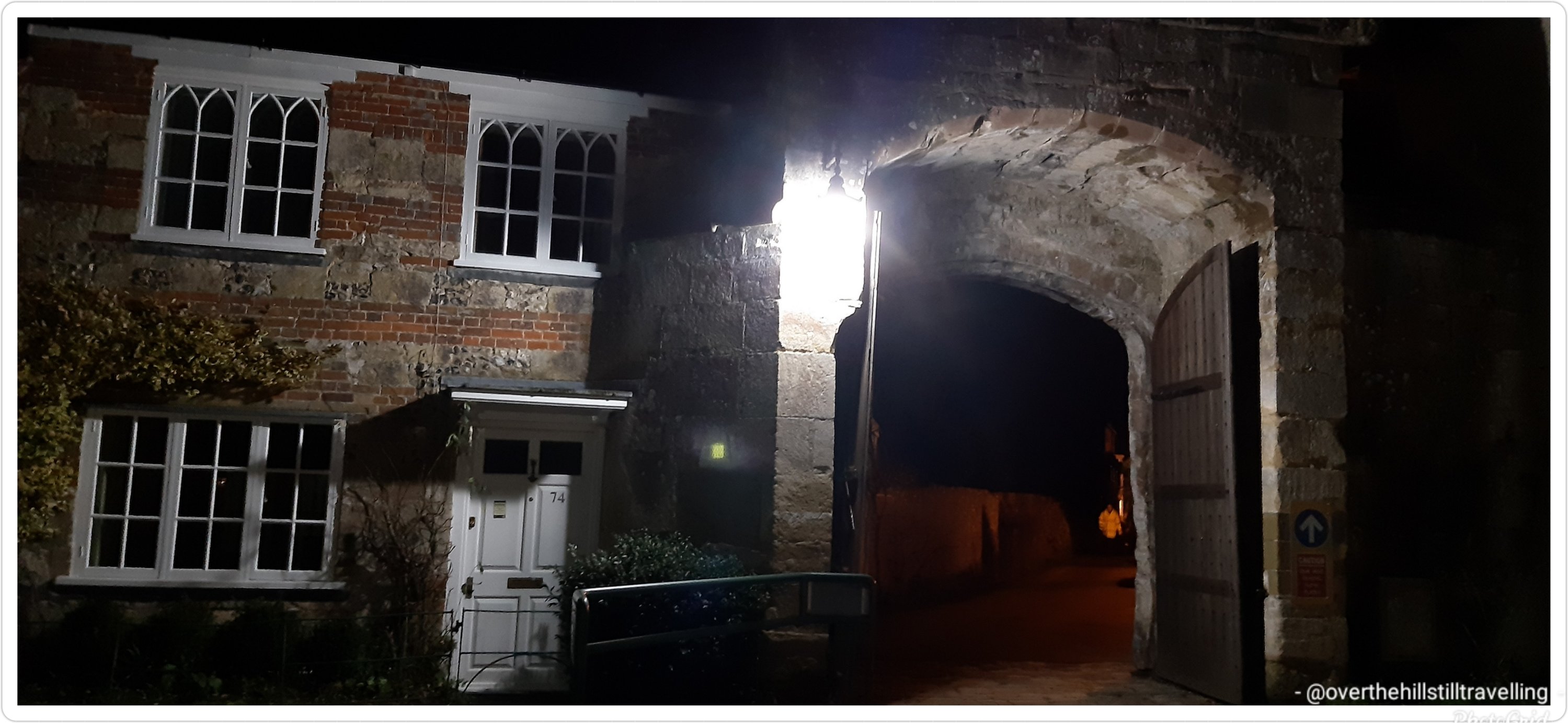
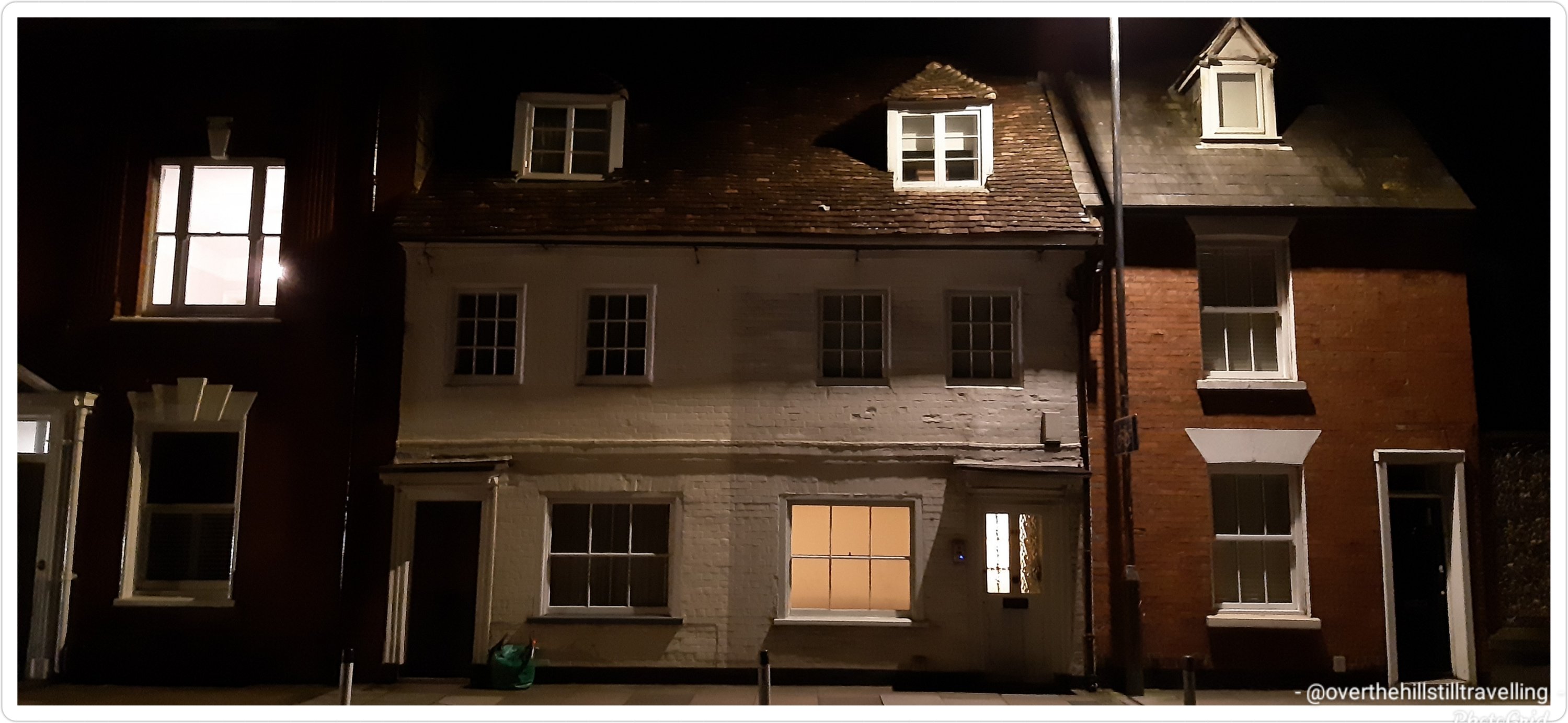
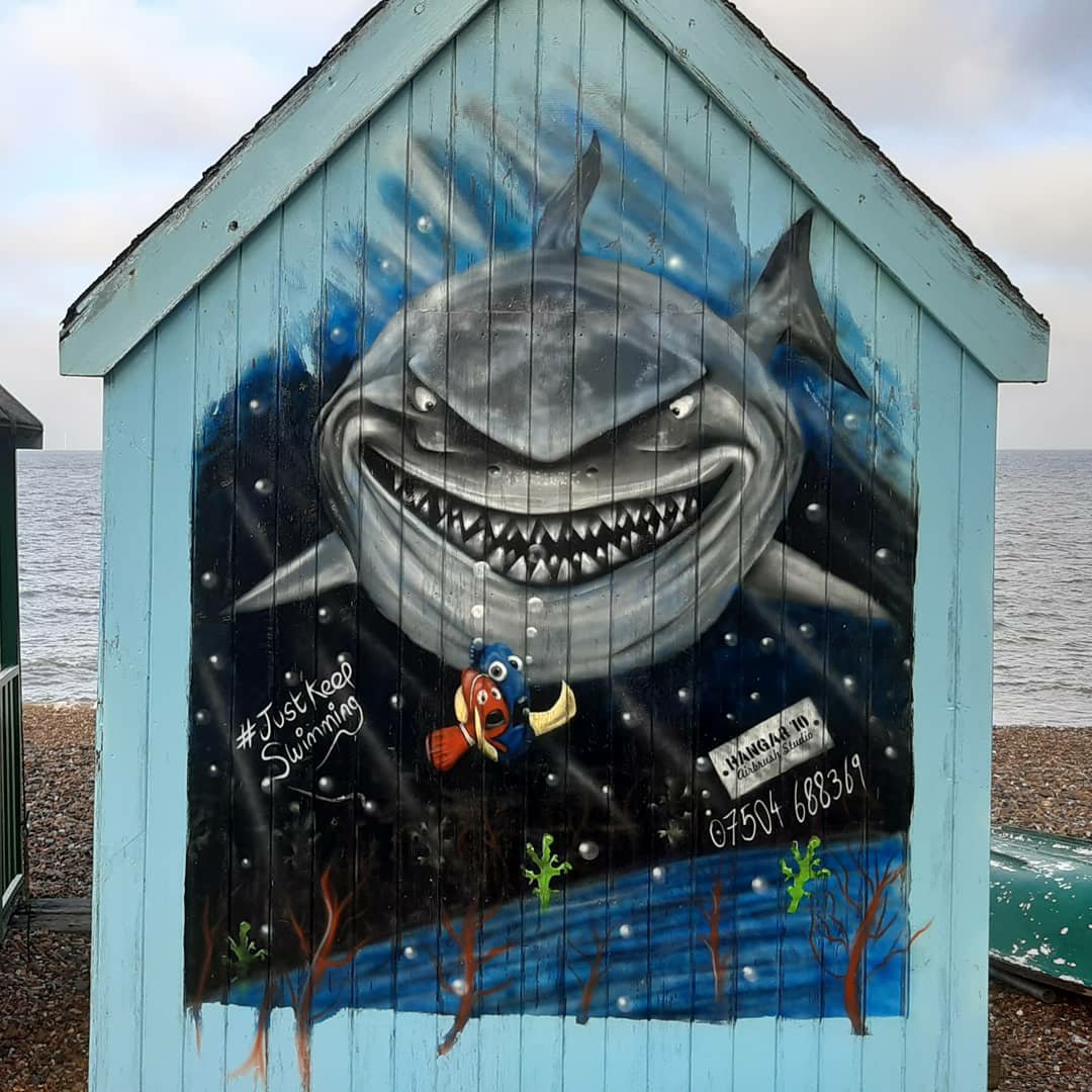
Last night I arrived in Salisbury for my next booking. Just 1 week but enough time to enjoy the area and explore. I’ve visited Salisbury and the Cathedral in pre-covid days, and love this area.
Because I only officially started work at 11am today, I was free to go walkabout last night and again this morning…. which I duly did.
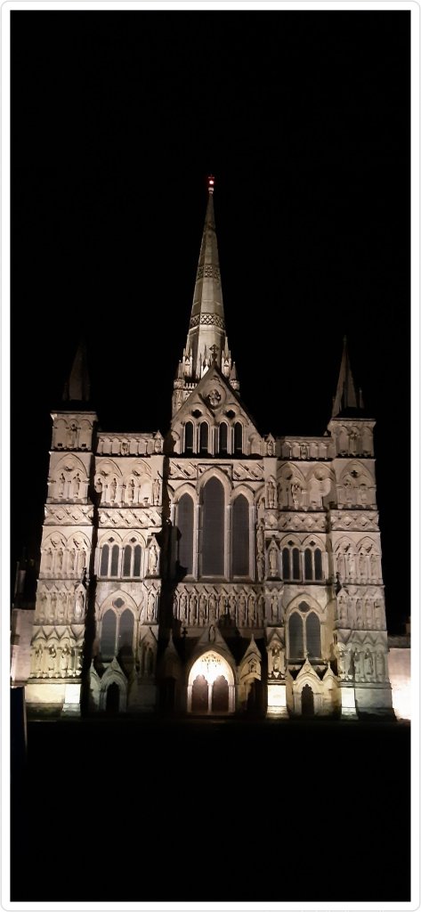
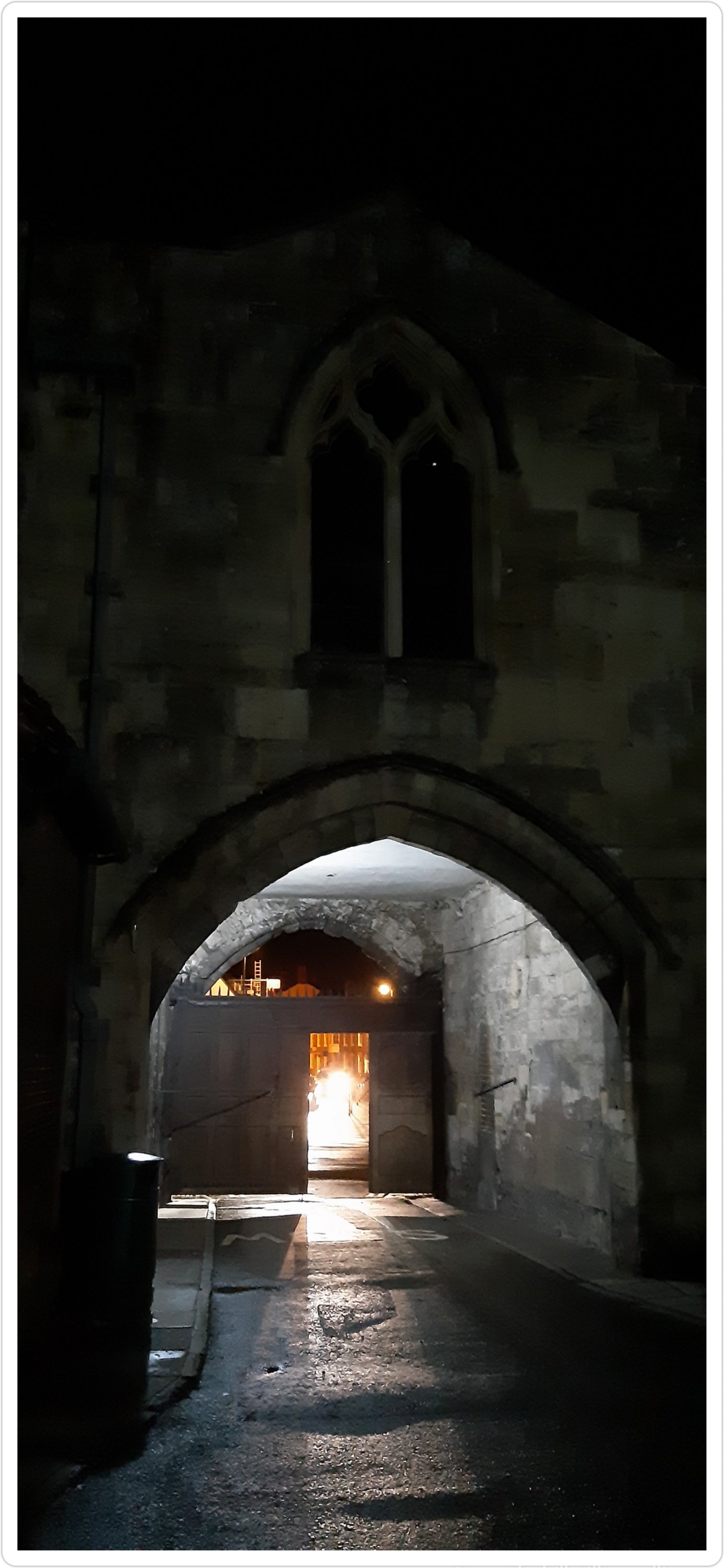
I’m working very close to the cathedral and can virtually see it from the front door of the house. Its an incredibly historic area and there’s a medieval hall within walking distance…like about 100 yards. Its amazing.
Because it was quite dark I didn’t stray too far, and didn’t take too many photos…but nonetheless, my camera was busy once again.
Here are a few images to whet your appetite
The main entrance
The original Salisbury Cathedral was completed at Old Sarum in 1092 under Osmund, the first Bishop of Salisbury. In 1220 the foundations were laid for the Cathedral at the site it is today.
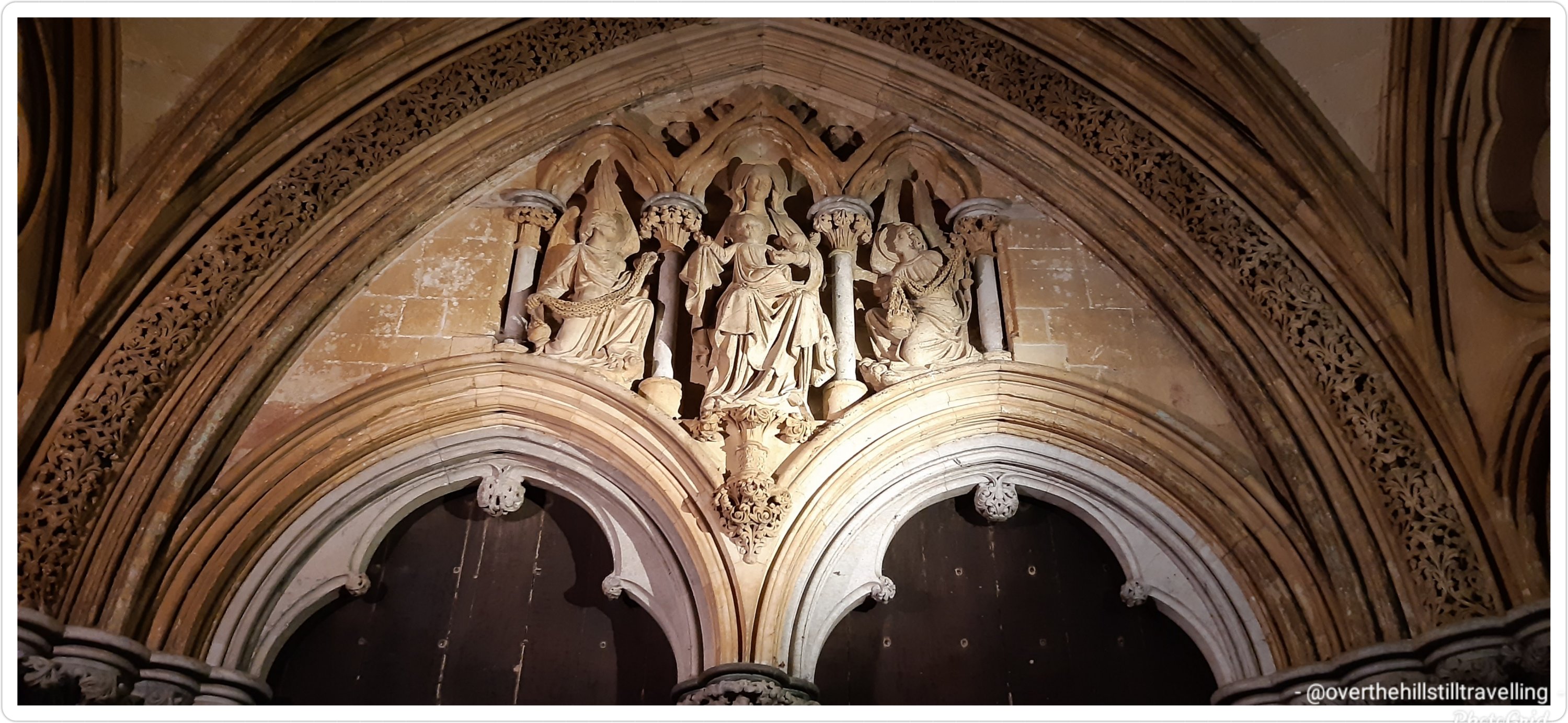
Stunning carving of Madonna and child above the entrance
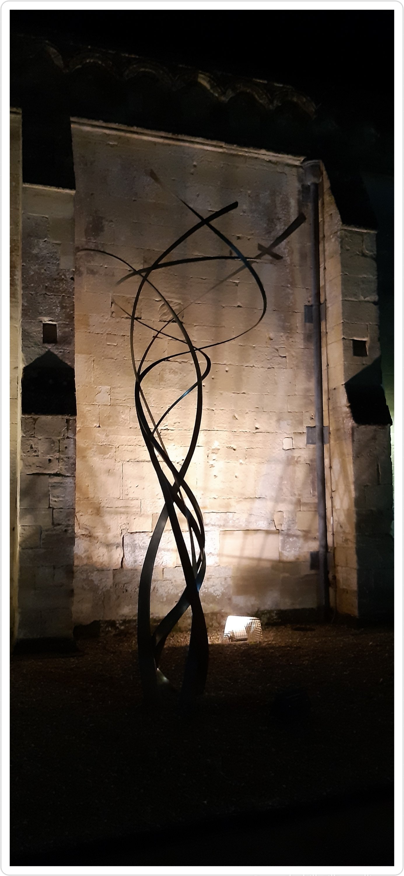
There are an amazing array of sculptures dotted around the cathedral grounds….
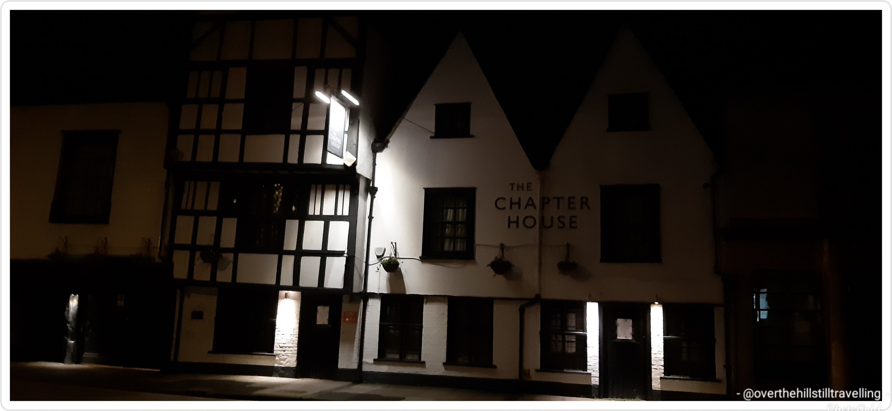
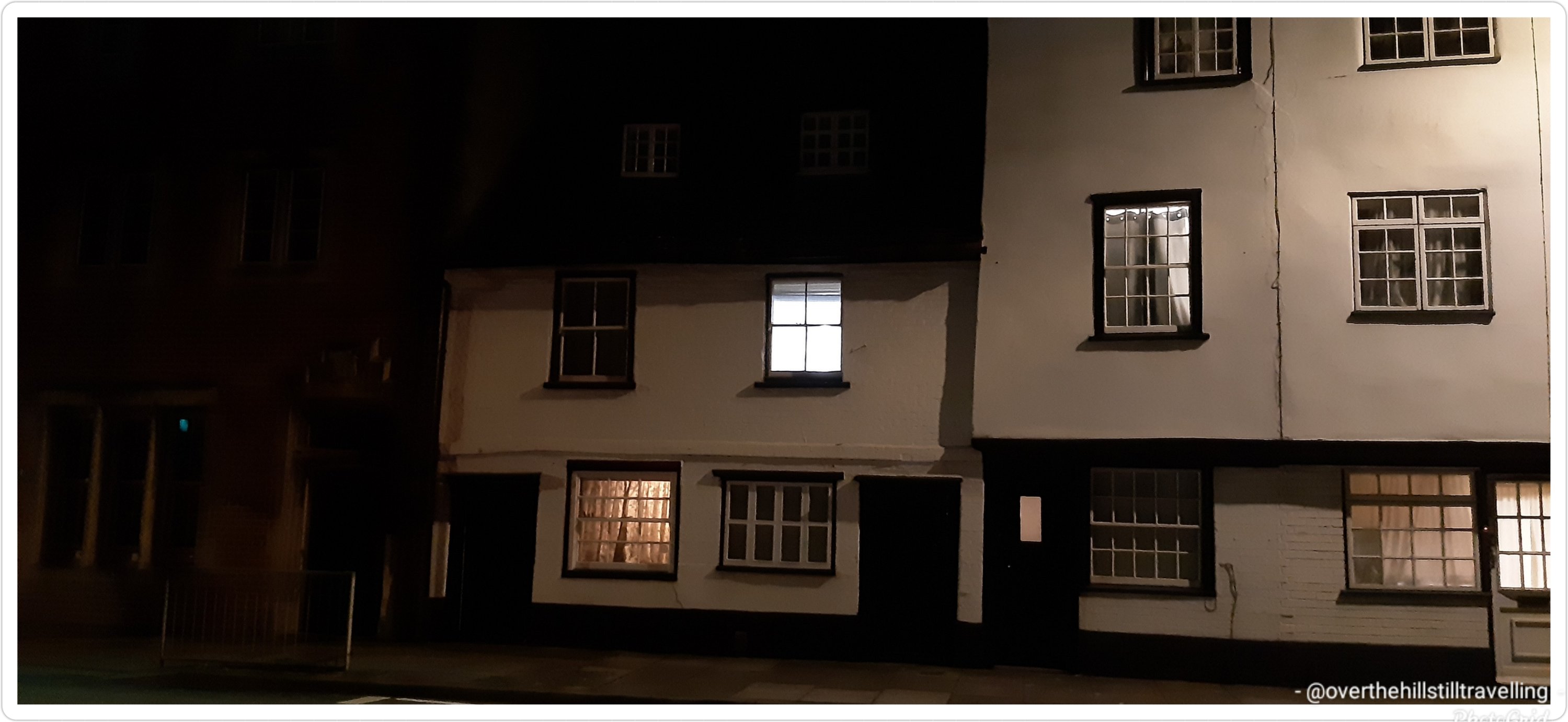
String QuartetSt Anne’s GateA bricked in door next to Malmesbury House History on the wall at Malmesbury House The Chapter House – outside the cathedral wallsOutside the cathedral wallsI’d love to know how old that house is Love love this Salisbury Cathedral looking ethereal in the dark
Salisbury Cathedral, formally known as the Cathedral Church of the Blessed Virgin Mary, is an Anglican cathedral in Salisbury, England. The cathedral is regarded as one of the leading examples of early English Gothic architecture. The main body was completed in 38 years, from 1220 to 1258.
At 80 acres, the cathedral has the largest cloister and the largest cathedral close in Britain. It contains a clock which is among the oldest working examples in the world. Salisbury Cathedral has the best surviving of the four original copies of Magna Carta. I was lucky enough to see the Magna Carta on my last visit.
In 2008, the cathedral celebrated the 750th anniversary of its consecration.
I’ll post some more photos taken this morning of the sculptures in the grounds, of which there is an amazing array, well as of the river Avon and some of the buildings in the city.
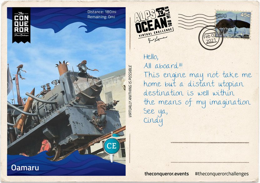
And tah dah!!!! I’m done! I reached Stage 9 and the end of my Alps to Ocean challenge on 2nd February. Hoorah.
Finally here I am 180miles (290km) later, having travelled from the alps of Mount Cook, along multiple lakes, countless connecting rivers, past seven Waitaki Hydro power stations, various mountain ranges, through tussock grasslands, beside electric fences (do not touch) to arrive in the urban town of Oamaru on the shore of the Pacific Ocean.
Oamaru is the largest town in the region and renowned for its Victorian precinct. A commercial streetscape, the Neoclassical architecture is a result of Scottish architect and engineer, Thomas Forrester, who emigrated with his family to NZ in 1861. Arriving in Oamaru to supervise the construction of the Bank of Otago, Forrester stayed on and shortly afterwards was integral to the construction of the Oamaru Harbour. Taking samples from the harbour floor, he deduced that the seabed could be dredged permitting the development of a deep water anchorage. This in turn allowed large ocean-going vessels to safely steer in and out of the harbour. Forrester then changed direction and together with his business partner, over a period of three decades, designed and built the various commercial buildings that still stand today. The precinct bustles with cafes, antiquity shops, bookshops and galleries. Each year it conducts the Victoria Fete, a one day fundraising event with stalls, music, food and period costumes. The funds raised go towards the ongoing care and restoration of the Victorian buildings.
For steampunk enthusiasts, inside one of the Victorian buildings is Steampunk HQ showcasing a collection of quirky items in retro-futuristic sci-fi style whilst outside is a full size train engine spitting fire and billowing smoke. Promoting sustainability and recycling Steampunk HQ collaborates with like-minded artists on projects to continue expanding the collection. Wish you could join me for a steampunk-Victorian era inspired dress-up and for a time feel like we have been transported into an alternative 19th century England.
At the north end of the Victorian precinct is the oldest public garden in NZ. When the town was surveyed in 1858 an area of 34 acres was set aside as a public reserve. Eighteen years later in 1876, the Oamaru Botanical Gardens was opened. Besides the flower beddings, bushes and trees the garden is dotted with various attractions such as the Japanese red bridge, Oriental garden, croquet lawn, sundial, aviary, peacock house, an Italian marble fountain and the Wonderland Statue made by the famous Scottish sculptor Thomas J Clapperton which he donated to the children of Oamaru in 1926. Thomas also made the bronze soldier sculpture on the World War 1 Memorial in Oamaru and is famous for his Robert the Bruce sculpture adorning the entrance of Edinburgh Castle, Scotland.
As I stand on the end of the pier and look across the expanse and vastness of the Pacific Ocean, I wonder at its hidden stories, sunken ships and deep trenches. I wonder what Portuguese explorer, Ferdinand Magellan was thinking when in 1521 he sailed across the Strait of Magellan into the Pacific Ocean and was inspired to name it Mar Pacifico which translates as Peaceful Sea. It’s certainly questionable when you consider the heavy swells, the earthquakes, volcanoes and tsunamis that have battered many Pacific islands and sometimes obliterated complete towns. When I consider the depth and perpetual darkness of the Mariana Trench or the Pacific Rim with the highly active Ring of Fire, peaceful is not something that comes to mind but it is intriguing and fascinating.
This has been such a fascinating journey, it is indeed intriguing. I mean snippets like this are just awesome: Mar Pacifico which translates as Peaceful Sea, although I’m not too sure about the earthquakes et al.
Albeit a virtual journey, it’s made more exciting with the postcards and the information you receive as you reach each stage, and how much I’d love to see that train!! I’ve learned more about New Zealand than I ever knew, as well as from my previous challenges: Mt. Fuji in Japan, The Great Ocean Road in Australia, Ring of Kerry in Ireland etc They’ve all been so interesting.
So far I’ve completed 9 challenges which includes the Conquer 2020 challenge which was a sum total of all my challenges and more in 2020. My favourite so far has been Hadrian’s Wall and I never did get to blog about it…I only thought about sharing these challenges on my blog while I was doing Mt. Fuji because it was so fascinating. I’ll try to blog about the others, but I’ll stick with the shorter ones otherwise it gets too tedious for everyone….anyway, The Ring Road in Iceland is 1,332kms long and I imagine has lots of postcards LOL and the St Francis Way is 503 kms…so likewise.
But I’m starting the Mt. Everest challenge next, and then the Giza Pyramids challenge after I’ve done The Cabot Trail in Canada, so I’ll share that at the time. Of course I may just change my mind and blog about The Cabot Trail too 😉 And here is my certificate. Seriously, within seconds of updating the app, the final postcard and certificate land in my mailbox. I’m going to make books from all of them for each walk….will be fun to look back on one day when I’m older, and infirm and unable to walk far….if I live that long LOL
You have received a new postcard! 🙌 its ridiculous how excited I get when I post a day’s mileage to my app and within seconds I hear the ping of a new email 😃😃 I reached Stage 8 on 28th January, and
It’s with mounting excitement that I realise I’m nearing the end of my virtual journey on the Alps to Ocean route in New Zealand. I started off the challenge on 30th December 2020, and except for a few days along the Kent coast, the majority of my walking has been in the countryside of Throwley, near Faversham – still in Kent.
I’ve been hard put to get my kms in because I only get a 2 hour break each day and some days due to weather I’ve not been able to walk at all. I set my initial goal at 5 weeks but was hoping to complete the challenge in 4 weeks. However, that plan was scuppered when the booking was extended for 3 weeks. 🤔🤔🤔 Nonetheless, I’m not complaining, I’ve enjoyed my stay in Throwley and with another 10 days to go till I leave (as of the 28th), I’m hoping to finish the Alps to Ocean challenge and start on the Giza Pyramids…meanwhile
Stage 8
The small farming-town of Duntroon is home to around 120 residents. It’s main economy is largely sheep farming and crop growing such as wheat and barley.
The town was bestowed its name by one of a handful of Robert Campbells that emigrated from the United Kingdom to Australia and New Zealand. It took quite a bit of unravelling and genealogical construction to discover which of the four generations of Robert Campbells was the relevant one associated with Duntroon. It seems that the name Robert was greatly favoured in the family.
The first Robert (#1) was a grand-uncle from Scotland who was the first merchant in the 1788 British colony New South Wales (Australia) and later a politician. Having built a private wharf at the time he is now referred to as “Campbell of the Wharf”. He had a son named Robert but his brother, John, also had a son named Robert (#2).
This nephew, Robert (#2), arrived in Sydney in 1806 and by 1818 he was the Director and afterwards the President of the first formal bank in Sydney, the Bank of NSW, today known as Westpac. Having also built himself a mercantile business on Bligh Street, Sydney, he became known as “Campbell of Bligh Street”. This Robert, unsurprisingly had a son also called Robert (#3), who was born in Sydney but chose to return to England and became a Member of Parliament from which he was unfortunately unseated threes month later. To distinguish him from previous Roberts’ he was given the appellation “Robert Campbell Tertius” meaning the third.
Finally the relevant Robert (#4), son of Robert Campbell Tertius, who was born in England in 1843, travelled to New Zealand early 1860s to either buy or lease land on behalf of the family. Robert became a successful sheep farmer, property owner and later politician. Together with his father, he owned a sheep station in the Waitaki District upon which they built a small town they named, Duntroon, a Scottish name possibly as homage to their ancestry and their ties to Clan Campbell of Argyll, Scotland.
Robert’s (#4) wife, Emma, bequeathed £6,000 to the parochial district with instructions to build a church for the benefits of Church of England members. The result was St Martin’s Anglican Church in a 14th century Gothic style, built out of limestone quarried in a nearby region. The side church door bears the Clan Campbell coat of arms. Sadly both Robert and Emma died childless and within a few months of each other.
By 1875 much of the acquired Campbell lands became plagued by rabbits that were imported in the 1830s and released for sport. Unable to curtail their rapid reproduction rate, by the early 1880s the pastures were depleted and hillsides eroded. This in turn produced lower quality wool thereby affecting the prices of wool. In the end, the devastation wrought in the region forced many sheep station owners into bankruptcy and the Campbell’s businesses in NZ were eventually wound up and ceased operating by 1920.
Just off the main highway is the Vanished World Heritage Centre, a fossil and geology museum that includes the fossils of two species of extinct genus of large penguins from around 27-28MYA. Known as Archaeospheniscus, the species is about the size of an Emperor Penguin. There was a third species, albeit a smaller one, in this genus that was discovered in Antarctica. These three species are the only ones currently existent in this genus.
Having left Duntroon, I’ve parted ways from Waitaki River which has been my companion since the Waitaki Dam and moved in a south-east zig-zag direction until I stopped at the Rakis Railway Tunnel, an old disused railway line. During the 1880s depression era the construction of the railway provided much needed unemployment relief. The 11mi (19km) line was in use from 1887 to 1930. Today the tunnel is only 330ft (100m) long and although it can be explored, a torch is needed because halfway in the tunnel curves cutting out all source of natural light.
Today will be by far my longest route of this entire journey, hence writing this letter on one of my rest stops. I look forward to rolling into my final destination, Oamaru.
Interesting information provided…..and therein lies the foolishness of history. You can’t just import alien species into a country for whatever reason and expect it to have a happy outcome. If you read history, you’ll discover that there were dozens of similarly stupid and foolish mistakes made by the invaders (of the people kind, not the animal or plant kind) of these islands as well as in Australia and various other countries around the world; the British Empire!! Geez. Well I have to admit that I have no sympathy for the unfortunate Campbells, shooting rabbits for sport – how cruel…and talk about a lack of imagination. With the huge variety of names on offer, could they not come up with something a little different…I mean I like the name Robert on the whole, but surely a little variety wouldn’t have gone amiss?
I do like the Elephant Rocks though and the Vanished World Heritage Centre, sounds like an awesome place to visit.
Anyway…. I’m rapidly reaching the end of my Alps to Ocean NZ challenge!! I always feel a little sad really when they reach the last few miles…..they become friends eventually LOL Okay, okay, don’t say it…I know, it’s daft.
Didn’t take any photos of the area this day because, seriously I have so many already, but I did spot that gorgeous iris hiding under a hedge and the snowdrops are in bloom. So pretty..I love this time of year when the first snowdrops appear…
And because I didn’t faff around too much taking photos, I managed to clock up 11.44kms in 2.5 hours 👏👏👏😁
I got back yesterday after working away for 5 weeks and opened my vast pile of post….
It’s like Christmas really 😄😄😄
And in the pile were my last 4 Conqueror medals 👏👏👏🏅🏅🏅🏅
In order of completion, from left to right
Great Ocean Road, Mt. Fuji, Conquer 2020 and Alps to Ocean which I completed this month. Awesome 😃😃
My target for 2020 was 2,020kms and I reached that on 31 December 2020
I probably walked wayyyyy more than that, but I mostly count ‘boots on’ mileage and if I’m stuck indoors at work and unable to get out for my break on any particular day, I count my indoor walking, which extraordinarily sometimes amounts to 12kms between going on duty at 8am to 2pm when I take my 2 hour break. Mostly I try to get out to walk, but sometimes like these last few days, I get snowed in, or its pouring with rain….ergo, no good for walking if you don’t have the right gear.
I first started these virtual challenges on 26th March 2020, and the Alps to Ocean is my 9th challenge completed. I have 5 to do this year, as well as the Conquer 2021 challenge which is a compilation of all challenges walked during the year. Of course they may well introduce more…in which case 😁😁😁 and ‘boots on’ and getttt walking!!!
Also in the mail were my next two Cicerone books: The Thames Path, which I’m planning on walking in April for my birthday. Its something I’ve wanted to do for years, and years, and of course I’ve walked many miles along the River Thames between Hampton Court Palace and as far as Greenwich – not all in one go, but different sections over the years, and right along the whole length between Rotherhithe and Lambeth, also at different times.
And of course the South Downs Way is a desirable walk for this year too.🤞🤞🤞 because so many factors affect that possibility.
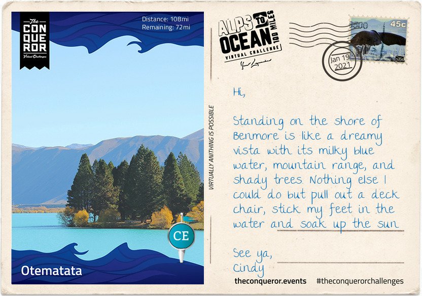
I reached this stage on 19 January, so not too far behind the last stage…either I was walking a lot more, or the distance to this stage was shorter. Of course all I have to do is check the details on the postcard!! In real life, from 1st January to the 19th I’d walked 128km which is just over 80 miles. Not too bad.
And doesn’t that water look amazing. Reminds me of the sea along the Thanet coastline when the water gets cloudy from the chalk after a storm…
Defined as “a populated area less than a town”, Otematata is more of a holiday town nowadays when it’s small population of around 180 explodes to 5,000 during the summer season. With easy access to both Lake Benmore, downstream Lake Aviemore and nearby hiking trails (known as tramping in NZ), holiday makers swarm to the area for camping, water skiing, boating, fishing, swimming and cycling among other activities.
Stage 6
Otematata sprung up in 1958 as a base for construction workers of the Benmore and Aviemore Dams. Within a year the population grew to 450 and at its peak it was as high as 4,000 residents. Built by the Ministry of Works the town had all the necessary facilities and services such as schools, clubs, pub, cinema and mall. The 1,500 strong workforce of engineers, builders, electricians, concreters and truckies spent seven years building the dam. Once the dam was finished, as it often happens with these kind of projects, the town was slowly dismantled. The houses that were trucked into town were years later trucked out and moved to Twizel for the next project. Benmore Dam is the largest earth-filled dam in NZ and the largest of eight in the Waitaki hydro scheme. As the second largest hydro station in the country, Benmore generates sufficient electricity to cover nearly 300,000 NZ homes.
Leaving Otematata, I travelled north on a sealed pathway alongside the Waitaki River until I reached the massive Benmore Dam and stood atop it with a bird’s eye view of the lake to the north and the river to the south. When the lake is over capacity, the floodgates open to release the water down a spillway and to prevent erosion a lip was inserted at the end to deflect the water. The spillway can handle ten times the normal river flow thereby allowing it to cope with severe flooding.
I skirted around the shore on a narrow sealed road to Deep Stream Track on Lake Aviemore for a walk along a flooded canyon. The deep green water was quite inviting for a swim but I settled for a picnic under a shaded tree enjoying the tranquility of this location and the reflection of the hills on the water.
A little further I crossed the Aviemore Dam back onto the State Highway and was relieved to be travelling on an off-road path beside the main road all the way to Waitaki Dam. Aviemore Dam was built in 1968 and the construction was on uneven ground because the Waitangi Fault runs beneath it. Although at the time of construction the fault was considered inactive, in the 2000s the fault was upgraded to dormant and as such the dam was reinforced against earthquakes and potential landslides. Because of the fault the dam is a mixed structure being part solid rock topped with concrete on the north side and earth-fill where the fault line runs beneath on the south side.
The Waitaki Dam is steeped in NZ history. As the smallest in the Waitaki hydro scheme, it is also the oldest having been built in 1935. Being the first dam to be built on the South Island, it was also the last to use pick and shovel. These archaic tools were retained because politicians wanted to reduce the unemployment rate during the Depression Era.
The building of the Waitaki Dam inadvertently played a major role in the birth of the social welfare system. In 1928, the Waitaki Hydro Medical Association together with the Waitaki Hospital Board developed a scheme to deduct monthly fees from wages in order to provide medical and ambulance services to the workers. When two politicians, one a doctor and the other a reverend, took office in 1935, they based the social welfare scheme on the one developed by the dam project.
From here it was a 5mi (8km) journey into Kurow. I heard the Waitaki Valley, which begins in Omarama, is a young winery region with a flair for developing good pinot noir and pinot gris. I’ll be sure to sample some after a hearty meal. I’m thinking fish and chips at the nearest pub.
I could live with fish and chips!! And do my journey continues. Seriously though, reading these emails makes me really really want to walk this route for real….
Now that I’m at my next booking my time has been limited. But I try to get out every day and explore the area.
After a week of daily walking, I reached the 4th stage on 10th January…
The roads here are very long and it takes me a good 10 minutes to reach an intersection, which means I can’t go too far afield as it will take too long to get back. But I’ve made a point of trying out different routes, in as much as my options are minimal, but I’ve discovered some lovely country lanes.
Meanwhile, on my virtual journey…
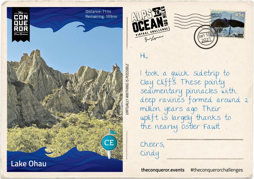
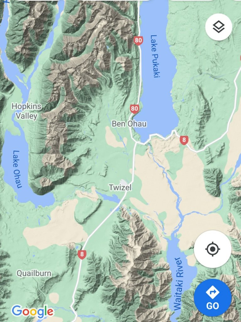
Here I am at Lake Ohau, the third and smallest parallel glacial lake in the Mackenzie Basin that serves as a water storage for the Hydro scheme. It is connected to Lake Pukaki and Lake Tekapo (the other two parallel lakes) via an artificial canal. Lake Ohau is stunningly located between The Barrier mountain range to the west, Ben Ohau range to the east and Naumann range to the north which lies between Hopkins and Dobson rivers that feed into the lake.
Stage 4
This turquoise blue lake is a perfect environment for both powered and non-powered activities. Although at the height of summer the temperature reaches a mere 60°F (15°C) any swimming enthusiast wouldn’t want to miss the opportunity for a crisp splash in the lake. Luckily for me the weather was in my favour and I went for a brisk swim before starting my onward journey. However, I did hear that any sailor or windsurfer on the lake must be mindful of the northerly winds as the water gets choppy very quickly.
It might be debatable what’s considered a national dish in NZ, perhaps fish and chips or perhaps a gourmet meat pie. No matter, my choice was the traditional piping hot meat pie encased in a crispy pastry. This humble meat pie has been part of NZ’s cuisine since 1863 when the early British settlers brought it to NZ’s shores. It’s the perfect size to be eaten with one hand whilst chugging their popular Lemon & Paeroa soft drink with the other. The soft drink’s history goes way back to 1907 when it was originally manufactured in the town of Paeroa by combining lemon juice and carbonated mineral water.
After my finger-licking good pie and L&P hydration, I set off for what was to be the hardest part of the journey. The first 3.5mi (6km) was an easy section as I traversed the lower slopes of the Ohau range across several creeks before I found myself on a narrow track and a sustained climb of about 2.5mi (4km) to the highest point of the trail at 2,952ft (900m). Not that I particularly trusted that I was at the highest point for a while since all along there were several “false summits” where the trail appeared to reach the highest point to then discover that there was more upwards winding to go. During the winter months part of this upward climb proves to be even more hazardous as it becomes part of an avalanche path.
Reaching the top was quite the accomplishment but given its exposure and strong winds I spent little time admiring the view and started my descent. If I thought the climb was a challenge the steep descent with its tight steep bends was even more ghastly for the next half-mile or so.
The rest was a rolling descent crossing several streams. Clean drinking water could be collected at these streams enabling me to top up my bottles. The track joined with Quailburn Road and for the remainder of my journey I travelled beside Quail Burn River first to the west of me and once I crossed it to the east of me, almost like a constant companion, until we parted way with the river flowing into Ahuriri River and me rolling into Omarama for the night.
Like the Mt. Fuji virtual challenge which I finished in December, I’m really enjoying learning more about New Zealand and its history. The powers that be could/should consider teaching history and geography in this way, the subjects would be so much more interesting.
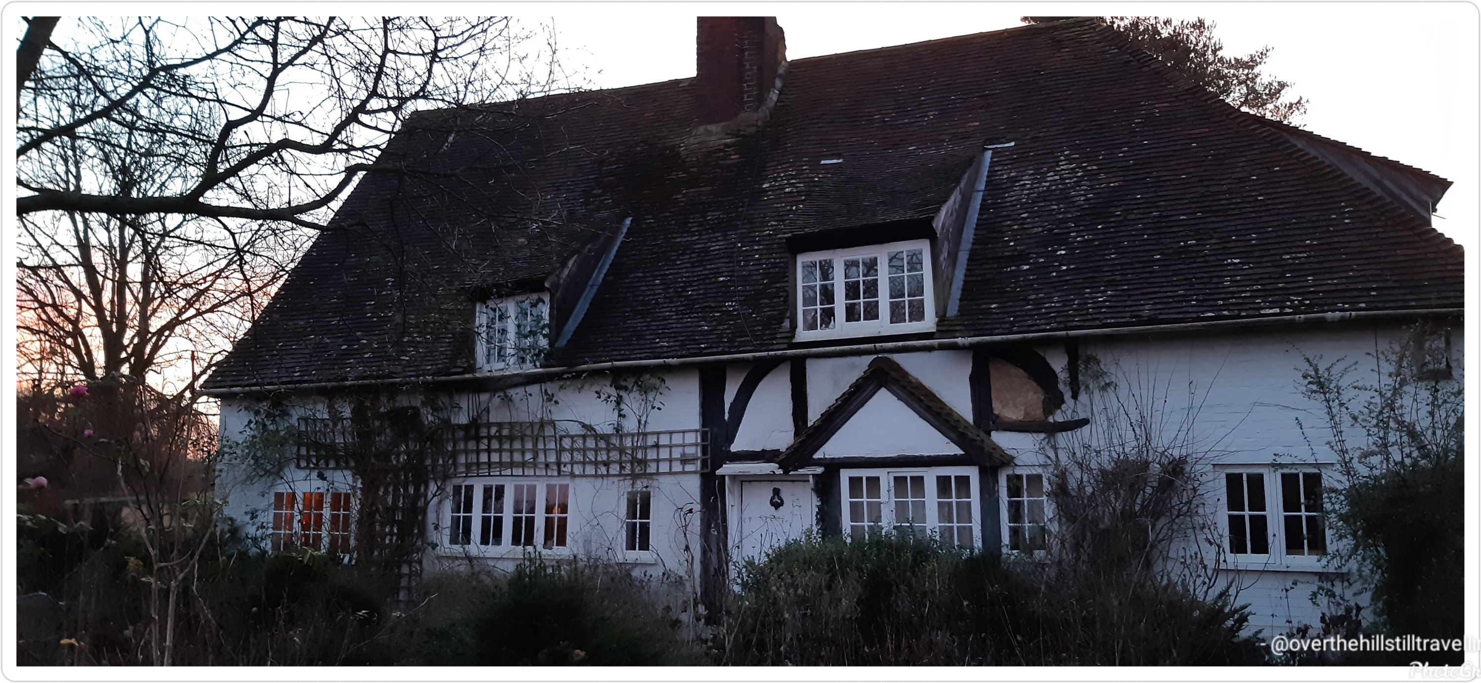
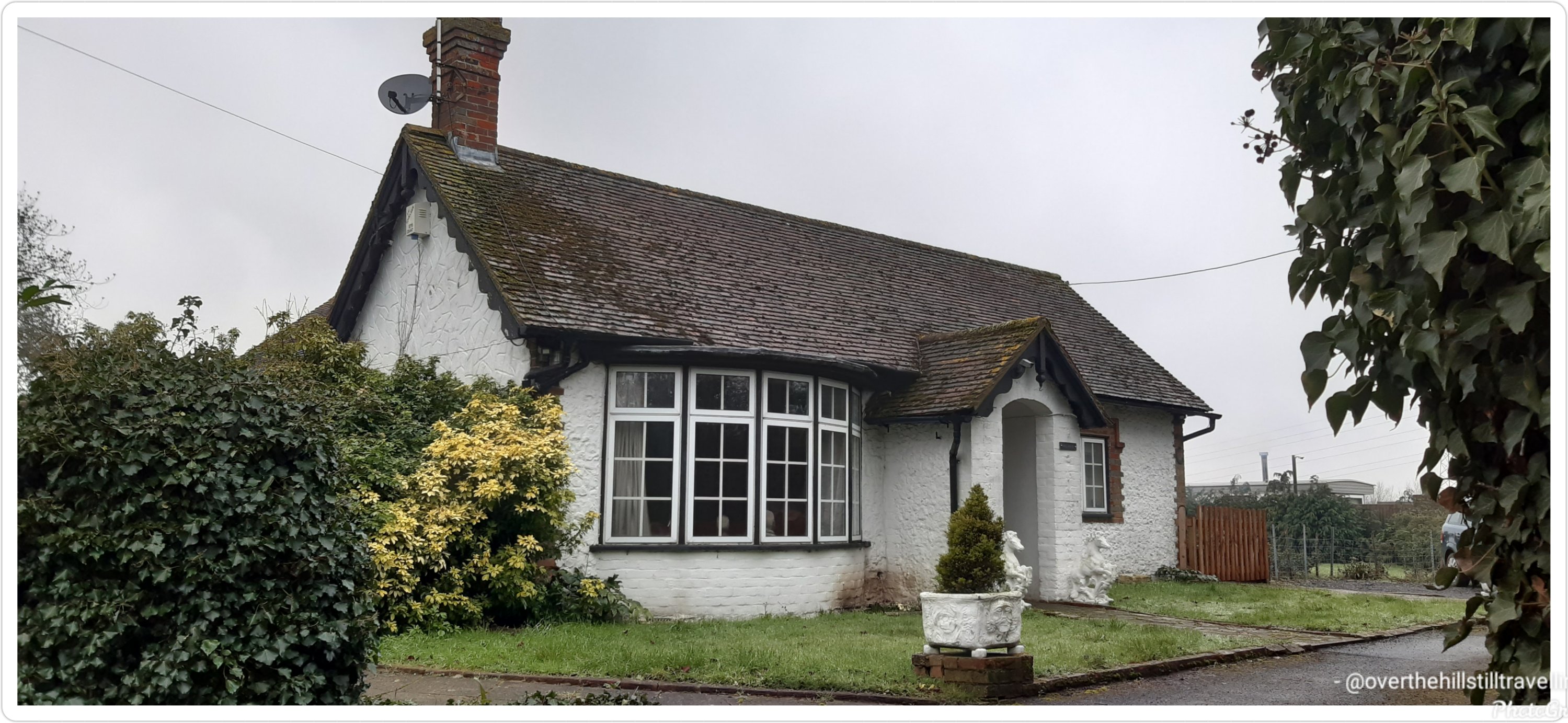
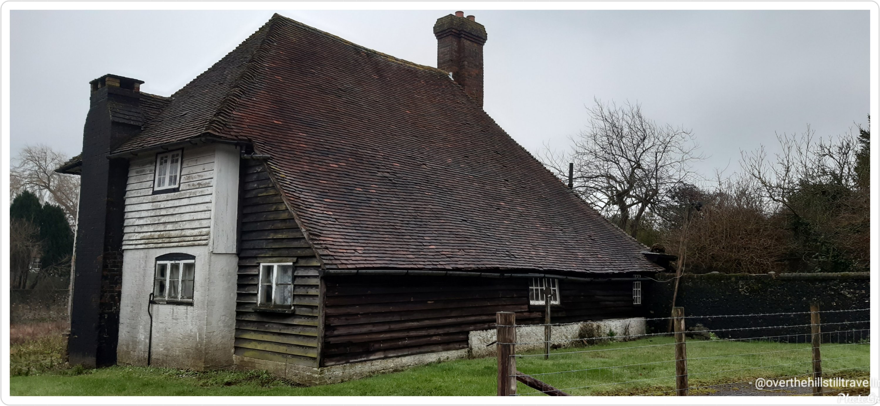
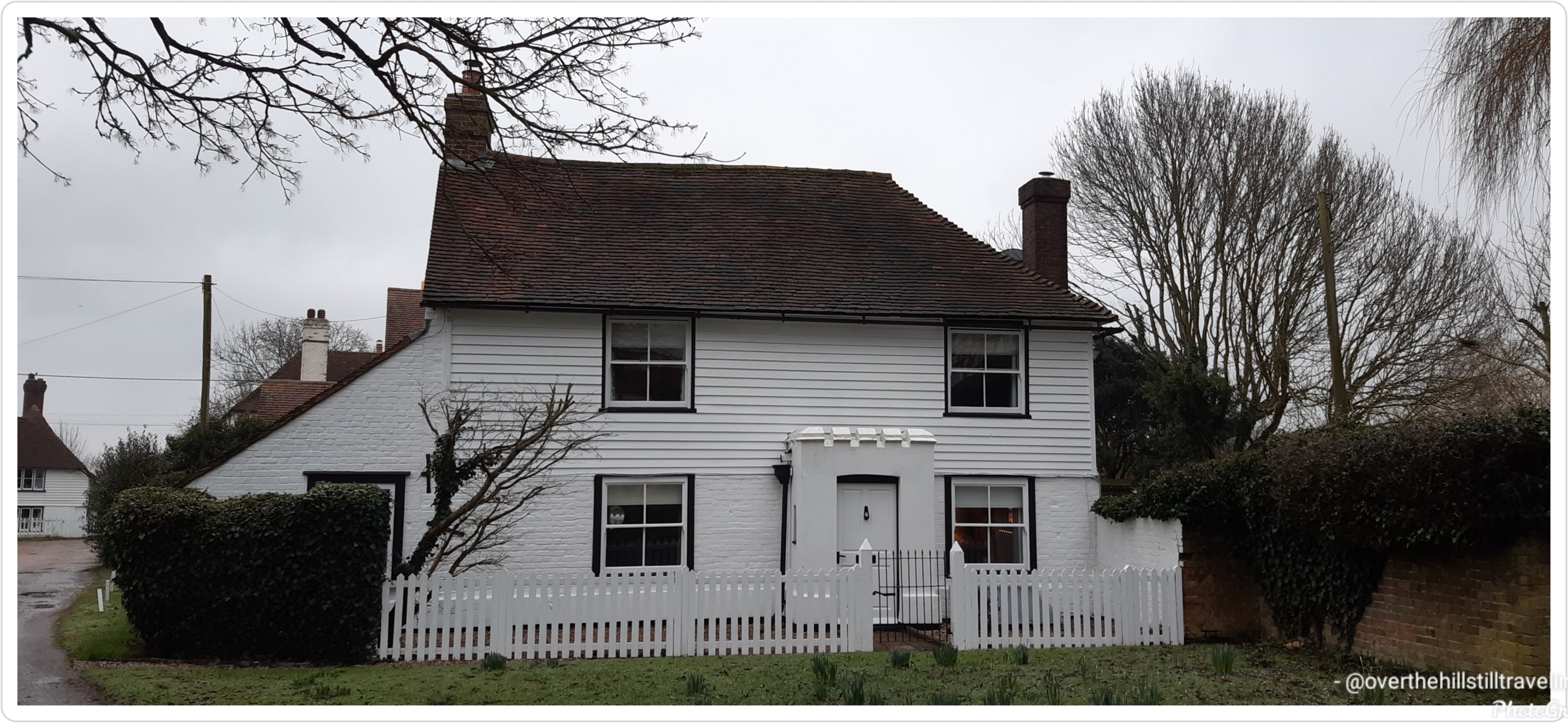
With just 3 days to go till I finish this booking, I went through my photos to decide which houses I loved the most…these are the ones
This was my absolute #1This house is for sale…a mere £450,000 and lots of renovation to be done Forge Farm 🧡💛
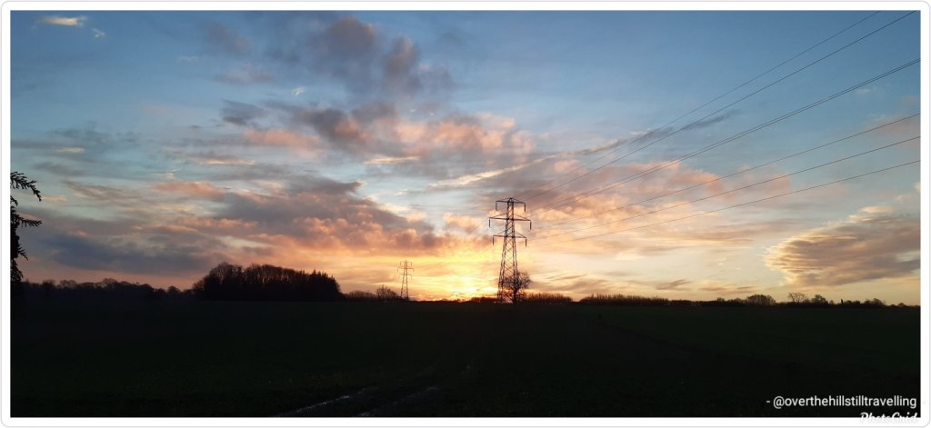
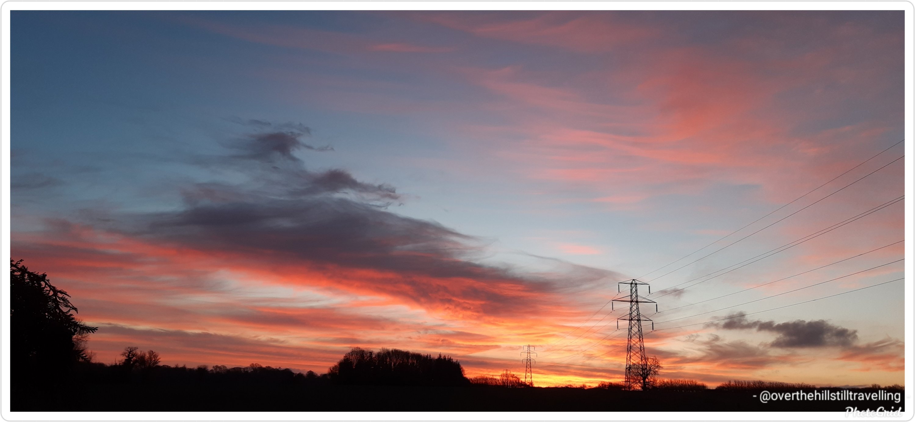
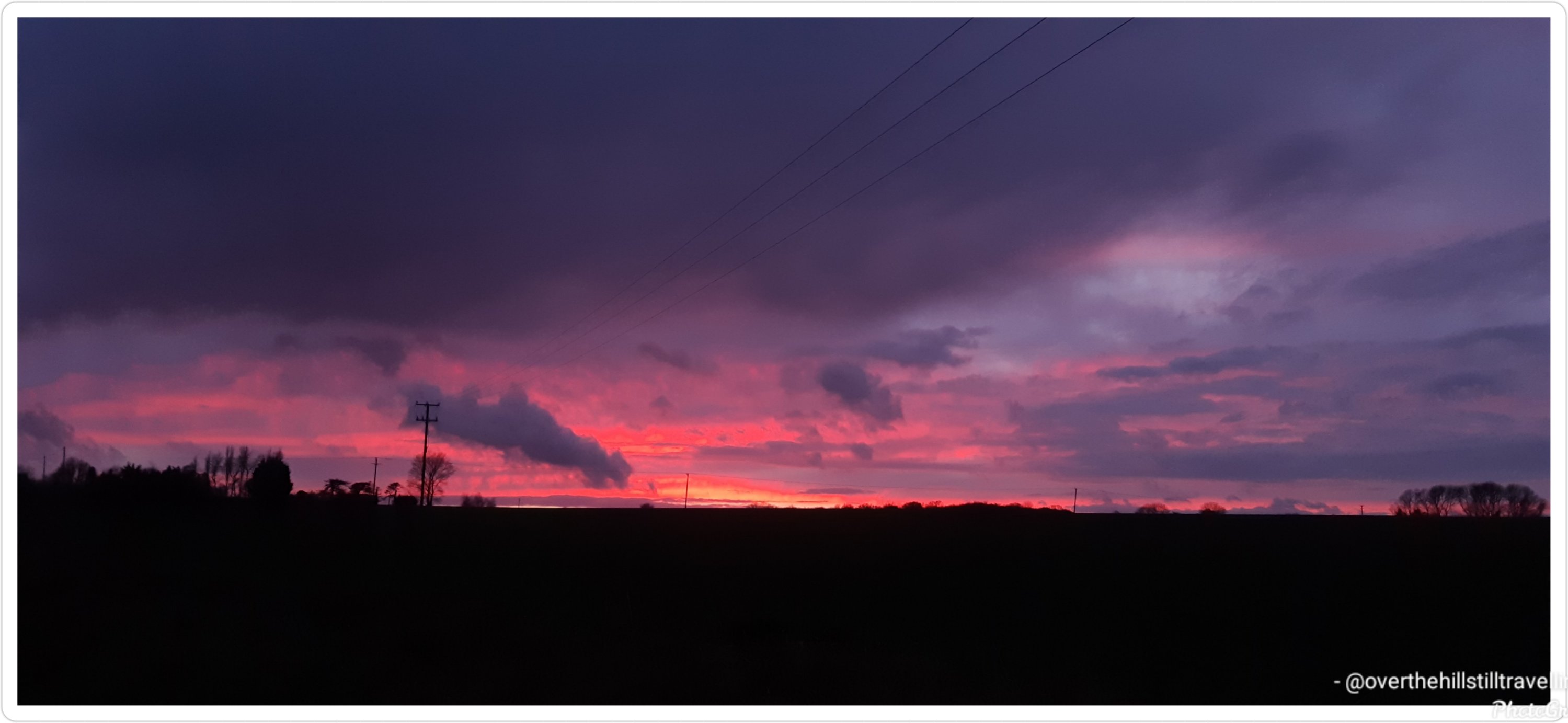
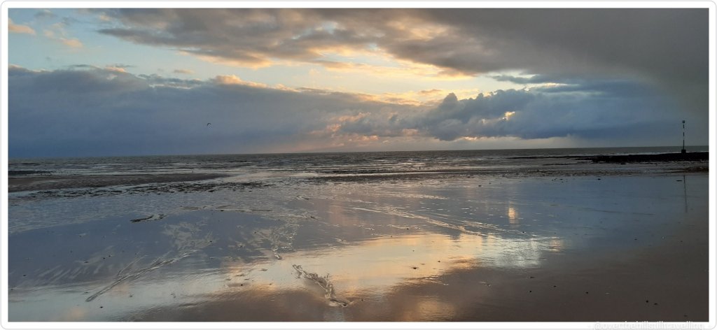
Most of the days were grey and overcast or rainy, but I saw a few beautiful sunrises and a few equally beautiful sunsets….just never on the same day 😁😁
Sunrise Sunrise SunsetSunset
Its been a vast but interesting area to explore and I certainly got a lot of mileage behind me.
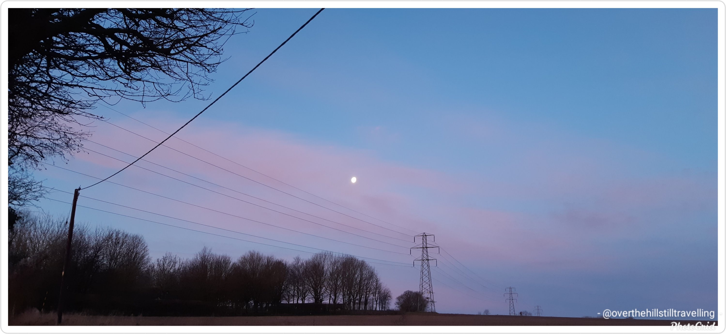
One of the few sunny days, albeit freezing cold
I am however really looking forward to returning to the sea.
Except for a very early morning walk, I didn’t do any serious walking on New Year’s day, or the 2nd January, and rather spent those days with my lovely family and some Granny time with my beloved grandson. But I got going again on the 3rd January and once again managed to get in a really decent amount of kms. Its brilliant walking early in the morning along the coast, I hardly ever see anyone about, and as a bonus, if the weather is fine, I get to watch the sunrise. 😊😊
Sunrise – 3rd January 2021 Isle of Thanet
So here we go…stage 3 of the Alps to Ocean route…
I enjoyed some exploring in Twizel. It’s the largest town in the region which unsurprisingly triples in population during the summer period.
Alps to Ocean – Twizel 😃 what a name
The town is relatively young having been founded in 1968 to house construction workers on the hydro scheme. Clever town planning placed all the services and schools in the centre with housing surrounding the central hub. Pedestrian paths straight into the centre made it more direct for residents to walk instead of driving the looped roads to get to the same destination. When the scheme wound up 15 years later the local residents successfully fought to save their town.
To the south of town is Lake Ruataniwha, an artificial lake formed in the late 1970s as part of the Hydro scheme. The lake is fed by Ohau River to the west and the overflow discharged from Lake Ohau further west. At 3mi (4.5km) long the lake is open to water enthusiasts with activities such as sailing, water skiing and rowing. I chose to stand-up paddle board but those mountainous views and blue lake were spellbinding. I should’ve just sat on a boat and soaked up the landscape.
Since I was already dressed for water activities I ducked across the State Highway to a waterhole I wanted to swim in. As blue as Lake Pukaki was, this ‘no name’ waterhole was emerald green greatly emphasised by the reflection of the willow trees on the waterhole’s edge. There was a time when the swimming hole was part of the Ohau River before the nearby dam and artificial lake disrupted the river’s flow and greatly reduced its size in the east separating the swimming hole from what is left of the river. If you have a satellite view of the waterhole it looks like a big emerald green bath.
Back in the late 1800s when Ohau River had its natural flow, crossing it was done by wire rope and a cage. In 1890 they built, what is now referred to as, the Old Iron Bridge. It served travellers for the next 80 years until the Hydro scheme came into the area, built Lake Ruataniwha, realigned the State Highway and bypassed the iron bridge. The bridge is now listed on NZ Historic Places Trust. A small monument can be found near the lake in memory of a mother and child who drowned in 1879 whilst fording, illustrating the difficulties and dangers of crossing the Ohau River at the time.
There’s another swimming hole called, Loch Cameron, northwest of Twizel, worthy of a visit but if I hoped to get to my next destination sometime today, I had to get cracking with my journey.
Making my way out of Twizel via the southern edge of Lake Ruataniwha, I followed the trail along the west side of Ohau River to Ohau weir. The weir is a low head dam that was constructed with a siphon to maintain a minimum flow into the Ohau River but conversely may overflow restricting access to travellers. Not needing to concern myself with flooding, I enjoyed my travel along the shore of Lake Ohau reaching the village for some lakeside dining and background view of Ben Ohau range.
Just for fun, and because I’m totally interested in finding out more, I did a Google maps search of Twizel and Lake Pukaki, then looked for images. OMG…its is breathtakingly beautiful!!! That water and the landscape… wowww. I’d probably end up wanting to stay 🤭🤭🤭
After this my wings were clipped, so to speak, and I started a new booking on the 4th January so my real time walking has been limited to 2 hours a day, weather permitting, which of course impacts my distances. Too sad.


You must be logged in to post a comment.