And so the time has come 😃😃😃 With just 37!!! days (😱) till I set off on my big adventure, Pepe needs a repack. I’ll be away working for 24 of those 37 days, so now is the time!! It’s both thrilling and terrifying…this will be my longest walk/s by far. The most I’ve walked continuously in the past has been 11 days on the Camino.
Pepe looking pretty in yellow 💛 and the colour matched poncho I bought yesterday 🤭🤭🤭
This walk will be 23 days. Naturally of course, 6 of those 23 days will be devoted to exploring the areas I’m in; Berwick Upon Tweed, Lindisfarne, Bamburgh, Newcastle, Carlisle and Glasgow, but that all involves walking 🚶♀️🚶♀️🚶♀️
So whewww, I’m ready, but I’m almost certain that my feet are not at all as excited – they’ll be doing most of the work, poor old 👣👣🥾🥾 #notjustagranny #overthehillstilltravelling
I’m going to be packing as light as possible, even lighter than the Camino, and very definitely, I am planning on using baggage forwarding wherever possible and feasible. As I have said in the past, I’m not into self-flaggelation, and walking for me is an enjoyable pastime not a penance for past sins!! Camino or not!! 😂😂😂
Tomorrow after I’ve returned the tiddler to his parental unit, I’m going shopping for new walking shoes. The asics I purchased a few months ago are not quite doing it for me, and weirdly the Salomons I tried on last week felt more like mini coffins than comfy trainers, which is toats weird since I wore a brilliant pair on my Camino. Shoulda bought 2 pairs!! 🙄🙄🙄
After a few weeks of intensive planning and calculating distances and studying the terrain via Google satellite maps, I am almost ready to rock and roll along the Northumbrian coast as I walk the Northumberland Coast Path from Berwick Upon Tweed to Cresswell – the official route.
Of course, because I’m just that way 🙄 I’ve decided to tweak the route and add on a few kms!! After all, why not? It’s only 100 kms, I’ve done way more than that on other walks, so yeah….I’ve planned my route to include the stretch from the border of Scotland at Marshall Meadows to Berwick Upon Tweed and since I’m going that way anyway, I’ll keep walking from Cresswell to Newcastle….not all on one day mind!!!
So whew, I’m now VERY familiar with the Northumbrian coast…I know just about every town on the route and the distances between – slight exaggeration of course, but it sure feels like it.
What’s not an exaggeration is how much time I’ve invested in searching for suitable places to stay that are not too far apart and not going to cost me a month’s salary for 1 night!! Exaggeration of course but some of those places do charge more than I earn in a day…
Google maps, Booking.com, Airbnb and I have all worked overtime since I decided on impulse to leave St Oswald’s Way and St Cuthbert’s Way for 2022 when I do the Two Saints Way (different saints), and instead walk the NCP as part of my quest to walk the whole of the English Coast – since I’m up that way anyway for my other big walk.
My train ticket is booked, my accommodation is now finally booked, I’ve identified bus routes for getting to and from stop/start points, and I’ve identified some of the must see sights.
There are a lot of castles and rivers and a few islands. Plus the coastline is a UNESCO heritage site (I think???) I’m sure I read somewhere that it was, but for the life of me I haven’t been able to find where I read it, so may just have to let that go, but it looks like I’ll be adding quite a few places to Project 101.
In the interim I got my official guidebook and passport 😃😃👏👏👏 and that was well exciting.
It’s been really tedious working this plan. You’d think that with the sea to my left and heading from north to south it would be a breeze to plan my days, but no!!
Accommodation has been a huge stumbling block. I figured I would aim for approximately 20kms a day or as close as possible, but because I couldn’t find affordable accommodation in some places, a few of my days are a bit of a yo-yo.
But yesterday I finally nailed it. Hoorah!!!
So 3 nights in Berwick Upon Tweed with 2 day trips: 1 to Lindisfarne and 1 to Bamburgh Castle and some walking to cover that part of the coast inbetween, then on day 4 I hit the road, so to speak.
I’ll be adding my kms to the Kruger Park Virtual Challenge since I need to complete that by the end of September.
I’ll pop up another post in a few days with more details, but for now…
…..all I have to do is keep my fingers crossed that we don’t go into another lockdown…
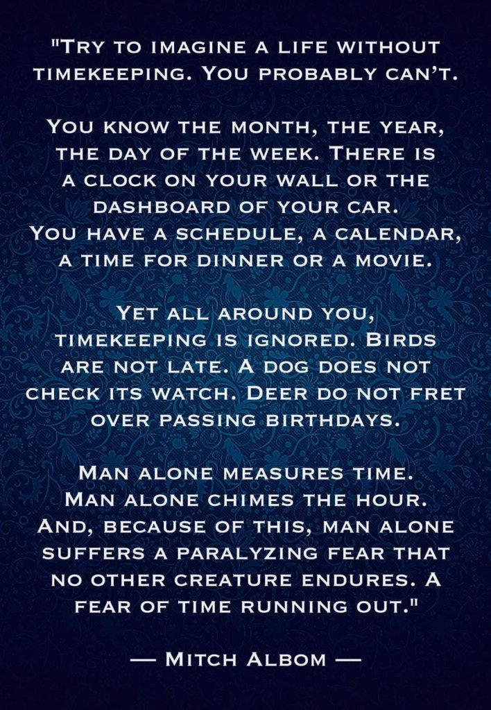
This is a very short post (hoorah I hear you shout 😁😁🤪) but I just saw this on Facebook and I found it SO powerful that I simply have to share it.
The words are absolutely spot on and I wonder why it is that we feel the need to control time.
I follow the Regenerative Conciousness Community on Facebook and they often post some really thought-provoking and powerful messages.
And as I think about the words above and feel them, I get quite panicky at how restrictive our need to control time actually is. I understand the fundamental need to do so, but it is quite restrictive.
When I was involved in the personal development environment 14 years ago, I remember working through a process during which we identified our highest value/s. Mine was freedom. So I guess that’s why those words have induced a feeling of panic.
And now I’m going to shut up 😂😂😂 this is turning into one of those posts where I go off on a tangent.
I wonder what your thoughts are on the above quote?
Last year, 2020, inbetween lockdowns, and somewhere between Sandwich and Deal, on a practice walk for my now started Thames Path jaunt, and having just finished reading The Salt Path, by Raynor Winn, I was inspired to attempt to walk the WHOLE of the English Coast….in stages – you know how I love my stages 😉🚶♀️🚶♀️
I have already walked from Broadstairs (when we still lived there) to Sandwich, and to Margate – countless times when preparing for my Portuguese Camino in 2016/2017.
Due to my job I also get to work in a variety of locations, and occasionally it’s at the seaside…so I’ve already walked a few sections of the English Coast Path accidentally. But of course, now I’ll have to walk them again, this time with purpose, and that won’t be any hardship.
I reckon it’ll take about 10 years at my current rate, and because I’m still working and following a multitude of other routes!
Actually, I recently had the good fortune to have a booking in Nether Stowey and planned a couple of days in Paignton during which time I walked from Berryhead to Torquay via Brixham over 2 days ✅✅ and I also walked as far as Dover last year. (I will eventually get to write about these walks – the scenery is just stunning, and of course the east coast is awash with history – forgive the pun!).
Although I have a penchant for just going on my walks ‘on impulse’, mostly a fair amount of planning has already gone into the ‘idea’ 😁😁 and its usually impulse meets opportunity, and off I go.
I’m walking Hadrian’s Wall in September, so decided to walk the Northumberland coast path from the border with Scotland and part of the Tyne and Wear coastal path. Since I’m up that way….
To that end I’ve ordered the Northumberland Coast Path guidebook and passport (yes!!! To my delight, I discovered that there is a passport to go with it yayyyy 🙃🙃).
The Northumberland Coast Path
And so planning has begun. Originally (2020) I had planned on walking St Cuthbert’s Way and St Oswald’s Way, both of which are in Northumberland/Scotland, but there are 2 other Saints walks I want to do, and since I have the St Francis’s Way Conqueror Challenge still waiting in the wings, I’m going to try plan those for 2022, and put the mileage towards that challenge. 😀
I better plan a trip soon…I joined this challenge in December 2020!!
Part of the enjoyment of these walks is the planning. I love to set up the spreadsheet, decide on suitable dates, identify the distance and then start my research : transport, accommodation, weather, food stops, and of course affordability. I usually budget for £100 a day all told because accommodation costs are quite expensive. There’s a HUGE difference between the UK prices and Portugal/Spain. Its wayyyy cheaper to travel the Camino than plan a walk in the UK, unless you wild camp, which I have not yet had the courage to do.
First I had to identify all the main towns along the route, which is 100kms +- from Berwick Upon Tweed to Cresswell, and onto Newcastle. Identified and noted – spreadsheet updated.
Then I broke the distance down into ideally 20km walking days to see the how long and where to stay places. Towns/places noted. Some days will be longer than other!!!
Next up: transport. Hmmm. There’s a railway line but it appears to goes direct from Berwick to Newcastle 🤔🤔🤔 and buses? Also a direct route, and no stops from what I can see (on closer inspection I found a few stops 🙄). So possibly basing myself in one place and hopping back and forth like I’m doing with the Thames Path and Saxon Shore Way! Tricky!
Next up: accommodation! I had a look on Airbnb and Booking.com. I nearly had heartfailure at the prices!! Even the YHA in Berwick Upon Tweed are charging £99 for 1 night! Restyled as a Hilton then?? Jeez. A more indepth search is required.
What I found during my searches is that accommodation is in short supply, and few and far between, and if available – very expensive!! Gosh, I hope the guide book is waiting for me when I get home!!
So I contemplated the possibility of ‘wild camping’ 🏕 🥴🥴 I’ve seen loads of people who do this on their long distance walks, but tbh I can’t even consider the idea of carrying a tent, sleeping mat and sleeping bag!! I carried a sleeping bag on my first day of the Pilgrim’s Way and the extra weight nearly destroyed my will to live.
I’ve been toying with the idea of just roughing it and sleeping with my jacket on under my emergency blanket…but I asked myself “what if it rains?” and of course there is this: Wild camping is not allowed in England, so please do not pitch your tent unless you have sought the permission of the landowner. What if I don’t have a tent? LOL
But ‘just in case’ I decided to check the weather patterns for September on the Northumbrian coast… very encouraging. Of course those 8 days, could coincide with my 6 days 😂😂😂😂 so perish the thought!!
I hope my trip coincides with those 22 days… Q. Weather Northumberland September? A. On average, it is maximum 16° in september in Northumberland and at least around 10° degrees. In september there are 8 days of rainfall with a total of 8 mm and then it will be dry 22 days this month in Northumberland’.
Not sure which year this was, but I hope it rings true for 2021 too!! Loving the average temperature!!
Sitting here on Saturday morning waiting for my client to wake up and scrolling despondently through the World Wide Web 🌐🕸 I had the bright idea to ask the community on the Long Distance Hiking page on Facebook 😁😁
Voila…I’ve had some lovely responses so far, but not much about accommodation. So, patience being a virtue, I’m keeping my fingers crossed 🤞 and hoping someone has relevant information.
If not, then I’ll have to just wait for the guidebook and hope for the best….other than that, I’ll just wing it. I have a limited amount of time to book my advance rail ticket…
So that was in the morning…. meanwhile I’ve had a few people respond with more information about accommodation and bus routes that I did not find during my searches – change the keywords and success! It seems there are indeed local bus services that ply the coast between towns (of course 🙄🙄 silly me, I had wondered how people get around).
I then had the bright idea (yes, I do wake up occasionally) of going back to the Northumberland Coast Path site from which I ordered my guide book, and hey presto! Guess what??? They have a whole section dedicated to the different stages and surprise surprise….accommodation options. However, on closer inspection some of the accommodation listed is well beyond my price range and when there are no prices listed….don’t even bother going there!
So back to the drawing board and fingers crossed by tomorrow I’ll have my route sorted and accommodation identified and booked.
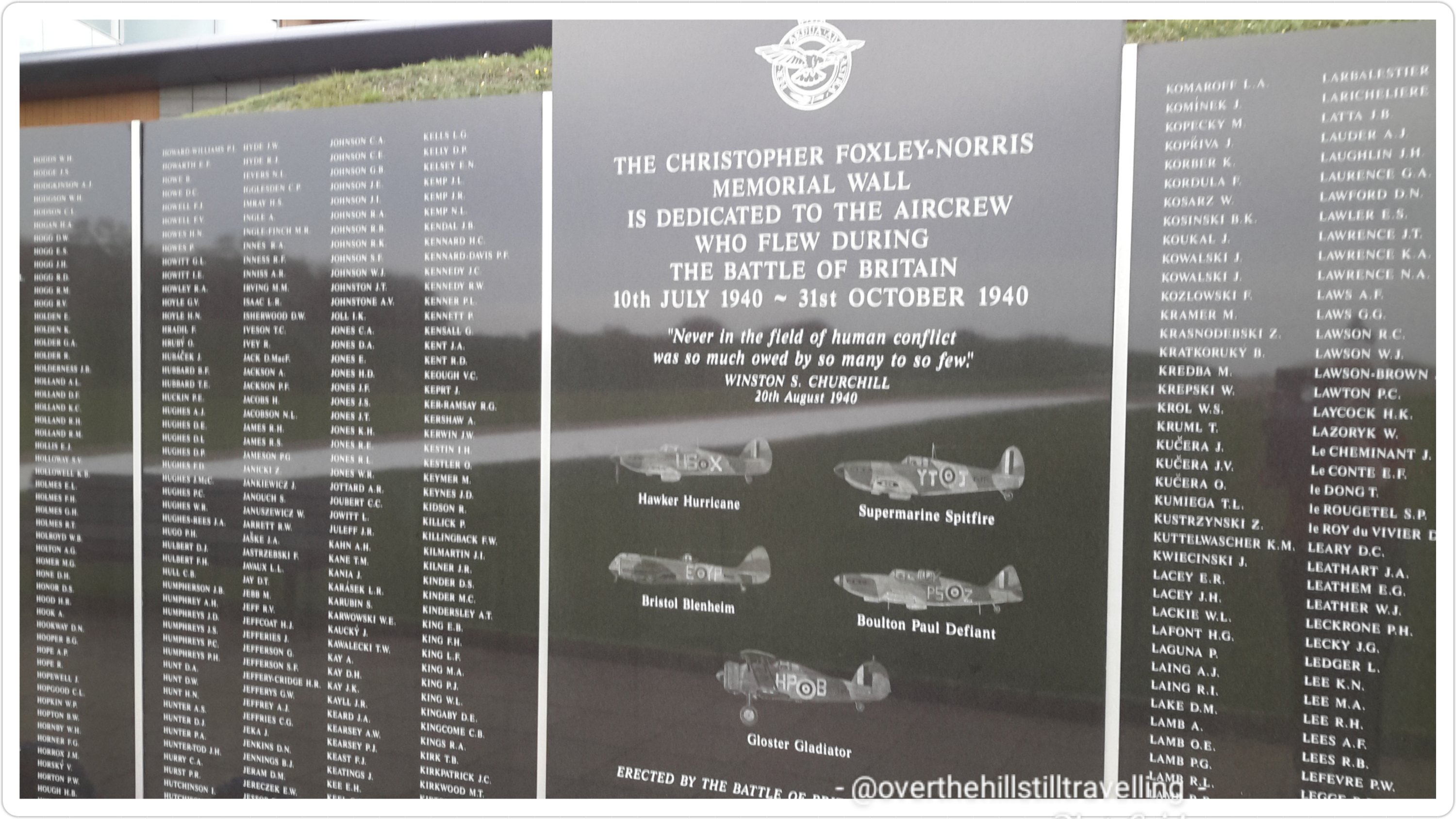
Eighty-one years ago today the Battle of Britain officially started, 10th July 1940.
Please spare a thought for all those who participated, from all Nations. Many would be killed during the Battle, some would die months later from wounds and burns sustained during those critical months, some would be killed later in the war. Others would carry their mental and physical scars for the rest of their lives.
We believe that only one Allied Battle of Britain airmen is alive today, Paddy Hemingway. Paddy celebrates his 102nd Birthday next week. We are not aware of any Luftwaffe airmen that survive from the Battle.
2938 Allied Airmen were entitled to wear the ‘clasp’ as a Battle of Britain airmen. 544 were killed or died from wounds sustained in the Battle. 795 further airmen would be killed by the end of the war.
All they ask is to be remembered….
Please ‘like’ and ‘share’ this, and the Kent Battle of Britain Museum page, and help us commemorate our Heroes ‘The Few’. Thank you
One of my absolute favourite memorials in London is the Battle of Britain memorial on Embankment in Westminster, opposite the London Eye.
Battle of Britain Memorial in London
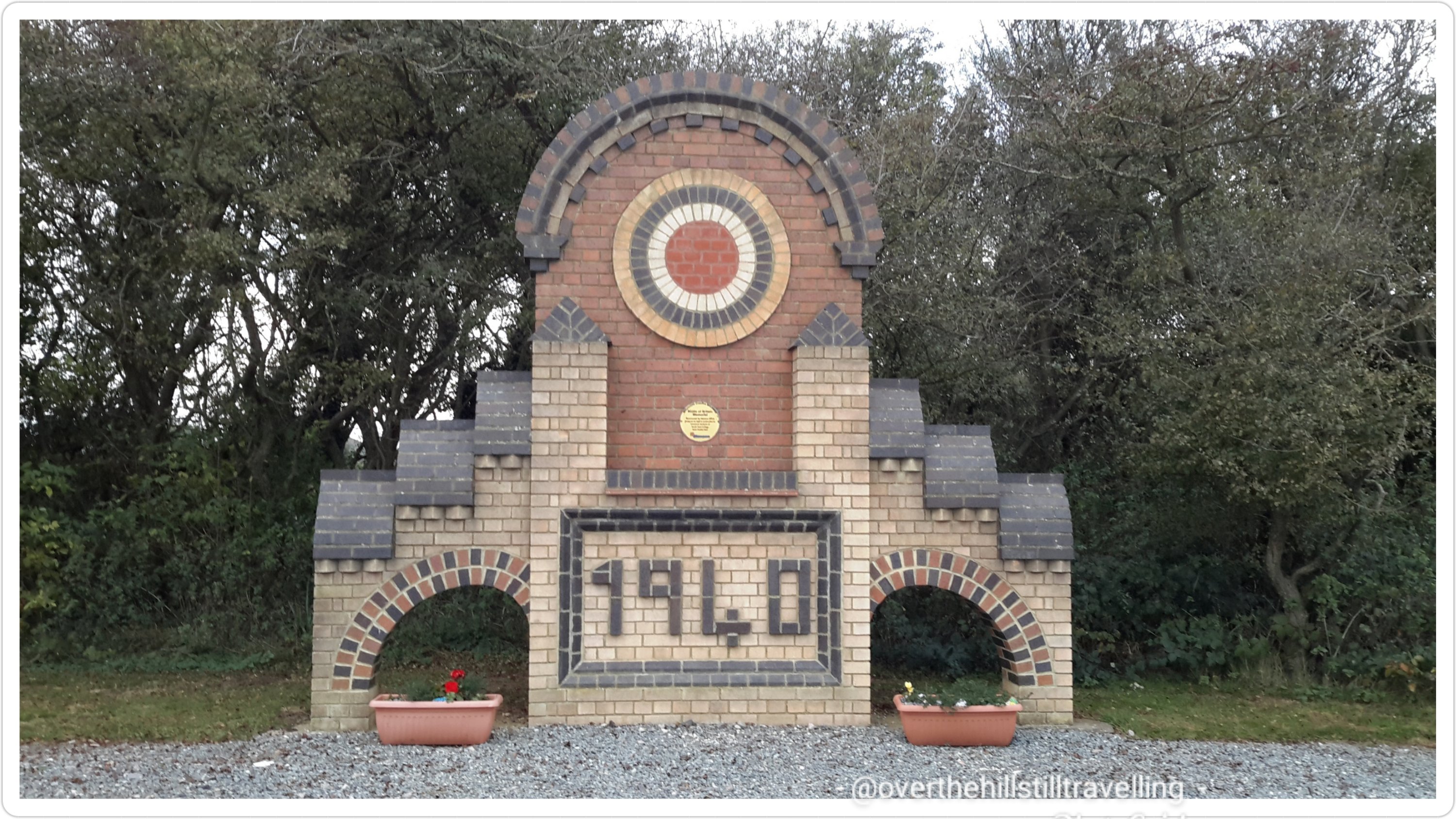
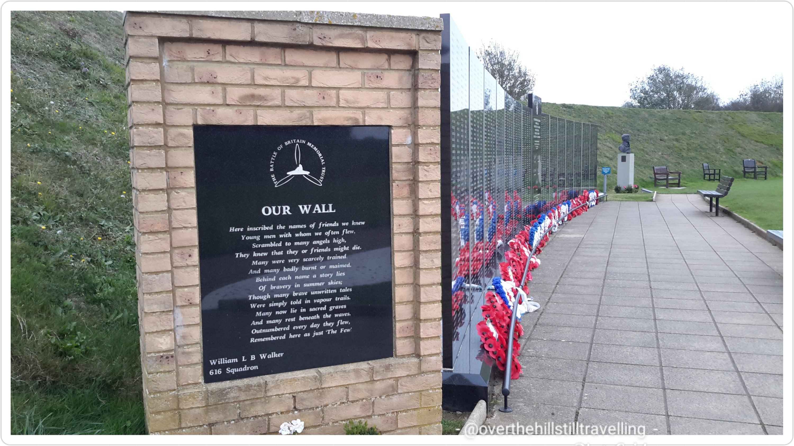
Perched above the White Cliffs of Dover you will find the memorial to The Few at Capel-le-Ferne.
‘Never in the field of human conflict was so much owed by so many to so few’. Winston Churchill. 20 August 1940.
Referring to the ongoing efforts of the Royal Air Force and Polish fighter crews No. 303 Squadron RAF who were at the time fighting the Battle of Britain, the pivotal air battle with the German Luftwaffe, with Britain expecting an invasion. Pilots who fought in the battle have been known as The Few ever since; at times being specially commemorated on 15 September, “Battle of Britain Day”.
The Sculpture His view across The English Channel to France 🇫🇷
Memorial to The Battle of Britain at Capel le Ferne.
Still one of my favourite places to have visited in my travels around England.
I remember seeing a film, in my late teens, back in South Africa called The Battle of Britain. It had a profound effect on me and I sobbed for days after, and never imagined that one day, not only would I be living in Britain, but that I would fall in love with London and see all these amazing places. I certainly NEVER imagined for even 1 second that I would one day become a British citizen.
Here’s to The Few, from all corners of the world, long may they be remembered…
I love history and I love the English language, and this little piece combines both. I’m constantly fascinated by the origin of everyday expressions and sayings and traditions…we learn them growing up and repeat them accordingly without knowing or understanding their origin.
Over the years, on various tours at ancient castles etc the guides have frequently imparted little gems of information…like the saying: getting a square meal. My daughter sent me these last night so I thought I’d share them. Love this language so much…
So without further ado…
They used to use urine to tan animal skins, so families used to all pee in a pot & then once a day it was taken & Sold to the tannery…….if you had to do this to survive you were “Piss Poor”
But worse than that were the really poor folk who couldn’t even afford to buy a pot……they “didn’t have a pot to piss in” & were the lowest of the low
The next time you are washing your hands and complain because the water temperature isn’t just how you like it, think about how things used to be. Here are some facts about the 1500s:
Most people got married in June because they took their yearly bath in May, and they still smelled pretty good by June.. However, since they were starting to smell . …… . Brides carried a bouquet of flowers to hide the body odor. Hence the custom today of carrying a bouquet when getting Married.
Baths consisted of a big tub filled with hot water. The man of the house had the privilege of the nice clean water, then all the other sons and men, then the women and finally the children. Last of all the babies. By then the water was so dirty you could actually lose someone in it.. Hence the saying, “Don’t throw the baby out with the Bath water!”
Houses had thatched roofs-thick straw-piled high, with no wood underneath. It was the only place for animals to get warm, so all the cats and other small animals (mice, bugs) lived in the roof. When it rained it became slippery and sometimes the animals would slip and fall off the roof… Hence the saying “It’s raining cats and dogs.”
There was nothing to stop things from falling into the house. This posed a real problem in the bedroom where bugs and other droppings could mess up your nice clean bed. Hence, a bed with big posts and a sheet hung over the top afforded some protection. That’s how canopy beds came into existence.
The floor was dirt. Only the wealthy had something other than dirt. Hence the saying, “Dirt poor.” The wealthy had slate floors that would get slippery in the winter when wet, so they spread thresh (straw) on floor to help keep their footing. As the winter wore on, they added more thresh until, when you opened the door, it would all start slipping outside. A piece of wood was placed in the entrance-way. Hence: a thresh hold.
In those old days, they cooked in the kitchen with a big kettle that always hung over the fire… Every day they lit the fire and added things to the pot. They ate mostly vegetables and did not get much meat. They would eat the stew for dinner, leaving leftovers in the pot to get cold overnight and then start over the next day. Sometimes stew had food in it that had been there for quite a while. Hence the rhyme: Peas porridge hot, peas porridge cold, peas porridge in the pot nine days old. Sometimes they could obtain pork, which made them feel quite special. When visitors came over, they would hang up their bacon to show off. It was a sign of wealth that a man could, “bring home the bacon.” They would cut off a little to share with guests and would all sit around and chew the fat.
Those with money had plates made of pewter. Food with high acid content caused some of the lead to leach onto the food, causing lead poisoning death. This happened most often with tomatoes, so for the next 400 years or so, tomatoes were considered poisonous.
Bread was divided according to status. Workers got the burnt bottom of the loaf, the family got the middle, and guests got the top, or the upper crust.
Lead cups were used to drink ale or whisky. The combination would Sometimes knock the imbibers out for a couple of days. Someone walking along the road would take them for dead and prepare them for burial.. They were laid out on the kitchen table for a couple of days and the family would gather around and eat and drink and wait and see if they would wake up. Hence the custom of holding a wake.
The country is old and small and the local folks started running out of places to bury people. So they would dig up coffins and would take the bones to a bone-house, and reuse the grave. When reopening these coffins, 1 out of 25 coffins were found to have scratch marks on the inside and they realized they had been burying people alive… So they would tie a string on the wrist of the corpse, lead it through the coffin and up through the ground and tie it to a bell. Someone would have to sit out in the graveyard all night (the graveyard shift.) to listen for the bell; thus, someone could be, saved by the bell or was considered a dead ringer.
And that’s the truth….Now, whoever said History was boring? 😁😁😁😁
One of the best aspects of the English language is how its a conglomeration of different languages like French and Latin with a smattering of others in the mix.
There are hundreds of these little gems. I really must, one day when I’m no longer jaunting around the country, compile a list.
Do you know of any other sayings or expressions we use daily (or infrequently)? I’d love for you to share. 😃😃
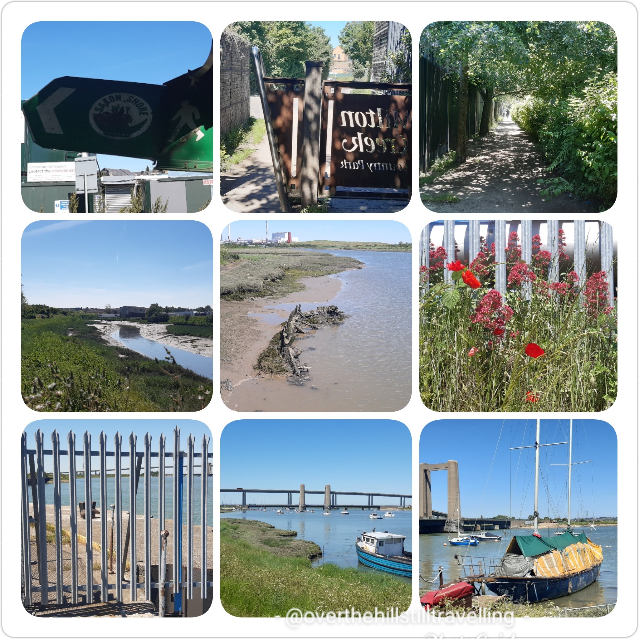
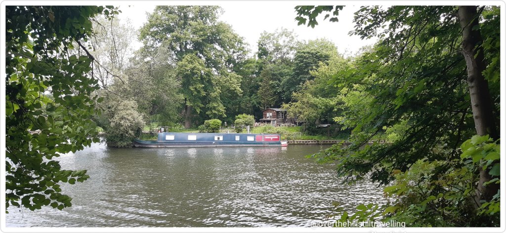
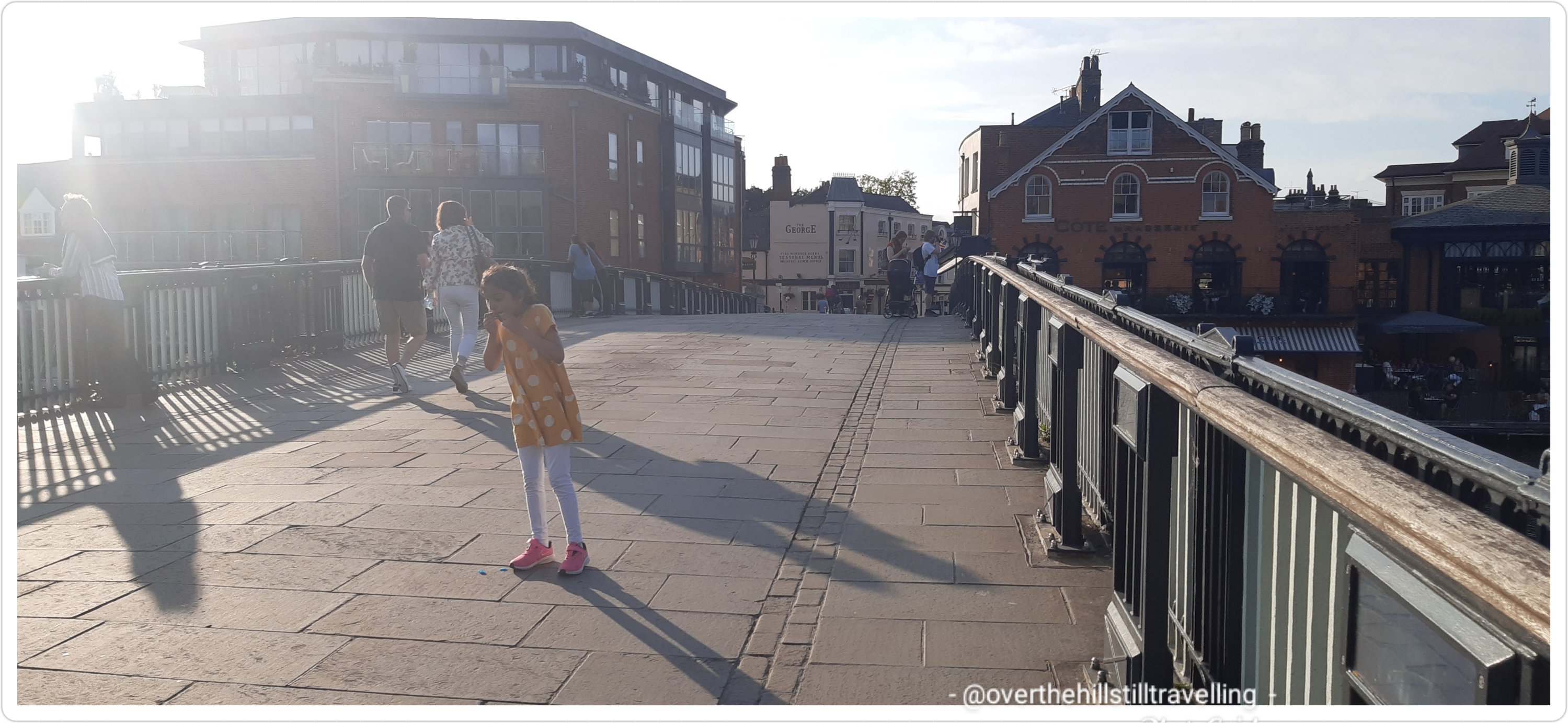
After a really hectic week of walking and taking my grandson on outings, plus a 19 km jaunt along the Saxon Shore Way and a brief visit to Sheppey Island, on Thursday 10th June I impulsively decided to walk another 2 stages of the Thames Path! I had planned on going up to London on Saturday 12th for Trooping the Colour, but fortunately I thought to check their website, only to discover that due to the continued lockdown, they had decided to hold the ceremony in Windsor again this year. And at that moment I decided to do the next 2 stages of the Thames Path; Staines-Upon-Thames to Windsor on the 11th and Windsor to Maidenhead on the 12th. Change of plans…
Walking the Saxon Shore Way
I quickly rejigged my calendar and rearranged my weekend plans, then a mad scramble to book accommodation ensued and at literally just on 9pm Thursday night I secured an Airbnb booking close to The Long Walk. I hastily packed my backpack with the absolute minimum requirements and prepared some food for the next day. Hoorah! I was off on the next 2 stages of my adventure. As mentioned in Stage 5, it was taking longer and longer to reach my starting point (the end point of my previous stage) and made more sense to stay overnight on day 1 and pick up again on day 2. The idea this time was to walk Stage 6: Staines to Windsor, stay overnight, watch as much of Trooping the Colour as I could see
after which I set off at approximately 1pm for Maidenhead, planning/hoping to arrive there relatively early for the long trip home. However, due to faffing around at the Three Store in Windsor for 2 hours, I missed the earlier train! LOL
The plans of mice and (wo)men….do not always work to plan! But that’s what I love about my life…I can change my plans any time I like 🙂
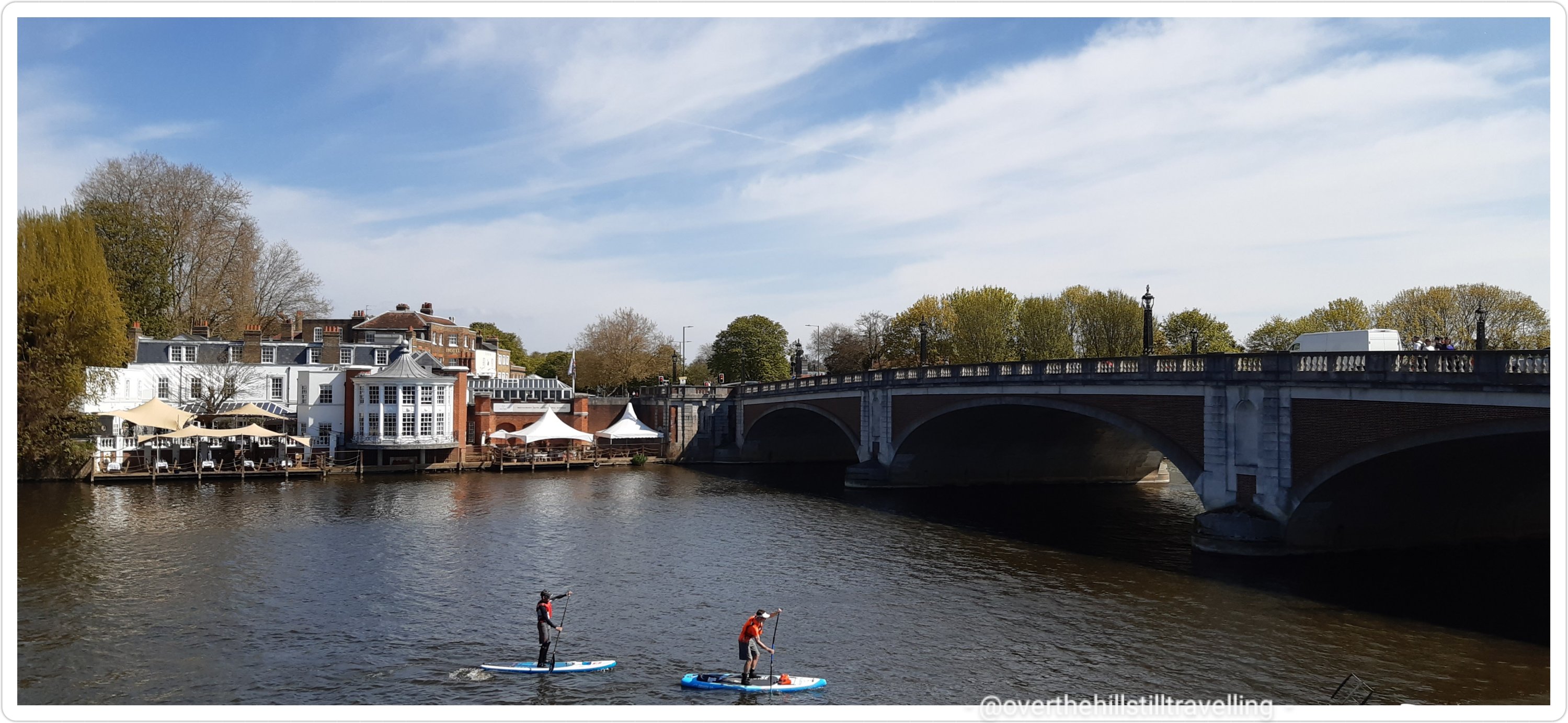
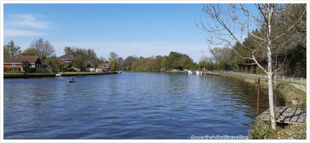
I left home early to get the 09:25 train as advised previously by the station attendant, and travelled to Staines via Vauxhall. Here things went a little awry…trains were either late, cancelled altogether or didn’t stop at the station. Total chaos reigned. Eventually sometime after 12noon, I finally boarded a train bound for Weybridge, stopping at Staines and arrived at just after 1pm. I made haste towards the river, reaching the railway bridge at 13:11 (now 34 minutes behind schedule!)
Staines Railway Bridge
Staines was the end of the tidal Thames until 1812 when the downstream locks were built.Staines Railway Bridge was built in 1856 and painted with yellow stripes in 1995 to stop swans from flying into it. ref Cicerone guide book.
Following the same route as when I first reached Staines on the 24th April at the end of Stage 5, I stopped to photograph the houses by the riverside that I passed at that time
So pretty, and there’s Staines Bridge in the distanceReminds me of Bermuda, so gorgeous and a fab view
Then a quick photoshoot (of course 😁😁) of all the interesting sculptures and the London Stone
The London Stone
The London Stone marks the end of the City of London’s river jurisdiction (1197-1857) and although it has been moved a few times in the area, it has stood in Staines-Upon-Thames since 1285. The Lord Mayor of London made an annual visit to touch the stone with a sword. (the London Stone at Staines, built in 1285 marked the customs limit of the Thames and the City of London’s jurisdiction– the Corporation acquired these rights from the Crown in 1197 in the reign of King Richard I and held them until 1857 when the Thames Conservancy was formed).
After saying hello to the bridge, I meandered along the north bank and found a shady spot opposite Church Island to have my lunch.
Perfect view, Church Island to my right and the opposite bank where I’ll soon be walking
It was so relaxing just sitting watching the river and the world go by, that I could have stayed all day.
Top pic behind me. Bottom pic looking towards Church Island
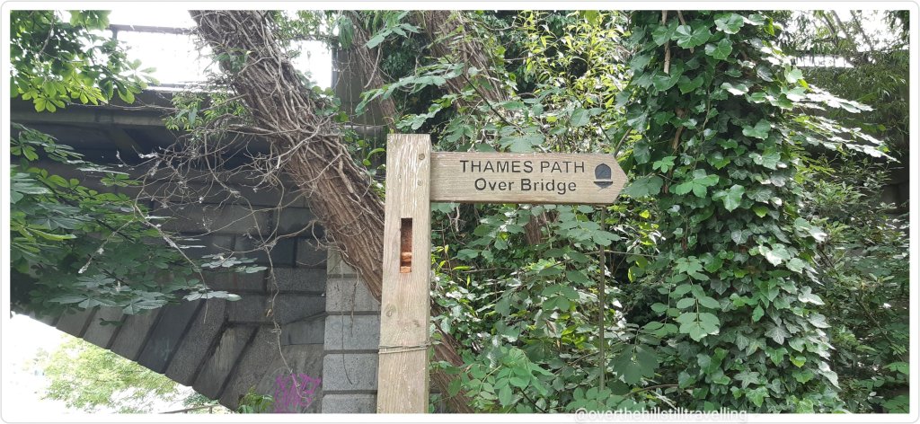
I didn’t tarry too long, time was passing and so I set off back to the bridge
Thames Path Over Bridge – sounds like the title of a book 😄
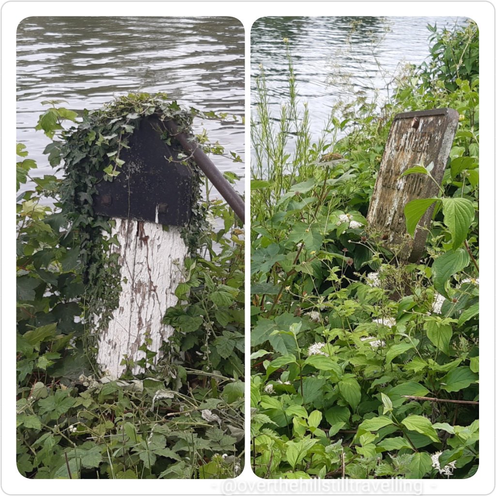
Following the instructions in the guide book I crossed over to the opposite bank and went in search of a City of London coal tax post, which the author said was opposite the London stone…it wasn’t…I used up 2.92 kms and 30 minutes searching for it before giving up and continuing my walk – but not before photographing a couple of items that could possibly have been it, but weren’t….
#notthecoaltaxpost
I did eventually come across what I suspect is what he was talking about….but it wasn’t opposite the London Stone!! it was in fact, a way further upstream of the bridge on the south bank, whereas the London Stone is downstream of the bridge on the north bank. Hmmm
I was really excited to be walking along this section and looking forward to visiting the Magna Carta memorial…which I thought was on an island but wasn’t. It was actually very easy to visit once I knew how!! LOL As with all things you read in the guide books, the reality is very different to what you imagine it would be like. But that was still to come…also a lot further along than I imagined.
I would also be passing from Surrey into Berkshire on this stage, the 4th county since I started my journey at 1. Erith in Kent 2. Greater London 3. Surrey and 4. Berkshire. Of course there are a greater number of boroughs that I passed through.
Even though Staines is quite far from London, especially if you follow the course of the river, there is still a tremendous amount of history alongside the banks, and as I had discovered at Walton-Upon-Thames, the Vikings travelled the distance to plunder the abbeys. In 871 Vikings, from the word vikingr meaning raider or explorer, attacked Reading before making their way along the Thames to London at the end of the year. Setting off from Staines across the fields they sacked Chertsey Abbey, setting fire to the buildings and stealing valuables. It is said that Abbot Beocca, Presbyter Ethor and 90 monks were murdered, however, it is unclear whether the deaths all occurred in the 871 raid, or whether the number is a total from three attacks on the abbey. ref Chertsey Museum
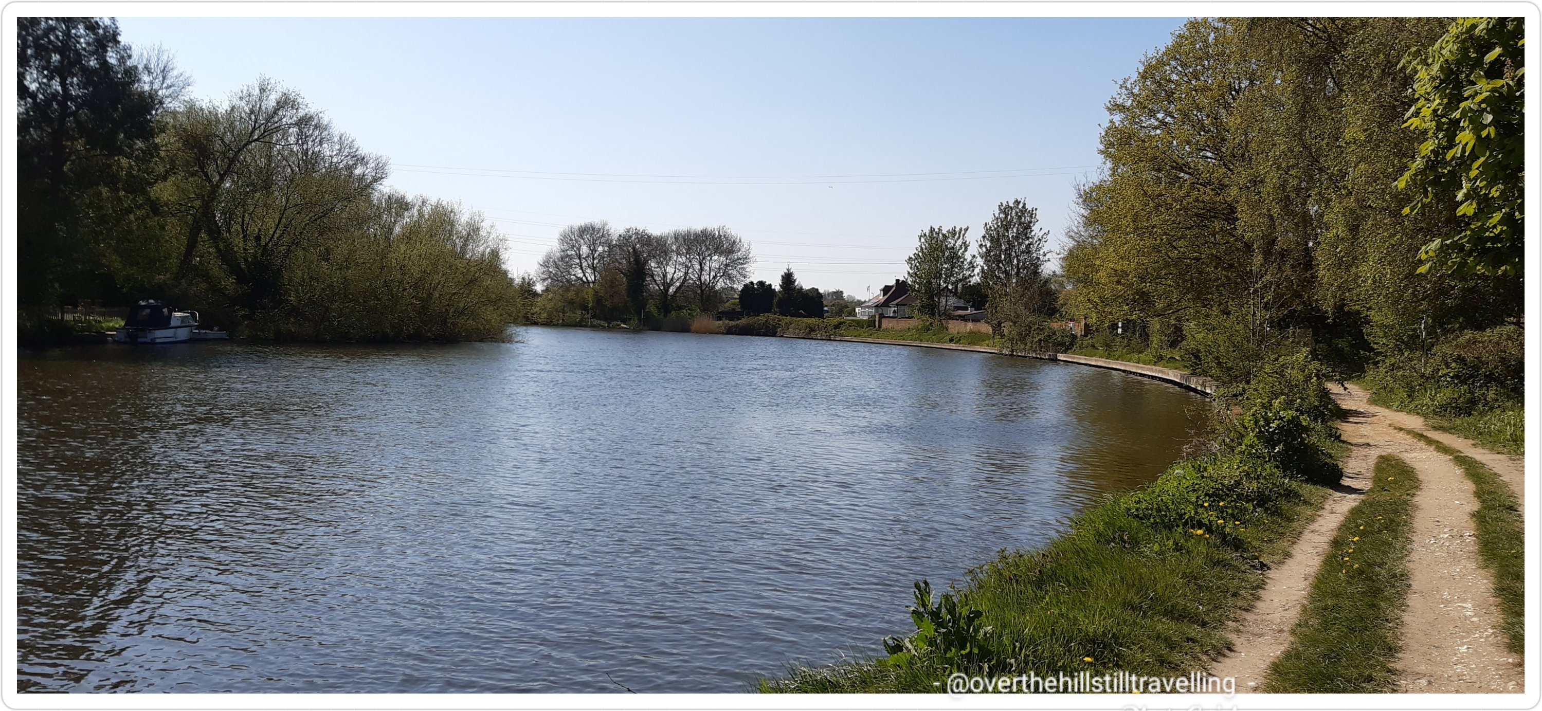
The brick path from the bridge to the river’s edge is lovely and quite decorative. The path from here onwards is also very rural with lots of beautiful green trees and rich undergrowth and I passed through many shady copses and open fields, as well as alongside cultivated gardens that ran right down to the riverside.
The paved pathway leading to the river and the Thames Path Onwards….Windsor, I’m on my way!!
Crossing a lovely arched bridge over a little inlet
You can now see Church Island on the right from a different angle – LOVE that house!
a minute later I plunged into a world of leafy green foliage and shade.
Blissful walking environment
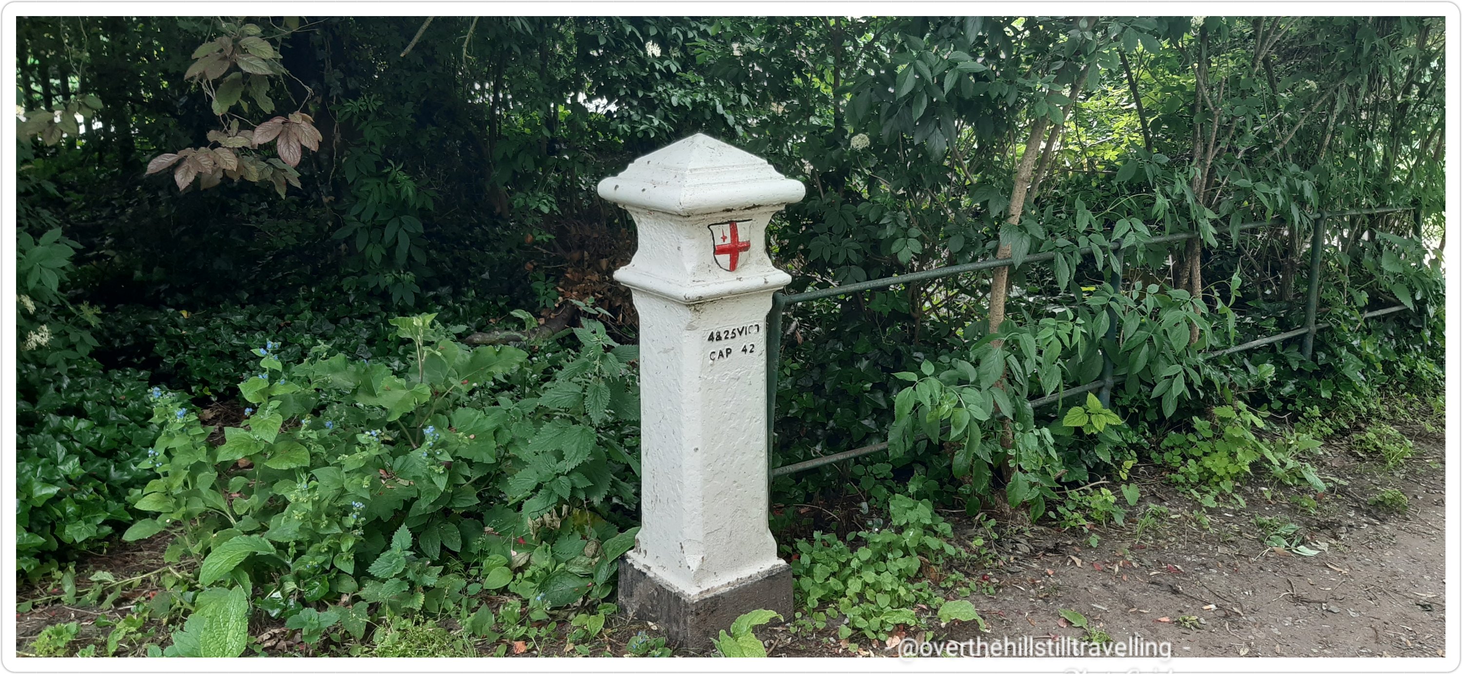
This continued for a few minutes and lo and behold….the City of London Coal Tax post…at least I think it was! I did a bit of research and found this on wikipedia Coal–tax posts are boundary marker posts found in southern England. They were erected in the 1860s and form an irregular loop between 12 and 18 miles from London to mark the points where taxes on coal were due to the Corporation of London. There were originally around 280 posts of which around 210 remain. So yes, I do believe this was (possibly) the coal tax post…
Coal Tax post me thinks!
The path continued with the river in close proximity through leafy green glades, past islands, across bridges, past creeks and canal boats. Tall trees abounded and provided the most glorious shade as the gravel path wound it’s way; turning this way and that way (reminded me of the nursery rhyme that my grandson loves)
in order of progress along the path….the bridge before the bridge…the hum of traffic from the M25 was already quite loud
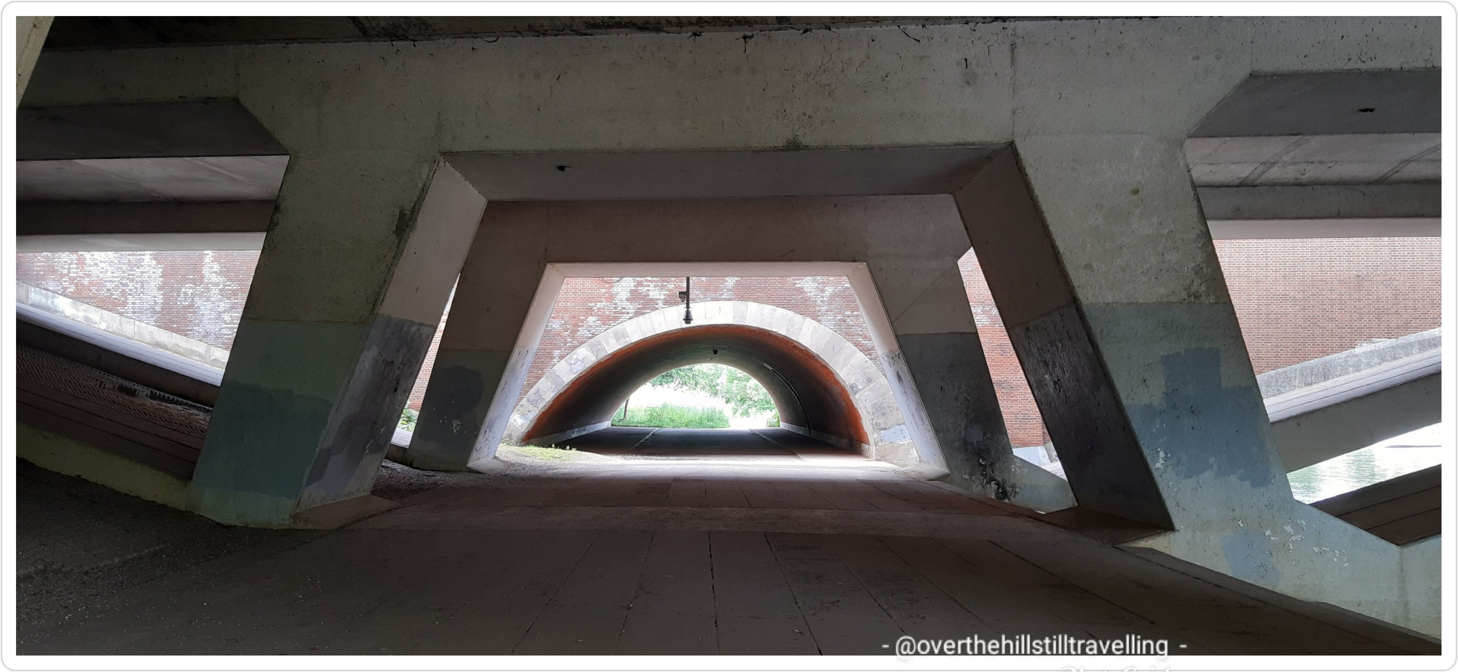
I soon reached and passed beneath Runneymede Bridge and the M25….the traffic noise was astounding and jarred on the senses. I did though enjoy the image presented by the architecture of the underpass.
I saw an information board that told me about a Bronze Age Settlement that has been discovered in 1975 during development of the M25 motorway. Fragments of pottery dating to 750BC were spotted by local archaeologists. Before the Runnymede Bridge excavations, little was known about late prehistoric South East England prior to the Iron Age. From the artefacts discovered, it is clear that the river played a fundamental role in the lives of our Bronze Age ancestors. Excavation has shown that the site includes a large number of post holes and a wattle and daub spread including a double row of in-situ pile driven timber uprights forming a river frontage. The finds recovered include part of a spearhead and socketed axe fragment, pins, ‘buttons’, rings, possible pommel, two pairs of tweezers, amber beads, spindle whorls, a loom weight and worked bone objects. This bronze assemblage was dated to the 9th-8th century BC.
now just a field of wild flowers…but haunted by the spirits of our ancestors
Absolutely fascinating! It gave me goosebumps to look out over the field of wild grasses and flowers and try to imagine the people who lived there so many centuries before. Magic
A short few paces on and I passed the first of the locks on this section; Bell Weir Lock – a pretty little island. The lock is named after its very first lock keeper, Charles Bell, who was employed by the Thames Navigation Commissioners in 1917. He earned a good wage of £4 per month, but for this he had to provide his own residence. He already owned a house close by, so he had no problems. Charles fought in the first World War but sadly, he didn’t return. His wife was believed to have taken over the job. Several years ago a rare bald eagle was sighted here. At the same time an Irish landowner had lost one and discovered it was the same bird! He travelled to Bell Weir, caught the bird and took it home to Ireland.
Bell Weir Lock
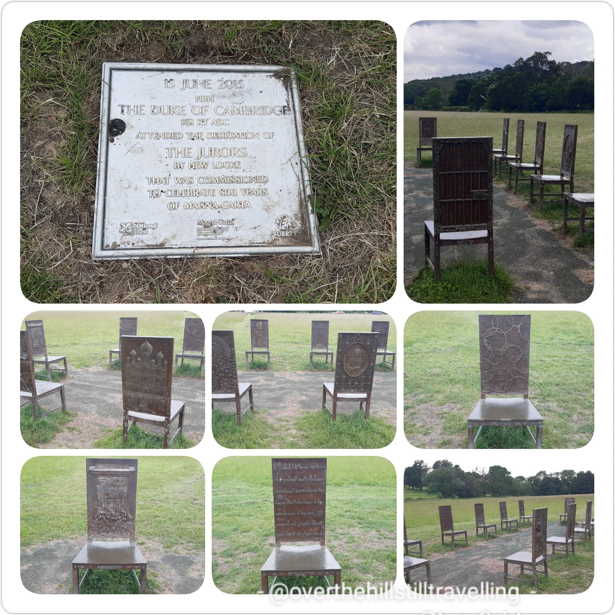
Imagine my delight when I spotted the fantastic Magna Carta mural on the wall of the Lockmaster’s house – brought back many wonderful memories of being a part of the Magna Carta flotilla from Datchet via Windsor to Runneymede meadows back in 2015! Again thanks to my very special friend Joe Lane who invited me along to join them on the Trinity Tide. A magical day and a great honour to be part of the celebrations. I was in a daze of delight the whole day!
Magna Carta
Prominent in my thoughts the whole day was how I was going to reach the Magna Carta Memorial – I could be forgiven for being confused when looking at the picture board!! It caused just a little bit (a lot) of stress…in fact I thought I had bypassed it altogether! but no….if I had but studied the board a little closer, I would have seen that the memorial was still to come and very accessible.
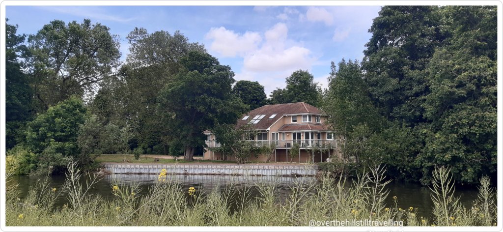
Across the river I spotted a really beautiful building, looked like a hotel really, and what appeared to be a weir with probably a pump house….but no matter how much searching I’ve done on google maps and the web, I am quite unable to find out what it is….intriguing and more than a little frustrating to not know what it is!.
what is this place?
As with the Stage 5, there are some stunning houses on very large properties along this section of the river. I saw one in particular that I just loved!
oh my word…how much I love this house
Near the Runnymede Boatyard I saw a number of quirky canal boats moored alongside the banks…absolutely gorgeous. Clearly they are more permanent residents if the gardens are anything to go by. They provided a stunning array of colours and designs. Apparently there is a mile of these boats along this stretch. Woww.
It looks so quaint and quirky, each boat completely different to the nexthow different a lifestyle this must be…away from the noise of civilization, but close to your neighbour!
Here the path changes again and runs alongside the river across from ‘The Island’ which according to google maps is not a complete island….there were however some gorgeous houses that fronted the river…wow. That side of the river is Wraysbury. It looks really lovely.
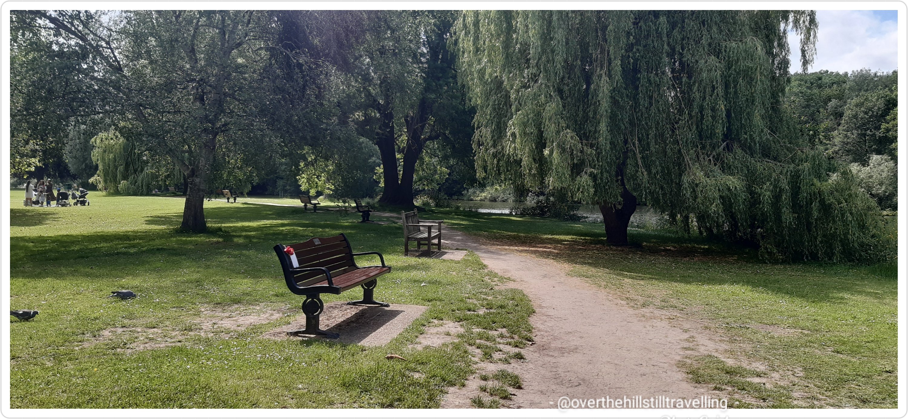
I soon reached the Runnymede Pleasure Grounds and rather than taking a shortcut across the field to the statue of Queen Elizabeth II, I followed the path as it rounded a rather large bend in the river. One thing for sure that I’m learning about this river; The Thames, is that it is anything but straight!!
Runnymead Pleasure Grounds
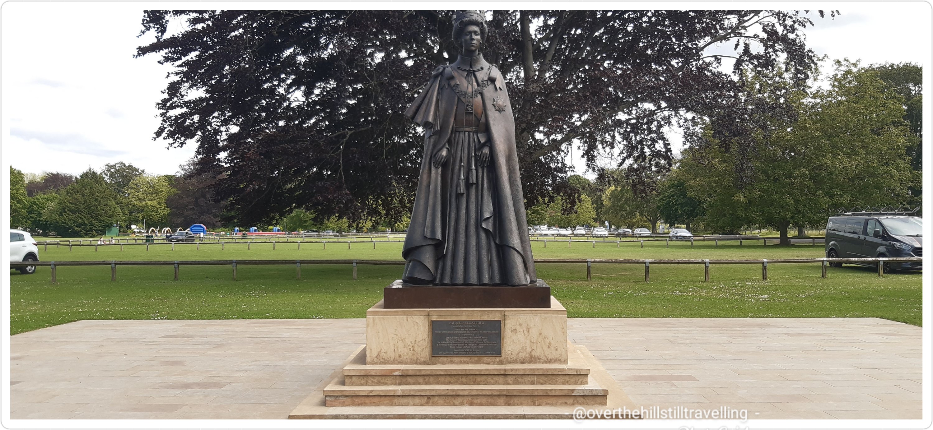
It is an incredibly beautiful stretch (kind of a horse-shoe shape) and by and by I reached the QEII statue. I loved the history timelines engraved on the flagstones and endeavoured to photograph them all…hah!
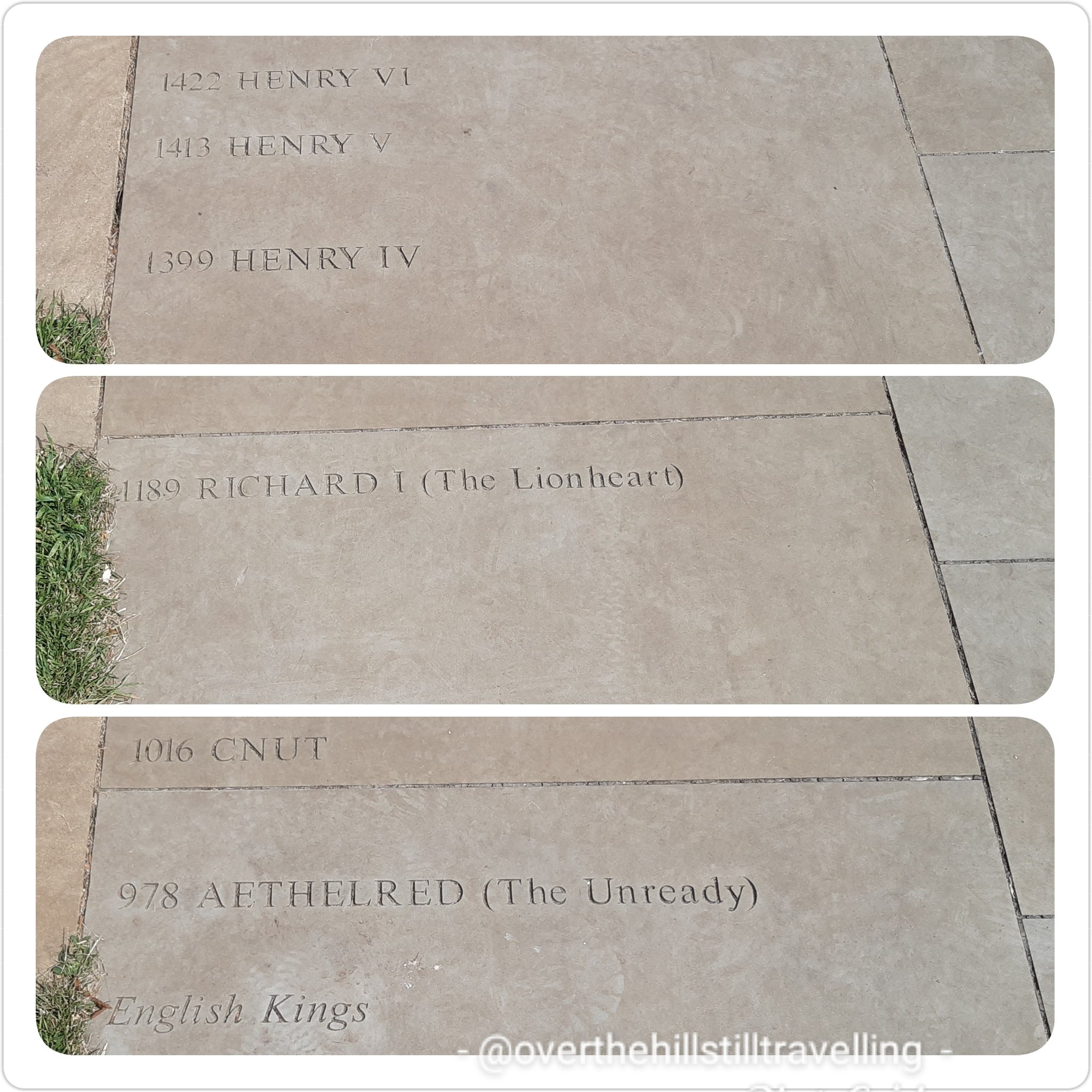
Looks more like Princess Anne than Queen Elizabeth IIthe dates freak me out LOL Magna Carta – meaning: Great Charter. I love how French sounds so exotic, but translated into English…so simple (boring LOL)
I’m not entirely sure that the essence of the Magna Carta is upheld today…
leaving Runnymead Pleasure Grounds behind me
Runnymede – I was getting closer to the memorial, but still for the life of me I could not see it. I didn’t dare use my google maps function on my phone coz it chews battery life, and even though I had a spare charger, I have a fear of losing battery power….so I just carried on and hope for the best. I needn’t have worried.
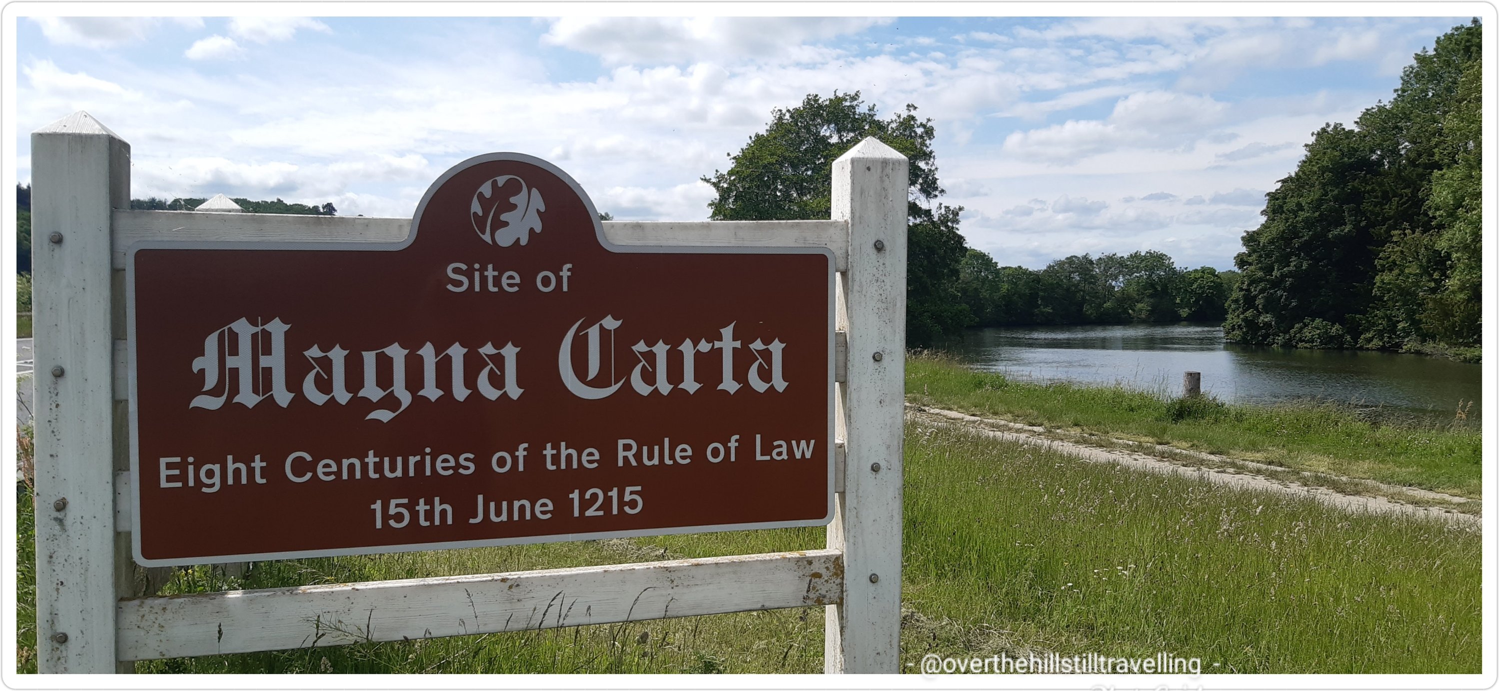
If you haven’t yet been to the Magna Carta Memorial and you happen to be walking the Thames Path, and wondering where the memorial is and how to get there…it is a lot easier than I thought.
I got really excited when I saw this sign!!
When the barons gathered here in 1215 to meet King John on Runnymede, they had to ford the river at Staines – the first bridge was built 7 years later. ref Cicerone guidebook.
Across the river I could see a small section of the Ankerwycke Abbey. But sadly not the Yew Tree…I’ll have to go back and approach from the other side of the river some other time.
the ruins of Ankerwyke Abbey
Meanwhile….I was getting closer to achieving my dream of visiting the Magna Carta Memorial….6 years is a long wait!
And finally, there it was. And so easy to get to LOL after all my stress of missing it.
Simply cross the road at the traffic lights by the National Trust buildings and a short walk across the fields and there it was
cross here 🙂follow this path
It was ever so worth the extra 2.5 km walk there and back. I met a delightful couple who were visiting the site, and we ended up chatting for well over 30 minutes while they asked questions, and I regaled them with snippets from my many journeys around the UK on the Camino. The lady of the couple said she was really keen to take up with long distance walking but didn’t want to go on her own….and I’m like “OMG that’s my ideal scenario!” She was already a member of Ramblers, but wanted to try something a little less crowded. She happened to say that one of the things with walking in a big group, is that you have to keep to their schedule…and that is exactly why I walk on my own. If I want to go off on a tangent to explore or spend an hour in a particular spot…then I am answerable to no-one.
Back to the memorial….it was everything I imagined and more. I got very emotional standing there and thought of my friend Joe (he has no idea just how very grateful I am that he invited me along, it was certainly one of the highlights of my life in the UK).
The Magna Carta Memorial – Symbol of Freedom Under Law
I took my time to read the information boards at the gate, walked around the memorial in a clockwise direction and mounted the steps to read the engravings. Absolutely thrilling.
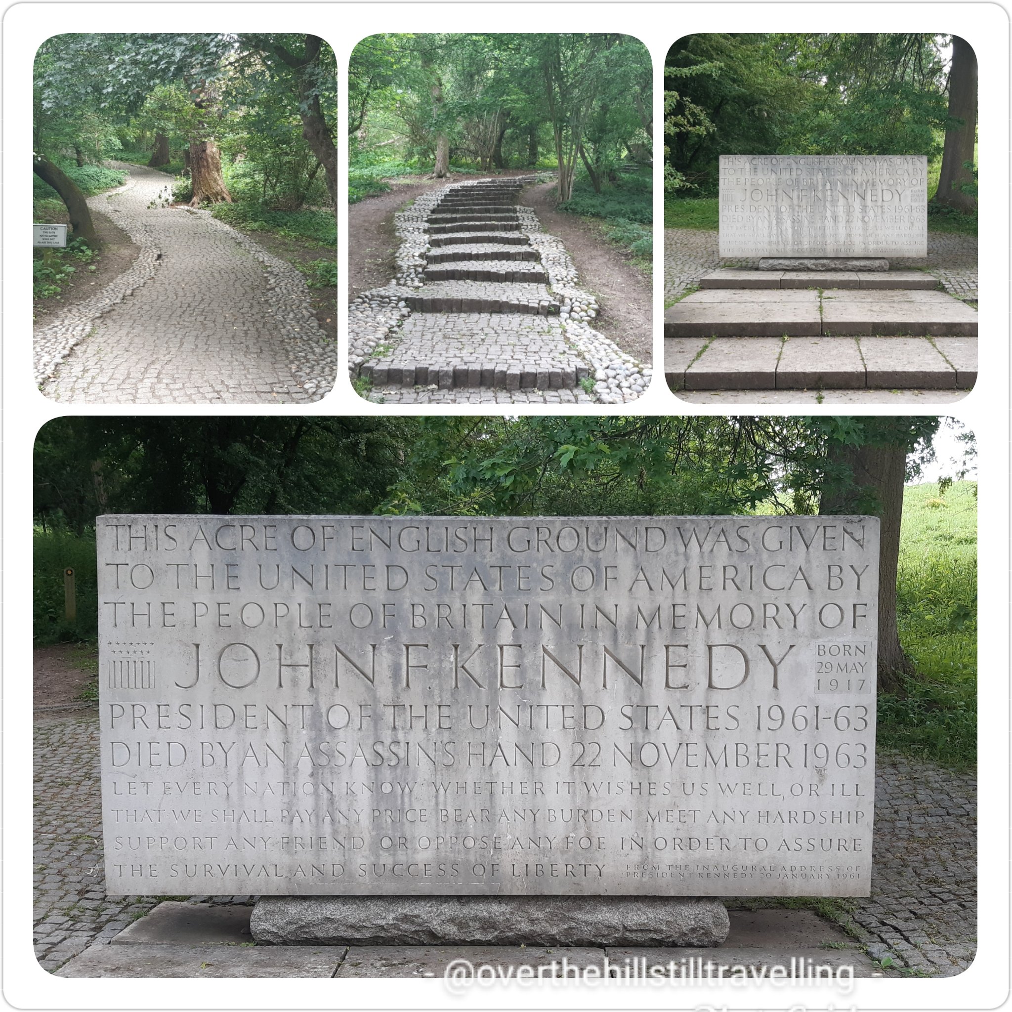
enroute to the Magna Carta memorial is this amazing oak tree planted in 1987 with soil from Jamestown, Virginia
From there, and on the way back to the road I first stopped to admire the sculpture in the field; the 12 chairs depicting the barons at their meeting with King John…they are terrific
a lovely ensemble of decorative chairs representing the barons
And then I visited the J F Kennedy Memorial which is beautiful and worth the fairly steep climb.
a tiny piece of America in England
On my way back to the gates I noticed a lot of yellow ribbons tied to the branches of some trees, fluttering in the wind. Intrigued I walked over for a closer look, and as with the memorial on the Albert Embankment on Stage 2 through London, my heart contracted and I was close to tears. Each ribbon depicts someone who has died from Covid-19. Oh my gosh, so so sad…and really heart-wrenching to see the hundreds of ribbons each with a name and a date. I saw a ribbon lying on the ground all spattered with mud, so picked it up and dusted it off as best I could, then tied it back onto the branch. These memorials really bring home the reality of the staggering number of people who have died since March 2020.
incredibly poignant, and a real whack to the heart
Feeling pensive, and grateful for my health, I meandered over to the National Trust tearoom, only to find them locking the door!! LOL my luck., I should have stopped there first…but then I will have missed that lovely couple I chatted to earlier. Cést la vie. I used the facilities instead and hope I could find some water somewhere…it was another hot day and I had already used up all my supplies.
Back at the river, at the boatyard, as I walked past two gentlemen sat on the riverside, I asked if they knew where I could top up my water…what a gentleman….he gave me a bottle of water 🙂 I could have kissed him…but then he might have turned into a frog! I was delighted to spot a wee bunny in a field to my left…I had to backtrack to get a photo to show my grandson, and amazed that the bunny actually stayed put and allowed me to snap away… I thought for sure it would bound off into the undergrowth at my approach. But the fence…
the rabbit, the boat and the willow tree – a story in there somwhere?
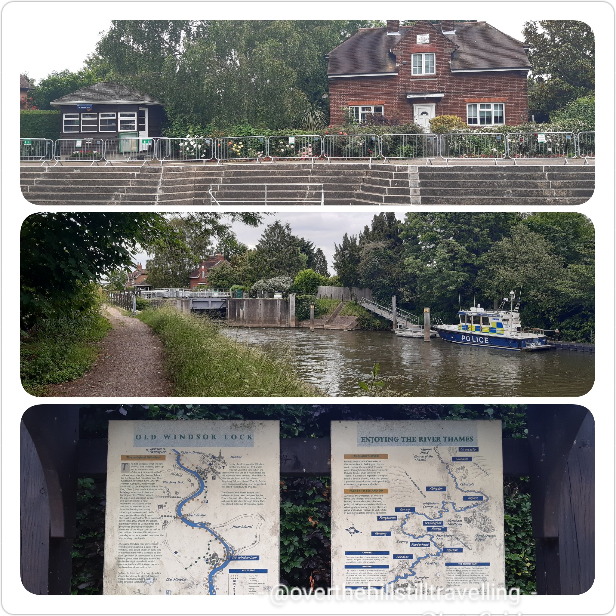
Boom! Suddenly I was in Old Windsor. whoo hoo!! time 16:47 and I had been walking and exploring for nearly 4 hours. I had wanted to visit the old church mentioned in the guide book, but frankly I was quite tired by then, so decided to leave it for another time.
Old Windsor
The first Windsor, what we now know as old Windsor, grew up just to the south west of this lock. It was a fortified, national centre for the Saxons. Edward the Confessor had his palace only 3oo meters from here. After the Norman Conquest, King William continued to use Kingsbury, its church and surrounding buildings as a council place and hunting centre. The name Windsor may derive from ‘windles ora’ meaning a bank with a windlass.
The path ran right alongside the river here and there were some splendid boats moored up on the opposite bank of the river.
Dark gloomy clouds hung heavy on the horizon and I hoped that I wasn’t going to be subjected to a shower (not yet anyway).
I’ve said this before….and it’s worth repeating, the Thames Path is varied!!
Check this cute little canalboat…in the background on the opposite bank is a capsized boat. Poor old thing. I saw quite a few dilapidated and abandoned boats alongside the river bank. I often wonder why they have just been left there to rot.
Up and down, around and switchback, the path is a bit like a rollercoaster, and took me through some beautiful green areas.
Suddenly I reached Old Windsor Lock…getting closer to ‘new’ Windsor!!
Old Windsor Lock – look at the diagram of the river LOL twisting and winding
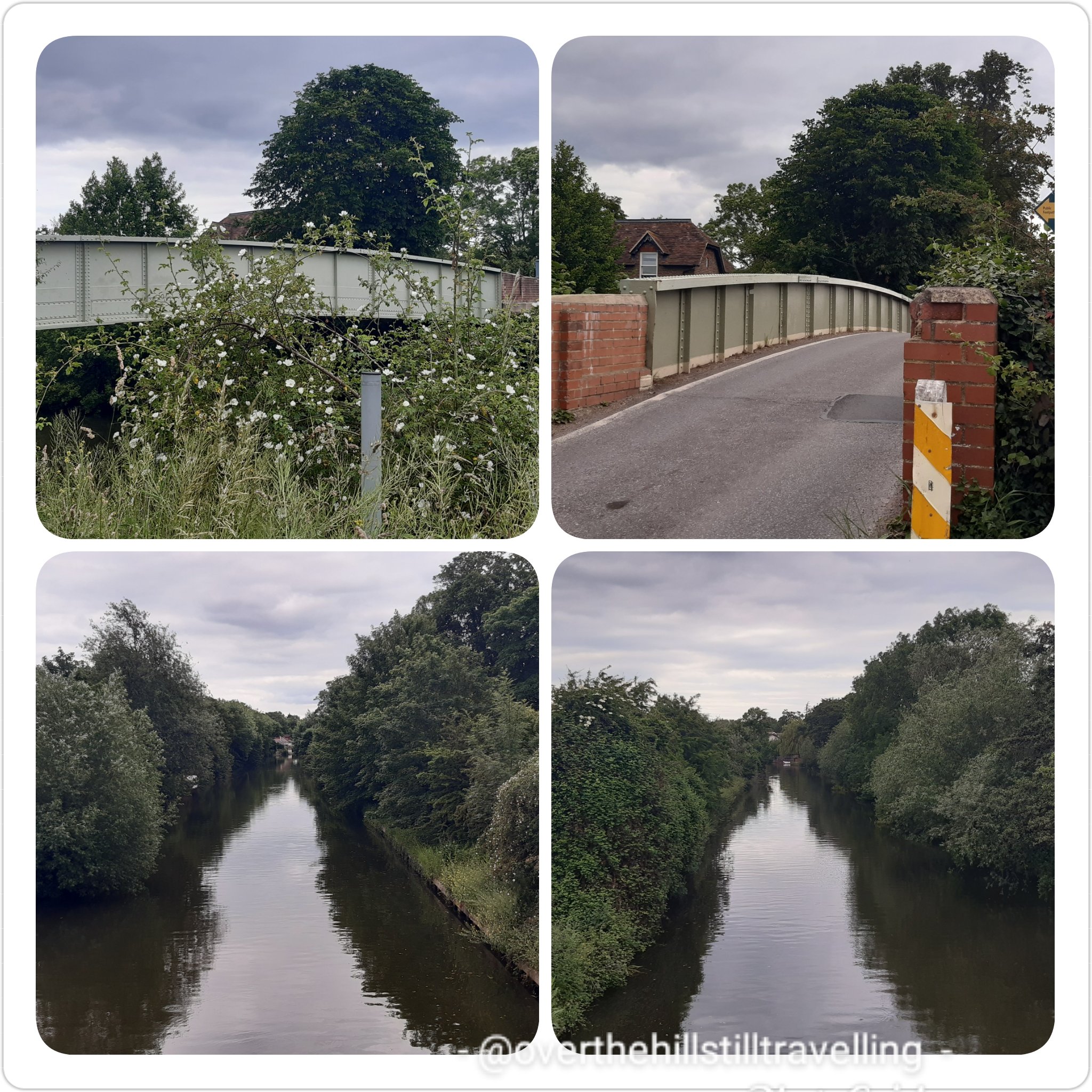
Continuing on my way I passed what I mistakenly thought was the Albert Bridge – it was in fact Ham Lane leading to Ham Island, which on closer inspection via google maps appears to have been created by another cut-through to avoid a large bend in the river… another section to try and walk at some stage then! Apparently I was walking in an area called Saint George’s Farm – okayyy, cool!
I walked over to the middle of the bridge to capture the scene upstream and downstream – looks the same either way.
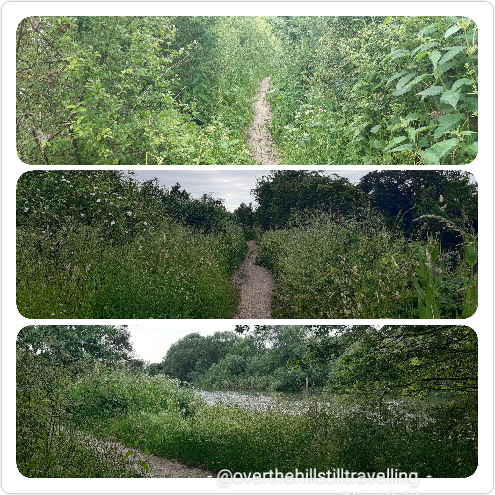
This section of the path wound it’s way through shoulder height grasses and wild flowers – a home for the bees and butterflies. Magical.
I was just about to sit down at this bench when a little black and white spaniel came bounding out of the underbrush trailing all manner of greenery and nearly gave me heart-failure LOL It bounded off along the path and joined an elderly gentleman I had seen walking ahead of me – one of very few people I encountered on the path.
I spent a few minutes at the bench relaxing, enjoying some welcome tea and sandwich and soaking up the tranquillity…birdsong the only sounds.
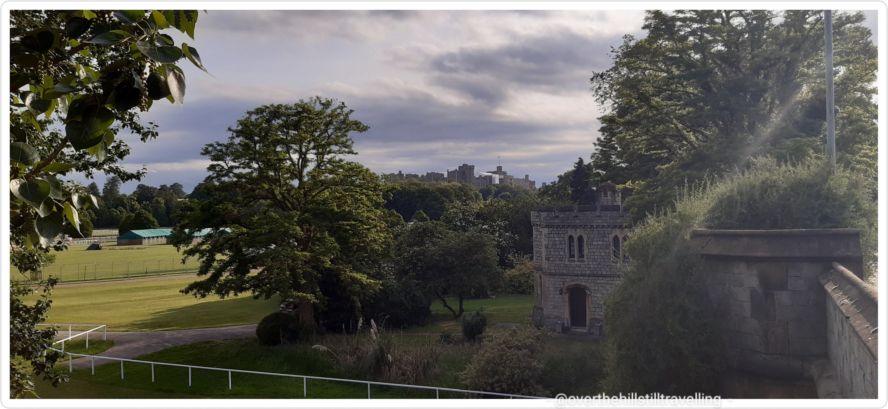
Albert Bridge. Here I had to cross over to the north bank once again because her Maj owns the next section all the way into town…so there! Prince Albert’s Walk m’dear!
I stopped at the top of the bridge to photograph the river, it’s so beautiful and looks so tranquil. Just around that bend, and another larger loop in the river, but not too far upstream is Windsor Castle and my bed for the night. Hoorah!
Around that bend…and the next 😉
Down and around and under the bridge I was now on the north side of the river. The bridge design is really pretty.
Albert Bridge
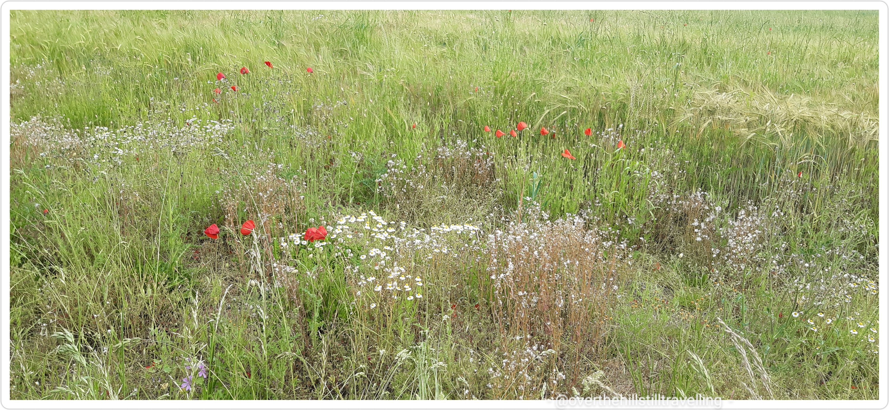
After crossing beneath the bridge the path meandered along past overgrown edges, a veritable plethora of plants. Over the fence a farmers field edged with a corridor of wild flowers for birds, bees and butterflies and all our wonderful wildlife that need this kind of habitat to thrive. Poppies waved their bright red heads, a stunning palette against the multi-colours of green.
In the distance I could see the red tiled roof of the farmhouse of Southlea Farm (Slough) … I’m nearing Datchet now.
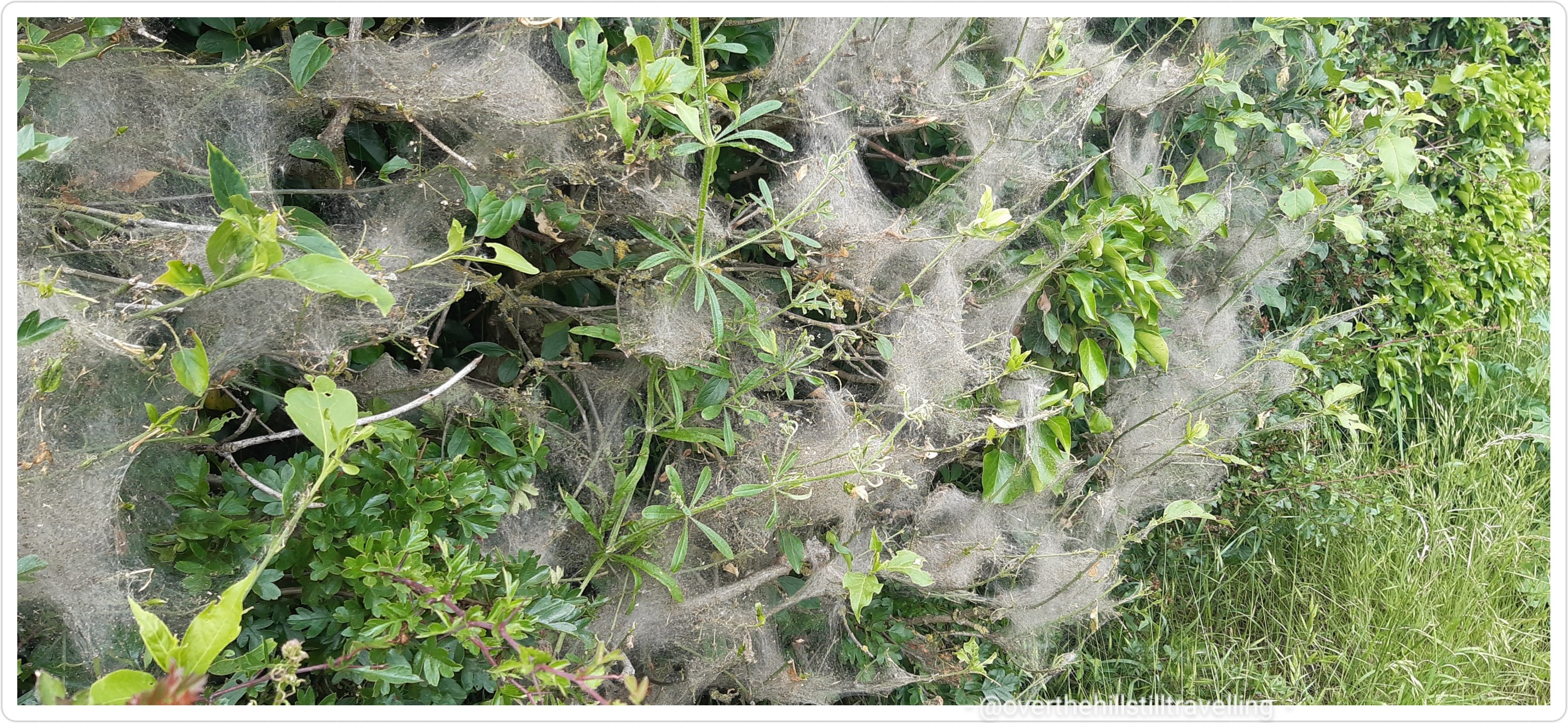
On my left a thick line of shrubs covered in spider webs…a bit like a dusty cloak. I’ve always been intrigued by these webs so did a bit of research…as it turns out, it’s caterpillars that build these webs. Who knew 🤔🤔
Soon the path turned away from the river, although along this short section I couldn’t really see the river anyway the undergrowth and overgrowth was so thick…but I knew it was there. Just before the B3021, the path took a sharp left (do not go through the gate said the guidebook, but turn left) and so I walked into Datchet.
It was horrible, lots of traffic, a very narrow pathway, overgrown hedges almost pushing you to step onto the roadway.
I ended up skirting a very very narrow verge since I hadn’t been able to cross the road. The guidebook didn’t say anything about crossing over so I carried on assuming the sidewalk would continue….it didn’t. Fortunately no big trucks came past and I managed to reach safety without mishap.
looking back – not fun to walk on what turned out to be the wrong side of the road…but I got through
A brief excursion onto The Green, which was not on the official Thames Path, but it looked pretty and offered brief respite from the traffic.
From there I did cross over the road, only to have to cross back over again not much further on. The guidebook could be updated here with more information. As it is, I just navigated by my nose until I spotted a direction marker pointing me in the right direction.
check out that traffic….I had to squeeze my way across
Along a short path, across a wee bridge alongside the Dachet Golf Club and once again I was plunged into a world of green, the traffic now barely a whisper.
Across the river, now visible again, I could see her Maj’s secret hideaway LOL
Do you think Her Majesty hides away here sometimes?
Anddd another flight of stairs..this time onto Victoria Bridge, and once again I returned to the south bank of the Thames. Looking back downstream from the top of the bridge the difference in vegetation between the two sides of the river is quite remarkable. On the left: an overgrown jungle of trees, shrubbery, flowers and grasses, and to my right her Maj’s perfectly manicured lawns, the trees marching in an orderly row evenly paced as they disappear around the bend. Someone needs to tell herself that we need wildlife corridors for the birds and the bees!
Her Majesty’s Lawns vs Nature
Hoorah!!! My first glimpse of Windsor Castle! From Victoria Bridge
I followed the directions in the guide book, although it wasn’t really necessary…but
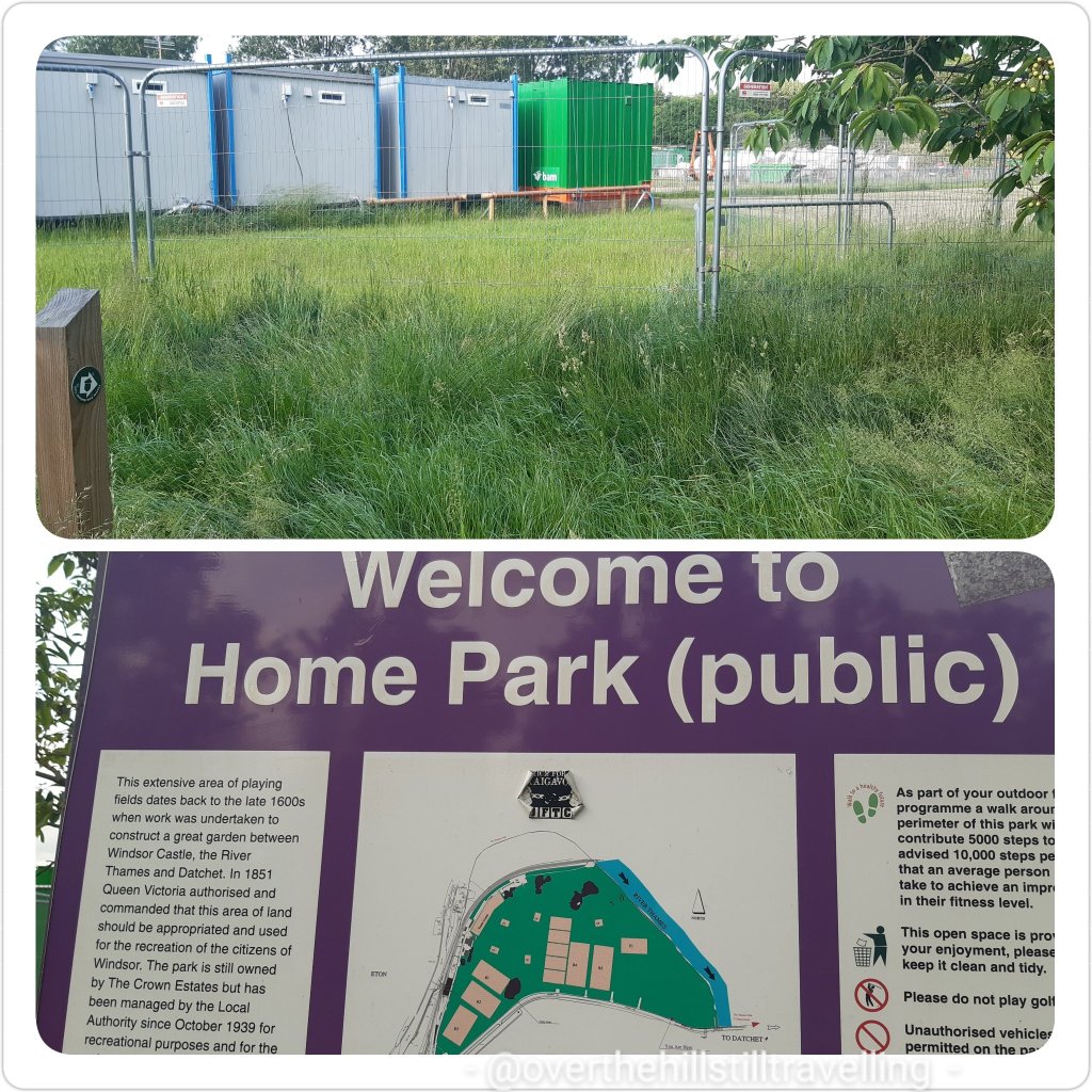
Then things took a turn for the worse…actually not really, it just felt like that at the time. By this time I was tired and footsore, desperate for a cup of tea and in no mood to be redirected around construction sites. How inconsiderate of them to go and put up fencing and stuff.. LOL grumpy granny was out her box!!
Home Park….and here I had to force my way through a jungle of overgrowth my panga swiping left and right to forge a way through….LOL sorry my mind went off on a tangent there. As you may well imagine, my vocabulary once again took a turn for the worse…if I were a witch, workmen would be dropping around me like flies! Turns out they’re repairing Black Potts Ait bridge.. or something like that.
Diversion is the spice (chilli 🌶) of life
Once past the fencing I made my way diagonally across Home Park to the river and met up with the Thames Path once again. Very pretty along this section…so much green and so tranquil.
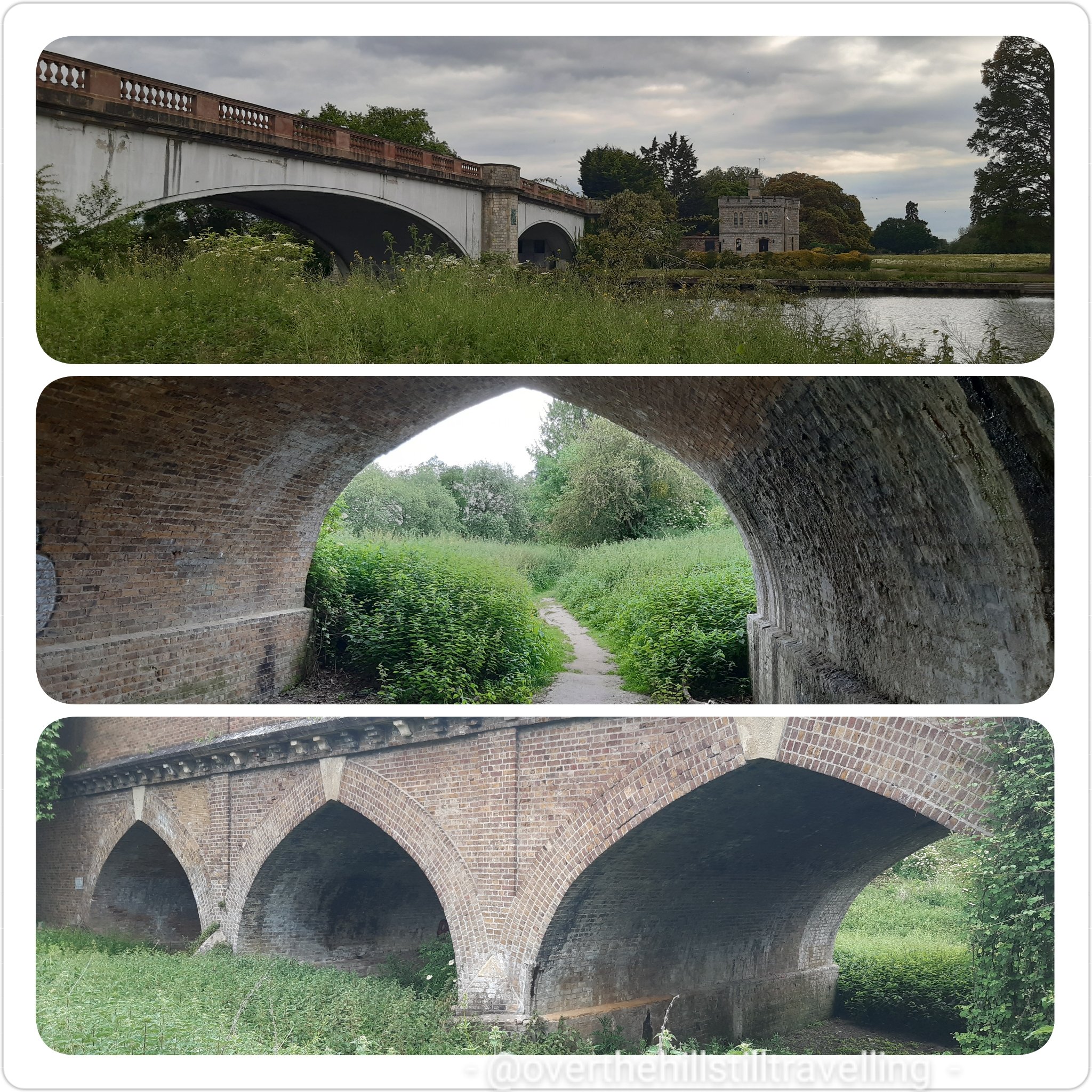
I walked beneath the railway line just as a train rumbled past. So glad I don’t have to rush to catch a train home tonight!
still going in the right direction!
I passed Romney Lock, but from the state of it I’d say it’s not in much use anymore.
Romney Lock
A metalled road soon took over from the lovely gravel pathway and hey ho, back in the urban jungle once again.
And there just ahead of me!!!! Wheyyy heyy heyyy my next sighting of Windsor Castle!! Hoorah.
Relax Lizzie, I’m almost there, put the kettle on sweetie 🙂 So exciting to finally see the towers of the castle. But first I had to traverse this metalled road and pass some ugly industrial sites/sights!!
The path suddenly veered away to the right and thankfully I was once again surrounded by green with a small canal to my right. After looking at google maps I can see that it’s a small cut-away from the main river that splits around Romney Lock.
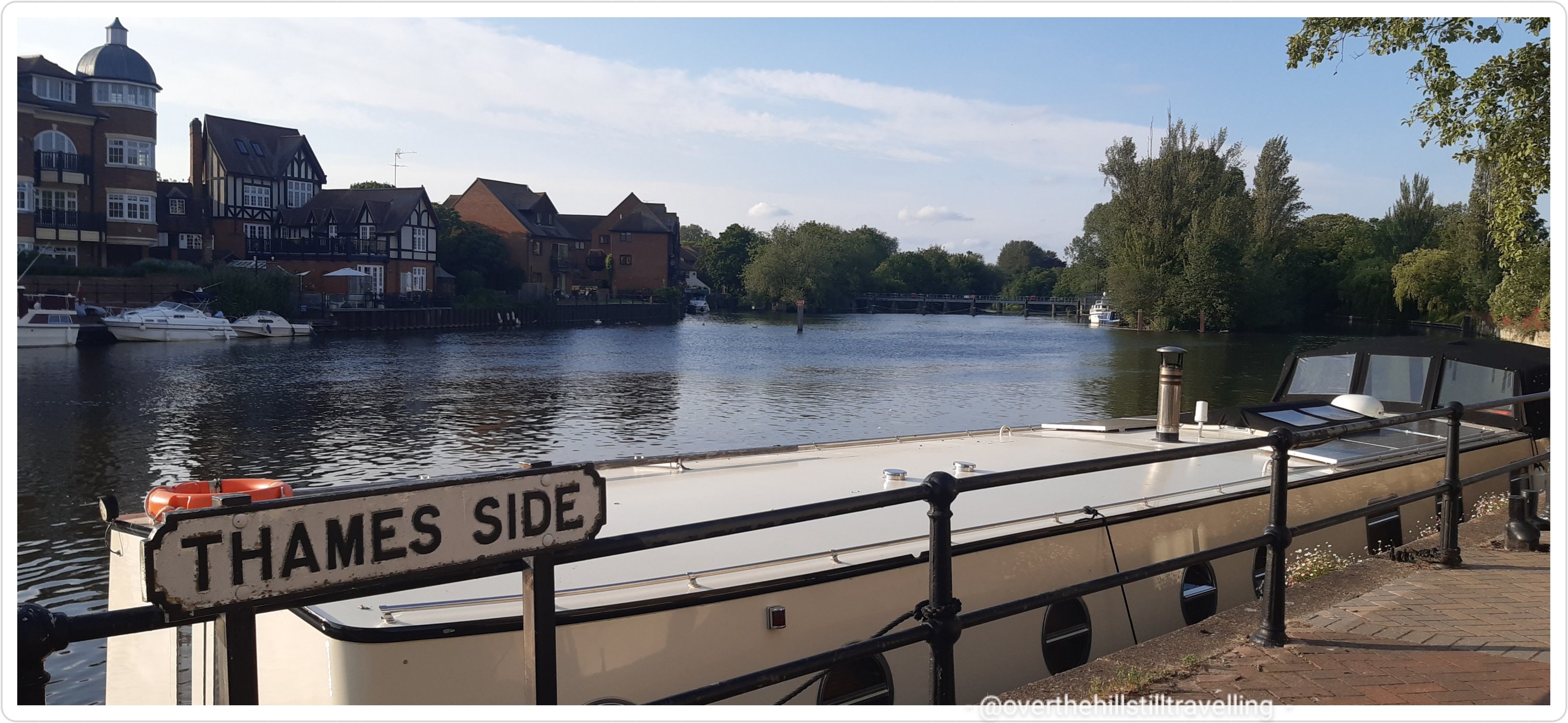
Walking alongside the Thames (Thameside) I could see Windsor Bridge in the distance…not long to go now!
Windsor Bridge in the distanceStopping to look back from whence I had come…the railway bridge in the distance
Lookie lookie!!!! What can I see? Without further ado, I was there…in Windsor. Glimpses of the castle as I walked towards the bridge
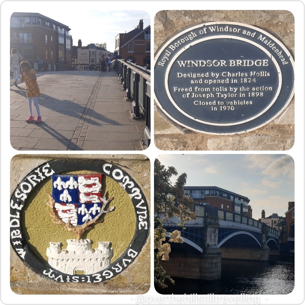
Knock knock! I’m here…..journey’s end! Hoorah. Windsor Bridge: designed by Charles Hollis and opened in 1824. Freed from tolls by the action of Joseph Taylor in 1898. Closed to vehicles in 1970. How sensible.
Windsor Bridge
Just across the bridge is Eton where our bonnie Princes William and Harry attended college. I mean why not? Granny’s pad was just up the road…makes sense really.
Looking towards Eton
I passed this really gorgeous old building on my way in…
Bell and The Dragon – serving food since the 11th century
And still light enough to have a bit of an explore and and ice-cream – come on! you knew there would be an ice-cream at the end of this! Actually, I asked a chap walking by if he would please take a photo of me with my ice-cream, in front of the castle… as you know, my selfies are not that good. But I’m not quite sure he got the idea of a good photo…and much of the pavement, my feet and legs are in the pic, but not much of the top of the castle. Oh well. I did a selfie anyway…rubbish as always. I might concede defeat and get one of those gadgets that allows you to take selfies when you have short arms. Oh wait! I have one. My daughter bought it for me. I hate it! LOL
if I look like I’m grimacing, it’s because I was – come on already, just take the photo!!
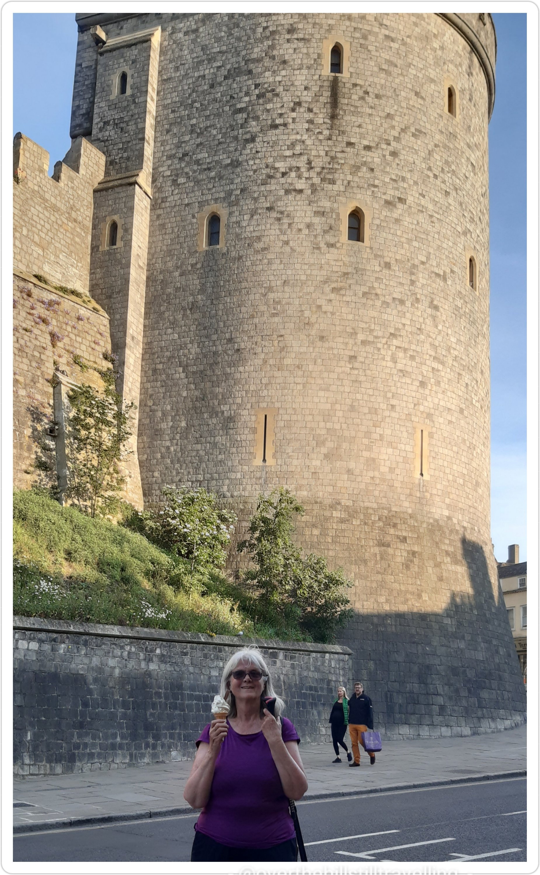
Windsor Castle. As castles go, this one is superb! Talk about intimidating! But it’s also beautiful and I love it! A quick few pics and then it was time to find my Airbnb.
Windsor Castle : Windsor Castle is the oldest and largest occupied castle in the world. Founded by William the Conqueror in the 11th century, it has since been the home of 39 monarchs. Today The Queen spends most of her private weekends at the Castle. In fact she was home this weekend for her Official Birthday Parade and to meet President Joe Biden and Dr Jill Biden.
I had messaged my host ahead to say that I would be there about 7pm, as it turns out I got there just on 8pm! Usually when I get to a ‘new’ place I always check in and then go out and explore…but not tonight! My fabulous host made me a much appreciated cup of tea and I had my cup-a-soup and a slice of bread. Then sat in her garden for 30 minutes or so just to unwind, after which I bade them goodnight, had a shower and fell into bed….absolutely knackered!
Another fantastic day! Gosh I do love walking. Even though my feet ache and I feel like I’ve been run over by a truck by day’s end, I love to discover new places, sights and scenes. Once again I had it all; fantastic weather, wonderful scenery – albeit very different to stage 5, pretty bridges, a few locks, and a historic and world-famous castle at the end of the day…and an ice-cream. I am just a bit put-out though…Lizzie forgot I was coming and made other arrangements. So rude!
What a wonderful day!!
May I add as a caveat to what I said about walking on my own…the only exceptions I’m prepared to make are walking with two of my younger sisters who are both seasoned long-distance walkers/cyclists/hikers and understand the dynamics.
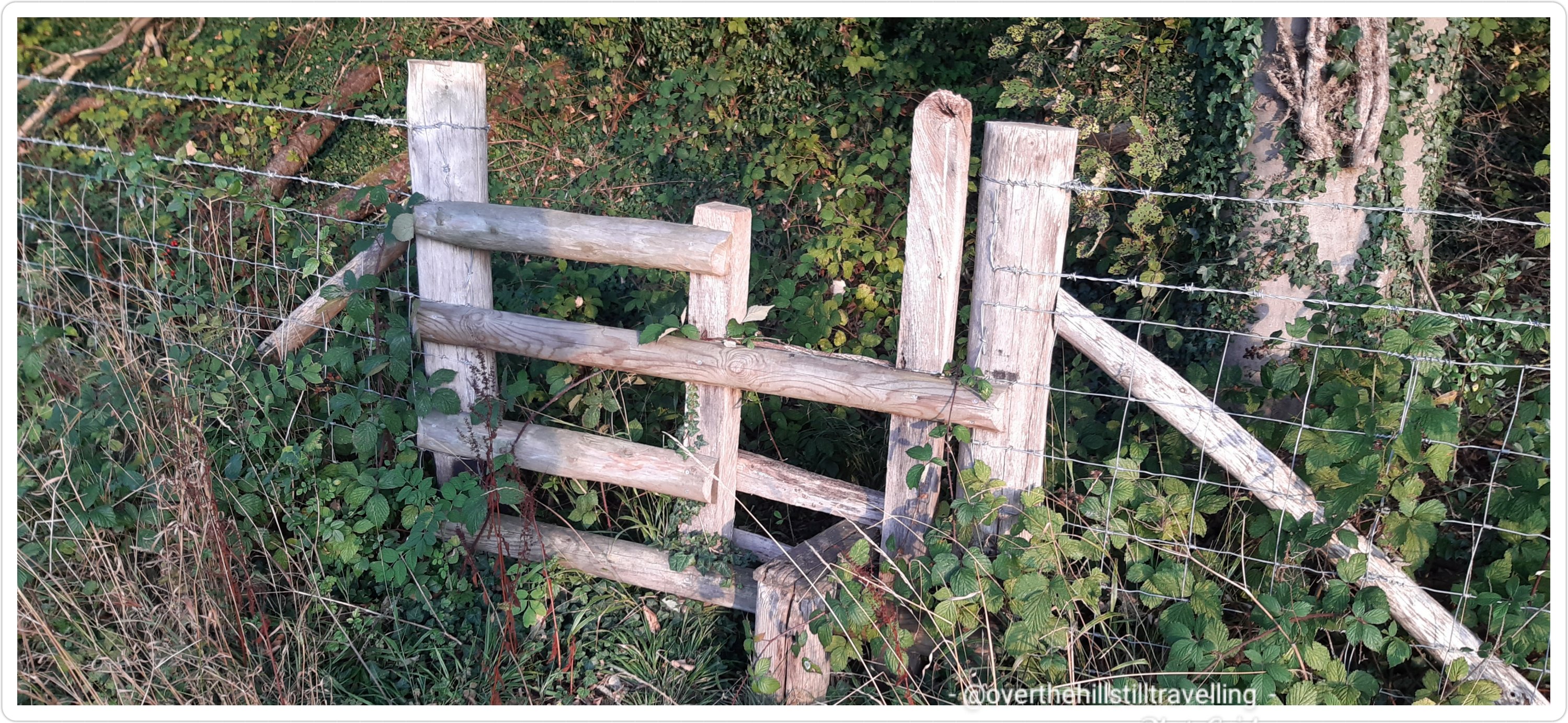
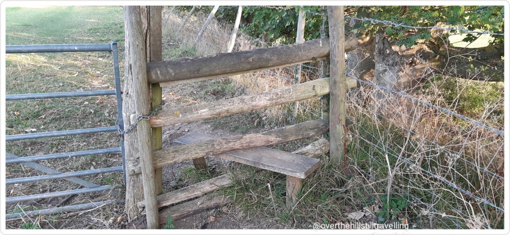
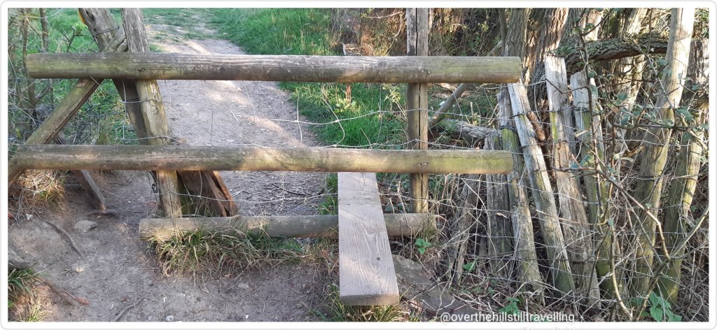
It totally reminded me of my walk along The Pilgrim’s Way back in 2018 and 2020…I cannot tell you how many, many stiles, of all shapes, sizes, state of decay or disrepair, and levels of navigable ability I encountered over the week of my final stages. At one point at the end of a very long day, near Detling, I literally sat down on the step of what was thankfully the last stile of the day for 30 minutes and just refused to climb it…my mind was bent!! I just couldn’t face having to hoik myself and my backpack, which by then felt like it weighed in at 5 tons, over the damn stile!! I seriously considered just parking myself in the surrounding field and staying there for the night….except…creepy crawlies and things that go bump in the night.
Another mile, another stile – near Detling alongside the motorway, not a very comfortable seat
In the space of 25 minutes, early evening, after walking for 10 hours, I encountered 1 kissing gate and 4 stiles, two of which were no more than 2 minutes apart! I kid you not!! So not funny! LOL I had just 3 hours earlier squeezed myself through another kissing gate…most times, as the article suggests, you have to just take the backpack off, throw it over (or lower it carefully depending on how fed-up you are) and squeeze through.
all shapes and sizes…variety is I guess, the spice of life
and then, just to really make my day….I had to climb this flight of stairs straight after, only to discover that I would be walking right next to a very busy motorway. What I said on seeing these stairs…. I’ll leave to your imagination
Oh! and may I just say…I did this walk between lockdowns in 2020! At a time when we were allowed to travel, albeit not hugely encouraged…I hardly saw a soul most days, and only encountered my airbnb hosts in a controlled environment. Just saying….as they say. I got some seriously nasty flack from someone I don’t even know on facebook…which is why my profile is private…
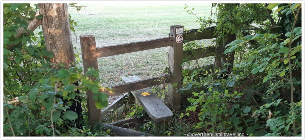
Other than that…what has been your experience with stiles? I’m truly grateful that so far there are none on the Thames Path and I’ve encountered only kissing gates so far on The Saxon Shore Way. The English Coast Path is also mostly free of stiles…probably coz you can’t farm on the beach. Or can you?
Hot on the heels of Stage 4 between Richmond and Hampton Court, from here on I was breaking new ground. Except for brief forays along the banks of the Thames at Windsor, Oxford, Henley-on-Thames and Reading when visiting those places or working there, I have never walked along the banks of the river beyond Hampton Court. A whole new adventure awaited; places to go and things to see!
As mentioned in Stage 4, it was now taking longer and longer to get to my starting point and the train tickets were getting to the point where it would cost more or less the same to stay in an AirBnb overnight as pay for a daily ticket. So after this stage I will continue my journey in 2 day increments or more…probably a 4 day stint would be good at some stage.
I arrived at Hampton Court Station just after 10:40 having discovered via a very helpful station assistant in Ramsgate, that if I bought a same day return, I could in fact leave before 09:35, and also…today was Saturday, so I could leave much earlier than usual; which I duly did.
Good morning Hampton Court Bridge
Because it was still relatively early I decided to have a short excursion onto the little promontory for a quick sandwich and some tea; Cigarette Island Park, juts out into the Thames and offers superb views of the river and the palace. Not sure I like the name of the park…but still, it’s pretty and cool and green.
Fab view of the palace and river for breakfast
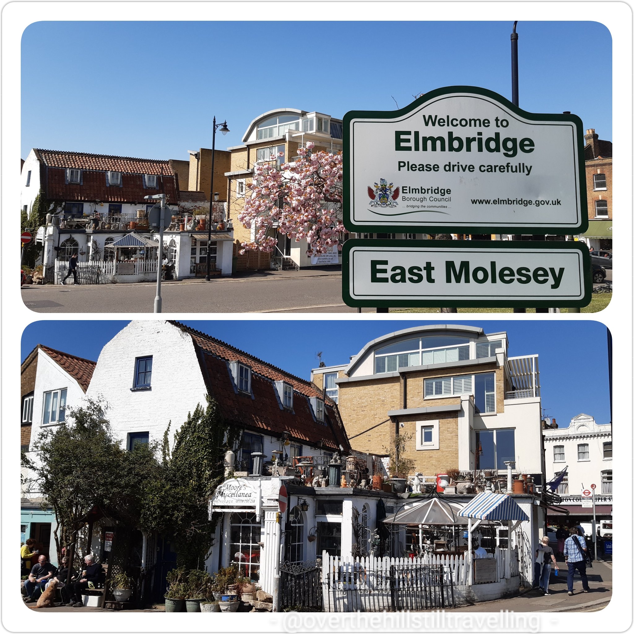
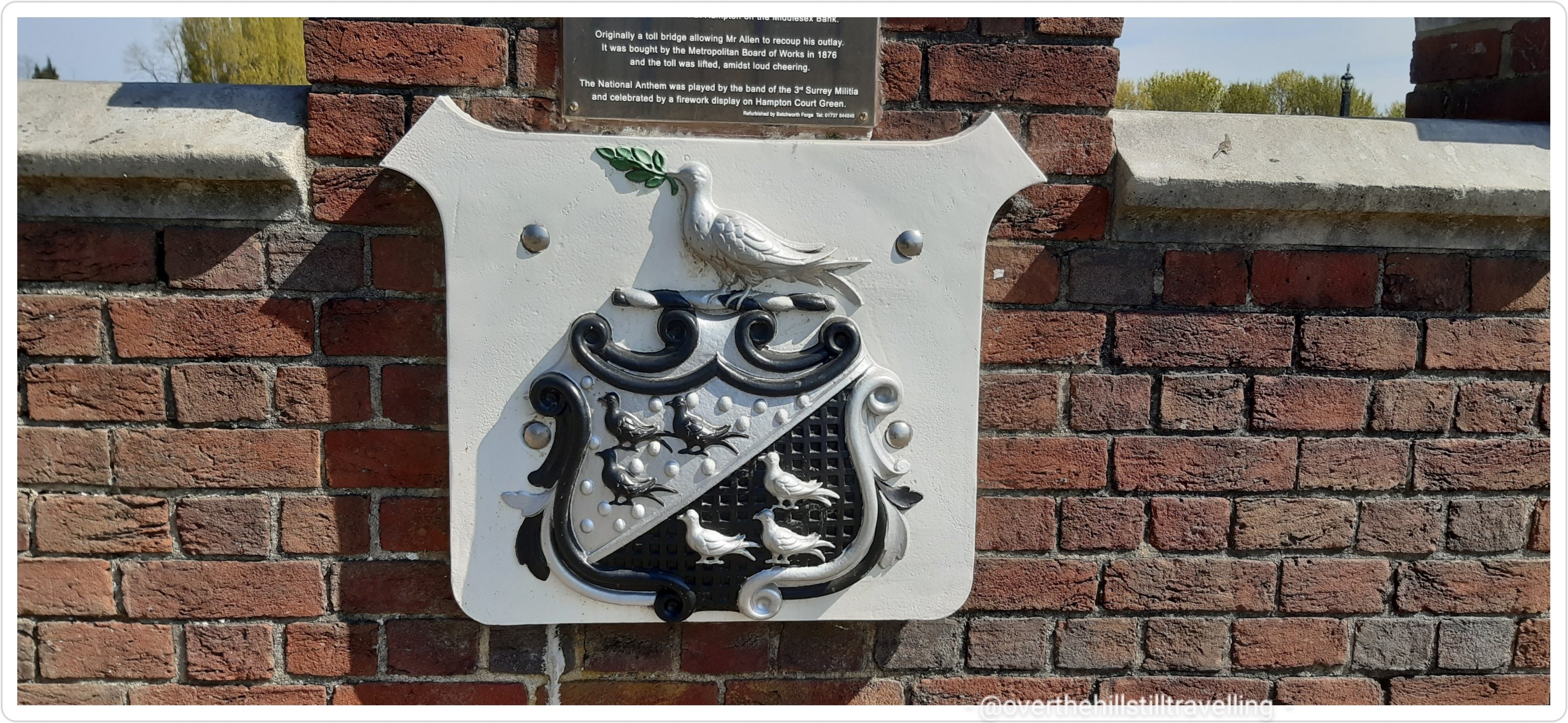
Now in East Molesey on the south bank of the Thames, after my tea and yum yums, I set off into the wild blue yonder…what will I find? First off some photos of the area, and a brief history…Hampton Court Bridge was opened in 1866 at the expense of a local man who lived in the area, Thomas Newland Allen (his coat of arms adorns the bridge). Originally a toll bridge, allowing Mr Allen to recoup his outlay, it was bought by the Metropolitan Board of Works in 1876, and the toll was lifted…I believe the locals were pleased – the National Anthem was played by the band of the 3rd Surrey Militia and there was a firework display!! I can’t imagine them doing that today!!
East Molesey – I just love this little house/storeCoat of Arms – Thomas Newland Allen. Love this design
Looking across the bridge to the Mitre Hotel (I had tea and scones with jam and cream there one day), I was reminded of the history of the hotel : the all new Mitre Hotel where quirky British sensibility meets elegant authentic luxury on the banks of the Thames…as it says on their website 🙂 Origins date back to the reign of Henry VIII. The building has been reconstructed since 1665 and is Grade II Listed as a mid-18th century edifice by Historic England. It is widely reported that The Mitre was built in 1665 at the direction of Charles II as a ‘hostel for visitors to the Palace’. The Mitre is on the site of The Toy, which originally stood on the opposite side of the road, near the Trophy Gates of the Palace… and is mentioned in 1653 in the Parliamentary survey of Hampton Court as a Victualling House. This house was famous for the convivial meetings held there by the “Toy Club”, of which William IV, then Duke of Clarence, was President. ref wikipedia
Mitre Hotel
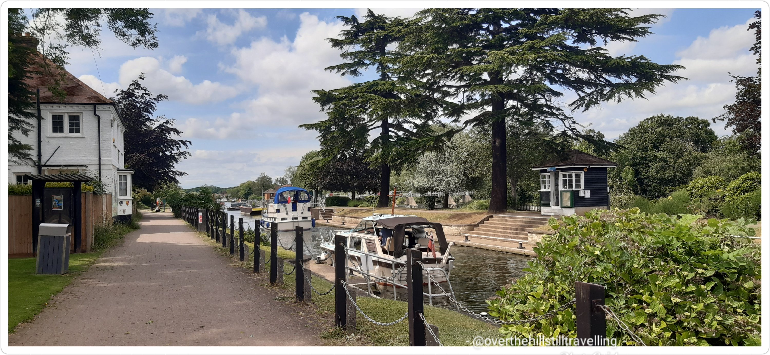
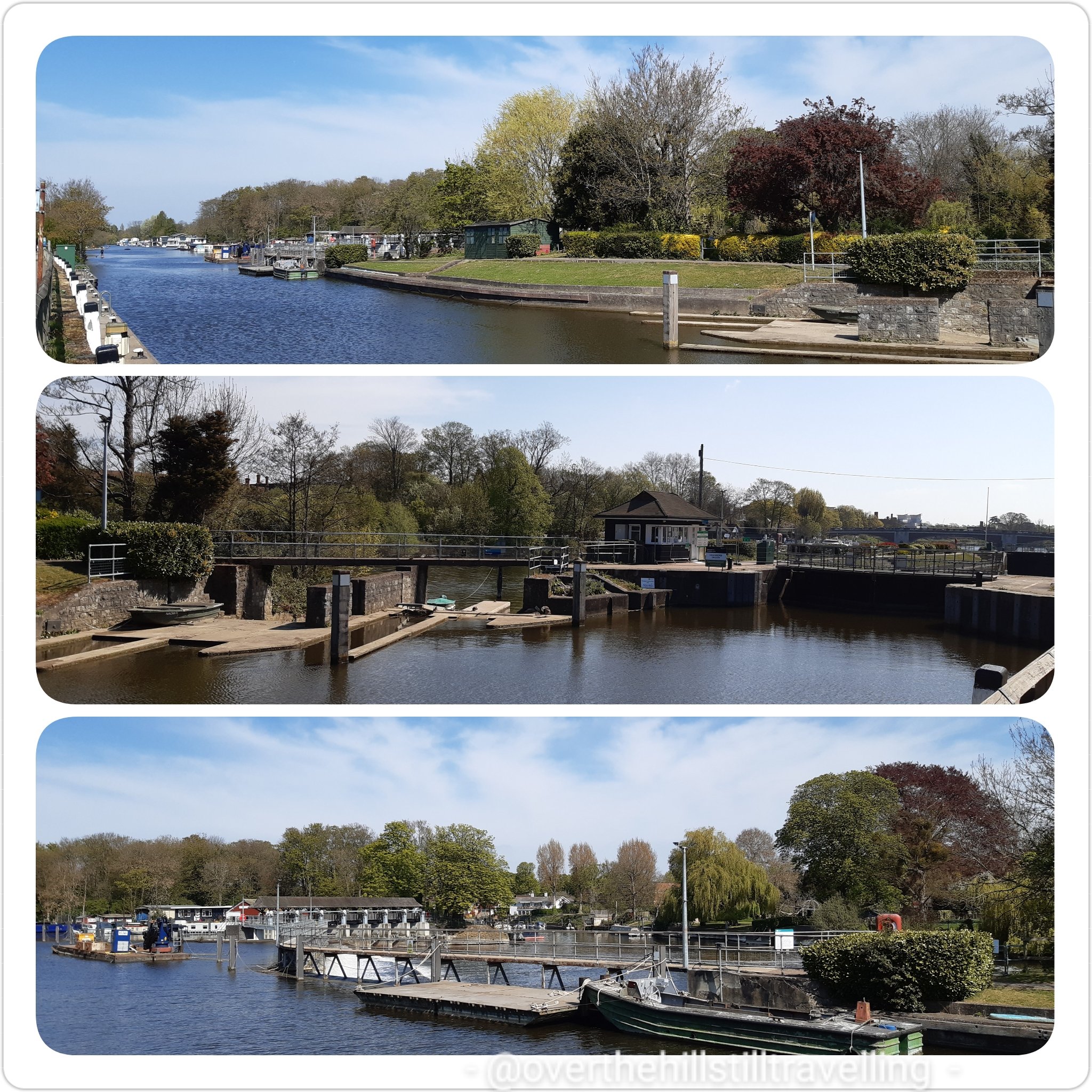
Moving on, within a few paces I encountered my first lock of the day; East Molesey.
Molesey Lock
A stone’s throw from Hampton Court Palace is Molesey Lock, built relatively recently in 1815 by the Corporation of London. Before this lock was built, Hurst Park (on the south bank by the lock) was known as Moulsey Hurst. During droughts, the Thames was liable to become too shallow for river craft to pass through. The heavily laden barges were held up, sometimes for weeks at a time while the bargemen waited for the weather to turn. When it did, the higher water levels allowed the barges to float through. The lock’s 1905 rebuild was carried out to accommodate the long 200ft naval craft built at Platt’s Eyot, just upstream of the lock. Between the 1800s and early 1900s, Molesey was probably the most popular lock on the Thames – on summer Sundays. ref their site
Molesey Lock
I was ever so lucky to have another fine spring, almost summer’s day with blue skies, puffy white clouds and a soft breeze that kept me cool for most of the day.
Lovely open pathway makes for easy walking
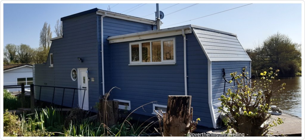
Heading towards Walton-on-Thames, the path is wide and very rural. I don’t often have ‘house envy’ having already owned a couple of houses back in South Africa and all the accompanying headaches, but oh my word….look at those houseboats! whoa. It looks heavenly, although I’m sure it’s probably quite noisy living on the river.
Fab.U.lous houseboats
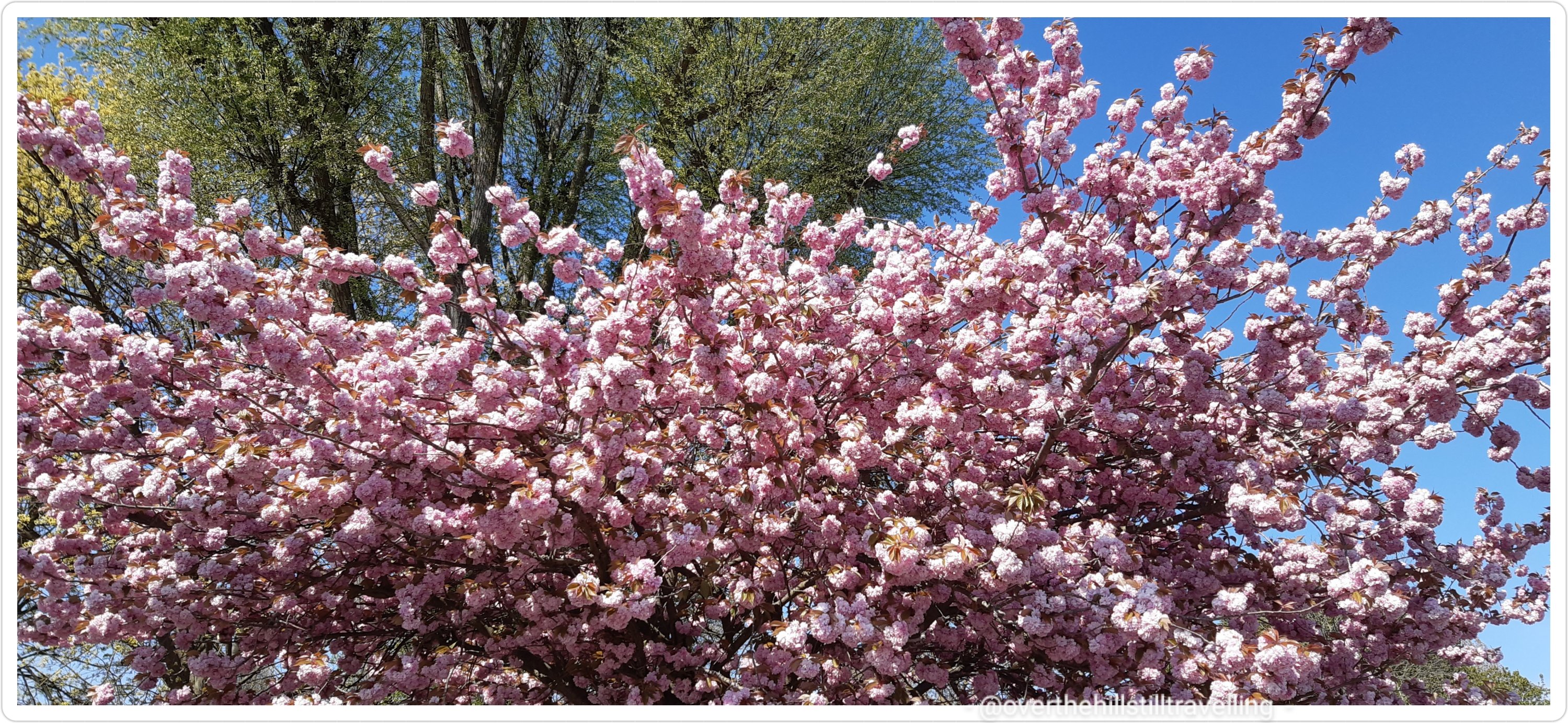
Again I was enchanted by the fabulous cherry blossoms and the many bluebells along the route. They really are gorgeous, just a shame they don’t last long.
Cherry Blossom 🌸lots of wonderful bluebells have flowered along the path…
I passed alongside Hurst Park and stopped briefly to look at what to expect ahead
Hurst Park – you are here! 😃 – heading upstream, river to my right
A little further on and I was amused by the antics of a little browney beige dog. He was splashing around in the river, then bounding out, running ahead of his entourage, hiding behind overgrowth on the river banks and when his ‘servants’ neared, he would bound into the river, splash about and jumping out run ahead and do the same all over again. It was ever so cute and went on for quite a while. He had so much fun! Lucky dog, I wished I could just jump in and splash about….approaching midday, it was getting quite hot.
Cute dog 🐕😍 had so much fun
At the next Thames Path direction marker, I could see Garrick’s Temple to Shakespeare across the river. I worked in Hampton once some years ago, so had the pleasure of visiting that little park on one of my many walks. Nearby is Garrick’s Villa where he lived : David Garrick became the lessee in 1754 and then bought the property in October that year, making it his country retreat and a place of recreation where he and his wife frequently entertained their friends. He embarked on extensive alterations inside the house and, either now or at a later stage, employed Robert Adam to re-design the facade in the classical style then in vogue. The house has a fascinating history if you’d like to learn more.
Garrick’s Temple to Shakespeare
Garrick’s Temple to Shakespeare, Hampton
David Garrick lived here – we don’t last as long as (some) bricks and mortar
The path runs alongside the river here without too much urbanisation, but with terrific views across the waters to Hampton. Garrick’s Ait on my right, I could see St Mary’s Parish Church across the river.
St. Mary’s Church, Hampton
Not much further along and I discovered the remarkable Memorial Sundial in Buckingham Gardens in West Molesey. I spent some time here reading as many of the plaques as I could see. The sun was right overhead and almost blinding, but it looks absolutely fascinating. Did you know that the Vikings sailed this far up the river!?? Apparently to raid Chertsey Abbey! Wow. Seriously, after all the stuff I’ve read about the Thames and London etc, I never knew that they travelled so far inland. I have not been able to find much information beyond this website about this amazing memorial, but there are some super images on the web.
Memorial Sundial West Molesey
Sundial
Vikings sailing up the Thames
Sundial
Hurst Park has a fantastic variety of wild life; fish and birds in particular. The river upstream of London is so much healthier for them.
The path too is super, wide and open albeit without much shade, which is always appreciated on a hot day. I got sunburned despite lashings of sunscreen.
So easy to follow…
A little further on and across the river from me was Platt’s Eyot, which sadly just 10 days later suffered a terrible fire that destroyed the warehouses and boat yard. Sadly one of the boats destroyed was one of the last remaining Dunkirk evacuation vessels.
Platt’s Eyot – no idea at the time it would burn to the ground in just a few short days
I loved all the canal boats tied up alongside the banks of the river…it must be such a different lifestyle living on a boat on the river. I think I’d like to try it out for a few months at some stage – perhaps when my grandson is older, then he can come visit and stay too ☺💙
Loved the canalboats…so quirky Lots of trees…no proper shade
Although you can’t really see it from the Thames Path, to my left are a lot of bodies of water…the Molesey Reservoirs Nature Reserve, Queen Elizabeth II Storage Reservoir, Bessborough Reservoir, Walton Advanced Water Treatment Works and Island Barn Reservoir, and across the river Sunnyside Reservoir and the Thames Water Hampton Water Treatment Works…..I was ignorant of all until I started looking at my photos on google maps LOL.
There are a lot of islands along this stretch of the river…and locks, and weirs. The path is well marked and you will see frequent direction markers.
Ya can’t get lost!!Secretive islands. That water looks incredibly tempting!
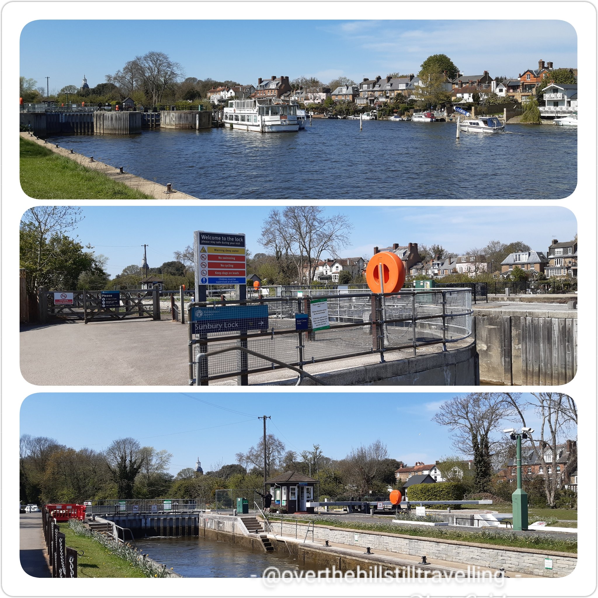
Next up was Sunbury Lock and weir. First built in 1812 Sunbury Lock is a lock complex of the River Thames near Walton-on-Thames, the 3rd lowest of 44 on the non-tidal reaches.
Sunbury Lock
I do love the lock masters houses! They are so pretty and so quaint. I spent a few minutes at each lock and for sure it’s a busy job being a Lockmaster! One of the qualities you would truly need is patience!! Did you know that they’re on duty from 9am to 6pm each day with an hour for lunch between 1pm to 2pm!.
Sunbury Lock..such a quaint house
I didn’t stop much along this stretch and I didn’t take many photos…mostly because the scenery was much the same; a long open path, few trees, and the river. A rare spot of shade and a bench…time for break
the guardians of the path – I really enjoyed the Thames Path along this section…wide and easy walkingA bench is always a good place for a rest..
There are a lot of really fancy houses along this stretch, on both sides of the river, some with gardens that stretch right down to the waterside. Oh and a pub! I was tempted to stop for a coke, but since I had refreshments I carried on till I found a bench under a shady tree and stopped there.
The Weir Pub – tempted to stop for a coke The Weir
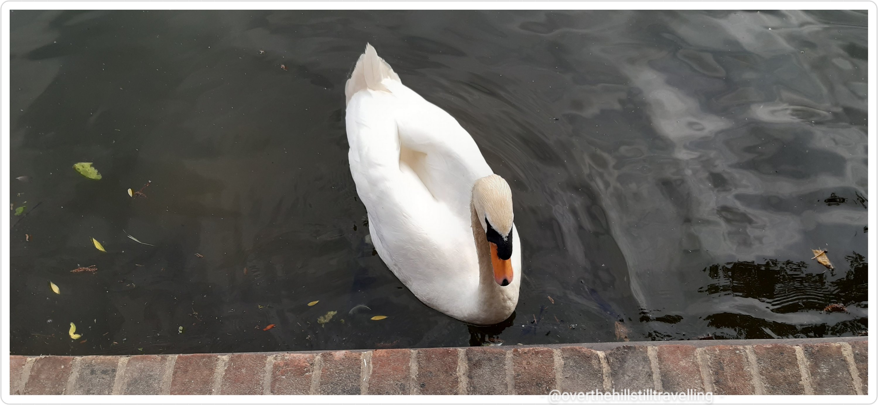
Nearing Walton-Upon-Thames I noticed a lot of swans on the river. They seem to be more prolific the closer you get to Windsor. Did you know that Queen Elizabeth II owns all the swans in England. According to the official Royal Family website, the Crown has held the right to claim ownership of all unmarked mute swans swimming in open waters across the country since the 12th Century. Some of the swans are owned by the Vintners and Dyers, but are marked by those companies.
All the Queen’s swans? Swans galore
I continued beneath the lovely Walton Bridge and along the Desborough Cut. Manmade and formed alongside the Thames in order to ‘cut’ out a lengthy double bend in the river…I felt a little bit cheated really. LOL I will probably go back one day and walk that section..🚶♀️🚶♀️
Walton Bridge
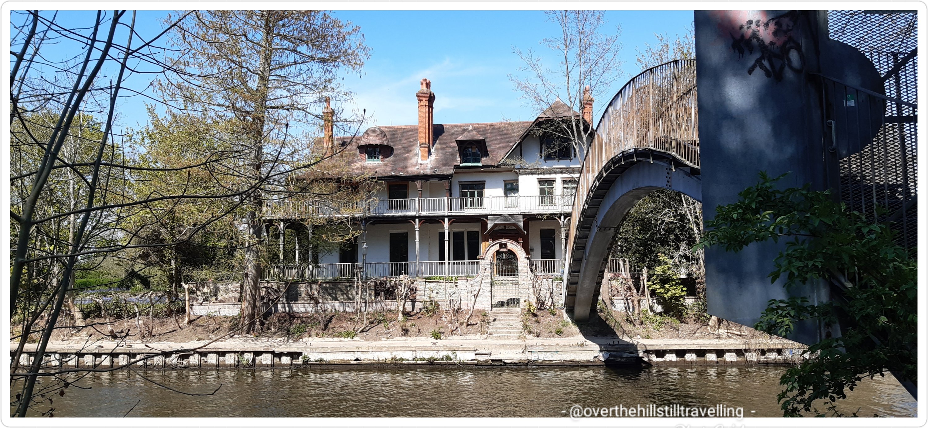
As I neared the ferry I noticed a stunningly beautiful, albeit dilapidated house (a 13-bedroom mansion actually), on a small island….this was D’Oyly Carte Island I had read about in the guide book. I chatted to someone about the house and apparently it’s recently been bought and will be restored to it’s former glory. Quite right too, it’s beautiful. If I were a rich (wo)man, I’d buy it…. The house has links to Gilbert & Sullivan : Richard D’Oyly Carte, born in 1844, was a London theatre impresario who brought together dramatist WS Gilbert and composer Arthur Sullivan. A key theatreland figure in the latter part of the Victorian era, he built the Savoy Theatre in London and founded the D’Oyly Carte Opera Company.
D’Oyly Carte Island – my dream house
After oohing and ahhing and just dying to cross the footbridge that leads to the island, I continued on my ‘wey’ LOL (get it…wey 😉) and soon reached the juncture where the River Wey joins the Thames and at this point took the ferry across to the north bank and Shepperton.
If you look at the river on google maps at this point it’s like spagetti junction with the two rivers joining forces and weaving around islands and locks.
Spagetti Junction.. Walking the Thames Path
It was good fun…I love crossing the river by ferry and take every opportunity to do so. I arrived at the ferry point at the same time as a family with two children. They read the notice that said you had to ring the bell to summons the ferry from the opposite bank, but they were a bit timid and didn’t ring it very loudly…so I humoured them and rang it vigorously 😁😁 they nearly had hysterics! But, it worked…the ferry crossed over and picked us up. Hoorah!
the ferry to Shepperton at spagetti junctiondon’t pay the ferry man till he gets you to the other side…safely across the Thames, now in Shepperton
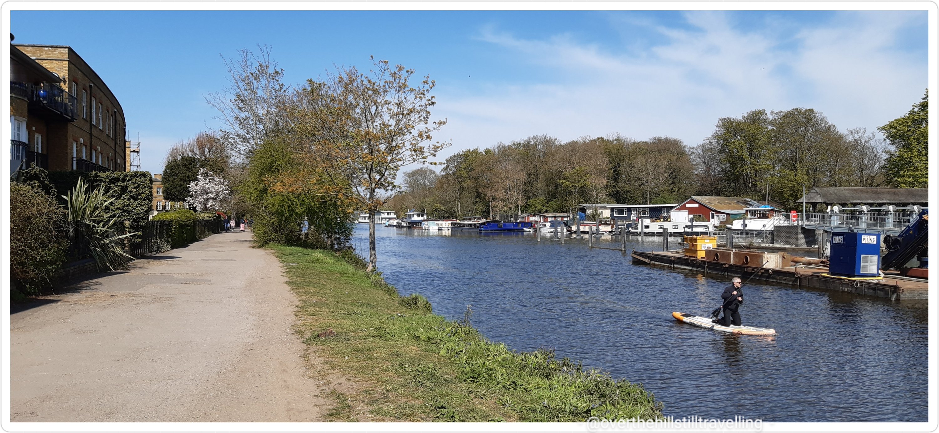
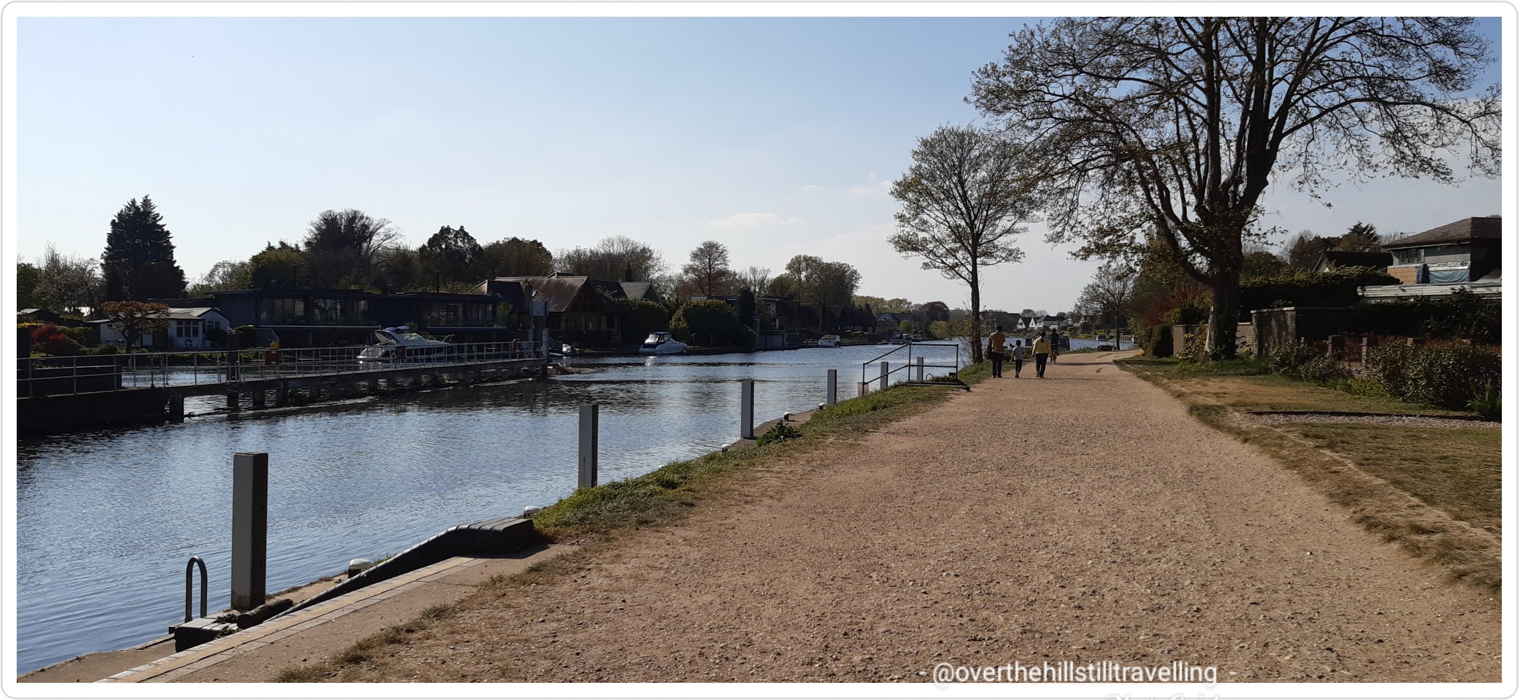
Safely across the river I headed upstream on what was now the north bank…my ultimate destination: Staines-Upon-Thames.
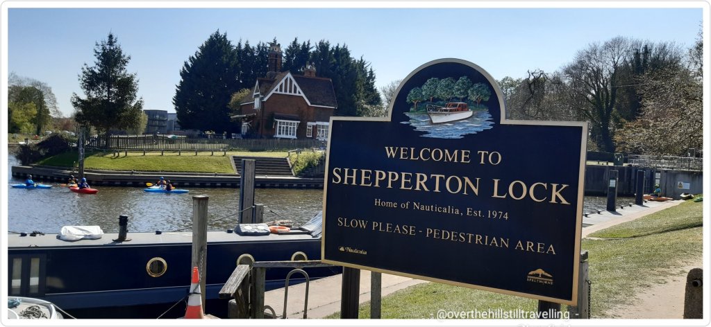
I passed Shepperton Lock on the left and felt sad that due to covid the tearoom was still closed, I would have stopped for tea for sure. I remember having tea there once many years ago…the view of the river is superb.
Shepperton LockStory of the river – when sorting through my images and reading these boards more closely, I was amused to note that they also called this section ‘spagetti junction’
I passed Pharaoh’s Island, so named after it was purchased by the Treasury to give to Admiral Nelson after the Battle of the Nile (1798). It’s fantastic how some of these islands got their names. It used to be called Dog Island, but Pharaoh sounds much more interesting.
love, love love this houseboat..moored alongside Pharaoh’s Island the river is now on my left hand side till Staines Upon Thames
Reaching Ryepeck Meadow Moorings I saw some fantastic boathouses…oh my gosh. Stunning. Lots of beautiful flowers lined the banks
another fantastic houseboat. I wonder what draws people to this type of lifestyle? It’s compact..a glorious splash of colour…so glad April is spring in the northern hemisphereFantastic houseboat – I’d live here 😀
The river curves and winds it’s way along, the path so close you could sit and dangle your hot, tired feet, in the cool, refreshing water…if only!! Maybe next time…although in reality, the water was quite a way down and I would have had to have long legs, which I don’t 🙄🙄
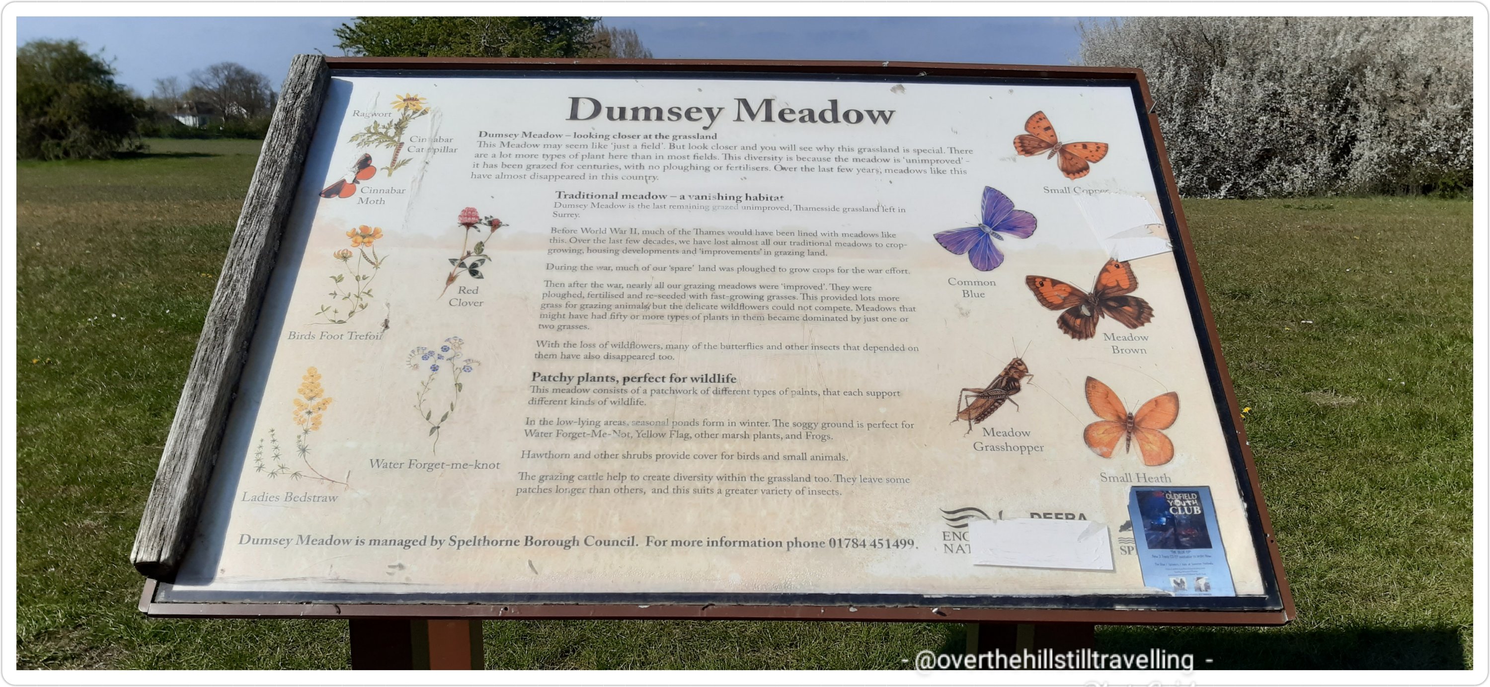
Ahead was a lovely green open space; Dumsey Meadow, but sadly few trees for respite from the baking sun. Mad dogs and Englishmen and all that springs to mind!
Dumsey Meadow – I was hoping for a shady break…
the birds of Dumsey Meadow – I love that they have these dedicated spaces to thrive
sadly I didn’t see any butterflies – they are really scarce this year
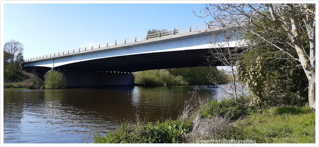
Hoorah! Chertsey Bridge…offered a brief respite from the sun! They need to put a couple of benches here..I’m sure they’d be well used.
Chertsey Bridge offered a brief respite – a couple of benches would be lovely
Follow the acorn!! Back to suburbia and a busy road – although I managed to get most of the way past before any traffic.
back to suburbia
And ahead Chertsey Lock and weir.
Chertsey Lock and weir
I soon passed under the M3
M3 I believe…although very noisy, at least it offered a brief respite from the sun
Ahead of me Laleham Park where I stopped for a short while to rest my poor feet, get some relief from the sun and have something to eat and drink. As I was walking towards the park a few horse and carts came clopping past.
absolutely beautiful animals…
I was a bit slow on the uptake and only managed to capture a very short snippet of film as they went past
but I did see the horses further up in Laleham Park cooling down in the river.
having a well-deserved swim at Laleham Park
Back to urban living and the often metalled surfaces that are so hard on the feet! Gosh, there are some gorgeous houses here. There are loads of direction markers too, so you can’t get lost.
another direction marker, another metalled surface, on the outskirts of StainesLarge houses…Laleham!
Hoorah! Staines 1.3/4 miles (2.8 kms) my feet rejoiced 🤭🤭
Staines!! Not too far to go
Penton Hook Lock soon hove into view (who makes up these names?) – I asked for a top-up of my water, but no-one had any taps available. There’s a huge marina here on the opposite side of the river… water water everywhere and nary a drop to drink! Bah humbug to covid. Penton Hook Lock, at 266 ft (81m) is the 3rd longest lock on the river, the 6th lowest lock of 44 on the non-tidal reaches of the River Thames. It faces an island which was, until its construction, a pronounced meander (a hook) and located on the site of its seasonal cutoff. It is against the left bank, marking the church parish medieval border of Laleham and Staines upon Thames in Surrey, for many centuries. Until 1965 their county was Middlesex.
Penton Hook Lock
Although the next few kilometres were quite residential, the houses were mostly set in large gardens and didn’t intrude on the path, which was lovely and wide and easy to walk on. I much prefer gravel to metalled surfaces.
Lovely wide gravel path
I passed a lovely old church; St Peter’s that I simply had to photograph…love these buildings.
St Peter’s Church, Staines-Upon-Thames
I was now on the outskirts of Staines, and nearing my destination….time 16:56 and I had been walking pretty much non-stop for 5 hours, except for brief stops as mentioned, which are seldom more than 10 minutes at a time.
2 minutes after passing St Peter’s Church I had my first view of the Staines-Upon-Thames railway bridge! Hoorah – soon I’d be crossing that bridge on my way home!
Staines Railway Bridge!! I could just see the Staines Bridge in the distance…whoop whoop
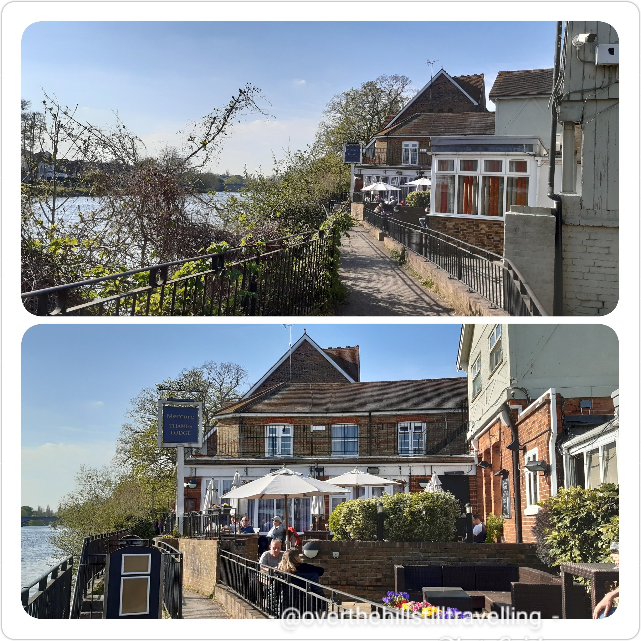
Back on urban territory I was soon in the thick of things, traffic, metalled surface etc etc….albeit a very pretty environment I must say. Enroute along the riverside path I passed by the Mercure Thames Lodge where I was meant to have stayed before the reality of the lockdown restrictions still in place hit home, and I had to cancel all my bookings 😦 It’s a gorgeous location, but ever so pricey over the period after lockdown.
where I was meant to stay if my plans had worked out…ahhh but lockdown rules! urgh
I walked by some absolutely gorgeous houses that reminded me of Bermuda…love those balconies and the flowers – just stunning. And finally…Memorial Gardens and so very near the end of today’s journey; Stage 5 of Walking the Thames Path!
I was well excited by now…soooo close to journey’s end
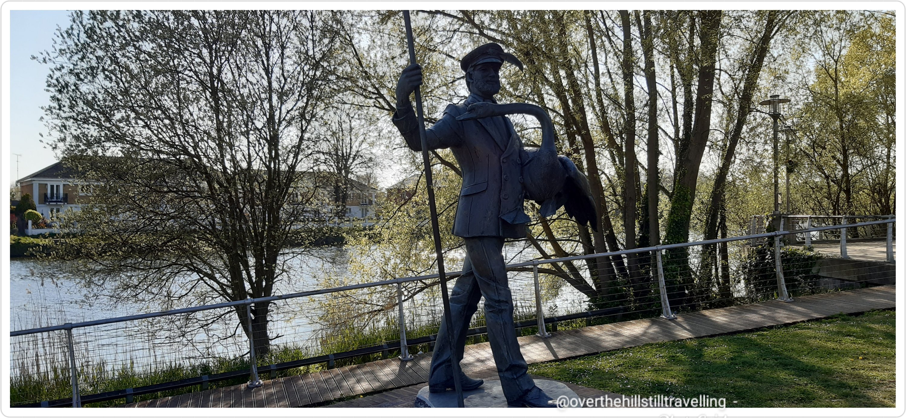
In the memorial gardens I saw a fabulous statue; The Swanmaster – he who counts the swans for The Queen during Swan Upping, a totally bizarre word for a really tricky job. Swan Upping still takes place once a year on the River Thames. The Swan Uppers weigh and measure the cygnets and check them for any signs of injury, commonly caused by fishing hooks and line. The young cygnets are ringed with individual identification numbers that denote their ownership if they belong to the Vintners or the Dyers livery companies; the cygnets’ ownership is determined by their parentage. However, all Crown birds are left unmarked. The Queen retains the right to claim ownership of any unmarked mute swan swimming in open waters, but this right is mainly exercised on certain stretches of the River Thames. ref their website. If you’d like to know more about swan upping, have a look at their website. It’s really interesting. I’ve been to both the the Worshipful Company of Vintners’ and the Worshipful Company of Dyers’ Halls during Open House in September. If you ever get a chance to go, do, it’s well worth the trip. The Vintners’ Hall in particular is absolutely stunning.
The Swan Master 1983 Staines-Upon-Thames by Diana Thomson FRBS
The Dancing Fountains – this must look gorgeous when the waterfountain is on
Dancing Fountain
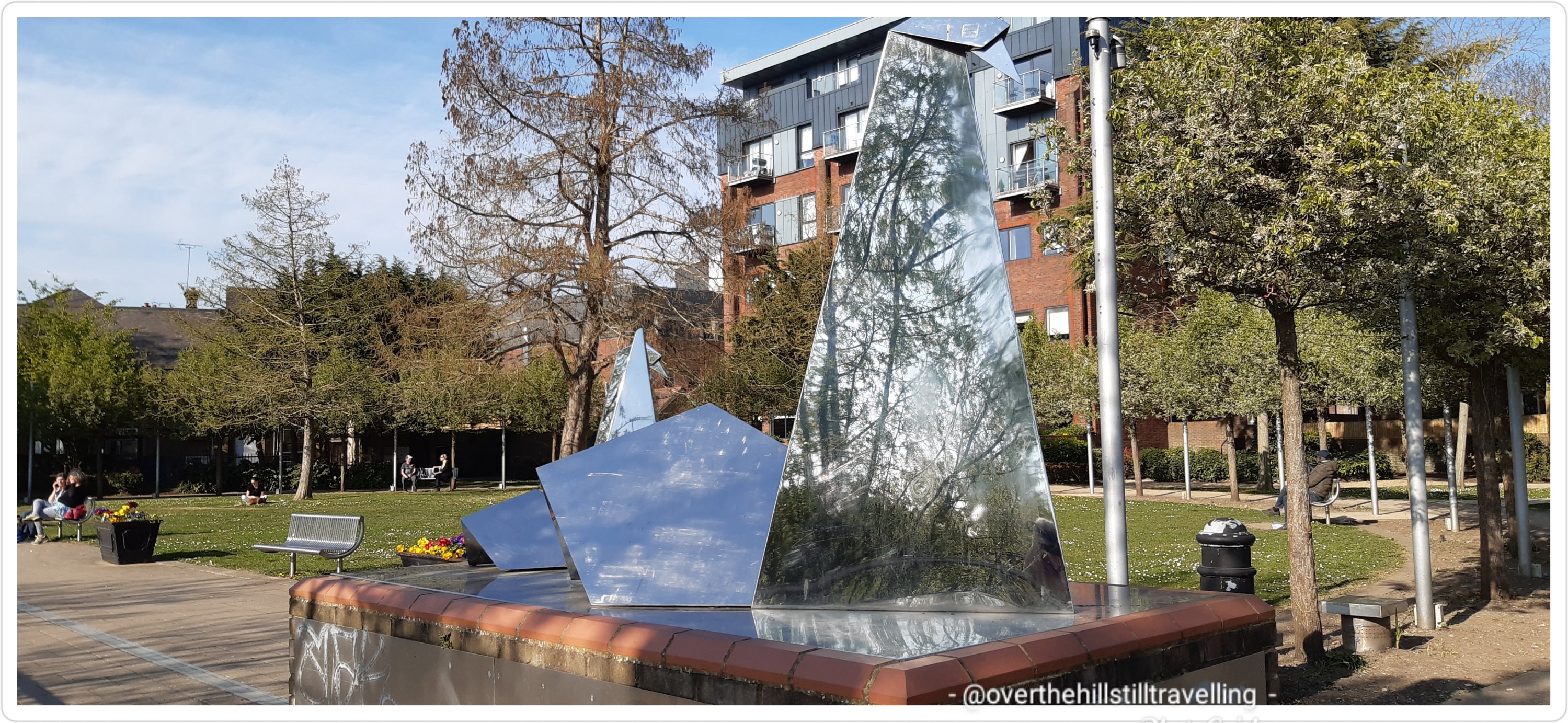
Abstract sculpture of a swan – trying to save on battery by now, I didn’t stop to look at who the artist is, I figured I’d find it on the www…but no, not yet! Do you know who the artist is?
Interesting sculpture…I think it’s mean to depict a swan
The London Stone!! I had waited a long time to see this!
The London Stone – ever since I first got the guide book, I’ve looked forward to reach this point
What an amazing day! I had it all; history, fabulous view of the river, an amazing sundial, stunning houseboats, mysterious islands, quirky canal boats, locks and weirs, a ferry ride, passed through some terrific parks, saw interesting sculptures and the London Stone! a mostly amazing path – easy to navigate, blue skies, sunshine, a soft breeze from time to time, 172 photos, and boo hoo no ice-cream LOL I literally didn’t see any ice-cream vendors the whole way from East Molesey to SuT.
It was lovely to see so many people out and about enjoying the sunshine. The Thames Path is very much a shared path and along this section there were a number of places where families could have picnics, kiddies could run about and play, and enjoy the fresh air and our fabulous river. Watersports on the upper reaches of the Thames are hugely popular and you will often see kyakers, canoeists, rowers and of course all the fancy speedboats. You can take a ride along the river on a commercial ‘steam’ boat at a number of places along the river pretty much from Richmond. And you will frequently see canal boats chugging by…I’m often tempted to call out and ask for a ride LOL Of course with spring in the air, there was much flitting about and trilling songs from the birdlife and since the river is so much less polluted here, you will spot many a heron in the shallows, amongst much else…swans in particular are plentiful. It’s just wonderful.
I’m ever so pleased with my progress and sooo grateful for the fabulous weather! Long may it last!
I managed to get the 17:38 train and home by 9pm. hoorah. So Stage 6 and 7….when shall I do those I wonder?
I’m fairly active on quite a few walking pages on Facebook (what a surprise!) I was looking through the UK Long Distance page and saw a post about this amazing challenge.
120 marathons!! Awesome
120 Marathon Manthe start date will be Saturday 26th June 2021, with the first marathon starting in Harrogate and the last marathon finishing in Harrogate on Saturday 23rd October 2021. Good luck Graham….
Graham is looking to connect with people along the way and have them join him for a few miles or steps…I thought it would be fun to connect so I had a look at his schedule.
Sadly I’m either working or a month ahead of him in some of the more easily reachable marathons he’s doing…but, oh my days…I’ve discovered some walks I’ve never heard of!!! So! Guess what? Hah! Yes, you guessed it….I’m going to do some research on some of them and see if I can add them to my list somewhere along the way LOL well before I reach 90 anyway!


You must be logged in to post a comment.