When we first moved to the coast in 2016, travelling from London to Broadstairs on the train, past all the stations enroute, I remember being intrigued by the places behind the names, and excited about the possibility of exploring them all….and that was only those north of my destination. I subsequently discovered many more, south of Broadstairs.
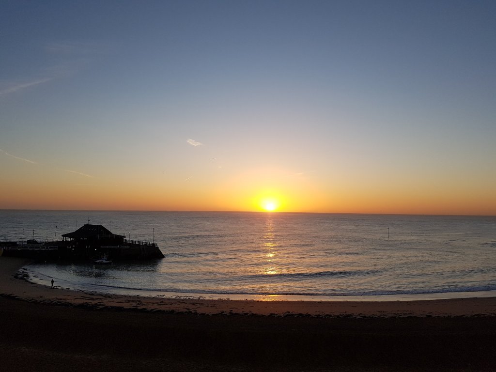
sunrise over Viking Bay, Broadstairs
I have since then been to all of the seaside towns, either by train or when out walking the coastline, as well as to many of the more inland places. They are all awash with centuries of history, and many of these villages, towns and the City of Canterbury, are mentioned in the 1086 Domesday Book. It is just phenomenal and I am constantly in thrall to the many layers uncovered during my research.
Faversham, along with Broadstairs, Canterbury, Sandwich and Dover are my favourite places to go….castles, Saints, Normans, Vikings, abbeys, a cathedral, ancient churches, historic houses, medieval houses, famous people and royal visits and tales of smugglers – who could resist!!
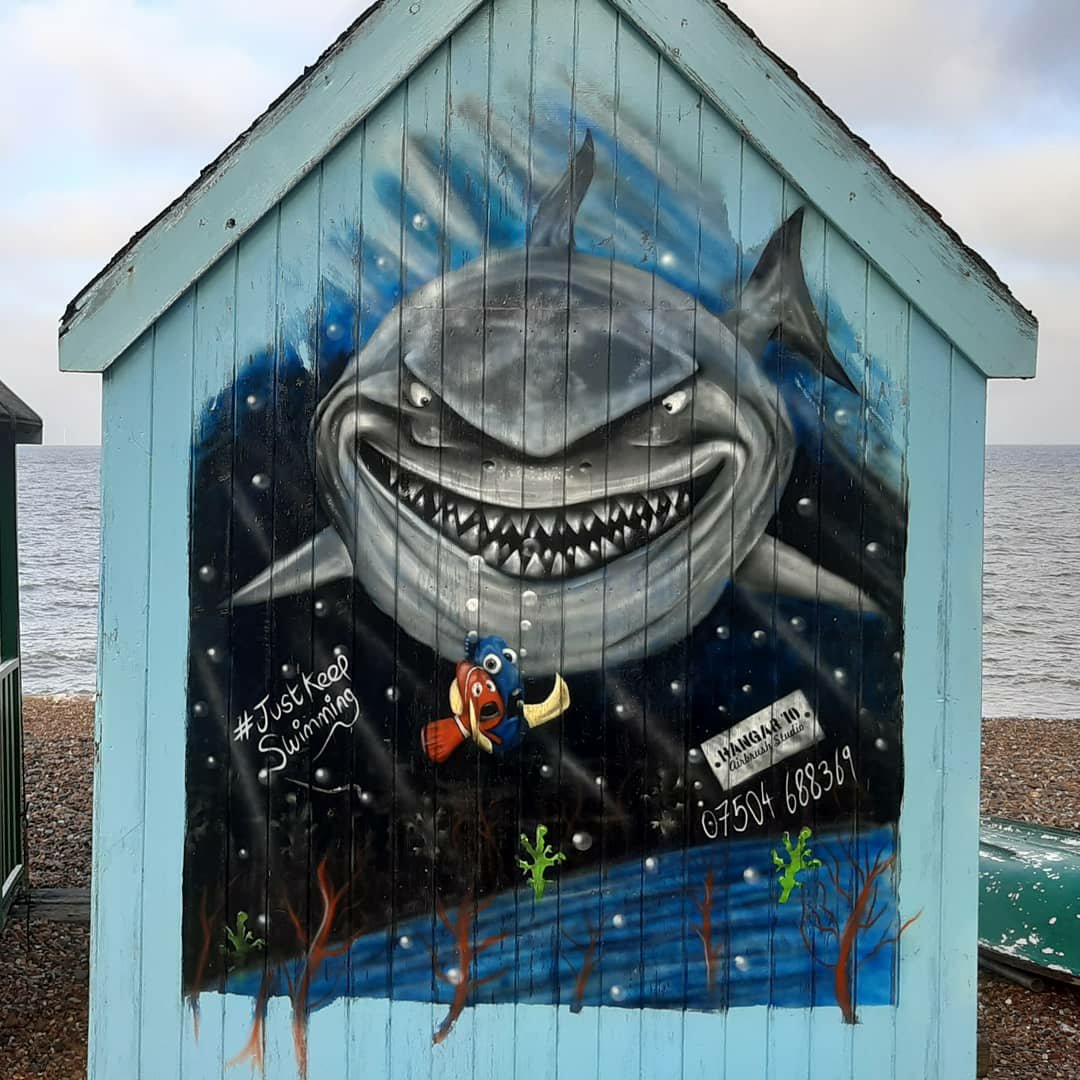
a network of smugglers tunnels wind their way below ground in Broadstairs
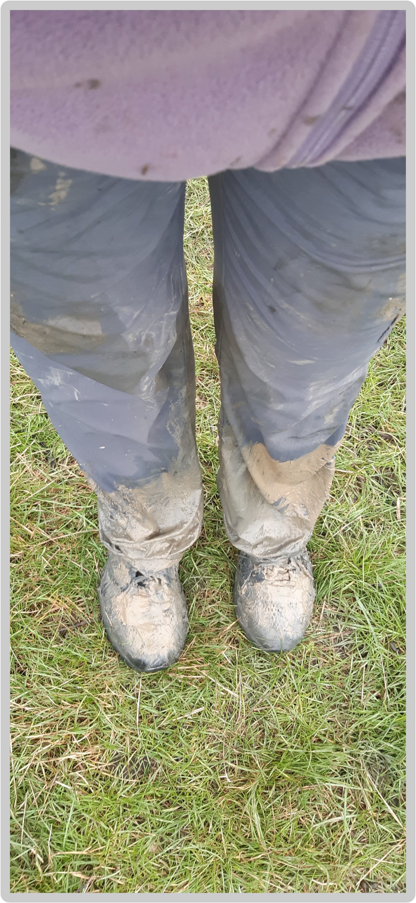
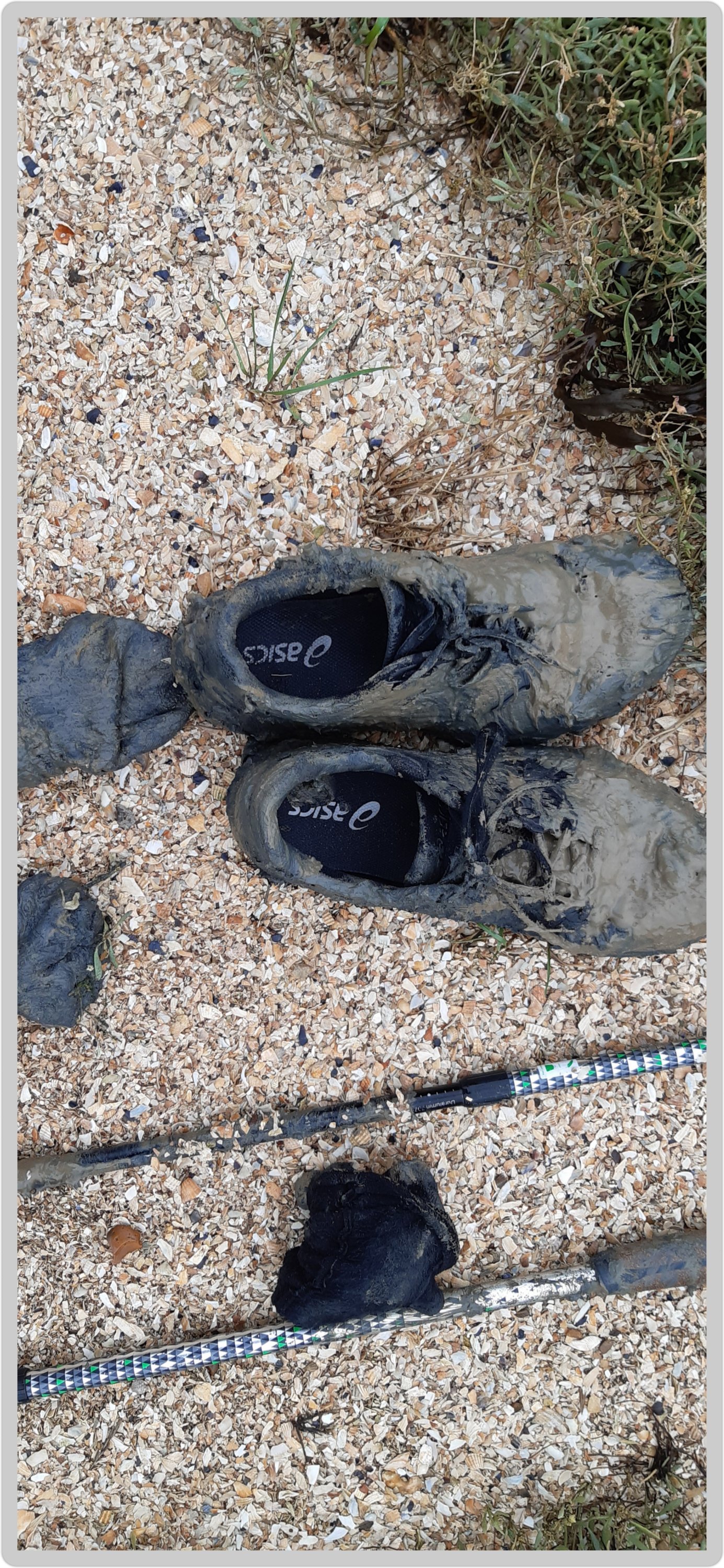
I first met Faversham on my Chaucer’s Canterbury Tales walk in 2017 (as mentioned in a previous blog), and although the memories are of blistered feet and muddy shoes, I still have fond feelings for the place 🤣🤣
The result of my foolish escapade!!
So since I mentioned it briefly yesterday, I thought I should expand on that and tell you more about this ever so fabulous and famous town, a town that missed out on being a city thanks to a small detail….it doesn’t have a cathedral (or a castle for that matter). Oh the semantics…
Faversham; Old English origin, meaning “the metal-worker’s village” lies next to the Swale, a strip of sea separating mainland Kent from the Isle of Sheppey in the Thames Estuary. There has been a settlement at Faversham since pre-Roman times, next to the ancient sea port on Faversham Creek, and was inhabited by the Saxons.
One of Henry VIII’s boats perchance??
Fefresham was held in royal demesne in 811, and is further cited in a charter granted by Coenwulf, the King of Mercia. Coenwulf described the town as ‘the King’s little town of Fefresham’, while it was recorded in the Domesday Book as Favreshant.
Mentioned as Favreshant in the 1086 Domesday Book, Faversham was noted as : King’s land, with 2 salthouses, a mill and a market; a market town and small port.
Faversham was used as a summer residence by the Kings and Queens of Kent, and has many other royal connections; Stephen (1092 or 1096 – 25 October 1154), often referred to as Stephen of Blois, was King of England from 22 December 1135 to his death in 1154 and was buried in Faversham Abbey. However, during the Dissolution of the Monasteries in 1538, most of the abbey was demolished, and the remains of Stephen were rumoured to have been thrown into Faversham Creek along with his consort and son who were buried with him. Subsequent excavations revealed empty tombs when they were opened.
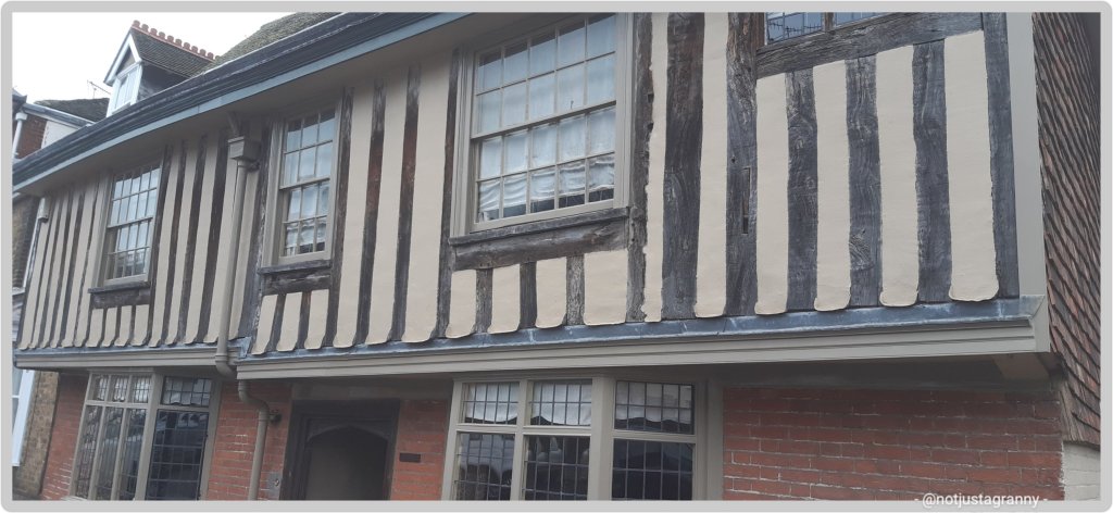
Abbey Street was constructed around 1201 in order to provide an appropriate approach to the abbey from the town, and still houses timber framed buildings; described as “the finest medieval street in southeast England”.
Medieval buildings in Abbey Street
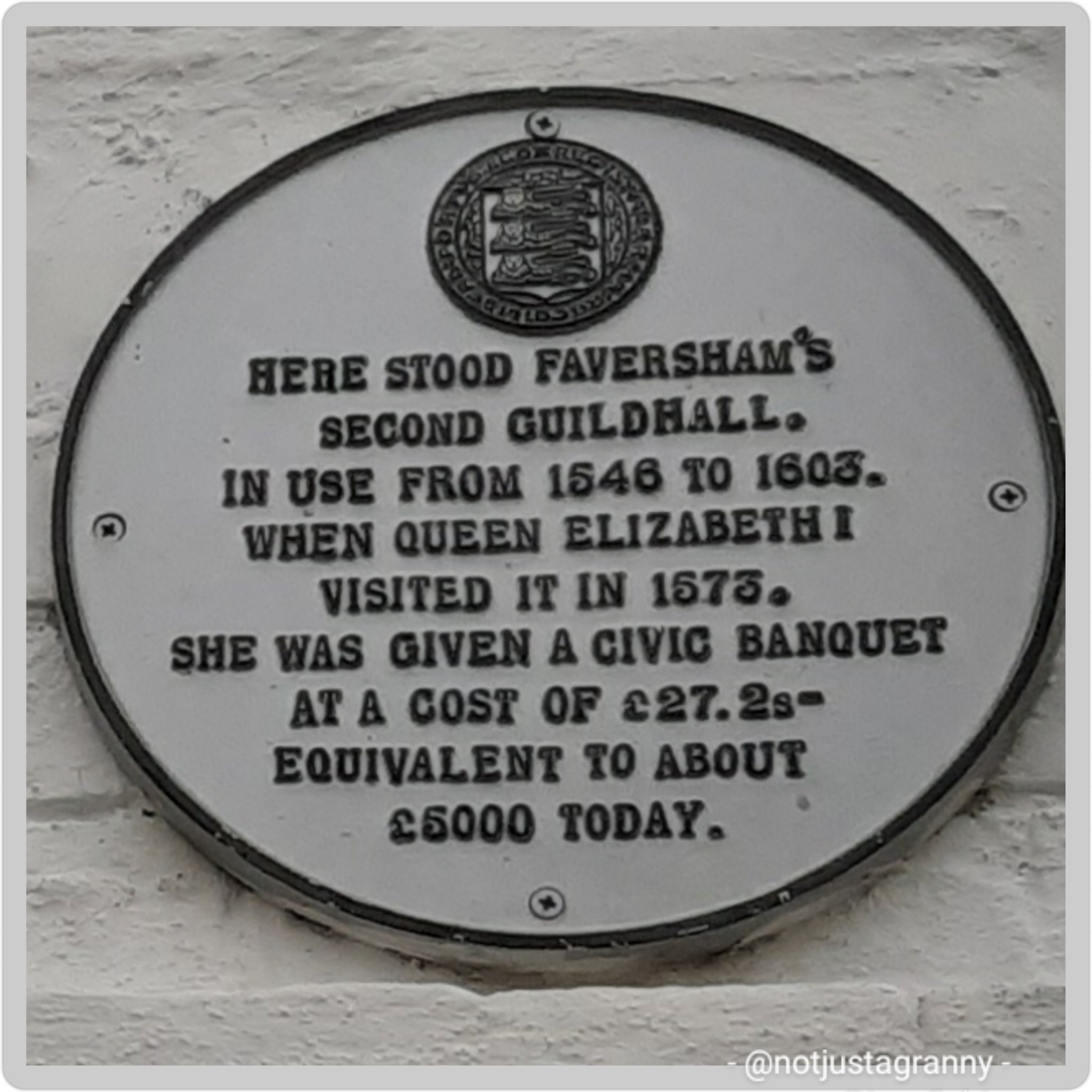
A royal visit by Queen Elizabeth I in 1573
Location of the Guildhall during Elizabeth I’s reignCurrent Guildhall – built as a market hall in 1574 by the people of the town and nearby parishes, converted into the Guildhall in 1605
Faversham was established as a link arm to the Confederation of Cinque Ports as the (Limb of Dover).
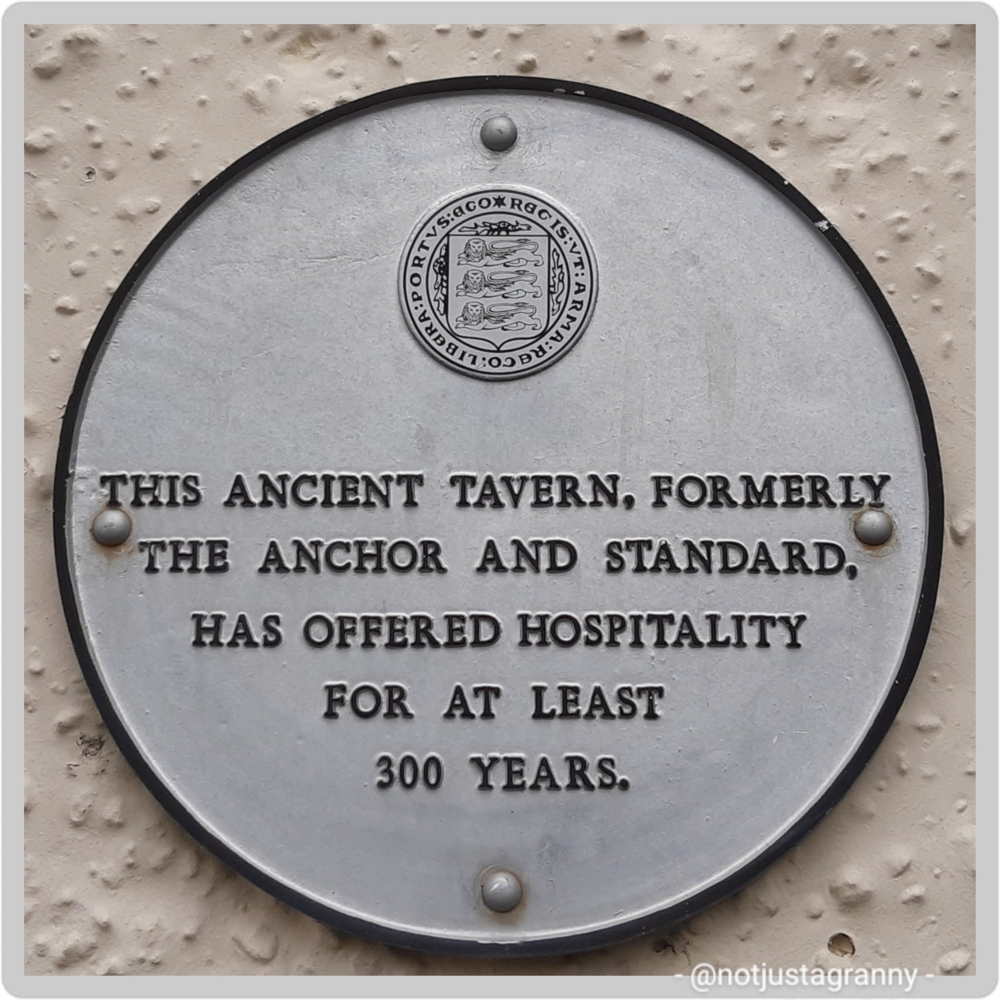
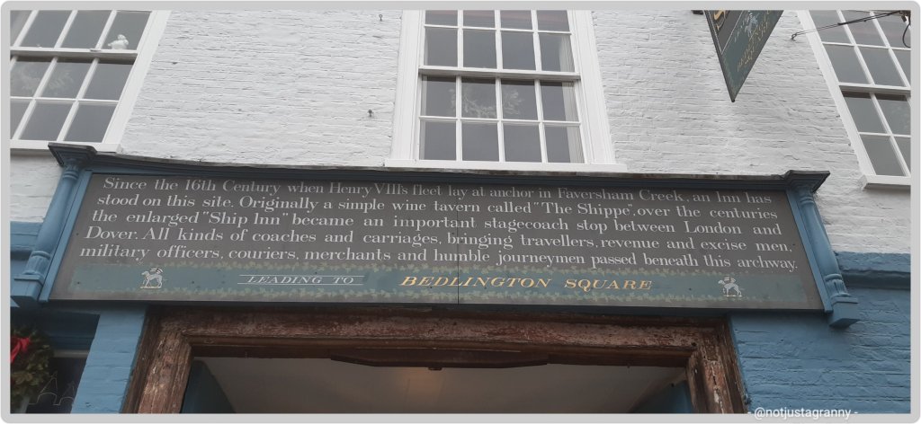
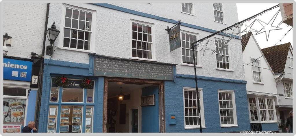
The Shippe Inn
Other famous people linked to Faversham (besides me, that is 🤣🤣🤣😉)
Richard Arden, a 16th century mayor, was murdered by his wife and her lover. Nice 🤪🤪🤪
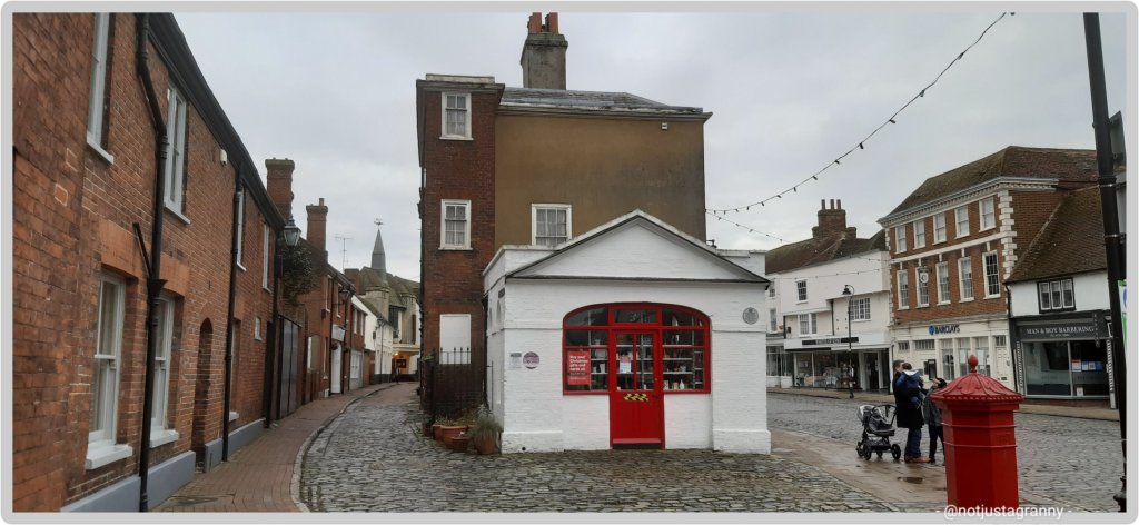
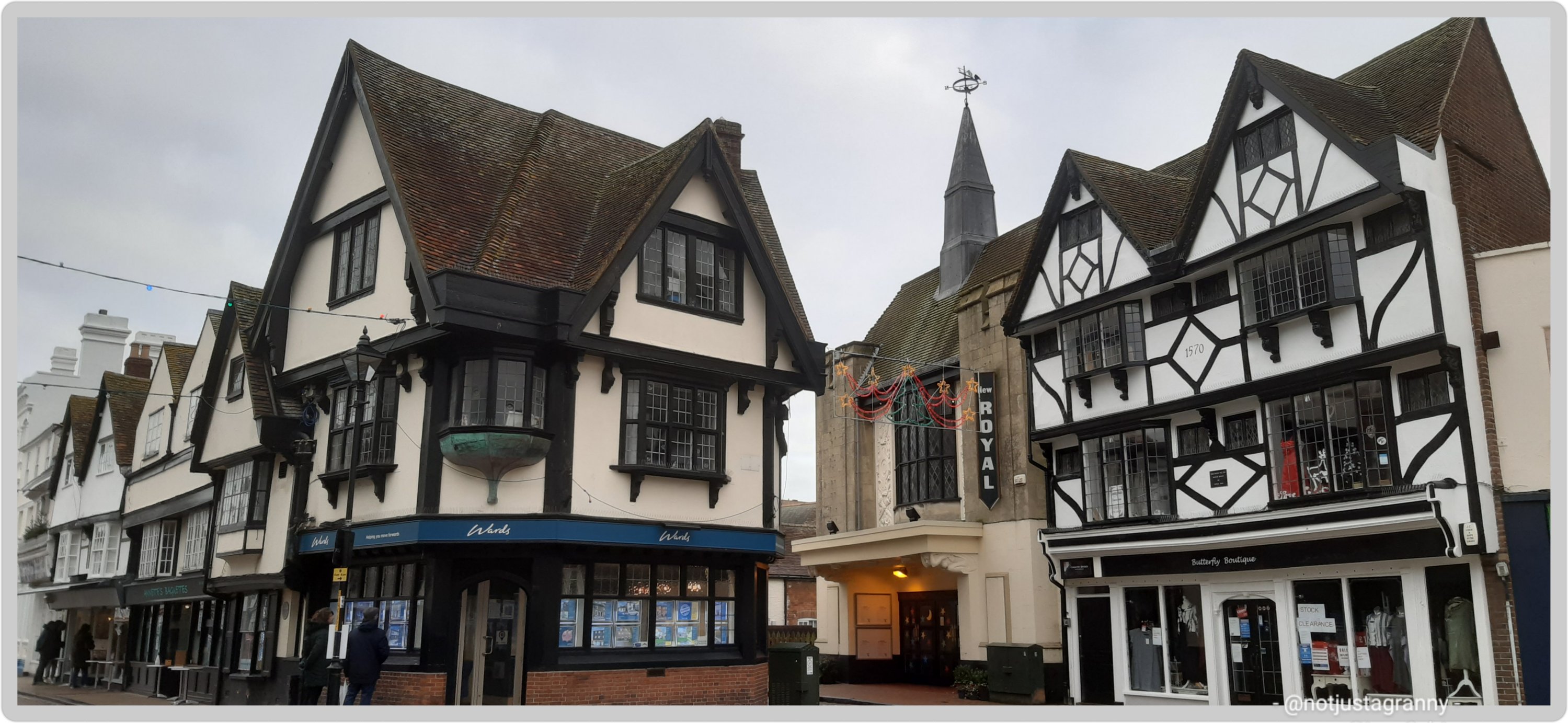
There are some fantastic buildings surrounding the market place
So many beautiful old buildings
Faversham also lies on the old Saxon Shore Way route between Gravesend on the river Thames near City of London and Hastings on England’s south east coast and known for the ‘Battle of Hastings’ which is when William the Conqueror defeated King Harald in 1066. William the Conqueror is responsible for the ‘Great Survey’ of England; the Domesday Book completed in 1086.
The Saxon Shore Way, a long-distance footpath of 163 miles in England, starts at Gravesend and traces the coast of SE-England as it was in Roman times, as far as Hastings in East Sussex. There are a couple of places where the route runs inland; around what was the Isle of Thanet – once separate from mainland England by the River Wantsum, and again on the south coast past Folkestone.
That’s us, the island on the right 😃😃
Some 5,000 years ago Thanet was separated from mainland Britain by 600 metres of sea – The Wantsum Channel, it is now connected again since the river/channel silted up some time ago.
When the English Channel was formed by the sea breaking through, an island of chalk was left on the east side of the county – now known as the Isle of Thanet.
The Wantsum Channel today
The SSW follows the creek inland from The Swale and into Faversham and then back out again from the opposite bank and once again follows The Swale and into the Thames river at Gravesend. Since I’ve already walked so many sections of the SSW on my various walks, it makes sense for me to actually do the whole route…one day LOL I mean it’s not like I don’t have about 100 other walks to do and I have LOADS of time on my hands ….as if 🤣🤣🤣
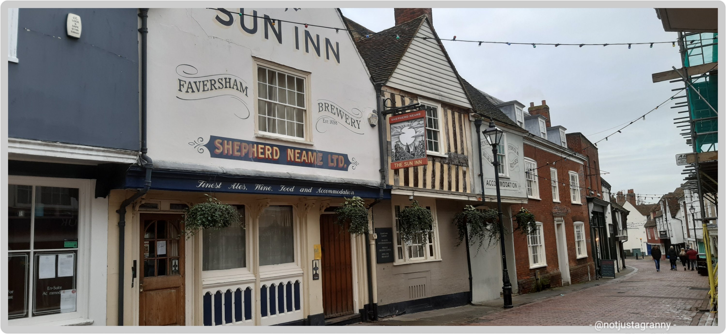
Faversham is located on the main road between the City of London and Dover and therefore became an important stop over for travellers between the Port of London and the Port of Dover. As a result of this inns were of paramount importance and today you can see and stay at one at least one such…The Sun Inn. Seriously one of my favourite ‘places I stayed’ on my many walks. It had everything I needed after arriving drenched and in pain. A massive double bed, a huge bath and fluffy white towels. Perfect.
The Sun Inn, Faversham – best room and bath everThe Sun Inn, Faversham – Day 3 Rochester to Faversham
Faversham truly is awash with history and I could write up so much more, but this is already quite a long post, so for now I’ll just add one more photo
historic buildings of Faversham
Okay, make it two photos LOL – the architecture is so varied that if you’re a fan of architecture you could spend the whole day walking around and still find more to see
architecture in Faversham
I’m sure to visit Faversham again when I start the next section of my insane intention of walking the entire English Coast and of course the Saxon Shore Way….now that my interest has been well and truly piqued. I’ll tell you more about it then…meanwhile…
Thanks for dropping by and taking the time to read about my adventures, I really do appreciate your time and support. Have a fab day/afternoon/evening wherever you may be in the world. 🌍🌎🌏
In case you’re interested: more about my Canterbury Tales Walk from Southwark Cathedral to Canterbury Cathedral (p.s. please don’t feel obliged to read any of them, it’s just in case you’re interested).
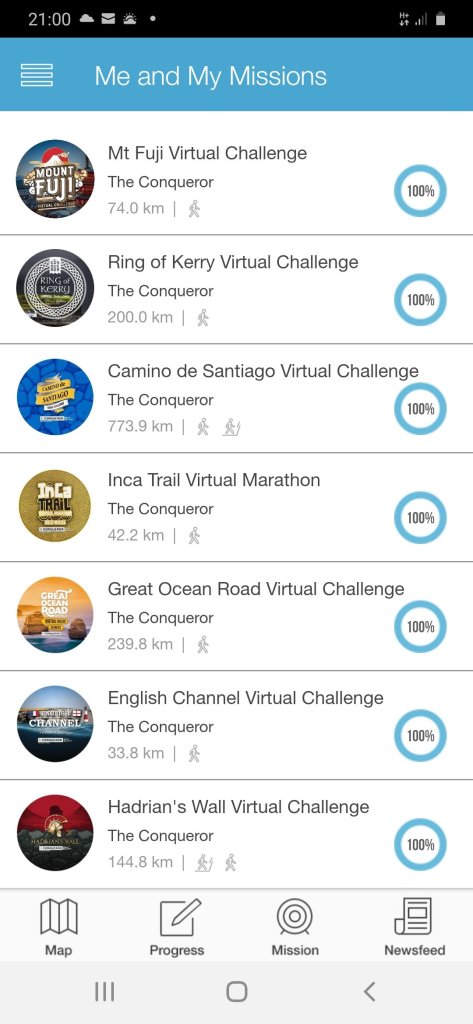
Really excited to receive my first postcard from my Alps to Ocean virtual challenge today.
Stage 1
I started the challenge on 30 December 2020 – I so enjoy reading the information that comes with the postcards; learning about places I never knew existed until I started these challenges.
I was 20kms ahead when I arrived at my current assignment on Monday but if course with limited time and 2 days a write off, I’m going to be hard put to keep up to speed 😉🚶🏻♀️🚶🏻♀️🚶🏻♀️ I’m going to try get up to date with the blogging and postcards as well….so here goes.
Alps to Ocean, New Zealand
Imagine crisp alpine air, snow-capped peaks, glaciers, milky lakes and starlit nights. The training ground for Sir Edmund Hillary’s climbing skills in preparation for Everest. The legendary story of Aoraki and his three brothers. These are just some of the highlights of Mount Cook.
At 12,217ft (3,724m) tall Mount Cook is located on the South Island and the tallest mountain in New Zealand. It sits within the Mount Cook National Park which runs 37mi (60km) in a southwest-northeast direction. Home to more than 400 flora and fauna the national park is part of the Te Wāhipounamu South Westland World Heritage Site. The park is also home to 35 species of birds, including the only alpine parrot called Kea.
When I was looking into Mount Cook, I was wondering about the 98ft (30m) height discrepancy between different written sources. Further investigations revealed that in 1991 an avalanche of 350 million cubic feet (10Mm³) of snow and rock followed by twenty years of erosion had shrunk the mountain’s elevation by 98ft (30m).
Of the twelve largest glaciers in New Zealand, eight of them are within the park with Tasman Glacier being the longest at 15mi (24km). The glacier terminates in the Tasman Lake which up until the 1990s never existed. The lake was formed due rapid glacial melting whilst the glacier itself continues to recede annually by as much as 2,697ft (822m). It is anticipated that within a few decades the glacier will be completely gone and the lake fully formed.
The lake’s primary outflow is the alpine braided Tasman River which flows south for 16mi (25km) through the Tasman Valley and into Lake Pukaki. The glacier, lake and river were named after Dutch explorer Abel Tasman, who in 1642 was the first European to sight the northwest coast of NZ’s South Island.
My journey begins at the base of Mount Cook, northwest of the river. Needing to cross the river to connect to Rotten Tommy trail, I took a short helicopter flight. The aerial view of this glacially-fed river and Mount Cook was a sight to behold. From Rotten Tommy, I took a southward bound route alongside the Tasman River. Although part of the route was quite rough and I had to cross several creeks, eventually the track changed to gravel road and made it easier to navigate towards my first overnight stop. Being a clear and sunny day, I had the treat of seeing Mount Cook in the distance rising above the lower snow-capped peaks in the National Park.
Before I go let me tell you about the Ngāi Tahu legend. The story goes that once the “Gods existed in the midst of a great sea of nothingness” and Raki, the Sky Father and Pokoharua-te-po, his wife had four sons, all living in the heavens. Raki left his wife to be with Papatuanuku, the Earth Mother, and together they created the world. Aoraki, the eldest son of Raki, along with his three brothers came from the heavens with a canoe in an attempt to persuade their father to return to their mother. Upon seeing him together with his new wife, the brothers knew Raki would never return. The brothers decided to go home but unfortunately their canoe wouldn’t rise and following strong winds and rising seas, the canoe overturned tipping the brothers into the water. Climbing atop the upturned canoe they waited for help. As time passed with no help coming, they eventually turned to stone. The canoe became the Southern Island and the brothers became the Southern Alps with Aoraki (Mount Cook) being the highest peak.
So far along this challenge I’ve walked from Ramsgate to Faversham over a few days and 3.5 days in Throwley. I wonder where else my journey will take me!!
Following on from my recent walk from Margate to Whitstable via Reculver, researching the Roman fort uncovered the information that Reculver too had been mentioned in the 1086 Domesday Book. 😃😃👏👏 Roculf: Archbishop of Canterbury. Church, mill, 5 salthouses, fishery.
By no means a huge number, and considering that 13,418 (settlements) : cities, towns, villages and hamlets are mentioned….150 is not that many, but it’s way more than most have visited.
It’s still astounding to discover that many English people who have grown up in the country, have no idea of its existence.
1086 is only one of the most significant dates in English history following on from the 1066 Battle of Hastings, and yet…..
My original intention was to visit 101, but it seems that my travels and my job will take me to many more than I anticipated.
I’ve wanted to walk to Reculver from Broadstairs ever since we first visited the place some years ago, but never seemed to find the time, it also did not seem doable. But now with my crazy decision to walk the entire English coast over the next 5 years, it became doable ….😁😁 and in comparison to the distances I’ve since covered on my various walks, it was easy peasy
When I set off from Margate last week I could see the ruins of the church farrrrr away in the mists of time and remember thinking ” oh gosh, it’s so far, will I be able to do it ?” But it was easier than expected, and voila
St. Mary’s Church, Reculver
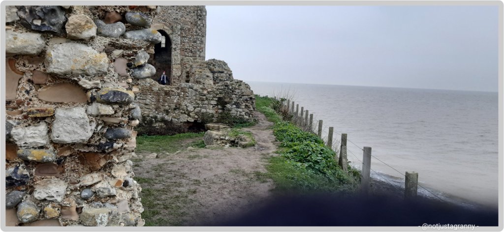
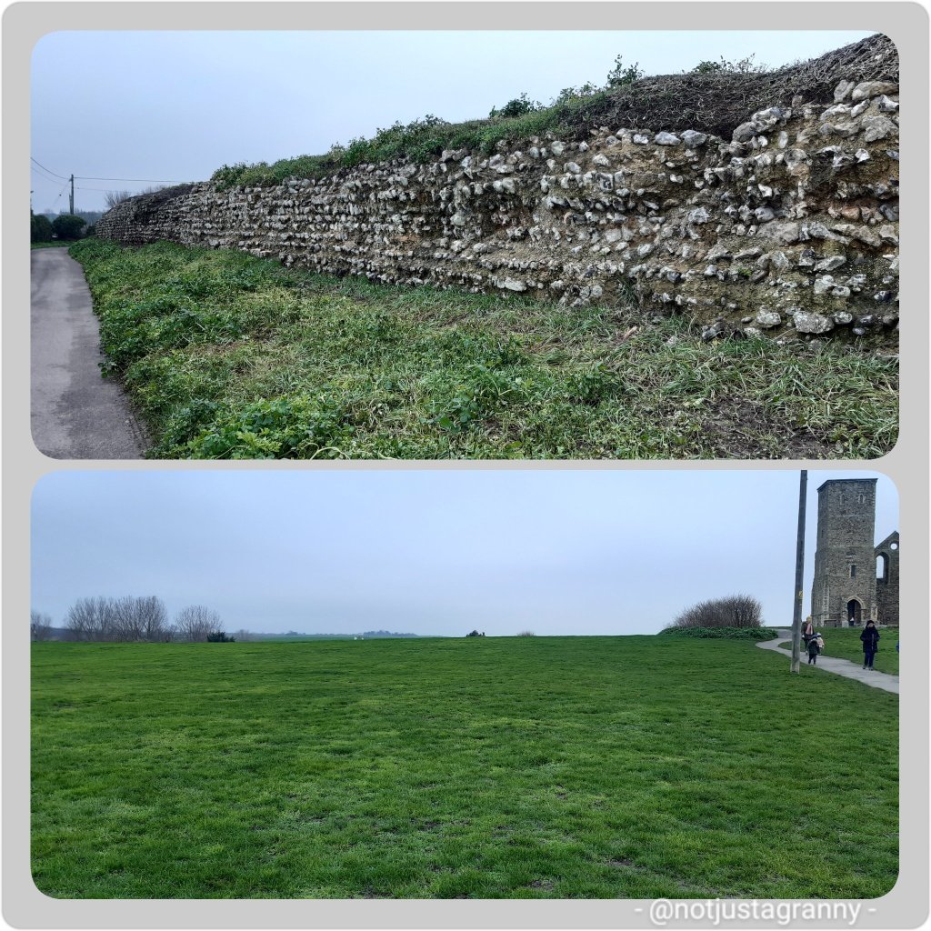
St Mary’s Church, Reculver, was founded in the 7th century as either a minster or a monastery on the site of a Roman fort at Reculver, which was then at the north-eastern extremity of Kent in south-eastern England. In 669, the site of the fort was given for this purpose by King Ecgberht of Kent to a priest named Bassa, beginning a connection with Kentish kings that led to King Eadberht II of Kent being buried there in the 760s, and the church becoming very wealthy by the beginning of the 9th century. Ref wikipedia
Will this too be eaten by the ever encroaching seaA Roman fort, now long gone The remains of the Roman wall, and where the fort once stood
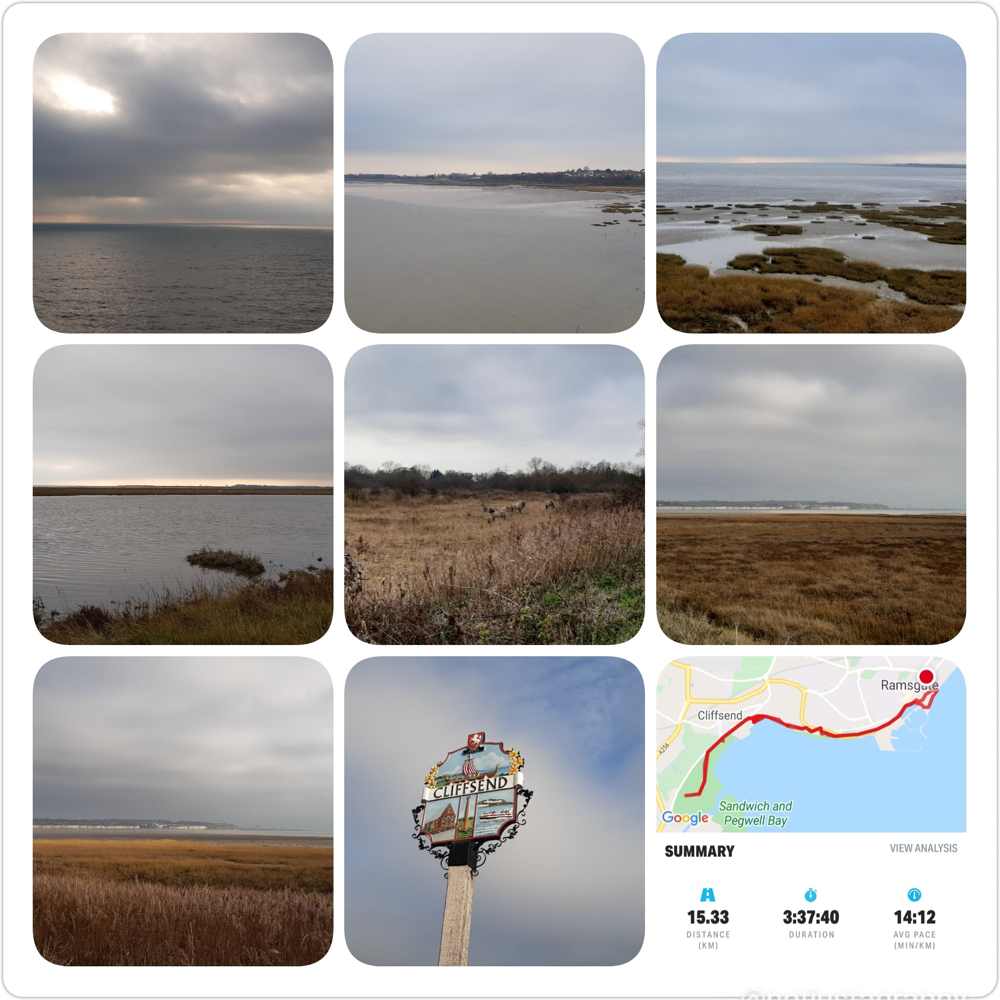
It’s a fascinating place and I’m certainly going to follow up on more of the history and I feel another visit is warranted. I noticed on my way to Reculver that there is a walk along the River Wantsum; which once cut off the Isle of Thanet from the mainland.
The River Wantsum
I 🔮 another walk in the future 😉😄😄 except it will not be in winter!! And I’m not walking across any mudflats….more of that later 🤪🤪
Well, would you just look at that!! Just over 24 hours to go (UK time) and we say goodbye to 2020. I can hardly believe it.
Not that the new year, 2021 is going to start off very well at all with now 8 in 10 people in the UK going into tier 4 and virtual lockdown. Although 2020 didn’t do too well at all, 2021 is not going to get off to a very good start.
To say I’m peeved at our useless government would be an understatement because tomorrow brings the double whammy of the final twist of the Brexit knife and the ongoing Covid-19 pandemic to really give this year a bad name. And do I believe our feckless PM when he spouts out his nonsense about having got a good deal?? No. I do not.
Meanwhile I, like millions of others, am trying desperately to keep my head and not fall into the pit of despair at the way life seems to be spiralling out of control. To that end I’m not watching the news nor reading the papers and still off Facebook. I am however spending quality time with my family and walking….walking and walking. I’m also grateful to still have work.
Although I only started in April, having the Conqueror virtual challenges has been a bit of a life saver really because keeping up with my targets gets me out, and the walking, which I love, keeps me sane.
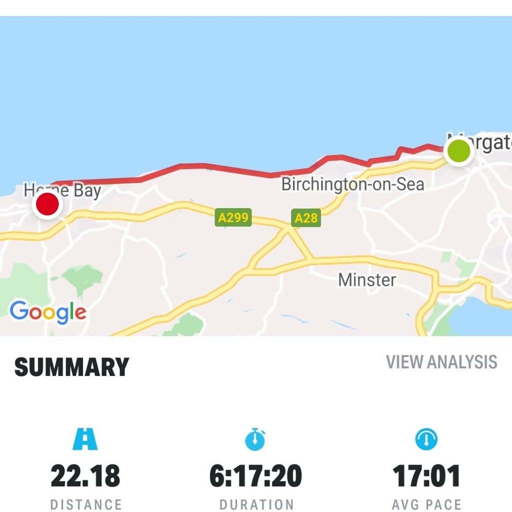
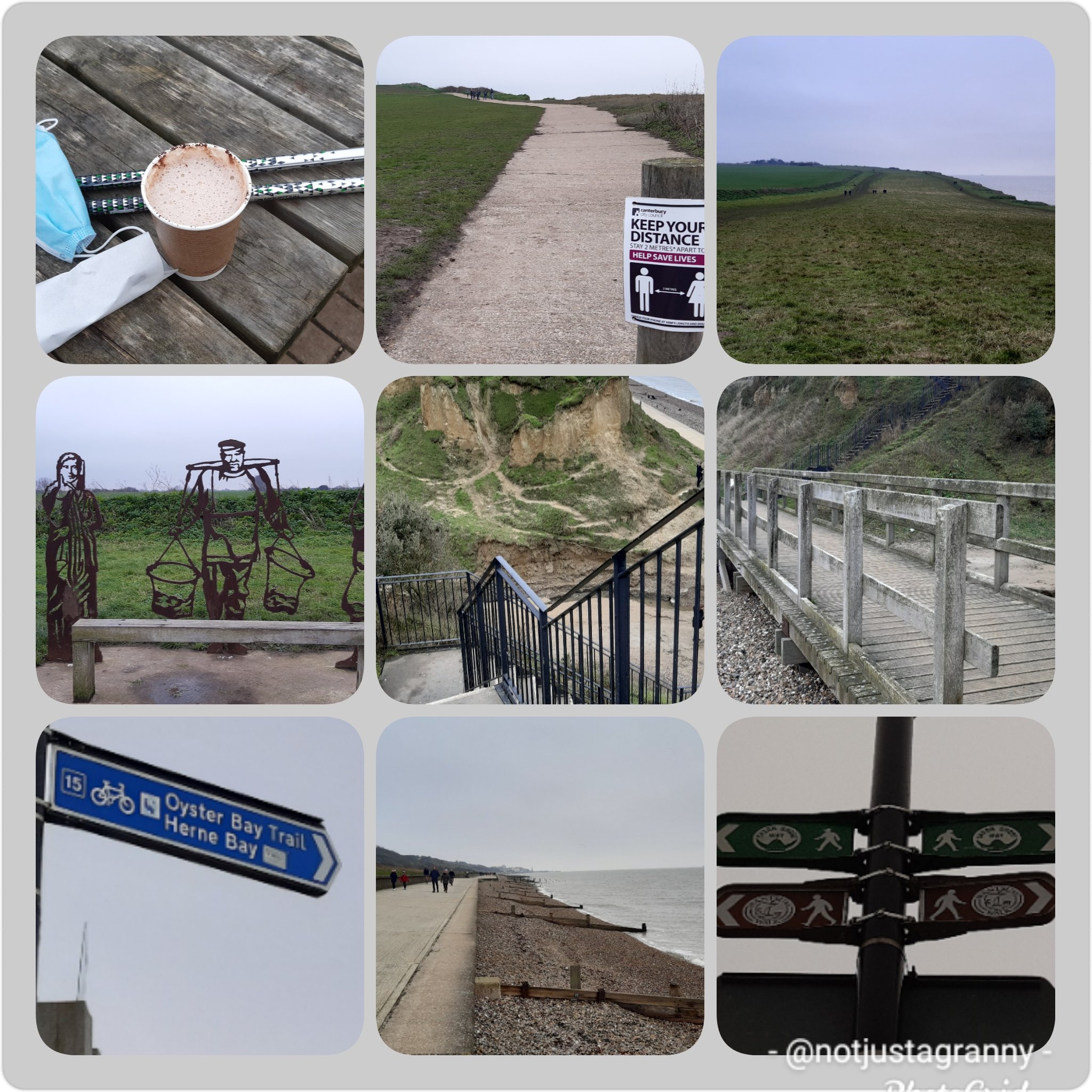
I’m nearly at the end of the 2020 challenge and yesterday I completed the Mt. Fuji challenge after a fantastic walk from Margate to Herne Bay 22.18 kms. Although it was bloody freezing, I thoroughly enjoyed the walk and was not only surprised at how quickly I walked the distance, but also at how easy it was.
I’ve long wanted to walk from Broadstairs to Reculver after visiting the Roman site a few years ago, so it was absolutely thrilling to finally make the journey, albeit only from Margate. Except for one very short section, there is a promenade/footpath and the sea the whole way. The final section to Herne Bay was a breeze…literally and figuratively. I nearly froze 😂😂😂 it was so darn cold – at one stage I was sucking my thumb just to get some warmth back into it.
Fortunately the cafeteria at Reculver was open so I stopped for 15 minutes to rest my feet and warm up with a hot chocolate and a yummy caramel fudge brownie…delicious.
Herne Bay is a fascinating place with so much history, not all of it good. But they do have some fantastic fish and chips shops….😁😁 I have to give a shout out to Gary of EKS Office Equipment in Herne Bay for not only agreeing to charge my phone (for free) but also allowed me to sit in a corner of the showroom to eat my chips while I waited. It was very much appreciated.
Although I thoroughly enjoyed the walk, despite the cold, the saddest sight was the vast amount of plastic pollution that quite literally lined the whole 22kms….I could have filled 50 black bags and still not cleared it all. Its terribly painful to see all that pollution.
So as the year comes to an end, I have one final day of walking to do to finish my 2020 km challenge. Its been a most satisfying pastime and I must thank my daughter for introducing me to the Conqueror Virtual Challenges….thanks to that I have improved my fitness levels, walked extensively in areas I would likely have not except for wanting to meet the challenge of the challenges 😉 and I’ve inadvertently accumulated way more medals than I had planned. Its been a fairly expensive hobby, but so much fun.
I’ve started on the Alps to Ocean, NZ challenge and hopefully tomorrow I’ll complete another decent distance as my final walk for 2020.
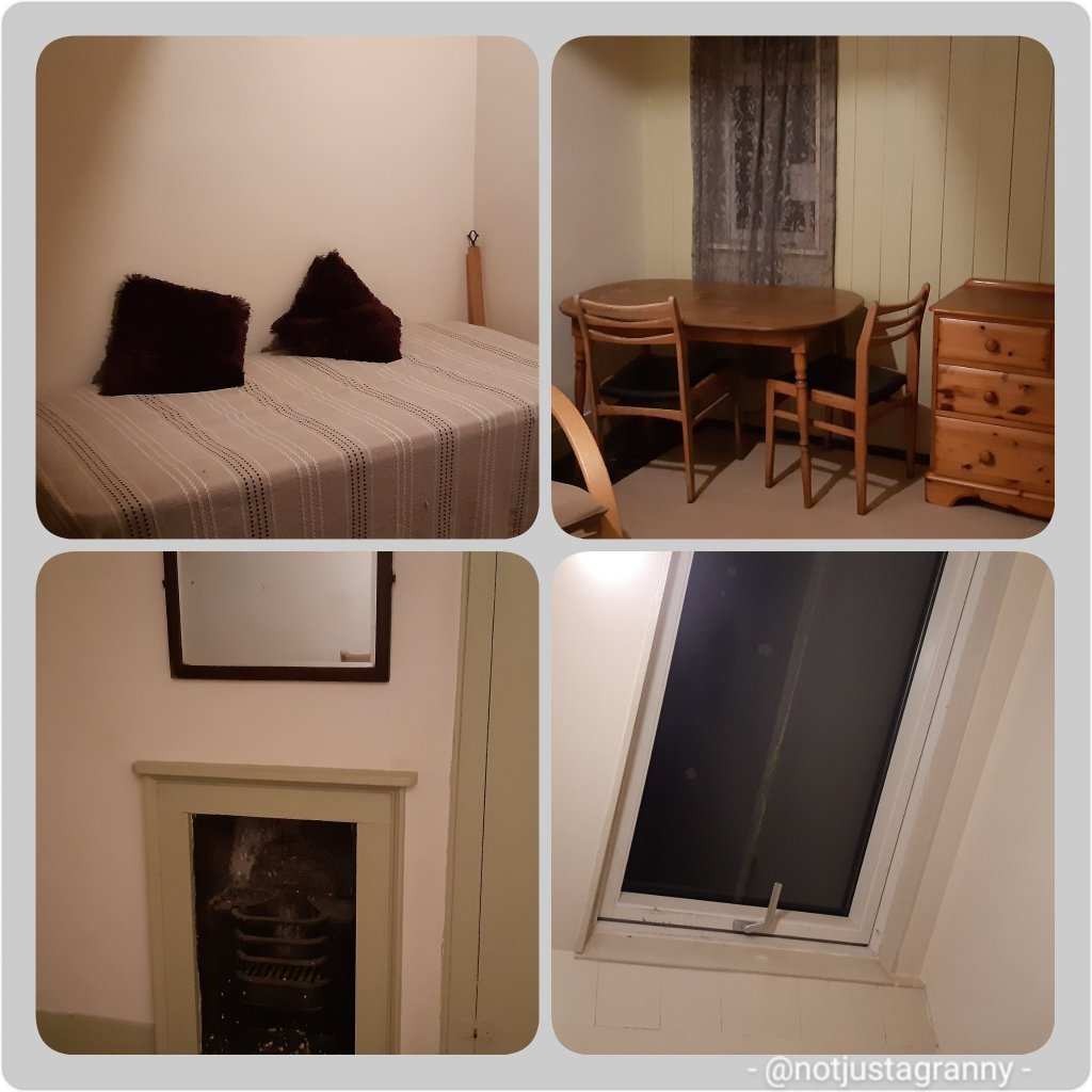
Other than that, I have finally found a suitable place to rent. Went to look at a room last night….and as Goldilocks said “it’s just right ” and I’m saying “It’ll do Pooh” 😃😃 It’s not a huge room, but it’s on the top floor, its spacious, it has cupboards, and a bed, and a skylight for summer nights, and a desk for my books and computer and MOST importantly, the landlord said Jamie can visit. So HOORAH!!! after 18months I’ll have a place to go ‘home’ to. I’m feeling quite emotional. It means I can get my clothes out of storage, and my books and Jamie’s toys and my amazing South African mattress. I can brighten it up with my own bed linen and pictures and bits and bobs.
Today we had a photoshoot done. The fab photographer of @createdwithlightphotography on Instagram did the shoot for me with my gorgeous grandson. We had lots of fun and then had hot chocolate to warm up, because of course it was freezing on the beach. ☃️☃️☃️☃️
Me and my boobee 🥰🥰
Tomorrow, weather depending I’ll walk from Ramsgate to Margate one last time before I tackle the next section of my own challenge….to walk the whole of the English coast within next 5 years.
Cheers folks, thanks for reading along with me. In case I don’t get to write a post tomorrow, although I probably will, I wish you all a VERY safe, healthy and wonderful New Year.
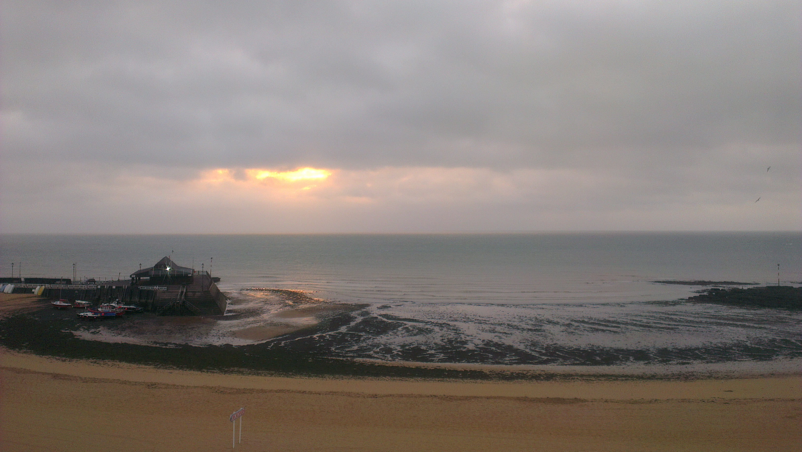
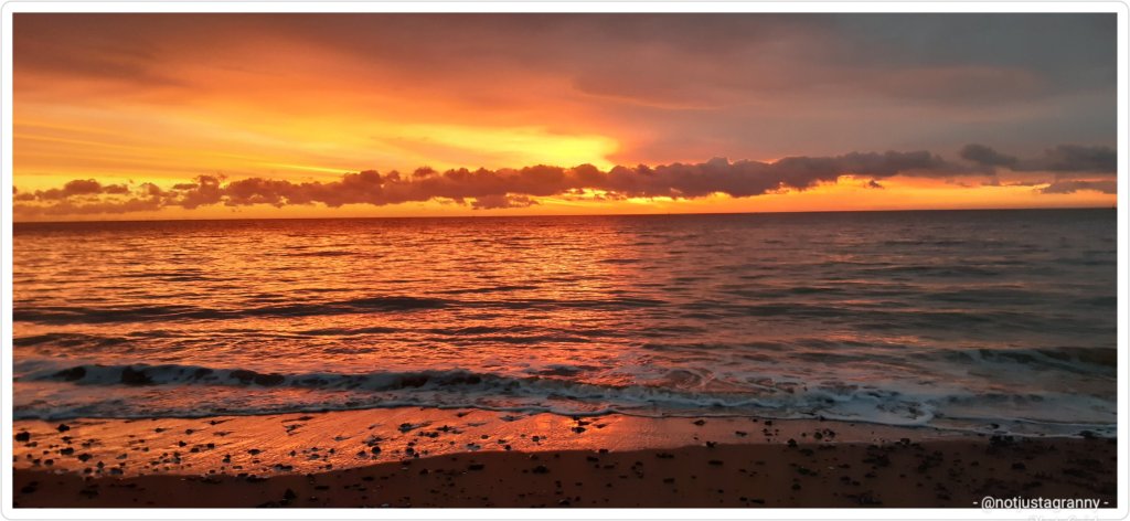
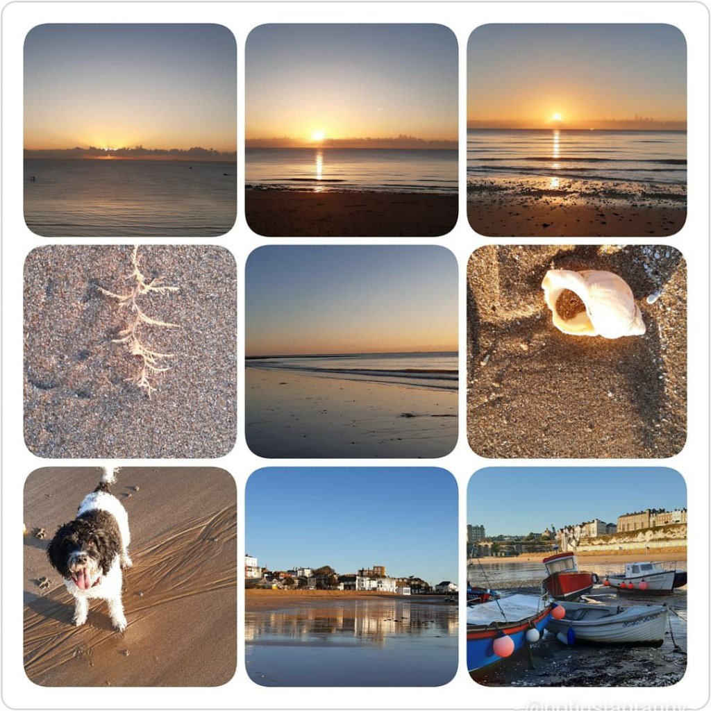
Got in a very respectable 15.9kms this morning. Starting off with a fantastic sunrise….red sky in the morning and all that
I headed up the coast to Stone Bay via Broadstairs where I stopped off at my favourite tearoom The Old Bakehouse for almond croissants (best ever) with a cup of coffee, which I enjoyed on the promenade, and fed the sparrows some toasted almond crumbs.
Almond croissant from The Old Bake House, Broadstairs Ever so cute…
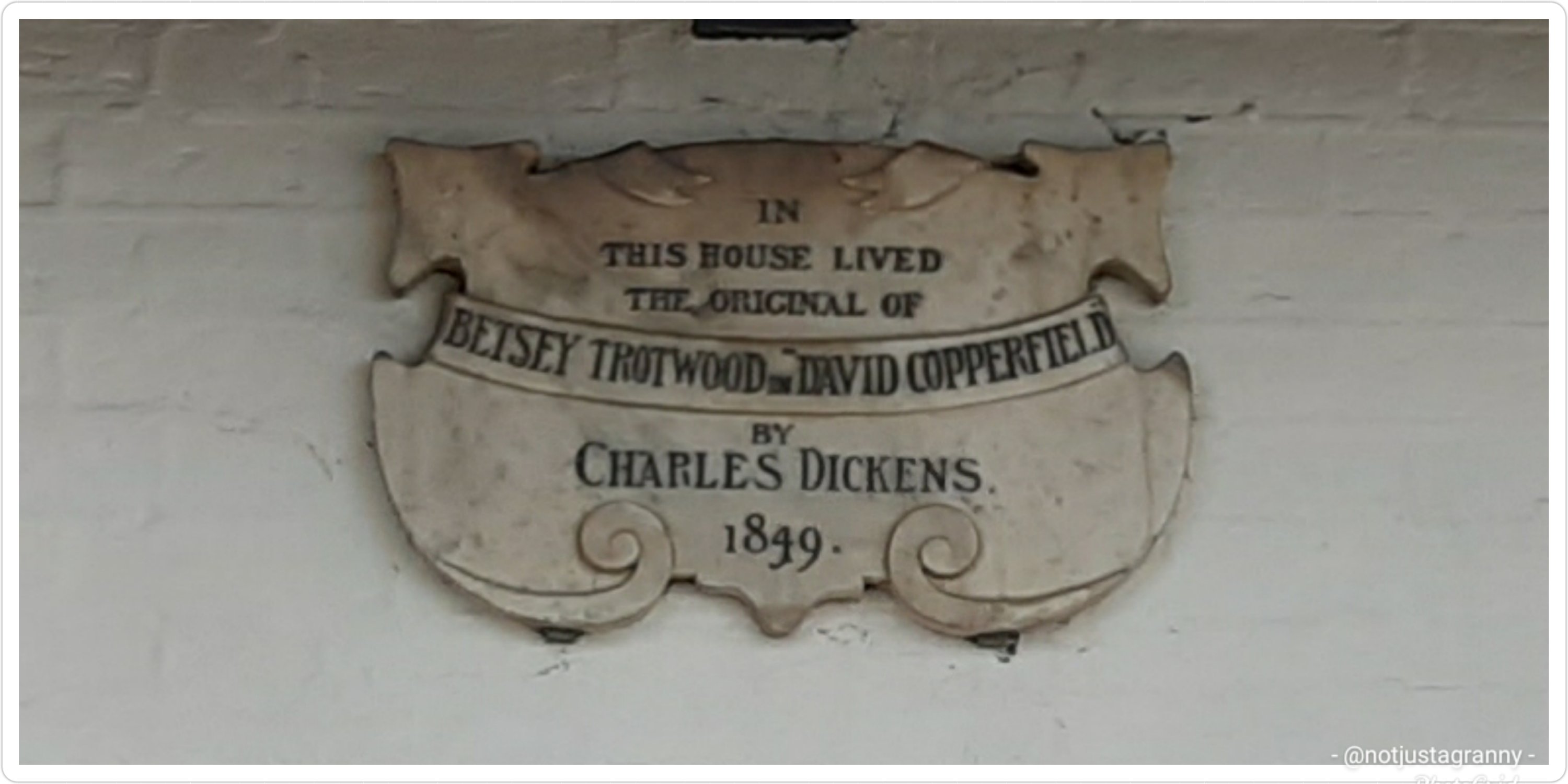
Enroute I strolled past the Dickens Museum – although he didn’t actually live here, it was the home of one of his characters in David Copperfield; Betsy Trotwood.
The Dickens Museum, Broadstairs
By the time I reached the end of Stone Bay the wind had come up and that promised storm blew in…with a vengeance.
Blowing up a storm I wondered why….
Before heading back to Ramsgate, I bought some bird seed and scattered it amongst the bushes for the wee sparrows.
The wind was so strong along the foreshore that my walking poles were blown backwards and I had to plow into the wind.
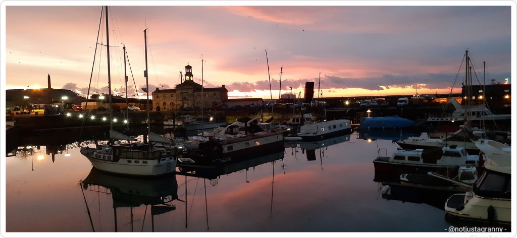
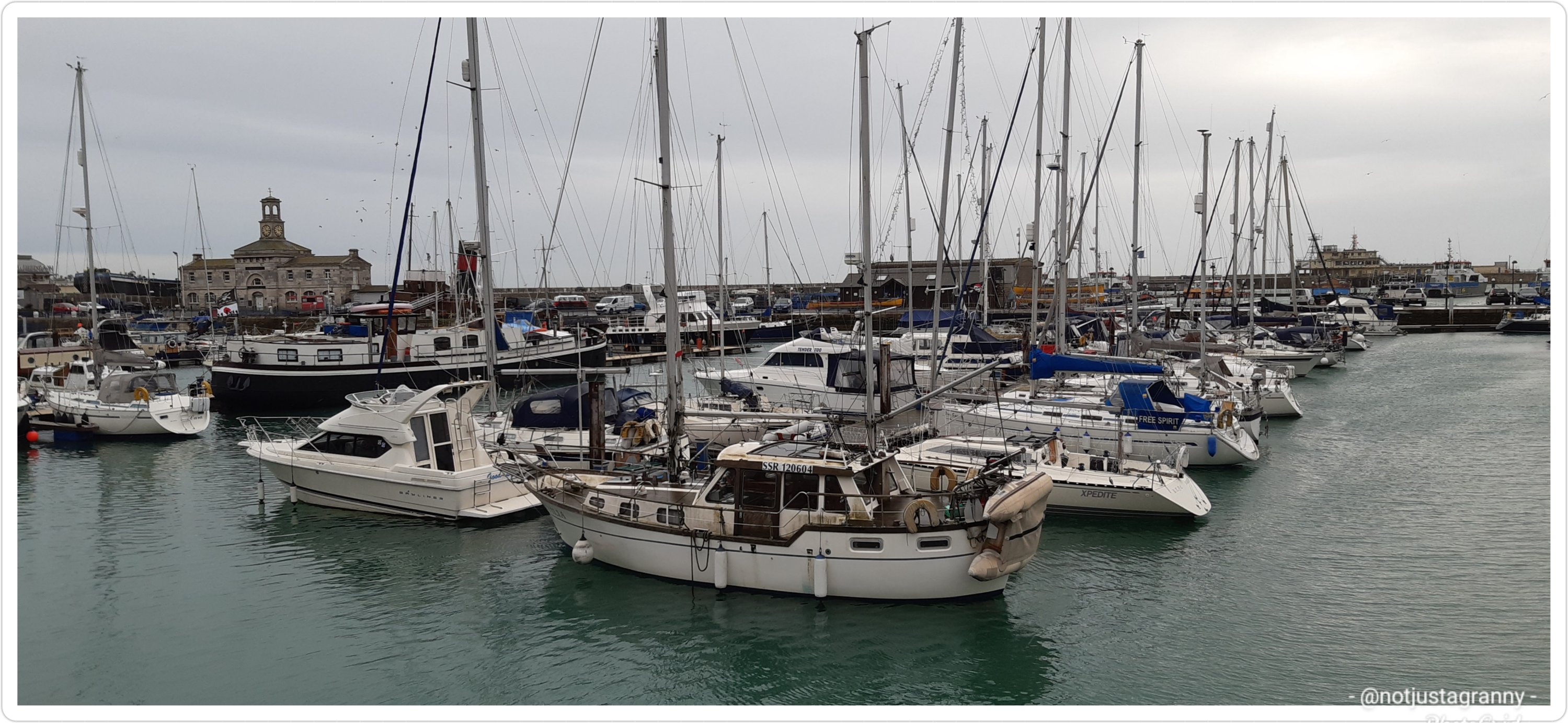
Despite the wind and cold and rain, I had a fantastic walk. The harbour looked very different when I got back from when I left just after 7am
7:20am11:14am
And tomorrow I’m back to work. I don’t feel as if I’ve had a proper break.
But I did have a most wonderful afternoon with my lovely family…Christmas tree decorating. I’ll write about that tomorrow..
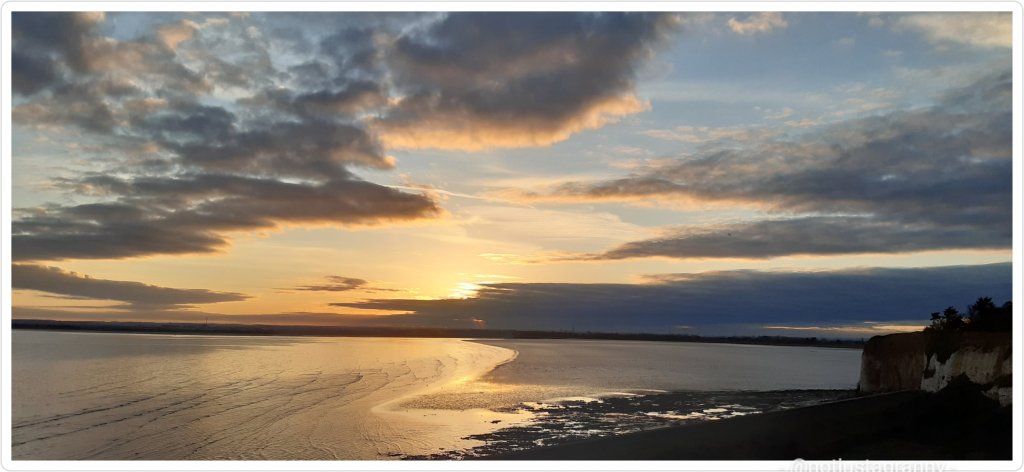
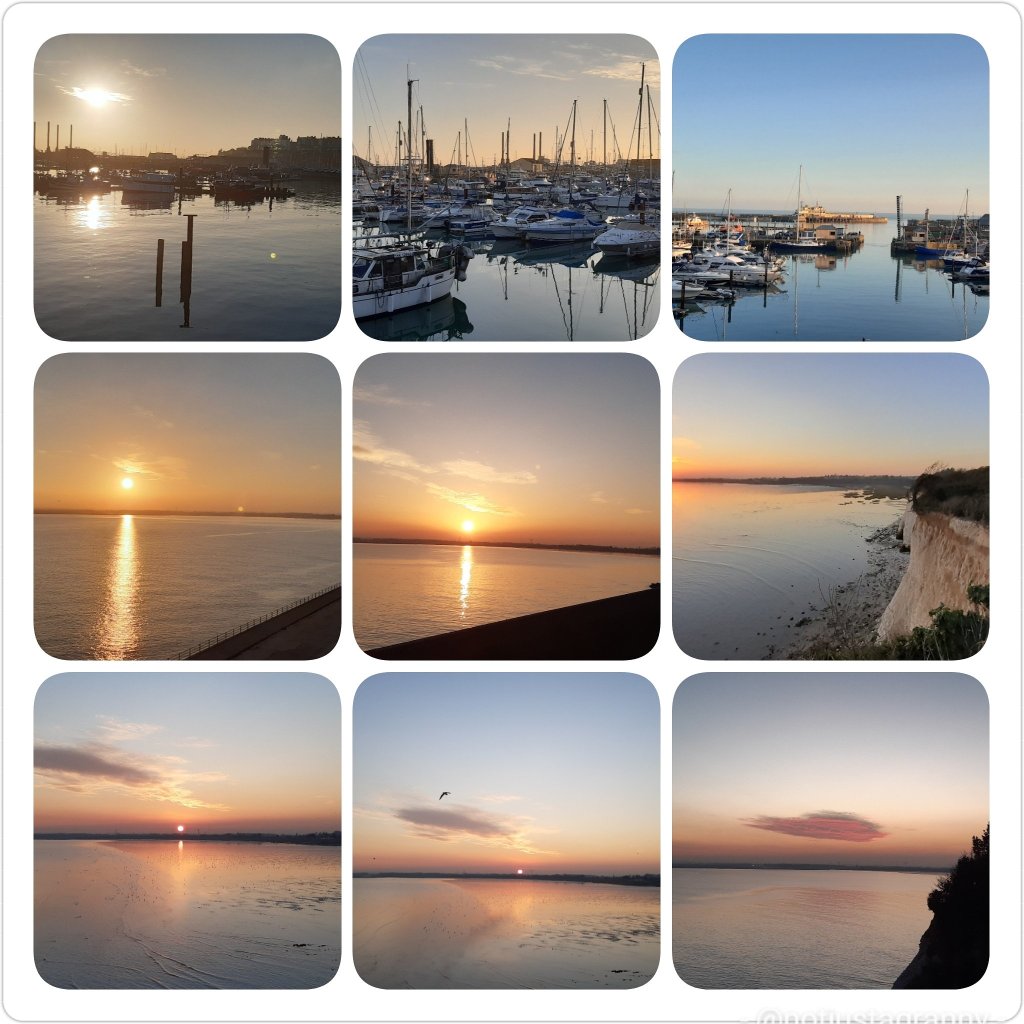
I really miss watching the sunrise on the coast. Sunrise is always lovely but when you’re living in a town or city, the view could be obstructed. I’m usually based in towns in the countryside and my routine doesn’t allow me to get out, so when I’m back at my base I try to get out every day.
I’m hoping there’s good weather on Sunday and I get a repeat of this ☺☺
I’ve had some amazing walks the last few years since moving to the east coast. The scenery along the Thanet coastline is really beautiful, especially at sunrise on a clear day, and then sunset. You can catch a gorgeous sunrise from Broadstairs or Ramsgate, and if it’s a good day, an equally gorgeous sunset from Pegwell Bay or Margate. I’ve been known to rush over to Margate to catch the sunset or a quick walk to the cliffs above Pegwell Bay.
Sunrise in Broadstairs Sunset over Pegwell Bay
I’ve always loved walking. As a young girl, in my 20s’ when I lived in Hillbrow Johannesburg, I used to spend the whole of Sundays just walking around the suburbs for hours on end. I used to walk to work every day, up the hill and down the other side….right up until I was 8 months pregnant, and then my boss wouldn’t allow me to walk anymore and insisted one of the staff take me home by car and collect me the next day.
I lost my walking after my daughter was born and my husband bought me a car. By then it wasn’t that safe to walk alone anyway and I got lazy.
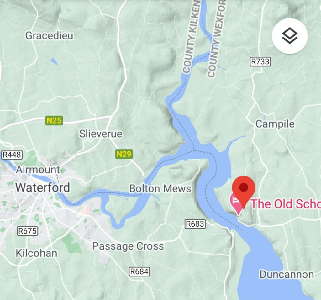
When I arrived in the UK, my love of walking was reignited. I lived in Dublin, Rep. Of Ireland for 6 months and my sister, brother-in-law and I used to walk everywhere, especially on weekends when we’d head out to Dún Laoghaire or Glendalough and the Wicklow mountains. In fact we travelled to so many places, I’ve quite forgotten all but the most memorable. I do remember though being able to walk home from Dublin to Monkstown late at night and never feel unsafe….and my love walking, freedom really, was reborn.
I remember one weekend when we walked across country from Waterford city to PassageEast in the County of Waterford, took the ferry across the River Barrow to Ballyhack Lower in County Wexford, then walked to Arthurstown and onto Duncannon…and in reverse the next day. One of the many fun excursions from my 6 months there.
A walk across country in Rep. Of Ireland
On most of my overseas trips since, I’ve invariably planned a 10 day stay and walked….everywhere, and included a day trip to another destination. When I visited Venice I literally walked around all the accessible islands and usually started at 8am and walked till late at night exploring every nook and cranny. Actually, after Ireland, Venice was my very first trip to Europe and albeit terrified, I loved every minute.
I’ve since walked 80%+ of the streets in the City of London….much of my free time was spent exploring every court, lane and street, and I walked a fair amount of the City of Westminster too. When we still lived in Richmond, I often walked along the Thames riverbank, either downstream to Kew Gardens or upstream to Kingston and even Hampton Court. Even in the snow 😉
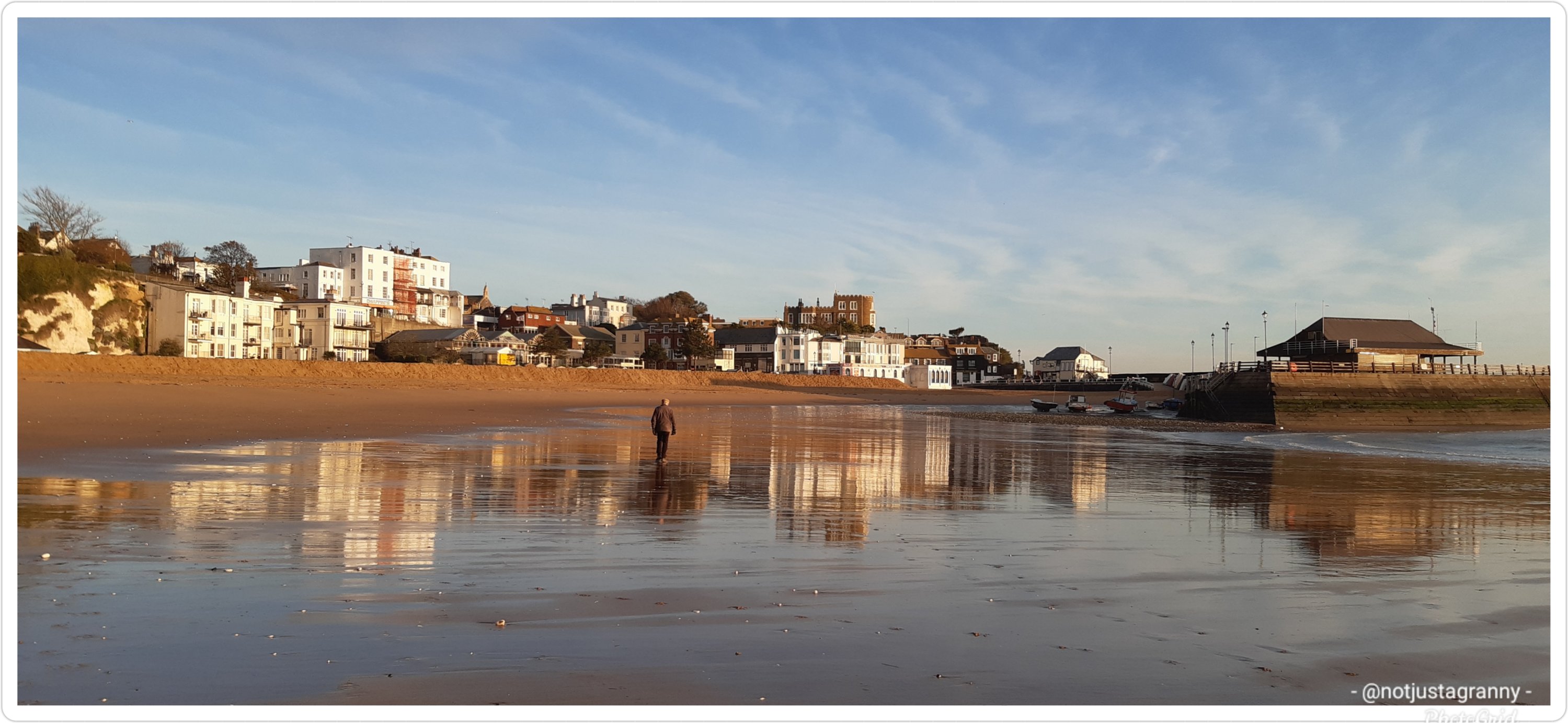
When we moved to Broadstairs we used to walk along the beach to Ramsgate. I always thought it was quite far, but its actually only just over 3kms. Now that I frequently walk in excess of 20kms and occasionally as much as 35kms, it seems absurd that I thought 3kms was far 😁😁
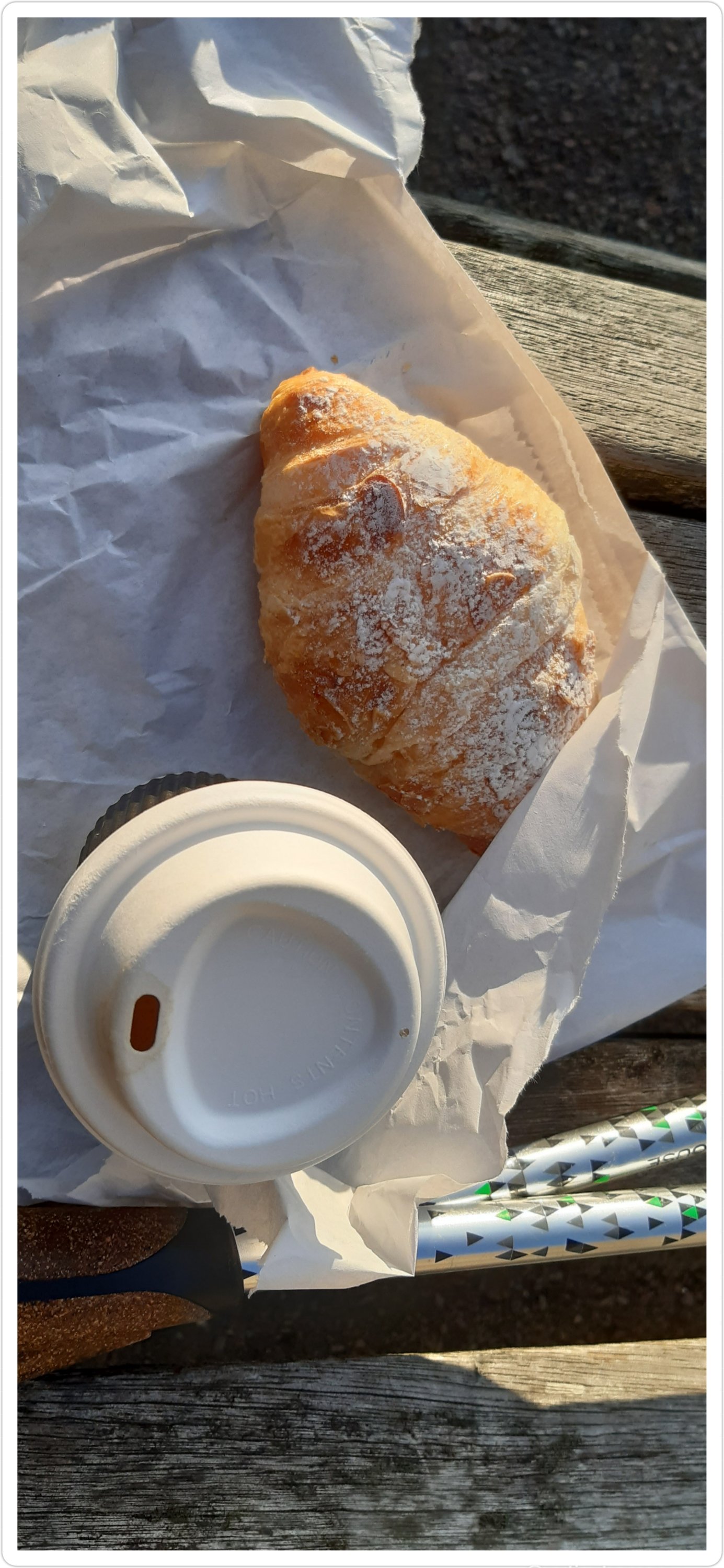
During my last stay, I walked along the beach from Ramsgate to Stone Bay and back, and one morning I enjoyed a sunrise walk to Viking Bay…of course I stopped off at The Old Bake House and bought a take-away coffee and my favourite pastry; an almond croissant then sat on a bench on the promenade to enjoy my treat.
Breakfast from The Old Bake House in Broadstairs
Its such a stunning section of the coast and offers much of interest to see. Stretch your legs and walk to Margate… fantastic route, especially along the beach.
No hardship walking in this environment
A few weeks ago I decided to walk to Sandwich (for the 3rd time) in order to increase my mileage for the Conqueror 2020 Challenge. Somewhere along the way I hatched the insane idea of walking the whole of the English coastline….I know…bring on the strait jacket. I blame it on the moon 🤭🤭🤭 I’ve walked as far as Dover so far. Of course Covid-19 has held back my horizons, but I’m hoping to get out more frequently in 2021.
Crossing the White Cliffs of Dover
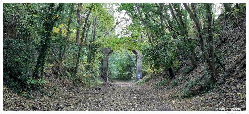
I love walking and one of the benefits of my job is that I get to travel all over England, often times to places I’d never heard of…and then I walk…
Old disused railway line in Lewes
But my walking got a real sense of seriousness when I started training for the Portuguese Camino in 2017, and started following the #walk1000miles challenge in 2016. That really got me going. I struggled at first to get into walking daily, bought my first pair of walking poles (still have them 😄), a decent pair of walking shoes (asics) and I’ve never looked back, now I find it difficult to not get out for a walk on a daily basis and get quite tetchy if my walking is interrupted ….😉
Oh my goddess I’ve found a new long distance walk to do!! 😃😃😃 I was doing some research on distances between towns for my ongoing quest to walk the whole England coast over the next 5 years (I blame it on the moon) and found the whole route for the Saxon Shore Way.
I’ve touched on the route during some of my previous excursions, but I didn’t realise just how long it was and how far it extended. Sigh..you just know I’m going to have to walk it 😂😂😂
The 160 mile / 257 km route starts in Gravesend on the banks of the River Thames in North Kent and ends in the colourful seaside town of Hastings in East Sussex. The route goes inland somewhere near Reculver and bypasses Margate, Broadstairs and Ramsgate and again from Folkestone to Rye/Camber but the rest of the route offers some of the finest coastal walking in England.
The reason the route bypasses Margate, Broadstairs and Ramsgate is due to the fact that they’re all on what was, and is still referred to as the Isle of Thanet, which used to be separated from the mainland by the Wantsum Channel up until 1550, by which time the river had silted up and was no longer navigable. And of course the Saxons were here from mid 5th century, so the route they created would have followed the then mainland coast.
According to wikipedia: The River Wantsum is a tributary of the River Stour, in Kent, England. Formerly, the River Wantsum and the River Stour together formed the Wantsum Channel, which separated the Isle of Thanet from the mainland of Kent. Now the River Wantsum is little more than a drainage ditch starting at Reculver, and ending where it joins the Stour.
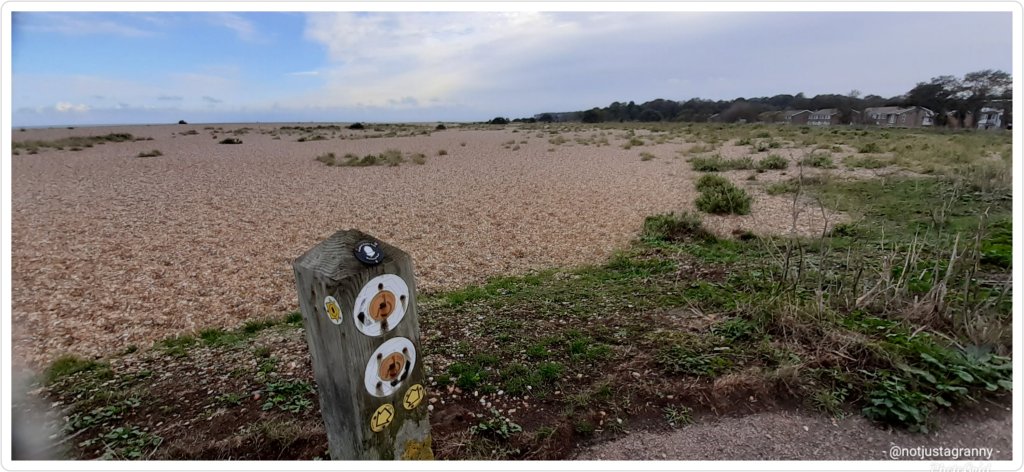
I’ve walked small sections of the Saxon Shore Way when I followed Chaucer’s Canterbury Tales route to Canterbury via Sittingbourne and Faversham, again when I followed St Augustine’s Way from Ramsgate to Canterbury and again more recently when I walked from Sandwich to Dover.
Saxon Shore Way, Sandwich
I’m gonna have to stop working so I can do all these walks 🚶🏻♀️🚶🏻♀️🚶🏻♀️🤭🤭
The header image is of Gravesend on the Thames from when I walked Chaucer’s Canterbury Tales from Southwark Cathedral to Canterbury Cathedral…my very first long-distance walks, along which I learned some really good lessons – like to never walk in wet socks 🤪🤪👣🧦👣🧦
274kms for November 😁😁😁 48 kms more than October. Getting closer to my target of 2020km, but the days are rapidly declining …with only 29 days left this year and 317.9kms to go….and as they frequently remind me…I have to up my game. 😉
#walk1000miles
But I have achieved my original goal of 1600kms/1000 miles. Hoorah 👏👏🚶🏻♀️
Places I’ve walked in November:
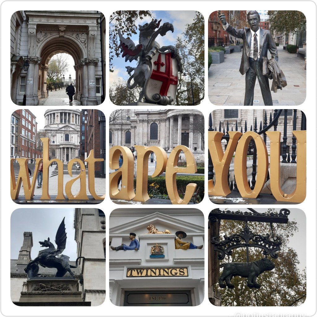
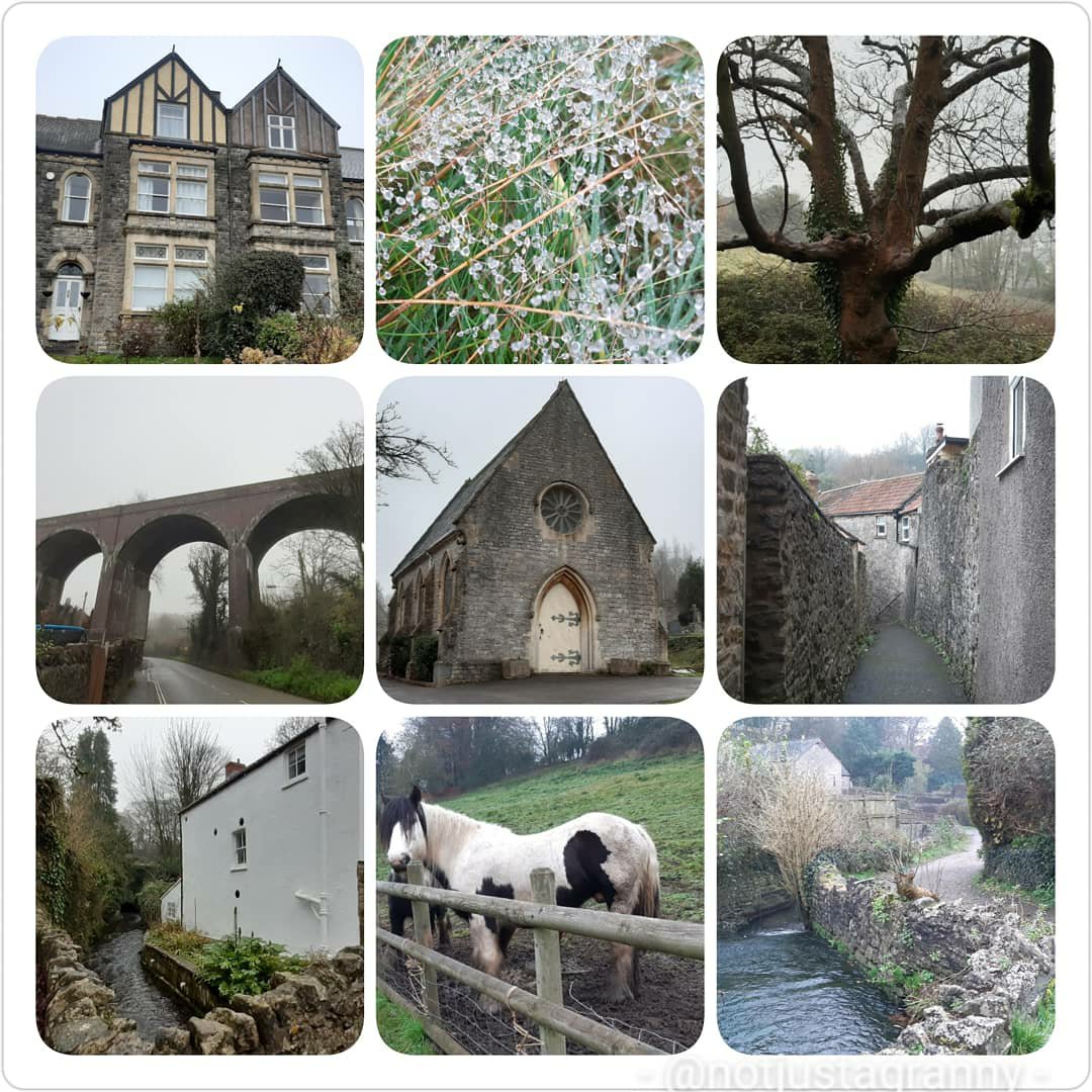
Sunrise walk Ramsgate to Broadstairs Lots of Ramsgate beach excursions Ramsgate to Pegwell Bay for sunset Ramsgate to Pegwell Bay / Sandwich Bay Nature Reserve Temple – LondonTemple – LondonShepton Mallet- Somerset Shepton Mallet- SomersetShepton Mallet- Somerset
As for December….my kms will have to be a final push of 317.9kms to reach my target….so, I’m guessing the week between Christmas and Old Year’s Eve when I’m off work, will see lots of sunrise walks and full day marching along the east coast of England 😂😂😂🚶🏻♀️🚶🏻♀️🚶🏻♀️🚶🏻♀️


You must be logged in to post a comment.