Feeds:
Posts
Comments

Archive for the ‘long distance walks – solo’ Category

When we first moved to the coast in 2016, travelling from London to Broadstairs on the train, past all the stations enroute, I remember being intrigued by the places behind the names, and excited about the possibility of exploring them all….and that was only those north of my destination. I subsequently discovered many more, south of Broadstairs.

sunrise over Viking Bay, Broadstairs

I have since then been to all of the seaside towns, either by train or when out walking the coastline, as well as to many of the more inland places. They are all awash with centuries of history, and many of these villages, towns and the City of Canterbury, are mentioned in the 1086 Domesday Book. It is just phenomenal and I am constantly in thrall to the many layers uncovered during my research.

Faversham, along with Broadstairs, Canterbury, Sandwich and Dover are my favourite places to go….castles, Saints, Normans, Vikings, abbeys, a cathedral, ancient churches, historic houses, medieval houses, famous people and royal visits and tales of smugglers – who could resist!!

chalk cliffs kent, the tartar frigate pub broadstairs, walks of england, coastal walks of england
a network of smugglers tunnels wind their way below ground in Broadstairs

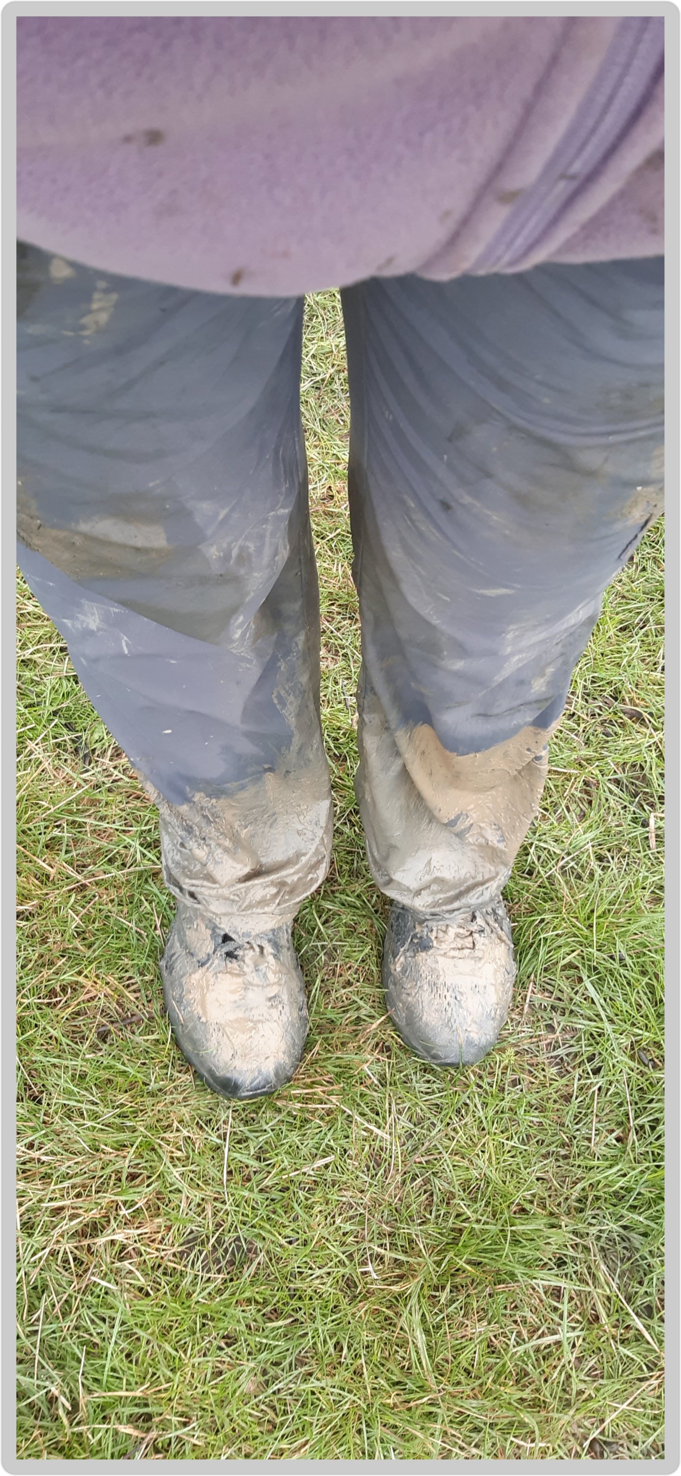
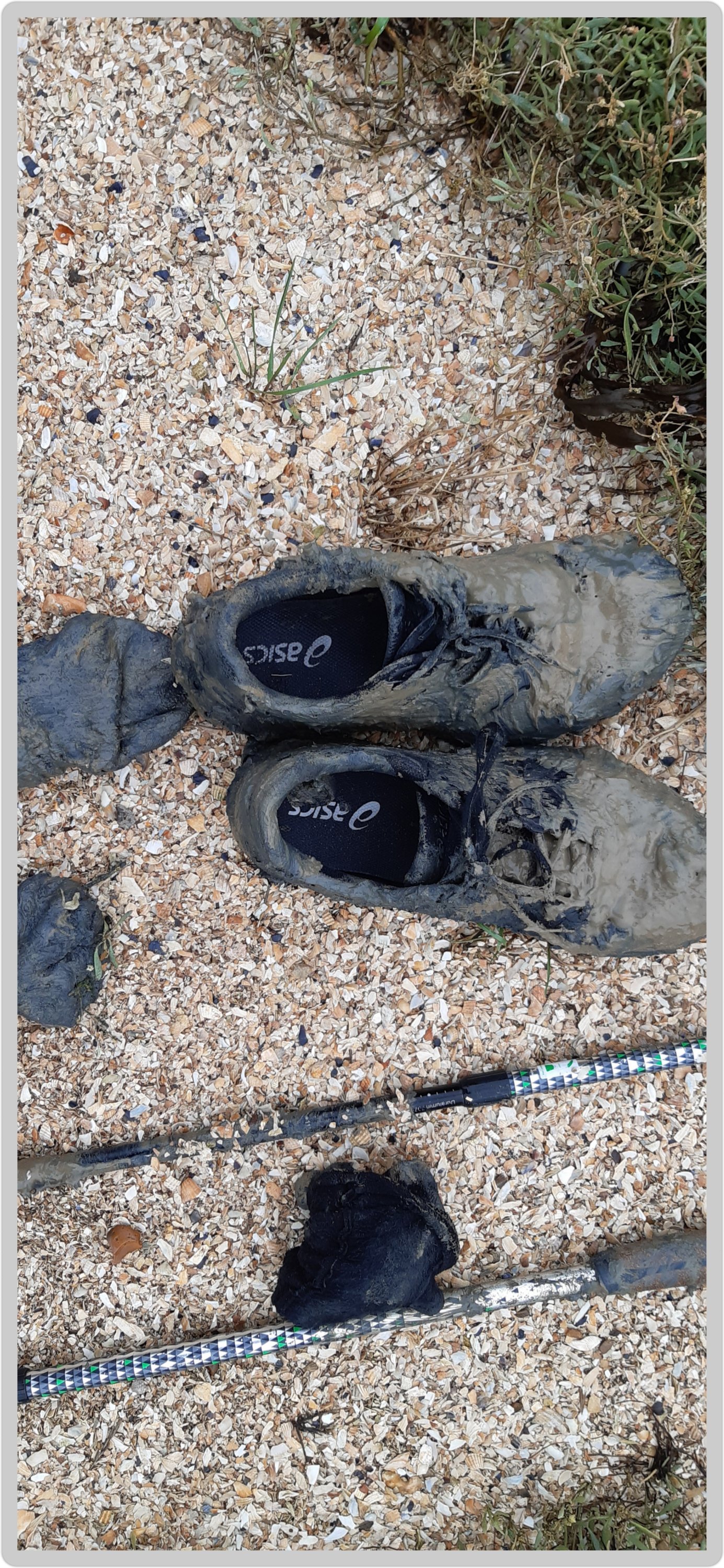
I first met Faversham on my Chaucer’s Canterbury Tales walk in 2017 (as mentioned in a previous blog), and although the memories are of blistered feet and muddy shoes, I still have fond feelings for the place 🤣🤣

So since I mentioned it briefly yesterday, I thought I should expand on that and tell you more about this ever so fabulous and famous town, a town that missed out on being a city thanks to a small detail….it doesn’t have a cathedral (or a castle for that matter). Oh the semantics…

Faversham; Old English origin, meaning “the metal-worker’s village” lies next to the Swale, a strip of sea separating mainland Kent from the Isle of Sheppey in the Thames Estuary. There has been a settlement at Faversham since pre-Roman times, next to the ancient sea port on Faversham Creek, and was inhabited by the Saxons.

One of Henry VIII’s boats perchance??

Fefresham was held in royal demesne in 811, and is further cited in a charter granted by Coenwulf, the King of Mercia. Coenwulf described the town as ‘the King’s little town of Fefresham’, while it was recorded in the Domesday Book as Favreshant.

Mentioned as Favreshant in the 1086 Domesday Book, Faversham was noted as : King’s land, with 2 salthouses, a mill and a market; a market town and small port.

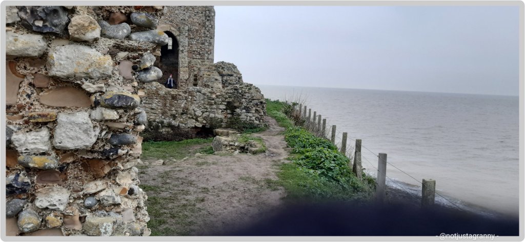
Faversham was used as a summer residence by the Kings and Queens of Kent, and has many other royal connections; Stephen (1092 or 1096 – 25 October 1154), often referred to as Stephen of Blois, was King of England from 22 December 1135 to his death in 1154 and was buried in Faversham Abbey. However, during the Dissolution of the Monasteries in 1538, most of the abbey was demolished, and the remains of Stephen were rumoured to have been thrown into Faversham Creek along with his consort and son who were buried with him. Subsequent excavations revealed empty tombs when they were opened.

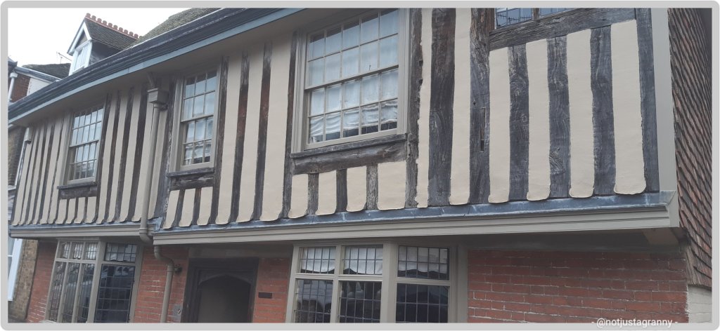
Abbey Street was constructed around 1201 in order to provide an appropriate approach to the abbey from the town, and still houses timber framed buildings; described as “the finest medieval street in southeast England”.

Medieval buildings in Abbey Street

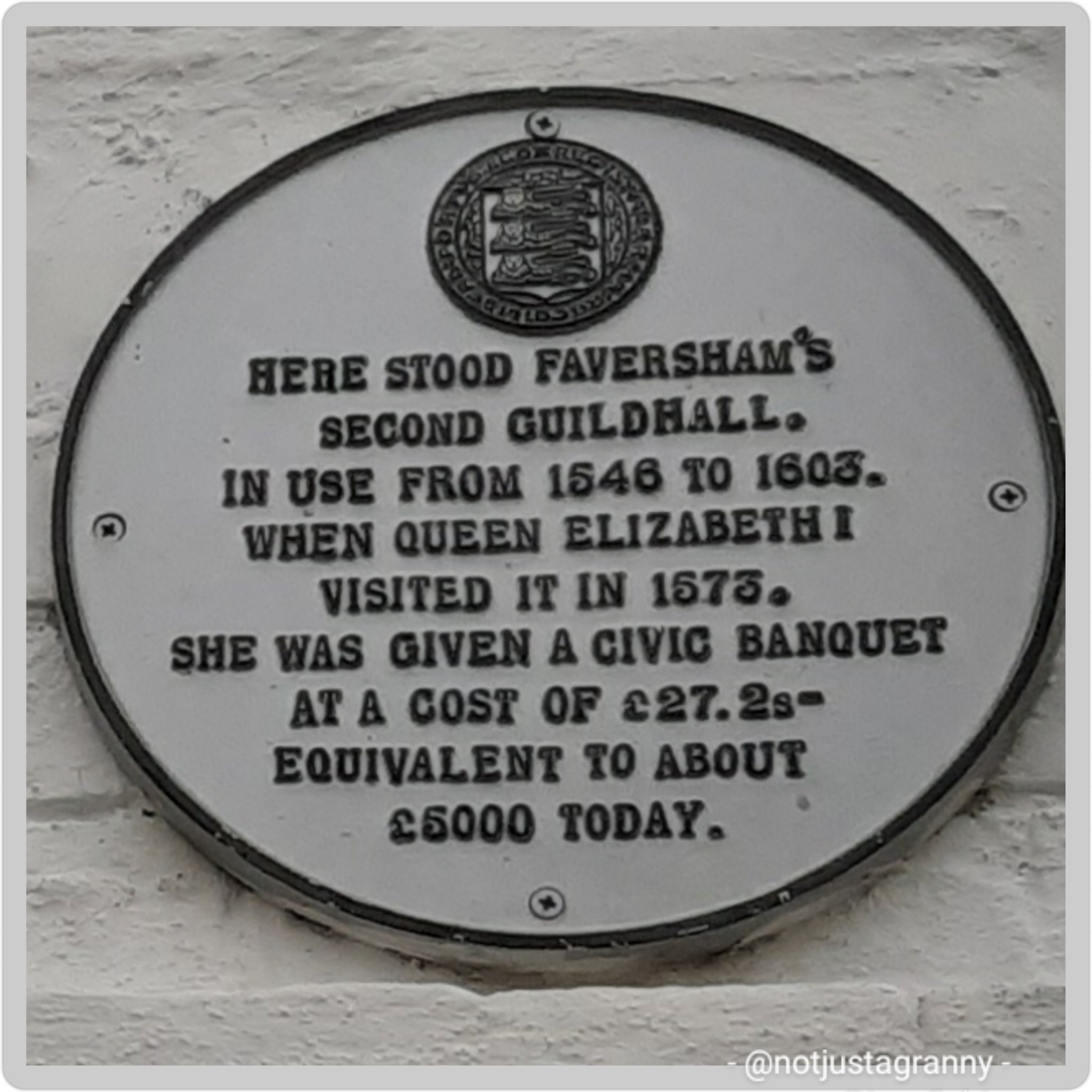
A royal visit by Queen Elizabeth I in 1573

Location of the Guildhall during Elizabeth I’s reign
Current Guildhall – built as a market hall in 1574 by the people of the town and nearby parishes, converted into the Guildhall in 1605

Faversham was established as a link arm to the Confederation of Cinque Ports as the (Limb of Dover).

The Shippe Inn

Other famous people linked to Faversham (besides me, that is 🤣🤣🤣😉)

Richard Arden, a 16th century mayor, was murdered by his wife and her lover. Nice 🤪🤪🤪

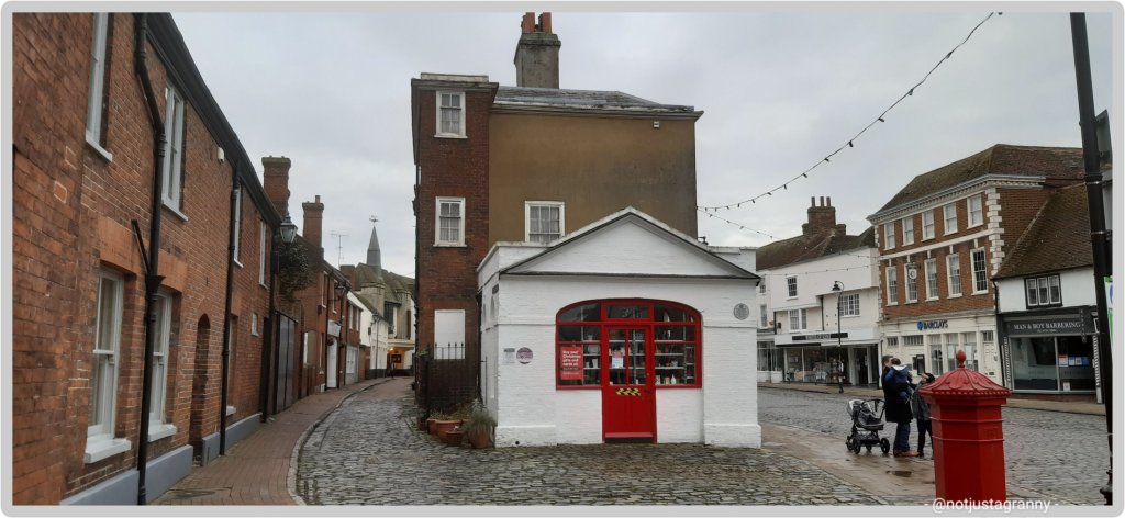
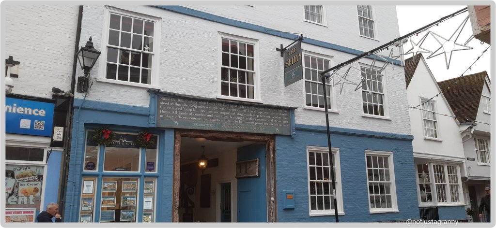
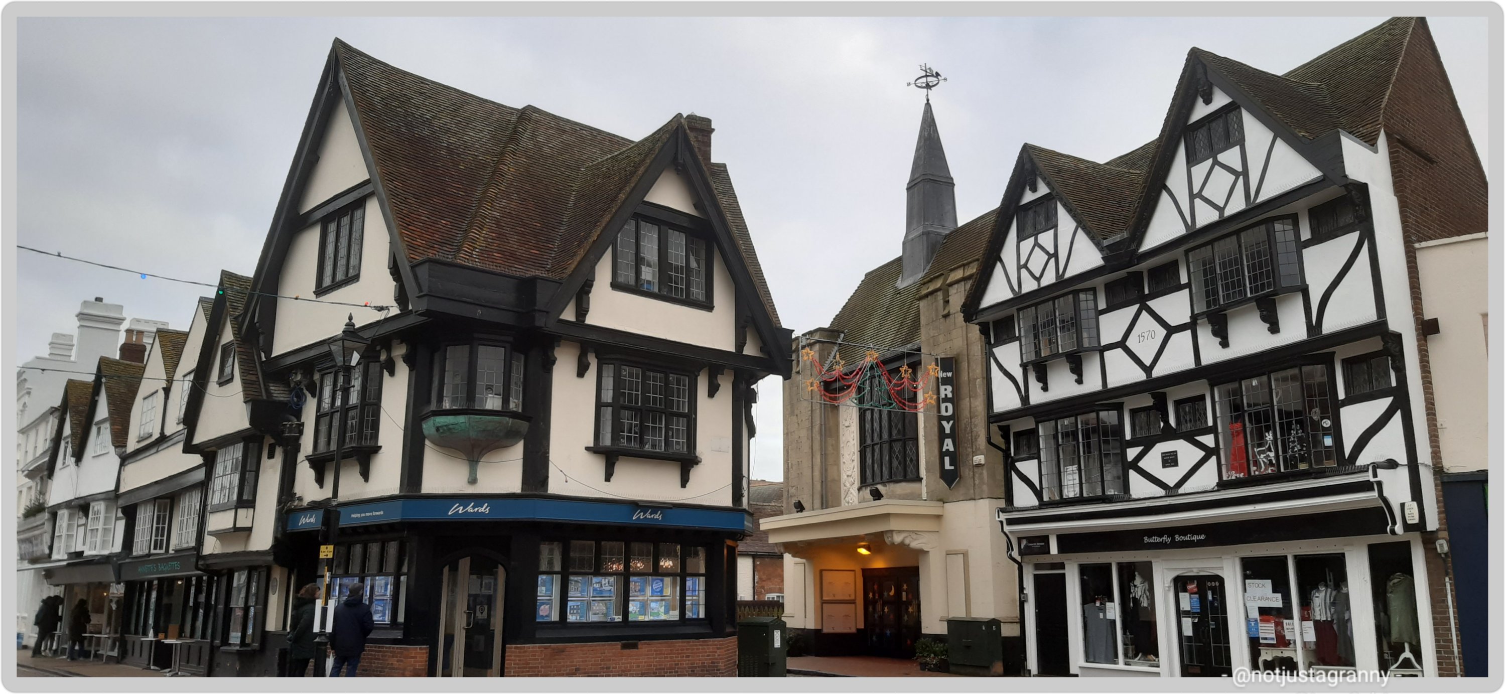
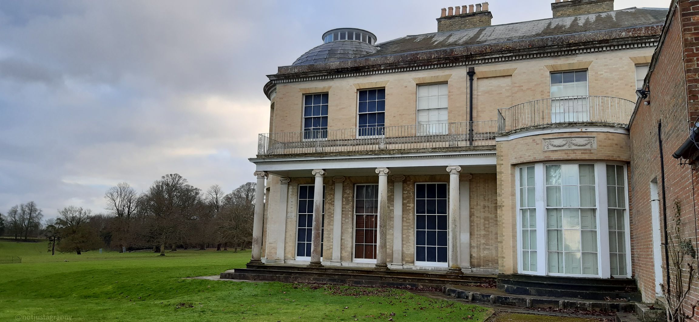
There are some fantastic buildings surrounding the market place

Faversham also lies on the old Saxon Shore Way route between Gravesend on the river Thames near City of London and Hastings on England’s south east coast and known for the ‘Battle of Hastings’ which is when William the Conqueror defeated King Harald in 1066. William the Conqueror is responsible for the ‘Great Survey’ of England; the Domesday Book completed in 1086.

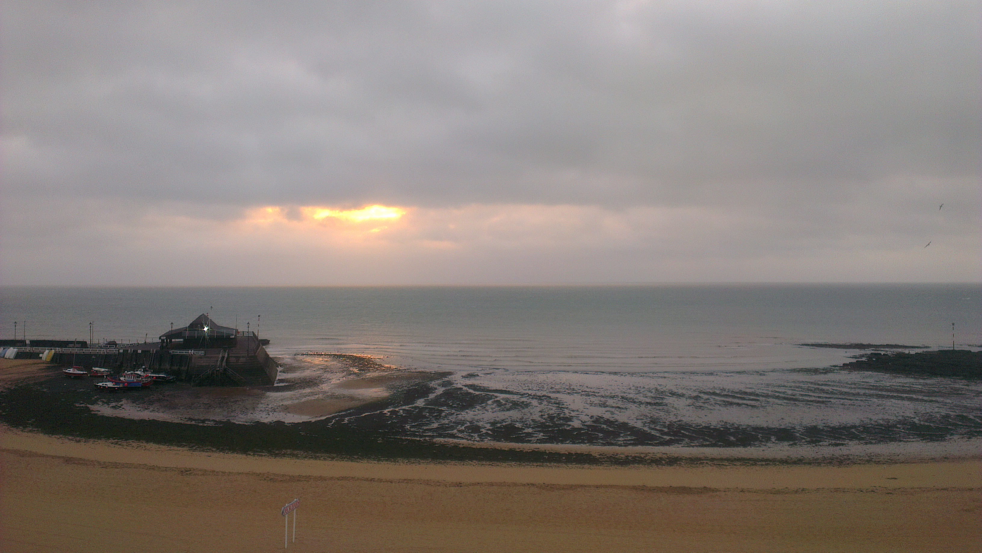
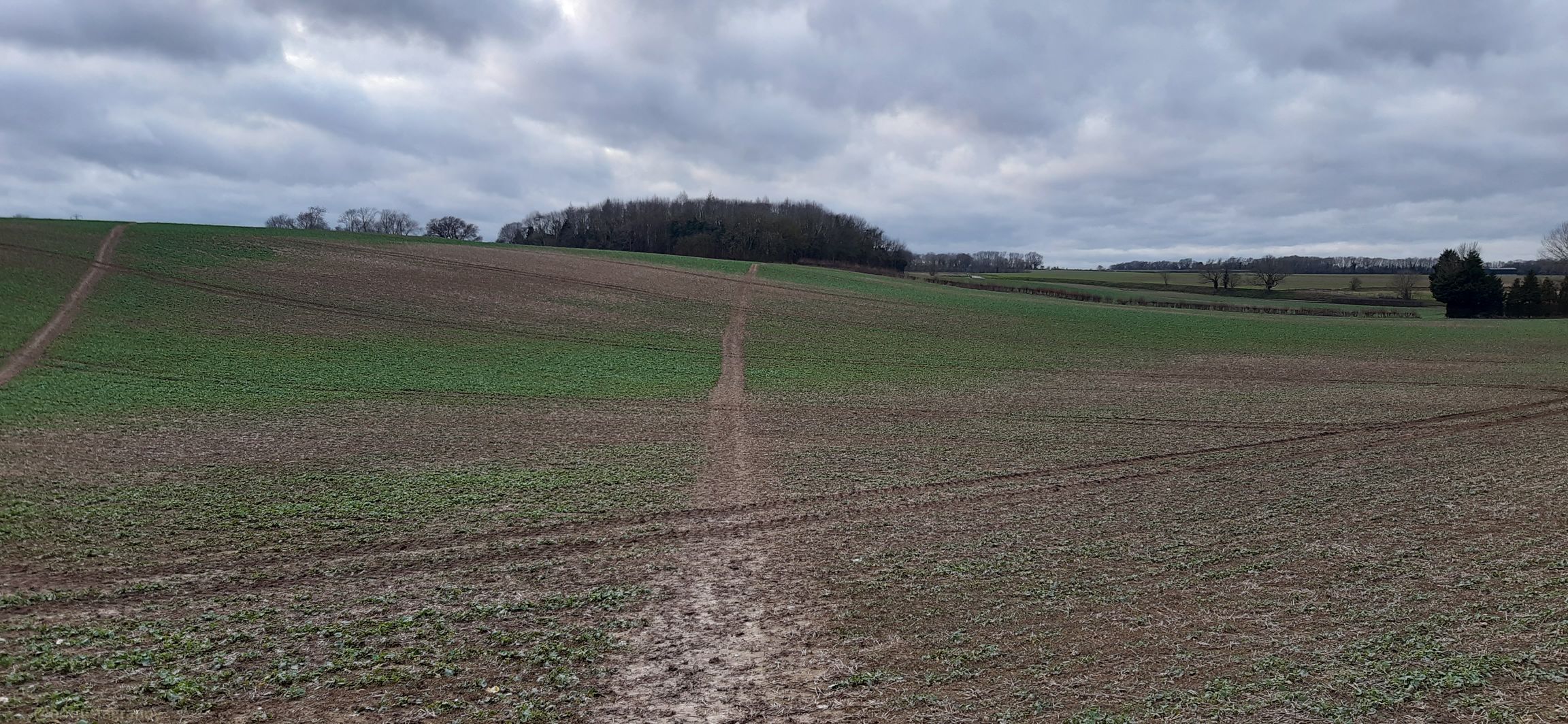
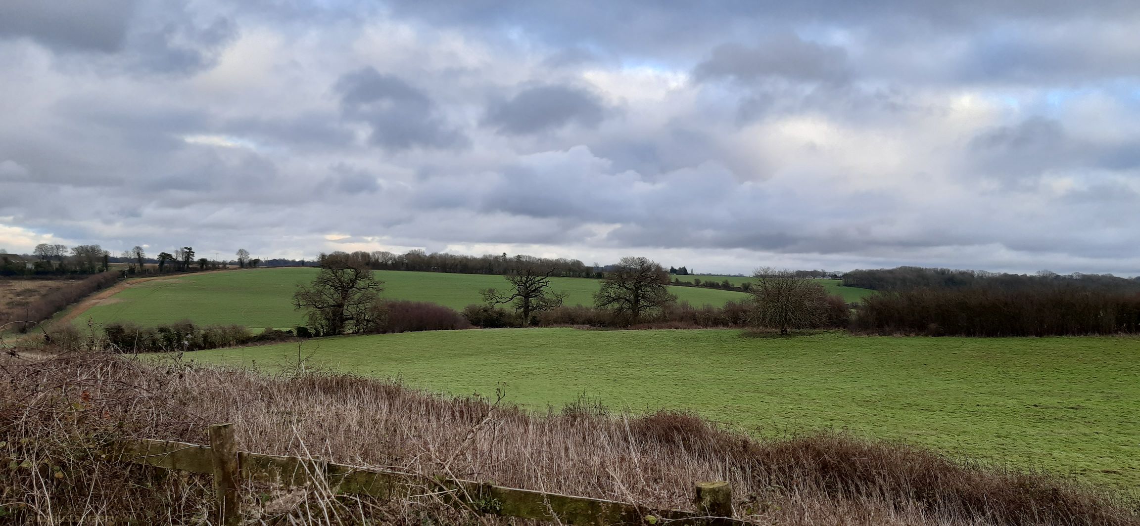
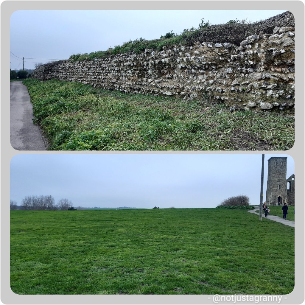
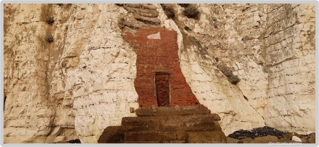
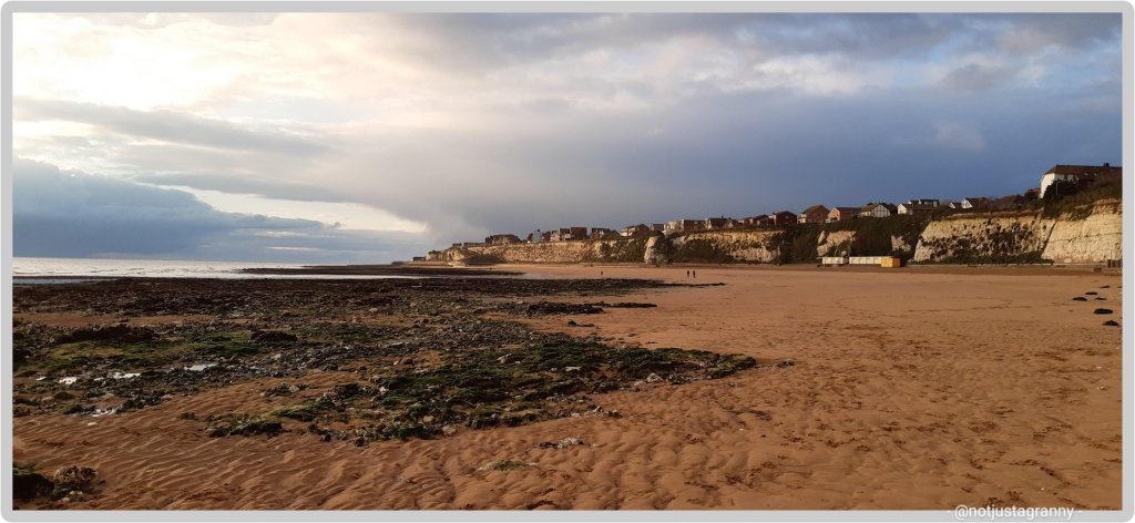
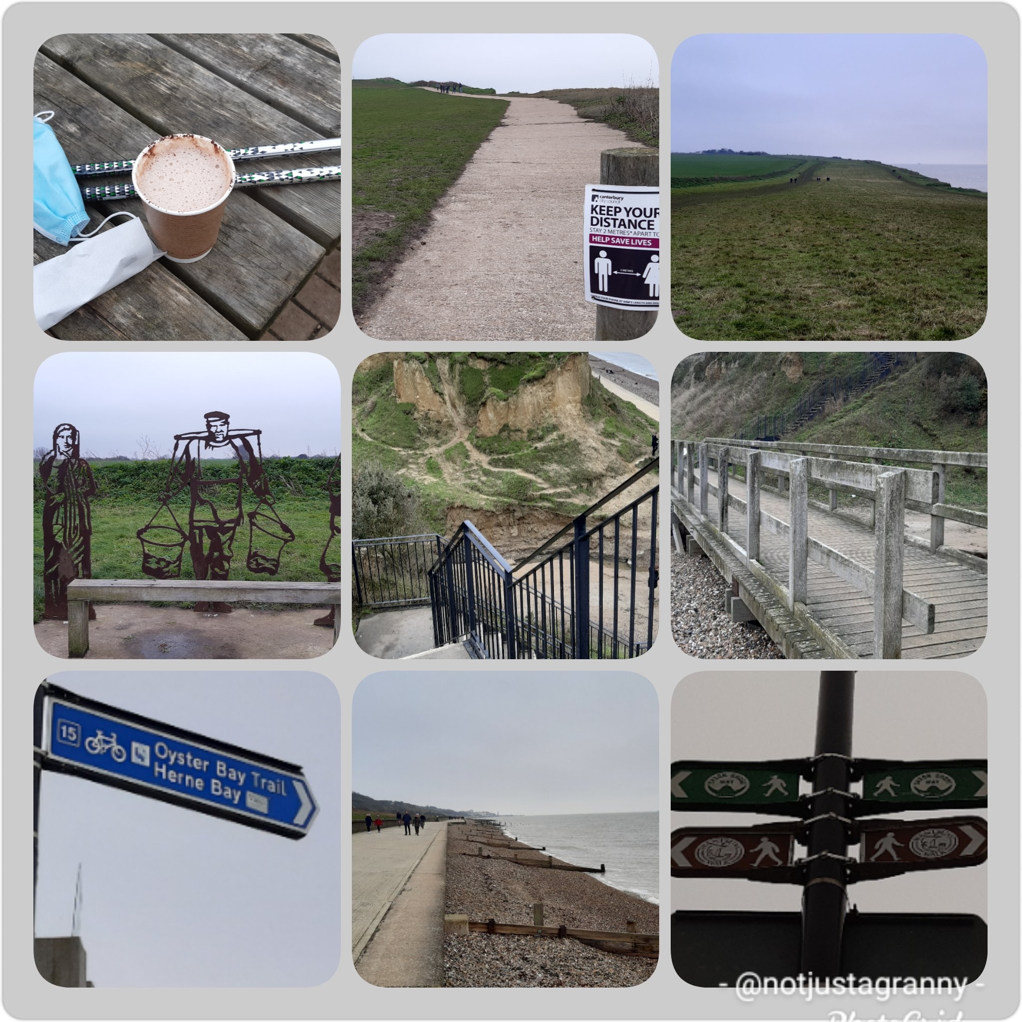
The Saxon Shore Way, a long-distance footpath of 163 miles in England, starts at Gravesend and traces the coast of SE-England as it was in Roman times, as far as Hastings in East Sussex. There are a couple of places where the route runs inland; around what was the Isle of Thanet – once separate from mainland England by the River Wantsum, and again on the south coast past Folkestone.

That’s us, the island on the right 😃😃

Some 5,000 years ago Thanet was separated from mainland Britain by 600 metres of sea – The Wantsum Channel, it is now connected again since the river/channel silted up some time ago.

When the English Channel was formed by the sea breaking through, an island of chalk was left on the east side of the county – now known as the Isle of Thanet.

The Wantsum Channel today

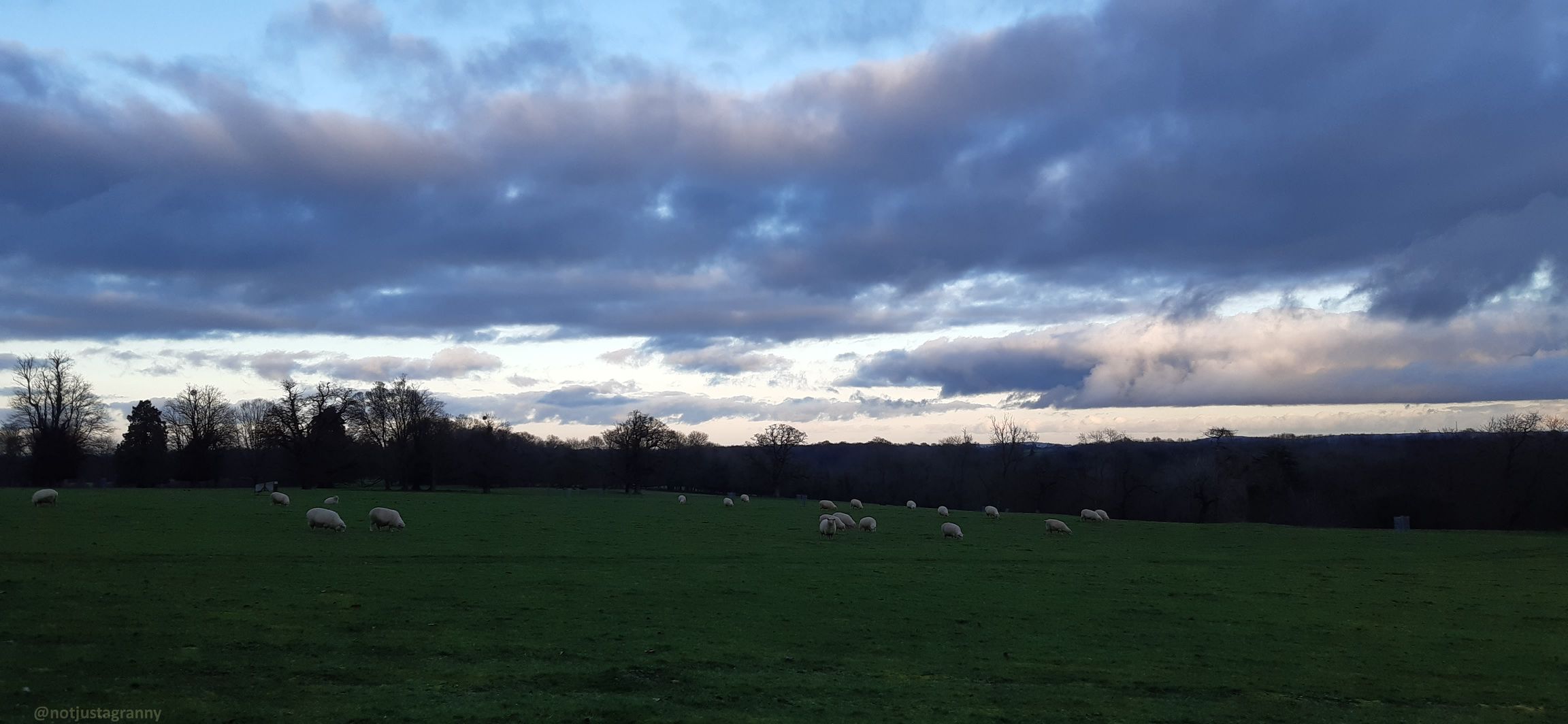
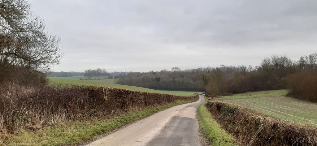
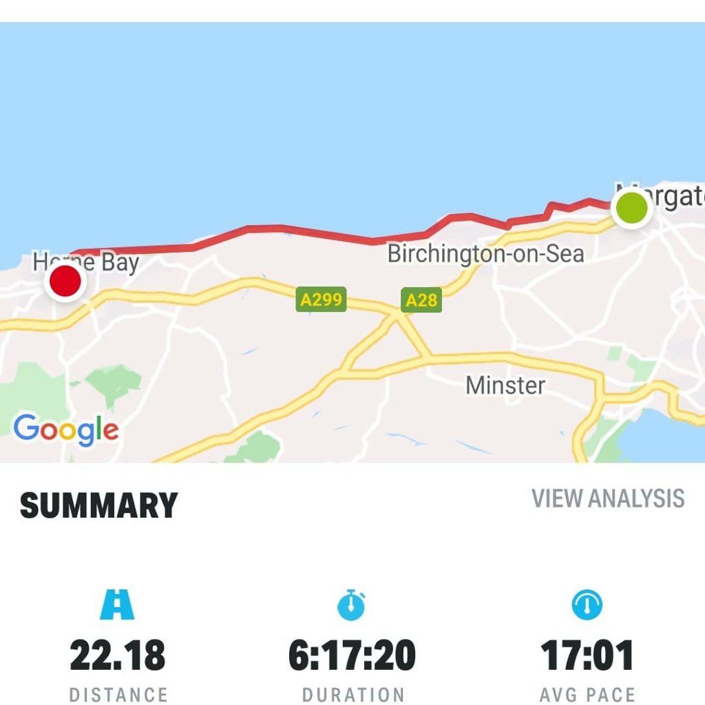
The SSW follows the creek inland from The Swale and into Faversham and then back out again from the opposite bank and once again follows The Swale and into the Thames river at Gravesend. Since I’ve already walked so many sections of the SSW on my various walks, it makes sense for me to actually do the whole route…one day LOL I mean it’s not like I don’t have about 100 other walks to do and I have LOADS of time on my hands ….as if 🤣🤣🤣

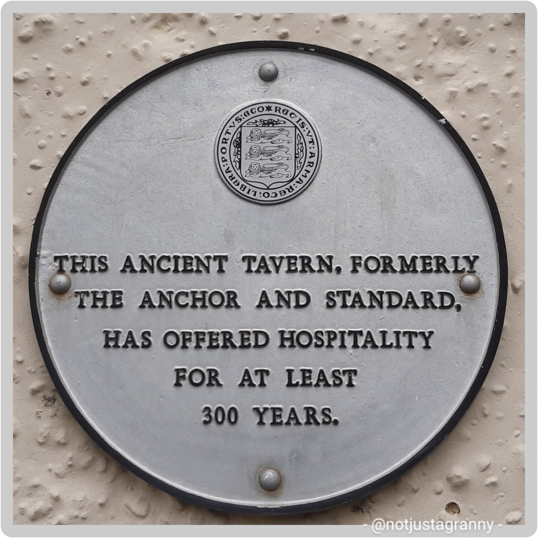
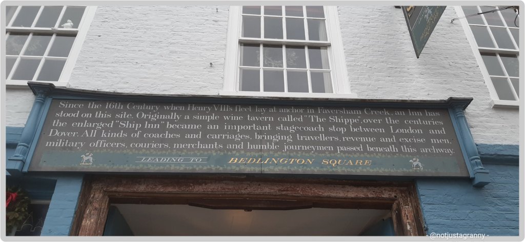
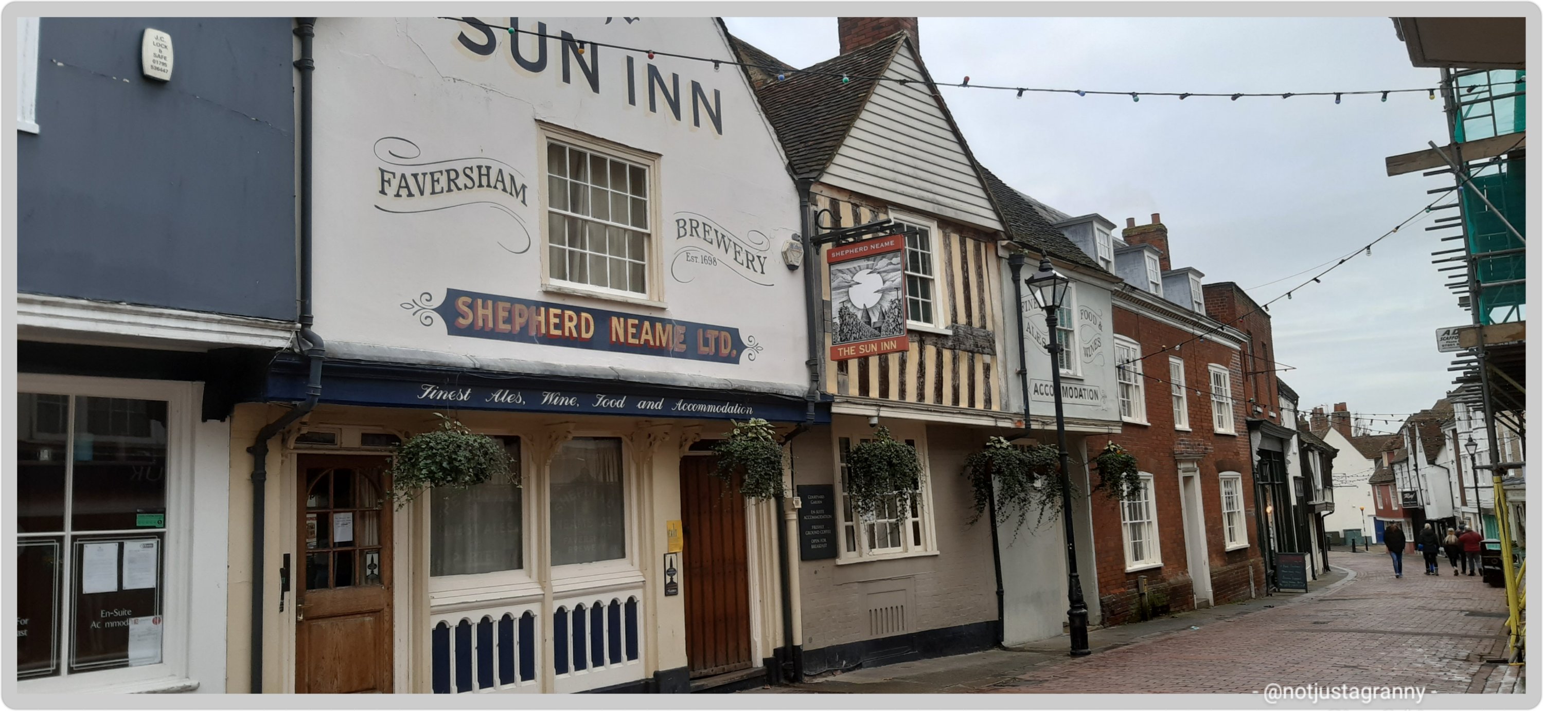
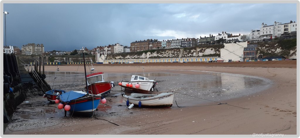
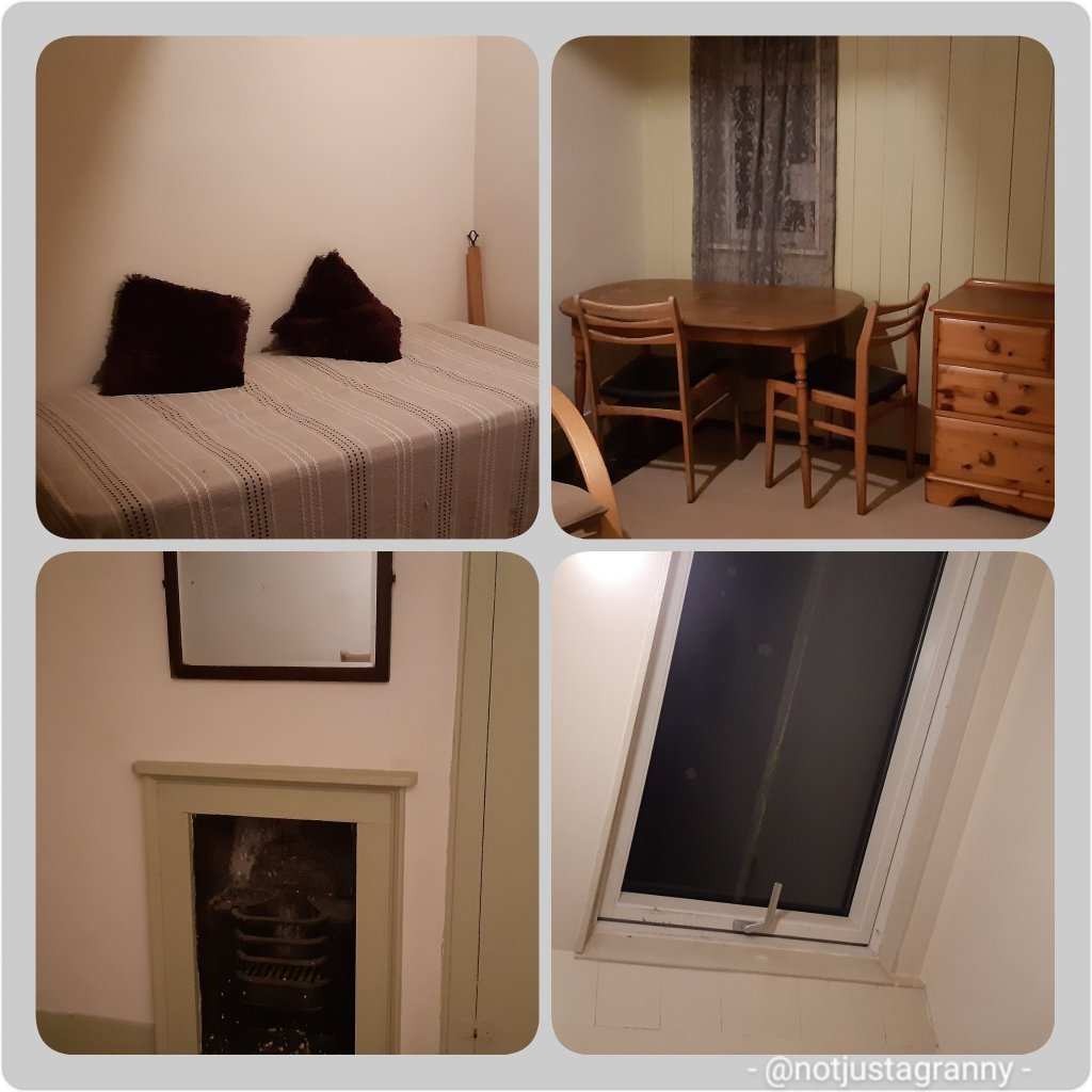
Faversham is located on the main road between the City of London and Dover and therefore became an important stop over for travellers between the Port of London and the Port of Dover. As a result of this inns were of paramount importance and today you can see and stay at one at least one such…The Sun Inn. Seriously one of my favourite ‘places I stayed’ on my many walks. It had everything I needed after arriving drenched and in pain. A massive double bed, a huge bath and fluffy white towels. Perfect.

the sun inn faversham
The Sun Inn, Faversham – best room and bath ever
The Sun Inn, Faversham - Day 3 Rochester to Faversham
The Sun Inn, Faversham – Day 3 Rochester to Faversham

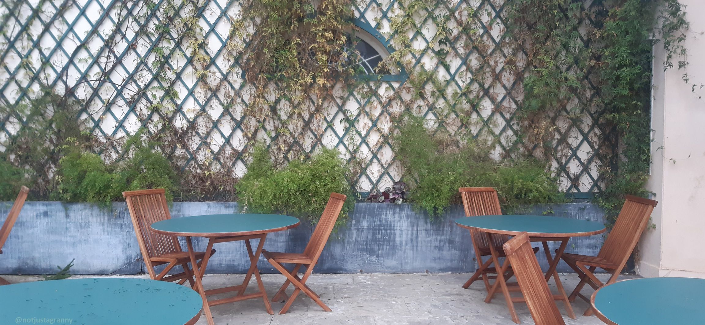
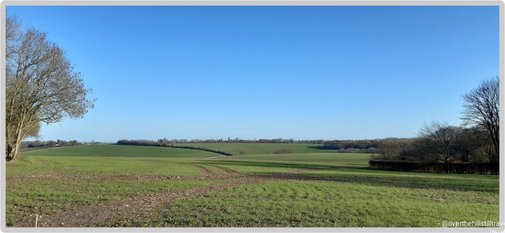
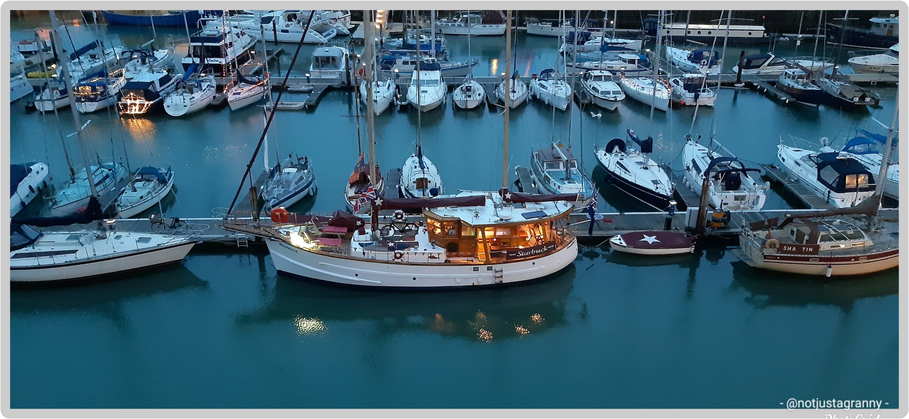
Faversham truly is awash with history and I could write up so much more, but this is already quite a long post, so for now I’ll just add one more photo

history of faversham
historic buildings of Faversham

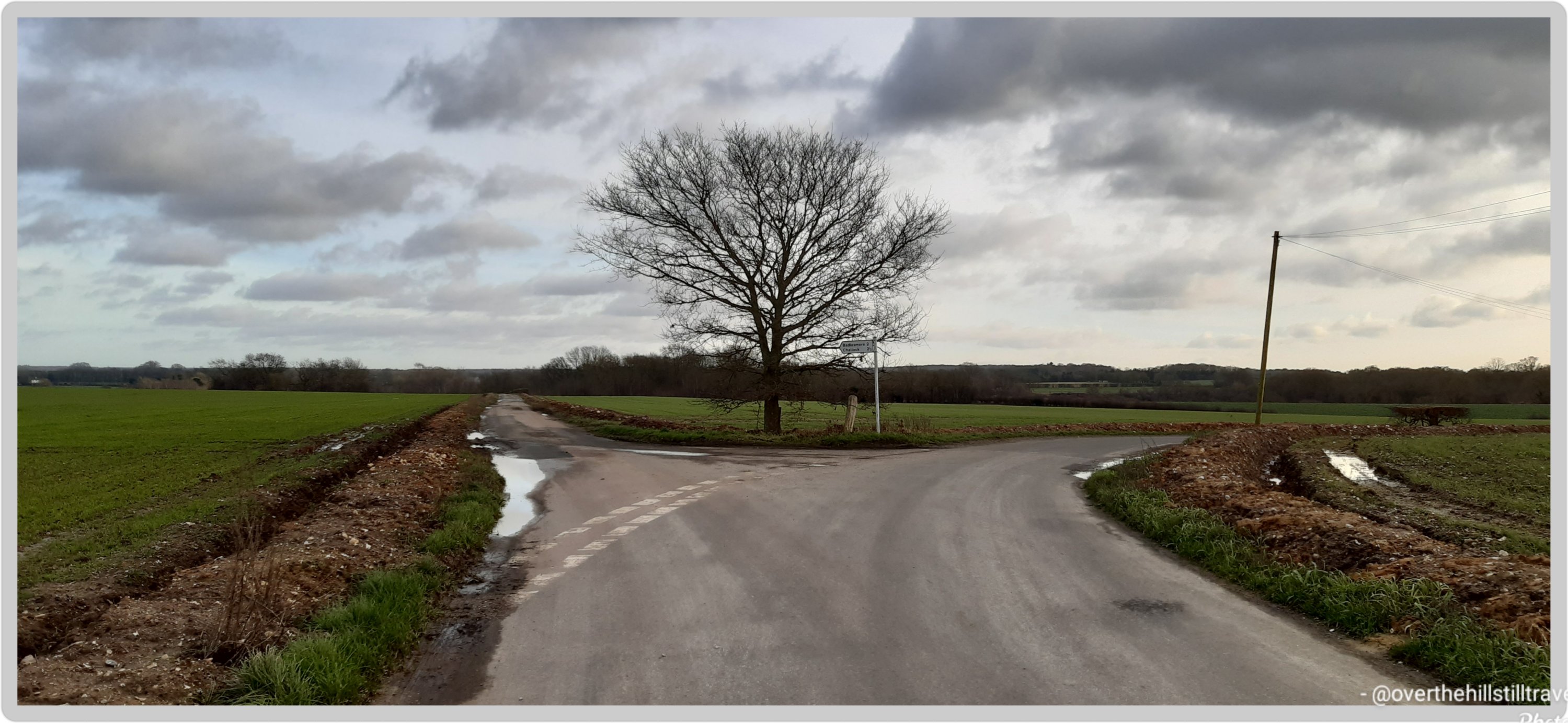
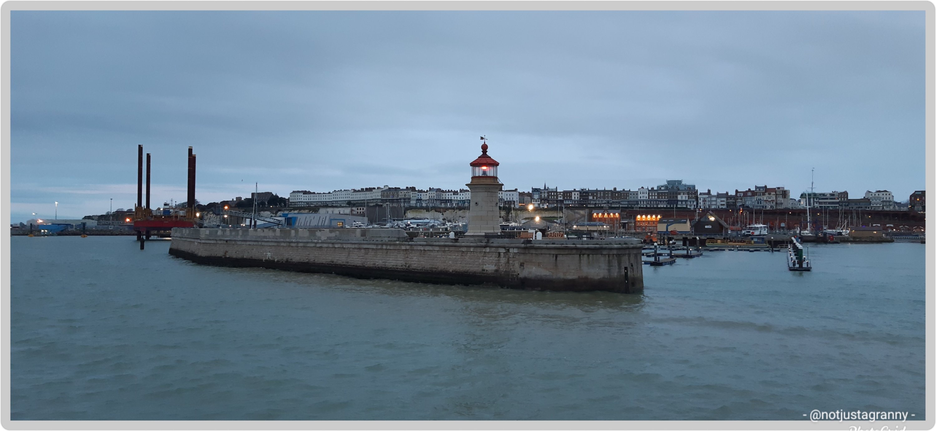
Okay, make it two photos LOL – the architecture is so varied that if you’re a fan of architecture you could spend the whole day walking around and still find more to see

architecture in faversham
architecture in Faversham

I’m sure to visit Faversham again when I start the next section of my insane intention of walking the entire English Coast and of course the Saxon Shore Way….now that my interest has been well and truly piqued. I’ll tell you more about it then…meanwhile…

Thanks for dropping by and taking the time to read about my adventures, I really do appreciate your time and support. Have a fab day/afternoon/evening wherever you may be in the world. 🌍🌎🌏

In case you’re interested: more about my Canterbury Tales Walk from Southwark Cathedral to Canterbury Cathedral (p.s. please don’t feel obliged to read any of them, it’s just in case you’re interested).

https://notjustagranny.co.uk/2011/02/20/the-start-of-my-pilgrims-journey-in-the-footsteps-of-chaucer/

https://notjustagranny.co.uk/2017/07/06/the-prelude-southwark-to-canterbury/

https://notjustagranny.co.uk/2017/07/07/prelude-day-1-southwark/

https://notjustagranny.co.uk/2017/07/09/prelude-day-2-southwark-and-the-city-of-london/

https://notjustagranny.co.uk/2011/03/10/my-canterbury-tales-12th-february-day-1/

https://notjustagranny.co.uk/2011/03/26/my-canterbury-tales-february-13th-day-two/

https://notjustagranny.co.uk/2017/08/03/arriving-in-rochester/

https://notjustagranny.co.uk/2017/08/08/day-3-rochester-to-faversham-part-1/

https://notjustagranny.co.uk/2017/08/09/day-3-rochester-to-faversham-part-2/

https://notjustagranny.co.uk/2017/08/14/faverham-to-canterbury-the-finale/

Read Full Post »

Its been a funny old week with grey overcast days, a rainy day not fit for ducks, and of course snow!! 😁😁❄ and today’s gorgeous sunshine.

Despite the weird weather I have managed to get out on a few walks and extended my horizons by going off in different directions….the problem of course is that the roads are so long, I have to walk for ages to reach an intersection, and there’s no such thing as “gosh I’m tired, let me head back” because the distances are so great there is no quick way to get back – you just have to keep traipsing along.

As for the scenery, beyond the few scattered hamlets, it’s mostly wet, muddy, grey/brown farm fields with a few copses of trees dotting the landscape. But I have enjoyed stretching my legs and hearing nothing but birdsong and the baaing of sheep, encountering minimal traffic as I go…..on Friday I walked for 70 minutes before encountering a car, and that was well timed (not really) – I was 2 thirds of the way around a huge puddle of the water that covered the road from one side to the other, making my way gingerly along the verges, hanging onto barbed wire fencing and precariously positioned wooden posts, when I heard the sound of an approaching car. 😱😱😱 wtf, you’re kidding me!!!

two-thirds of the way around on the r/h side just before the tree…I heard a car

With utter dismay I turned towards the sound and prayed that is wasn’t some young buck who thought it would be fun to drive through at speed and drench the old lady 👵🏻 hanging on to the fence for dear life. Thankfully it was another little old lady 👵🏻 and she drove sedately through the puddle leaving small waves in her wake, and me dry!! I thanked her as she drove by! 😁😁😁

Another place that looked enticing was Belmont House and it played host to my visit on Tuesday. A good 2.2 miles from my current location, it took me 35 minutes to get there, which shaved 7 minutes off google’s eta. If I don’t dilly dally too much, its amazing the places I can go.

Belmont House and Gardens located in the Throwley area of Faversham on the rolling North Downs of Kent. The 18th century house was designed by Samuel Wyatt in the neo-classical style, built in 1769 by Edward Wilks – storekeeper at the nearby Faversham Powder Mill, and enjoys a stunning view over the estate and the downs. The estate is made up of house, gardens, cricket pitch, orchards, farm and woodlands…over 3,000 acres. Belmont has an extensive history and the Lords Harris served as soldiers and colonial governors. The house is distinguished for the collection of clocks created by the 5th Lord Harris. Needless to say I didn’t get to see any of these, except for the clock tower, and the house is covid-19 closed. blergh. Maybe I will return at some stage to this booking and perhaps the house will be open then.

3 o’clock and all is well…😉

Meanwhile, my walks have taken me as far as I can go and some days I’ve gotten back just within my allotted break time of 2 hours. Of course if I had more time…..who knows where I could go!!

I’d love to walk to Ospringe, but that’s just a tad too far for 2 hours – I still have to get back

It wouldn’t however be across the fields along the footpaths…since not only do the farmers rudely put up electrified fencing as close to the path as possible, making it difficult to access, but atm the paths are just gloopy sticky muddy horrors. I know, because I foolishly walked along not one, but 3 paths last week – on the sameday😝😝. My shoes were sluggish with sticky mud.

We experienced some icy cold weather that caused the ponds and puddles to freeze over…

Ice at least half inch thick

But oh the views!!!!

And this always makes me smile

😃😃😃

Today I woke to a fabulous sunrise and blue skies, that developed into a beautiful morning.

So beautiful in fact that I asked my client if I could beg an extra hour and go for a walk before the weather turned.

Country roads…
All the way to the sea…
Fields of green

And a good thing I did too, by 2pm the clouds had blown in and once again it was grey….but we had a lovely sunset

And blow me down if once again I didn’t get caught out, no, make that twice!! No cars at all for well over an hour in all directions, yet just before I reached the flooded corner a car came whizzing down the road from behind me and sent waves of water flying through the air. Well, that’s done I thought, I should be safe now….hah! Once again, as I was about halfway round along comes another car, from the opposite direction. I scurried into the field through a gap in the fence and waved them on…waited for the water to settle and hurried the rest of the way round before car number 3 came by. None did 🤪🤪

This puddle and I have history 🤨🤨🤨

And so endeth week 2 in Throwley. I think I have pretty much exhausted the area and shared plenty images of just about everything you could hope to see, so for the next week I shall concentrate on bringing my Pilgrim’s Way posts up to date, as well as the walks along the English coast. I will of course still do as many walks as I can.

I’ve accumulated 38kms this week and had 2 non walking days. Not too bad.

Read Full Post »

After a brief walk this morning, to stretch my legs and get some fresh air after being indoors yesterday due to icy roads after the snow, I updated my kms to the Conqueror Challenge app and voila, another postcard arrived into my mailbox 😁😁😁🚶🏻‍♀️🚶🏻‍♀️🚶🏻‍♀️ I get really excited when these cards arrive…its fun to see where I’ve been travelling virtually while walking in reality.

So stage two:

Having left the alps and peaks behind, the town of Omarama marked the halfway point of my journey. Although a small rural town, mainly a service centre for locals and nearby residents, Omarama had a few surprises up its sleeve.

Disney’s 2020 movie release of Mulan was entirely shot in New Zealand with scenes filmed at the Clay Cliffs just outside of Omarama.

In 2009, NZ pilot Terry Delore set a new world record in his 87ft (26.5m) wingspan glider. Taking off from Omarama, Terry travelled 1,491mi (2,400km) up and down NZ for 15 hours reaching speeds of up to 93mph (160kph) before landing back in town. Omarama has strong gliding conditions making it a popular destination for gliding pilots. Omarama hosted the 1995 and 2007 World Gliding Championships of which Kiwis took first place in the 1995 open category and third place in 2007.

For the weary soul like myself, a Hot Tub soak the night before to rejuvenate my muscles and unwind was just what I needed. The Hot Tub was located outside in a private setting within a tussock and rock landscape. The tub was filled with fresh mountain water without any chemicals added. The business reuses the water for irrigation. A submersible firebox allowed me to adjust the water’s temperature. As I settled in, I watched the Milky Way appear and spill across the night sky with its millions of stars.

Eastward bound, I left Omarama refreshed and ready to tackle the next half of the journey. The trip was relatively easy and short when compared to previous days. The first half of the trail was off-road running parallel to the State Highway on the right. Crossing at Chain Hills to the left of the highway I began my descent alongside Lake Benmore, the largest artificial lake in NZ.
Lake Benmore was created in the 1960s as part of the Benmore Dam construction. The lake is split into two arms. The largest is fed by three rivers, Tekapo, Pukaki and Twizel plus the Ohau canal with Waitaki River flowing right through the lake, whereas the smaller arm is fed by Ahuriri River.

It is this smaller arm that I travelled along to Pumpkin Point, a grassy beach area, for a break and a splash in the lake, then onto Sailors Cutting where the off-road trail terminates and I join the highway for the rest of today’s trip. Not the most relaxing part of the journey as I braved the high-speed highway with an upward climb to Otematata Saddle. The views of Lake Aviemore and the valley beyond was a lovely compensation until I continued on the busy highway downhill all the way into Otematata.

Hmmm. The more I’m reading about this, the more I’m thinking I should add this route to the itinerary for my pending trip to Australia in a few years time. I’ve included a trip to NZ but only to visit the main attractions as well as a friend and her daughter (if she’s still living there at the time and not somewhere else in the world, as she is wont to do 😃😃). The route is approx 290kms and would take about 12-14 days to complete. 🤔🤔🤔

Where I actually walked this morning
Where I ‘virtually’ walked

If you’d like to join these challenges, here is my link https://www.theconqueror.events/r/CE1474 – I don’t get any money from anyone joining, but you get a discount and I get a discount on any future challenges. However, I’ve already signed up for 15 challenges (8 completed in 2020), so I think I need to put the brakes on for this year 🙃🙃😆

Read Full Post »

Really excited to receive my first postcard from my Alps to Ocean virtual challenge today.

Stage 1
Stage 1

I started the challenge on 30 December 2020 – I so enjoy reading the information that comes with the postcards; learning about places I never knew existed until I started these challenges.

I was 20kms ahead when I arrived at my current assignment on Monday but if course with limited time and 2 days a write off, I’m going to be hard put to keep up to speed 😉🚶🏻‍♀️🚶🏻‍♀️🚶🏻‍♀️ I’m going to try get up to date with the blogging and postcards as well….so here goes.

Alps to Ocean, New Zealand

Imagine crisp alpine air, snow-capped peaks, glaciers, milky lakes and starlit nights. The training ground for Sir Edmund Hillary’s climbing skills in preparation for Everest. The legendary story of Aoraki and his three brothers. These are just some of the highlights of Mount Cook.

At 12,217ft (3,724m) tall Mount Cook is located on the South Island and the tallest mountain in New Zealand. It sits within the Mount Cook National Park which runs 37mi (60km) in a southwest-northeast direction. Home to more than 400 flora and fauna the national park is part of the Te Wāhipounamu South Westland World Heritage Site. The park is also home to 35 species of birds, including the only alpine parrot called Kea.

When I was looking into Mount Cook, I was wondering about the 98ft (30m) height discrepancy between different written sources. Further investigations revealed that in 1991 an avalanche of 350 million cubic feet (10Mm³) of snow and rock followed by twenty years of erosion had shrunk the mountain’s elevation by 98ft (30m).

Of the twelve largest glaciers in New Zealand, eight of them are within the park with Tasman Glacier being the longest at 15mi (24km). The glacier terminates in the Tasman Lake which up until the 1990s never existed. The lake was formed due rapid glacial melting whilst the glacier itself continues to recede annually by as much as 2,697ft (822m). It is anticipated that within a few decades the glacier will be completely gone and the lake fully formed.

The lake’s primary outflow is the alpine braided Tasman River which flows south for 16mi (25km) through the Tasman Valley and into Lake Pukaki. The glacier, lake and river were named after Dutch explorer Abel Tasman, who in 1642 was the first European to sight the northwest coast of NZ’s South Island.

My journey begins at the base of Mount Cook, northwest of the river. Needing to cross the river to connect to Rotten Tommy trail, I took a short helicopter flight. The aerial view of this glacially-fed river and Mount Cook was a sight to behold. From Rotten Tommy, I took a southward bound route alongside the Tasman River. Although part of the route was quite rough and I had to cross several creeks, eventually the track changed to gravel road and made it easier to navigate towards my first overnight stop. Being a clear and sunny day, I had the treat of seeing Mount Cook in the distance rising above the lower snow-capped peaks in the National Park.

Before I go let me tell you about the Ngāi Tahu legend. The story goes that once the “Gods existed in the midst of a great sea of nothingness” and Raki, the Sky Father and Pokoharua-te-po, his wife had four sons, all living in the heavens. Raki left his wife to be with Papatuanuku, the Earth Mother, and together they created the world. Aoraki, the eldest son of Raki, along with his three brothers came from the heavens with a canoe in an attempt to persuade their father to return to their mother. Upon seeing him together with his new wife, the brothers knew Raki would never return. The brothers decided to go home but unfortunately their canoe wouldn’t rise and following strong winds and rising seas, the canoe overturned tipping the brothers into the water. Climbing atop the upturned canoe they waited for help. As time passed with no help coming, they eventually turned to stone. The canoe became the Southern Island and the brothers became the Southern Alps with Aoraki (Mount Cook) being the highest peak.

So far along this challenge I’ve walked from Ramsgate to Faversham over a few days and 3.5 days in Throwley. I wonder where else my journey will take me!!

Read Full Post »

I was researching some carvings on the portico if a church I visited a couple of days ago and came across this article. Absolutely love this story. Clever man 😃😃😃

An Art Historian Discovered a Cheeky Self-Portrait That a Stonemason Left as an Easter Egg Inside a Famous Spanish Cathedral 800 Years Ago

https://news.artnet.com/art-world/art-historian-discovered-secret-stonemason-self-portrait-800-year-old-cathedral-spain-1920189

If you’ve walked to the Cathedral in Santiago you’ll know why this is such a fascinating find….

If you haven’t walked to the Cathedral in Santiago…..why not!!! Start planning 😉😄😄

Read Full Post »

Following on from my recent walk from Margate to Whitstable via Reculver, researching the Roman fort uncovered the information that Reculver too had been mentioned in the 1086 Domesday Book. 😃😃👏👏 Roculf: Archbishop of Canterbury. Church, mill, 5 salthouses, fishery.

To say I was delighted would be an understatement. Updating my Project 101 page brought the tally to the grand total of 150!! Hoorah. https://notjustagranny.co.uk/project-101/project-101-domesday-book-towns-villages/

By no means a huge number, and considering that 13,418 (settlements) : cities, towns, villages and hamlets are mentioned….150 is not that many, but it’s way more than most have visited.

It’s still astounding to discover that many English people who have grown up in the country, have no idea of its existence.

1086 is only one of the most significant dates in English history following on from the 1066 Battle of Hastings, and yet…..

My original intention was to visit 101, but it seems that my travels and my job will take me to many more than I anticipated.

I’ve wanted to walk to Reculver from Broadstairs ever since we first visited the place some years ago, but never seemed to find the time, it also did not seem doable. But now with my crazy decision to walk the entire English coast over the next 5 years, it became doable ….😁😁 and in comparison to the distances I’ve since covered on my various walks, it was easy peasy

When I set off from Margate last week I could see the ruins of the church farrrrr away in the mists of time and remember thinking ” oh gosh, it’s so far, will I be able to do it ?” But it was easier than expected, and voila

St. Mary’s Church, Reculver

St Mary’s Church, Reculver, was founded in the 7th century as either a minster or a monastery on the site of a Roman fort at Reculver, which was then at the north-eastern extremity of Kent in south-eastern England. In 669, the site of the fort was given for this purpose by King Ecgberht of Kent to a priest named Bassa, beginning a connection with Kentish kings that led to King Eadberht II of Kent being buried there in the 760s, and the church becoming very wealthy by the beginning of the 9th century. Ref wikipedia

Will this too be eaten by the ever encroaching sea
A Roman fort, now long gone
The remains of the Roman wall, and where the fort once stood

It’s a fascinating place and I’m certainly going to follow up on more of the history and I feel another visit is warranted. I noticed on my way to Reculver that there is a walk along the River Wantsum; which once cut off the Isle of Thanet from the mainland.

The River Wantsum

I 🔮 another walk in the future 😉😄😄 except it will not be in winter!! And I’m not walking across any mudflats….more of that later 🤪🤪

Can you see my folly?

More about Project 101 https://notjustagranny.co.uk/project-101/

Read Full Post »

I’ve started reading the book my daughter gave me for Christmas; ‘Walking Home – Clare Balding.’

In the very early pages Clare talks about how she was taught to ‘walk mindfully’; to feel her feet hitting the ground, to hear the birds or background sounds, to feel the wind on her face. So today on my daily perambulation, instead of rehashing the same self-talk that goes over and over around my head (mostly coz its unresolved), today I practised mindful walking….

I felt how my feet scrunched on the beach, I observed how my poles felt as they supported me over the rocks or sank in the sand, I really listened to the seagulls, felt how the wind ruffled my hair and sneaked down my collar (I forgot my scarf at the b&b🤨🤨), and in particular I listened to the songs of the sea…it changed my whole mindset. I felt uplifted,  invigorated and tingled from the cold icy air, and barely noticed that I was soaked from the softly falling rain. What a difference.

My issues are still unresolved, but I can breathe…and I got in 10.26 kms by the time of the real downpour, which spoilt my plan to sit on the bench in Broadstairs to eat my croissants… instead I ran for the bus (the driver kindly waited for me 😃😃) and took the quick way back.

It was dark when I left the b&b, the streets were quite deserted and I only saw 4 people enroute. I got to the harbour just before 7am.

Town centre at 06:55
Still and quiet at 7am

It had started raining but I barely noticed it until looking at the lights shining on the rain.

Oh…its raining 😄

By then I was quite wet, so I sat under the shelter at the Royal Victoria Pavilion and watched the sky lighten…

A blue sky
My view from under the pavilion

Debating a return to the b&b to dry out, instead, as soon as the rain eased off, I meandered down to the waters edge and collected some more sea glass – found some lovely pieces.

Sea glass and pottery pieces

Then turning my head north for Broadstairs watching the sunrise while I listened to the seagulls and the incoming tide I walked…..as I walked the colours of the sky changed and depending on which way I was facing, was either that early morning cold blue or the golden colours of the sun cracking through the clouds…

Passing through Broadstairs I phoned ahead to order my almond croissants from The Old Bakehouse and stopped to photograph the boats in the little harbour – I never tire of seeing them

Pretty wee boats in the harbour

A few dog walkers and early morning strollers passed me by and suddenly, or so it seemed, I reached my turning point at Stone Bay.

A good place as any to turn around

How far I’ve come….

Looking back across Stone Bay

One last photo of Viking Bay

Viking Bay, Broadstairs

Having phoned ahead earlier, The Old Bakehouse kept 2 almond croissants aside for me 😊😊🥐🥐. As I left, the rain I’d seen crossing the channel reached our shores and the heavens opened…🌧🌧🌧

There comes the rain…

I drank my coffee, then made my way quickly up the High Street towards the bus stop. Suddenly down the road…the bus approached. I ran – fast!! The driver (bless his heart) waited for me. 😃😃

Then it was back to the b&b for tea.

Brilliant walk: 10.26kms. And thus ends my holiday/Christmas/New Year break. Back to work tomorrow and limited time to walk for the next 2 weeks. 🤔🤔🤔 I’m hoping the area I’ll be working in has some interesting walks. Meanwhile, I’ve reached 20% of the Alps to Ocean NZ virtual challenge and got my 3rd postcard of the route.

I’ve started uploading the Mt. Fuji postcards and information and will post those asap and then I’ll get the Alps to Ocean postcards uploaded and share those too. The organisers have done an outstanding job of creating the postcards and the relevant information. It’s totally impressive

Read Full Post »

Well, would you just look at that!! Just over 24 hours to go (UK time) and we say goodbye to 2020. I can hardly believe it.

Not that the new year, 2021 is going to start off very well at all with now 8 in 10 people in the UK going into tier 4 and virtual lockdown. Although 2020 didn’t do too well at all, 2021 is not going to get off to a very good start.

To say I’m peeved at our useless government would be an understatement because tomorrow brings the double whammy of the final twist of the Brexit knife and the ongoing Covid-19 pandemic to really give this year a bad name. And do I believe our feckless PM when he spouts out his nonsense about having got a good deal?? No. I do not.

Meanwhile I, like millions of others, am trying desperately to keep my head and not fall into the pit of despair at the way life seems to be spiralling out of control. To that end I’m not watching the news nor reading the papers and still off Facebook. I am however spending quality time with my family and walking….walking and walking. I’m also grateful to still have work.

Although I only started in April, having the Conqueror virtual challenges has been a bit of a life saver really because keeping up with my targets gets me out, and the walking, which I love, keeps me sane.

I’m nearly at the end of the 2020 challenge and yesterday I completed the Mt. Fuji challenge after a fantastic walk from Margate to Herne Bay 22.18 kms. Although it was bloody freezing, I thoroughly enjoyed the walk and was not only surprised at how quickly I walked the distance, but also at how easy it was.

I’ve long wanted to walk from Broadstairs to Reculver after visiting the Roman site a few years ago, so it was absolutely thrilling to finally make the journey, albeit only from Margate. Except for one very short section, there is a promenade/footpath and the sea the whole way. The final section to Herne Bay was a breeze…literally and figuratively. I nearly froze 😂😂😂 it was so darn cold – at one stage I was sucking my thumb just to get some warmth back into it.

Fortunately the cafeteria at Reculver was open so I stopped for 15 minutes to rest my feet and warm up with a hot chocolate and a yummy caramel fudge brownie…delicious.

Herne Bay is a fascinating place with so much history, not all of it good. But they do have some fantastic fish and chips shops….😁😁 I have to give a shout out to Gary of EKS Office Equipment in Herne Bay for not only agreeing to charge my phone (for free) but also allowed me to sit in a corner of the showroom to eat my chips while I waited. It was very much appreciated.

Although I thoroughly enjoyed the walk, despite the cold, the saddest sight was the vast amount of plastic pollution that quite literally lined the whole 22kms….I could have filled 50 black bags and still not cleared it all. Its terribly painful to see all that pollution.

So as the year comes to an end, I have one final day of walking to do to finish my 2020 km challenge. Its been a most satisfying pastime and I must thank my daughter for introducing me to the Conqueror Virtual Challenges….thanks to that I have improved my fitness levels, walked extensively in areas I would likely have not except for wanting to meet the challenge of the challenges 😉 and I’ve inadvertently accumulated way more medals than I had planned. Its been a fairly expensive hobby, but so much fun.

I’ve started on the Alps to Ocean, NZ challenge and hopefully tomorrow I’ll complete another decent distance as my final walk for 2020.

Other than that, I have finally found a suitable place to rent. Went to look at a room last night….and as Goldilocks said “it’s just right ” and I’m saying “It’ll do Pooh” 😃😃 It’s not a huge room, but it’s on the top floor, its spacious, it has cupboards, and a bed, and a skylight for summer nights, and a desk for my books and computer and MOST importantly, the landlord said Jamie can visit. So HOORAH!!! after 18months I’ll have a place to go ‘home’ to. I’m feeling quite emotional. It means I can get my clothes out of storage, and my books and Jamie’s toys and my amazing South African mattress. I can brighten it up with my own bed linen and pictures and bits and bobs.

Today we had a photoshoot done. The fab photographer of @createdwithlightphotography on Instagram did the shoot for me with my gorgeous grandson. We had lots of fun and then had hot chocolate to warm up, because of course it was freezing on the beach. ☃️☃️☃️☃️

Me and my boobee 🥰🥰

Tomorrow, weather depending I’ll walk from Ramsgate to Margate one last time before I tackle the next section of my own challenge….to walk the whole of the English coast within next 5 years.

Cheers folks, thanks for reading along with me. In case I don’t get to write a post tomorrow, although I probably will, I wish you all a VERY safe, healthy and wonderful New Year.

Read Full Post »

Just thrilled to have finished the Great Ocean Road, Australia virtual challenge yesterday….exactly 5 weeks & 5 days 👏👏👏 🚶🏻‍♀️🚶🏻‍♀️

And just because I can….I signed up for another 3 and the 2021 challenge. 🤪🤪 so some serious walking coming up next year.

My goal for 2021 is 2600kms

I’m planning on walking these as part of my 2021 challenge…along with The Ring Road of Iceland, Alps to Ocean New Zealand and the Cabot Trail in Canada.

First though, I must finish off my 2020 challenge…Getting started on the Mt. Fuji (74kms) challenge this morning I set off just on 7am and headed to the cliffs. Hardly saw a soul…it was quiet and peaceful, not a breath of air. I didn’t get a spectacular sunrise, but it was soft and pretty and I had a super walk and my total for today is 15.76kms.

The harbour is so pretty, especially now with the Christmas lights decorating many of them.

The wind came up on my way back as storm Bella started making herself felt.

With only 63.4 kms to go, I’m really excited to be reaching the end of the 2020 challenge.

Why not join me https://www.theconqueror.events/r/CE1474

I finished off the walk with fresh croissants from the CoOp 🥐🥐 and a cup of tea with the family and then a much enjoyed sleep, but not often done. My daughter and I had a quiet walk to the cliffs and back before supper as well, after which I spent the late afternoon and evening with my beloved family and just enjoyed being with my grandson. He is ever so cute, a real little munchkin, so full of beans, and boy can he be demanding…when he says “G’anny sit down!!!” – I sit 😂😂😂 usually on the floor which is not good for the old bones 👵🏻🦴🦴🦴😩😩

I hope you are all well and had a lovely 2 days. If you didn’t get to see family and friends, I truly hope that 2021 will see you all reunited.

Read Full Post »

I’ve been invited to participate in the 2020 Travel Challenge by fellow travellers and Camino pilgrims http://wetanddustyroads.com Thank you 🥰

I’m honoured to be nominated and will do my very best to live up to the challenge!!

February

The Travel Challenge involves posting one favorite travel picture for each day. That’s 10 days, 10 travel pictures, and 10 nominations, without any explanation. If you take up this challenge, then you also need to nominate someone each day.

Today, on the 2nd day of the challenge, I  nominate http://theatozoftravel.com

You’re under no obligation to accept the nomination, but if you do…you can post any of your favorite pictures from 2020…enjoy and happy travels!!

Read Full Post »

« Newer Posts - Older Posts »

Self Propelled

Self propelled adventures through life; blogging on cycling, touring, micro-adventures, general shenanigans, and environmental news

johnelsewhere

Thoughtful wanderer in search of virtual meaning

Things Helen Loves

TRAVEL, WALKS & EVERYDAY ADVENTURES

Short Walks Long Paths

Wandering trails around the coast of Wales

Port Side Travel By Jill

My travels, photos, tips/tricks and anything else I think of!

Wonderwall

My 360: wonderwalls,theatre, travel, Sheffield, books...

Robyn's Ramblings

My Thoughts. Expressed.

Graham's Long Walk

Graham King's long walks around Britain

The Lawsons on the Loose

Philip & Heather are making memories through their travels.