Feeds:
Posts
Comments

Archive for the ‘walk 1000 miles 2021’ Category

A couple of days ago my phone had a bit of a ‘moment’ and wouldn’t switch on!! My heart almost stopped because besides my photos, most of which thankfully are in dropbox, are still in camera memory waiting to be transferred, but as well as that I have dozens of Samsung notes with information on all the walks I plan to do…depending on how long I live of course.

So in order to avoid the stress of losing the information if the phone needs a factory reset, its time to transfer them elsewhere. So why not here. It sets my intention and let’s the universe know I’m still wishing for a sponsor to pay for them all 😉😁😁😁 and from here I can copy paste to dropbox. Of course if dropbox goes down…..🤪🤪🤪😱😱

For starters: https://www.theguardian.com/travel/2021/jan/13/how-intention-turns-a-walk-into-a-pilgrimage-5-british-walking-pilgrim-trails

Anyway, here goes. In no particular order as they say on Strictly Come Dancing…..or should that be ‘strictly go walking’…

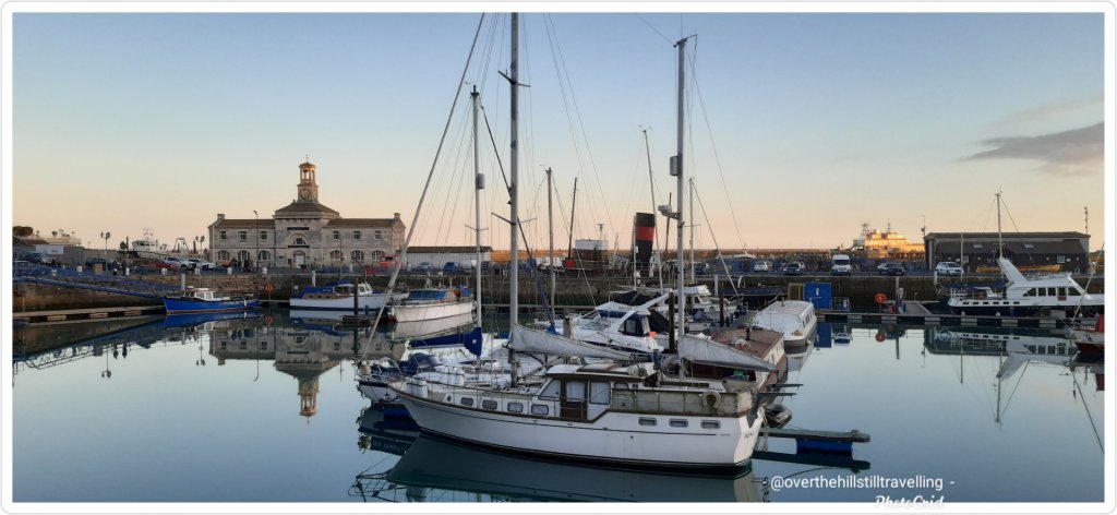
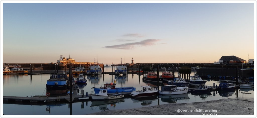
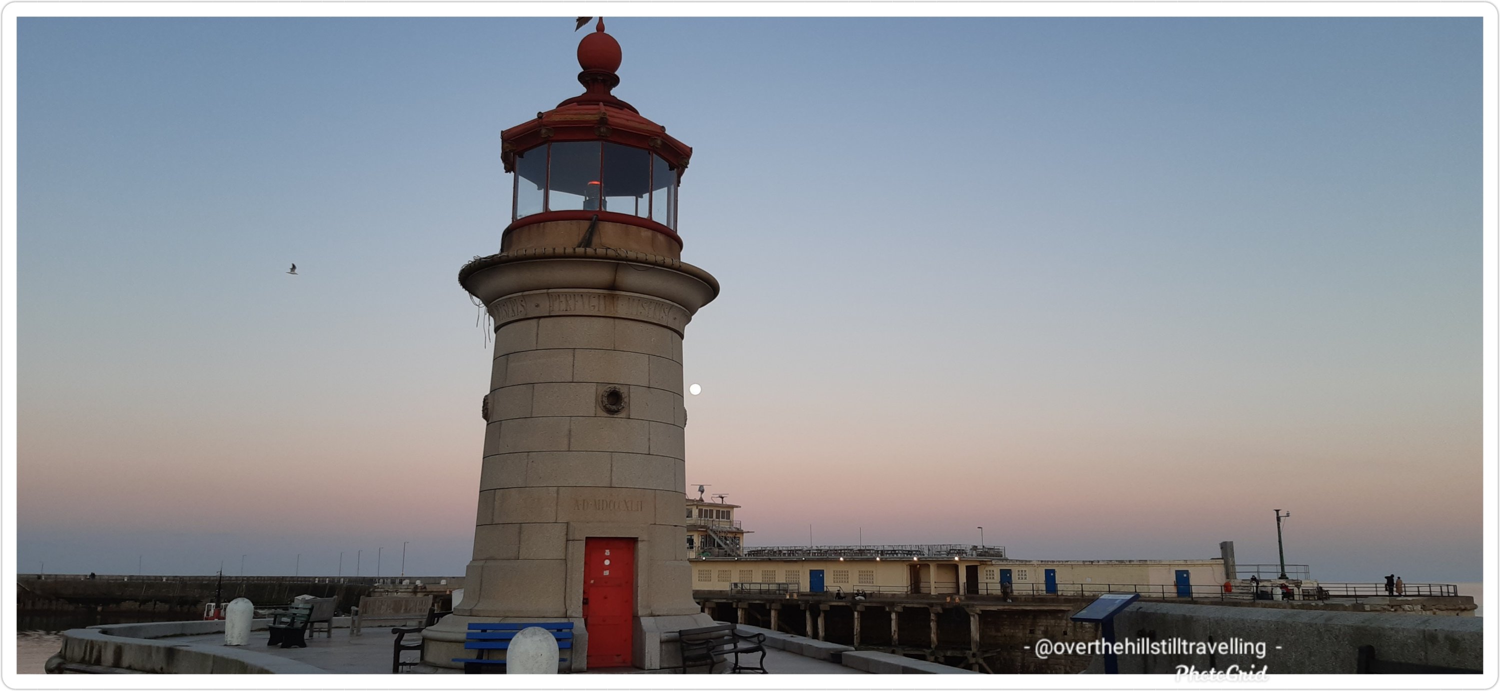
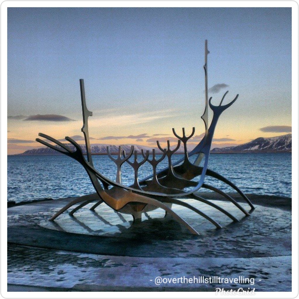
The Viking Trail, Kent : Cliff’s End to Reculver, Kent, Isle of Thanet – 32 mile (51.4km) / 2 days route on the Isle of Thanet. I’ve already walked the coastal route over various excursions, some of it a number of times. This trail takes you on a coastal walk from Cliff’s End off Pegwell Bay where you can see the Hugin Viking Boat replica, passing through Ramsgate, Dumpton Gap, Broadstairs, Kingsgate, Margate, Westgate, Birchington on Sea to Reculver, where it then heads inland….the inland section I have not yet walked, but I have walked St Augustine’s Way from Ramsgate to Canterbury via Minster which is on the route.

Saxon Shore Way, Gravesend to Hastings : http://www.kentramblers.org.uk/KentWalks/Saxon_Shore/153-mile (246 km) / 14 days – as with The Viking Trail, I’ve walked a number of sections of this trail, but now that I’ve bought the book and see the whole route, I’m keen to walk all the way in one go…..we’ll see. The sections I’ve walked are from Gravesend to Faversham when I walked Chaucer’s Canterbury Tales route (I diverted inland to Canterbury from Faversham) and from Ramsgate to Dover (this section I’ve walked over a few days in 2020 as part of my quest to walk the entire English Coast). What surprised me when I bought the book, is that the trail goes inland near Margate to Sandwich. But if you’re aware of the Isle of Thanet, then you’d realise that in fact the route did follow the coast at the time, when Thanet was actually an island and cut off from the mainland by the River Wantsum. The route also goes inland from Folkestone to Rye. The ‘historian’ is treated to the “Saxon Shore” forts built by the Romans at Reculver, Richborough, Dover and Lympne, to the landing place of St. Augustine and of Caesar (Pegwell Bay) and to defences of more modem times against Napoleon and Hitler.

Celtic Way, Cornwall : https://www.cornishcelticway.co.uk/ 125 miles (200km) / 12 days – from St. Germans to St, Michael’s Mount. There’s a guide book and passport that goes with this walk…I guess I’ll just have to do it “sigh”.

Coast to Coast Britain : 182-mile (293 km) St Bees (west) to Robin Hood’s Bay (east) : passes through three contrasting national parks: the Lake District National Park, the Yorkshire Dales National Park, and the North York Moors National Park. Long Distance Walks This is probably going to be one of those walks that I maybe never get to do; it’s almost a 3 week walk….but hey, add it on.

After reading the book The Salt Path (a true story), I found I was suddenly very keen to walk the South West Coast Path as well, so I’ve added it to my list https://m.southwestcoastpath.org.uk/walk-coast-path/south-west-coast-path-national-trail/SWCP-itinerary/

Southwest Coast Path, England : https://www.nationaltrail.co.uk/en_GB/trails/south-west-coast-path/ 630 miles (1008kms) / 56 days – this is a walk I would plan to do over a period of time for sure and incorporate it into my quest to walk the entire English Coast.

South Downs Way, England : https://www.southdowns.gov.uk/south-downs-way/ 100 miles (160kms) / 10 days – I’m well keen to walk this route ASAP. Winchester to Eastbourne; follows the old routes and droveways along the chalk escarpment and ridges of the South Downs.

The Egrets Way, East Sussex, England : https://www.egretsway.org.uk/route 7 miles (11.2kms) / 1 day : from Newhaven’s Riverside Park the Egrets Way follows the course of the River Ouse north to Lewes passing close to the villages of Piddinghoe and Southease. I’ll tie this in with the South Downs Way when I do that route.

The Fosse Way – a Roman route from Exeter to Lincoln, England : https://britishheritage.com/travel/roman-road-fosse-way 240 miles (384kms) / 21-28 a number of days!! I suspect this is going to be one of those walks that I do in sections. I’ve already walked a very tiny section of the ‘way’ in Shepton Mallet last year. During the Roman occupation in Britain (AD 43–410), they built some 8,000 miles of known roads, and to this day many of them underlie our more modern constructions. The name “Fosse” derives from the Latin fossa meaning “ditch”.

Hadrian’s Wall, England – https://www.nationaltrail.co.uk/en_GB/trails/hadrians-wall-path/ The Hadrian’s Wall Path is an 84 mile (135 km) long National Trail stretching coast to coast across northern England, from Wallsend, Newcastle upon Tyne in the east to Bowness-on-Solway in Cumbria on the west coast. The National Trail follows the line of the Hadrian’s Wall UNESCO World Heritage Site, passing through some of the most beautiful parts of England – from rolling fields and rugged borderlands to the vibrant cities of Newcastle and Carlisle – with dozens of fascinating museums along the way. An absolute must do, I’ve got the dates pencilled in and plans are afoot.

And then we have the 4 pilgrimage routes I’m still keen to walk. I’ve already walked The Pilgrim’s Way 153 miles (244.8kms) and planning to walk St Cuthbert’s Way and St Oswald’s Way in August, but I’d love to walk some of these others as well. https://www.independent.co.uk/travel/uk/britain-best-pilgrimage-routes-walking-holidays-uk-b485539.html

Old Way Pilgrimage, England : https://britishpilgrimage.org/old-way/ Southampton to Canterbury a 250 mile (400km) 21-28 days journey. This is quite a lengthy pilgrimage and would require careful planning.

St Cuthbert’s Way, Scotland/Northumberland : https://www.stcuthbertsway.info/ 62.5 Miles (100kms) / 7 days : Melrose in Scotland to Holy Island, Northumberland and onto Berwick-on-Tweed I’m planning this for August 2021

St Oswald’s Way, Heavenfield, Northumberland : https://www.stoswaldsway.com/ 97 miles (155.2kms) / 10 days : Heavenfield from/to Holy Island and onto Berwick-on-Tweed I’m planning this for August 2021 and plan to walk the Northumberland Coast as well https://www.visitnorthumberland.com/

Two Saints Way, Chester, Cheshire West : https://britishpilgrimage.org/portfolio/two-saints-way/  92 miles (147.2 kms) / 9 days : Chester to/from Lichfield

Peddars Way, Suffolk to Norfolk : https://www.nationaltrail.co.uk/en_GB/trails/peddars-way-and-norfolk-coast-path/ 49miles (78.4kms) / 5 days : Knettishall Heath Country Park, Suffolk to Holme-next-the-Sea, Norfolk. I’ll tie this in with my plan to walk the entire English Coast (in time) for when I reach Norfolk: Hunstanton to Hopton-on-Sea; Norfolk’s heritage coast 87miles (139.2kms) / 9 days

Pendleton Hill Witches Walk, Lancashire : https://www.historic-uk.com/CultureUK/The-Pendle-Witches/ 4miles (6.4kms) – a one day circular walk

The London Martyrs Way, London : https://britishpilgrimage.org/portfolio/london-martyrs-way/ 8 miles (12.8kms) / 1 day I’m planning on following this route in April 2021 when I walk the Thames Path. I’ll overnight in London enroute and do the walk, then continue.

And walking in Scotland is a must do…

West Highland Way, Milngavie to Fort William, Scotland : https://www.westhighlandway.org/the-route/  96 miles (154 Km)/10 days. I had planned to walk this route in September 2020, but we all know what happened then!!!

Great Glen Way, Fort William to Inverness, Scotland : https://www.scotlandsgreattrails.com/trail/great-glen-way/ 78 miles (125km)/10 days. This was also planned for 2020; a back to back walk of the 2 ways…but you know…Covid ???

The Rob Roy Way, from Drymen to Pitlochry, Scotland : https://www.undiscoveredscotland.co.uk/uswalks/robroyway/index.html  79 miles (125km) / 12 days. Features along the route: Killin. Falls of Dochart. Lochte Tay and Oban lost railway. This walk follows the tracks and paths used by Rob Roy MacGregor in the 17th & 18th centuries as he worked fought and lived the life of Scotland’s most notorious outlaw (I recently read about Rob Roy in Neil Oliver’s book ‘The History of Scotland’).

And then there are these… https://www.theguardian.com/travel/2019/dec/28/10-best-winter-walks-uk-2019

Of course I’d have to do a Welsh walk or two

Aberglaslyn trail from Beddgelert, Snowdonia, Wales : https://www.nationaltrust.org.uk/craflwyn-and-beddgelert/trails/cwm-bychan-and-aberglaslyn-pass-walk 5.7 miles (9.1kms) / 1 day Lovely views of snow-capped Snowdon along the way.

Anglesey Coastal Path, Anglesey Island, Wales https://www.visitanglesey.co.uk/en/about-anglesey/isle-of-anglesey-coastal-path/ 130 miles (200km) / 14 days – I’ve long wanted to walk this route as it would add to my islands for Project 101

Offa’s Dyke, Wales : https://www.nationaltrail.co.uk/en_GB/trails/offas-dyke-path/ The 8th century King of Mercia built this mighty earthwork to keep the Welsh out, and it still roughly marks the present England-Wales border, runs coast-to-coast and links Sedbury Cliffs near Chepstow on the banks of the Severn estuary with the coastal town of Prestatyn on the shores of the Irish sea. 177 miles (285km) / 18 days I’ve walked parts of this route when working in Montgomery.

Follow a river or two…

The Thames Path – Thames Barrier to Cricklade ‘the source’ : https://www.nationaltrail.co.uk/en_GB/trails/thames-path/ : 184 miles (294.4kms) / 14 days I have this planned for April 2021, but we all know how fickle Covid is, and how much our government dithers, so although I’ve ‘planned’ to do this walk, a long held dream since I lived in London, I’m not holding my breath!!

The River Severn Path, Bristol, Gloucestershire, Powys, Shropshire, S Gloucestershire, Worcestershire : https://www.ldwa.org.uk/ldp/members/show_path.php?path_name=Severn+Way 224 miles (360km) : this would require careful planning and I suspect that I would also walk this over 2/3 sections at different times.

Let’s throw a few islands into the mix:

Isle of Wight, England – https://www.visitisleofwight.co.uk/things-to-do/walking/coastal-path approximately 67 miles (107.2 kms) 5/6 days : I’ve walked quite a bit of this coastal route already, but I’m very keen to actually walk the whole perimeter in one go…over a period of days of course

Anglesey Island, Wales – as above…. https://angleseywalkingholidays.com/routes/ approximately 140 miles (224kms) / 14 days  The Coast Path is a  circular path around the whole Isle of Anglesey. This is a walk I’ve seen other people do on instagram and I’ve saved the photos!! It looks amazing. I’ve only been on this island twice since arriving in the UK and both times it’s been on a bus in-transit from Ireland to England and visa versa…time to put my feet on the ground and walk.

Isle of Harris, Scotland – Hebridean Way https://www.visitouterhebrides.co.uk/hebrideanway/walking Over the course of 156 miles (252km) / 14+ days : the route goes through 10 islands, crosses 6 causeways and includes two stunning ferry journeys. It is a route of astonishing variety – one day you may be walking on an exquisite deserted beach, with silver shell sand stretching far into the distance. The Hebridean Way walking offers keen hikers a unique opportunity to walk the length of this spectacular archipelago.

And then we have the canals…there are 2,000 miles of canal towpaths you can choose from! Not going to get bored then…these are my 4 favourite routes that I’d love to walk.

Kennett and Avon Canal – London to Bristol : https://canalrivertrust.org.uk/enjoy-the-waterways/canal-and-river-network/kennet-and-avon-canal 87 miles (139.2kms) / 7 or 8 days This is one of my must do canal routes

Bridgwater and Taunton Canal, Somerset : https://canalrivertrust.org.uk/enjoy-the-waterways/canal-and-river-network/bridgwater-and-taunton-canal 14 miles/22.5 kms / 1 day

Leeds & Liverpool Canal, England : https://canalrivertrust.org.uk/enjoy-the-waterways/canal-and-river-network/leeds-and-liverpool-canal 127 miles (203.3kms) 14 days This route includes a World Heritage Site; Saltaire.

Royal Military Canal, Kent : This 28 mile (45km) regal waterway, which was built as a watery defence against Napoleon, runs from Seabrook near Folkestone to Cliff End, near Hastings in Sussex. I’ve walked a small section of this canal near Hythe and it’s beautiful.

How about a viaduct…. or two

Glen Ogle Viaduct, Scotland : http://www.walkscotland.com/route96.htm – I love that the old disused railways have been turned into walking trails. 5 miles/8km I could do this in 2 hours LOL

Avoncliffe Aquaduct on the Kennet & Avon Canal : https://canalrivertrust.org.uk/places-to-visit/avoncliff-aqueduct

Disused railway walkshttps://www.mountainwarehouse.com/community/spring-time/top-15-rail-trails I especially love the look of The Strawberry Line: Somerset and The Cuckoo Trail: East Sussex and then right on my doorstep The Crab and Winkle Way: Kent I may well investigate these as easy walks to do with my grandson.

Monsal Trail, Peak District, England : https://www.peakdistrict.gov.uk/visiting/trails/monsaltrail The trail runs along the former Midland Railway line for 8.5 miles between Blackwell Mill, in Chee Dale and Coombs Road, at Bakewell.

High Peak Trail, Peak District, England : https://www.peakdistrict.gov.uk/__data/assets/pdf_file/0027/58518/PDNP-White-Peak-Trails-Map.pdf17.5 miles (28 kms) 2 days

Tissington Trail, Peak District, England : website as above 13 miles (20.8kms) / 1 days these 2 trails connect at Parsley Hay (that name alone would make me want to do the walk).

And what about these for good measure….https://www.kent-life.co.uk/out-about/places/waterside-walks-in-kent-1-6674762

Lands End to John O’Groats, Britain : I’m still not sure about this walk…..I may just save it till I run out of ideas for long distance walks and pilgrimage. https://www.landsendjohnogroats.info/route/ 1,111 miles/3 months LOL I may just drive it

Other countries:

Tsitsikamma Mountain Trail, southern Cape, South Africa – https://www.tsitsikamma.info/listing/tsitsikamma_mountain_trail Beginning in Nature’s Valley and ending at either the Storms River Bridge or Village 38.9 miles (62.3km) / 6 days.

Kumano Kodo, Japan : https://www.japan-guide.com/e/e4952.html – specifically the Nakahechi trail 19 miles (30 kms) / 2-3 days. I’d love to do this walk in spring over my birthday, then I can see the cherry blossoms too which has been a dream of mine for decades….I may well plan this for 2025 when I visit Australia and New Zealand.

St. Francis Way, Italy : https://www.viadifrancesco.it/en/# 344 miles (550kms) / 28 days a pilgrimage route from Florence through Tuscany, Umbria and Assisi to Rome and its seven pilgrim churches. I’ve purchased this walk via the Conqueror Virtual Challenges and plan to follow this while waking St Cuthbert’s Way & St Oswald’s Way and Hadrian’s Wall in August/September.

NORWAY https://www.afar.com/magazine/the-worlds-northernmost-pilgrimage-route-is-in-norway-and-almost-no-ones-heard/amp?__twitter_impression=true

I’m not sure how I stumbled across this website, but if I ever go walking or camping in Belgium it will be very useful https://welcometomygarden.org/explore Is a brilliant concept. I just wish we had something similar here in the UK.

And finally….”Walk with the dreamers, the believers, the courageous, the cheerful, the planners, the doers, the successful people with their heads in the clouds and their feet on the ground. Let their spirit ignite a fire within you to leave this world better than when you found it…” Wilferd Peterson

I have no idea if I’ll get to do all these walks, but so long as I have life in my legs, I shall give it a damn good go…meanwhile, perhaps my list have given you some ideas of walks to do. I’m going to tie in 4 of my Conqueror Challenges with the 2021 walks I have planned, and I have no doubt that they will come up with a few more that I can add to my itinerary for 2022.

Read Full Post »

And finally…I did actually push myself today and managed to finish this challenge

On the border of Nepal and Tibet (autonomous region of China), standing proudly at 29,032ft (8,848m) is Mount Everest, the tallest mountain in the world and crown jewel of the Himalayas. First summitted in 1953 by Sir Edmund Hillary of New Zealand and Sherpa Tenzing Norgay, Everest has since been summitted by over 5,700 people a staggering 10,000+ times. Of course like any high risk activity, accidents and deaths do occur and in the last century just over 300 people have lost their lives on Everest. Although Everest has 17 different routes to the summit, only two of them are primarily used: the North Ridge route from Tibet and Southeast Ridge from Nepal.

As the air continued to thin the remainder of the climb was done with supplemental oxygen, using a full face mask with a rubber tube that connected my mask to a metal cylinder that held the oxygen tucked inside my backpack. The cylinder had a regulator on top that controlled the flow of oxygen.

Heading out from Camp 3 at sunrise I made my way up steep terrain for about 500ft (150m), traversed to a strip of limestone known as Yellow Band, across a stratified (layered) rock-ledge and up a 200ft (60m) at 40 degree angle stepped rock cresting the Geneva Spur. Following a rocky path I arrived at South Col (Camp 4) and had my first view of Everest’s peak. The true summit wasn’t visible from here but I could see most of the route to the South Summit (the secondary summit).

South Col was a waypoint for the final stretch at an elevation of 26,000ft (7,925m). Here I ate what little I could ingest as my appetite waned (a common problem at high altitude as the body no longer metabolises food efficiently), rested and waited for the night to roll in. Most climbers will depart for the summit between 10pm and 2am and take anywhere between 8 to 12 hours to reach the summit.

Wanting to catch the sunrise just before 5am, I checked my gear, put my headlamp on and headed across a broad plateau before ascending the steep 40 degree Triangular Face to the Balcony, a resting platform at 27,500ft (8,380m). Many of the early climbing teams including Edmund Hillary, put in a higher camp here in order to give them a shorter time to the summit and more time to climb in the warmth of the sun. Nowadays it’s rarely used. I took the opportunity to change my oxygen bottle, rest, eat and hydrate.

Once I crossed over 26,246ft (8,000m), I was technically in what is known as the “Death Zone”, where the oxygen is so thin that it is unable to sustain human life. Up here the oxygen level is 33% of what is available at sea level. At this altitude the body uses up its oxygen stores faster than it can replenish and without supplemental oxygen the body deteriorates and shuts down. That is not to say that experienced climbers haven’t succeeded in reaching the summit without supplemental oxygen. In 1978, Reinhold Messner and Peter Habeler were the first climbers to summit without bottled oxygen. A mere 0.02% have succeeded to summit without oxygen since.

From the Balcony the route took a slight left on gentle terrain till the route moved north and I was met with a 200ft (60m) slab of steep rock and snow terrain. Clipped into my fixed line, I pulled myself up using a jumar (ascending device) and in some exceptional steep sections my crampon points were precariously placed on jutting rock, strongly hoping they wouldn’t slip. It didn’t end here. When I made it above the slab, I was met with an even steeper section with a 60 degrees incline but thankfully it was shorter at around 100ft (30m).

Cresting the South Summit, I stopped for a short hydration break and a snack. From here the next section was a 20ft (6m) vertical drop, followed by the Cornice Traverse, a knife edge-like ridge-crossing to what was once known as Hillary Step. The Step was a nearly vertical rock face of 39ft (12m) and a technically difficult climb but it was destroyed when the region was struck by an earthquake in 2015. What was left were snow steps at 45 degree angles. It was debatable whether this was an easier way to climb but the real loss was the “Hillary Step monument”, a testament to Hillary and Tenzing’s success as the first summiteers.

With the end in sight, it took a further 20minutes to reach the pinnacle of the world. Adorned in prayer flags the summit at 29,032ft (8,848m) was a breathtaking 360 degree view of mountain peaks, glaciers and valleys. I watched the sun rise, casting an orange-red hue across the diminishing night sky as I reflected at the magnitude of this journey.

In Edmund Hillary’s words: “It is not the mountain we conquer but ourselves.”

And on that note, I’m reminded that for me its about the adventures I have with my walking and over the last 4 years, I have truly conquered quite a lot, albeit not Mt. Everest, I’ve climbed my fair share of mountains – both actual and metaphorical.

Done and dusted

I hope you’ve enjoyed reading about Mt. Everest, and even though it sounds absolutely amazing, I’m still not in the least interested in actually climbing Mt. Everest…I’ll leave that to someone else 😉🧗‍♀️🧗‍♀️🧗‍♀️

Onwards.

Read Full Post »

Yesss…..I know!! I said “no more challenges” – don’t criticise me please 🤪😁😁

But I signed up for not one, but TWO of the new Conqueror challenges….how could I resist…I mean seriously, just look at that medal. Is it beautiful or what!!! 🧡🧡

Mount Kilimanjaro https://www.theconqueror.events/kilimanjaro/ can you just imagine what the postcards are going to look like! 🏔🌄🐘🐘🐘 I’ve been hoping they would produce another short-distance challenge that I could squeeze in somewhere this year, and this fits perfectly 97km.

and please don’t tell anyone 🤫🤫🤫but I’ve also signed up for the Kruger Park challenge – since I have visited the Kruger National Park a couple of times in my life, this was a MUST DO. I’m going to do this challenge in memory of my brother Arnold who died when he was in his late 20s from a ruptured ulcer. He would have been 66 in August of this year…. One of my fondest memories of him is on our 1st visit to the Kruger National Park. We were in our mid teens, when my father took us, his 2nd wife, my baby brother Kevin and my younger sister Susan to the KNP. While we were driving there my baby brother threw up all over Arnold’s trousers…..so instead of walking around in his underpants, my father made me give him my bright blue psychedelic bell-bottoms (1970’s fashion) to wear…the top fortunately was long enough for me to be wearing a very short mini-skirt 🤭🤭 It wouldn’t have been quite so bad, except that Arnold had on a burnt orange stripped shirt…paired with bright blue psychedelic patterned pants…not so cool. And that is my over-riding memory of my 1st trip to the KNP. I’m sure we saw lots of animals, but mostly my memories are of that, oh and the breakfasts…I thought I’d died and gone to heaven! The breakfasts were sumptuous.

The pink outfit in this image is pretty much what it looked like, except blue with multi-coloured patterns. If I recall correctly, it was a suit my Mother would have made for me since she was a seamstress and made most of our clothes growing up.

Kruger National Park https://www.theconqueror.events/kruger/ these postcards are going to be amazing!! Looking forward to the information that comes with them.🦓🦏🐘🦒🦛🦁🌅

Anyway, they’re the very first African themed challenges so of course I simply HAD to sign up – Mt. Kilimanjaro whoop whoop Of course my reason for signing up for this one is that my sister and her husband have in fact climbed the REAL Mount Kilimanjaro. I wonder if maybe one day I too will climb it…..??? I got my race bib!! #29 I’m getting closer and closer to #1 But! to my utter dismay, the internet was very slow in my area today and so my race bib number for the KNP is #87 too sad!! 🥺😪😪 damn

This will be my 3rd mountain challenge 1. Mt Fuji 2. Mt. Everest and now 3. Mr Kilimanjaro

Mt. Kilimanjaro

Kruger National Park

My other race bibs were St Francis Way #149 / Giza Pyramid #178 / Mt Everest #218

If you’d also like to walk these challenges, you can find the details here https://www.theconqueror.events/all-challenges/#hw_card This is not my affiliate link….I’ve already had 39 people sign up under my link which is just crazy….so I’m not using it anymore.

Read Full Post »

In the real world, on 22nd of February I was traipsing through the meadows and fields of Salisbury, marginally warmer I’m sure, and a heck of a lot easier 😁😁

With the Himalayas towering on either side of the trail, I trudged on and I say trudged because as you may well imagine fatigue, high altitude, low oxygen level and the constantly changing terrain was having an impact but as you may also imagine the desire to climb Everest was even greater and gave me the impetus to carry on.

The terrain morphed from tundra with low level shrubs to rocks and boulders. It was rugged, remote and massive. Rounding the bend at Dughla, a small hamlet and resting point, I was confronted by a pile of rising rubble where high up on the hill at 16,100ft (4,900m) is the terminus of the Khumbu Glacier, the highest glacier in the world. To the right I could see the glacial meltwater as it was making its way down the hill into the Lobujya River flowing southward as the Imja River and into the Dhudh Kosi.

The next hour’s climb was a steep 656ft (200m) trek to Chukpi Lhara. Set atop a large plateau, Chukpi Lhara is Everest’s memorial ground. Monuments made of stone or cement, some covered in prayer flags were built to honour climbers and Sherpas who lost their lives on Everest. It was a sobering and reflective moment.

Located at the foot of the Khumbu Glacier to the east and the soaring peak of Mount Lobuche East to the west sits the seasonally busy village of Lobuche. The village is the second-last stop for overnight lodging before base camp. Mount Lobuche has two peaks and is differentiated by calling it East and West. Permits are required to climb the mountain with East (20,075ft/6,119m) being classed as a trekking peak, whereas West (20,160ft/6,145m) being classed as an expedition peak. The two peaks are connected by a long and deeply notched ridge with sheer drops on either side making the West peak inaccessible from the East but it can be climbed via the southern shoulder.

I didn’t stop in Lobuche, I pressed on to Gorak Shep the absolutely last place to stay in a lodging. The village was buzzing with trekkers and climbers either coming or going. At an elevation of 16,942ft (5,164m), Gorak Shep was located at the base of Mount Pumo Ri on the edge of a frozen lakebed covered with sand with Khumbu Glacier to the east and Changri Shar Glacier to the west.

The village was completely barren and devoid of vegetation but the peaks were ever-present from every angle. The summit of Kala Patthar on the south ridge of Pumo Ri was a major landmark for any trekker who wanted a clear view of Everest and Nuptse’s peaks. Because of Everest’s structure view of its summit from base camp is blocked by Nuptse. Climbing Kala Patthar was another great way to acclimatise. With an elevation gain of 1,270ft (390m) it was a short-two hour return trip. After a hearty lunch of curry potato and paratha bread for dipping, I was ready for the last trek of the day.

And here I thought I did good climbing halfway up Mt. Snowdon!!! And no, I still can’t do a decent selfie 🤪🤪

November 2017, Mt. Snowdon. My hair was still pink after my Camino in September 🤪🤪🤫

It all sounds absolutely amazing, and the curry potato sounds yummy, but as for the rest of it, I get tired just reading about it and once again I’m ever so glad this is not something I ever have to do 🥶🥶🥶😰😰 it just sounds exhausting.

Read Full Post »

Reading through this information, I’m left thinking that some people need their heads read!! I know I push myself and I’ve done some crazy shit when on my long-distance walks, but I would not want to do any of this. Thank the lord it’s a virtual climb and I don’t ACTUALLY have to do this 😁😁😁😄 instead I was whizzing around Salisbury

Exploring Salisbury – far more my style ☺

Starting out with an easy hike, I nearly missed the iconic yellow and red sign against a huge boulder simply stating “Way to Everest B.C.” with a big red arrow beneath the words pointing towards base camp. At least I was certain I was on the right path.

After what felt like hours of trekking, the treacherous Khumbu Icefall loomed into view spilling its way down the valley between Everest and Nuptse. Khumbu Icefall sits at the head of Khumbu Glacier, a constantly moving sheet of compacted ice. As the glacier makes its way down the valley it fractures, creating deep crevasses that are always in motion and large towers of ice called seracs that are known to suddenly collapse.
Making the final ascent I arrived at the cairn adorned in prayer flags with its rudimentary sign signalling that I have arrived at Everest Base Camp (17,477ft/5,327m). It was located on a scree-covered section (loose broken stones) at the foot of Khumbu Icefall. I settled into one of the yellow tents and mentally prepared for the high altitude acclimatisation process I would begin to endure.

As sea-level dwellers our bodies are not designed to live at high altitude but we are certainly capable of adapting to it through appropriate acclimatisation. The higher we go, our bodies go through physiological changes by producing more red blood cells in order to carry more oxygen to our muscles and organs whilst combating the thinner air.

The acclimatisation process on Everest is lengthy taking up to a month and done by exposing the body to higher and higher altitude then descending to sleep, recover and overcome any signs of acute mountain sickness due to sudden changes in altitude.

High altitude sickness can affect any person regardless of fitness or age. Ignored or left untreated altitude sickness can have serious consequences including fatality by developing either into cerebral oedema or pulmonary oedema which is fluid build-up in the brain or lungs. Some of the immediate ways to treat altitude sickness is by taking specific medication, supplemental oxygen and/or descending.

During that month I climbed and returned to base camp three times with each climb going higher. It looked something like this:
1. Base camp to icefall, return to base camp. Have a day of rest.
2. Base camp across icefall to Camp 1 and stay; then Camp 2 return to Camp 1 for sleep; then Lohtse Face return to Camp 2 for sleep; and descend back to base camp. Have four days of rest.
3. Climb to Camp 1 and stay; then Camp 2 and rest the next day; then Camp 3 return to sleep at Camp 2; and descend back to base camp. Have five days of rest and wait for the right weather to summit.

The anticipation was over and the much awaited good-weather window presented itself for the final part of the expedition: Summitting Everest.

Starting in the wee hours of the morning, geared up and harness on I negotiated my way through the camp under the light of my headlamp to Crampon Point and attached my crampons to my boots.

Staring out at Khumbu Icefall with a good dose of mixed emotions I began the perilous yet now more familiar climb across. Crevasses were crossed on horizontal ladders and towering ice blocks on vertical ones. Some crevasses were so wide that more than one ladder had to be tied together to bridge the gap. For safety I was clipped into fixed lines. If I was to lose my footing on the ladders and fall the fixed lines would help break my fall. Climbs in some areas fluctuated between 20 to 60 degree angles but there was no time to dwell as the ongoing shifting and settling of the glacier and icefall was a constant reminder how unsafe the area was and moving quickly was necessary.

Several hours passed crossing the icefall till I made it to a large flat expanse of snow with more ladders to climb all the way to Camp 1. Situated at 19,390ft (5,910m), Camp 1 was in the middle of the Western Cwm (Cwm is Welsh for valley), a broad and flat glacial valley. From here I could see the Pumo Ri Mountain to the west and Lhotse Face straight up the valley. I then climbed on to Camp 2 about 1.74mi (2.8km) further up from Camp 1. Located at the base of a gully on scree, Camp 2 was well provisioned and is often considered as Advanced Base Camp. I stopped for a day of rest.

Early next morning I began making my way across the Western Cwm to the base of Lhotse Face where I had to cross a short ladder over a bergschrund (a deep crevasse where the steep slope meets the glacier). Lhotse Face is a 3,690ft (1,125m) glacial wall of blue ice. Sections of Lhotse Face average 40 degrees incline thereby needing to kick my crampon points into the ice to secure my footing. Throughout this climb I was clipped into a fixed line which was attached to the face with ice screws and anchors. I could feel the altitude change, my breathing labouring as I slowly and steadily climbed my way into Camp 3. I was now at 24,015ft (7,320m) gaining an elevation of 6,538ft (1,993m) from base camp. There were several camping spots here, essentially wherever one could find a flat spot to pitch a tent. I remained fixed to my safety line. The sun was up bestowing me with glorious views of the valley below, the peak of Pumo Ri and the others beyond.

Quite honestly, that all just sounds like a lot of hard work – so for me, its a no thanks. I’ll stick with my virtual journey and leave this to someone else. Seriously?? Why would anyone want to do this??

Read Full Post »

If seems there are still some mountains to be climbed. In a way its quite awesome to learn that not all mountains have been conquered, especially as it is a sacred mountain…some things should just be left alone…onwards and in reality when I reached stage 3 in was exploring Salisbury

Leaving Namche Bazaar, the trail was wide and level following the curves of the Khumbu Yui Lha mountain. The mountain is 18,900ft (5,761m) above sea level and considered sacred by the Sherpa people. With the exception of one unsuccessful attempt in the 1980s, the mountain has never been climbed.

As beautiful as it is, it just looks cold..

Winding my way up the trail, I could feel the climb in my legs as my muscles strained on sections of steep, stone steps then levelling out and just around the next bend it’d be another round of steep steps and on and on it went. Occasionally, I’d be rewarded with tiny peeks of Everest in the distance.

Suddenly, my trail began its descent to the valley floor and if I thought my muscles strained on the ascent, I now felt the strain on my knees during the descent. Reaching the village of Phungi Thenga, I traversed Dhudh Kosi river again and just as I made it into a gorge the trail took on another brutal ascent all the way to Tengboche. The highlight in the village is the Tengboche Monastery, a Tibetan Buddhist monastery for the Sherpa community. First built in 1916, the monastery has been destroyed and rebuilt a few times. Home to 60 monks, the prayer room is a kaleidoscope of colour with murals and paintings adorning the walls. A nunnery is a short trek away in Deboche.

Tengboche is beautifully located with its panoramic views of several peaks but the most outstanding was Ama Dablam and its imposing 22,349ft (6,812m) peak. Flanked by long ridges and a hanging glacier, it was first climbed in 1961 and it is the third most popular Himalayan peak for climbing.

The constant up and down trekking seemed a little self-defeating until I realised that since Lukla, I was an extra 3,280ft (1,000m) above sea level. I couldn’t ponder that for long as down into the valley I went again to cross Imja Khola river, a tributary of Dhudh Kosi.

Once I crossed the river, I left the woodland behind. The trail from here was in the open, no more trees in the way of my view presenting me with the enormity of this place. Up and down went the trail, yet progressively gaining elevation. The air had changed. A little thinner, a little colder, no trees to provide shelter from the wind.

Eventually I reached the tiny village of Phiroche. It is located above the Tsola River at an altitude of 14,340ft (4,371m). It is a major stopping point for acclimatisation and also an evacuation point. The village has a hospital that runs during the climbing seasons and is operated by the Himalayan Rescue Association with Nepalis staff and volunteer doctors from the US, Europe, Canada and Australia.

Rather than sitting in a lodge, I dug out my gloves and beanie and very slowly over a period of about two hours, I hiked up to Nangkartshang peak (also referred to as the Dingboche Viewpoint) with an altitude of 16,676ft (5,083m). I was wonderfully rewarded at the top with a glorious view of several peaks such as Ama Dablam, Imja Tse, Tobuche and Lobuche and further afield even higher peaks Cho Oyu, Makalu, Lhotse and of course Everest.

As dusk was closing in I retired to my lodge for dinner. Looking for a warm and comforting dish, I settled on a hot noodle soup with pieces of meat and vegetables called Thukpa, accompanied by hot momos, steam filled dumplings.

Amazing to learn about all if this. Certainly one of the highlights for me following these virtual challenges is the postcards, I really do find it ever so interesting.

Read Full Post »

And so to stage 2…

I reached stage 2 while I was in Deal for my Covid-19 innoculation and the weather wasn’t much better by all accounts, although they had blue skies, whereas mine was grey

Walking in Deal

Leaving Hillary Bridge behind at 9,514ft (2,900m) it was time for the next gripping ascent. Travelling uphill on single-lane switchbacks demanded patience, slowly shuffling along putting one step in front of the other, often needing to pull aside to let the steady stream of traffic pass me by. Mules, trekkers, porters and yaks were a common sight, breaking my already slow momentum. As I was gaining elevation, I could feel the change in the air, a shortness of breath, clearly indicating the change in altitude. I’d say more garlic soup was on the horizon.

Two hours later I arrived in Namche Bazaar, the largest village in the region. Namche was located on a plateau, rising up the hillside at 11,285ft (3,440m). On either side of the village were the 19,800ft+ (6,000m+) peaks of Kongde Ri to the west and Thamserku to the east.

From single-storey to triple-storey buildings, a plethora of teahouses and lodges are readily available to service visitors and trekkers. Anyone who was up for a pint of Guinness or a shot of Jameson or Teeling Irish whiskey would find it in the centre of town at the remotest Irish Pub in the world.

Namche is a trading centre, altitude acclimatization stop, gateway to the upper Himalayan region and the final stop to purchase any gear needed for the upcoming trek to Everest.

Resting here overnight and taking the time to acclimatize, I stopped at a teahouse to enjoy the national dish of Dal Bhat Tarkari, a lentil soup with steamed rice, accompanied by seasonal vegetables and curried meat. It is a staple meal of the Sherpa people eaten once or twice a day as a perfect combination of protein and carbs for their physical workouts at high altitude.

Just slightly out of town up a hill is the Sagarmatha National Park Museum with a statue of Tenzing Norgay on the grounds. A worthy visit not just for the museum but also the amazing views of the surrounding peaks.

I spent a full day acclimatising with a nearby hike to Khumjung at an ascent of about 2,000ft (600m). Khumjung is a village known for the Edmund Hillary School which when built in 1961 only had one classroom but today teaches children up to grade 10. Then onto Khumjung Monastery to check-out the mysterious yeti scalp. The yeti is steeped in Himalayan folklore as a large monster which in western culture is known as the Abominable Snowman.

Before descending back to Namche, I grabbed a pastry and hot drink from the closest bakery and whilst standing outside absorbing the mountainous vista I watched the Sherpa women harvest the potato fields, a staple crop and one of the few that can be grown at such high altitude.

One more night of rest in Namche. The long, slow, steady climb awaits.

Crikey, reading all that makes me glad I’m not really there 🤪🤪🤪 even though it would be quite cool to visit the remotest Irish Pub in the world 🍀🥳💚💚

Read Full Post »

I finally found a bit of space to start reading up on the Mt. Everest virtual challenge which I completed last month, and although I had decided to not post any further posts about the various challenges I’m following, this was so very interesting that I changed my mind and so here we go….I hope you enjoy reading more about Everest and what the climbers who actually go there experience. So often we read or hear about climbers and teams of people who climb Mt Everest but we seldom read about the finer details. So this has been really interesting.

I actually started the challenge in Ramsgate on the 10th February on the tail-end of the ‘beast from the east’ snow storm. So this is a bit behind the actual times 😉 But since it’s not real anyway, it doesn’t really matter…anyway, I hope you enjoy reading these posts…

Where I actually was….pretty realistic really

Flying into Kathmandu is a walk in the park when compared to Lukla. Dubbed as the most dangerous airport in the world, Lukla’s runway is a mere 1,729ft (527m) long, with mountainous terrain to the north and a steeply angled drop to the south. It is built on a 12% uphill gradient to help planes slow down. There are no go-around procedures if the planes miss their approach, as such only highly experienced pilots with short-takeoff-and-landing missions under their belt, experience in Nepal and ten flights in Lukla with a certified instructor, are permitted to land at the airport. In a nutshell if climbing Everest doesn’t cause prickles on the back of your neck, then a high intensity landing in Lukla certainly should.

Where I wasn’t really 😁😁 Stage 1

In 2008, Lukla airport was renamed Tenzing-Hillary Airport in honour of Sir Edmund Hillary and Sherpa Tenzing Norgay, the first climbers to reach the summit of Everest. Hillary was instrumental in the construction of the airfield in Lukla, building an unsurfaced airstrip on a mountain shelf in 1964. It took 37 years to finally asphalt the runway.

Home to 1200 people, the village sits at 9,383ft (2,860m) above sea level, nestled on a small plateau amongst the awe inspiring mountain peaks of the Himalayan Ranges. The nearly 40mi (64km) trek to Mount Everest, skirts steep mountainsides, through deep valleys and over alpine glaciers. The hike travels through small villages and teahouses, past prayer wheels and fluttering prayer flags to the memorial site honouring mountaineers and Sherpas who lost their lives climbing the mountain, continuing to Base Camp and then the final summit climb.
Leaving the viewing platform of the Lukla airport, I made my way through the centre of town on a narrow street that was sometimes cobbled and sometimes just compacted soil. Double-storey buildings lined the street filled with shops, teahouses and lodging services.

Shortly after leaving the village I passed through the National Luminary Pasan Lhamu Memorial Gate which was built to honour Pasan Lhamu, the first Sherpa woman to summit Everest in 1993. It is the gateway to the Khumbu Region that encompasses the Sagarmatha National Park and the Nepalese side of Mount Everest.

It was a gradual downhill hike, passing through a forest on narrow paths with the colossal mountainside ever present to my right. I continued on this downward hike, on a trail that wound itself up and down, passing through villages with teahouses until I reached Phakding, a small village that lies in the Dudh Kosi river valley. Here was the first of many suspension bridge crossings. The bridge, about 100ft (30m) above the river, stretched across what seemed to be an old landslide with large boulders and debris settling beside the river. As the bridge swayed and moved beneath my feet, I pondered about those whose fear of heights may find the crossing challenging. This isn’t the tallest suspension bridge on this trek, that is yet to come.

Finally reaching the small village of Benkar with its tin-roofed, brightly painted window frames, four-storey residences/storefronts, I settled into one of the teahouses for a meal. Known to aid with altitude adaptation I had garlic soup with Tibetan flat bread. Between the warmth of the soup and the crusty on the outside, fluffy on the inside bread, I filled my belly and finished with a Tibetan tea.
Rested and fed, I resumed my hike crossing another suspension bridge. Soon I reached the entrance to Sagarmatha National Park. A UNESCO listed site since 1976, the 1,148km² park is home to the Sherpa people, rare species like the snow leopard and several mountains including Mount Everest.

After obtaining the necessary permits to enter the park, I walked through the Jorsalle Entrance Gate, a concrete structure with Buddhist artwork on its interior walls to a set of steps that began a steep descent into a gorge, onto Jorsalle village, alongside the thundering Dhudh Kosi river and over two more suspension bridges.

However, what goes down, must come up and it wasn’t long before I engaged my hiking poles to start the steep ascent onto a woodland path until I reached a wide open low lying land beside the river filled with stones and boulders making trekking through it unstable and difficult.

But nothing prepared me for the next suspension bridge. Like all the others, Hillary Bridge was made of galvanized steel cables that’s connected to the grated deck by interlinked wire fence. An old version of the bridge was right beneath this one just hanging, blowing in the wind, no longer in use. At 410ft (125m) above the Dhudh Kosi river, this 459ft (140m) long bridge was exposed to the elements swaying laterally and vertically as the strong wind blew through the valley. It was a heart thumping, adrenaline spiking exercise that on this trek one could do without. I was grateful to reach solid ground.

If I ever entertained even the slightest idea of ACTUALLY doing this ‘walk’, reading about that bridge has pretty much scuppered any possibility 🤣🤣🤣 I don’t have a fear of heights and I’m a bit of an adrenaline junkie, but I have my limits 🤪🤪

So, no go for me thanks, virtual suits me just fine.

Read Full Post »

I arrived home last night, after a 4.5 hour journey, from a week’s booking in Salisbury. As much as what I really enjoyed exploring the city, and learning more of the history and her green spaces, it was wonderful to be back home.

You cannot underestimate the sheer joy of coming ‘home’ to your own place. It may not be much, but it’s got my stuff in it, and I’m home.

My own duvet…magic

After I’d dropped my bags off, I grabbed my walking poles and immediately set off for a sunset walk to the harbour

Absolutely stunning
A Royal harbour
Can you see the moon?
The sun setting in front of me

and then along the lower promenade

The snow moon rising behind me

before climbing up to the clifftop and a walk to Pegwell Bay.

View of Pegwell Bay from the bottom of the cliffs
From halfway up the path to the top of the cliffs

It was quite dark already by the time I reached the hotel, so I stopped there for a few photos and then walked back along the clifftop.

View from Pegwell Bay hotel
A bit of fun with the moon and the hands and molecules sculpture
One lone boat still has its Christmas lights on

A magical walk with no pressure to get back within 2 hours, and 9.9 kms added to my 2021 Conqueror virtual challenge.

I’m going to start the Ring Road Iceland virtual challenge on Monday 1st March. I’m so looking forward to the postcards, should be amazing. My daughter and I had a fantastic 4 day trip to Iceland in 2014, so I’m really keen to see the information that comes with the postcards.

The Sun Voyager (Icelandic: Sólfar); a sculpture by Jón Gunnar Árnason

Read Full Post »

When I got back from my Throwley booking earlier this month, I decided to take a walk along the beach to get some kms in since I’d completed the Alps to Ocean challenge and started climbing Mt. Everest 🥶🥶🥶🗻🗻 (also completed while in Salisbury).

BUT!!! To my horror I found that most of the beach has been stripped away by the storm. As far as the eye can see, used to be beach…its now mostly stones and rocks and the sand has been stripped right down to the chalk bedrock. I genuinely could not believe my eyes. I can see just beneath the waves there’s still some beach, but not sure how far it extends.

The beach where I used to take my grandson to play is now just a rocky morass.

To give you an idea of the power of the sea, this great big chunk of very degraded concrete was washed up and dumped onto the beach almost halfway up towards the Royal Pavilion
Quite awesome to see the pure chalk bottom though…just think….this is billions of sea creatures solidified into chalk from millions of years ago.

Unreal, the power of nature. I’m saddened too because it’s one of my favourite places to walk. But a local said the wind and sea will likely blow it all back when the winds blow from another direction. Meanwhile…😔😔😔 no beach walking🚶🏻‍♀️🚶🏻‍♀️ for me atm, I’ll have to try catch it when the tide is out.

Meanwhile, I shall have to head southward and visit Pegwell Bay again.

Read Full Post »

« Newer Posts - Older Posts »

Self Propelled

Self propelled adventures through life; blogging on cycling, touring, micro-adventures, general shenanigans, and environmental news

johnelsewhere

Thoughtful wanderer in search of virtual meaning

Things Helen Loves

UK and European Travel inspiration & life outdoors

Short Walks Long Paths

Wandering trails around the coast of Wales

Port Side Travel By Jill

My travels, photos, tips/tricks and anything else I think of!

Wonderwall

My 360: wonderwalls,theatre, travel, Sheffield, books...

Robyn's Ramblings

My Thoughts. Expressed.

Graham's Long Walk

Graham King's long walks around Britain

The Lawsons on the Loose

Philip & Heather are making memories through their travels.