I can’t tell you how often we get weather reports that predict snow, and it all just fizzles out in a flurry.
So when I heard on Friday that we should expect the Beast from the East and 20 cms of snow, I was like “yeah, yeah…whatever “. They never get it right…
We hah! I got it wrong. When I woke up this morning it was raining, as it had been since the afternoon before. Have you ever heard of rain preceding snow? No. It always come afterwards. So I looked out the window at 7am, and instead of the predicted 2am sleet⁸⁸ and snow, I saw rain.
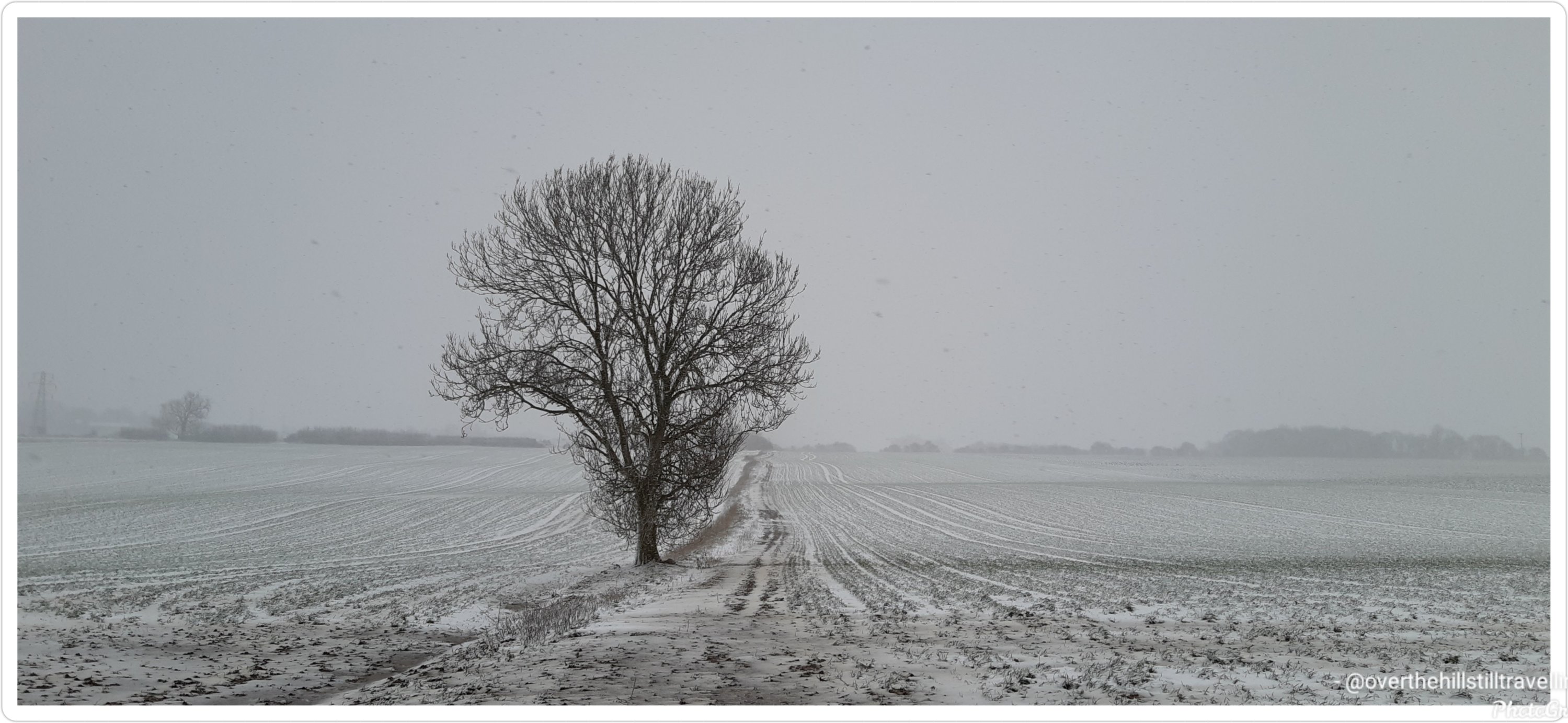
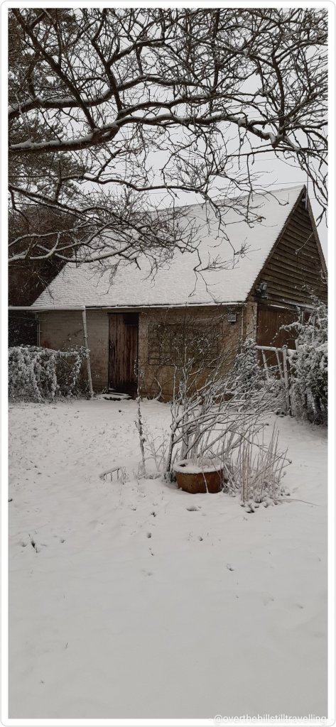
And hour later and it was a ‘whiteout’. Blimey, the snow arrived on the back of the beast and it hasn’t stopped since. Even as I write its blowing a bloody gale outside and the snow is piling up!!! And up!!
Now, I love snow, and I always get really excited when it snows, but this is just seriously bad timing. My booking ends tomorrow and by looks of things, I am not going to be able to get out….😱😱😱🥺🥺
The incoming Carer decided to come this afternoon coz there’s no trains tomorrow, so at least she’s here, but blimey…it looks like I may get stuck here for another day. Meanwhile….
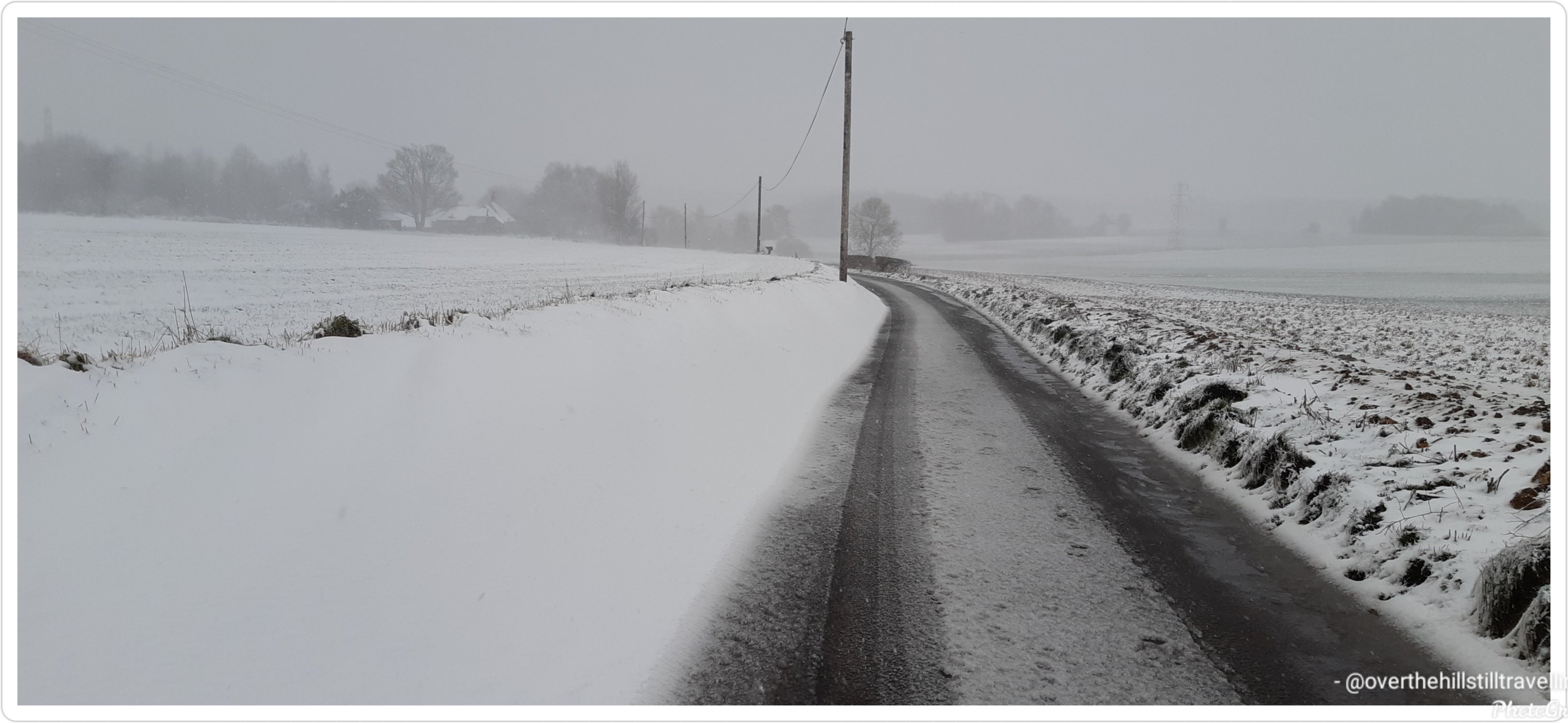
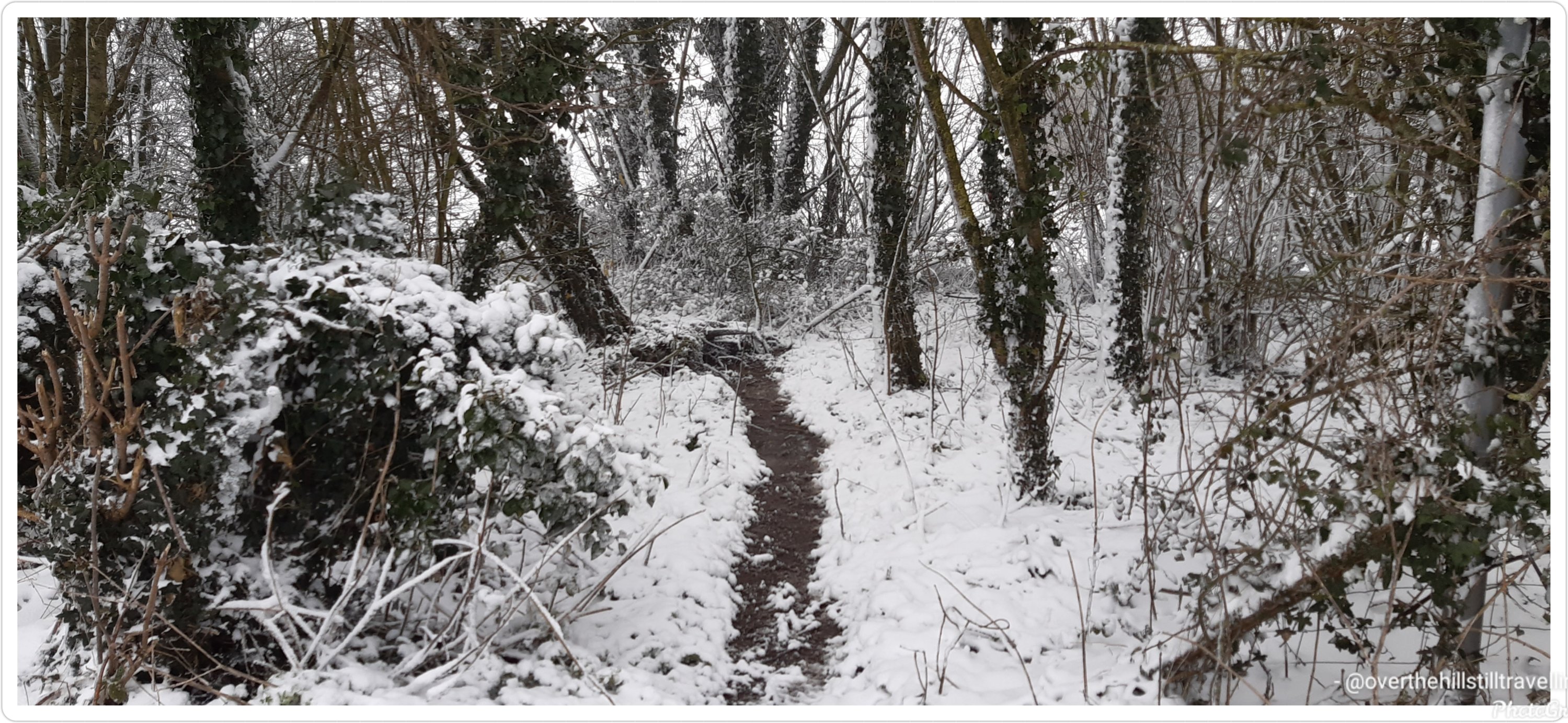
….because I am slightly daft, and because I really wanted some photos of the snow before I (hopefully) leave this booking tomorrow, I decided at 3pm to go for a walk….I didn’t get very far, only 750 meters up the road before returning to the house blinded by freezing snow whipped up by the wind, covered from head to toe in snow, and frozen to the bone 🥶🥶🥶 – okay, not really frozen to the bone, but close enough 🤪🤪🤪 and I got my photos 😁😁😁
The wind has continued to blow for the rest of the day, the snow continues to pile up and the electricity keeps going off!!! It looks like I may well end up getting stuck here for another day…oh well. At least the incoming Carer is here, so I won’t have to work 😉 so for your viewing pleasure, some snow pics
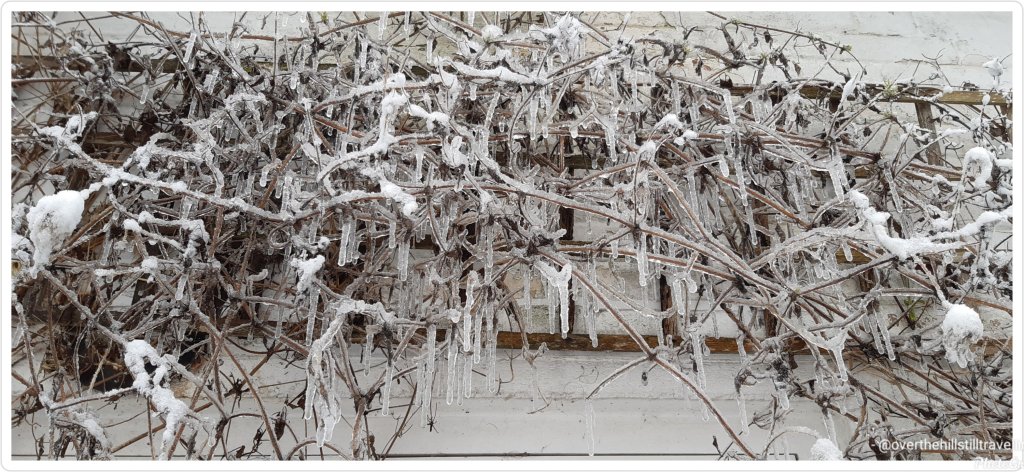
I put seeds out for the birds..the blackbird and robin found them despite the snow The food is in the freezer in the garage – I have to go out in the pitch dark with a torch to get it…🥶🥶Icicles above the back door 🥴🥴🥴
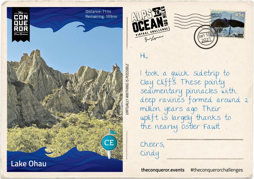
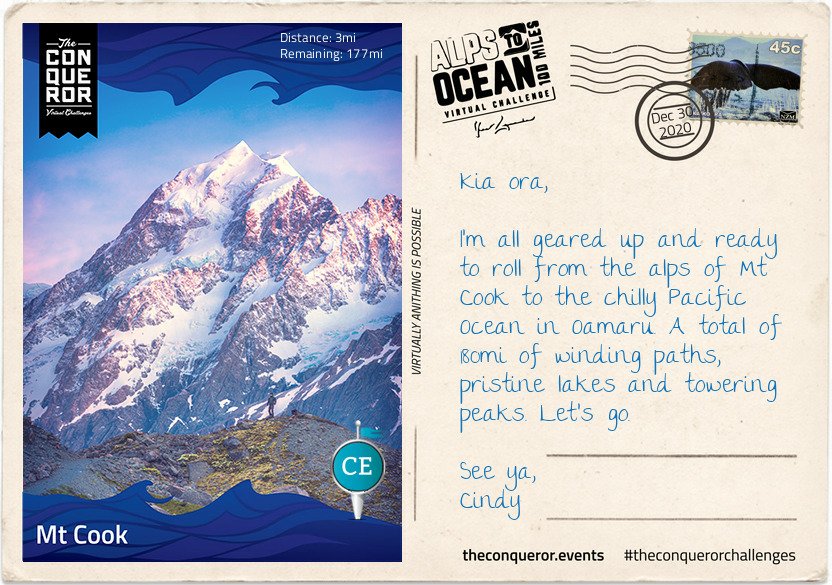
This challenge is 289.7 kms, takes considerably longer to complete if you’re walking short distances each day weather depending, and can sometimes be a bit wearying as you plod along every day building up the miles/kms. But it’s all worthwhile when the next postcard pops up. How awesome it must have been to glide over the NZ landscape for 15 hours. The views must be stunning from that height.
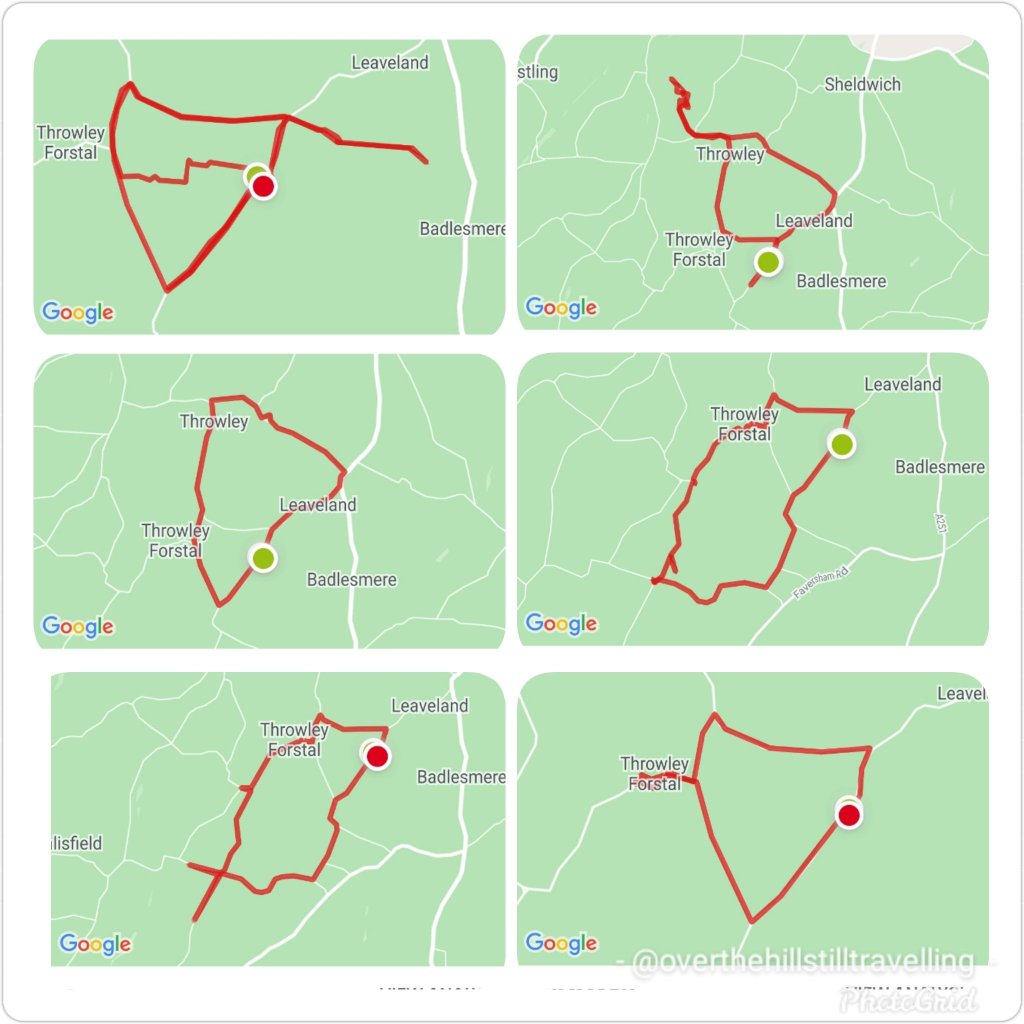
The days have been mostly grey, overcast and lots of rain, but I managed to get out nearly every day between 10th and 17th, explored a few public footpaths (big mistake – they’re mud baths in the current weather), and created some interesting configurations 😄😄
I try to vary my route each day and create more shapes
Meanwhile, on my virtual journey I covered 47kms, and am just on 18 kms over halfway through my challenge/virtual journey. I plan to finish by 3rd February. 🤔🤔🤞🤞🤞
Here we go Stage 5, which I reached on 17th January, done and dusted…
Having left the alps and peaks behind, the town of Omarama marked the halfway point of my journey. Although a small rural town, mainly a service centre for locals and nearby residents, Omarama had a few surprises up its sleeve.
Disney’s 2020 movie release of Mulan was entirely shot in New Zealand with scenes filmed at the Clay Cliffs just outside of Omarama.
Stage 5
In 2009, NZ pilot Terry Delore set a new world record in his 87ft (26.5m) wingspan glider. Taking off from Omarama, Terry travelled 1,491mi (2,400km) up and down NZ for 15 hours reaching speeds of up to 93mph (160kph) before landing back in town. Omarama has strong gliding conditions making it a popular destination for gliding pilots. Omarama hosted the 1995 and 2007 World Gliding Championships of which Kiwis took first place in the 1995 open category and third place in 2007.
For the weary soul like myself a Hot Tub soak the night before to rejuvenate my muscles and unwind was just what I needed. The Hot Tub was located outside in a private setting within a tussock and rock landscape. The tub was filled with fresh mountain water without any chemicals added. The business reuses the water for irrigation. A submersible firebox allowed me to adjust the water’s temperature. As I settled in, I watched the Milky Way appear and spill across the night sky with its millions of stars.
Eastward bound, I left Omarama refreshed and ready to tackle the next half of the journey. The trip was relatively easy and short when compared to previous days. The first half of the trail was off-road running parallel to the State Highway on the right. Crossing at Chain Hills to the left of the highway I began my descent alongside Lake Benmore, the largest artificial lake in NZ. Lake Benmore was created in the 1960s as part of the Benmore Dam construction. The lake is split into two arms. The largest is fed by three rivers, Tekapo, Pukaki and Twizel plus the Ohau canal with Waitaki River flowing right through the lake, whereas the smaller arm is fed by Ahuriri River.
It is this smaller arm that I travelled along to Pumpkin Point, a grassy beach area, for a break and a splash in the lake, then onto Sailors Cutting where the off-road trail terminates and I join the highway for the rest of today’s trip. Not the most relaxing part of the journey as I braved the high-speed highway with an upward climb to Otematata Saddle. The views of Lake Aviemore and the valley beyond was a lovely compensation until I continued on the busy highway downhill all the way into Otematata.
Not the most relaxing part of the journey.…reminds me of when I walked the Portuguese Camino…there were quite a few occasions I had to brave a high-speed highway 🤪🤪
I did a quick Google search tonight and discovered that the Alps to Ocean route is actually a dedicated cycling route 🤣🤣🤣🚴♀️🚴♀️🚴♀️🚴♀️ so no walking then 🤨🤨 damn. I’ll have to do more research. I’d really love to walk the route, it looks awesome
Now that I’m at my next booking my time has been limited. But I try to get out every day and explore the area.
After a week of daily walking, I reached the 4th stage on 10th January…
The roads here are very long and it takes me a good 10 minutes to reach an intersection, which means I can’t go too far afield as it will take too long to get back. But I’ve made a point of trying out different routes, in as much as my options are minimal, but I’ve discovered some lovely country lanes.
Meanwhile, on my virtual journey…
Here I am at Lake Ohau, the third and smallest parallel glacial lake in the Mackenzie Basin that serves as a water storage for the Hydro scheme. It is connected to Lake Pukaki and Lake Tekapo (the other two parallel lakes) via an artificial canal. Lake Ohau is stunningly located between The Barrier mountain range to the west, Ben Ohau range to the east and Naumann range to the north which lies between Hopkins and Dobson rivers that feed into the lake.
Stage 4
This turquoise blue lake is a perfect environment for both powered and non-powered activities. Although at the height of summer the temperature reaches a mere 60°F (15°C) any swimming enthusiast wouldn’t want to miss the opportunity for a crisp splash in the lake. Luckily for me the weather was in my favour and I went for a brisk swim before starting my onward journey. However, I did hear that any sailor or windsurfer on the lake must be mindful of the northerly winds as the water gets choppy very quickly.
It might be debatable what’s considered a national dish in NZ, perhaps fish and chips or perhaps a gourmet meat pie. No matter, my choice was the traditional piping hot meat pie encased in a crispy pastry. This humble meat pie has been part of NZ’s cuisine since 1863 when the early British settlers brought it to NZ’s shores. It’s the perfect size to be eaten with one hand whilst chugging their popular Lemon & Paeroa soft drink with the other. The soft drink’s history goes way back to 1907 when it was originally manufactured in the town of Paeroa by combining lemon juice and carbonated mineral water.
After my finger-licking good pie and L&P hydration, I set off for what was to be the hardest part of the journey. The first 3.5mi (6km) was an easy section as I traversed the lower slopes of the Ohau range across several creeks before I found myself on a narrow track and a sustained climb of about 2.5mi (4km) to the highest point of the trail at 2,952ft (900m). Not that I particularly trusted that I was at the highest point for a while since all along there were several “false summits” where the trail appeared to reach the highest point to then discover that there was more upwards winding to go. During the winter months part of this upward climb proves to be even more hazardous as it becomes part of an avalanche path.
Reaching the top was quite the accomplishment but given its exposure and strong winds I spent little time admiring the view and started my descent. If I thought the climb was a challenge the steep descent with its tight steep bends was even more ghastly for the next half-mile or so.
The rest was a rolling descent crossing several streams. Clean drinking water could be collected at these streams enabling me to top up my bottles. The track joined with Quailburn Road and for the remainder of my journey I travelled beside Quail Burn River first to the west of me and once I crossed it to the east of me, almost like a constant companion, until we parted way with the river flowing into Ahuriri River and me rolling into Omarama for the night.
Like the Mt. Fuji virtual challenge which I finished in December, I’m really enjoying learning more about New Zealand and its history. The powers that be could/should consider teaching history and geography in this way, the subjects would be so much more interesting.
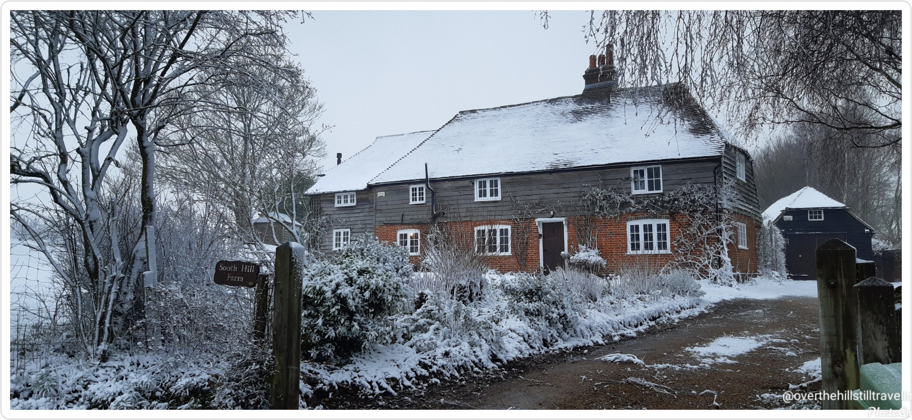
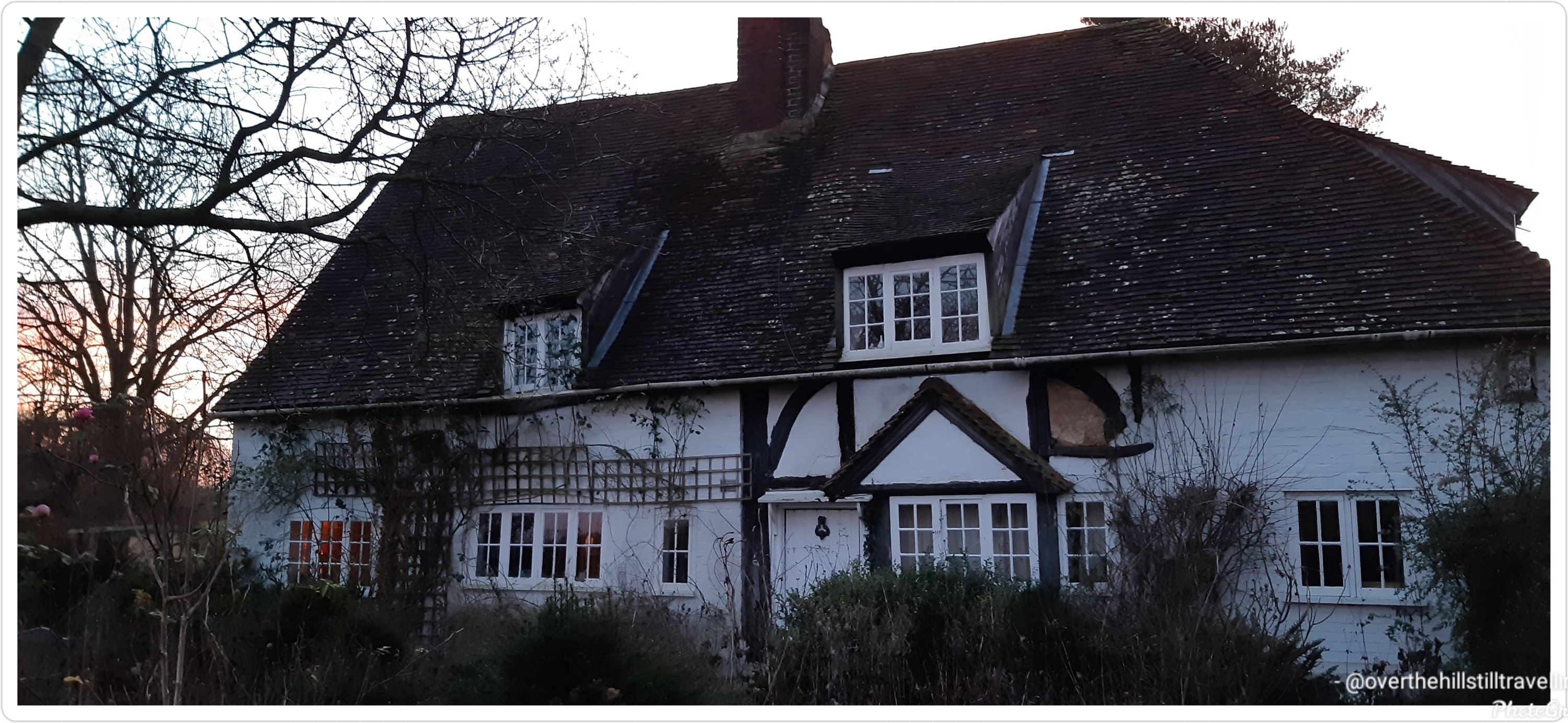
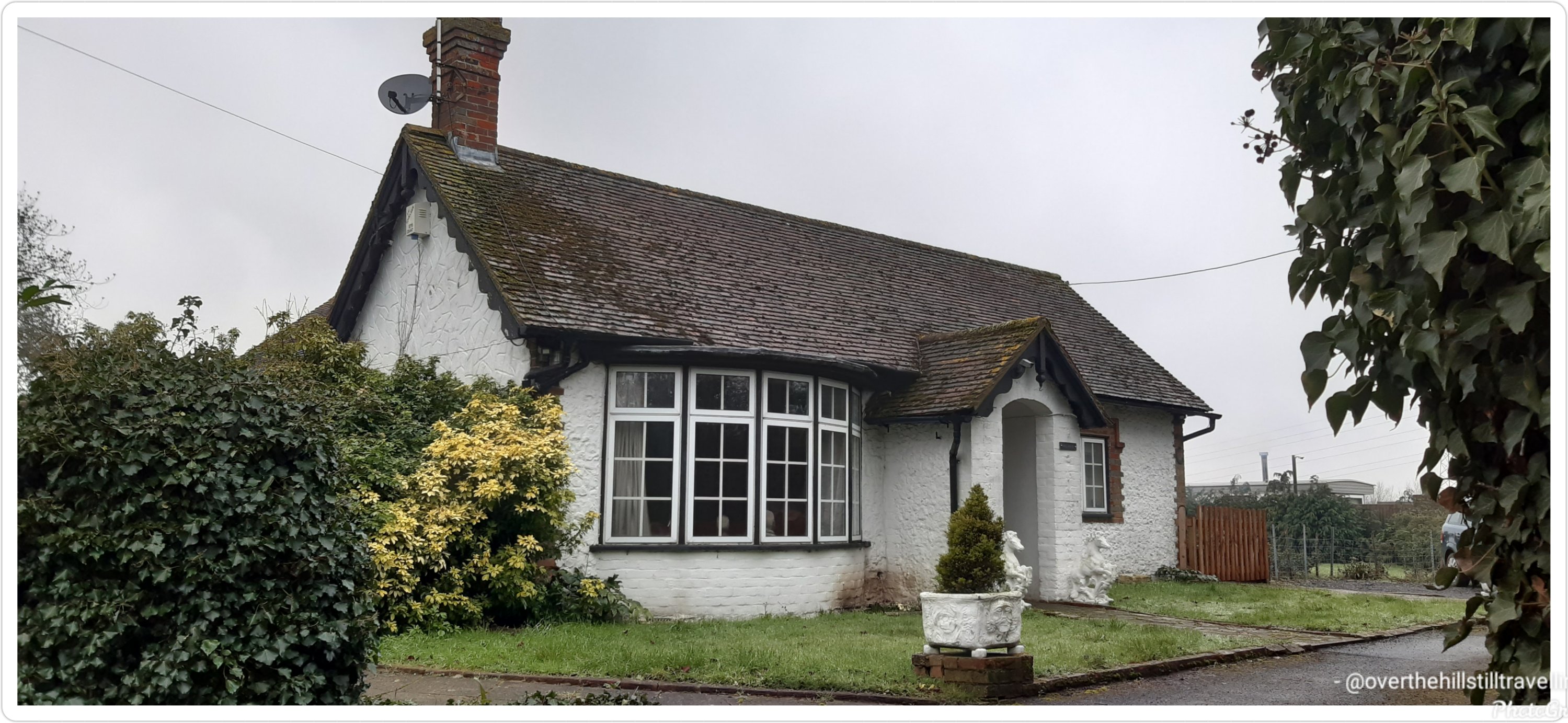
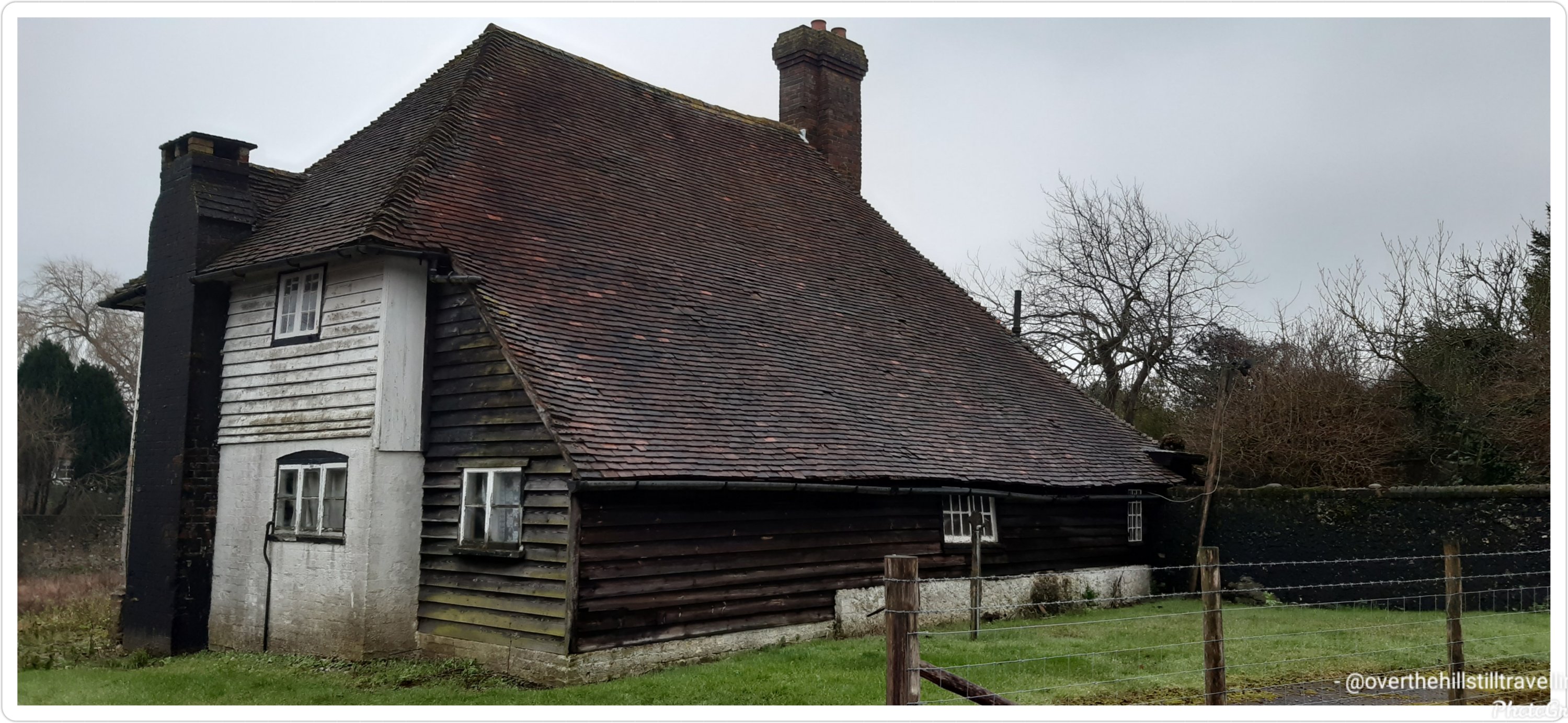
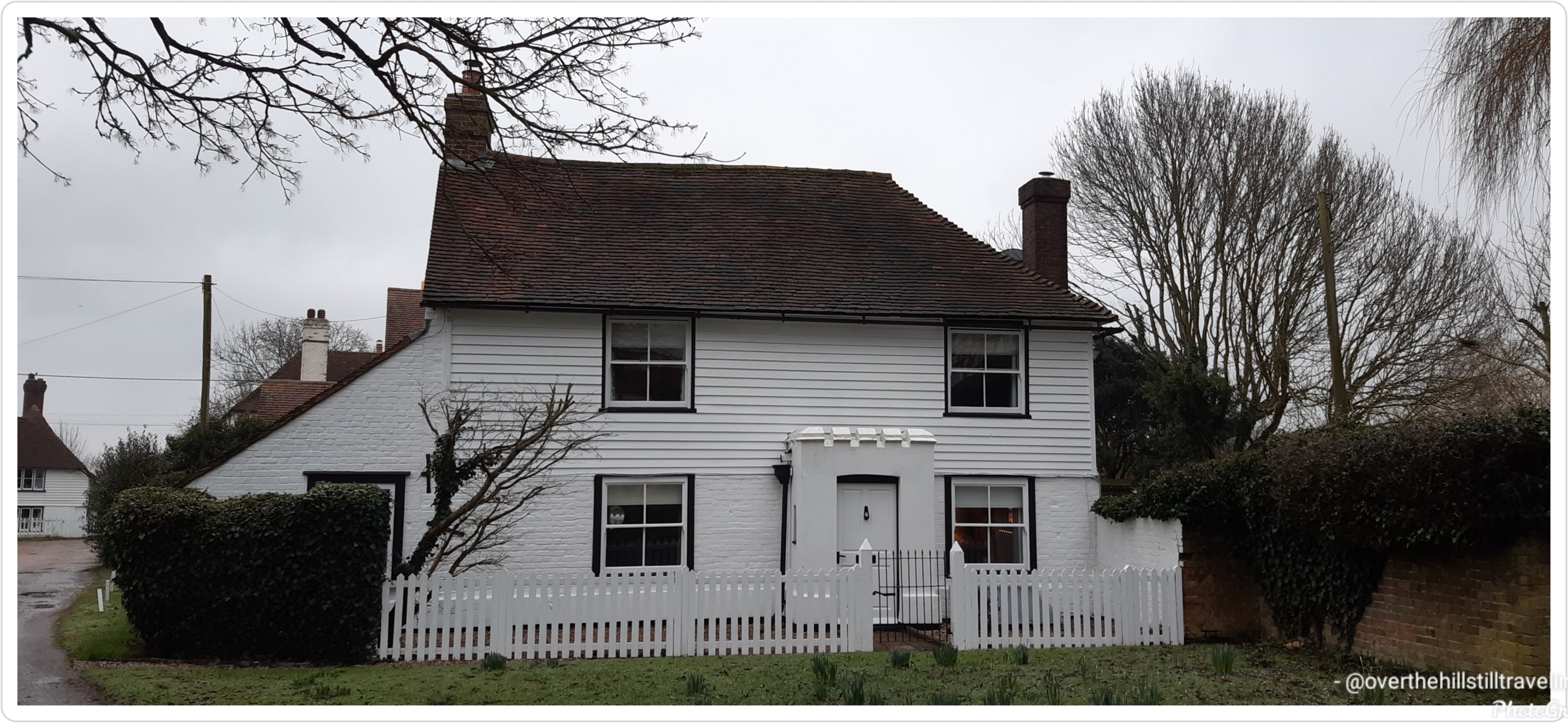
With just 3 days to go till I finish this booking, I went through my photos to decide which houses I loved the most…these are the ones
This was my absolute #1This house is for sale…a mere £450,000 and lots of renovation to be done Forge Farm 🧡💛
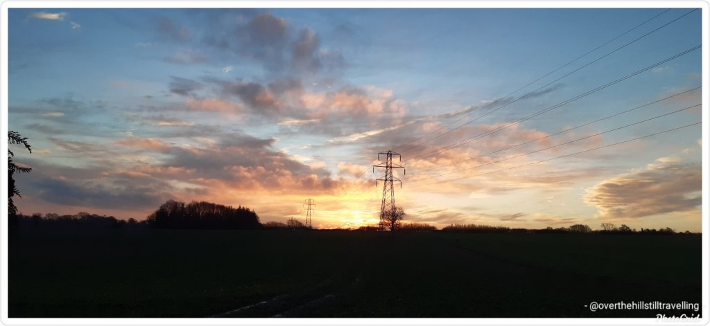
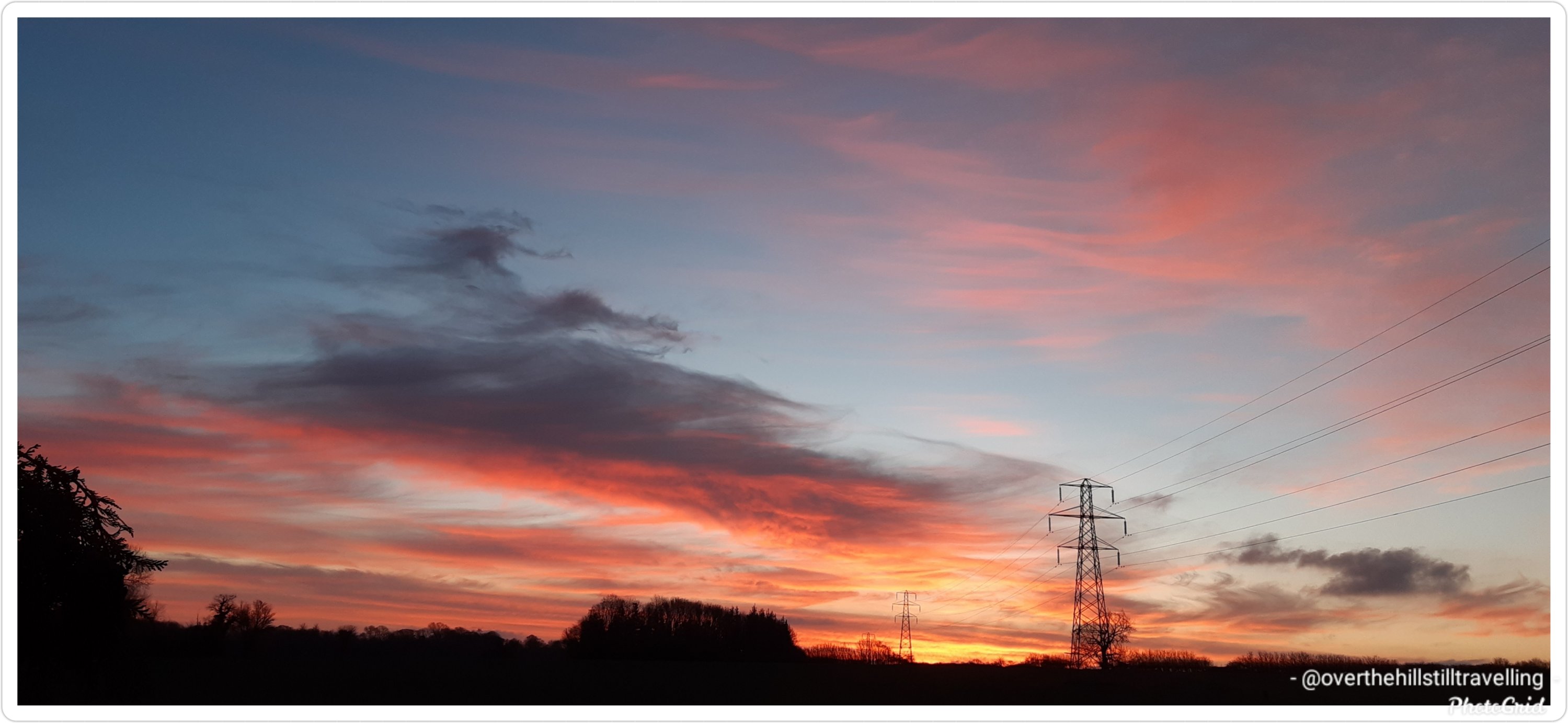
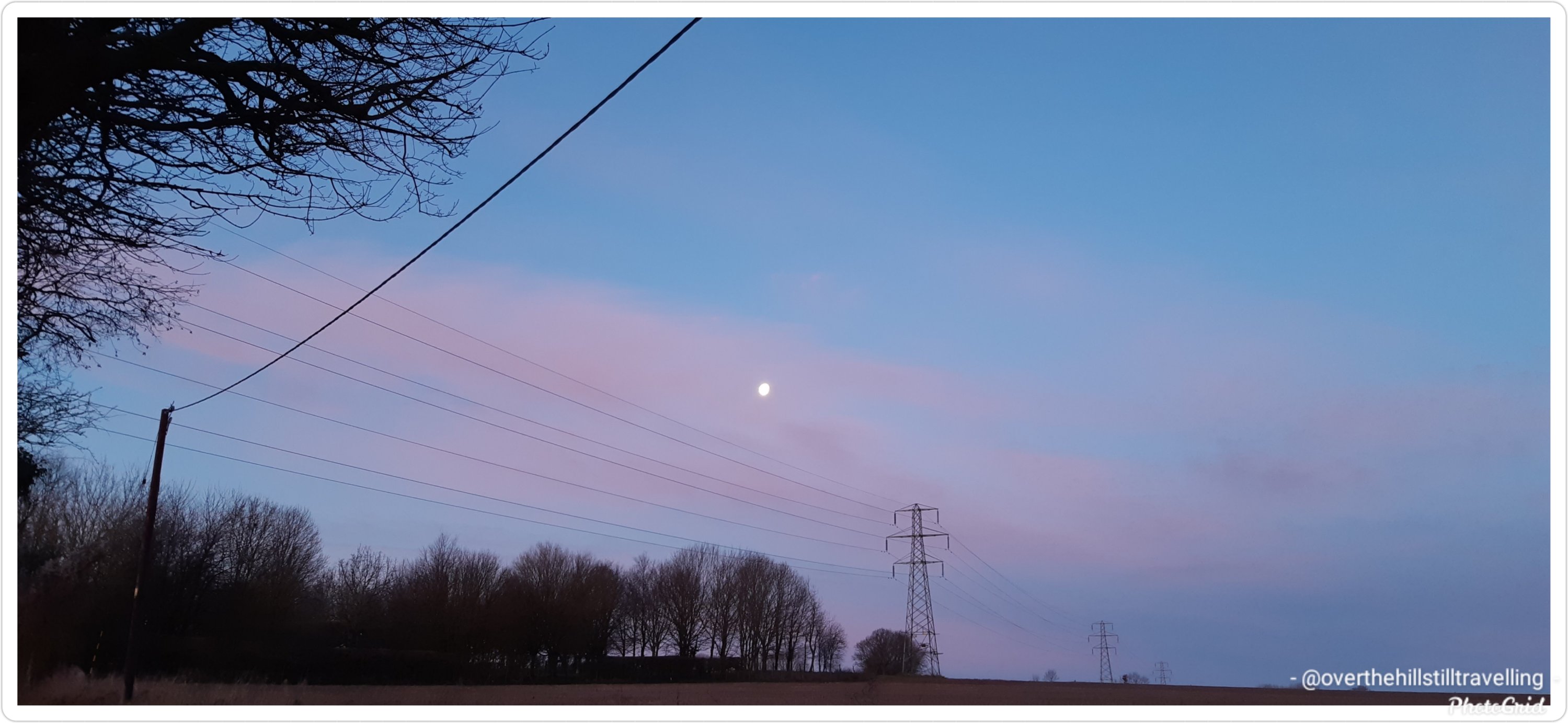
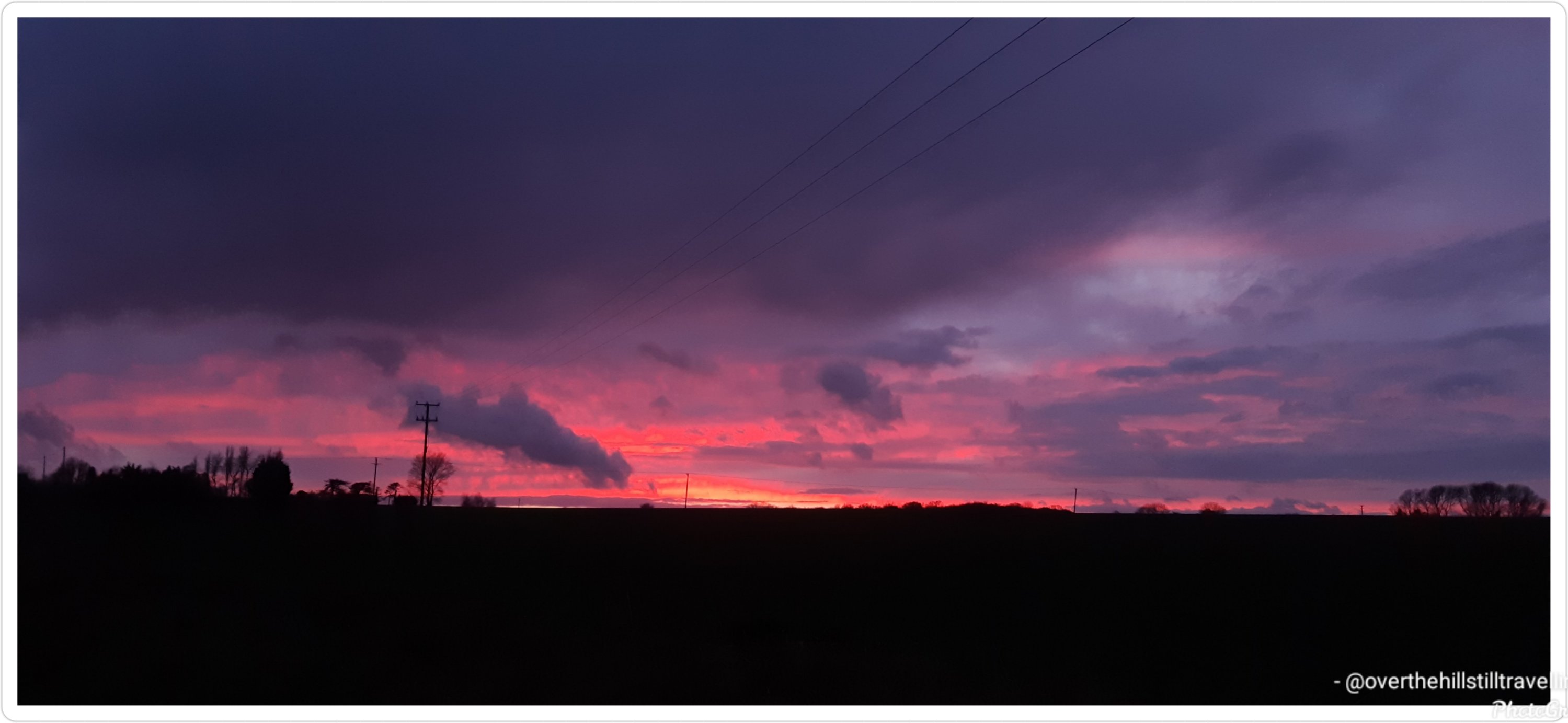
Most of the days were grey and overcast or rainy, but I saw a few beautiful sunrises and a few equally beautiful sunsets….just never on the same day 😁😁
Sunrise Sunrise SunsetSunset
Its been a vast but interesting area to explore and I certainly got a lot of mileage behind me.
One of the few sunny days, albeit freezing cold
I am however really looking forward to returning to the sea.
Since I was still at home, and had a few days yet before starting work, I was lucky enough to be able to put in some really good distances to get started on this challenge.
My lodging on Lake Pukaki was under the star-studded sky of the southern hemisphere. Here the Southern Cross, Milky Way and the inverted view of the Orion constellation are just part of the night sky spectacle. Lake Pukaki sits in the Mackenzie region, one of very few regions around the world classified as an International Dark Sky Reserve. Due to its limited light pollution, the night sky with millions of stars are visible as far as the eyes can see.
Stage 2
Lake Pukaki is the largest of three parallel alpine lakes in the Mackenzie Basin with Lake Tekapo and Lake Ohau being the other two. It’s milky blue colour is a result of finely ground rock particles from glaciers. The lake is part of the Waitaki hydroelectric scheme providing hydroelectricity, irrigation and municipal water supply. The lake originally had an outflow at the southern end but it has since been dammed. To increase storage capacity the lake has been raised twice eventually submerging Te Kohai Island which appeared on NZ’s five pound note pre-decimal currency era. Looking at some of the old images of Lake Pukaki there was a time in the mid-19th century when ferries were used to cross the river outlet south of the lake with a hotel on the bank. A bridge was added in the late 1800s. Both the bridge and hotel have now perished with the raising of the lake.
Firing up for today’s longer journey, I indulged in a sizeable breakfast, a quick swim in the lake to get the blood circulating and I was ready to tackle the next stage. I continued the trail on the eastern side of the lake on a nice quiet country road. Travelling along the shoreline of the lake I was greeted with incredible northward views of the Southern Alps and Mount Cook and kept imagining them as the mythical Aoraki and his three brothers. Directly across the length of the lake was the Ben Ohau range known for its ski touring route across the top of it.
Carrying on the trail I crossed the Pukaki Dam towards the Salmon Shop at Lake Pukaki Visitor Centre. It all went rather well until I reached the southern section of the lake and found myself exposed to the gusty winds from the north-west. It was quite the balancing act aiming to move forwards without taking a tumble down the cliffs and drop-offs near the trail.
With a stop at the Salmon Shop for some locally farmed freshwater salmon, I took this opportunity to gather my rattled nerves, have a rest and absorb the last of this vista. I left the lake behind and moved on south across the Pukaki Flats, a substantial expanse of tussock grasslands and a very flat route. These dry grassy plains are distinctive to the South Island and are largely used for grazing livestock. Without any shading available, plenty of water was necessary and a good head covering.
Having made it into the region’s largest town with time to spare, I’m off to see the highlights before I turn in for the night. I’ll tell you all about it in my next letter.
Wow, amazing. I really love the amount of information the Conqueror organisers provide along with the postcards. Plenty of hints and tips amongst the history, which is just enough to be really interesting – its certainly piqued my interest. Note to self ‘take swim costume’ 🏊♀️🏊♀️🏊♀️
Damn, I want to go now 😂😂😂😂 anyone know a millionaire with a few thousand pounds lying around that they don’t need….😁😁 I really REALLY want to see those stars 🌌🌌🌌
Immediately after finishing the Mt. Fuji challenge, and without further ado, I started my next challenge: the Alps to Ocean route in New Zealand on 30th December 2020.
This brought me to the end of the year and helped me to reach my Conquer 2020 goal of 2,020 kms.
And off we go….from one mountain on an island to another mountain on an island…
Imagine crisp alpine air, snow-capped peaks, glaciers, milky lakes and starlit nights. The training ground for Sir Edmund Hillary’s climbing skills in preparation for Everest. The legendary story of Aoraki and his three brothers. These are just some of the highlights of Mount Cook.
Stage 1
At 12,217ft (3,724m) tall Mount Cook is located on the South Island and the tallest mountain in New Zealand. It sits within the Mount Cook National Park which runs 37mi (60km) in a southwest-northeast direction. Home to more than 400 flora and fauna the national park is part of the Te Wāhipounamu South Westland World Heritage Site. The park is also home to 35 species of birds, including the only alpine parrot called Kea.
When I was looking into Mount Cook, I was wondering about the 98ft (30m) height discrepancy between different written sources. Further investigations revealed that in 1991 an avalanche of 350 million cubic feet (10Mm³) of snow and rock followed by twenty years of erosion had shrunk the mountain’s elevation by 98ft (30m).
Of the twelve largest glaciers in New Zealand, eight of them are within the park with Tasman Glacier being the longest at 15mi (24km). The glacier terminates in the Tasman Lake which up until the 1990s never existed. The lake was formed due to rapid glacial melting whilst the glacier itself continues to recede annually by as much as 2,697ft (822m). It is anticipated that within a few decades the glacier will be completely gone and the lake fully formed.
The lake’s primary outflow is the alpine braided Tasman River which flows south for 16mi (25km) through the Tasman Valley and into Lake Pukaki. The glacier, lake and river were named after Dutch explorer Abel Tasman, who in 1642 was the first European to sight the northwest coast of NZ’s South Island.
My journey begins at the base of Mount Cook, northwest of the river. Needing to cross the river to connect to Rotten Tommy trail, I took a short helicopter flight. The aerial view of this glacially-fed river and Mount Cook was a sight to behold. From Rotten Tommy, I took a southward bound route alongside the Tasman River. Although part of the route was quite rough and I had to cross several creeks, eventually the track changed to gravel road and made it easier to navigate towards my first overnight stop. Being a clear and sunny day, I had the treat of seeing Mount Cook in the distance rising above the lower snow-capped peaks in the National Park.
Before I go let me tell you about the Ngāi Tahu legend. The story goes that once the “Gods existed in the midst of a great sea of nothingness” and Raki, the Sky Father and Pokoharua-te-po, his wife had four sons, all living in the heavens. Raki left his wife to be with Papatuanuku, the Earth Mother, and together they created the world. Aoraki, the eldest son of Raki, along with his three brothers came from the heavens with a canoe in an attempt to persuade their father to return to their mother. Upon seeing him together with his new wife, the brothers knew Raki would never return. The brothers decided to go home but unfortunately their canoe wouldn’t rise and following strong winds and rising seas, the canoe overturned tipping the brothers into the water. Climbing atop the upturned canoe they waited for help. As time passed with no help coming, they eventually turned to stone. The canoe became the Southern Island and the brothers became the Southern Alps with Aoraki (Mount Cook) being the highest peak.
It all sounds absolutely amazing. I’m really going to have to seriously consider planning to walk these routes for real as part of my Project 101, especially if I want to see that glacier before it disappears completely – I’ve got just over 4 years to save…
Oooopps, it seems I missed a stage on my Mt. Fuji virtual walk, and frankly it’s a pretty awesome stage, so even though I missed the email (found whilst tidying up my mailbox last night), I thought I’d share it anyway. So here it is; the correct Stage 2…
Mt. Fuji – Aokigahara Forest
Aokigahara nicknamed Sea of Trees and at times infamously referred to as Suicide Forest, is a dense, moss-covered forest that sits within the Hakone Izu National Park. Registered as a National Natural Treasure the forest was born out of an eruption from Mount Fuji about 1,200 years ago, when new trees started sprouting from cooled lava. Because the forest is formed on top of dried magma, trees are unable to grow their roots deep into the ground. Although the thickness of the soil is only 10cm, the forest is filled with evergreen conifers, Mongolian oak, Fuji cherry and maple trees.
Hiking trails have been paved in the forest for visitors but anyone veering off the designated path can easily get lost and be difficult to rescue. Plastic tapes can often be seen rolled out to mark the path and assist visitors to find the way out. Then there are times when people have no intention of coming out and getting lost is a means to ending it all.
When I entered one of the trails on Aokigahara it was with the intent to find Fugaku Wind Cave and Narusawa Ice Cave. The trail was wide, well-marked and well-maintained with sunlight streaming through the canopies of the trees. I needn’t worry that I might get lost.
Fugaku Wind Cave was a 659ft (201m) long lateral cave accessed via a staircase. Due to its natural ventilation and year-round average temperature of 37°F (3°C) the cave was used as a refrigerator during the 17th to early 20th century to store the eggs of silkworms.
Narusawa Ice Cave was a looped 492ft (150m) lava tube that maintained the same temperature as Fugaku and was also used as a natural fridge during the pre-electric refrigerator era. A small section of the cave was only 3ft (91cm) high where I needed to walk sideways in order to see remnants of trees from a thousand years ago. Ice pillars begin forming over the winter period here reaching their maximum size by April. They can grow up to 10ft (3m) high and as thick as 20in (50cm) wide.
Leaving the forest, trail and caves behind, I proceeded to trek through urban areas to Lake Kawaguchi.
Doesn’t that description just make you want to go there right now? Imagine all the cool photos you could capture!! I’d spend a whole day there if I could, besides being described as the Suicide Forest, it looks so invitingly peaceful and calm.
I’m sure if we stayed still long enough, and looked hard enough, we’d see faeries.
And as for those caves…..oh my gosh, bring it on!!!
And with one final push, I completed the Mt. Fuji, Japan Conqueror challenge on the evening of the 29th December. After my walk earlier the day I noticed I had only just over 1km to go, so off I went 🚶🏻♀️🚶🏻♀️🚶🏻♀️
This final stage took me to the summit of Mt. Fuji, and apparently some of the best views….wish I was there for real 😉🏔🚶🏻♀️
I’ve enjoyed several days exploring the lakes, the forest, the ice caves and seeing Mount Fuji with its perfectly shaped cone from all angles but today was the day for the final climb to the summit.
Shortly after leaving the 5th Station I reached a fork in the trail. To the right was the trek to Fujiko. Heading left, I soon arrived at the Komitake Shrine, named after old Komitake Mountain which is now buried deep beneath Mount Fuji. The Shrine is important to many worshippers who each year on 1 July attend the Kaizansai festival and celebrate the opening of Mount Fuji.
From here to the 7th Station the trek weaved its way through a shady and dense forest. On hot summer days the forest provides a welcoming relief. The path itself was narrow and rough with rocks jutting out and tree branches stretching across the pathway. As with any climb sure-footedness was essential alongside some duck and weaving around branches. There were trail sections resembling carved out channels instead of just flat paths. I can imagine on foggy days this trail would be quite challenging with low visibility and for those who climb at night in order to catch the sunrise at the summit could run the risk of getting lost if not careful. Thankfully ropes line the route providing guidance and assistance up the mountain. Occasional openings in the forest canopy gave me glimpses of Fuji’s peak, like small teasers of what is yet to come.
Leaving the forest zone behind, there were no more trees, just very low shrubs with small white flowers. The ground became more rocky and gravel-like, making it looser underfoot. It makes me realise that although Mount Fuji is not a technically difficult climb, it does however, present its own set of challenges such as a sudden change in weather, the steep inclines, long switchbacks and more importantly the potential for altitude sickness because the oxygen density is only two-thirds of the normal oxygen thereby making it more difficult to breathe.
I forged my way onto the 8th Station where my trail merged with the very popular Yoshida Trail. As expected it became quite congested. Taking a slow and steady approach it was time for the final push. The terrain here was barren, vegetation seemed non-existent.
I knew the summit was near when I made my way through the white Torii gate, which stood proudly on a set of steps signifying that “heaven on earth” is within my grasp.
Reaching the summit though was not the end, yet. The final part was a walk around the crater on the Ohachimeguri Trail. The crater has a 2,560ft (750m) surface diameter and a depth of 790ft (240m). With its jagged edge, the crater is encircled by eight sacred peaks, each with their own name: Oshaidake, Izudake, Jojudake, Komagatake, Mushimatake, Kengamine, Hukusandake, and Kusushidake.
My quest ended at the Kusushi Shrine near the last station. Here I stood to absorb the aerial views, reflecting on my journey and contemplating my descent but that’s a story for another time.
On a final note, did you know that the top 1,312ft (400m) of Mount Fuji is actually private property? Here’s an online excerpt explaining how this ownership evolved:
“… belongs to Fujisan Hongu Sengentaisha, a Shinto shrine. The land originally belonged to Tokugawa Ieyasu, the founder of the Edo Shogunate (1603 – 1867), and the area of Mt. Fuji from the 8th station to the top is said to have been given to this shrine as a gift by the Tokugawa clan in 1779. The land was re-designated as national property for a time after 1871, when the Tokugawa Shogunate relinquished power to the Imperial Court, but has since been returned to the Fujisan Hongu Sengentaisha. The Hongu (Main Shrine) of the shrine is at the foot of Mt. Fuji, and the Okumiya (Rear Shrine) is located at the mountain peak.”
So there you have it, my 5 Stages of the Mt. Fuji Conqueror challenge. 👏👏👏 I hope you enjoyed the journey, as well as all the information, and the amazing history linked to this iconic mountain…instantly recognisable. Who knew the top of Mt. Fuji was private property? 🤔🤔🤔
Hoorah!! 4 days to virtually ‘climb’ Mt. Fuji
Immediately after finishing this challenge I got started on the Alps to Ocean challenge in New Zealand (289.7kms). Nothing like putting a bit of pressure on yourself then Cindy 🤣🤣🤣🤣 But of course, starting that challenge/walk is taking a wee bit longer to complete because not only is it much longer, but I started my next booking on 4th January and my free time is limited to 2 hours a day, weather permitting. Still, I hope/plan to finish the walk by 31st January.
Why not join me on one of the challenges https://www.theconqueror.events/r/CE1474 they are excellent motivation to get out and and walk, especially now that our wings are clipped by Covid-19 and lockdown.
The research proves to be as interesting as the walks 😉 On receiving the postcards from the Conqueror challenge organisers, I usually set about investigating various aspects that are of interest. This usually takes me on another adventure altogether….😁😁
There are four trails to choose from to climb Mount Fuji. The most popular trail, Yoshida Trail, gets a whopping 150,000 climbers a year. Looking for more solitude and introspection I chose the less trodden trail called the Subashiri Trail, which sees an average 25,000 climbers per year. Where the Yoshida climb is from the north of the mountain, the Subashiri climb is from the east.
My target was to reach the 5th Station where the actual trail to the Summit really begins. Reaching the 5th Station can be made by vehicle but during the climbing season, which is July to September, private vehicles are prohibited from using the road. A shuttle buses services the area ferrying climbers from the base of the mountain to the station.
The ascending route to the 5th Station started at the Subashiri Sengen-jinja Shrine which was tucked away amongst giant pine trees. According to legend the shrine was built in 807AD and although it was damaged during the 1707 eruption, it was rebuilt in 1718. Followers of the Fuji-ko religion, a fusion of ancient Japanese mountain worship and Buddhism, congregated at this shrine to commence their pilgrimage to the summit. They continue to do that today and are usually seen dressed in white robes and carrying pilgrims’ staffs.
Heading southwest, just before the Subashiri turn off, was a monument commemorating Prof Frederick Starr. He was a New Yorker who in the late 19th century took up a position as professor of anthropology with the University of Chicago. Upon request to undertake field work in Japan circa 1909, the Professor would eventually become a “student of Japan” visiting the country 15 times in his lifetime. He had a deep love of Mount Fuji having climbed it five times. His ultimate wish was to be buried in a place where he could always see Mount Fuji. In his words: “By climbing Mount Fuji, I found heaven on earth”.
The road up to the 5th Station was a gently sloping, straight section with a beautifully manicured tree-lined road. Two miles (3km) in the landscape morphed into tall, dense pine trees until the road took a sharp, left turn and continued in a zig-zag fashion for the next 5mi (8km) up to the station. Halfway up the zig-zag the trees changed again taking on a rugged appearance indicating the kind of forest trail I will be travelling through on part of my climb.
The 5th Station is far less developed than the Yoshida Trail with limited amenities and shops, however near the main trail was a short hiking trail to a small peak called Kofuji (Little Fuji). Kofuji is a secondary peak that formed on the side of Mount Fuji and stands at 6,492ft (1,979m) tall. Access was via a nature trail through the forest. A twenty minute walk, I eventually emerged onto the peak of Kofuji. It was a large, long, oblong clearing with a beautiful 360 degree view of a lush forest, the peak of Mount Fuji to the west, Lake Yamanaka to the east and Fujiyoshida city to the north.
I wonder, if by doing these walks… will I too find ‘heaven on earth’? And if not in Japan, then certainly the varied scenery on my walks around the UK, which astounds me every time I watch a programme about Scotland, or the many famous islands, or the Lake District and Yorkshire Dales…..
Why not join me on one of the challenges https://www.theconqueror.events/r/CE1474 they are excellent motivation to get out and and walk, especially now that our wings are clipped by Covid-19 and lockdown.


You must be logged in to post a comment.