Now that I’m at my next booking my time has been limited. But I try to get out every day and explore the area.
After a week of daily walking, I reached the 4th stage on 10th January…
The roads here are very long and it takes me a good 10 minutes to reach an intersection, which means I can’t go too far afield as it will take too long to get back. But I’ve made a point of trying out different routes, in as much as my options are minimal, but I’ve discovered some lovely country lanes.
Meanwhile, on my virtual journey…
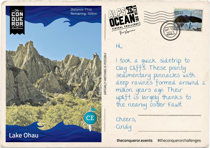
Here I am at Lake Ohau, the third and smallest parallel glacial lake in the Mackenzie Basin that serves as a water storage for the Hydro scheme. It is connected to Lake Pukaki and Lake Tekapo (the other two parallel lakes) via an artificial canal. Lake Ohau is stunningly located between The Barrier mountain range to the west, Ben Ohau range to the east and Naumann range to the north which lies between Hopkins and Dobson rivers that feed into the lake.
Stage 4
This turquoise blue lake is a perfect environment for both powered and non-powered activities. Although at the height of summer the temperature reaches a mere 60°F (15°C) any swimming enthusiast wouldn’t want to miss the opportunity for a crisp splash in the lake. Luckily for me the weather was in my favour and I went for a brisk swim before starting my onward journey. However, I did hear that any sailor or windsurfer on the lake must be mindful of the northerly winds as the water gets choppy very quickly.
It might be debatable what’s considered a national dish in NZ, perhaps fish and chips or perhaps a gourmet meat pie. No matter, my choice was the traditional piping hot meat pie encased in a crispy pastry. This humble meat pie has been part of NZ’s cuisine since 1863 when the early British settlers brought it to NZ’s shores. It’s the perfect size to be eaten with one hand whilst chugging their popular Lemon & Paeroa soft drink with the other. The soft drink’s history goes way back to 1907 when it was originally manufactured in the town of Paeroa by combining lemon juice and carbonated mineral water.
After my finger-licking good pie and L&P hydration, I set off for what was to be the hardest part of the journey. The first 3.5mi (6km) was an easy section as I traversed the lower slopes of the Ohau range across several creeks before I found myself on a narrow track and a sustained climb of about 2.5mi (4km) to the highest point of the trail at 2,952ft (900m). Not that I particularly trusted that I was at the highest point for a while since all along there were several “false summits” where the trail appeared to reach the highest point to then discover that there was more upwards winding to go. During the winter months part of this upward climb proves to be even more hazardous as it becomes part of an avalanche path.
Reaching the top was quite the accomplishment but given its exposure and strong winds I spent little time admiring the view and started my descent. If I thought the climb was a challenge the steep descent with its tight steep bends was even more ghastly for the next half-mile or so.
The rest was a rolling descent crossing several streams. Clean drinking water could be collected at these streams enabling me to top up my bottles. The track joined with Quailburn Road and for the remainder of my journey I travelled beside Quail Burn River first to the west of me and once I crossed it to the east of me, almost like a constant companion, until we parted way with the river flowing into Ahuriri River and me rolling into Omarama for the night.
Like the Mt. Fuji virtual challenge which I finished in December, I’m really enjoying learning more about New Zealand and its history. The powers that be could/should consider teaching history and geography in this way, the subjects would be so much more interesting.
Since I was still at home, and had a few days yet before starting work, I was lucky enough to be able to put in some really good distances to get started on this challenge.
My lodging on Lake Pukaki was under the star-studded sky of the southern hemisphere. Here the Southern Cross, Milky Way and the inverted view of the Orion constellation are just part of the night sky spectacle. Lake Pukaki sits in the Mackenzie region, one of very few regions around the world classified as an International Dark Sky Reserve. Due to its limited light pollution, the night sky with millions of stars are visible as far as the eyes can see.
Stage 2
Lake Pukaki is the largest of three parallel alpine lakes in the Mackenzie Basin with Lake Tekapo and Lake Ohau being the other two. It’s milky blue colour is a result of finely ground rock particles from glaciers. The lake is part of the Waitaki hydroelectric scheme providing hydroelectricity, irrigation and municipal water supply. The lake originally had an outflow at the southern end but it has since been dammed. To increase storage capacity the lake has been raised twice eventually submerging Te Kohai Island which appeared on NZ’s five pound note pre-decimal currency era. Looking at some of the old images of Lake Pukaki there was a time in the mid-19th century when ferries were used to cross the river outlet south of the lake with a hotel on the bank. A bridge was added in the late 1800s. Both the bridge and hotel have now perished with the raising of the lake.
Firing up for today’s longer journey, I indulged in a sizeable breakfast, a quick swim in the lake to get the blood circulating and I was ready to tackle the next stage. I continued the trail on the eastern side of the lake on a nice quiet country road. Travelling along the shoreline of the lake I was greeted with incredible northward views of the Southern Alps and Mount Cook and kept imagining them as the mythical Aoraki and his three brothers. Directly across the length of the lake was the Ben Ohau range known for its ski touring route across the top of it.
Carrying on the trail I crossed the Pukaki Dam towards the Salmon Shop at Lake Pukaki Visitor Centre. It all went rather well until I reached the southern section of the lake and found myself exposed to the gusty winds from the north-west. It was quite the balancing act aiming to move forwards without taking a tumble down the cliffs and drop-offs near the trail.
With a stop at the Salmon Shop for some locally farmed freshwater salmon, I took this opportunity to gather my rattled nerves, have a rest and absorb the last of this vista. I left the lake behind and moved on south across the Pukaki Flats, a substantial expanse of tussock grasslands and a very flat route. These dry grassy plains are distinctive to the South Island and are largely used for grazing livestock. Without any shading available, plenty of water was necessary and a good head covering.
Having made it into the region’s largest town with time to spare, I’m off to see the highlights before I turn in for the night. I’ll tell you all about it in my next letter.
Wow, amazing. I really love the amount of information the Conqueror organisers provide along with the postcards. Plenty of hints and tips amongst the history, which is just enough to be really interesting – its certainly piqued my interest. Note to self ‘take swim costume’ 🏊♀️🏊♀️🏊♀️
Damn, I want to go now 😂😂😂😂 anyone know a millionaire with a few thousand pounds lying around that they don’t need….😁😁 I really REALLY want to see those stars 🌌🌌🌌
And with one final push, I completed the Mt. Fuji, Japan Conqueror challenge on the evening of the 29th December. After my walk earlier the day I noticed I had only just over 1km to go, so off I went 🚶🏻♀️🚶🏻♀️🚶🏻♀️
This final stage took me to the summit of Mt. Fuji, and apparently some of the best views….wish I was there for real 😉🏔🚶🏻♀️
I’ve enjoyed several days exploring the lakes, the forest, the ice caves and seeing Mount Fuji with its perfectly shaped cone from all angles but today was the day for the final climb to the summit.
Shortly after leaving the 5th Station I reached a fork in the trail. To the right was the trek to Fujiko. Heading left, I soon arrived at the Komitake Shrine, named after old Komitake Mountain which is now buried deep beneath Mount Fuji. The Shrine is important to many worshippers who each year on 1 July attend the Kaizansai festival and celebrate the opening of Mount Fuji.
From here to the 7th Station the trek weaved its way through a shady and dense forest. On hot summer days the forest provides a welcoming relief. The path itself was narrow and rough with rocks jutting out and tree branches stretching across the pathway. As with any climb sure-footedness was essential alongside some duck and weaving around branches. There were trail sections resembling carved out channels instead of just flat paths. I can imagine on foggy days this trail would be quite challenging with low visibility and for those who climb at night in order to catch the sunrise at the summit could run the risk of getting lost if not careful. Thankfully ropes line the route providing guidance and assistance up the mountain. Occasional openings in the forest canopy gave me glimpses of Fuji’s peak, like small teasers of what is yet to come.
Leaving the forest zone behind, there were no more trees, just very low shrubs with small white flowers. The ground became more rocky and gravel-like, making it looser underfoot. It makes me realise that although Mount Fuji is not a technically difficult climb, it does however, present its own set of challenges such as a sudden change in weather, the steep inclines, long switchbacks and more importantly the potential for altitude sickness because the oxygen density is only two-thirds of the normal oxygen thereby making it more difficult to breathe.
I forged my way onto the 8th Station where my trail merged with the very popular Yoshida Trail. As expected it became quite congested. Taking a slow and steady approach it was time for the final push. The terrain here was barren, vegetation seemed non-existent.
I knew the summit was near when I made my way through the white Torii gate, which stood proudly on a set of steps signifying that “heaven on earth” is within my grasp.
Reaching the summit though was not the end, yet. The final part was a walk around the crater on the Ohachimeguri Trail. The crater has a 2,560ft (750m) surface diameter and a depth of 790ft (240m). With its jagged edge, the crater is encircled by eight sacred peaks, each with their own name: Oshaidake, Izudake, Jojudake, Komagatake, Mushimatake, Kengamine, Hukusandake, and Kusushidake.
My quest ended at the Kusushi Shrine near the last station. Here I stood to absorb the aerial views, reflecting on my journey and contemplating my descent but that’s a story for another time.
On a final note, did you know that the top 1,312ft (400m) of Mount Fuji is actually private property? Here’s an online excerpt explaining how this ownership evolved:
“… belongs to Fujisan Hongu Sengentaisha, a Shinto shrine. The land originally belonged to Tokugawa Ieyasu, the founder of the Edo Shogunate (1603 – 1867), and the area of Mt. Fuji from the 8th station to the top is said to have been given to this shrine as a gift by the Tokugawa clan in 1779. The land was re-designated as national property for a time after 1871, when the Tokugawa Shogunate relinquished power to the Imperial Court, but has since been returned to the Fujisan Hongu Sengentaisha. The Hongu (Main Shrine) of the shrine is at the foot of Mt. Fuji, and the Okumiya (Rear Shrine) is located at the mountain peak.”
So there you have it, my 5 Stages of the Mt. Fuji Conqueror challenge. 👏👏👏 I hope you enjoyed the journey, as well as all the information, and the amazing history linked to this iconic mountain…instantly recognisable. Who knew the top of Mt. Fuji was private property? 🤔🤔🤔
Hoorah!! 4 days to virtually ‘climb’ Mt. Fuji
Immediately after finishing this challenge I got started on the Alps to Ocean challenge in New Zealand (289.7kms). Nothing like putting a bit of pressure on yourself then Cindy 🤣🤣🤣🤣 But of course, starting that challenge/walk is taking a wee bit longer to complete because not only is it much longer, but I started my next booking on 4th January and my free time is limited to 2 hours a day, weather permitting. Still, I hope/plan to finish the walk by 31st January.
Why not join me on one of the challenges https://www.theconqueror.events/r/CE1474 they are excellent motivation to get out and and walk, especially now that our wings are clipped by Covid-19 and lockdown.
The problem I have with the Conqueror Challenges is that the routes are so amazing, it makes me want to do the walks in real time, and not just virtually. So to that end, I’ve added them to my list of ‘walks I want to do before I die’ and 🙏🙏🙏 the Universe is listening and provides a sponsor so I can go walking instead of working 🤣🤣🤣
I actually completed the Mt. Fuji virtual challenge in 2020, but as usual I got distracted by other walks and places and forgot to share them….so here’s the 1st stage. I’ll post the next few stages over the coming days. I love the information that comes with the postcards and find them absolutely fascinating.
I started the Mt. Fuji challenge on 26 December, immediately after finishing the Great Ocean Road Australia challenge, and because I was not working, managed to complete the challenge in a few days…chop chop as they say.
When I decided to hike Japan’s tallest mountain, Mount Fuji, I pondered the best route that would capture its culture and spirit whilst travelling through its lush green landscape. The result was a 46mi (74km) journey starting at the base of the mountain, leading past lakes, caves, temples, shrines, dense forestry and ending with the final climb to the summit.
Mt. Fuji virtual challenge
Mount Fuji is one of three holy mountains in Japan. At 12,388ft (3,776m) tall, Fuji sits atop a triple junction trench where three tectonic plates meet. Although geologists classify it as active, Fuji is a dormant volcano that last erupted in 1707. At the base it is surrounded by the Fuji Five Lakes which were formed by previous eruptions damming up the rivers with the lava flows.
Mount Fuji is a composite of four successive volcanoes meaning it’s made up of layers. The first two layers were the result of an eruption more than 700,000 years ago known as Sen-Komitake and Komitake Fuji. The next eruption, about 100,000 years ago, engulfed Komitake Fuji and added the second layer creating Old Fuji. The third eruption about 10,000 years ago formed New Fuji and the summit zone producing the near perfect conical shape we know today.
Recognised as a sacred place and considered a symbol of Japan, Mount Fuji is a pilgrimage destination for practisers of Shinto. Each year between July and August, up to 400,000 tourists and pilgrims make the long trek to the summit. In 2013, Mount Fuji was added to UNESCO’s World Heritage List.
Dotted throughout Japan are Shinto shrines and Torii gates. Shinto is the indigenous faith of the Japanese people and the shrines are places of worship and homes of the Kami (Gods). Practitioners come to pay their respects to the Kami or pray for good fortune. The entrance to a shrine is marked by a gate known as Torii and they symbolise the “transition from mundane to sacred”. To enter through a Torii, one enters the world of the Kami (Shinto Gods).
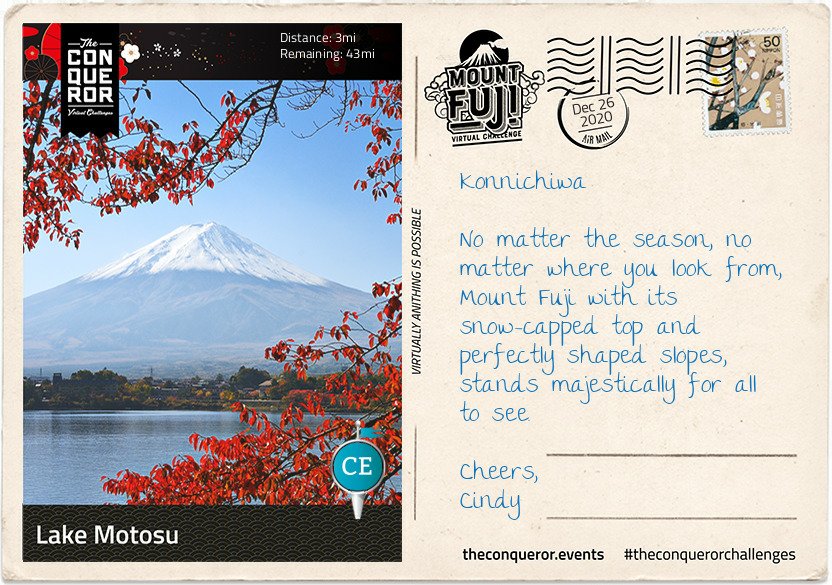
I began my hike at the Yama Shrine near Lake Motosu, one of the Five Lakes. The third largest and deepest of the five lakes, it is subteranneously connected to Lake Shoji and Lake Saiko. Originally one lake, these three lakes were divided by one of Mount Fuji’s enormous lava flows. The water temperature on Lake Motosu never drops below 39 °F (4°C) and as such it is the only lake of the five that never freezes over winter.
Northward bound, I passed by Lake Shoji, the second and smallest of the Five Lakes. On the left side of the lake you can still see large remnants of the lava flow jutting out of the water. With a greenish hue due to algae and rich in nutrients including plankton, locals can be seen standing on the lava rocks fishing.
My final stop for today was Lake Saiko, the third of the Five Lakes. With no natural outflow an artificial channel was made to connect it to Lake Kawaguchi. Lake Saiko’s banks borders the Aokigahara Forest which I will write about in my next letter.
Don’t you think that’s fascinating? There’s so much to learn about this fabulous world of ours.
Why not join me on one of the challenges https://www.theconqueror.events/r/CE1474 they are excellent motivation to get out and and walk, especially now that our wings are clipped by Covid-19 and lockdown.
If you have recorded or want to watch Strictly Come Dancing on catch up….
Because…..
Well well well well….Strictly Come Dancing champion 2020……issssss
BILL BAILEY!!!!! 🕺🕺🕺🏆👏👏👏👏
Huge congratulations to Oti for raising a champion dancer.
I genuinely thought Hrvy would win due to his age and popularity and of course I would have loved Jamie to win, even though I didn’t think he would, and Maisie…..what a little ray of sunshine…
They were ALL amazing and the final was quite simply SPECTACULAR or as Craig would say FAB.U.LOUS 😁😁😁
but I’m THRILLED that Bill won. He was amazing and definitely made the most improvement and ended in a spectacular fashion.
Strictly Come Dancing has been so uplifting during the last few months and it’s still my absolute favourite show. It brings so much joy.
After correcting the start date for the Great Ocean Road virtual challenge in Australia, it seems I’m actually ahead of myself
Why thank you, I’m giving it some welly…😁😁
But with the 2020 Conqueror Challenge I’m still behind
Okay, okay…I’m trying…🤪🤪
121.1km doesn’t seem like a lot, but when you’re not ‘actually’ walking ‘virtually’ it’s a longggg way to zero!!Now if only this sodding weather would improve, I might actually finish them on schedule, and considering that I still want to virtually climb Mt. Fuji before 31.12.2020 …..
Still to get started, never mind completed
Meanwhile, the last day of 2020 creeps ever nearer….
4 years ago, after the orange swamp thing was voted in (I mean seriously wtaf???) and entered The White House, I decided that unless it was the title of something like The Great Wall of China for example, I was not going to use the word ‘great’ to describe anything.
That awful aberration of a human used it for everything, and he revolted me, so I determined to avoid it.
I’ve been about 95% successful… occasionally the dreaded word has slipped out…much to my son-in-law’s amusement and he doesn’t let me hear the end of it 🤔🤔🤣🤣
Besides that, just about every TV presenter or chat show host, or quiz show host and the general public use the word ‘great’ to describe just about everything. Just watch the Breakfast Show in the morning on BBC1….the word ‘great’ is over used by all the hosts.
We have literally hundreds of descriptive words in the English language, that with a bit of imagination and ingenuity, the word ‘great’ could be avoided.
I saw this gif the other day…thought I’d add it to the post 😁😁
In April of this year, just one month after we went into lockdown, my daughter introduced me to the Conqueror virtual challenges. A friend of hers was participating in them, and knowing how much I love walking, she thought they would be a fun idea for me too. Initially I was like…hmmm that’s a bit expensive, but hey I like the Hadrian’s Wall medal, so yeah, why not sign up and do just the one (please note, at the time I said “just the one” 🤪🤪)
I signed up, downloaded the app and for the next week I swore and spluttered as I tried to get to grips with how it all worked…and I walked. But soon enough I figured it out and in no time at all I was adding on the miles and watching my progress.
My very first walk …
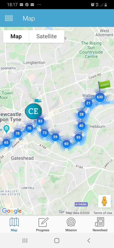
The organisers are very clever… besides the fact that the app has (actually) been beautifully designed, the features keep you hooked as you progress along the route…click on the map and you can see ‘where you are on the route’ and until I figured how to turn it off, all the other virtual travellers who were either with you, or ahead or coming up behind. I found that a bit busy and switched to only me.
A little too busy for me, but wow, there were a lot of people on the same route
Besides that, you get award notifications (via the app)…Flying Start Award 5%, or Trail Blazer 20% and Halfway There Award 50%, a bit like a coach would do, keeping you motivated.
Virtual coaching
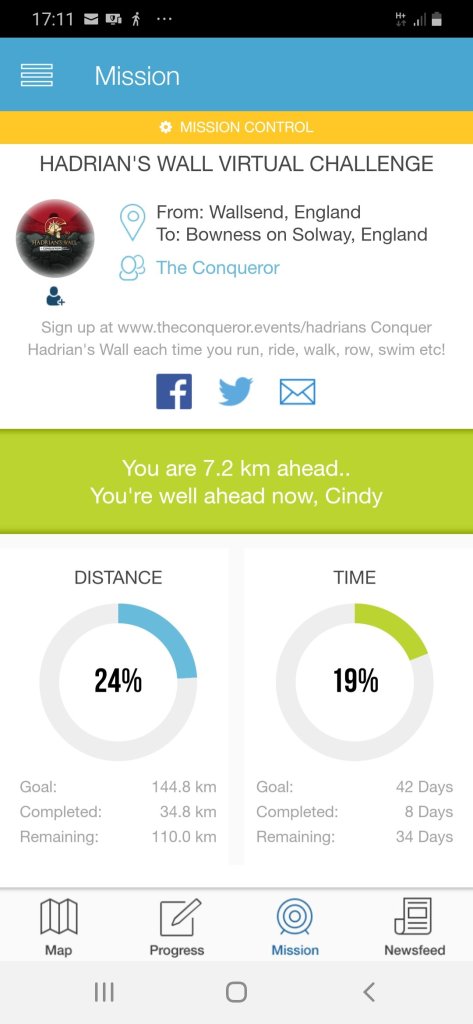
If you click through to the actual challenge they have 2 stats: Distance and Time which show you the distance you’ve covered and how long it’s taken you. You can set the length of your own challenges. I usually overstate mine and end up completing well before my expected date – then you get a message that says “well done Cindy, are you sure you’re not a pro? Or “you’re well ahead now” LOL Brilliant.
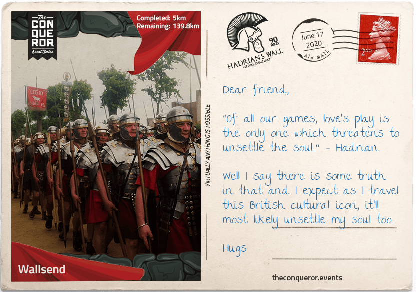
Besides that excitement, they intermittently send you virtual postcards telling you more about the route and the history of said route or the country you’re virtually walking through – and they have really put a lot of thought into it. I get a thrill each time a new postcard pops up in my email.
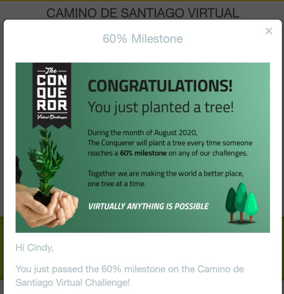
They’ve recently introduced a new feature and for every 20% of the challenge you complete, they plant a tree in conjunction with their partners Eden Projects; their reforestation programs help the environment and reduces extreme poverty by employing local villagers. The trees are planted all over the world, from Madagascar and Indonesia to Central America and Haiti. Being eco-conscious and concerned about the destruction of our planet, this was an exciting feature and keeps me heading for the 20% markers. I’ve planted about 20 trees so far ☺☺👏👏👏
Conqueror virtual challenges
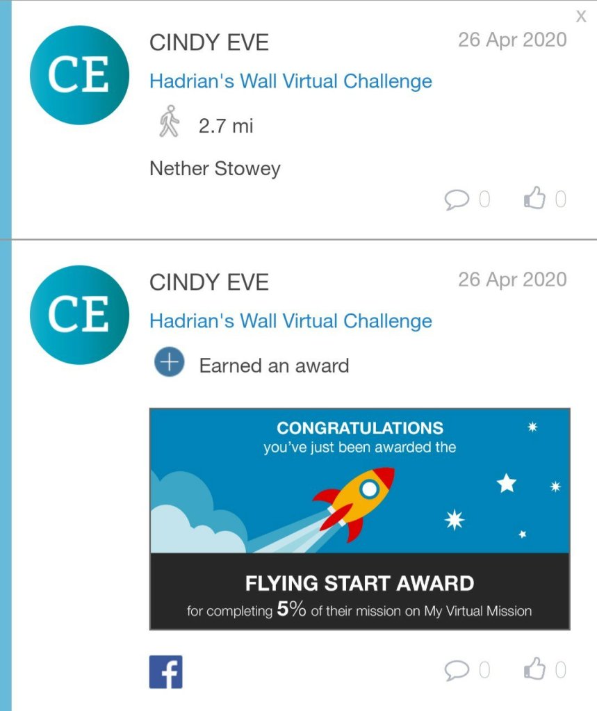
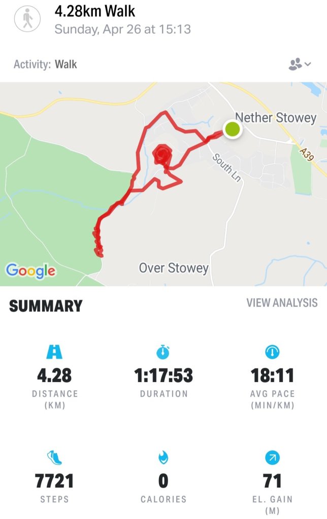
At the time I started the Hadrian’s Wall challenge I was working in a wee village in Somerset; Nether Stowey, miles from anywhere, out in the countryside and right slap bang on the Quantocks. Give me the name of a walk to do, and I’m there…🚶🏻♀️🚶🏻♀️🚶🏻♀️
Stepping out on Hadrian’s Wall virtual challenge
And so, during lockdown, I used most of my 1 hour allocated free time for exercise and I was out exploring and walking, the kms/miles soon added up. Using the calendar on the app I added a description of where I’d walked and added a photo for each day’s mileage and looking back its brilliant to see what I did each time I went out ‘boots on’ walking.
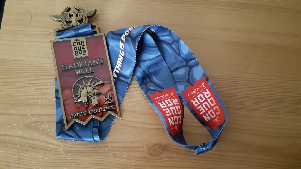
Suddenly hoorah!! To my excitement I completed Hadrian’s Wall challenge….I marked it as completed and waited in anticipation for my medal. Yes!!! You get a real life medal, and it is beautiful, a real solid medal on a lanyard. Clever clever organisers.
My first medal – Hadrian’s Wall
At that stage I was like okay, that was fun but I’m not going to spend anymore money on this….
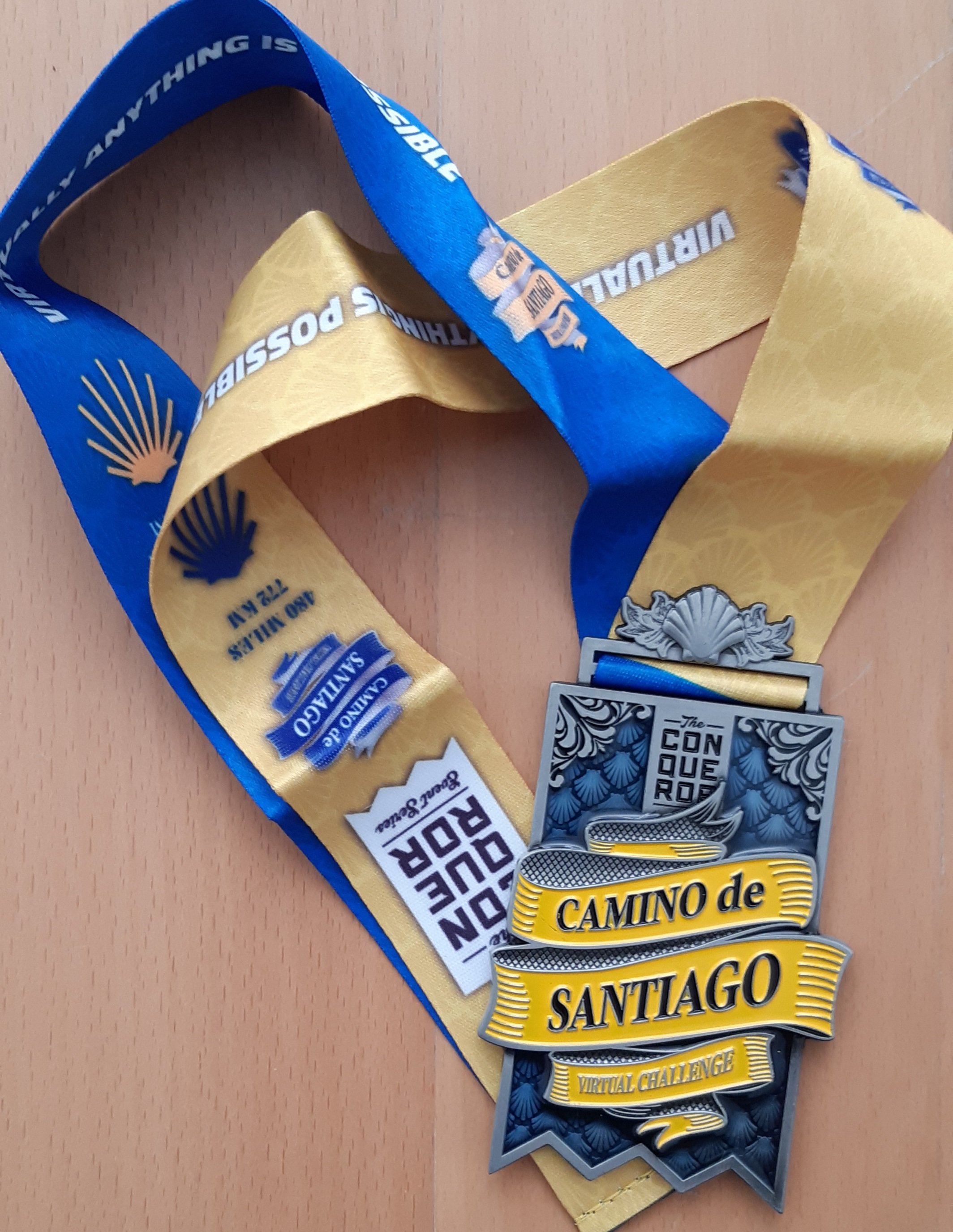
Until I did 🤣🤣🤣 I ‘happened’ to look at the website and saw the Camino de Santiago challenge….my resolve dissolved. I loved the medal, and since I’m planning on actually walking the Camino in the next couple of years, I decided to sign up for ‘just one more’. So I signed up for the Camino de Santiago; at check out, they offered a 15% discount for doing 2 challenges….how could I resist!
Conqueror virtual challenges
Conqueror virtual challenges
Conqueror virtual challenges
Conqueror virtual challenges
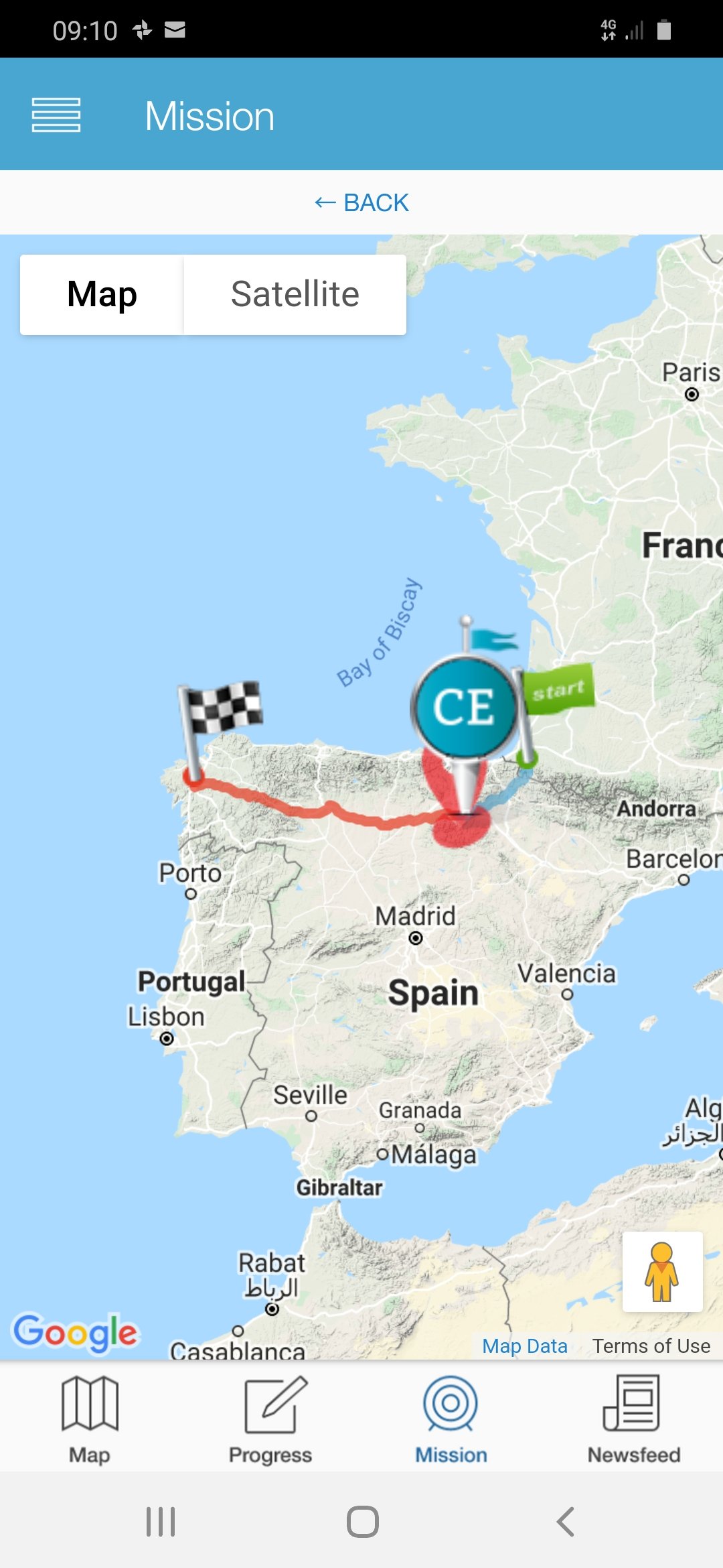
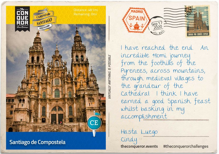
Camino de Santiago
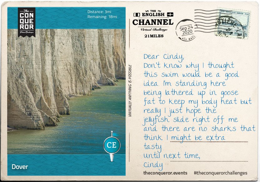
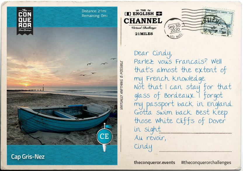
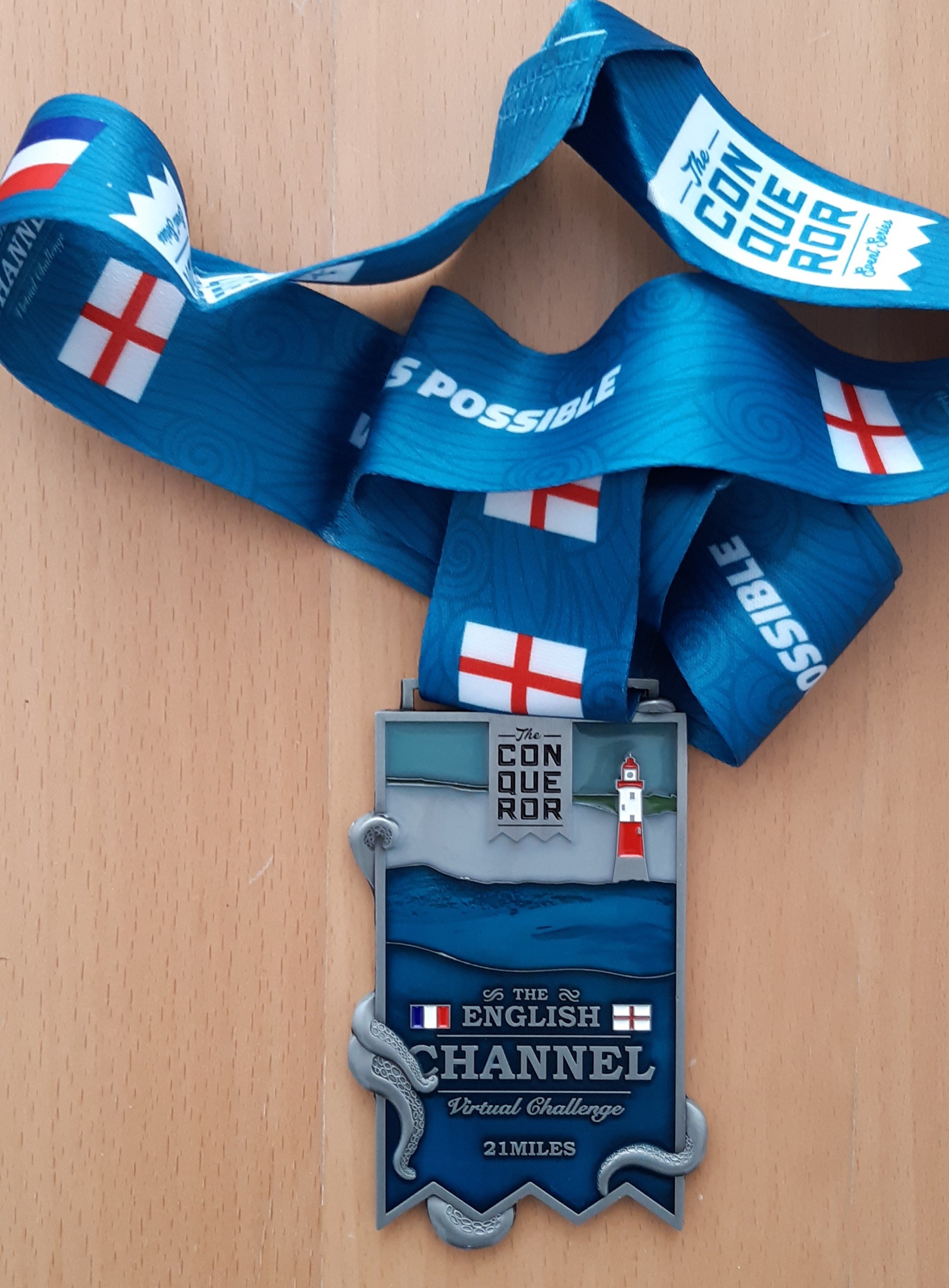
And so my one challenge became 3 as I signed up for the English Channel challenge as well – of course the medal had NOTHING at ALL to do with my choice hahaha. Of course I had/have no plans to actually swim the English Channel, but I’ve walked along the beaches and waded in the sea often enough…so, I walked. The distance is only 34 miles and within 4 walks I was done! Whoo hoo…another challenge completed (30/09) and my medal was in the post! Some people actually swim laps in a pool while doing this challenge.
Conqueror virtual challenges
Conqueror virtual challenges
‘Swimming’ the English Channel – virtually How could I possibly resist this??
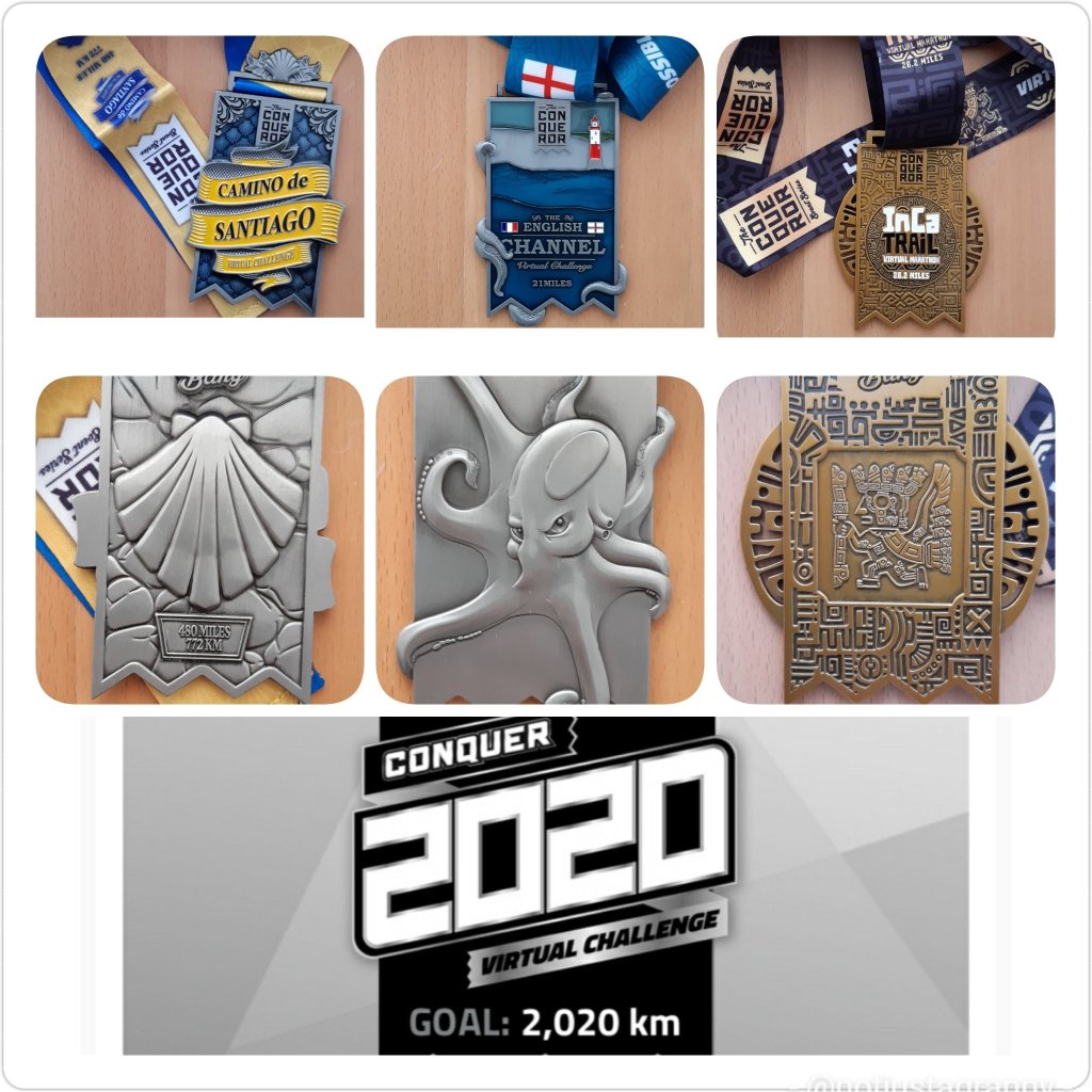
Now what? I really really didn’t want to spend any more money on this, but! I follow the Conqueror Conquest Challenges on instagram and one day to my cost, I noticed their new challenge : The Ring Road – Iceland! OMG Sold to the lady in the corner LOL Dammit it. The medal is absolutely stunning. I caved, and not only that but I bought the 5 challenge pack as mentioned in an earlier post, as well as the 2020 Challenge which lists all my walks from 01.01.2020 right through to 31.12.2020 – super awesome. Of course the amazing medal had nothing to do with that either. My goal for 2020 was to walk 1600kms (1000miles) again, since I didn’t in 2019.
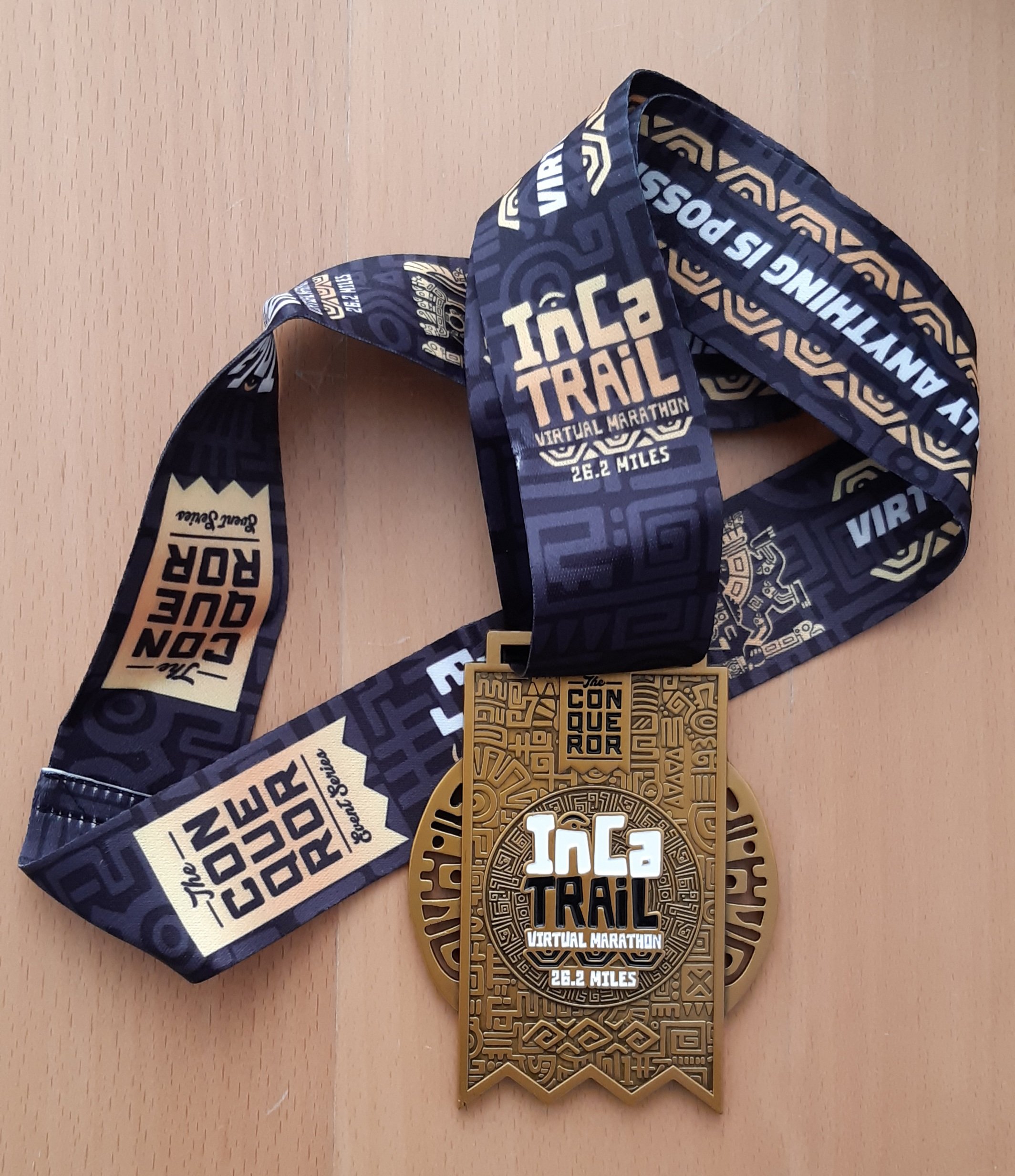
….and so I bought The Inca Trail – Peru (since completed), The Ring of Kerry – Ireland (since completed), The Ring Road – Iceland (for 2021), The Cabot Trail – Canada (for 2021), and the 2020 challenge. And then for good measure I added the Great Ocean Road – AUS (currently walking) and Alps to Ocean – NZ (for 2021).
Conqueror virtual challenges I’ve completed
Conqueror virtual challenges
Conqueror virtual challenges
Conqueror virtual challenges
Conqueror virtual challenges
Conqueror virtual challenges
Conqueror virtual challenges
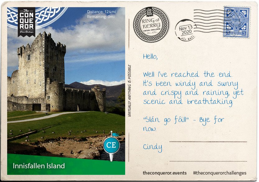
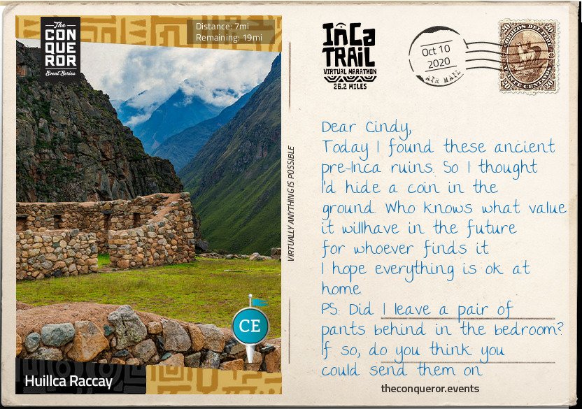
The Ring of Kerry medal is in the mail Congratulations on starting the Inca Trail Challenge. This is a 26.2 miles / 42.1 km journey from Ollantaytambo District, Peru to Ponte da reserva de Machu Picchu, Peru.
This trail is so beautiful and full of historical value and because of that, UNESCO declared it a “World Heritage” site.
Machu Picchu — A New Wonder of the World
Richard L. Burger (an American archaeologist and anthropologist) thinks that Machu Picchu was built in 1450 – 1460.
The reason it was built is unknown. But most archeologists agree that the city was built to be a “royal” estate.
They think that the Inca emperor Pachacutec ordered the construction for himself, most likely after a successful military campaign. However, it is interesting that although it is considered a “royal” estate, it has not been inherited.
How is the journey so far, Cindy? Don’t forget to drink plenty of water and rest from time to time.
But at the rate I’m going trying to complete each challenge asap to get the medal, I’ve already exceeded my 1600km target and am close to completing 2020kms, my current total is 1749kms including today 9th December LOL – an awesome challenge!! Its been good to push myself to achieve that target.
And so, I’ve gone from signing up for 1 challenge to 10…..I love it. It’s a bit crazy really, but I love walking, and these challenges really keep me motivated, and the medals…..well, they really are beautiful and had a lot to do with my decisions..
In fact you can join up and either walk indoors, run, swim, cycle either indoor or outdoors, you can do rowing and skiing, you can participate even if you’re in a wheelchair, and of course outdoor walking which is my preferred method of exercise. It’s just brilliant.
As for the future…well there’s the John O’Groats to Land’s End challenge …that’s quite far at 1733kms/1083 miles, so I’ve looked at that for 2022 and maybe I’ll plan to walk that in real time and follow the virtual trail at the same time…😉
Now, I wonder what other challenges they’re going to design? I have no doubt that I will in all likelihood sign up for those as well. This could keep me going until I fall over…kaputski!! LOL
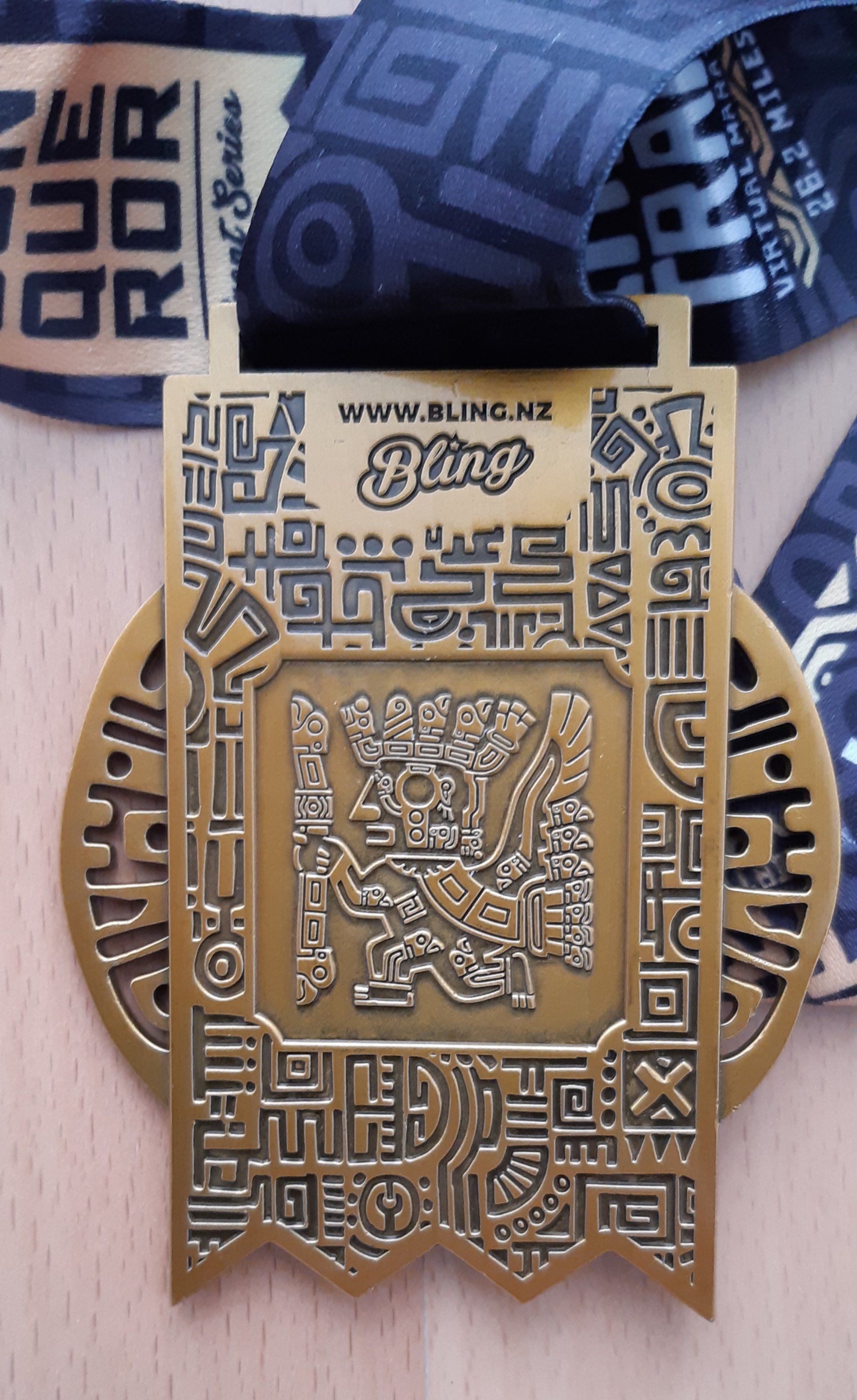
and unbelievably (or not) just last week I signed up for their latest challenge: to climb Mount Fuji – Japan…virtually of course 😁😁😁 The medal is absolutely stunning, why would I resist
I mean, come on seriously…why would I not!!
And that brings me up to 11 challenges!! To say I’m addicted would be an understatement….
Why not join me and sign up to complete a couple before the end of 2020 and maybe set yourself a challenge for 2021. If you sign up via my link you get a 10% discount, as do I on my next challenge. https://www.theconqueror.events/r/CE1474
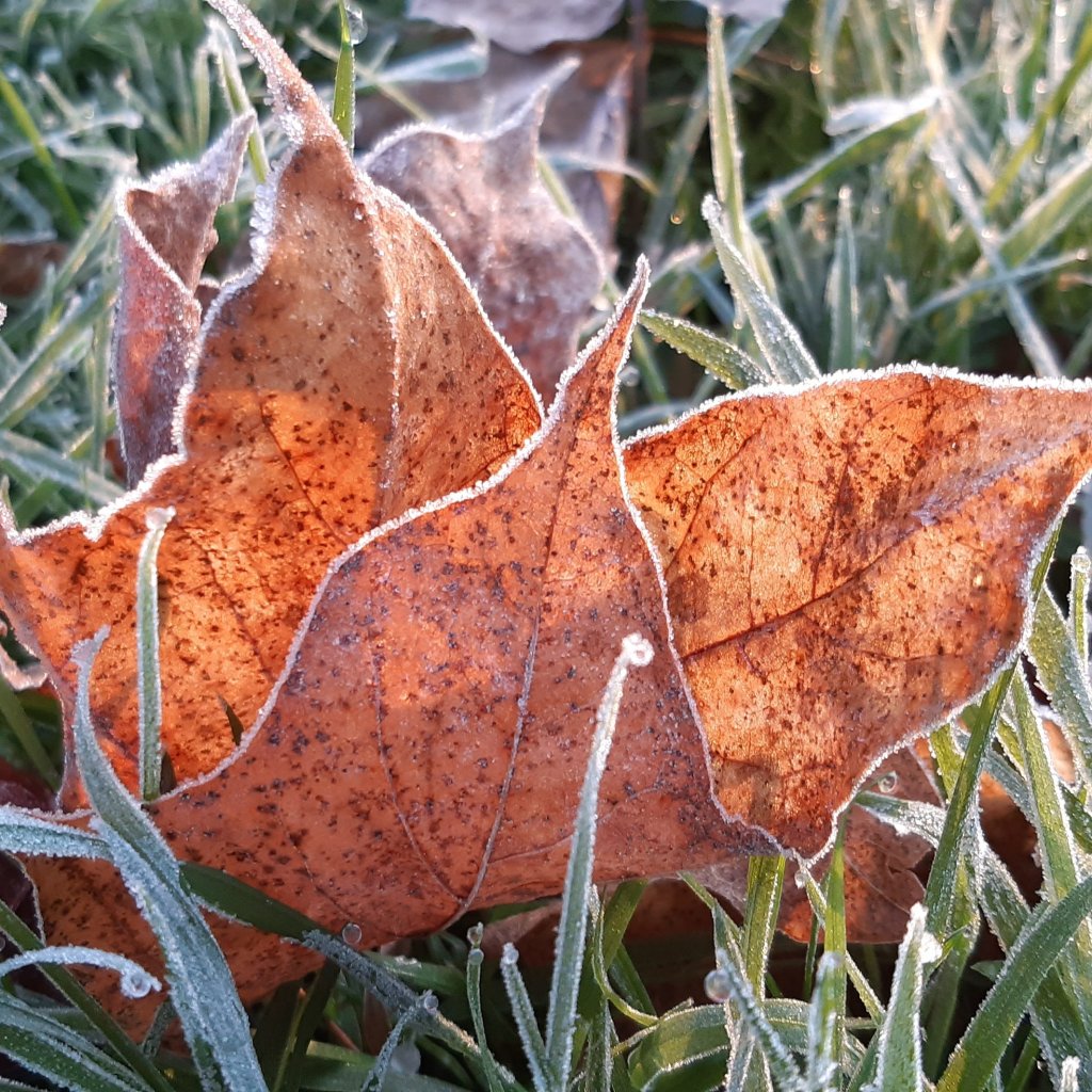
Okay so it’s not actually Friday but it sounds good 😁😁 Frosty Tuesday doesn’t quite sound the same.
But…..look at this!! I thought this leaf looked like an origami creation.
Frosty origami
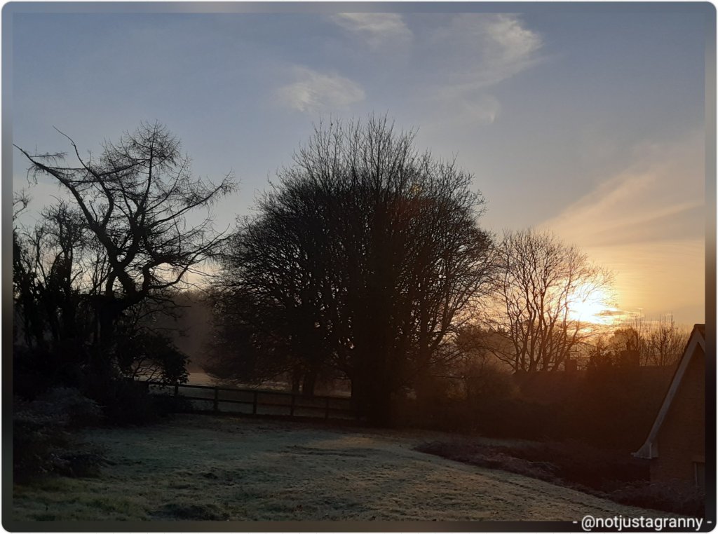
It’s a beautiful blue sky day in the Mendip Hills and I’m hoping that the fog doesn’t come in before I go on my break at 2.45pm….but I’m not holding my breath.
If you have a magnifying glass, you’ll be able to see the deer 🦌🦌
Yesterday also started off as a blue sky day but by the time I went on my break at 12.30pm….this is what I had to contend with.
Foggy days in the Mendip Hills
Mind you I don’t mind foggy days, they have their own beauty, but I would love to see some more clear skies.


You must be logged in to post a comment.