I can’t tell you how often we get weather reports that predict snow, and it all just fizzles out in a flurry.
So when I heard on Friday that we should expect the Beast from the East and 20 cms of snow, I was like “yeah, yeah…whatever “. They never get it right…
We hah! I got it wrong. When I woke up this morning it was raining, as it had been since the afternoon before. Have you ever heard of rain preceding snow? No. It always come afterwards. So I looked out the window at 7am, and instead of the predicted 2am sleet⁸⁸ and snow, I saw rain.
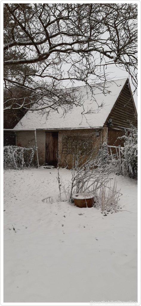
And hour later and it was a ‘whiteout’. Blimey, the snow arrived on the back of the beast and it hasn’t stopped since. Even as I write its blowing a bloody gale outside and the snow is piling up!!! And up!!
Now, I love snow, and I always get really excited when it snows, but this is just seriously bad timing. My booking ends tomorrow and by looks of things, I am not going to be able to get out….😱😱😱🥺🥺
The incoming Carer decided to come this afternoon coz there’s no trains tomorrow, so at least she’s here, but blimey…it looks like I may get stuck here for another day. Meanwhile….
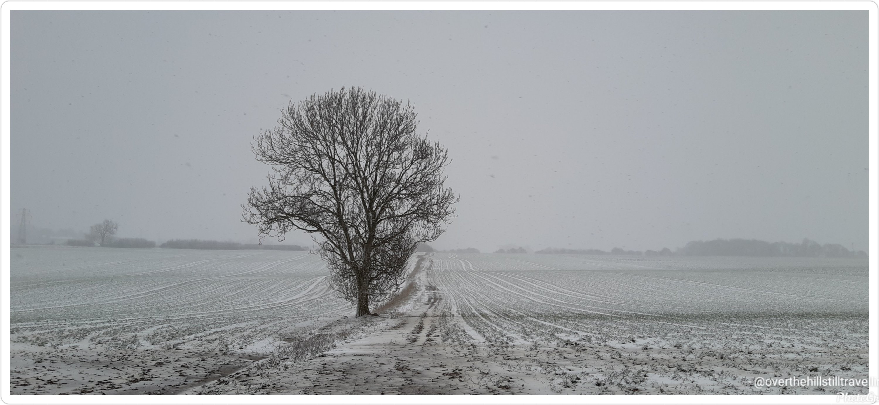
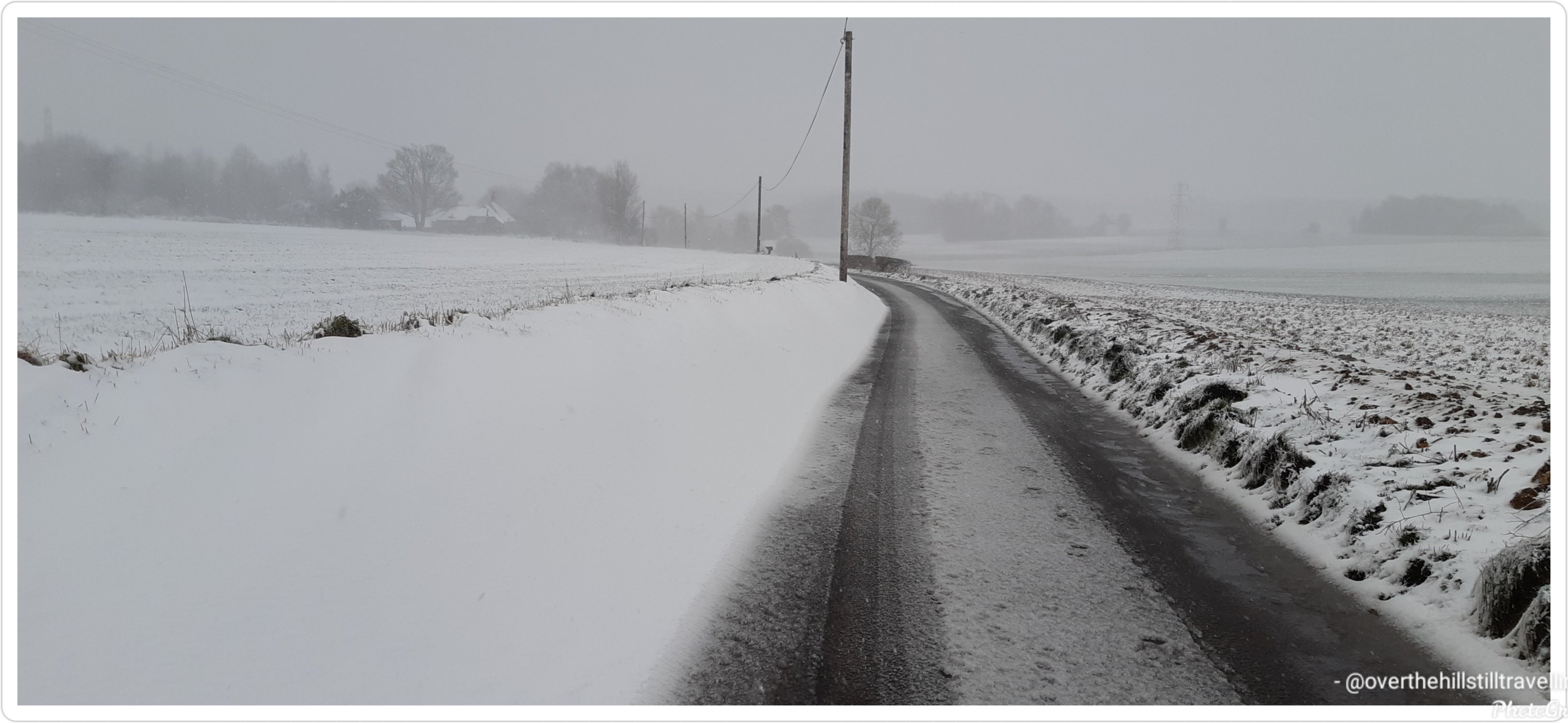
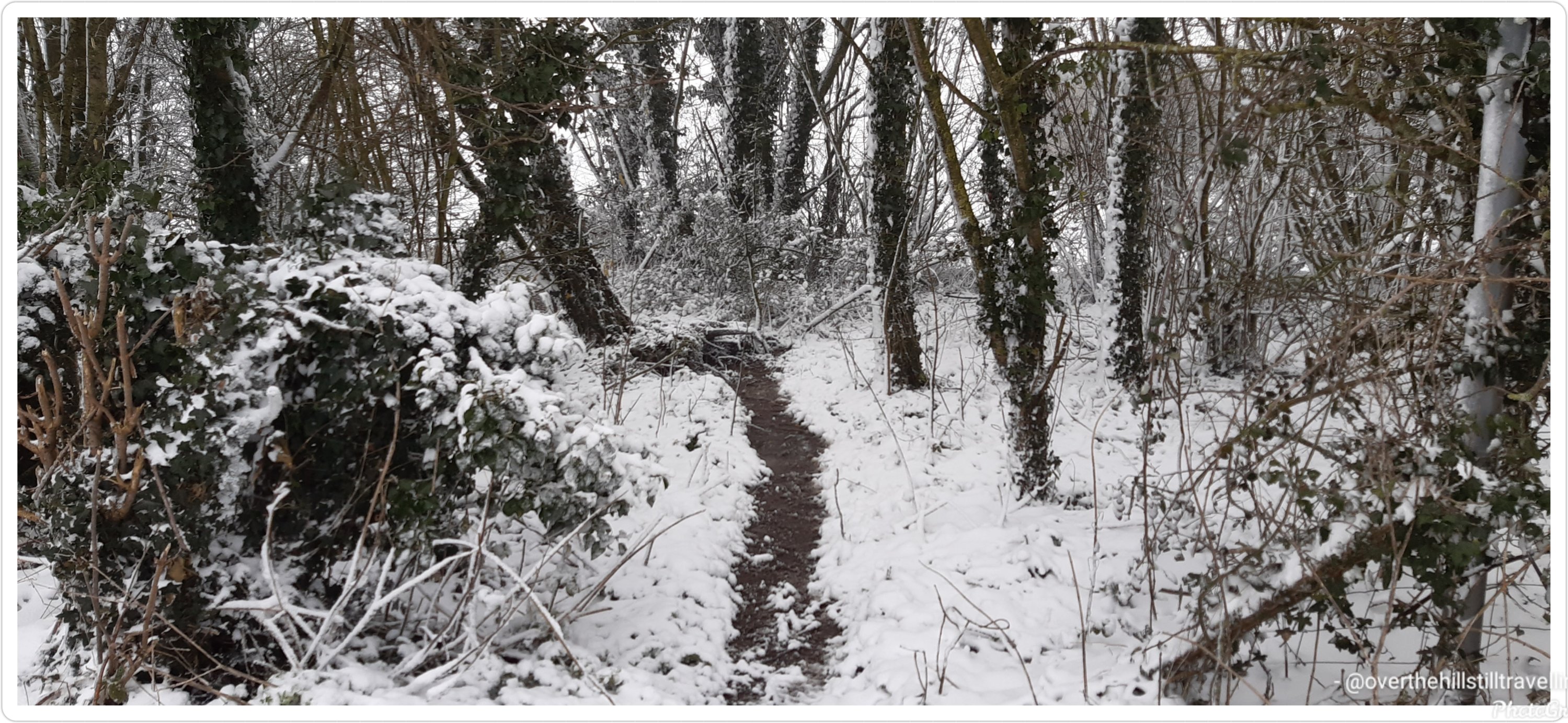
….because I am slightly daft, and because I really wanted some photos of the snow before I (hopefully) leave this booking tomorrow, I decided at 3pm to go for a walk….I didn’t get very far, only 750 meters up the road before returning to the house blinded by freezing snow whipped up by the wind, covered from head to toe in snow, and frozen to the bone 🥶🥶🥶 – okay, not really frozen to the bone, but close enough 🤪🤪🤪 and I got my photos 😁😁😁
The wind has continued to blow for the rest of the day, the snow continues to pile up and the electricity keeps going off!!! It looks like I may well end up getting stuck here for another day…oh well. At least the incoming Carer is here, so I won’t have to work 😉 so for your viewing pleasure, some snow pics
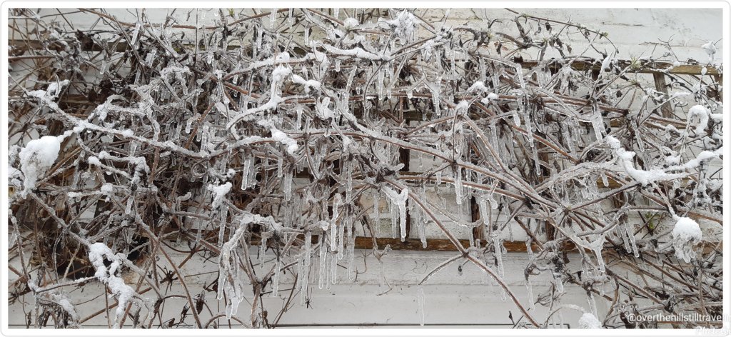
I put seeds out for the birds..the blackbird and robin found them despite the snow The food is in the freezer in the garage – I have to go out in the pitch dark with a torch to get it…🥶🥶Icicles above the back door 🥴🥴🥴
This challenge is 289.7 kms, takes considerably longer to complete if you’re walking short distances each day weather depending, and can sometimes be a bit wearying as you plod along every day building up the miles/kms. But it’s all worthwhile when the next postcard pops up. How awesome it must have been to glide over the NZ landscape for 15 hours. The views must be stunning from that height.
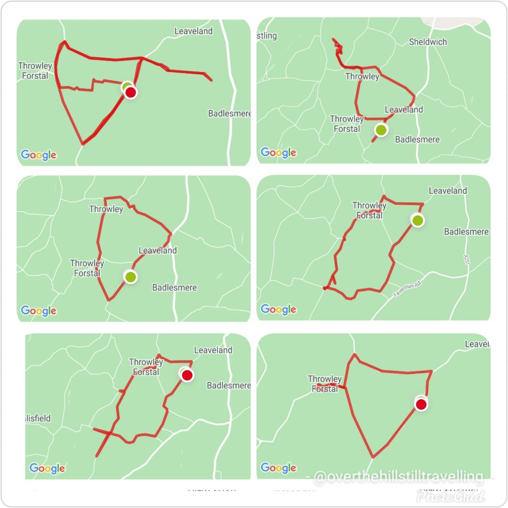
The days have been mostly grey, overcast and lots of rain, but I managed to get out nearly every day between 10th and 17th, explored a few public footpaths (big mistake – they’re mud baths in the current weather), and created some interesting configurations 😄😄
I try to vary my route each day and create more shapes
Meanwhile, on my virtual journey I covered 47kms, and am just on 18 kms over halfway through my challenge/virtual journey. I plan to finish by 3rd February. 🤔🤔🤞🤞🤞
Here we go Stage 5, which I reached on 17th January, done and dusted…
Having left the alps and peaks behind, the town of Omarama marked the halfway point of my journey. Although a small rural town, mainly a service centre for locals and nearby residents, Omarama had a few surprises up its sleeve.
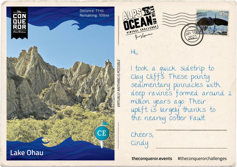
Disney’s 2020 movie release of Mulan was entirely shot in New Zealand with scenes filmed at the Clay Cliffs just outside of Omarama.
Stage 5
In 2009, NZ pilot Terry Delore set a new world record in his 87ft (26.5m) wingspan glider. Taking off from Omarama, Terry travelled 1,491mi (2,400km) up and down NZ for 15 hours reaching speeds of up to 93mph (160kph) before landing back in town. Omarama has strong gliding conditions making it a popular destination for gliding pilots. Omarama hosted the 1995 and 2007 World Gliding Championships of which Kiwis took first place in the 1995 open category and third place in 2007.
For the weary soul like myself a Hot Tub soak the night before to rejuvenate my muscles and unwind was just what I needed. The Hot Tub was located outside in a private setting within a tussock and rock landscape. The tub was filled with fresh mountain water without any chemicals added. The business reuses the water for irrigation. A submersible firebox allowed me to adjust the water’s temperature. As I settled in, I watched the Milky Way appear and spill across the night sky with its millions of stars.
Eastward bound, I left Omarama refreshed and ready to tackle the next half of the journey. The trip was relatively easy and short when compared to previous days. The first half of the trail was off-road running parallel to the State Highway on the right. Crossing at Chain Hills to the left of the highway I began my descent alongside Lake Benmore, the largest artificial lake in NZ. Lake Benmore was created in the 1960s as part of the Benmore Dam construction. The lake is split into two arms. The largest is fed by three rivers, Tekapo, Pukaki and Twizel plus the Ohau canal with Waitaki River flowing right through the lake, whereas the smaller arm is fed by Ahuriri River.
It is this smaller arm that I travelled along to Pumpkin Point, a grassy beach area, for a break and a splash in the lake, then onto Sailors Cutting where the off-road trail terminates and I join the highway for the rest of today’s trip. Not the most relaxing part of the journey as I braved the high-speed highway with an upward climb to Otematata Saddle. The views of Lake Aviemore and the valley beyond was a lovely compensation until I continued on the busy highway downhill all the way into Otematata.
Not the most relaxing part of the journey.…reminds me of when I walked the Portuguese Camino…there were quite a few occasions I had to brave a high-speed highway 🤪🤪
I did a quick Google search tonight and discovered that the Alps to Ocean route is actually a dedicated cycling route 🤣🤣🤣🚴♀️🚴♀️🚴♀️🚴♀️ so no walking then 🤨🤨 damn. I’ll have to do more research. I’d really love to walk the route, it looks awesome
Now that I’m at my next booking my time has been limited. But I try to get out every day and explore the area.
After a week of daily walking, I reached the 4th stage on 10th January…
The roads here are very long and it takes me a good 10 minutes to reach an intersection, which means I can’t go too far afield as it will take too long to get back. But I’ve made a point of trying out different routes, in as much as my options are minimal, but I’ve discovered some lovely country lanes.
Meanwhile, on my virtual journey…
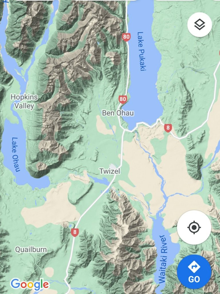
Here I am at Lake Ohau, the third and smallest parallel glacial lake in the Mackenzie Basin that serves as a water storage for the Hydro scheme. It is connected to Lake Pukaki and Lake Tekapo (the other two parallel lakes) via an artificial canal. Lake Ohau is stunningly located between The Barrier mountain range to the west, Ben Ohau range to the east and Naumann range to the north which lies between Hopkins and Dobson rivers that feed into the lake.
Stage 4
This turquoise blue lake is a perfect environment for both powered and non-powered activities. Although at the height of summer the temperature reaches a mere 60°F (15°C) any swimming enthusiast wouldn’t want to miss the opportunity for a crisp splash in the lake. Luckily for me the weather was in my favour and I went for a brisk swim before starting my onward journey. However, I did hear that any sailor or windsurfer on the lake must be mindful of the northerly winds as the water gets choppy very quickly.
It might be debatable what’s considered a national dish in NZ, perhaps fish and chips or perhaps a gourmet meat pie. No matter, my choice was the traditional piping hot meat pie encased in a crispy pastry. This humble meat pie has been part of NZ’s cuisine since 1863 when the early British settlers brought it to NZ’s shores. It’s the perfect size to be eaten with one hand whilst chugging their popular Lemon & Paeroa soft drink with the other. The soft drink’s history goes way back to 1907 when it was originally manufactured in the town of Paeroa by combining lemon juice and carbonated mineral water.
After my finger-licking good pie and L&P hydration, I set off for what was to be the hardest part of the journey. The first 3.5mi (6km) was an easy section as I traversed the lower slopes of the Ohau range across several creeks before I found myself on a narrow track and a sustained climb of about 2.5mi (4km) to the highest point of the trail at 2,952ft (900m). Not that I particularly trusted that I was at the highest point for a while since all along there were several “false summits” where the trail appeared to reach the highest point to then discover that there was more upwards winding to go. During the winter months part of this upward climb proves to be even more hazardous as it becomes part of an avalanche path.
Reaching the top was quite the accomplishment but given its exposure and strong winds I spent little time admiring the view and started my descent. If I thought the climb was a challenge the steep descent with its tight steep bends was even more ghastly for the next half-mile or so.
The rest was a rolling descent crossing several streams. Clean drinking water could be collected at these streams enabling me to top up my bottles. The track joined with Quailburn Road and for the remainder of my journey I travelled beside Quail Burn River first to the west of me and once I crossed it to the east of me, almost like a constant companion, until we parted way with the river flowing into Ahuriri River and me rolling into Omarama for the night.
Like the Mt. Fuji virtual challenge which I finished in December, I’m really enjoying learning more about New Zealand and its history. The powers that be could/should consider teaching history and geography in this way, the subjects would be so much more interesting.
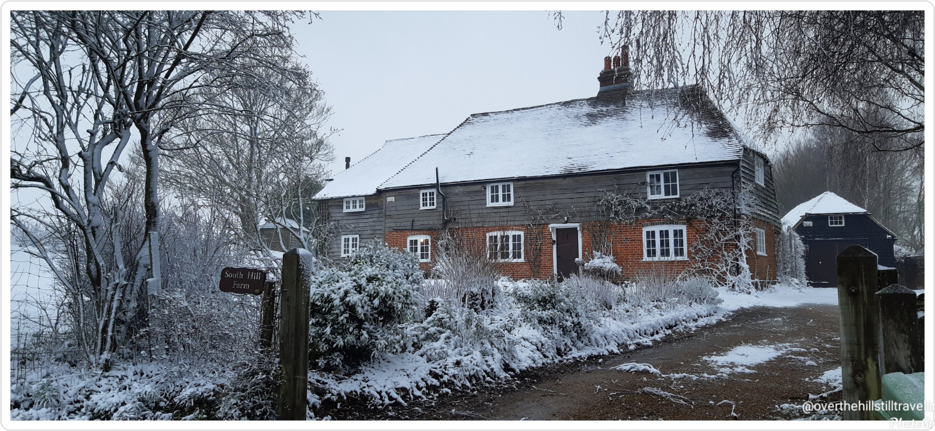
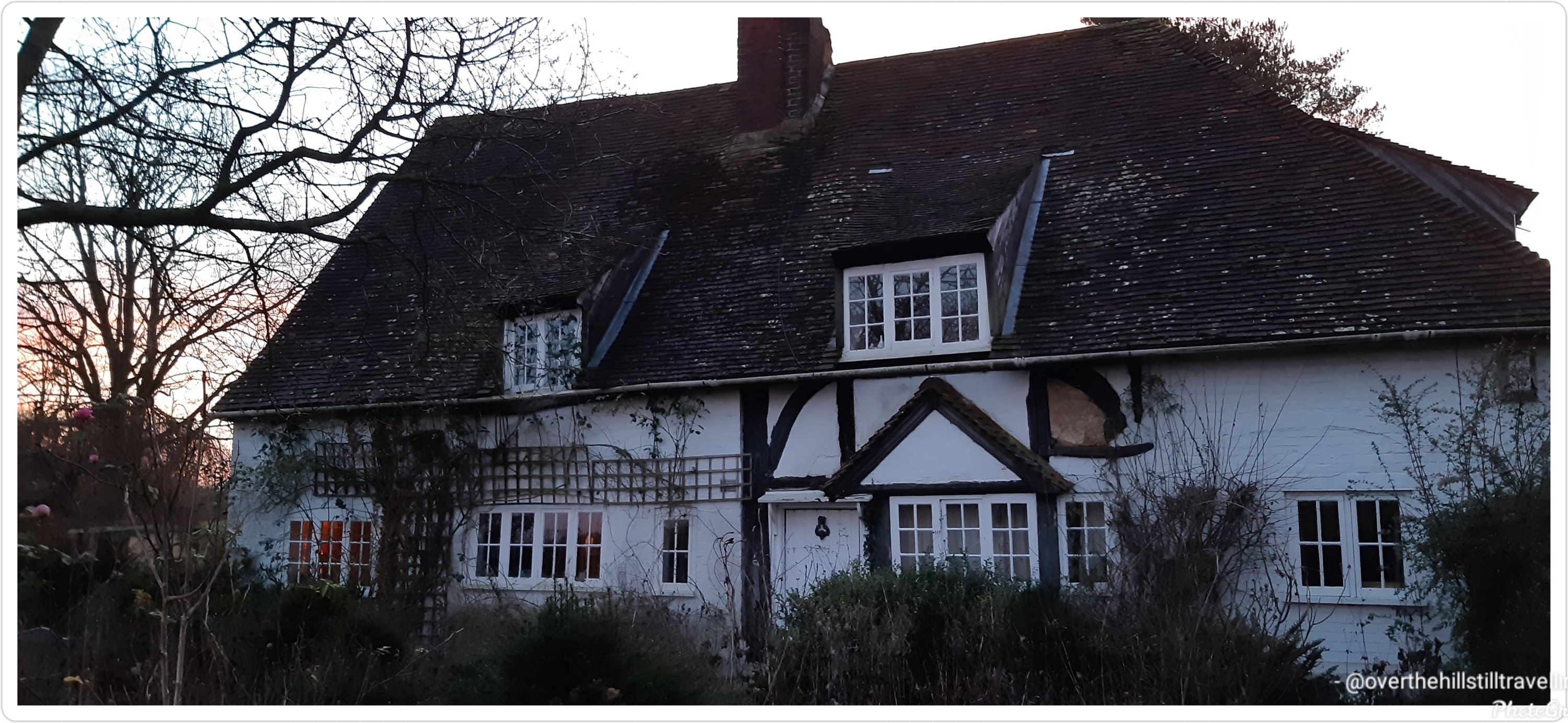
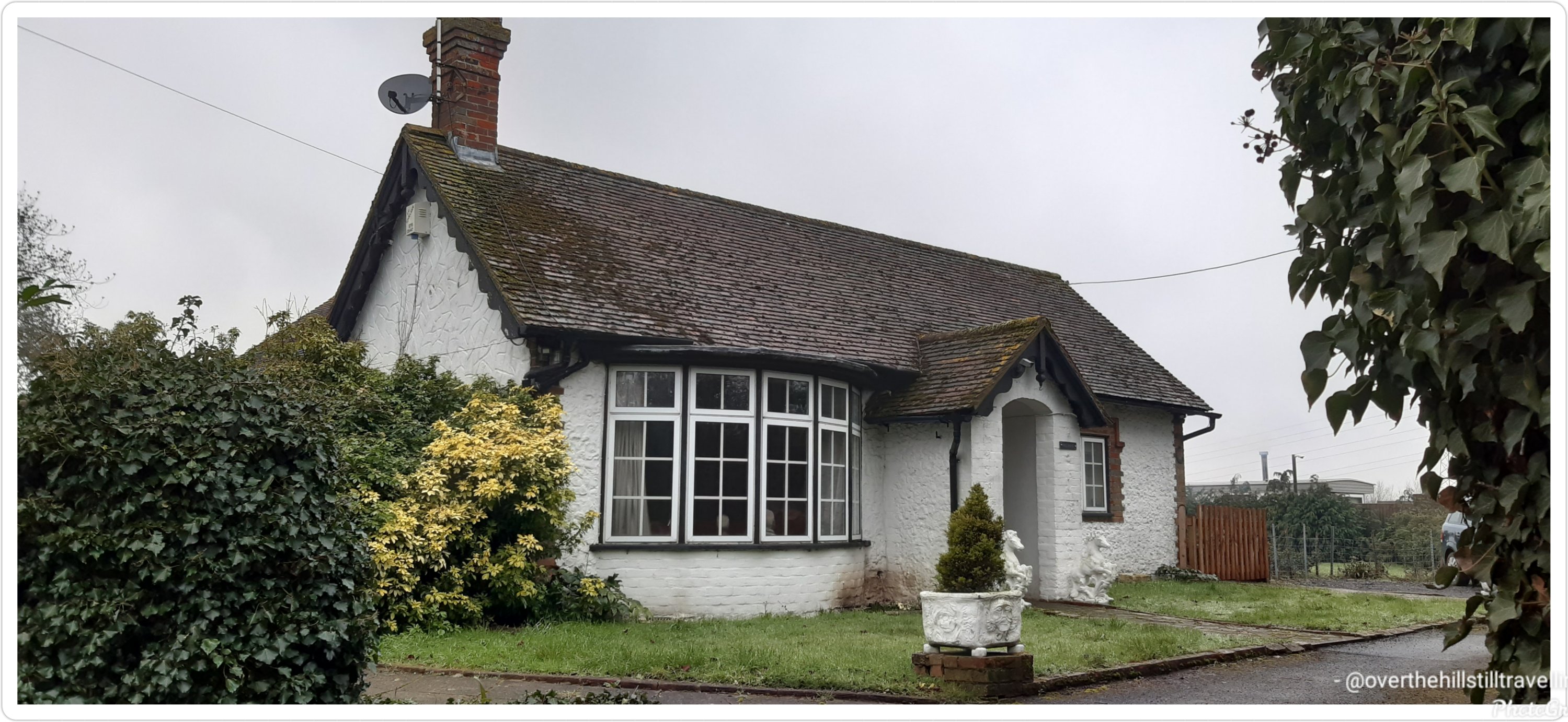
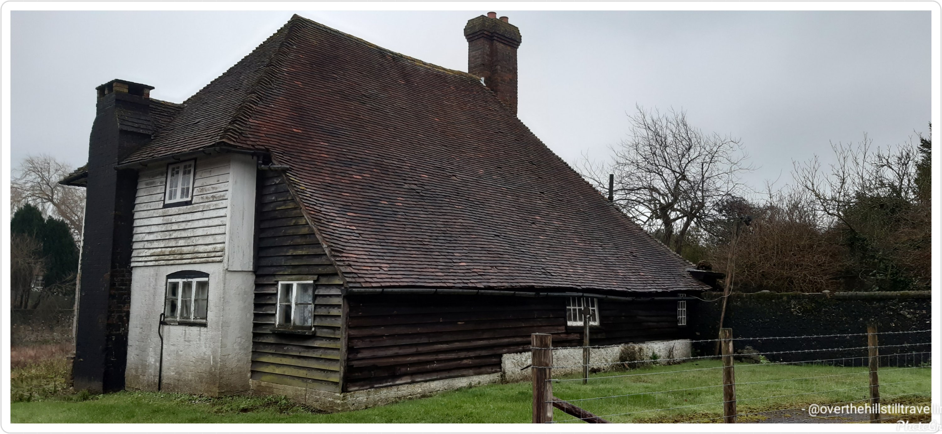
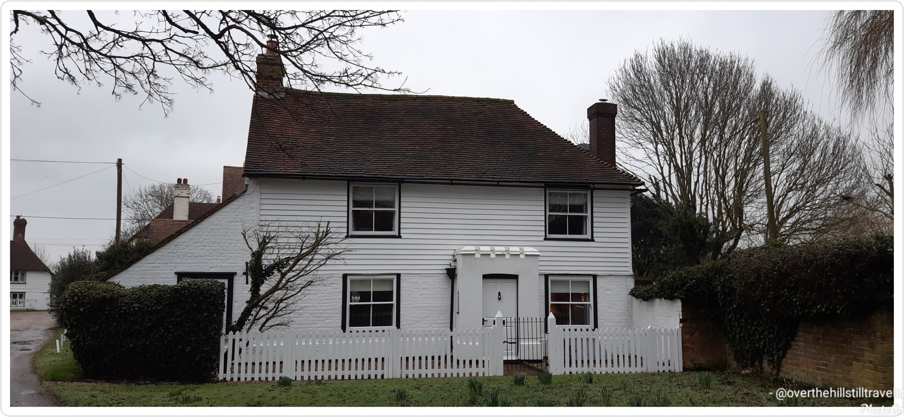
With just 3 days to go till I finish this booking, I went through my photos to decide which houses I loved the most…these are the ones
This was my absolute #1This house is for sale…a mere £450,000 and lots of renovation to be done Forge Farm 🧡💛
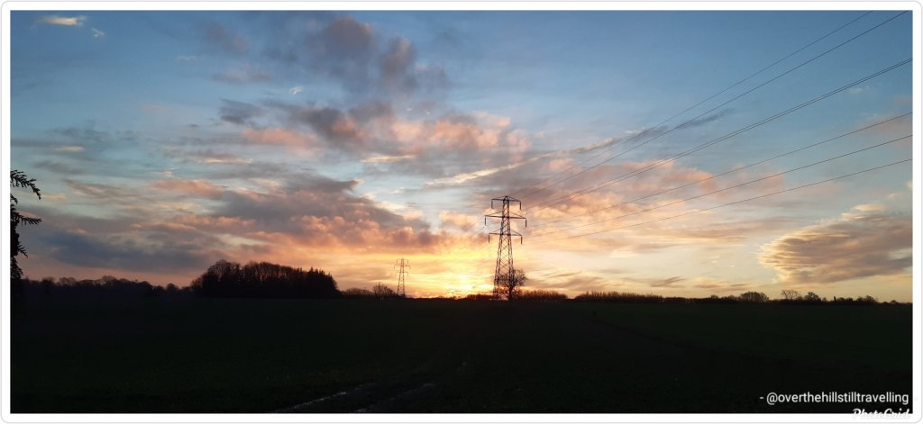
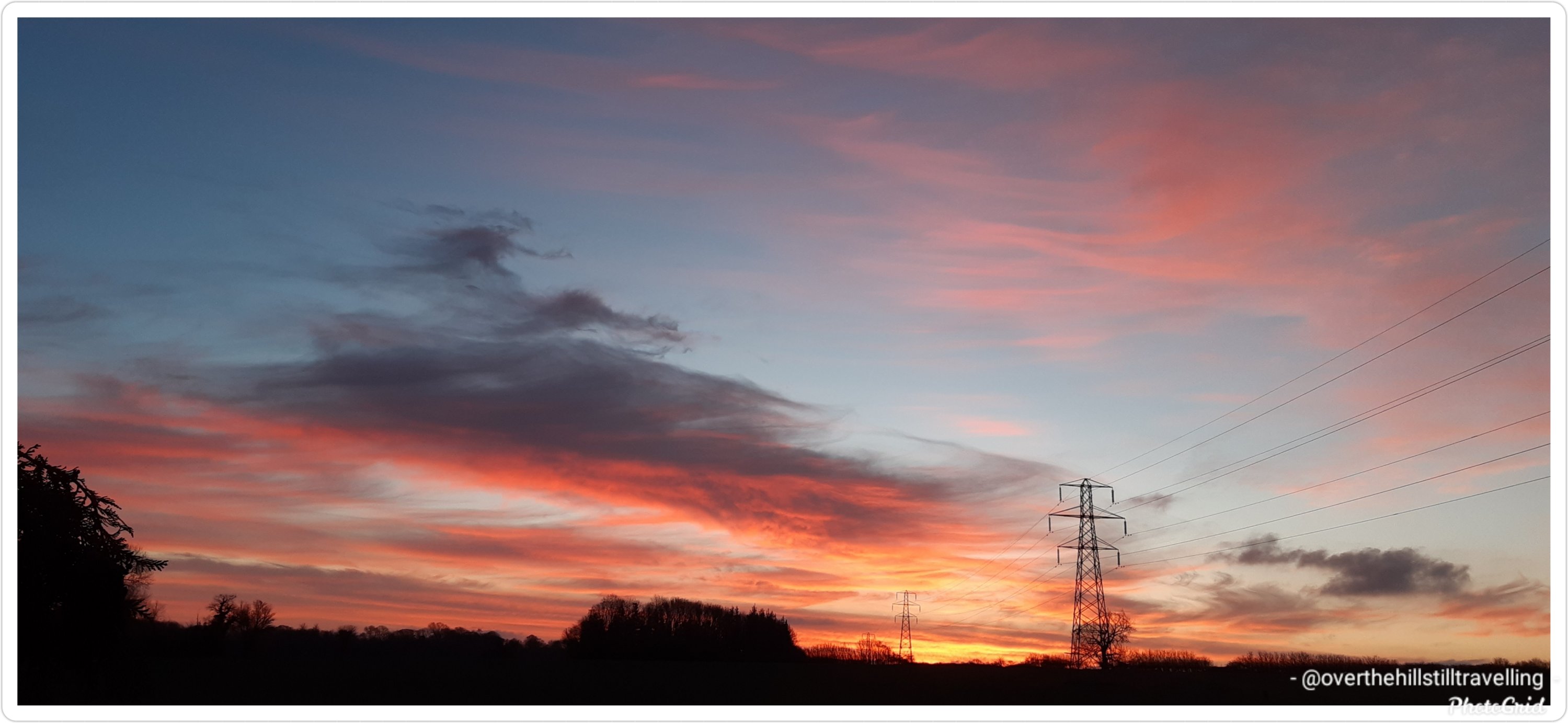
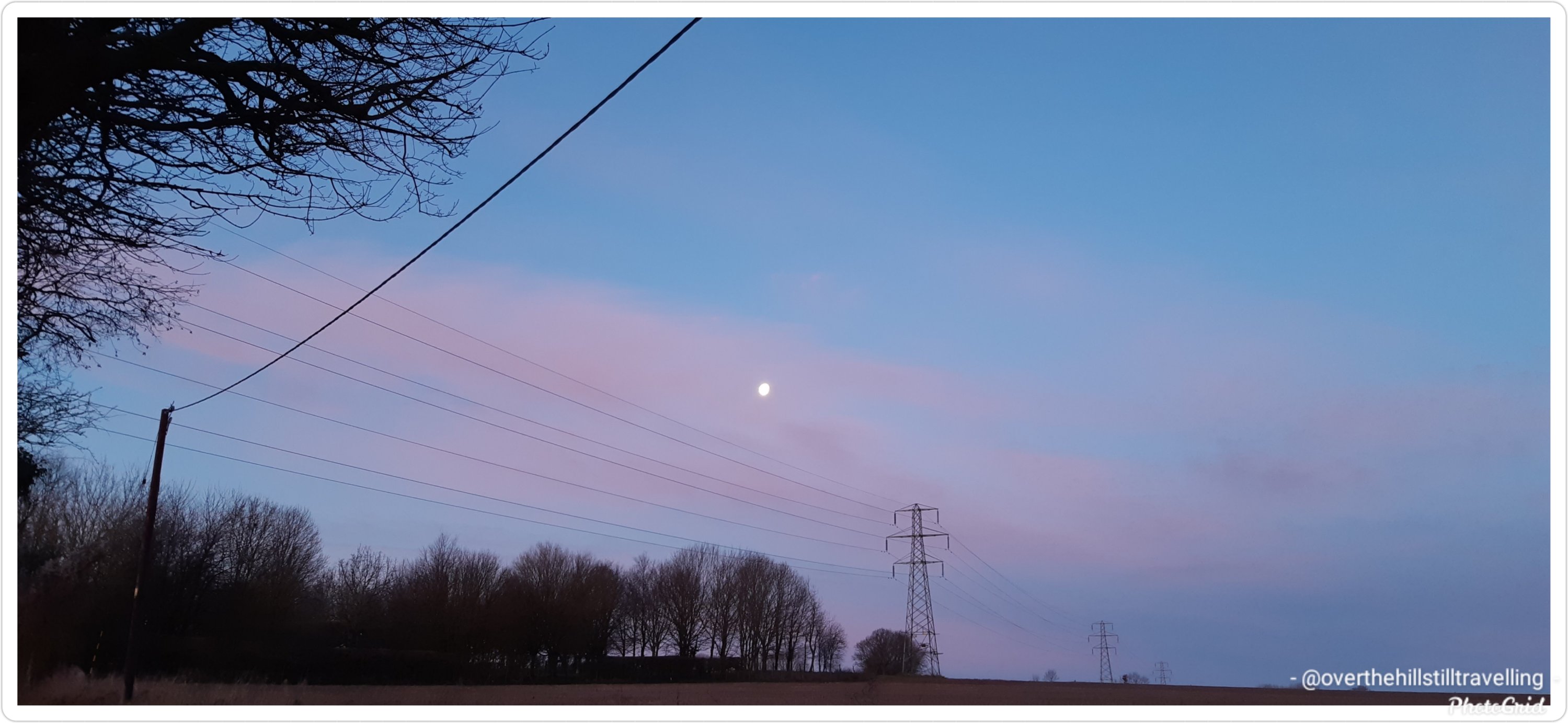
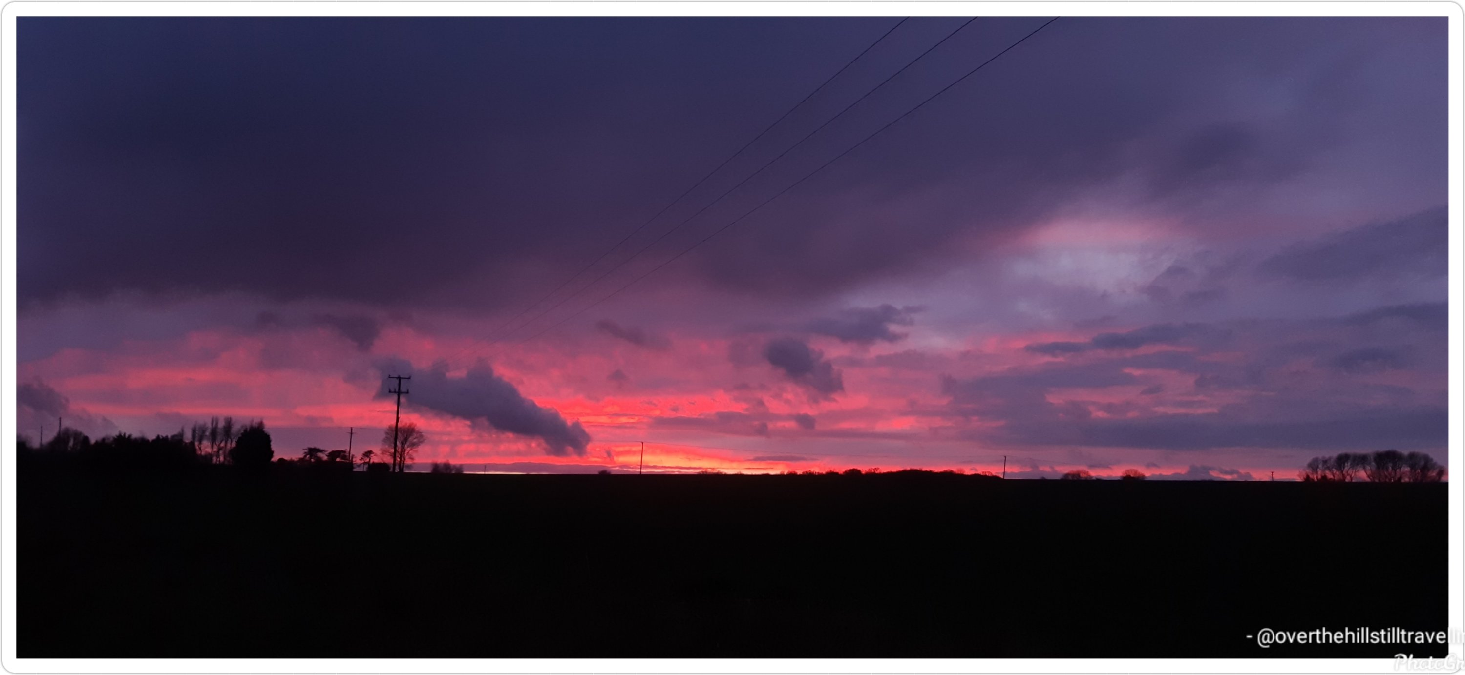
Most of the days were grey and overcast or rainy, but I saw a few beautiful sunrises and a few equally beautiful sunsets….just never on the same day 😁😁
Sunrise Sunrise SunsetSunset
Its been a vast but interesting area to explore and I certainly got a lot of mileage behind me.
One of the few sunny days, albeit freezing cold
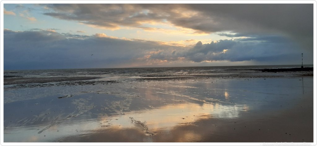
I am however really looking forward to returning to the sea.
Except for a very early morning walk, I didn’t do any serious walking on New Year’s day, or the 2nd January, and rather spent those days with my lovely family and some Granny time with my beloved grandson. But I got going again on the 3rd January and once again managed to get in a really decent amount of kms. Its brilliant walking early in the morning along the coast, I hardly ever see anyone about, and as a bonus, if the weather is fine, I get to watch the sunrise. 😊😊
Sunrise – 3rd January 2021 Isle of Thanet
So here we go…stage 3 of the Alps to Ocean route…
I enjoyed some exploring in Twizel. It’s the largest town in the region which unsurprisingly triples in population during the summer period.
Alps to Ocean – Twizel 😃 what a name
The town is relatively young having been founded in 1968 to house construction workers on the hydro scheme. Clever town planning placed all the services and schools in the centre with housing surrounding the central hub. Pedestrian paths straight into the centre made it more direct for residents to walk instead of driving the looped roads to get to the same destination. When the scheme wound up 15 years later the local residents successfully fought to save their town.
To the south of town is Lake Ruataniwha, an artificial lake formed in the late 1970s as part of the Hydro scheme. The lake is fed by Ohau River to the west and the overflow discharged from Lake Ohau further west. At 3mi (4.5km) long the lake is open to water enthusiasts with activities such as sailing, water skiing and rowing. I chose to stand-up paddle board but those mountainous views and blue lake were spellbinding. I should’ve just sat on a boat and soaked up the landscape.
Since I was already dressed for water activities I ducked across the State Highway to a waterhole I wanted to swim in. As blue as Lake Pukaki was, this ‘no name’ waterhole was emerald green greatly emphasised by the reflection of the willow trees on the waterhole’s edge. There was a time when the swimming hole was part of the Ohau River before the nearby dam and artificial lake disrupted the river’s flow and greatly reduced its size in the east separating the swimming hole from what is left of the river. If you have a satellite view of the waterhole it looks like a big emerald green bath.
Back in the late 1800s when Ohau River had its natural flow, crossing it was done by wire rope and a cage. In 1890 they built, what is now referred to as, the Old Iron Bridge. It served travellers for the next 80 years until the Hydro scheme came into the area, built Lake Ruataniwha, realigned the State Highway and bypassed the iron bridge. The bridge is now listed on NZ Historic Places Trust. A small monument can be found near the lake in memory of a mother and child who drowned in 1879 whilst fording, illustrating the difficulties and dangers of crossing the Ohau River at the time.
There’s another swimming hole called, Loch Cameron, northwest of Twizel, worthy of a visit but if I hoped to get to my next destination sometime today, I had to get cracking with my journey.
Making my way out of Twizel via the southern edge of Lake Ruataniwha, I followed the trail along the west side of Ohau River to Ohau weir. The weir is a low head dam that was constructed with a siphon to maintain a minimum flow into the Ohau River but conversely may overflow restricting access to travellers. Not needing to concern myself with flooding, I enjoyed my travel along the shore of Lake Ohau reaching the village for some lakeside dining and background view of Ben Ohau range.
Just for fun, and because I’m totally interested in finding out more, I did a Google maps search of Twizel and Lake Pukaki, then looked for images. OMG…its is breathtakingly beautiful!!! That water and the landscape… wowww. I’d probably end up wanting to stay 🤭🤭🤭
After this my wings were clipped, so to speak, and I started a new booking on the 4th January so my real time walking has been limited to 2 hours a day, weather permitting, which of course impacts my distances. Too sad.
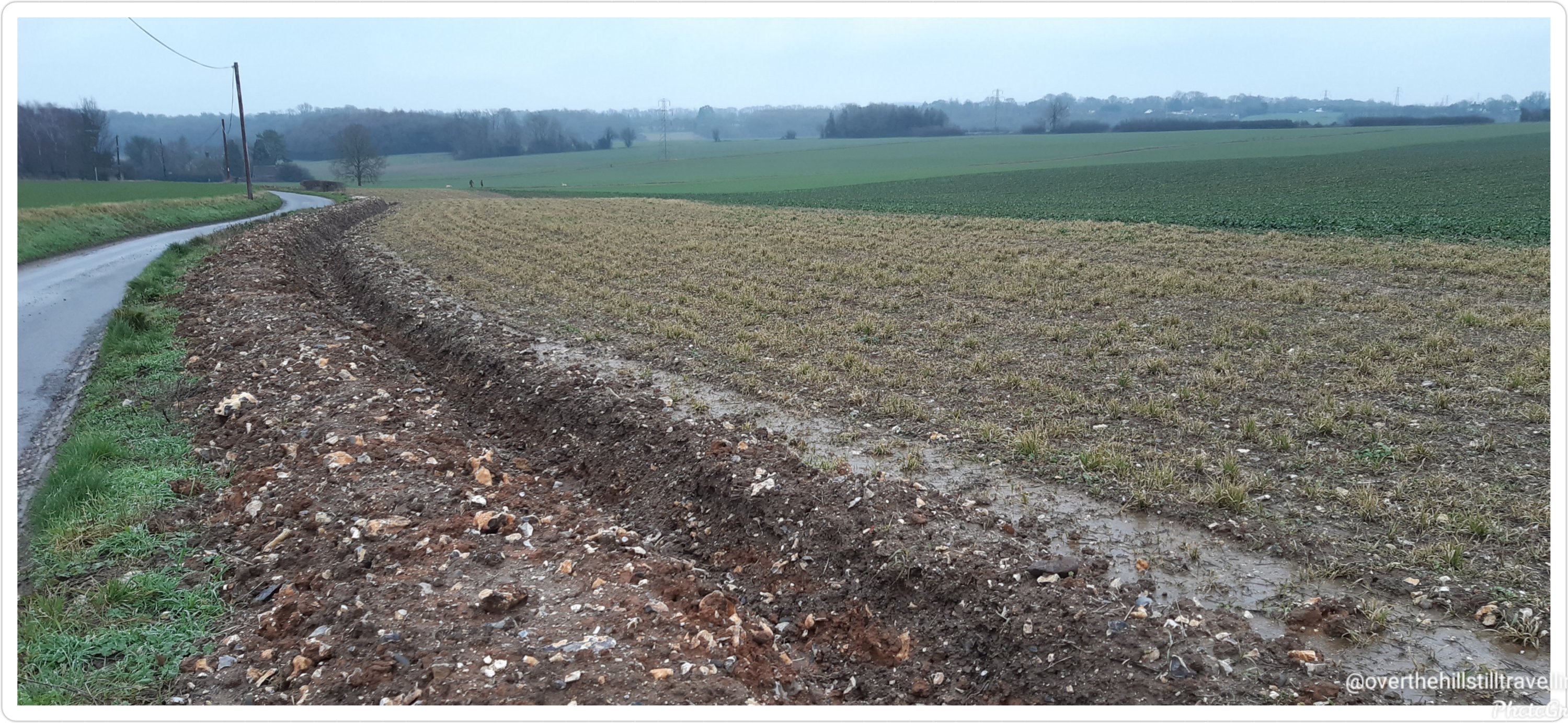
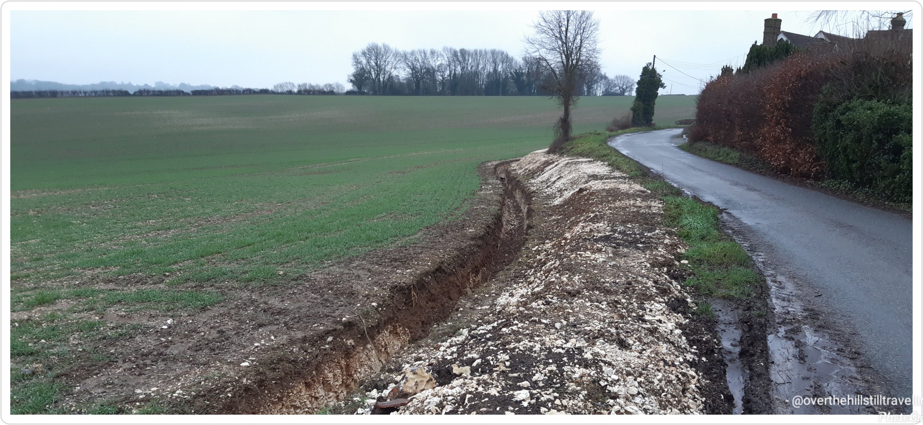
Ever since I’ve been at this latest booking, in the countryside of Kent near Faversham, I’ve wondered about the deep ditches alongside the farm fields.
In my naivety I thought they were to catch rainwater and keep the ground hydrated.
Today on one of my walks I met a farmer and asked him what they were for? I think the heading of the blog should give you a clue.
To my horror I discovered that the ditches are there to prevent vehicles from being driven onto the fields for the horrible horrible ‘sport’ of hare coursing. 😱😱😱😡😡😡😡
Hare coursing is the pursuit of hares with greyhounds and other sighthounds, which chase the hare by sight, not by scent. In some countries, it is a legal, competitive activity in which dogs are tested on their ability to run, overtake and turn a hare, rather than a form of hunting aiming at the capture of game.
Hare coursing is illegal in Scotland, Wales and England and became illegal in Northern Ireland in 2011. It, however, continues elsewhere in the world as a regulated and judged, competitive sport, in places like the Republic of Ireland, Iberia, and the Western United States.
I can’t even put into words what I think of that. Barbaric springs to mind.


You must be logged in to post a comment.